

Historic U.S. 66
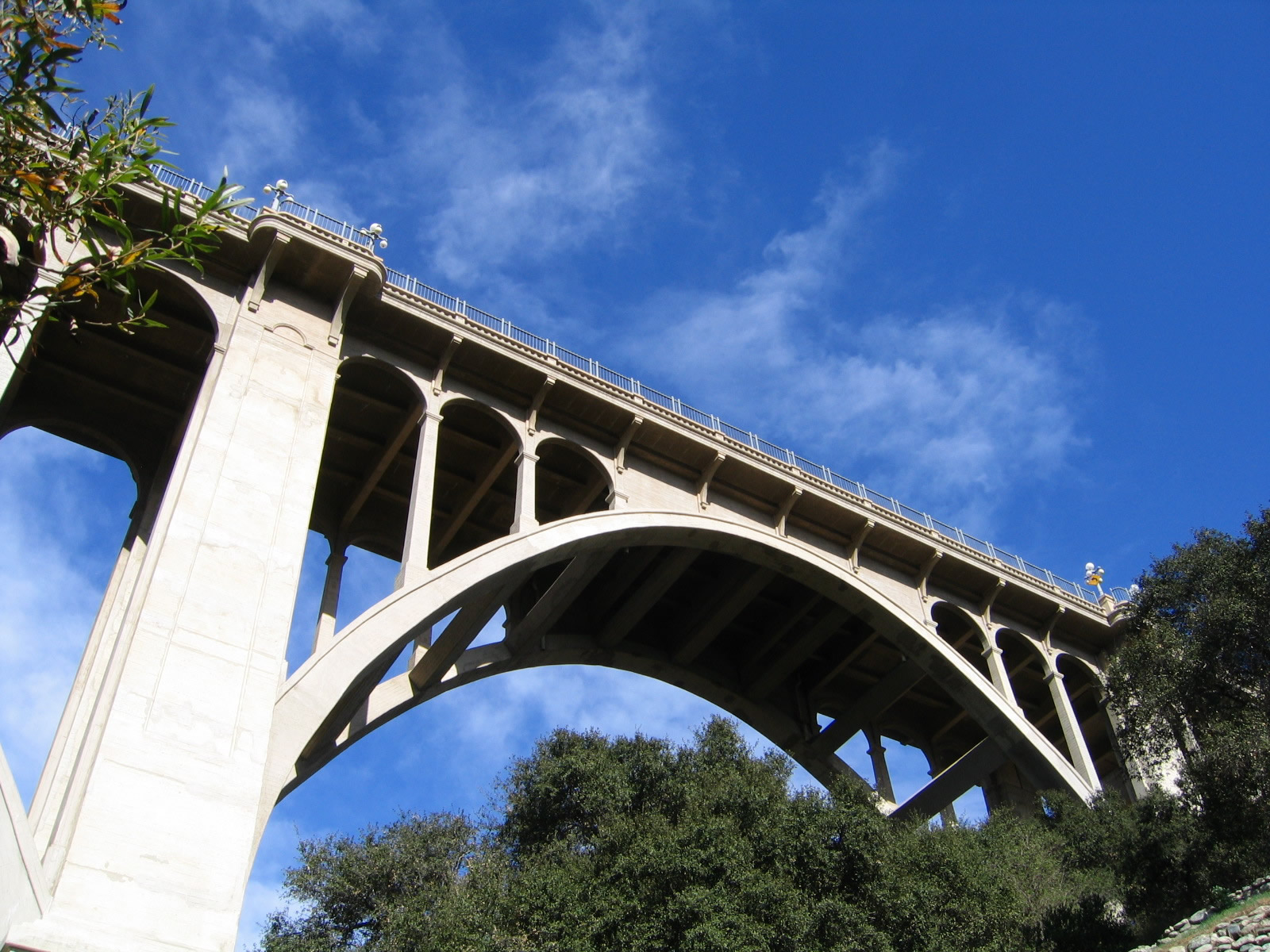
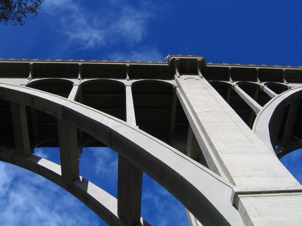
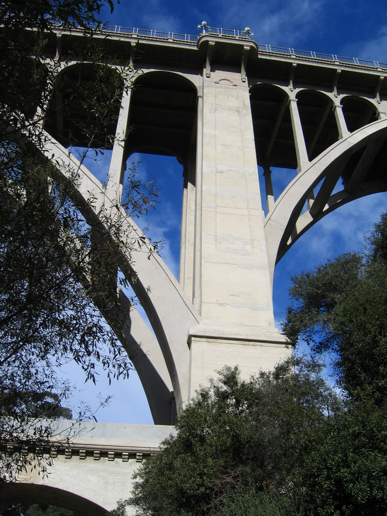
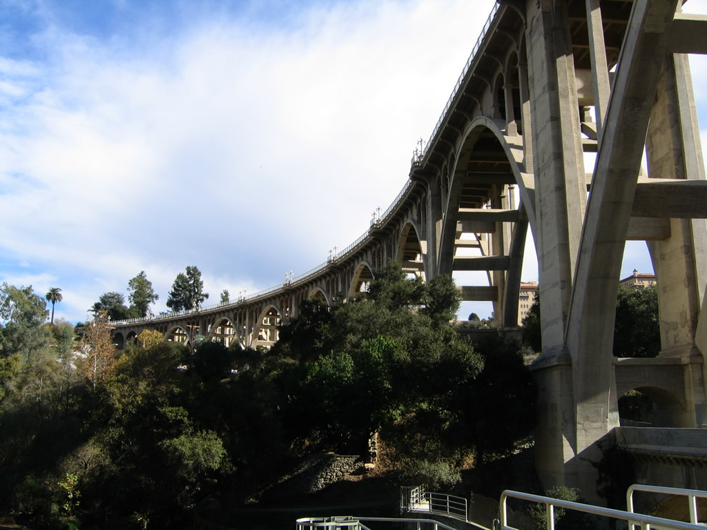
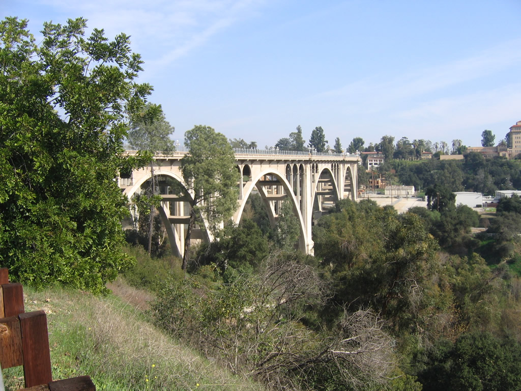
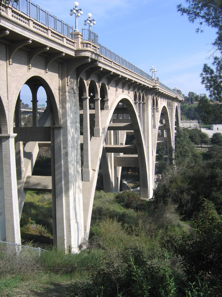
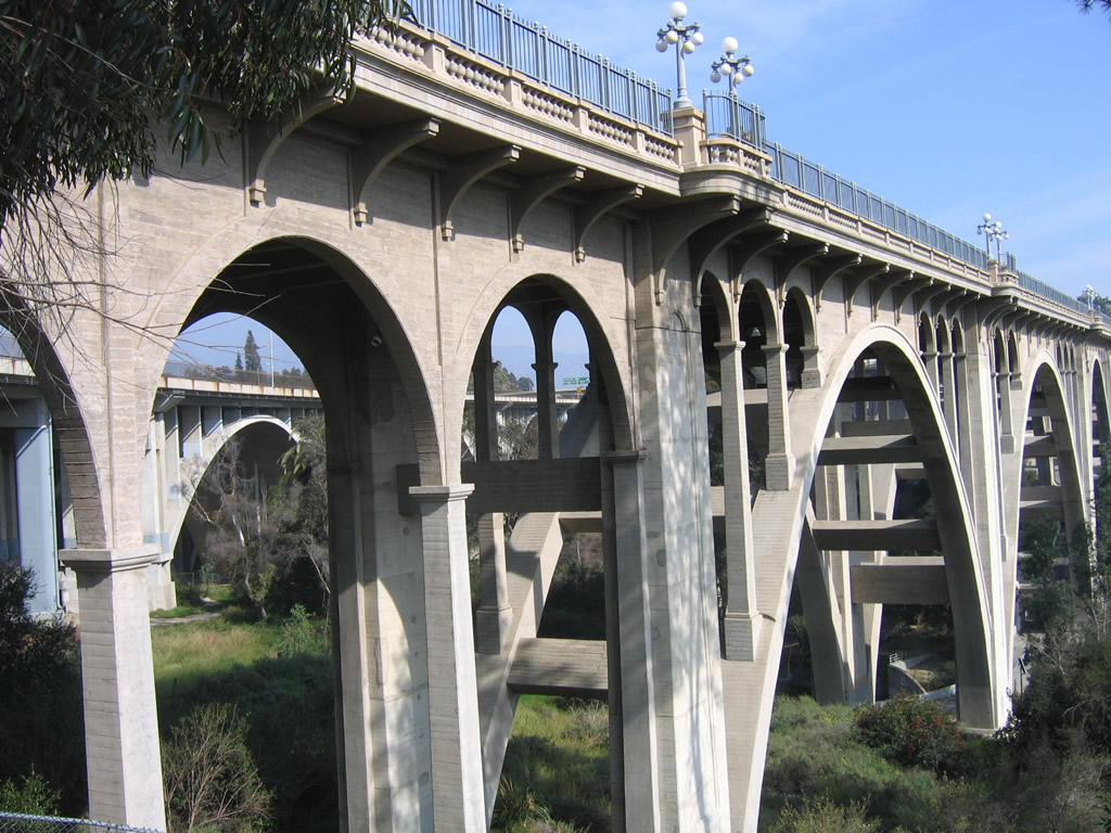
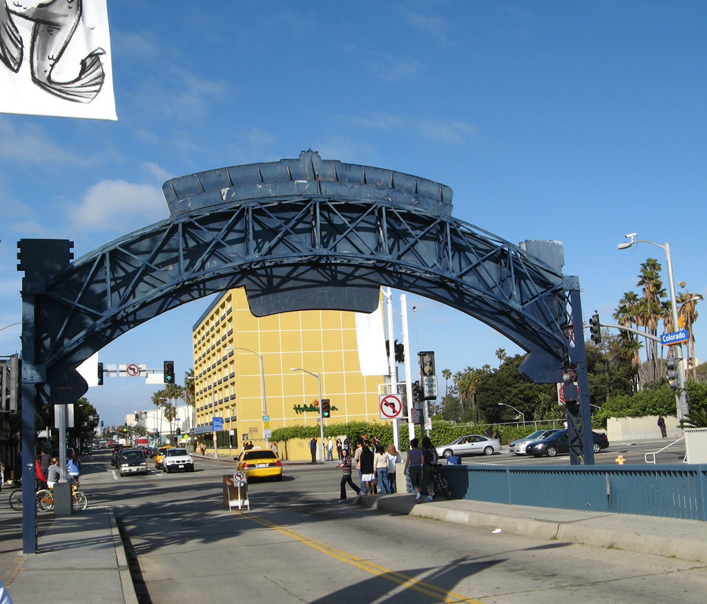
The Colorado Street Pioneer Bridge, which carries Historic U.S. 66 and Colorado Boulevard over the Arroyo Seco in Pasadena. Built in 1913, this 1,486 foot long bridge still makes a statement today with its bold concrete arches and sheer height. Photo taken 12/10/05.
U.S. 66 California Highway Guides
- U.S. 66 East
- U.S. 66 West
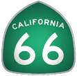
- California 66
- California 2
- Business Loop I-15 and Historic U.S. 66-91 - Victorville
- Business Loop I-15 and Historic U.S. 66-91 - Barstow
Historic U.S. 66 (also known as Route 66, the Mother Road, Will Rogers Highway, and National Trails Highway) is perhaps the most famous highway in the United States. Traversing eight states on its trip from Santa Monica to Chicago (through California, Arizona, New Mexico, Texas, Oklahoma, Kansas, Missouri, and Illinois), Historic U.S. 66 passes through many towns that time forgot. Relegated to business loop or frontage road status for much of its route nationally, the last segment of U.S. 66 was bypassed by freeway in 1985 in Arizona. The entire route was decommissioned shortly thereafter, and now U.S. 66 is signed as an historic route. Signs are erected all along the various routings of U.S. 66 in the Los Angeles metropolitan area and Inland Empire, and U.S. 66 is well-signed on its extant sections between Cajon Pass, Barstow, and Needles.
A portion of this route is still state maintained, even though portions of the route are being remanded to local control. Currently, however, California 66 is Foothill Boulevard between California 210 in San Dimas/Claremont and Interstate 215 in San Bernardino. California 66 matches the original routing of Historic U.S. 66 for its entire length. This highway is much more often signed as either Historic U.S. 66 (brown shields) or even as U.S. 66, even though U.S. 66 is long since decommissioned.
The longest extant sections of Historic U.S. 66 are located in San Bernardino County. On November 4, 2011, signs were erected along the National Trails Highway between Victorville and Barstow and from Barstow to Needles designating Historic U.S. 66 as San Bernardino County 66, complete with blue and gold pentagon markers. These signs were installed at the request of County Supervisor Brad Mitzelfelt after he had observed similar route marker signs on county highways in other states and other parts of California.1 A dedication ceremony for the county route followed on November 11, 2011.
| U.S. 66 scenes | |
|---|---|
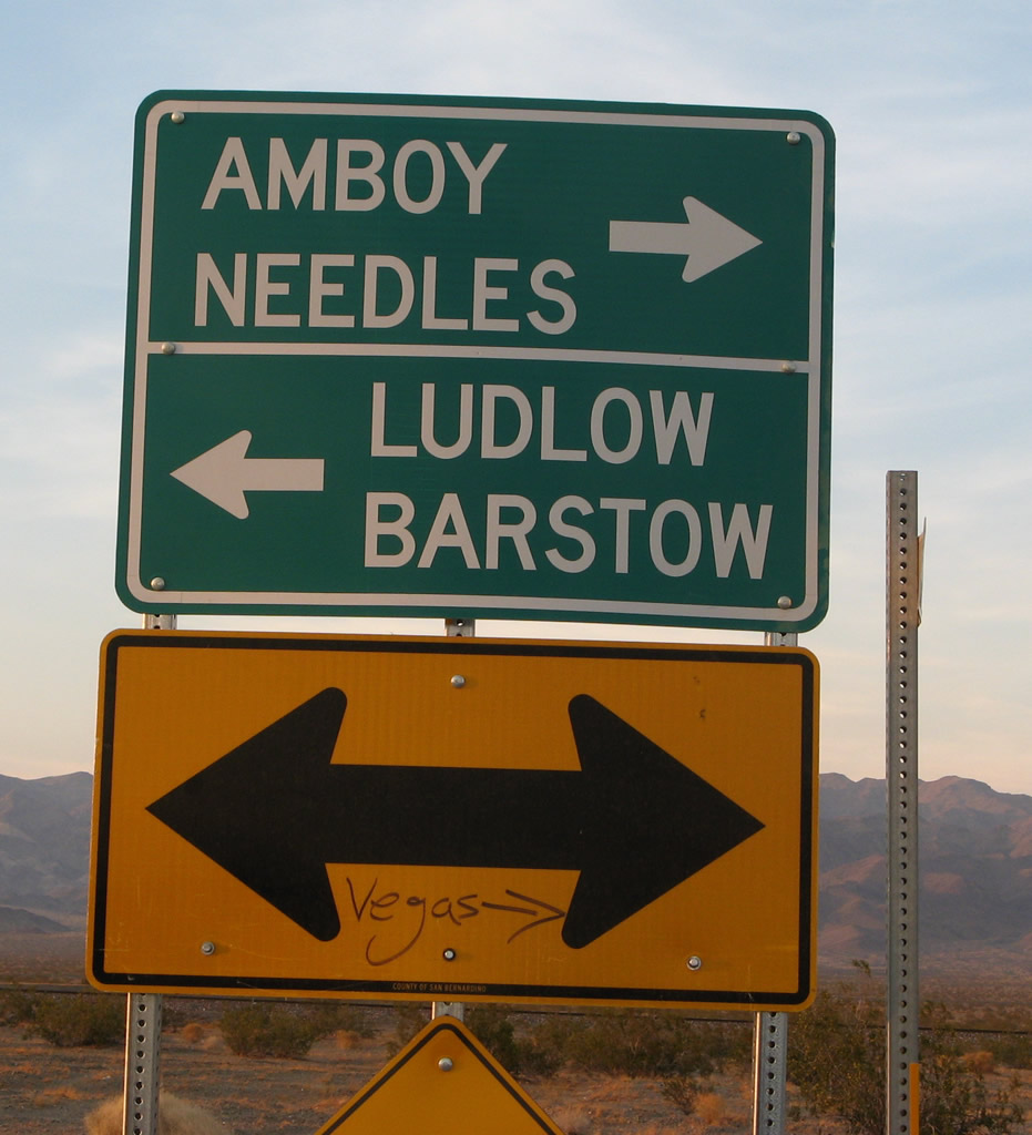 |
At the north end of Amboy Road west of Amboy is this directional sign for U.S. 66 east to Amboy and Needles and U.S. 66 west to Ludlow and Barstow. Someone added "Vegas," since the best route to Las Vegas from here is to take U.S. 66 east to Kelbaker Road north through Mojave National Preserve to Interstate 15. Photo taken 04/01/07. |
 |
 |
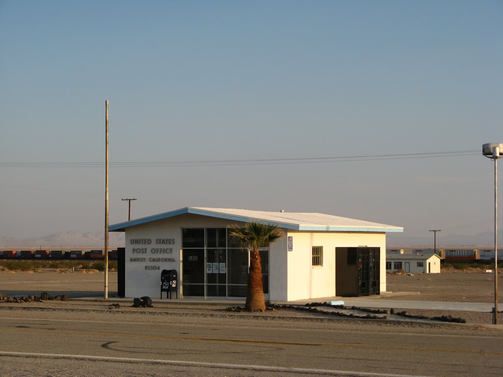 |
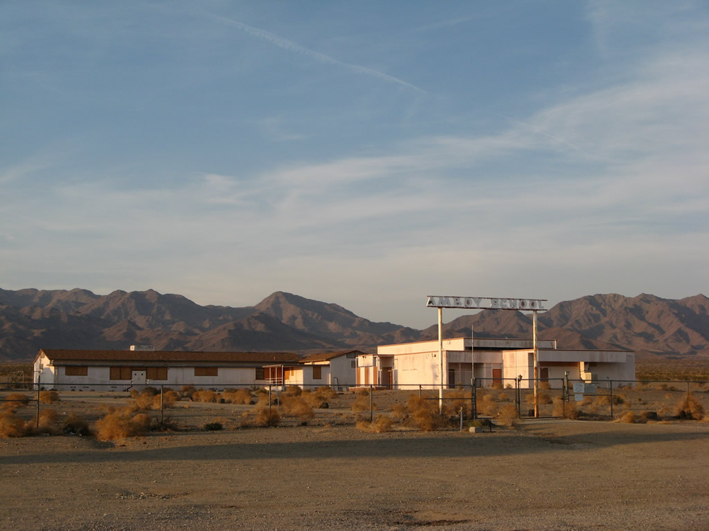
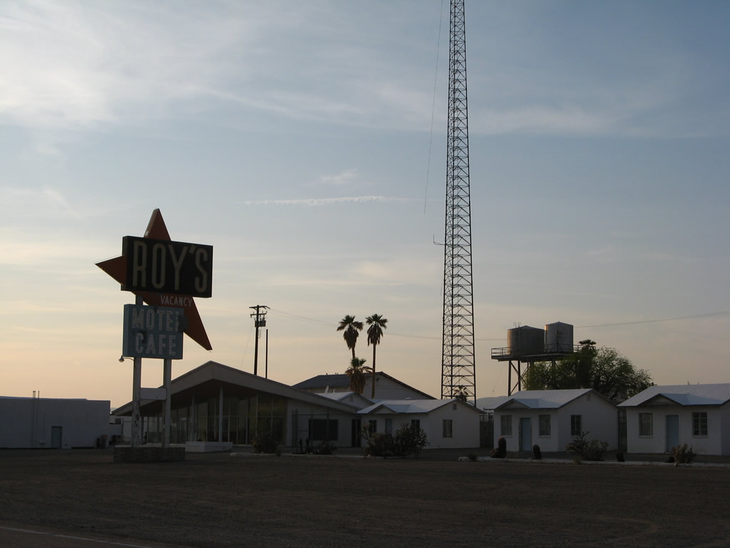
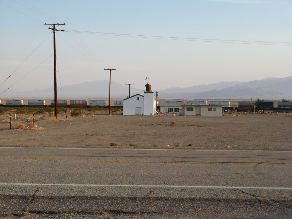
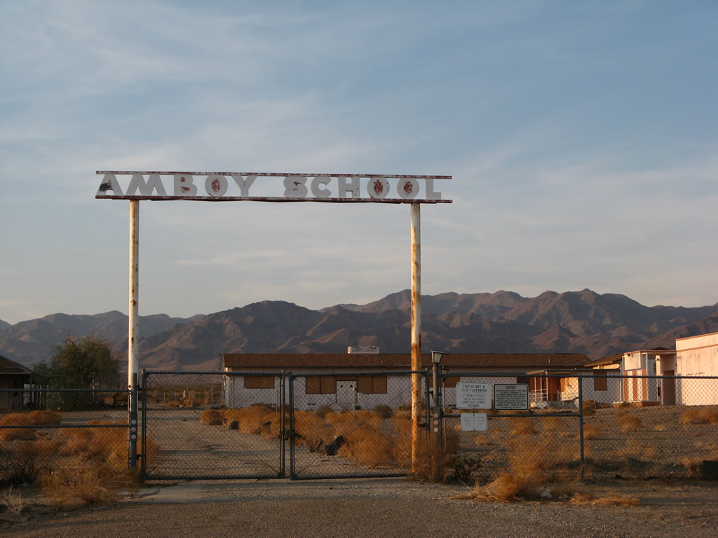
In the unincorporated community of Amboy, U.S. 66 passes by Amboy School, Roy's Motel and Cafe, and the Amboy Post Office. These pictures show some of these locations in this minimally populated town in the Mojave Desert. Photos taken 04/01/07. |
 |
 |
 |
 |
 |
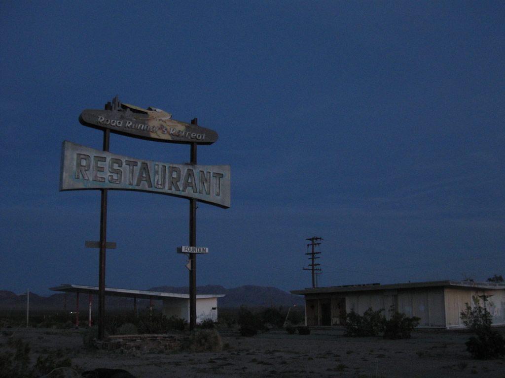 |
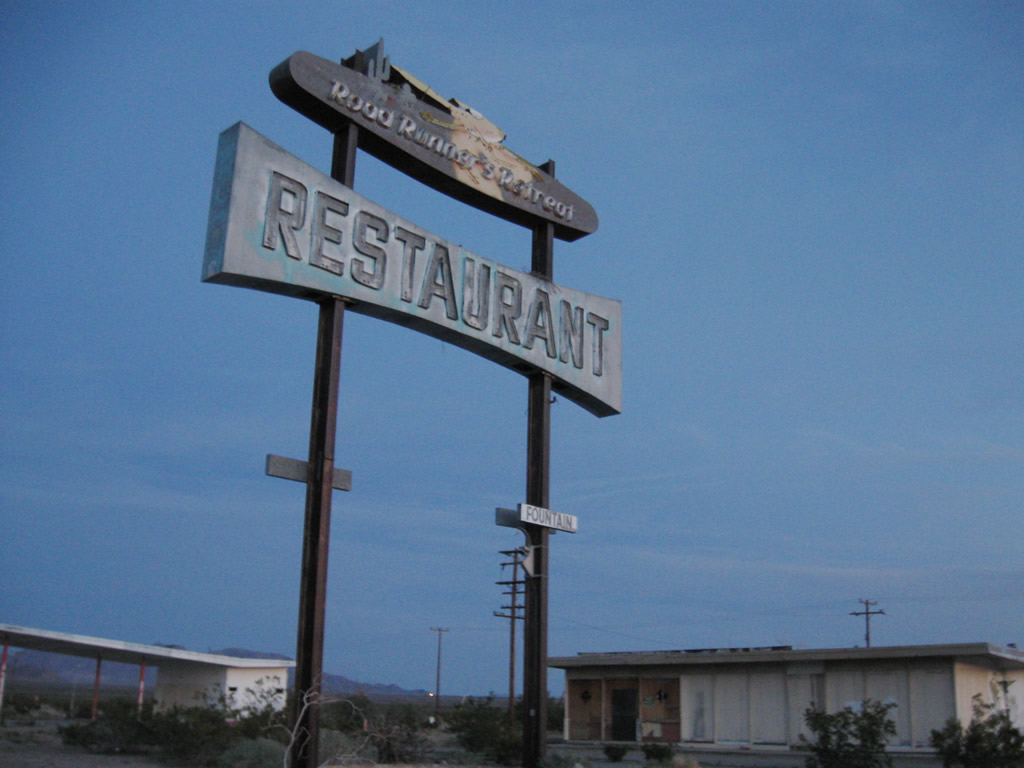
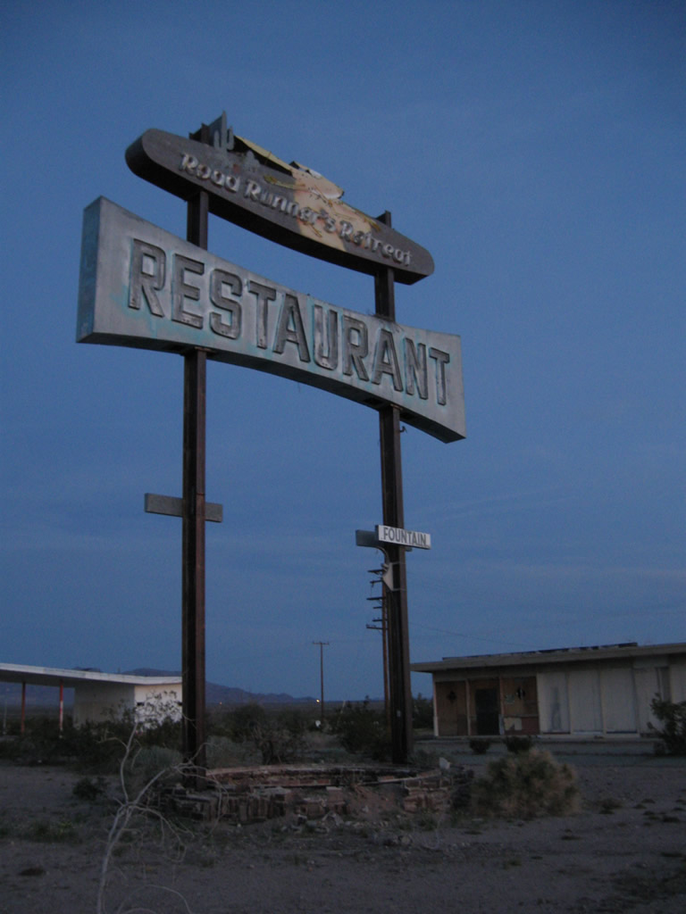
The Roadrunner's Retreat is a former gas station and restaurant that has been left in place in the Mojave Desert along U.S. 66. While the site is fenced off, decay and weathering are evident throughout the site. Photos taken 03/14/09. |
 |
 |
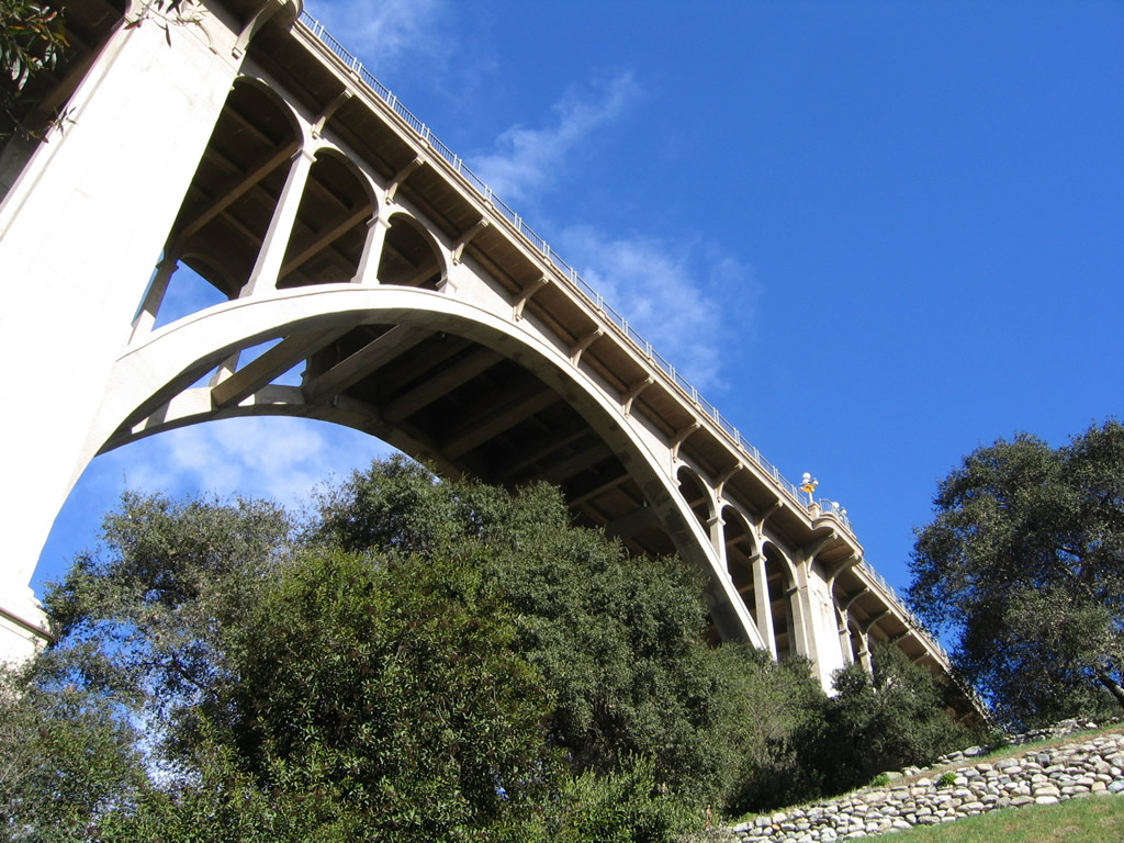 |
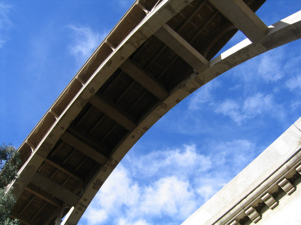
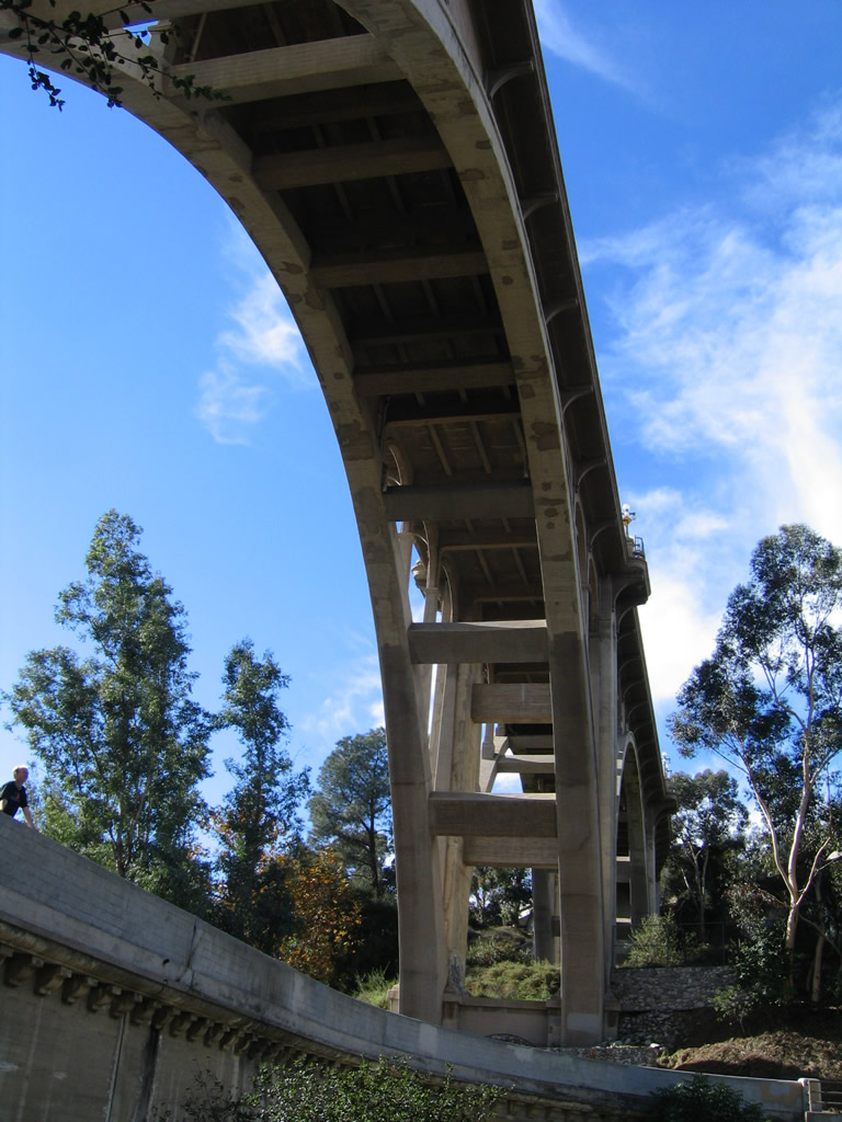
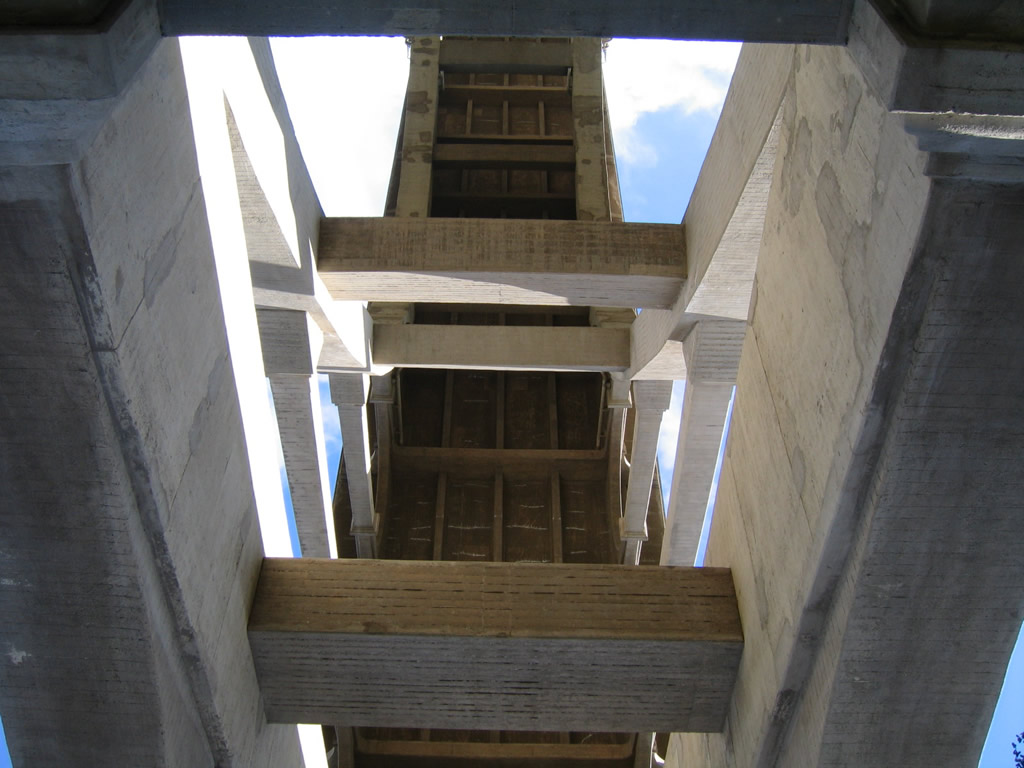
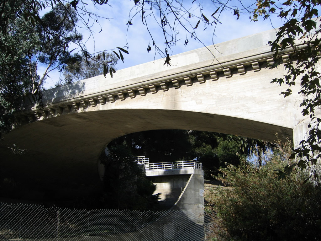
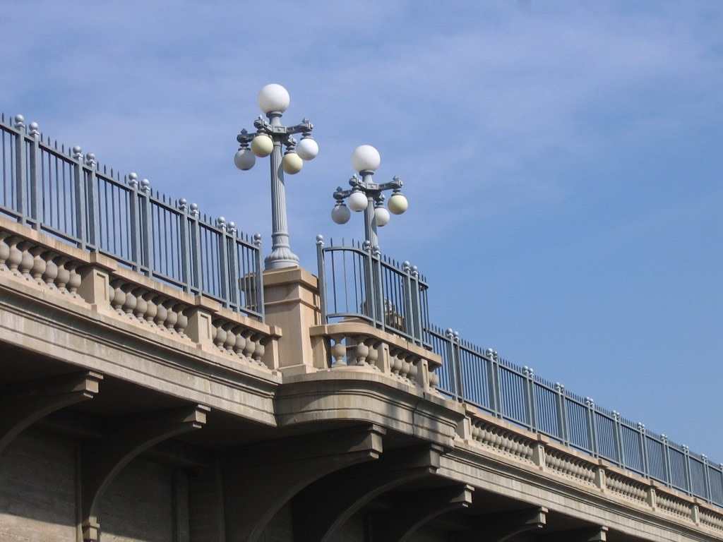
The Colorado Street Pioneer Bridge is one of the most remarkable bridges along Historic U.S. 66. Located along Colorado Boulevard between downtown Pasadena and Eagle Rock, the bridge opened to traffic in 1913. Photos taken 12/10/05. |
 |
 |
 |
|
 |
 |
 |
|
 |
 |
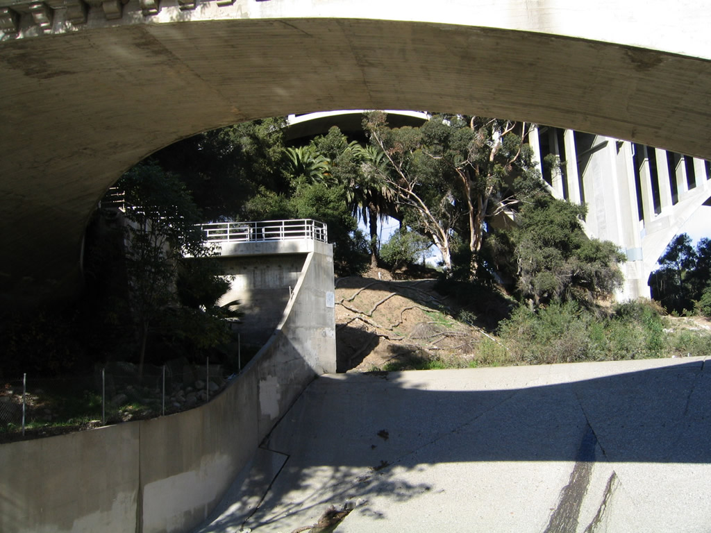 |
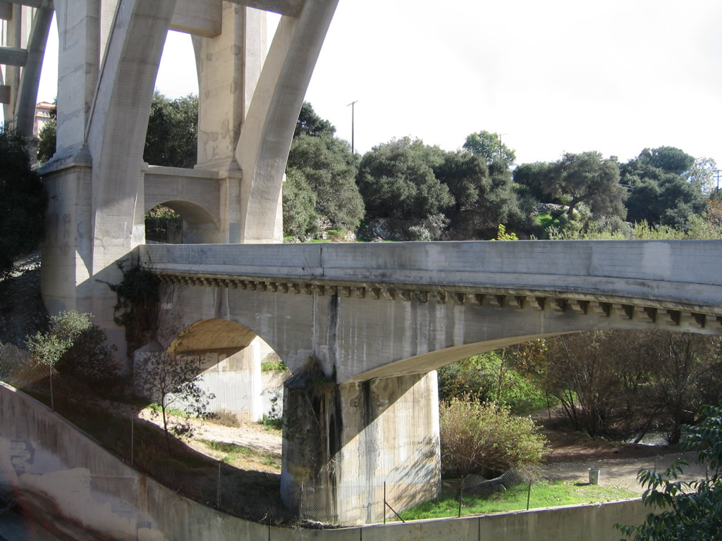
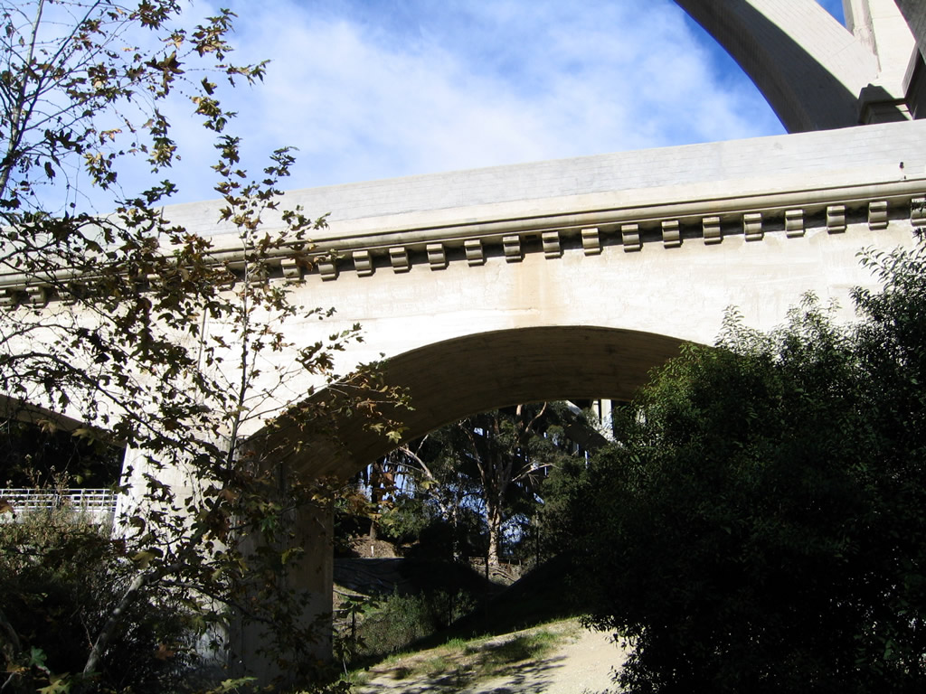
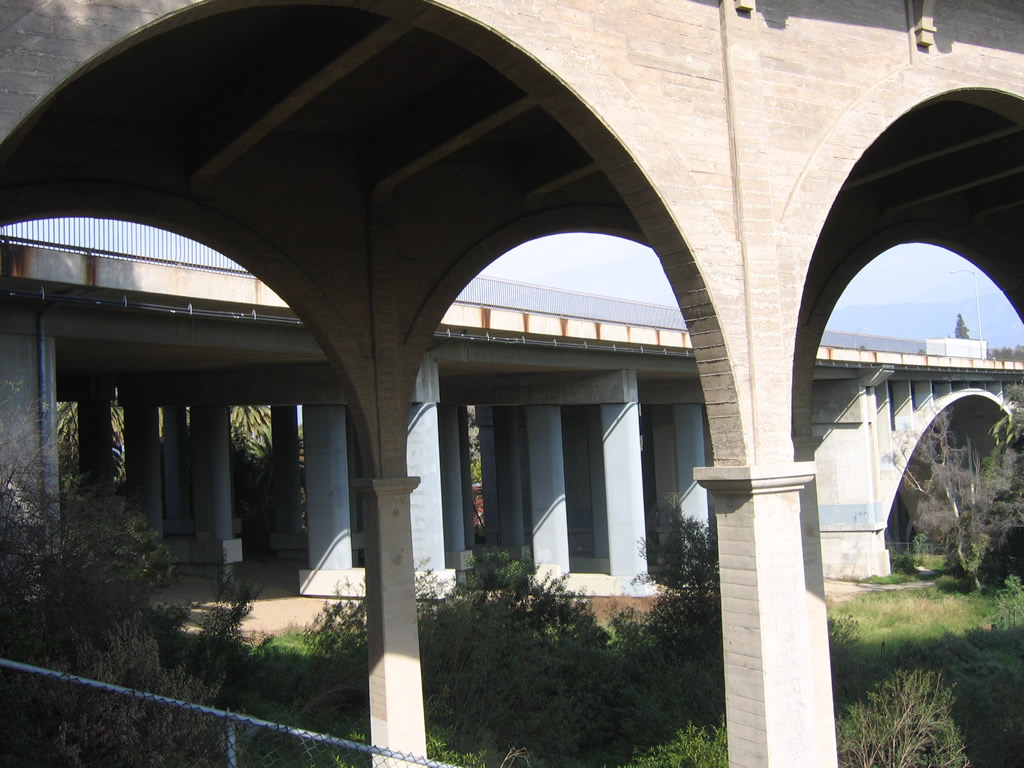
An even older bridge spans the Arroyo Seco below the Colorado Street Pioneer Bridge in Pasadena. Photos taken 12/10/05. |
 |
 |
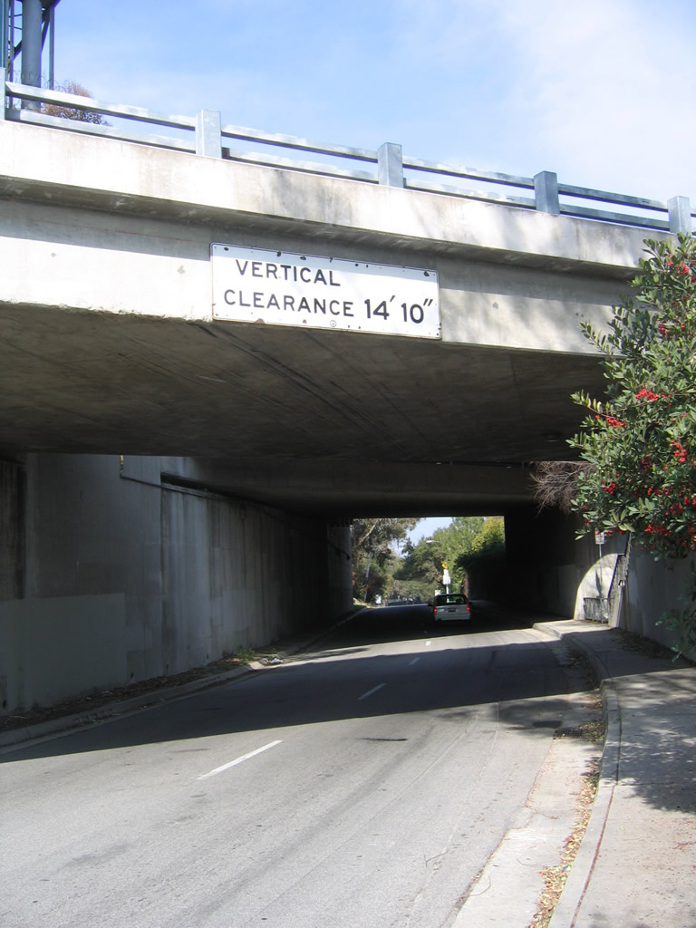 |
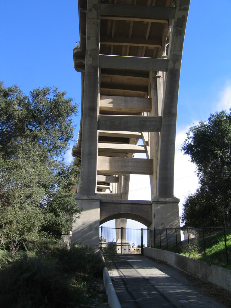
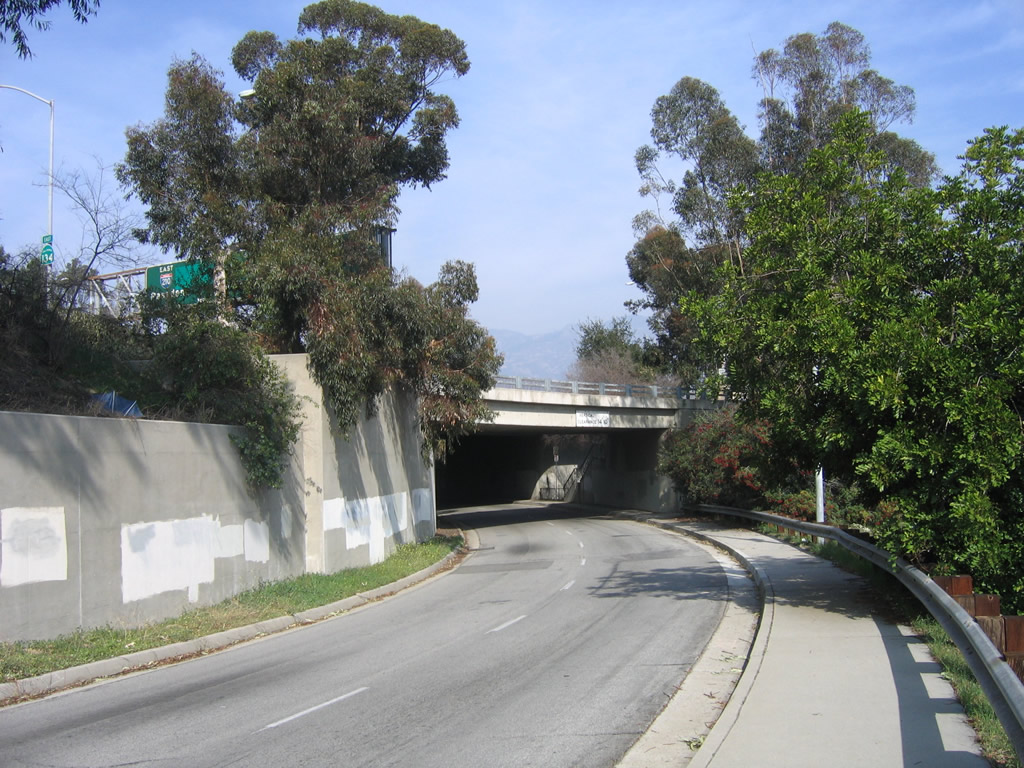
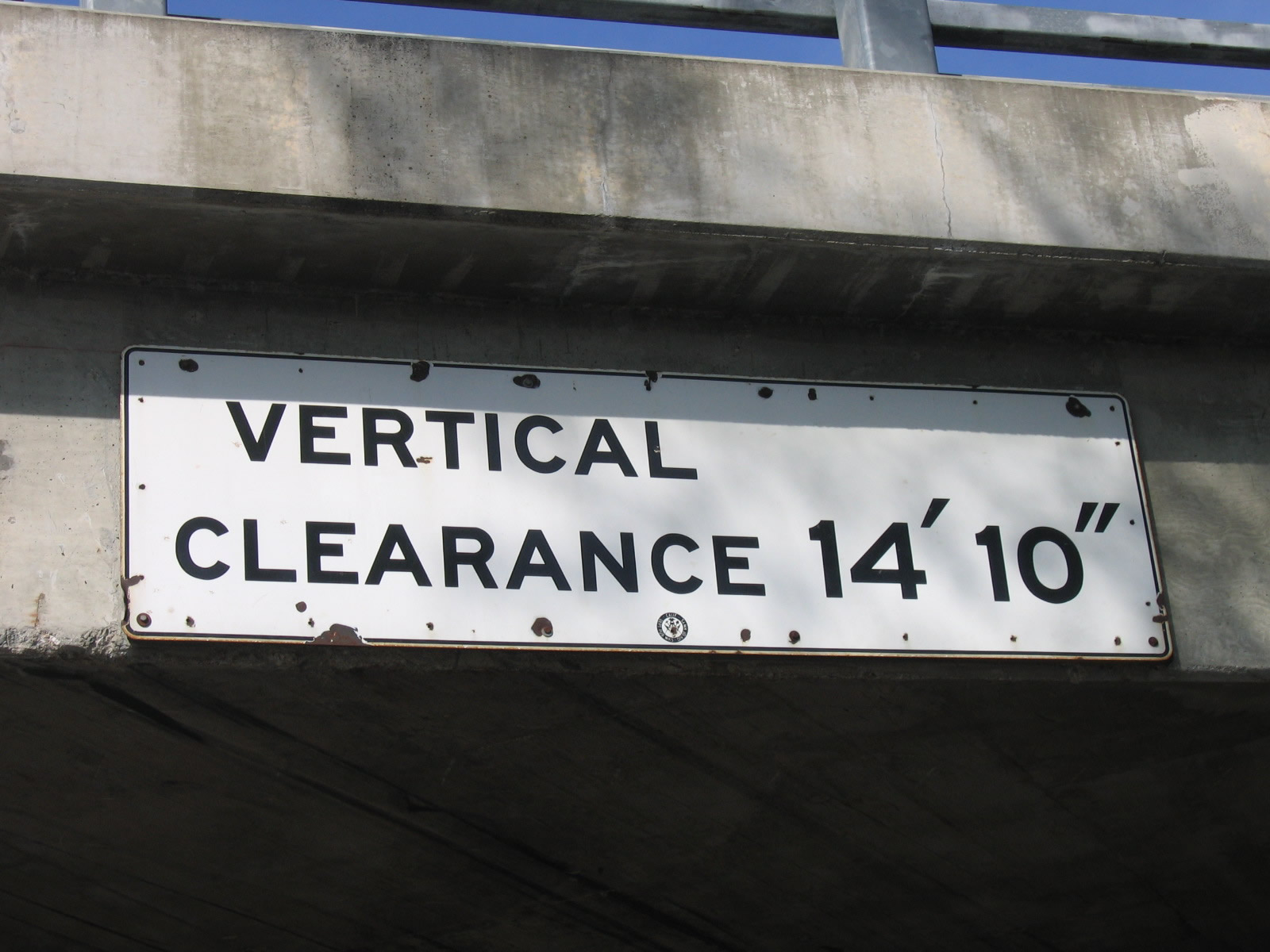
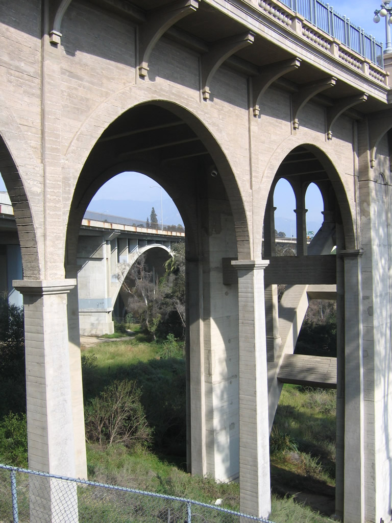
This series of photos follows Linda Vista Avenue as it passes under the Colorado Street Pioneer Bridge in Pasadena en route to the Rose Bowl. Mounted on top of the underpass is a rare California Division of Highways sign. This section of highway was originally part of California 11 and later became California 159, which was removed from the state highway system in 1989. Photos taken 01/28/06. |
 |
 |
 |
|
 |
 |
 |
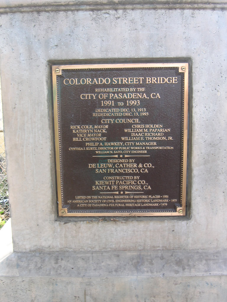 |
At the east end of the Colorado Street Pioneer Bridge is this plaque, which memorializes the 80-year anniversary of the bridge in 1993. Dedicated on December 13, 1913, the bridge was designed by DeLeuw, Cather & Co. from San Francisco and was built by Kiewit Pacific Co. from Santa Fe Springs. Photo taken 01/28/06. |
| Santa Monica Pier | |
|---|---|
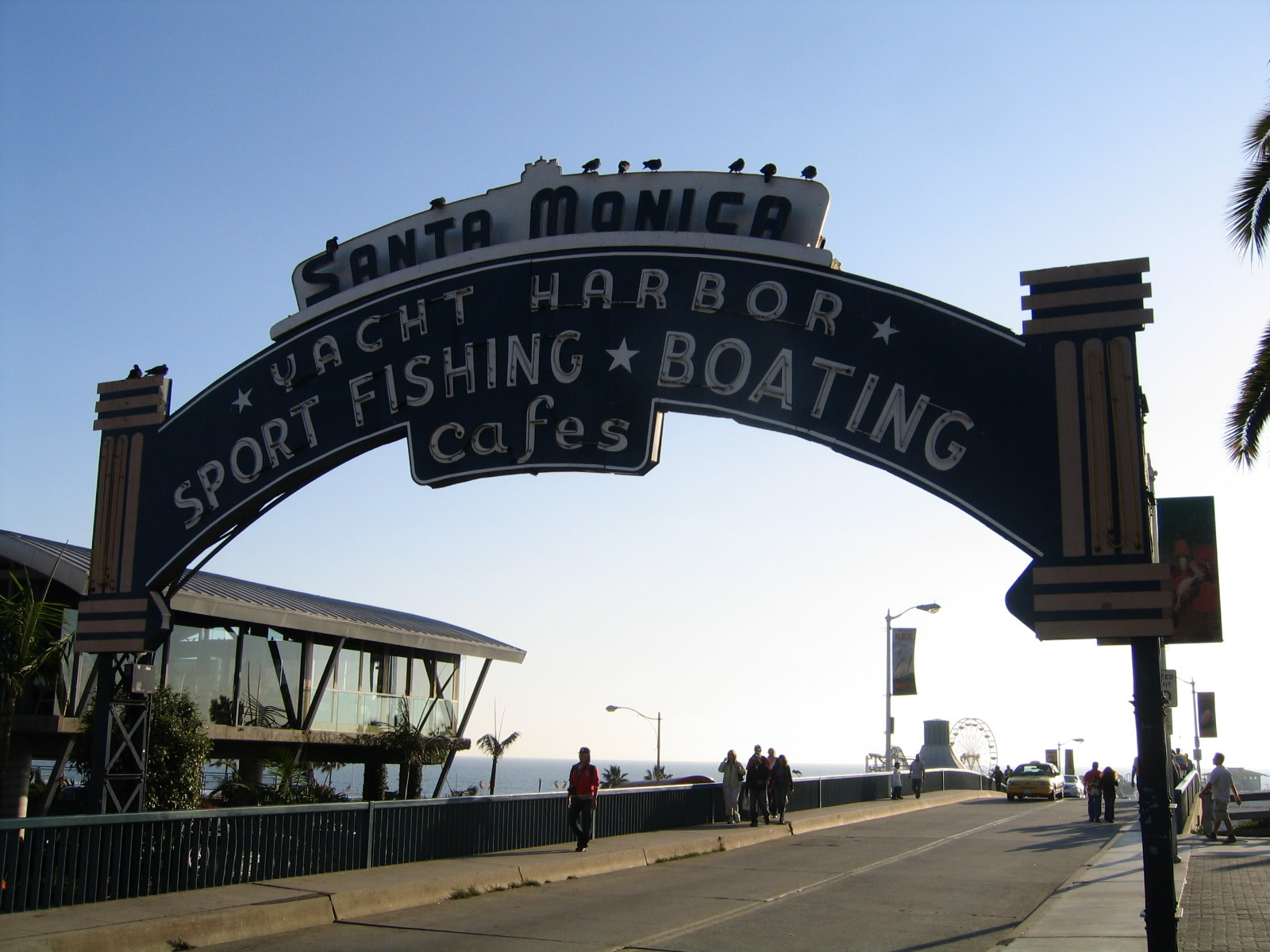 |
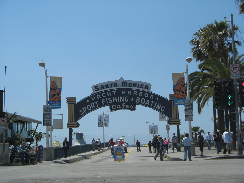
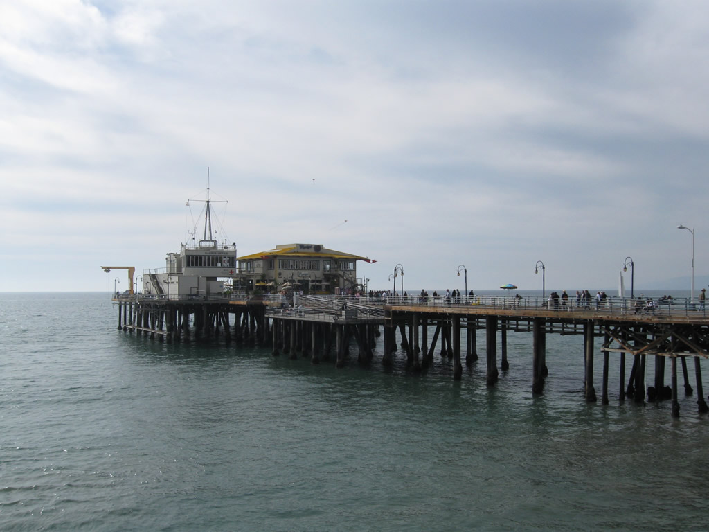
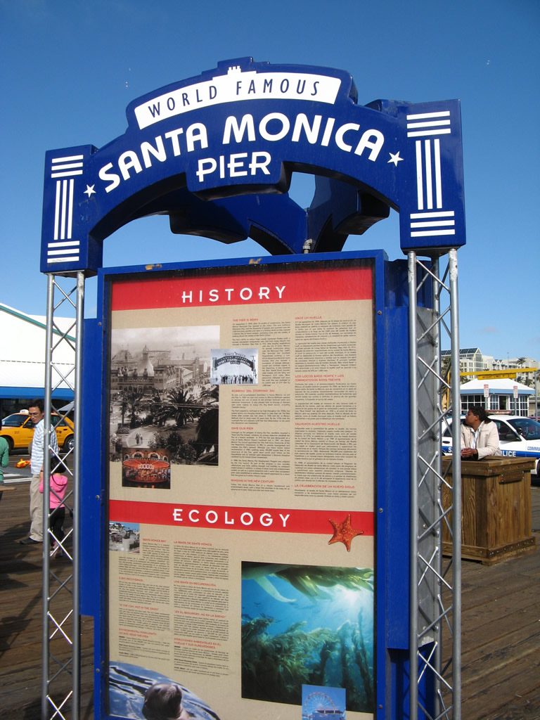
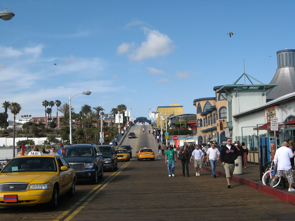
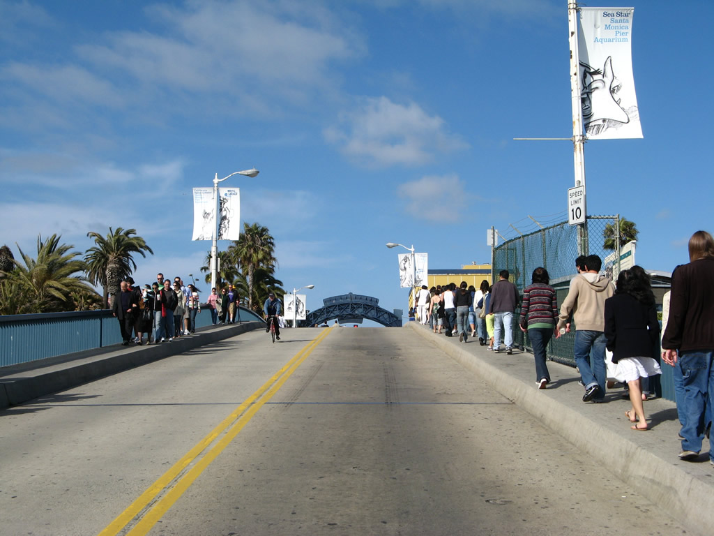
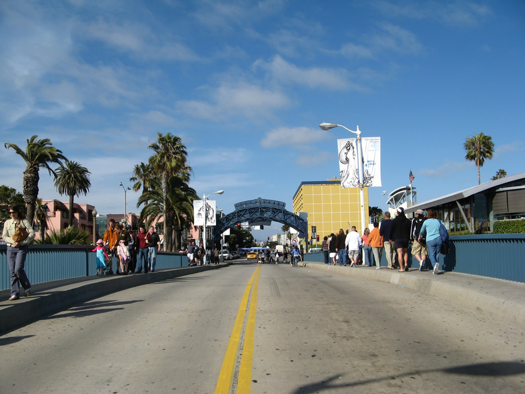
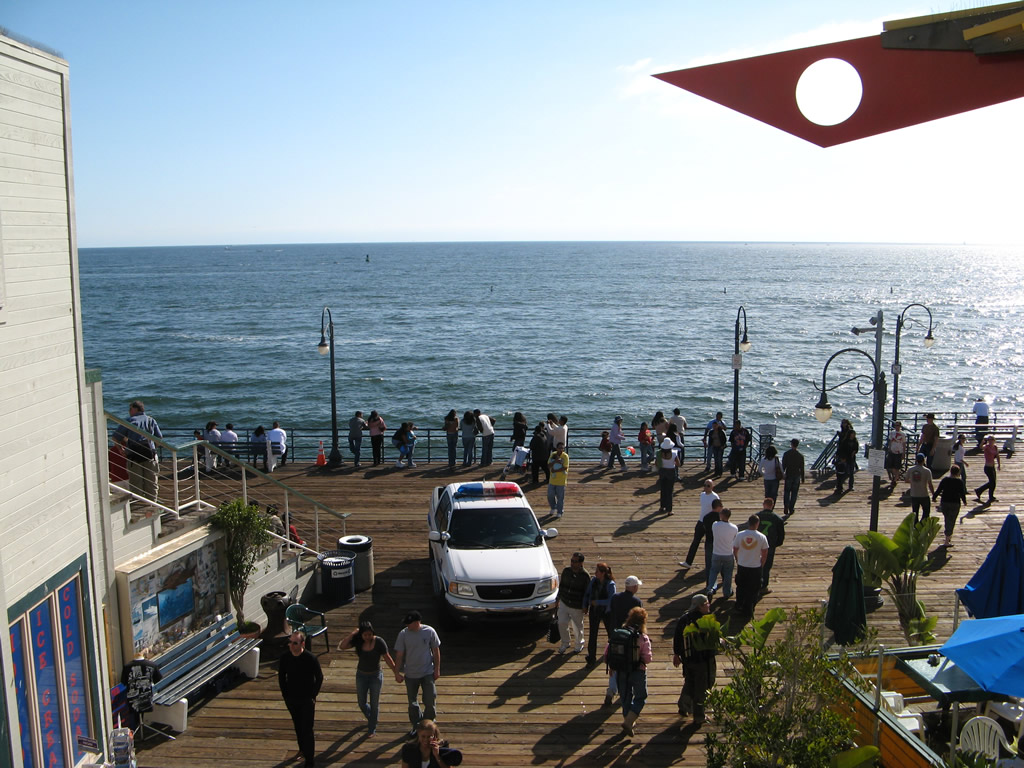
The Santa Monica Pier is located at the western end of Colorado Avenue. Despite the fact that U.S. 66 never officially ended at the pier, popular media has made the pier the sentimental western terminus of U.S. 66. An "End of Route 66" sign is posted on the pier next to a memorabilia store. The actual end of U.S. 66 was at the intersection of Olympic Boulevard and Lincoln Boulevard, near the western terminus of Interstate 10 (Santa Monica Freeway). Below the bridge connecting Colorado Avenue to the pier is California 1 (Pacific Coast Highway). Photos taken 10/30/05 and 04/21/07. |
 |
|
 |
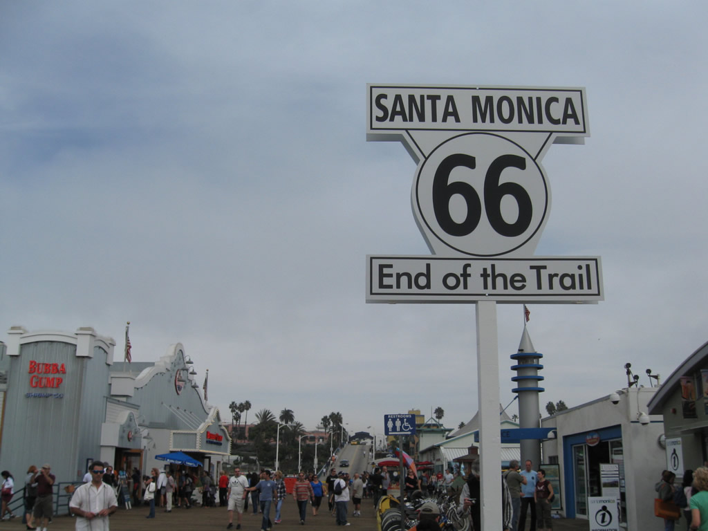 |
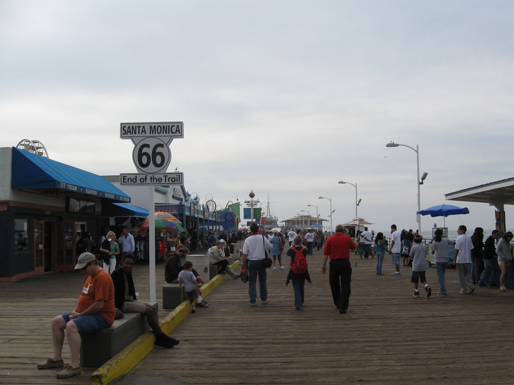
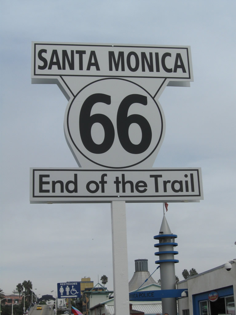
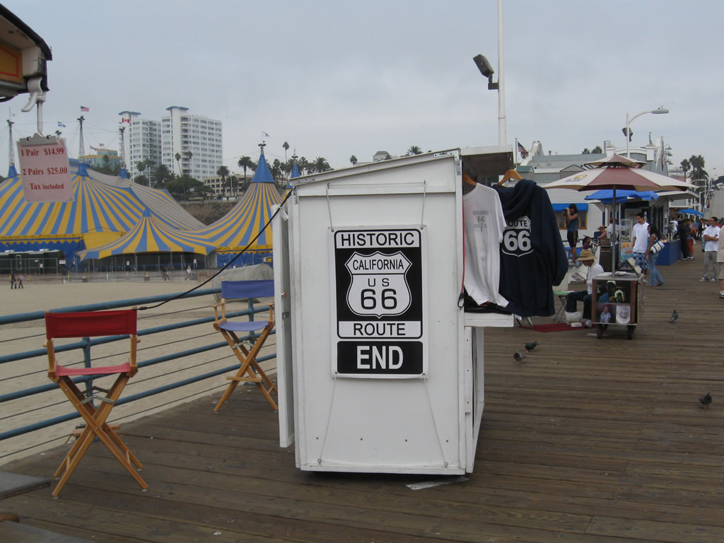
On the Santa Monica Pier is the 66 End of Trail marker. Dedicated on November 11, 2009, the marker signifies the sentimental terminus of U.S. 66 on the pier (even though its last official terminus was at Olympic Boulevard and Lincoln Boulevard a few blocks east of the pier entrance off Ocean Boulevard and Colorado Avenue). A small kiosk (66-to-Cali) selling Route 66 memorabilia is located next to the End of Trail marker at the end of the driveable section of the pier. On the side of the 66-to-Cali souvenir shop is a replica End Historic Route U.S. 66 sign on the side of the kiosk. These pictures were taken exactly 83 years after U.S. 66 was first commissioned in 1926. Photos taken 11/11/09. |
 |
 |
 |
 |
 |
 |
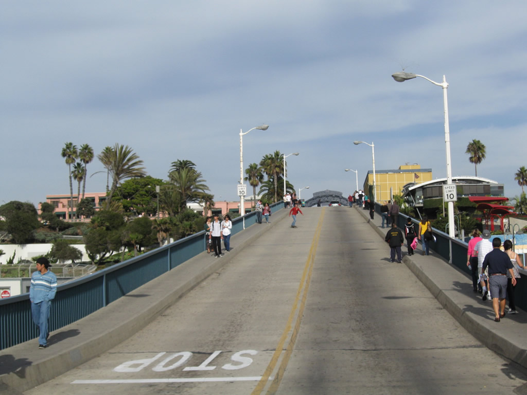 |
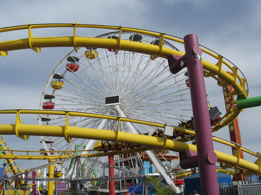
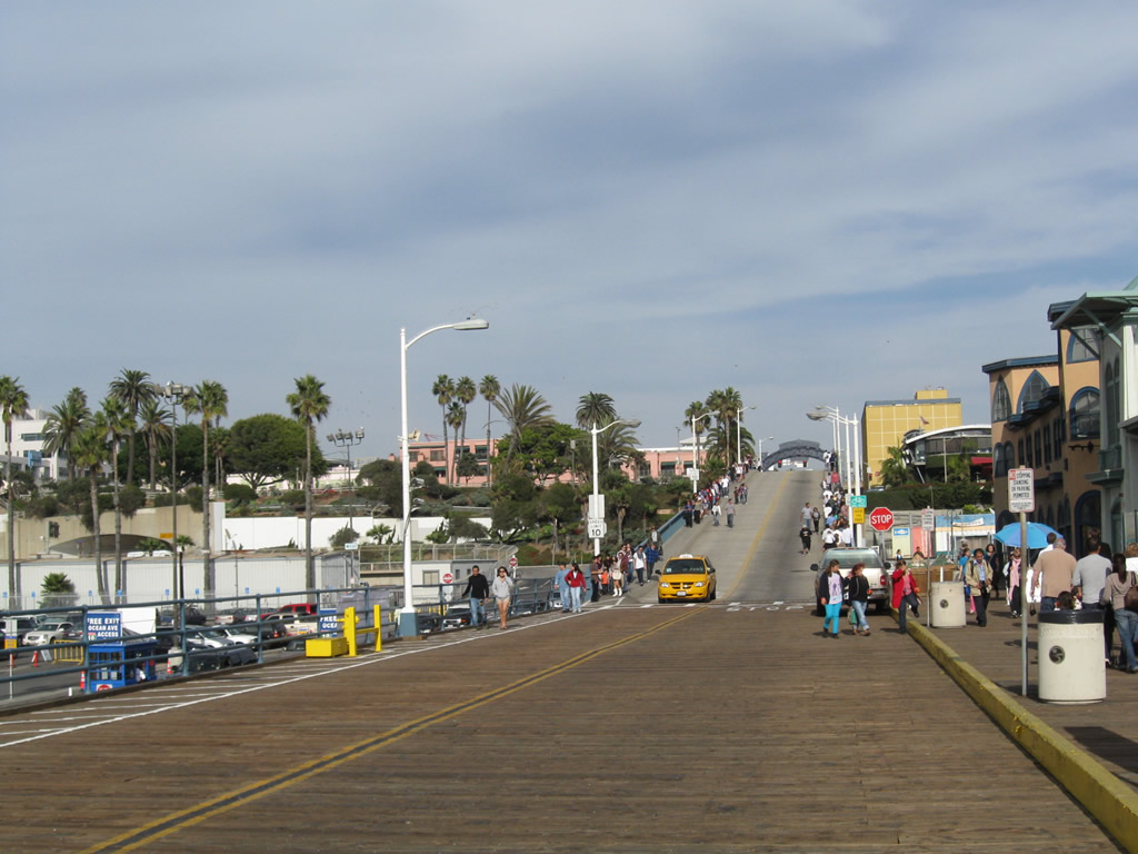
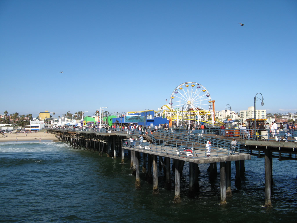
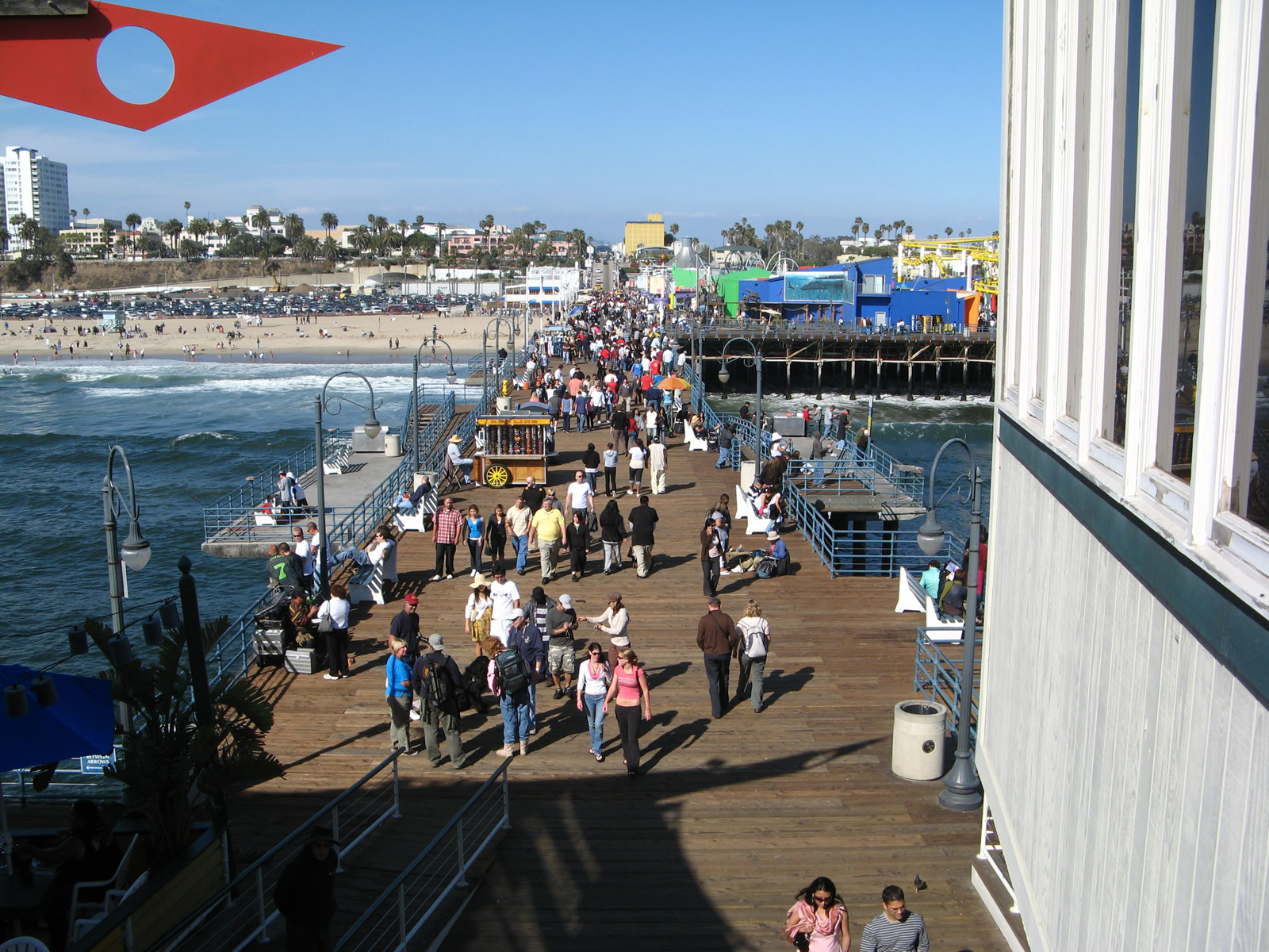
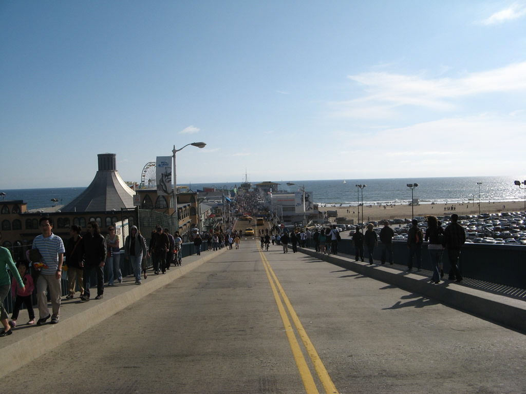
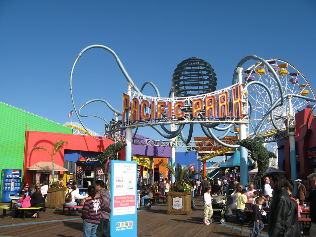
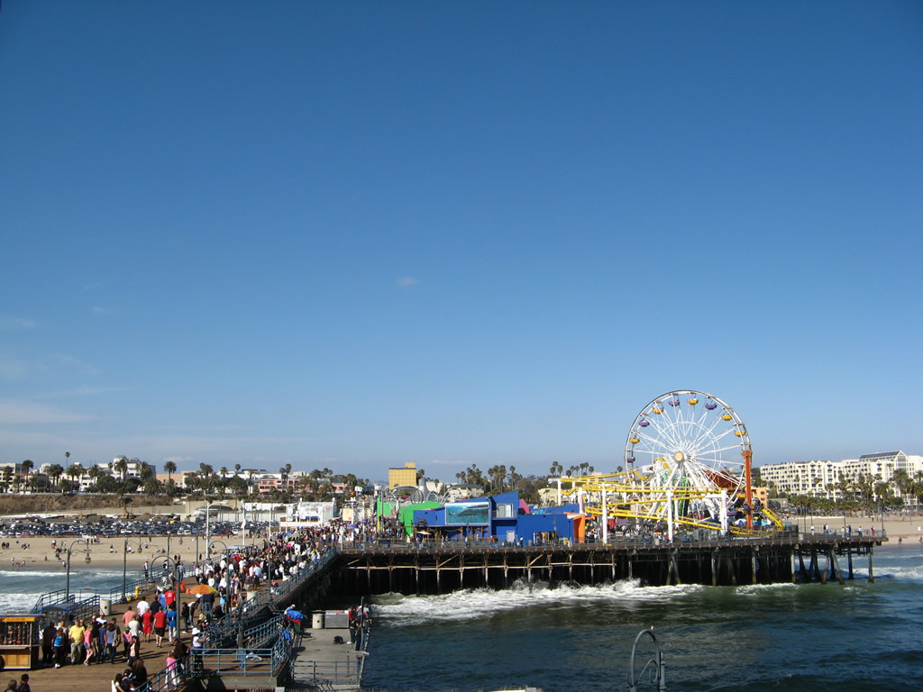
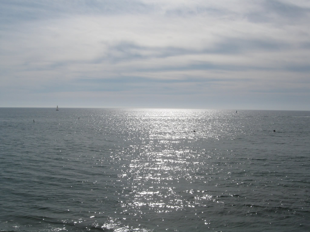
| This series of pictures offers views of the Santa Monica Pier as seen from various vantage points. Cars are allowed to drive onto the pier, with a small parking area near the 66-to-Cali souvenir shop. Toward the back of the pier are various amusement park rides (at Pacific Park). Photos taken 11/11/09 and 04/21/07. | ||||
 |
 |
 |
 |
 |
 |
 |
 |
 |
 |
 |
 |
 |
 |
 |
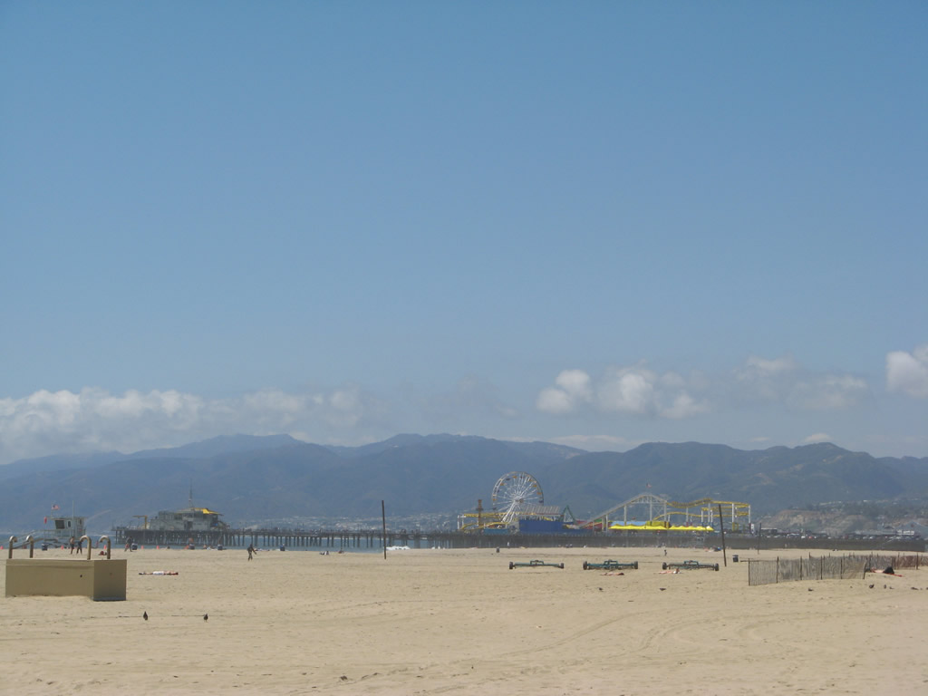
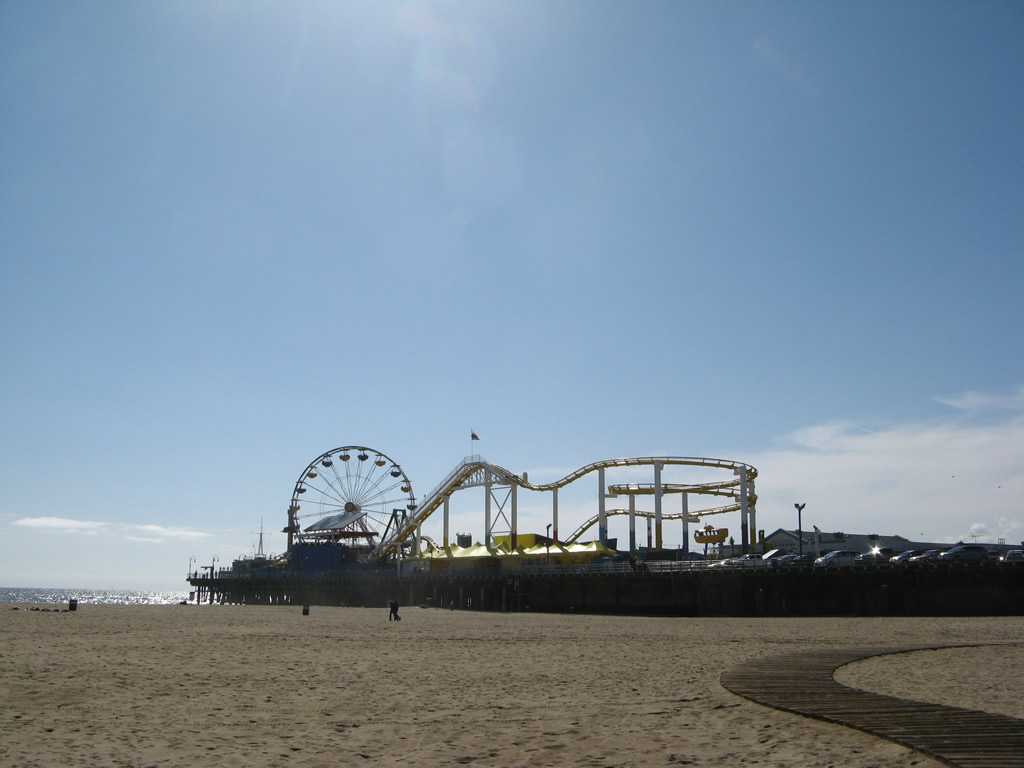
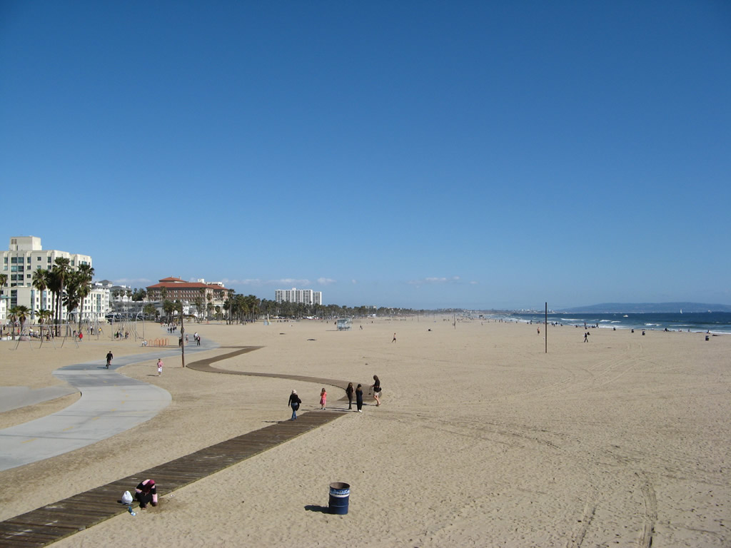
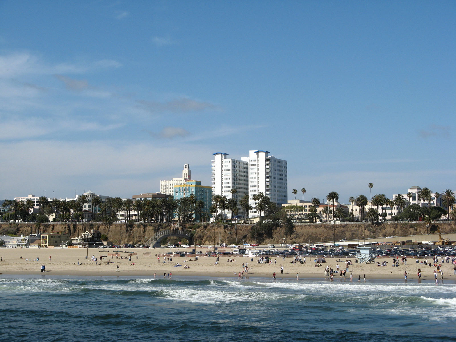
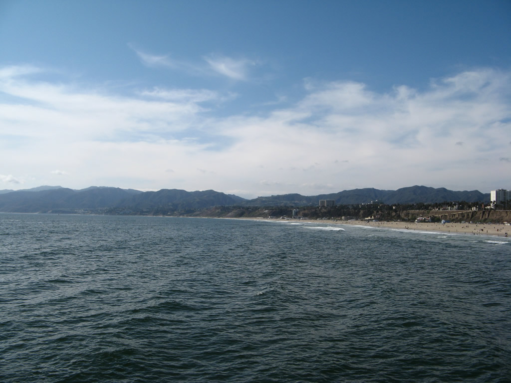
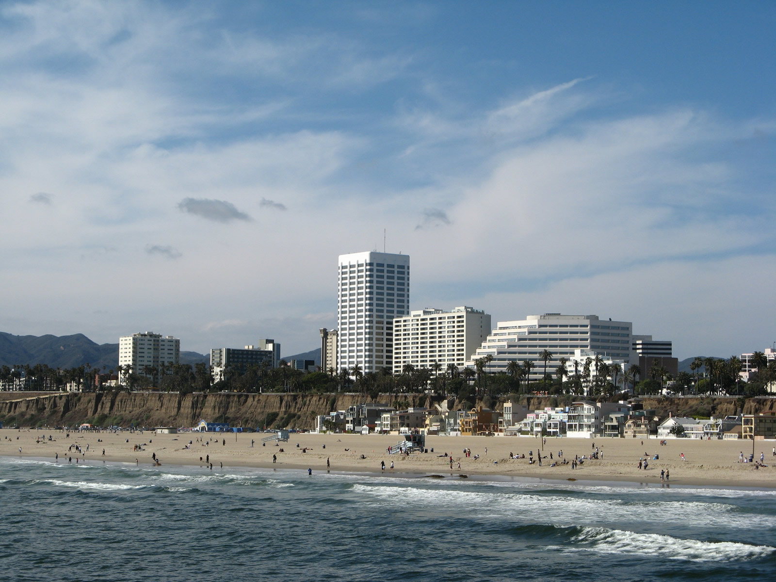
| These views look east, north, and south from the Santa Monica Pier. The Palisades rise above the sandy beach next to the Pacific Coast Highway. Photos taken 04/21/07. | ||||
 |
 |
 |
 |
 |
 |
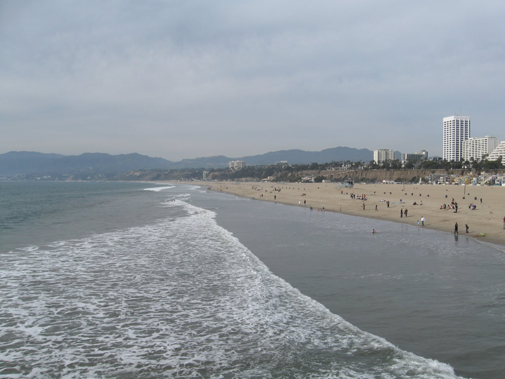 |
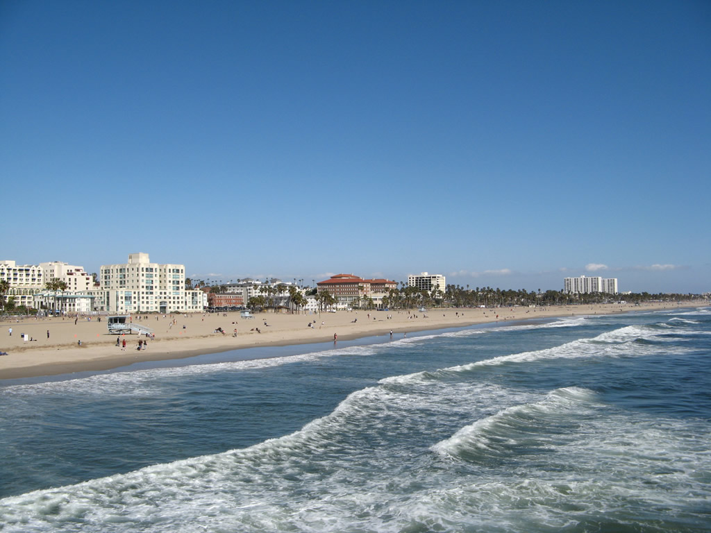
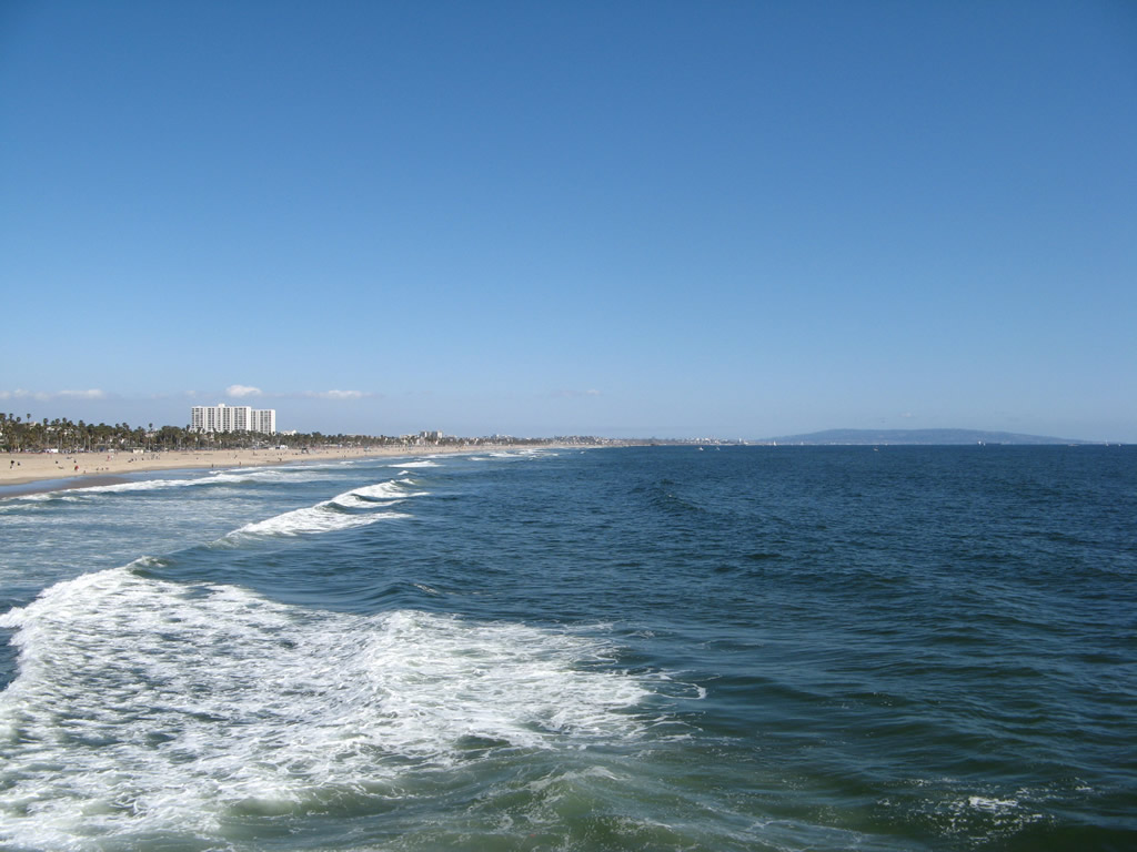
The Pacific Ocean, Santa Monica Mountains, and Palisades all come into view from the Santa Monica Pier. The Route 66 "End of Trail" sign is located on the pier, which serves as a sentimental end to U.S. 66 even if U.S. 66 never officially extended all the way onto the pier. Photos taken 11/11/09. |
Sources:
- New SB County Route 66 signs are in!, by Brad Mitzelfelt, San Bernardino County’s First District Supervisor from 2007-2012, dated November 4, 2011

Page Updated January 12, 2013.
|
About Contact Glossary |
In The News Testimonials Interstate Guide |
Social Media:
 |
|
© 2000-23 AARoads.com | All Rights Reserved | Privacy Policy / Terms of Use
|
||