|
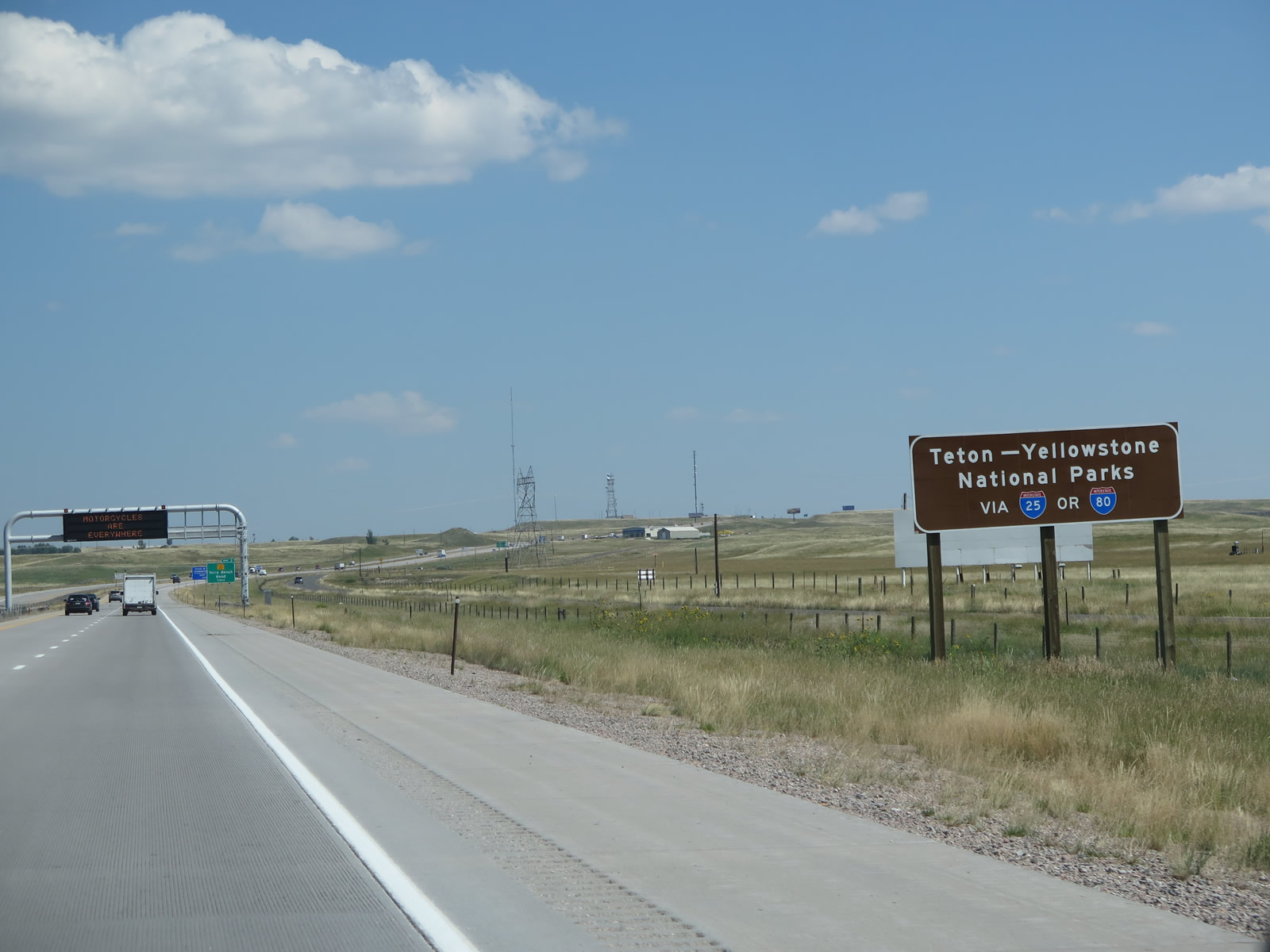
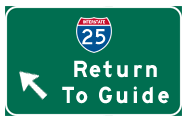
Many tourists entering Wyoming are traveling to Yellowstone and Grand Teton National Parks. This sign, which is posted along Interstate 25 north, advises that either Interstate 25 or Interstate 80 are good routes to Yellowstone and Grand Teton National Parks. Interstate 25 connects directly with U.S. 20 at Casper and U.S. 16 at Buffalo, and both U.S. 20 and U.S. 16 travel west to Yellowstone. It also connects to U.S. 26 west to Grand Teton. (Access to Yellowstone via U.S. 14 is afforded via Interstate 90 west after the northern terminus of Interstate 25.) As for Interstate 80, it connects directly with three routes that travel north toward Grand Teton: U.S. 287 at Rawlins, U.S. 191 at Rock Springs, and U.S. 189 via Wyoming 372 at Green River. All three routes of these routes serve Jackson, and two of them -- U.S. 287 and U.S. 191 -- continue onward into Grand Teton and Yellowstone. Photo taken 08/11/14. |
|
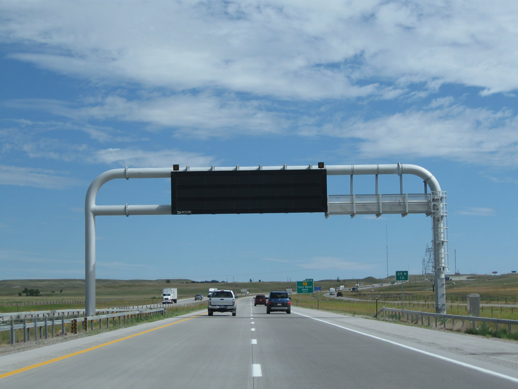
A large dynamic message sign is mounted over the freeway travel lanes after the national parks sign. Photo taken 08/02/10. |
|
|
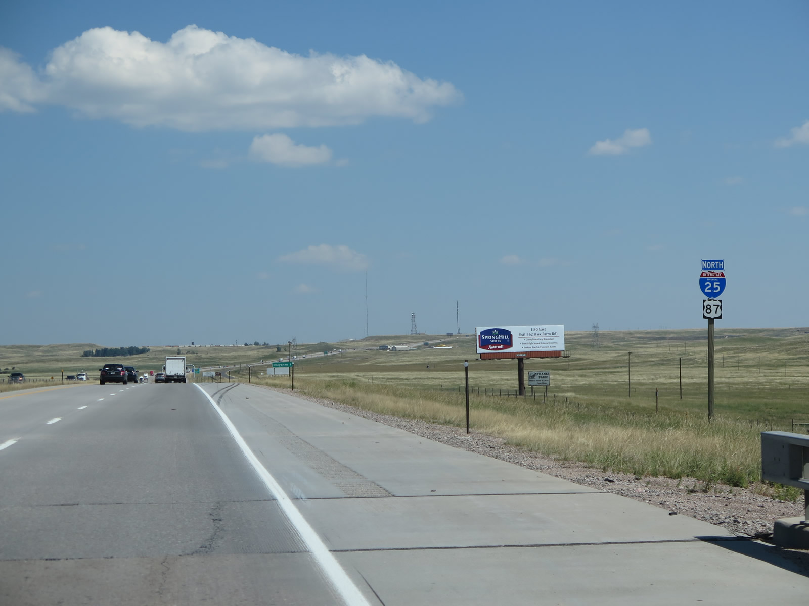
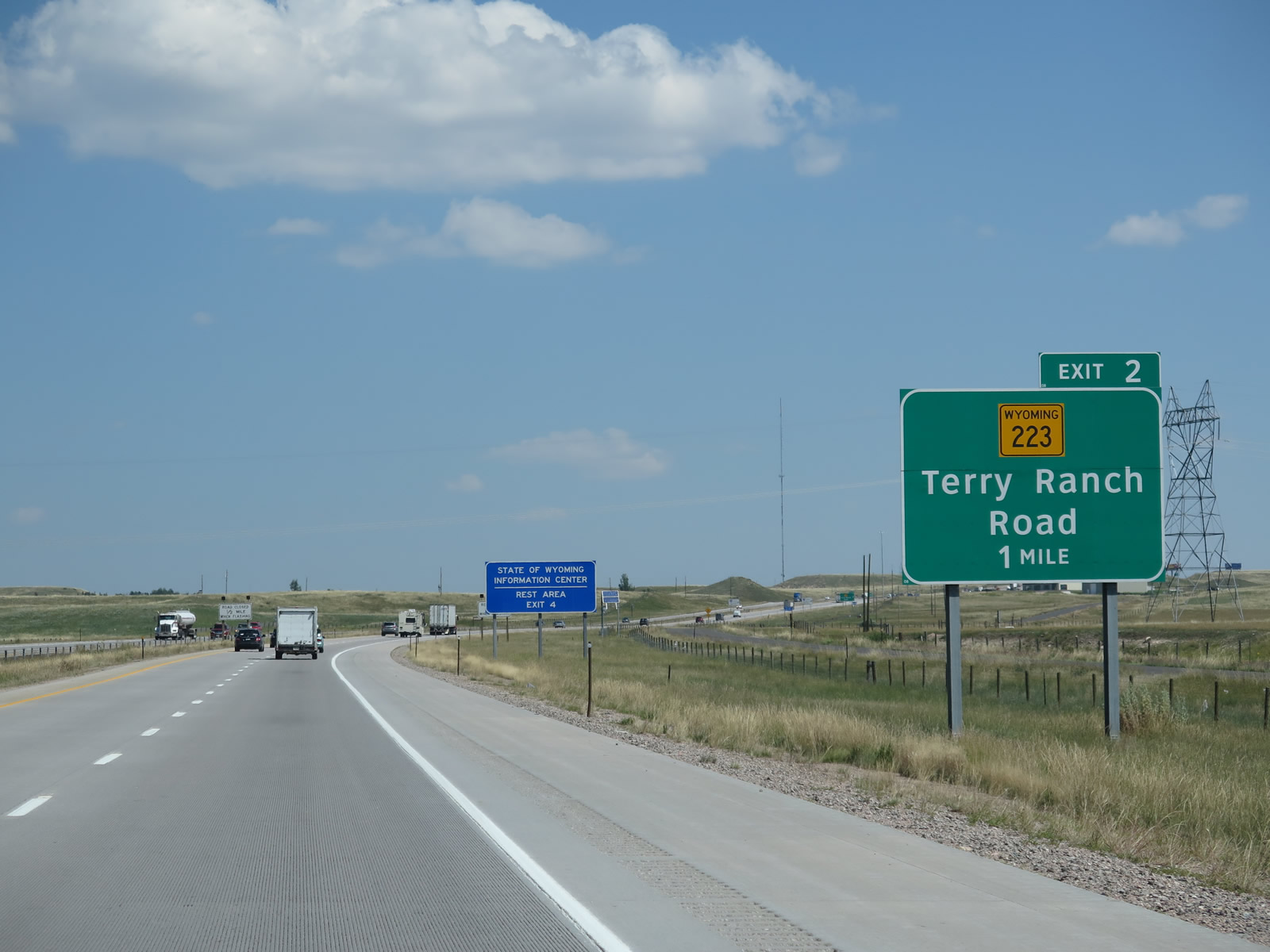
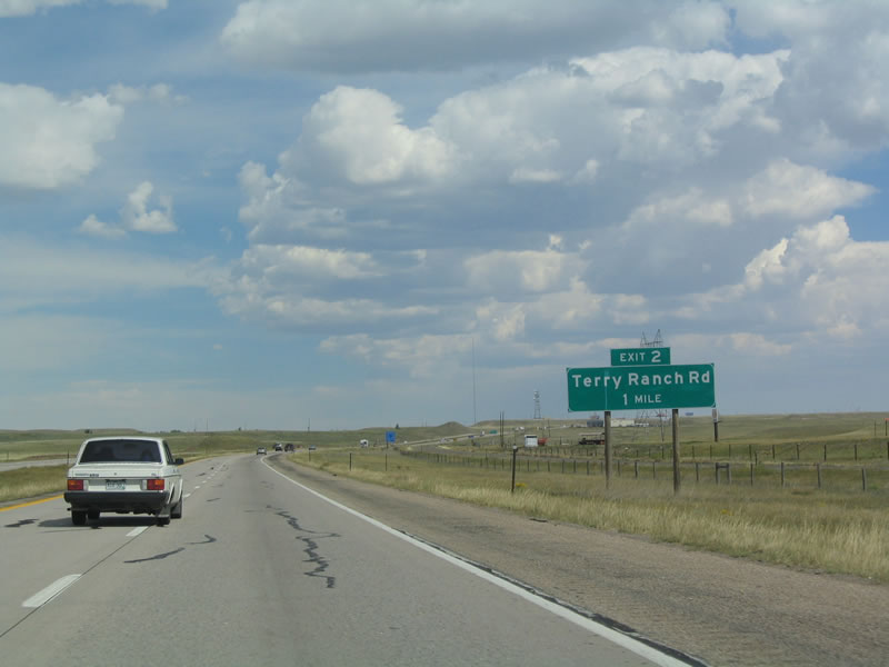
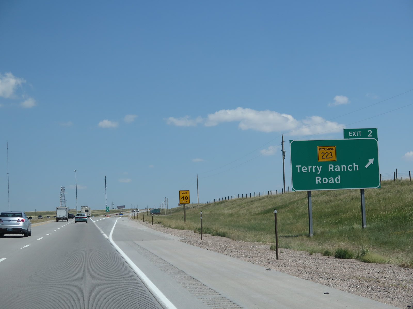
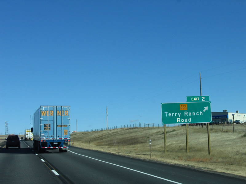
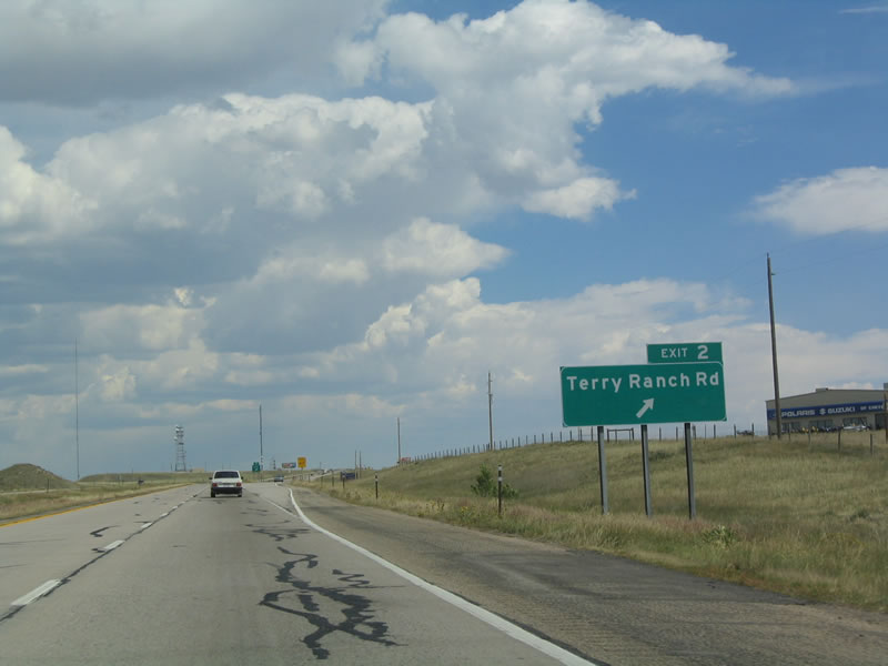
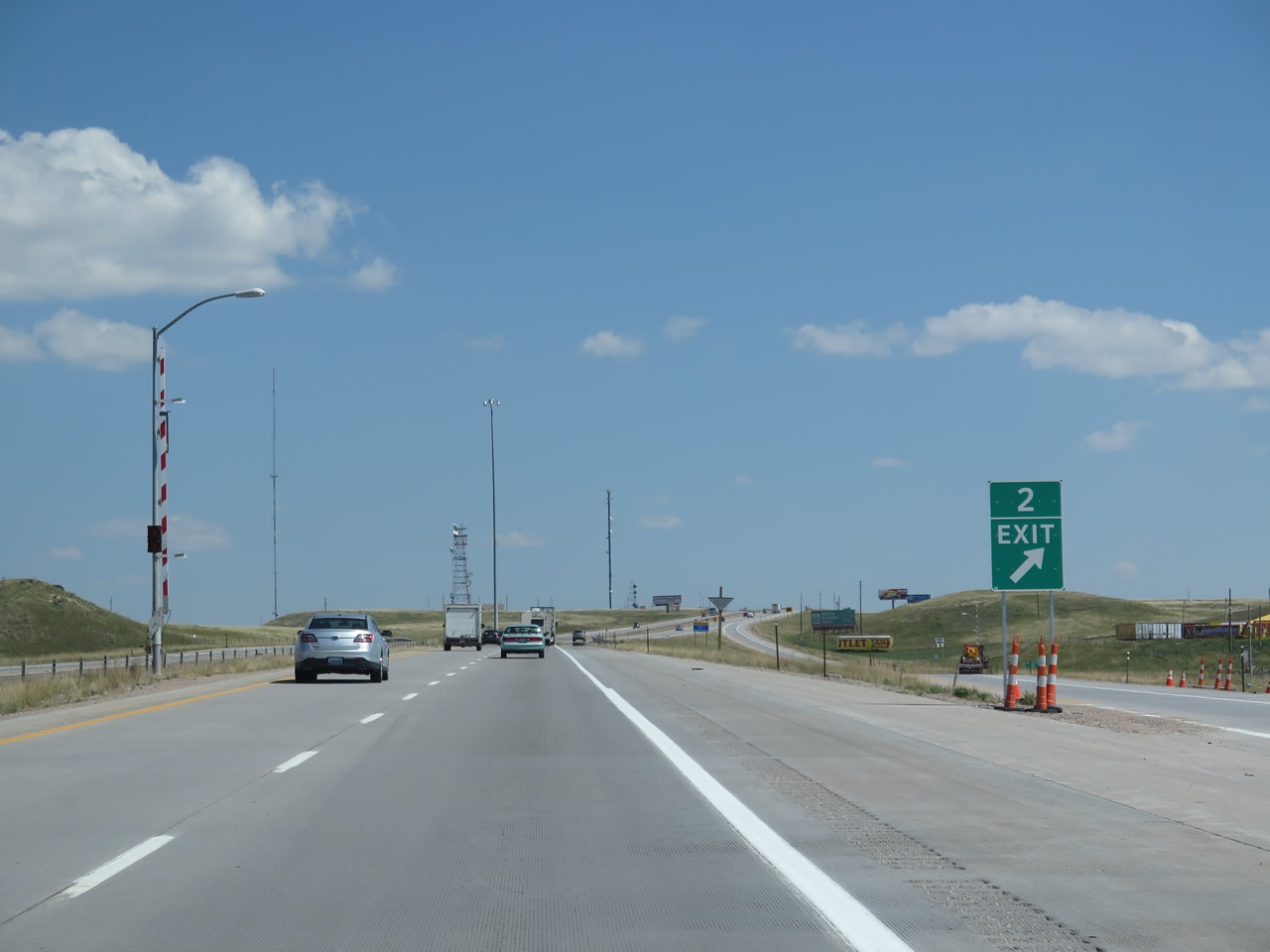
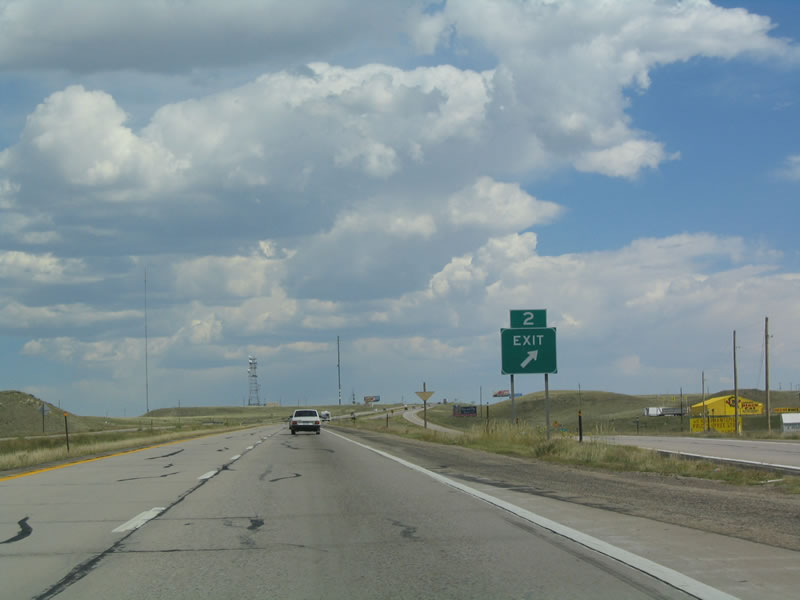
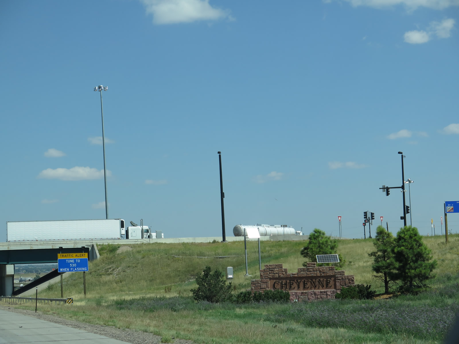
The first exit along northbound Interstate 25 and U.S. 87 in Wyoming is Exit 2, Wyoming 223/Terry Ranch Road northeast to U.S. 85, Greeley Highway. Historically, Wyoming 223 is the old alignment of U.S. 87 before it was moved onto Interstate 25. The Terry Bison Ranch is a well known cattle and bison ranch located south of Cheyenne and west of Interstate 25. Occasionally (but rarely) bison may be seen from the freeway. This sign was replaced in 2008 and now includes the state highway designation. Photos taken 08/11/14 and 09/01/04. |
|
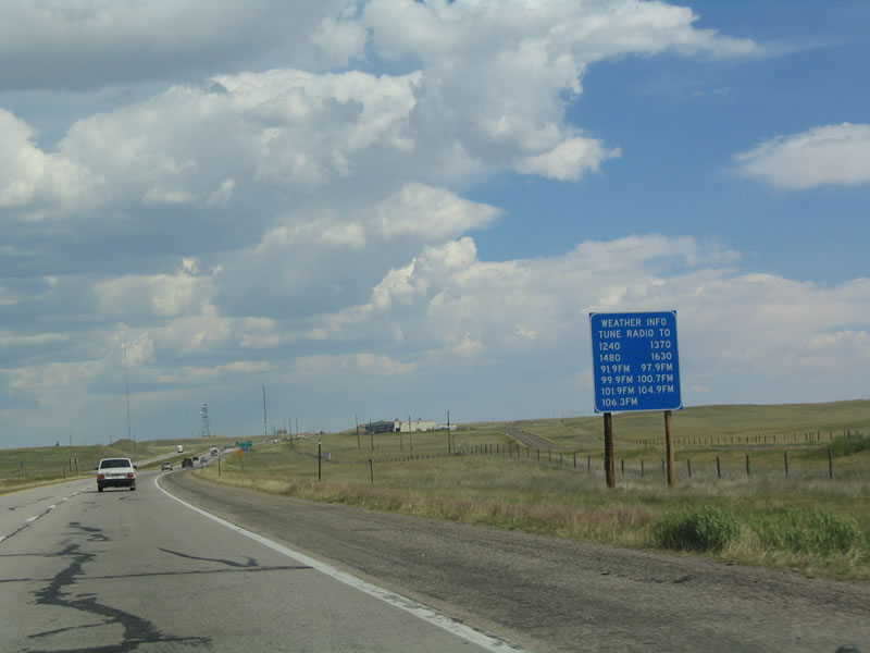
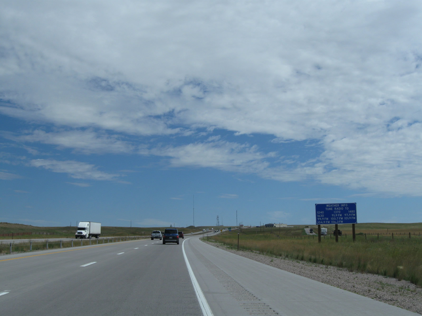
Through the 1990s and 2000s, the Wyoming Department of Transportation placed signs such as this one uopn entering the metropolitan area of the larger cities in Wyoming. These blue service signs would provide radio station information to inform motorists of changing weather and traffic conditions. Thunderstorms in the summer, blizzards in the winter, and wind storms year-round can change road conditions throughout the year. With the advent of satellite radio, wireless Internet, and other sources of information, these signs have become less frequently found around Wyoming. This particular sign on the approach to Exit 2 was removed and not replaced in 2008. Photo taken 09/01/04. |
|
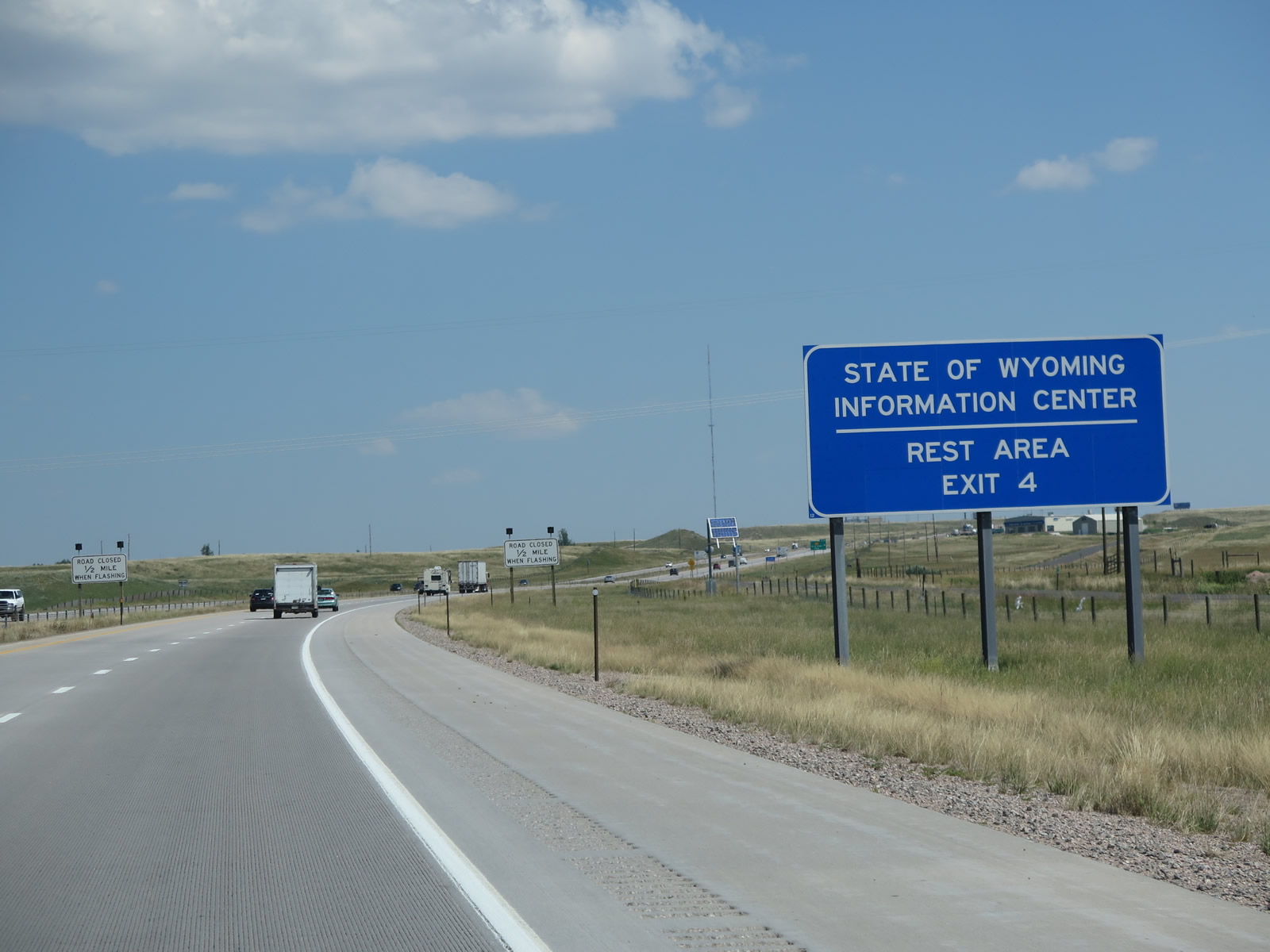
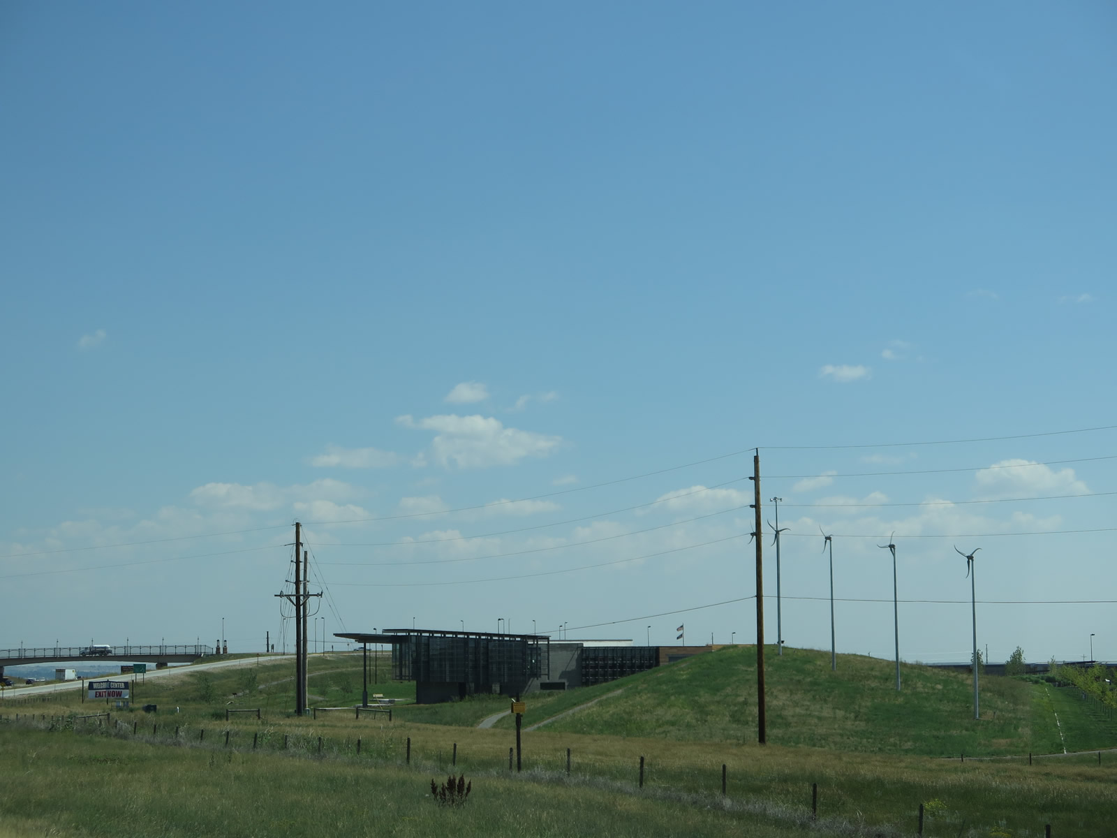
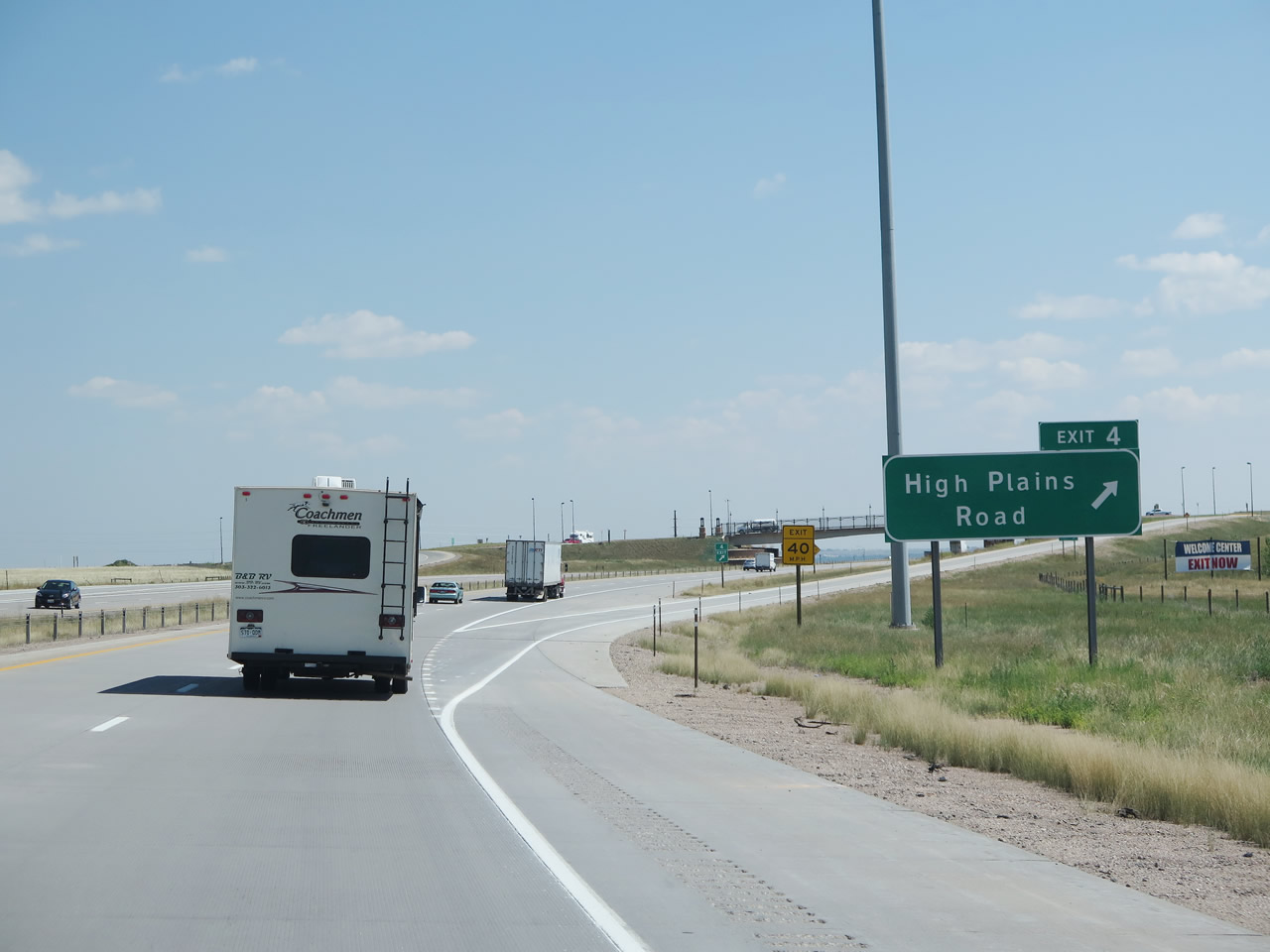
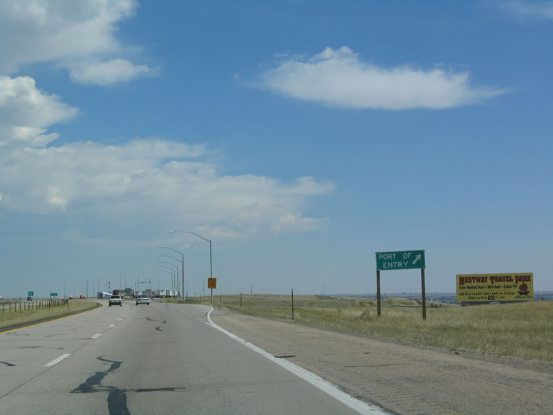
The State of Wyoming Information Center was relocated from the College Drive interchange (Exit 7) to the High Plains Road interchange (Exit 4) in 2010. As a result, a new advance sign for the welcome center was added to correspond with the center's opening. The center features interactive displays of Wyoming's natural bounty as well as maps, brochures, and restrooms. Photo taken 08/11/14. |
|
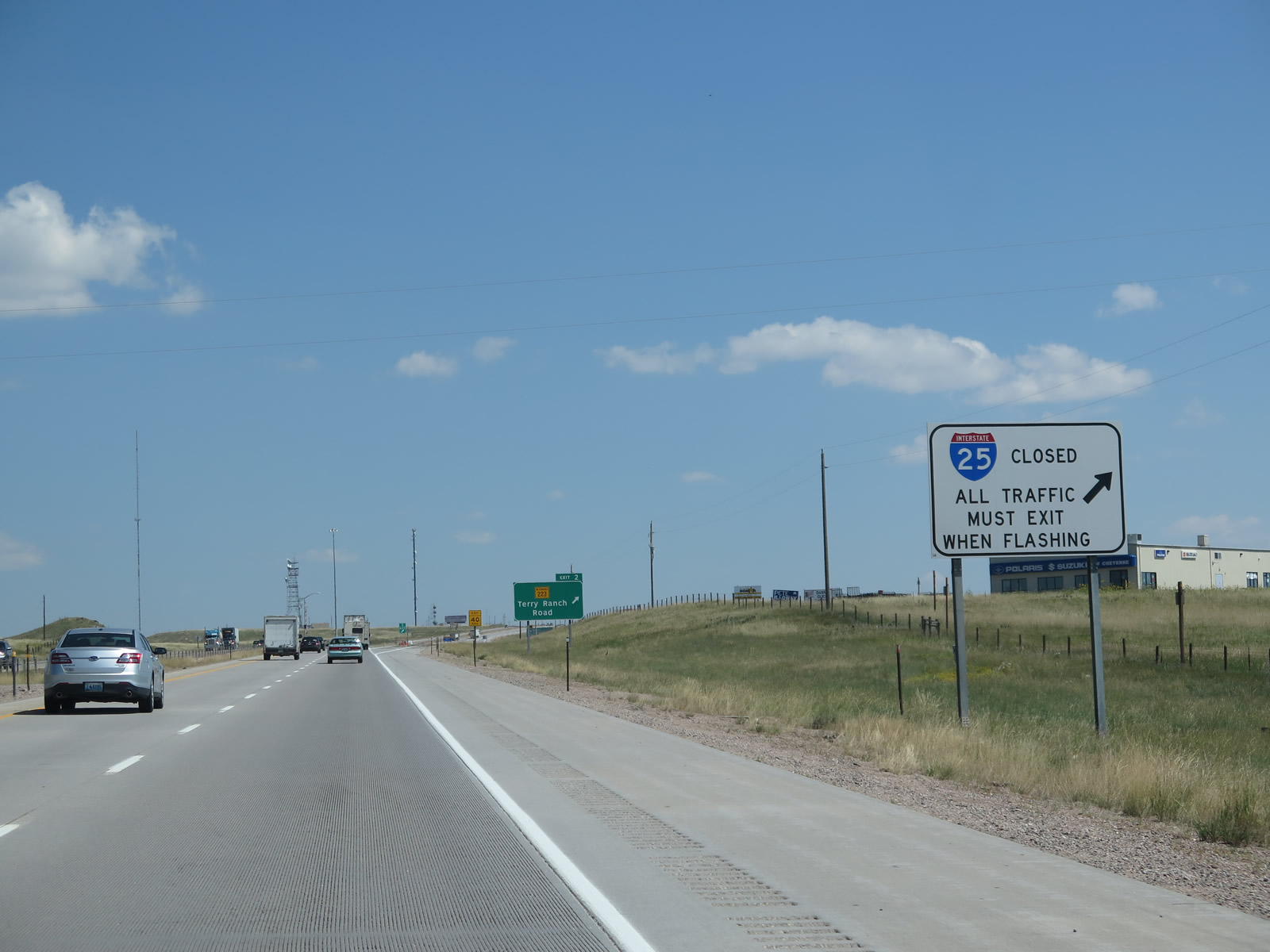
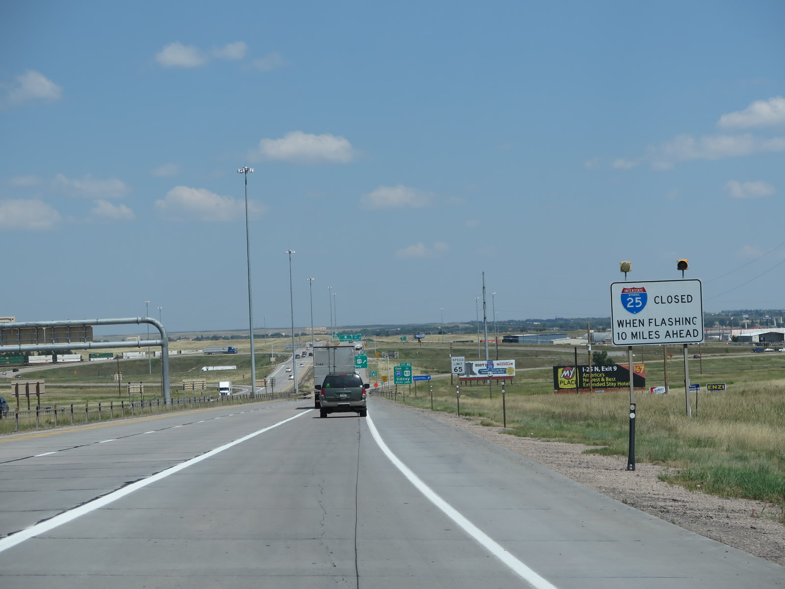
At major interchanges in Wyoming, signs such as this one advise whether the Interstate is closed ahead due to weather or traffic issues. Photo taken 08/11/14. |
|
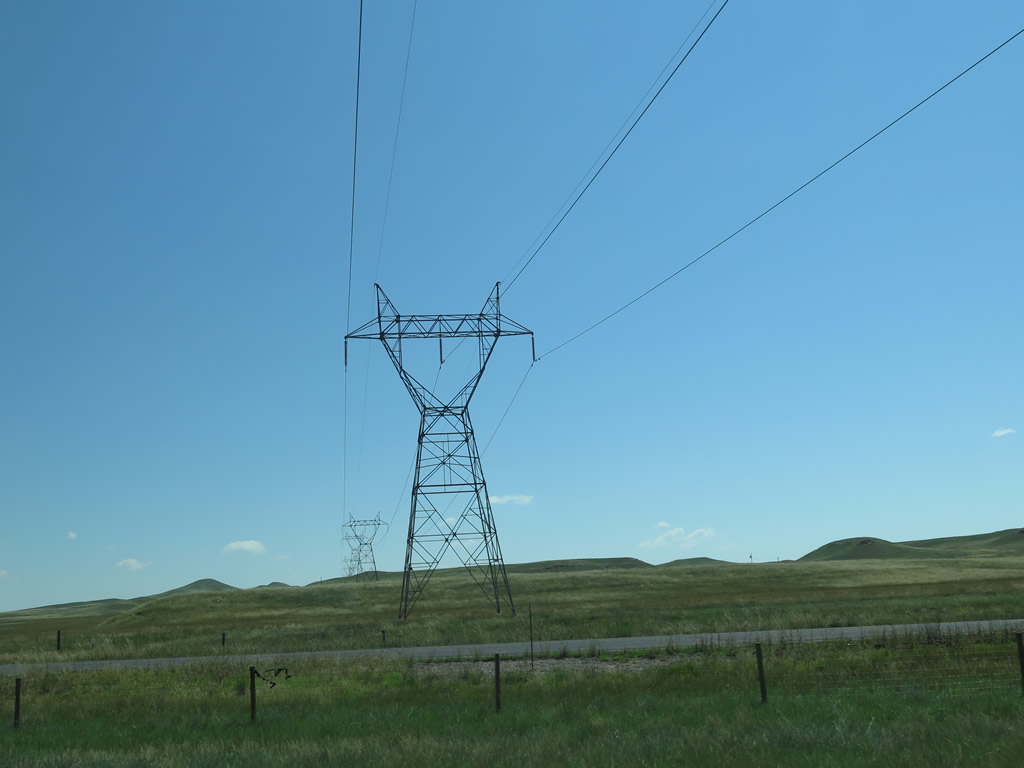
A single-circuit power line crosses over Interstat 25; this line links a substation located near Archer (south of Interstate 80 Exit 370) with some power generating facilities southwest of here (near Craig, Colorado). Photo taken 08/11/14. |
|
This blue services sign advises of various local AM and FM radio stations in Cheyenne that offer weather and traffic information. This sign appeared to be gone in 2014. Photo taken 08/02/10. |
|
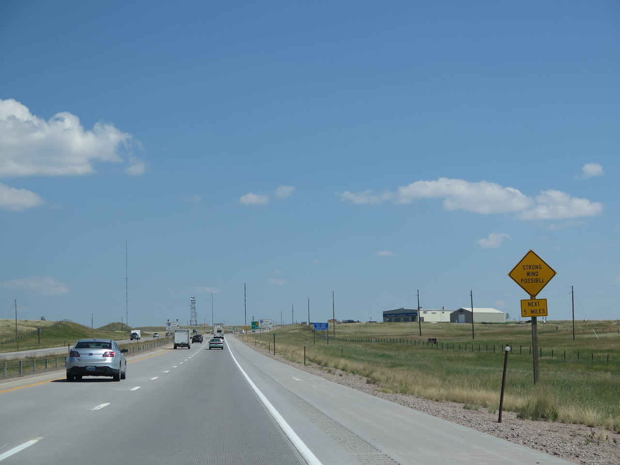
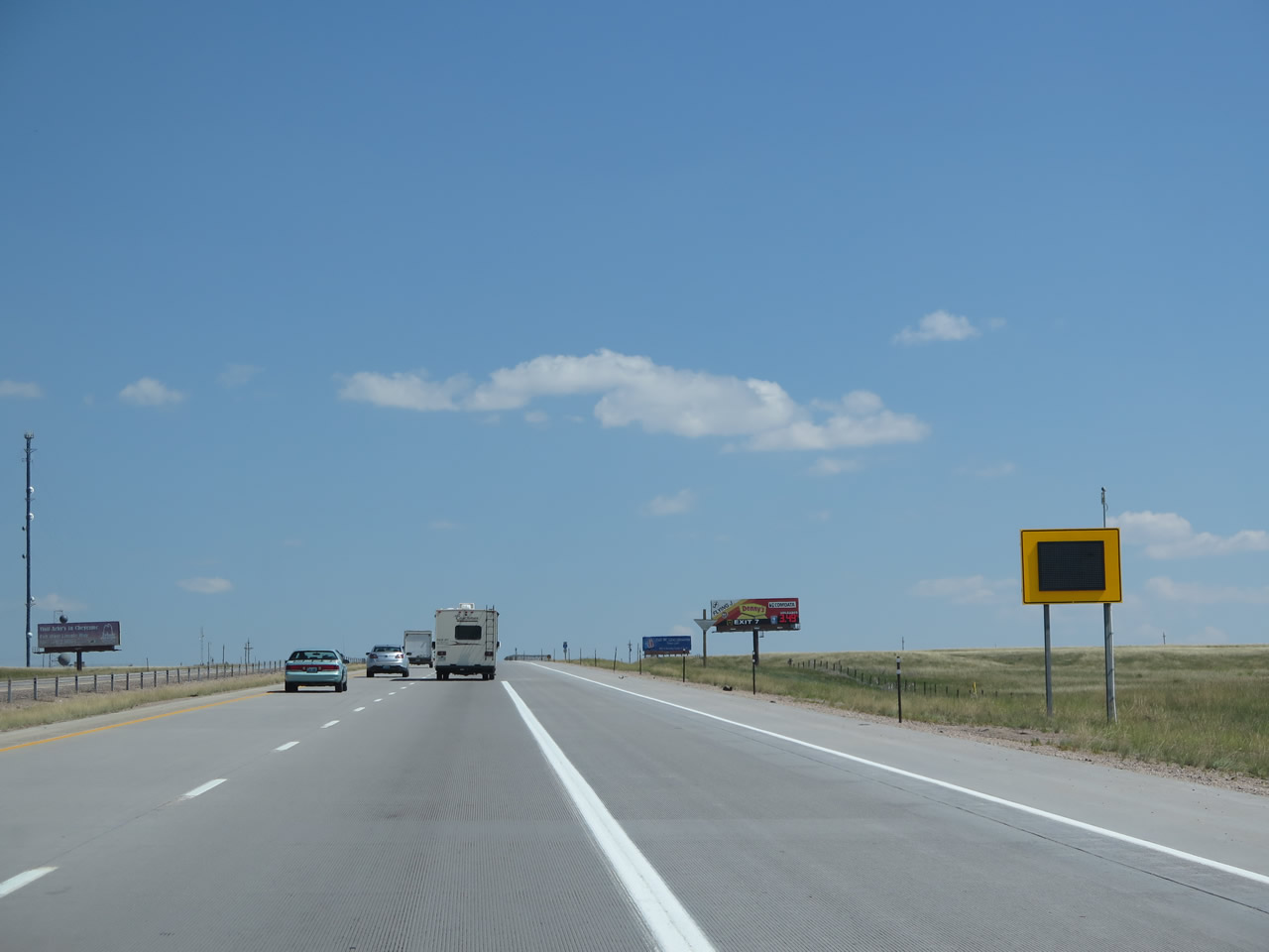
Strong wind is possible for the next five miles. Signs like this are posted in known windy areas along Interstate 25 and Interstate 80; the Wyoming wind is well-known to locals and frequent travelers through these areas, so signage appears frequently along both routes in southeastern Wyoming. Photo taken 08/11/14. |
|
Another road closure sign for Interstate 25 north is posted prior to the offramp for Exit 2. Photo taken 08/11/14. |
|
As traffic from Wyoming 223 merges onto Interstate 25 and U.S. 87 north, we find this unusual variable messsage warning sign. Photo taken 08/11/14. |
|
A reassurance shield assembly for Interstate 25 and U.S. 87 north was posted after Wyoming 223 in 2004, but the signs were gone by 2010, most likely due to the upcoming and relatively new High Plains Road interchange (Exit 4). Photo taken 09/01/04. |
|
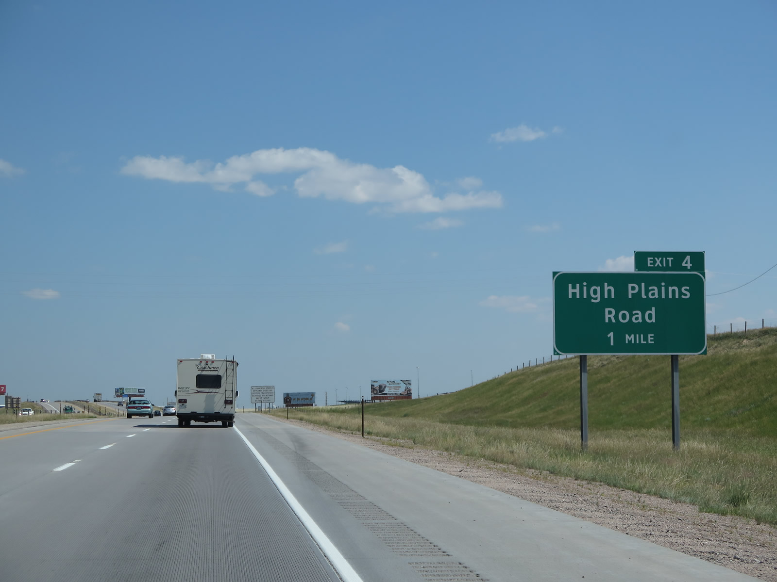
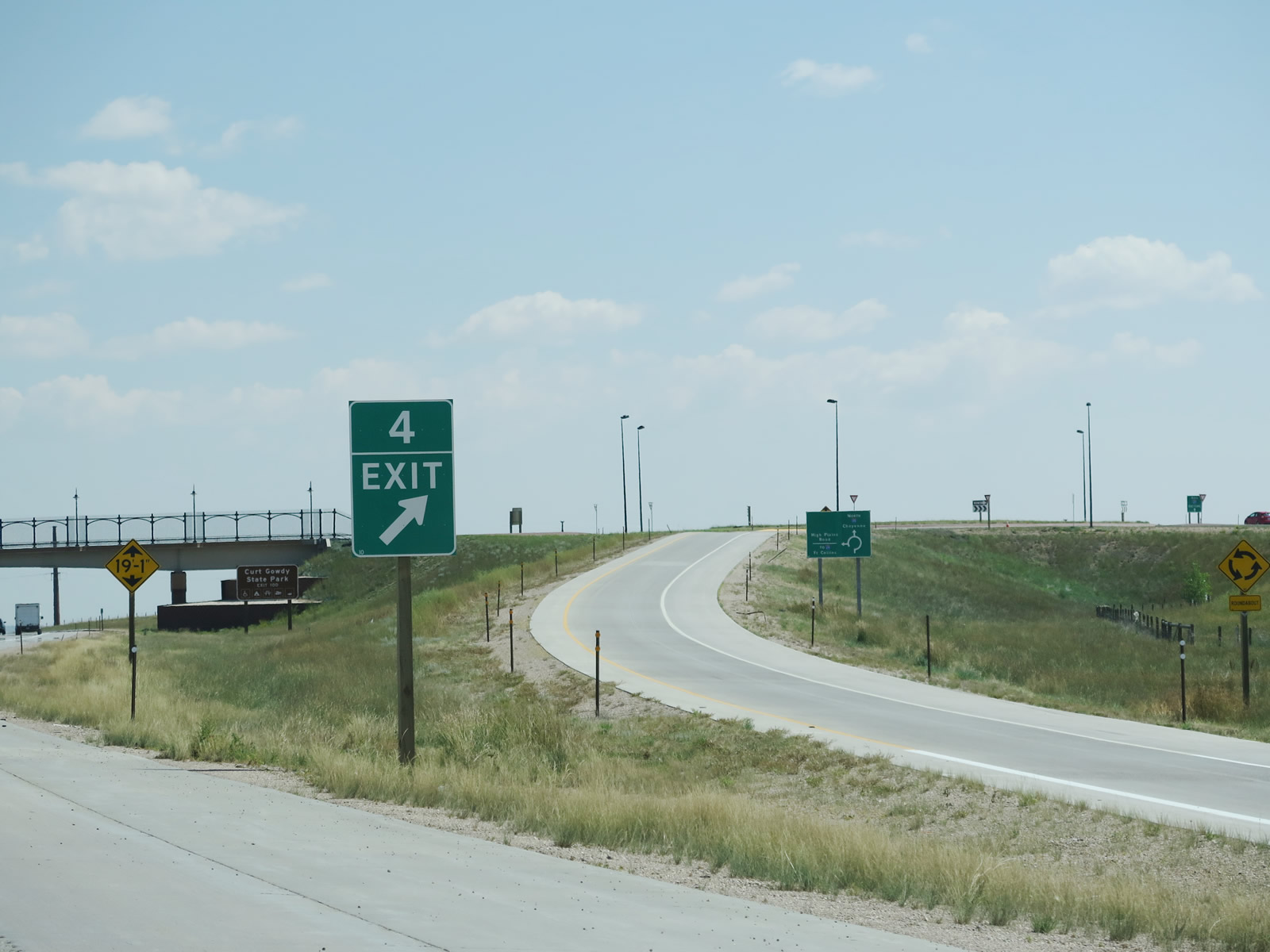
The next interchange along Interstate 25 north is Exit 4, High Plains Road (one mile). Photo taken 08/11/14. |
|
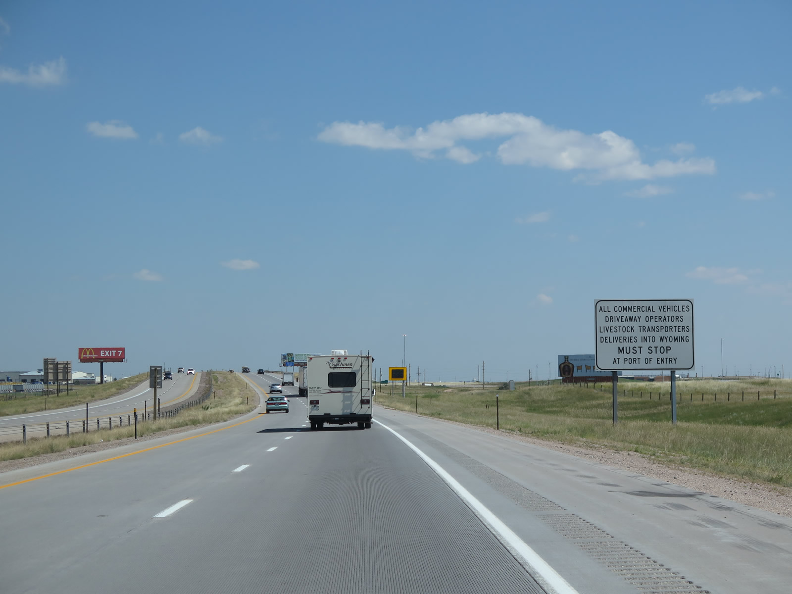
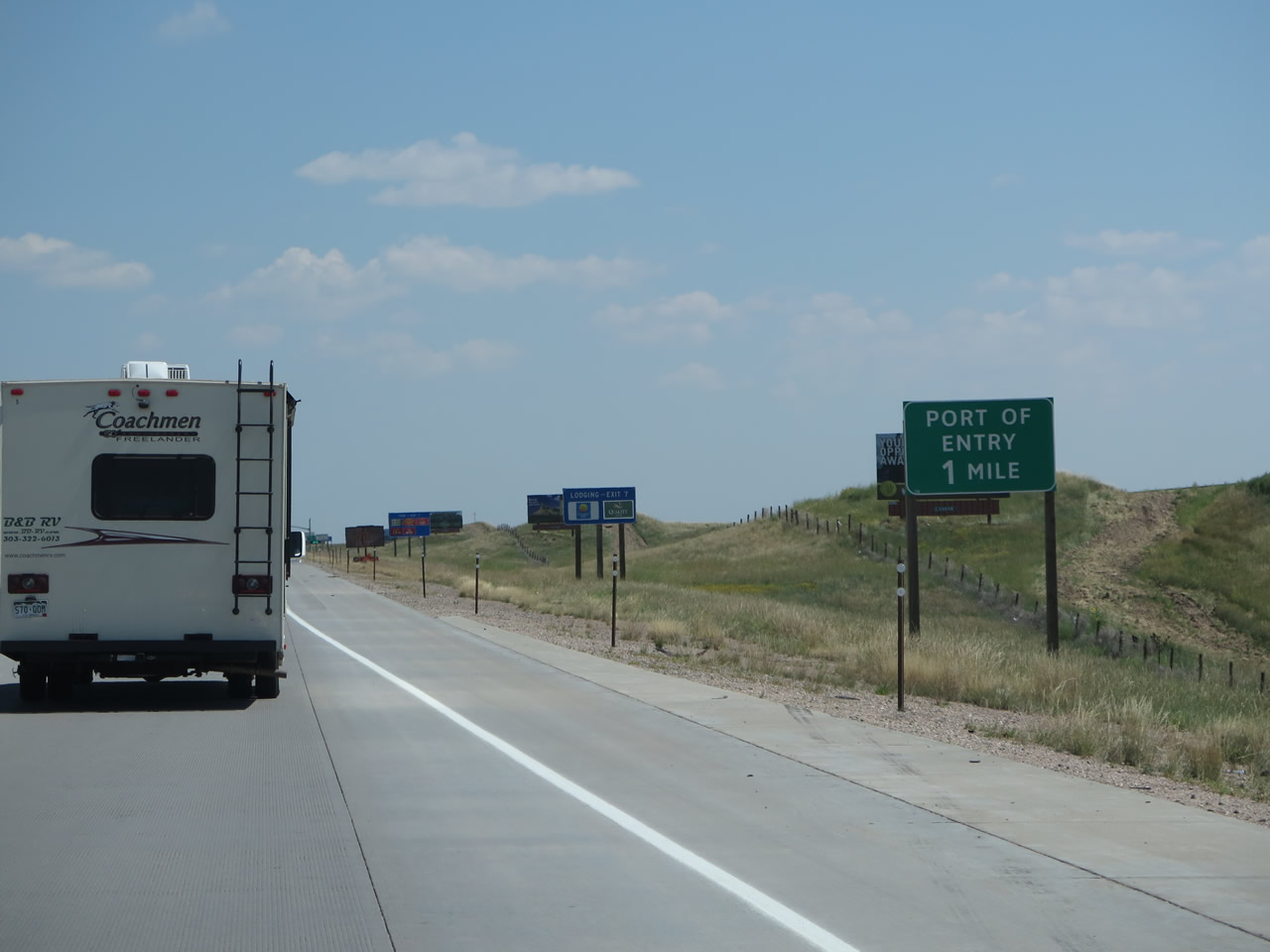
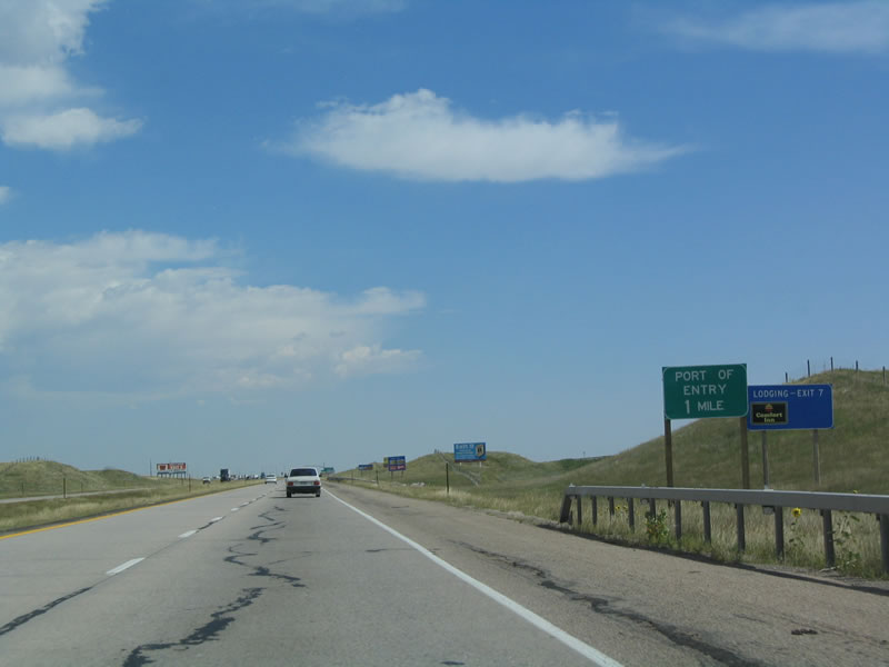
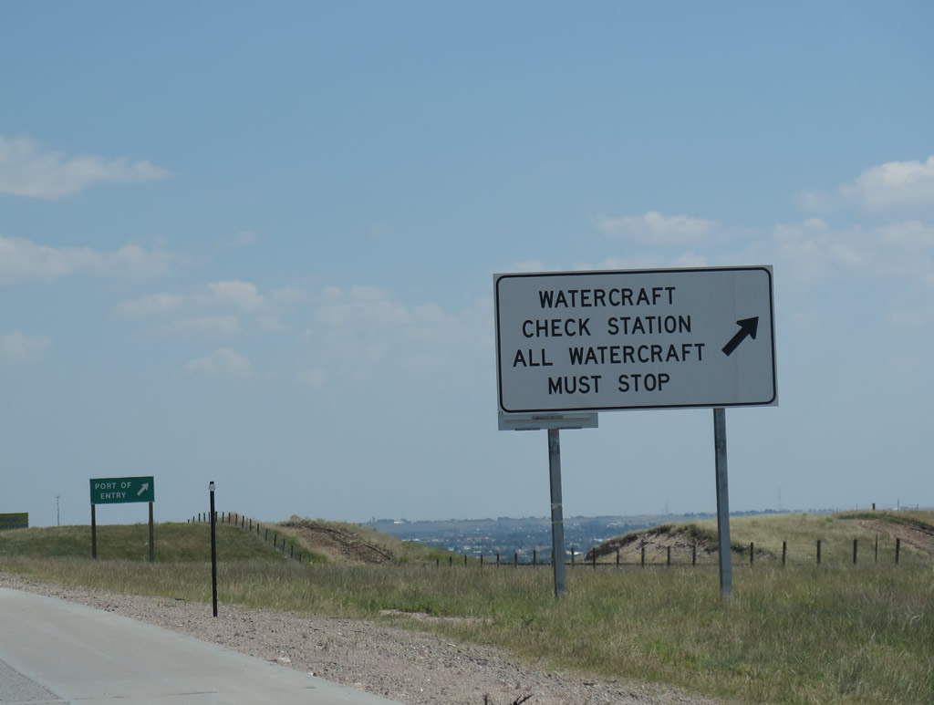
All commercial vehicles must stop at the Port of Entry (Weigh Station), which is located between Exits 4 and 7 along northbound Interstate 25. Photo taken 08/11/14. |
|
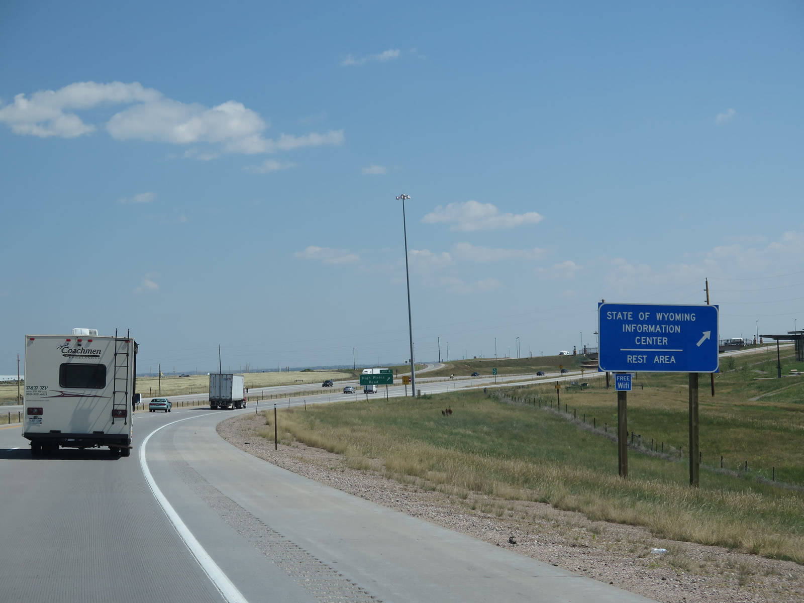
Use the High Plains Road exit to the State of Wyoming Information Center, which offers travel brochures, attraction and event information, general tourist information, state and local maps, wi-fi (wireless Internet), and restrooms. Photo taken 08/11/14. |
|
The State of Wyoming Information Center is located at the southeastern quadrant of the High Plains Road interchange. Upon exiting, follow the signs to the right (stay right while passing through the roundabout at the top of the exit ramp). Photo taken 08/11/14. |
|
Northbound Interstate 25 and U.S. 87 meet Exit 4, High Plains Road to the State of Wyoming Information Center and Clear Creek Parkway. The High Plains Road project webpage1 provides an overview of this interchange construction project, which brought the first roundabouts into the Wyoming state highway system: "The new I-25 and High Plains Road Interchange seven miles south of Cheyenne showcases the first ever roundabouts on the Wyoming highway system. The growing development southeast of Cheyenne prompted construction of the new interchange, which will relieve traffic at the College Drive Interchange to the north. Built in a standard diamond configuration, the interchange serves the Swan Ranch business park and the planned Southeast Wyoming Welcome Center and new offices for the State Travel and Tourism Division. The east side of I-25 proved too close to the railroad for conventional access, so roundabouts for the intersection of the ramps with High Plains Road solved the right-of-way problem. The Wyoming Department of Transportation awarded the contract to Reiman Corp. with Interstate Highway Construction as the paving contractor. Construction of the intersection included placing approximately 27,500 square yards of 10" thick PCCP." Photo taken 08/11/14. |
|
Upon exiting, all traffic enters a roundabout that connects to High Plains Road and the visitor information center. This interchange, which was constructed in spring 2010. The project webpage provides this additional detail: "Scheduled to begin on March 31, 2010, paving prep work was delayed by three storms, including 1.8" of rain in one day followed by a day of 60 m.p.h. winds. The weather cleared on April 14, leaving only one week before the April 21 scheduled paving start. Despite the delay, paving operations began as planned. Although two more storms interfered in May, dumping 7" of snow on the 11th, paving was completed on May 18, as scheduled." Photo taken 08/11/14. |
|
|
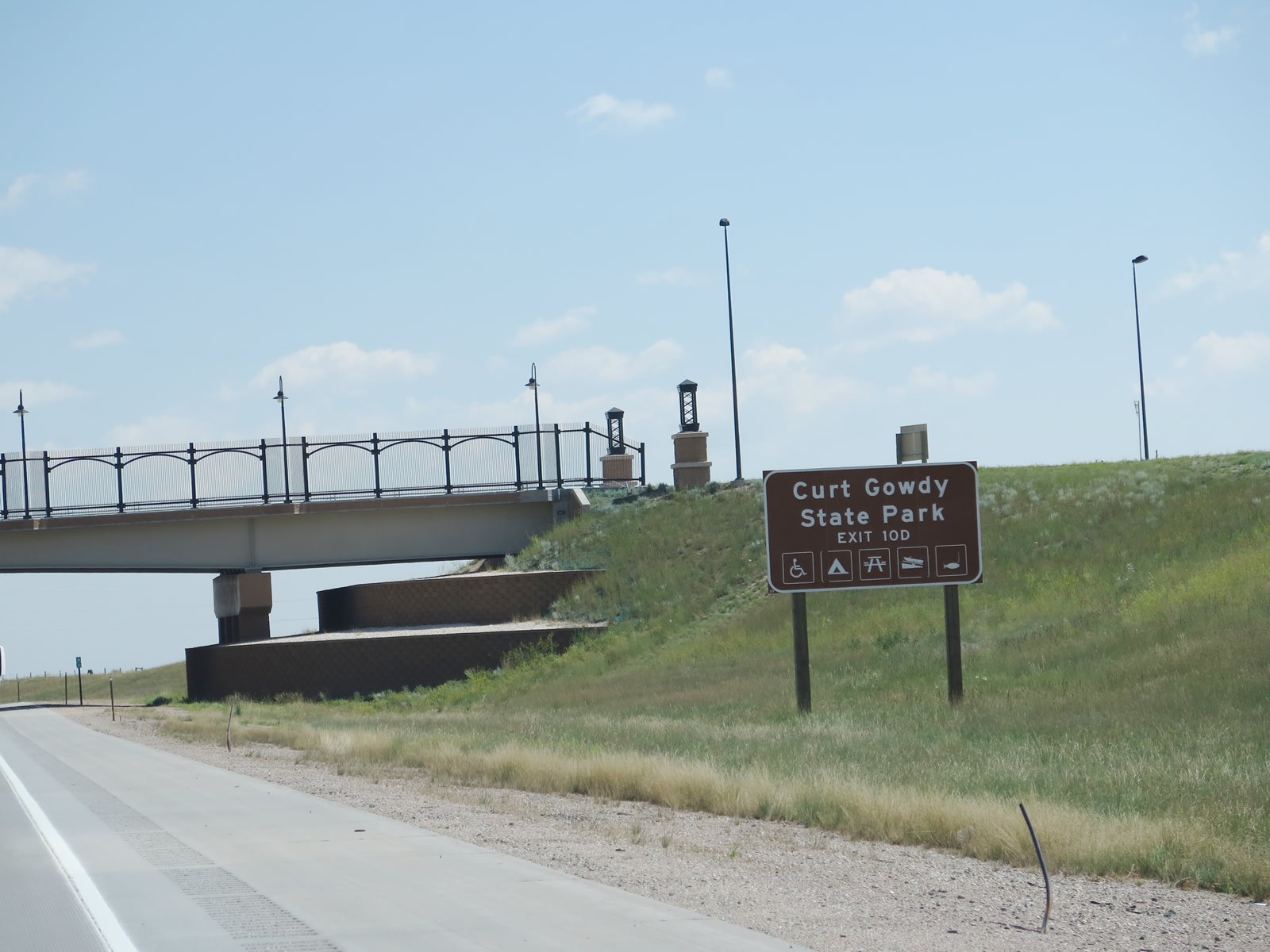
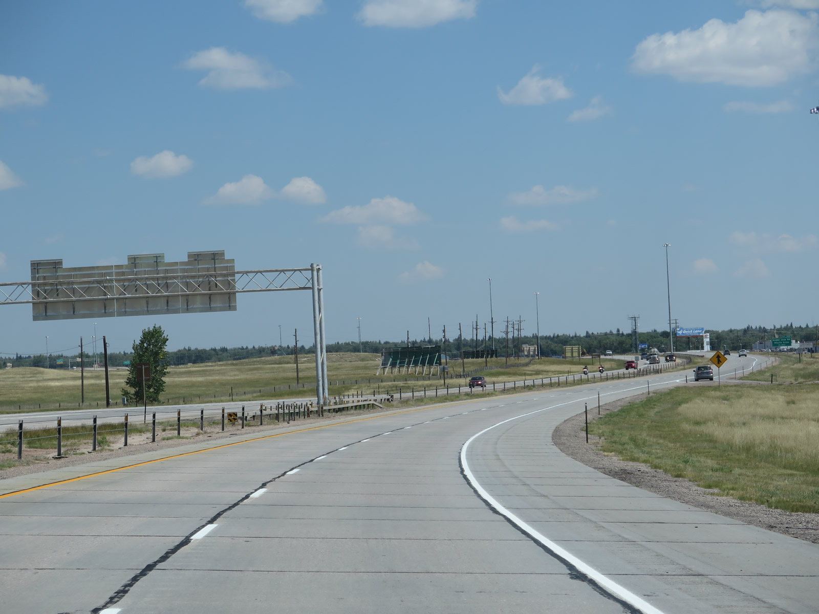
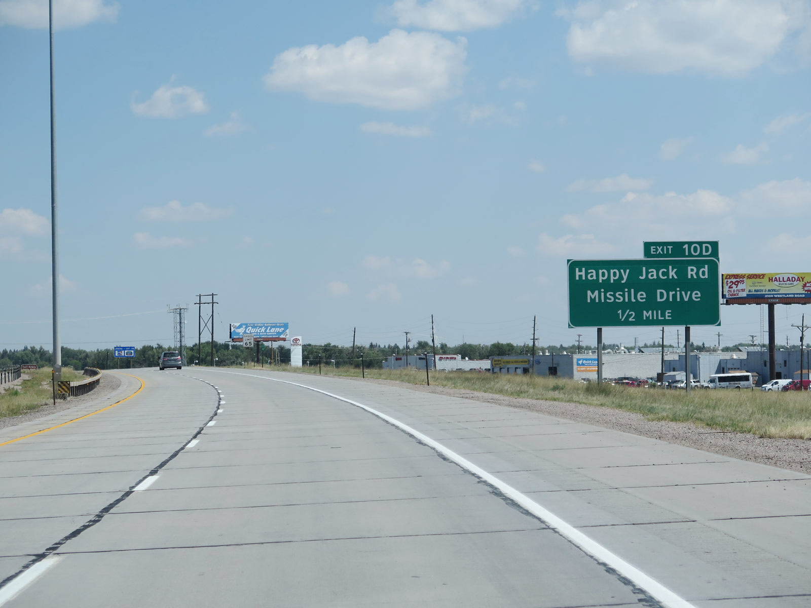
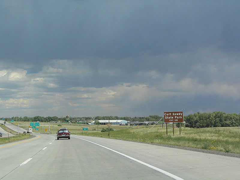
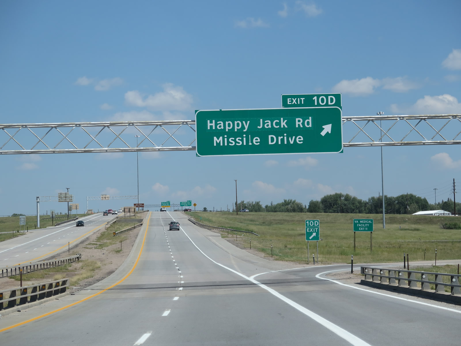
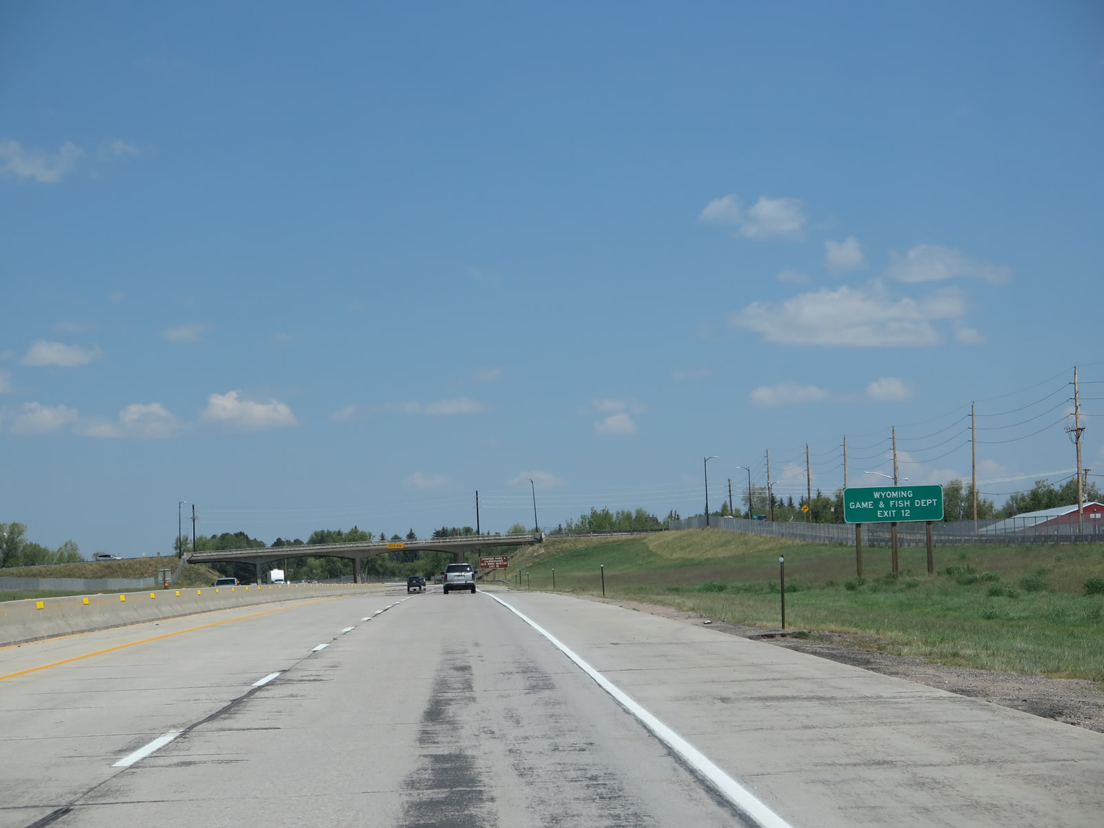
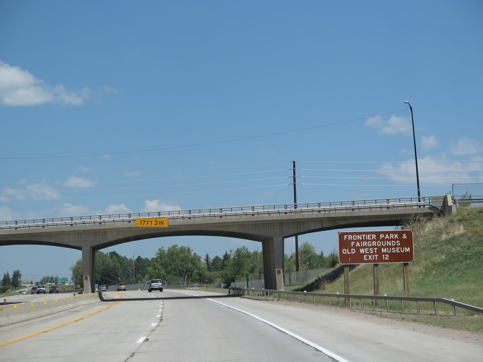
This guide sign for Curt Gowdy State Park is located along northbound Interstate 25 and U.S. 87 as we pass under the High Plains Road overpass.The 2004 picture shows the sign in its former location before Exit 4 opened to traffic. Curt Gowdy State Park is located in the Laramie Mountains along Wyoming 210. This sign suggests using Exit 10D, Wyoming 210/Happy Jack Road west to access this state park. The park was named after Curt Gowdy, the famous television sportscaster from Wyoming.2 The park is home to two reservoirs (Crystal Lake and Granite Lake) along Crow Creek that were constructed to supply Cheyenne with a consistent water source. They were built in the early 1900s and completed by 1910. A pipeline, built in the 1950s, carries water from these two reservoirs into the city, a distance of about 25 miles. Cheyenne relies on these reservoirs primarily, but it has claims in other water sheds, including a few in the Sierra Madre range in Carbon County. Both of these reservoirs generally freeze over in the winter, but they are accessible for boating and other water-based recreation in the summer. This sign could be slightly more descriptive by saying "Curt Gowdy State Park via Wyoming 210 Happy Jack Road Exit 10D." A final note: the reconfiguration of the Missile Drive and Happy Jack Road interchange resulted in the removal of Exit 10B, so the sign was changed to read Exit 10D rather than Exit 10B. Photos taken 08/11/14 and 09/01/04. |
|
|
Continuing north, the next exit along Interstate 25 and U.S. 87 is Exit 6, the port of entry and weigh station. The signs were changed from FHWA font to Clearview font sometime around 2008-2010. Photos taken 08/11/14 and 09/01/04. |
|
|
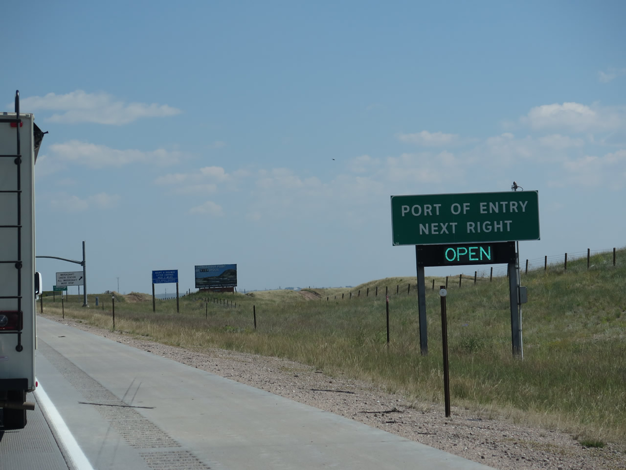
In Wyoming, weigh stations for trucks are included as part of the port of entry. Every major entrance into the state of Wyoming has a port of entry, even the two-lane routes. Photos taken 08/11/14 and 09/01/04. |
|
|
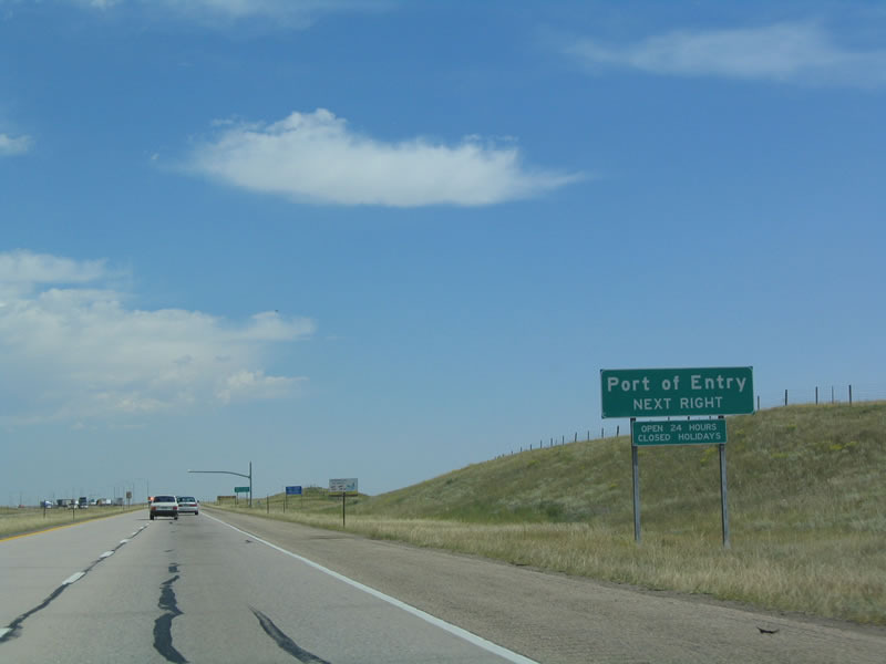
Northbound Interstate 25 and U.S. 87 reach Exit 6, Port of Entry/Weigh Station. Photos taken 08/11/14 and 09/01/04. |
|
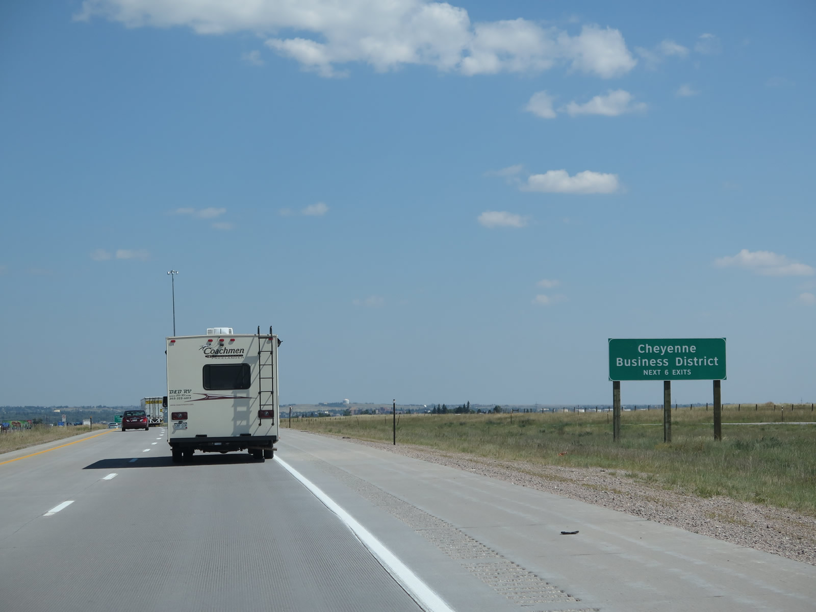
The next six exits will serve the Cheyenne metropolitan area: Exit 7 (Junction Business Loop I-25 and Wyoming 212/College Drive), Exit 8 (Interstate 80), Exit 9 (Junction Business Loop I-80 and U.S. 30/Lincolnway), Exit 10D (Missile Drive and Wyoming 210/Happy Jack Road), Exit 11 (Pershing Drive and Randall Avenue), and Exit 12 (Junction Business Loop I-25, U.S. 85, and Business U.S. 87/Central Avenue). Photo taken 08/11/14. |
|
|
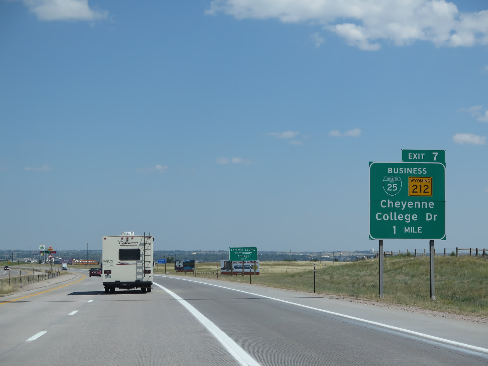
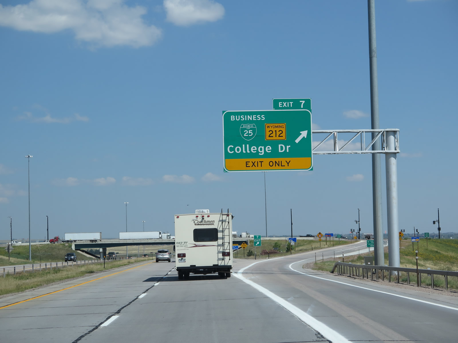
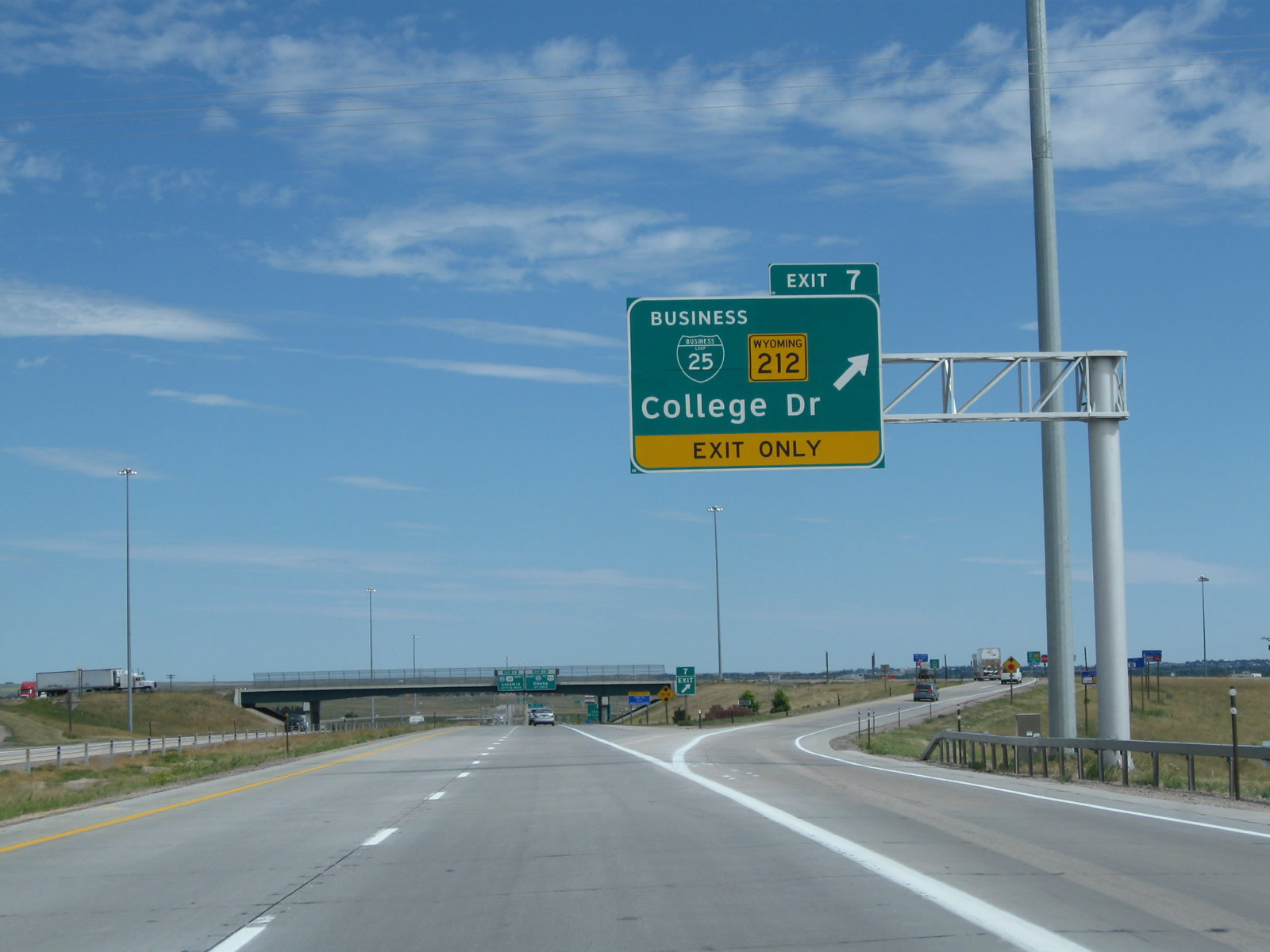
The next exit along northbound Interstate 25 and U.S. 87 is Exit 7, Junction Business Loop I-25, Business U.S. 87, and Wyoming 212/College Drive (one mile). Looking at the guide sign, note that wooden posts were used to support the older green guide signs, but metal poles are becoming more common and are in use for the replacement sign. Also note the changes in the signage between 2004 and 2014, as Wyoming 212 is now included in the sign whereas it was omitted previously. Photos taken 08/11/14 and 09/01/04. |
|
|
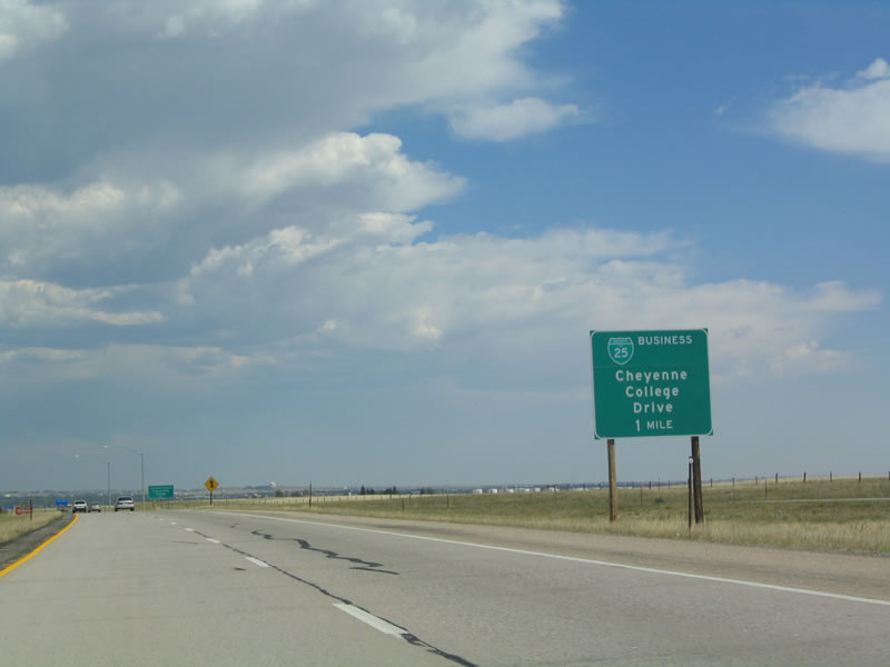
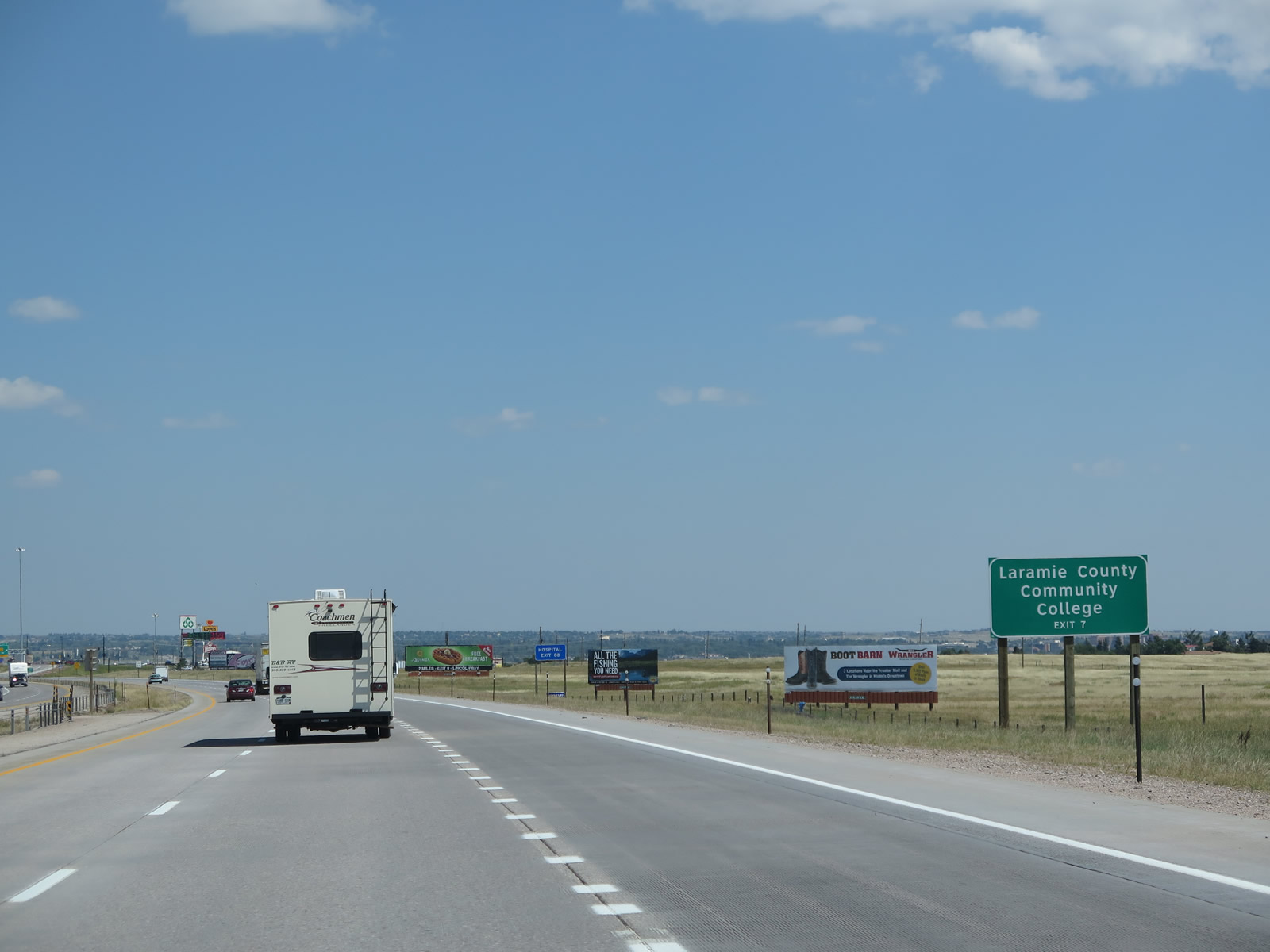
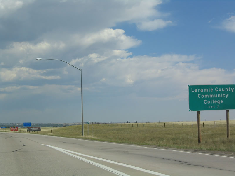
Follow Wyoming 212 east via College Drive to Laramie County Community College, a two year school located southeast of downtown Cheyenne. Exit 8 D for I-80 west leads to I-180 and U.S. 85 north to Cheyenne Regional Medical Center hospital. Photos taken 08/11/14 and 09/01/04. |
|
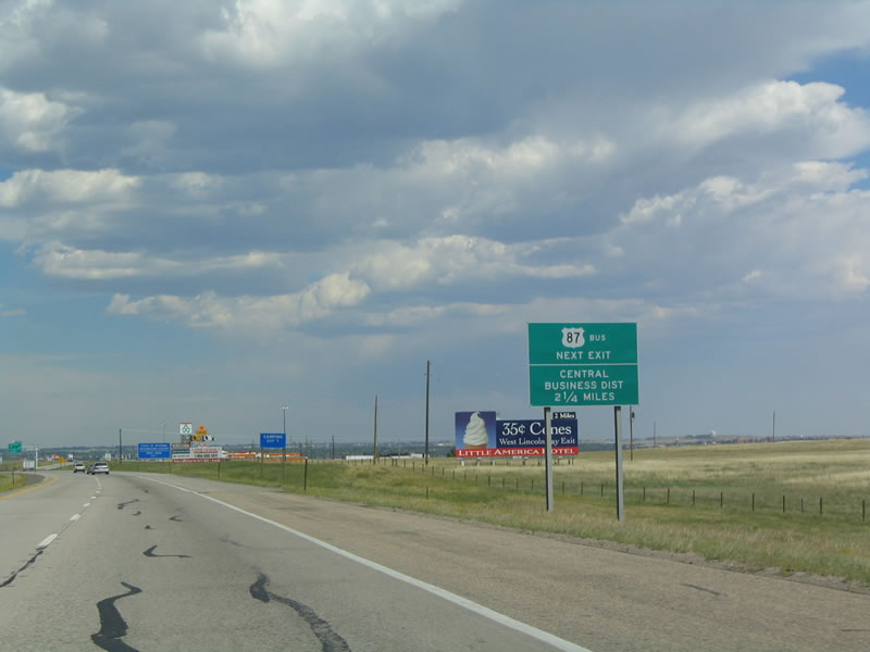
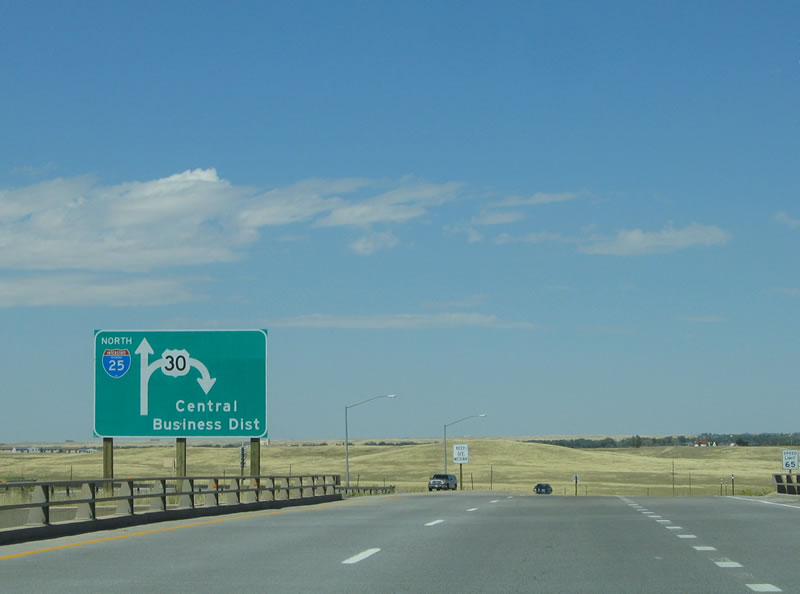
This was the only advance sign indicating Business U.S. 87 on Interstate 25 north; it was removed when the High Plains Road interchange was constructed. As of 2014, there is no signage for Business U.S. 87 from mainline Interstate 25 and U.S. 87. To approach the Central Business District from the south follow Business Loop I-25 and Business U.S. 87 north or follow Interstate 25 north to Interstate 80 east to Interstate 180 north (also Business Loop I-25 and Business U.S. 87). To approach the Central Business District from the west, follow Interstate 25 north to Exit 9, Junction Business Loop I-80 and U.S. 30/Lincolnway east into the downtown area. Photo taken 09/01/04. |
|
|
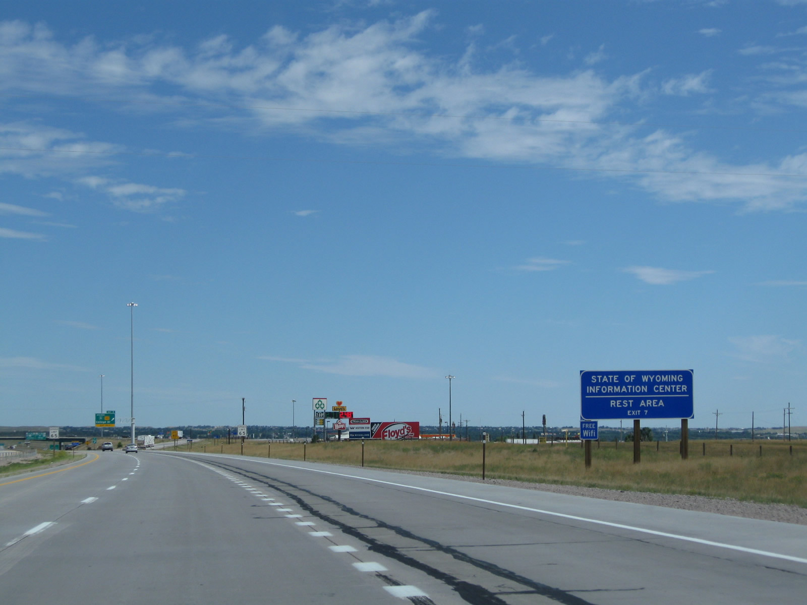
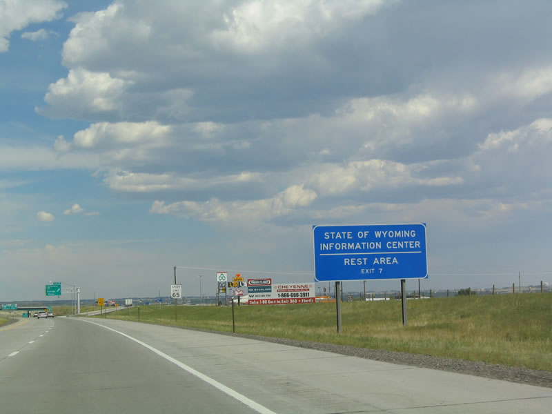
Prior to the opening of the Southeast Wyoming Information Center at High Plains Road (Exit 4), a rest area and tourist information center with complete facilities used to be located at Exit 7. The old rest area has since been decommissioned. However, Exit 7 continues to feature several truck stops and restaurants. Note the addition of an exit only lane for Exit 7. Photos taken 08/11/14 and 09/01/04. |
|
|
Northbound Interstate 25 and U.S. 87 meet Exit 7, Junction Business Loop I-25 north, Business U.S. 87 north, and Wyoming 212 east via College Drive to southern Cheyenne and Laramie County Community College. Use Business Loop I-25 to follow Old U.S. 87 to enter downtown Cheyenne from the south via Interstate 180. Turn left on College Drive for a connection to Clear Creek Parkway, which travels back south to High Plains Road (Exit 4). This is a diverging diamond interchange, converted from a diamond interchange in 2013. Photos taken 08/11/14 and 08/02/10. |
|
The city of Cheyenne is the capital of the state of Wyoming and is its largest city as of 2010. Home to 59,466 people as of the 2010 Census, Cheyenne ("Magic City of the Plains") is considered to be the northern end of the populous Front Range region, which extends south into Colorado encompassing Fort Collins, Denver, and Colorado Springs to the south. The city was founded as Crow Creek Crossing during Wyoming's territorial days in 1867, and it became the state capital in 1890 when Wyoming achieved statehood. Photo taken 08/11/14. |
|
Now on the offramp, we see the prior configuration of the College Drive exit before it was converted from a standard diamond interchange to a diverging diamond interchange. Photo taken 10/13/07. |
|
A sign for Business Loop I-25 and Wyoming 212 was posted at the top of the ramp; this sign was replaced, and the stop signs were replaced with traffic signals to accommodate the diverging diamond interchange built in 2013. The information center is no longer at Exit 7 and is now at Exit 4. Photo taken 10/13/07. |
|
|
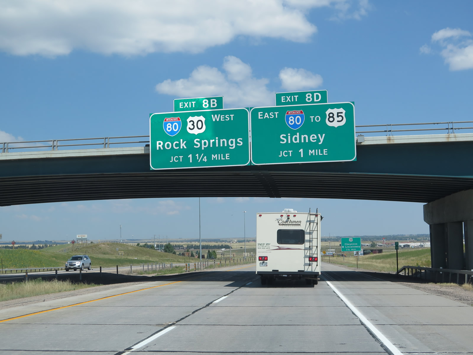
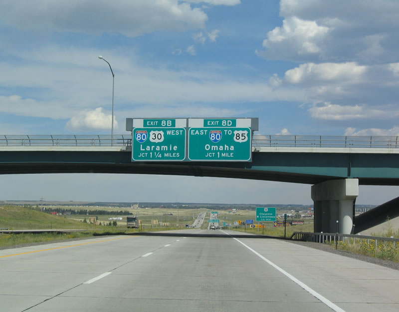
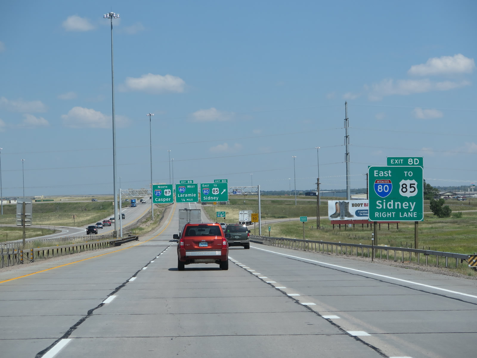
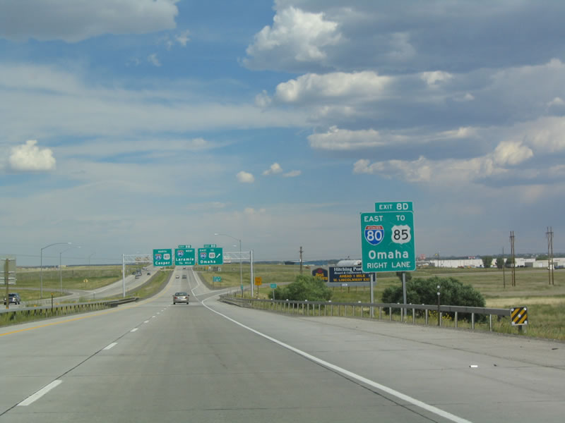
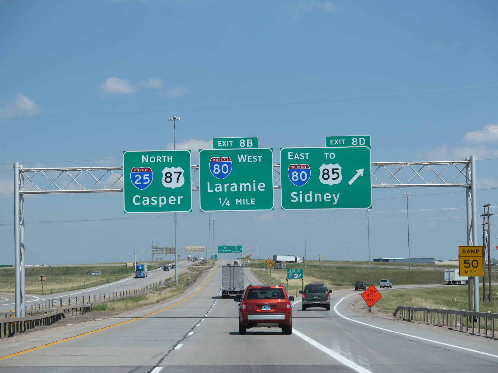
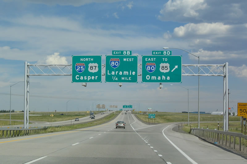
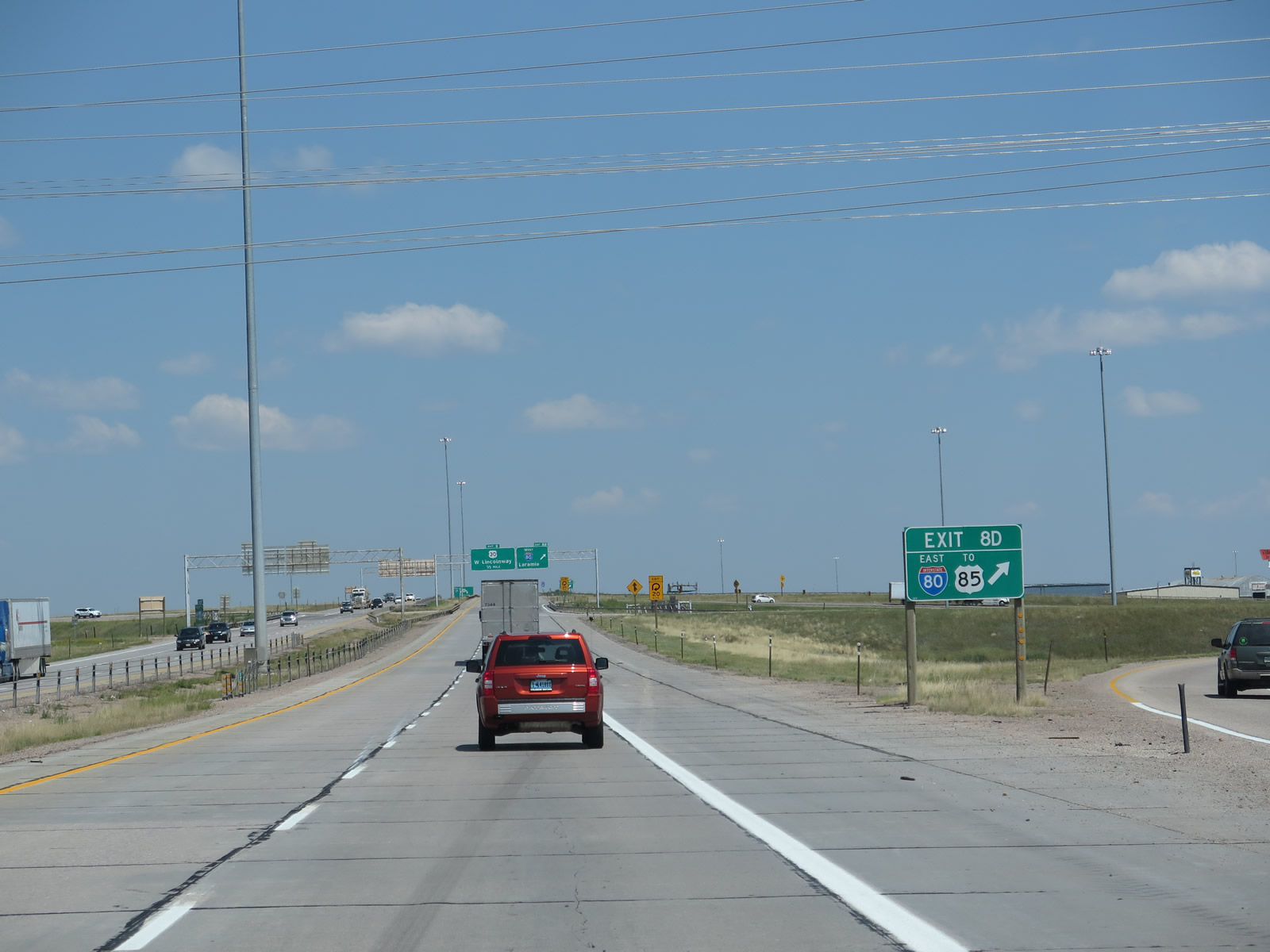
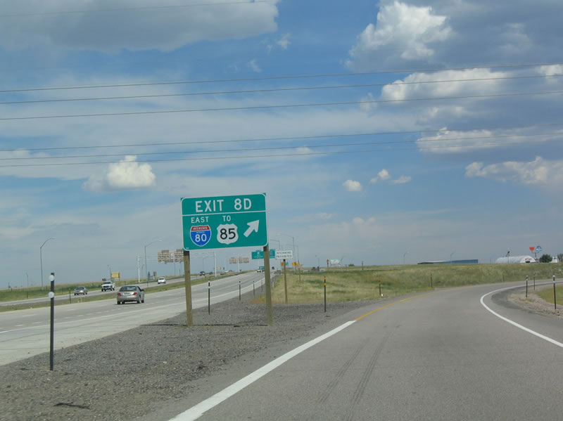
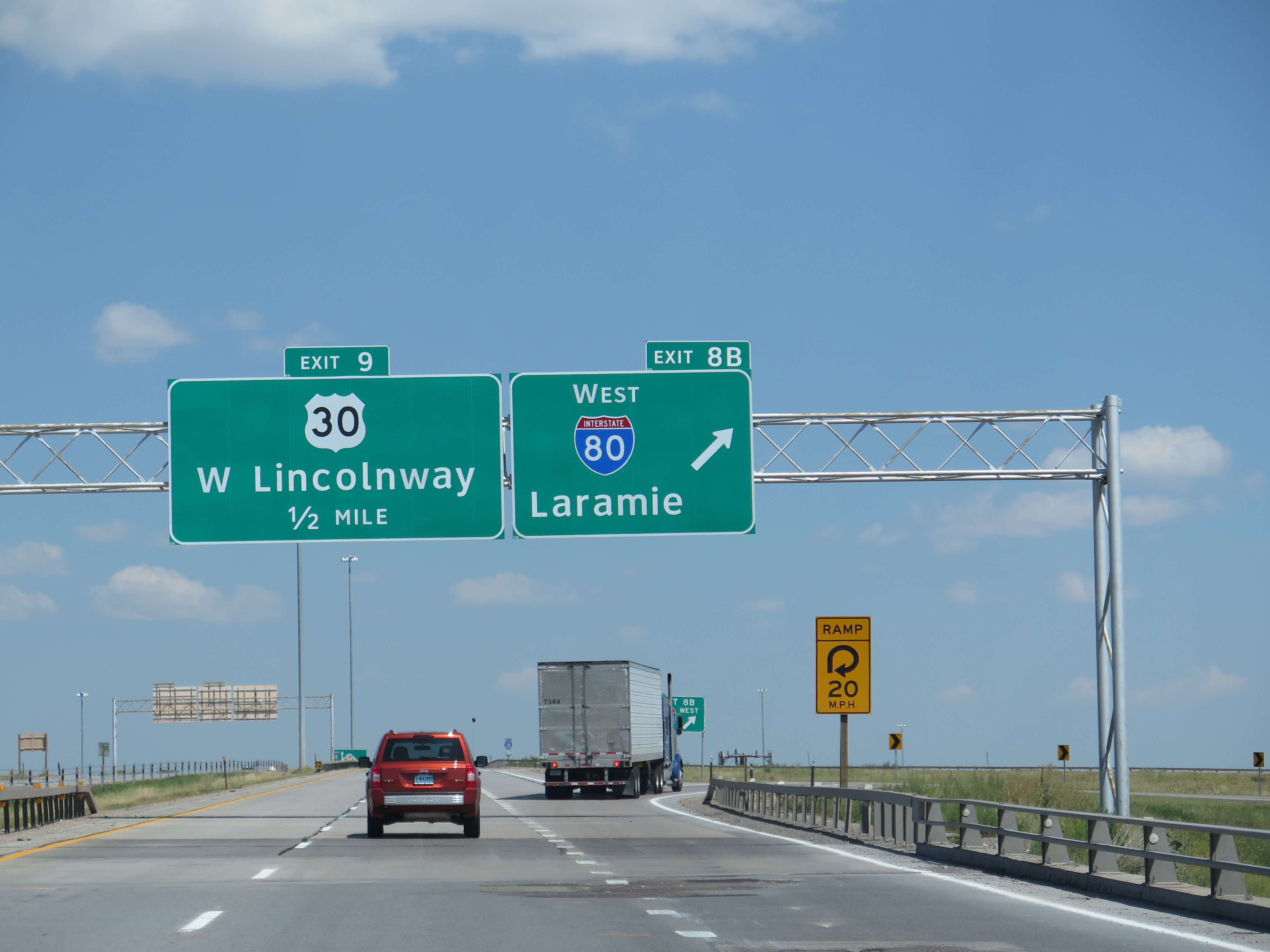
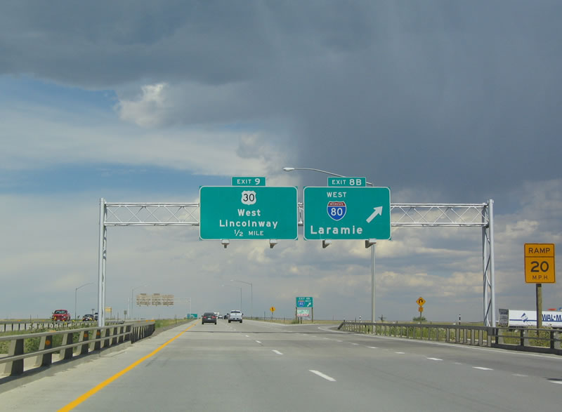
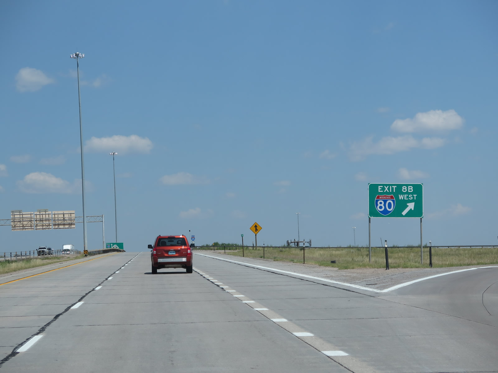
The next two exits along northbound Interstate 25 and U.S. 87 are Exits 8D and 8B, Interstate 80 east to Pine Bluffs, Sidney, Lincoln, and Omaha (Exit 8D) and west to Laramie and Rock Springs (Exit 8B). Transcontinental Interstate 80 travels across the central-northern tier of the country, connecting San Francisco, California with New York City, New York. For much of its route between Wyoming and Pennsylvania, Interstate 80 generally follows U.S. 30. Today it is one of the principal long-haul routes across the country. The interchange between Interstate 25 and Interstate 80 is a cloverleaf; each ramp is assigned a letter, hence why letters A and C appear on Interstate 80's exit numbering for connections to Interstate 25 north/south and B and D appear on Interstate 25's exit numbering for connections to Interstate 80 east/west. This logic appears to be unique to the Wyoming Department of Transportation; other states would likely use A and B for the first and second exits, respectively. Photos taken 08/11/14 and 09/01/04. |
|
After passing under the College Drive overpass, a roadside sign indicates that the third exit after the two ramps to Interstate 80 east and west will be Exit 9, Junction Business Loop I-80 and U.S. 30 (Lincolnway) east to downtown Cheyenne and west to Interstate 80 and Wyoming 225/Otto Road (Old Lincoln Highway). Photo taken 09/01/04. |
|
After the onramp from College Drive, another "road closed when flashing" sign is posted for 10 miles north of here along Interstate 25. Photo taken 08/11/14. |
|
|
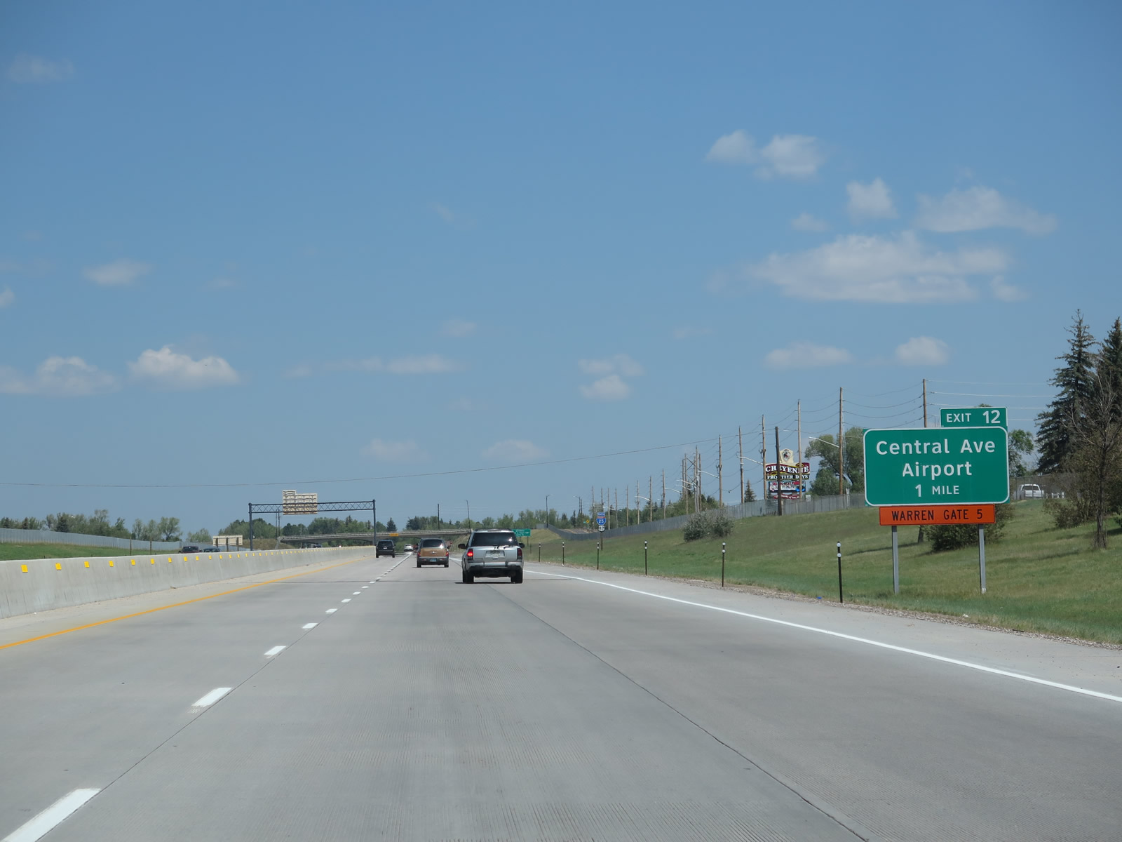
To the east, Interstate 80 travels another 45 miles through Wyoming before crossing into Nebraska at Pine Bluffs. The freeway then travels east through cities such as Kimball, Sidney, Ogallala, North Platte, Grand Island, and Lincoln, before reaching Omaha. This exit is also marked for U.S. 85, which travels south to Greeley, Colorado, and travels north into downtown Cheyenne. For motorists taking U.S. 85 north to Torrington, Lusk, Newcastle, or the Black Hills of South Dakota, stay on Interstate 25 north. Photos taken 08/11/14 and 09/01/04. |
|
|
Northbound Interstate 25 and U.S. 87 reaches the junction with Interstate 80 (Exits 8B-D). This is one of the few cloverleaf interchanges in the state of Wyoming, and the individual ramps have the aforementioned unusual exit numbering system. Exits 8B and 8D on Interstate 25 connect to Interstate 80, while Exits 359A and 359C on Interstate 80 connect to Interstate 25. Photos taken 08/11/14 and 09/01/04. |
|
|
The gore point signage for the transition from Interstate 25 north to Interstate 80 contains the interstate shield. This large interchange is a cloverleaf, so watch for merging traffic ahead. Follow Interstate 80 east to downtown Cheyenne via Interstate 180 and U.S. 85/Central Avenue north. Photos taken 08/11/14 and 09/01/04. |
|
|
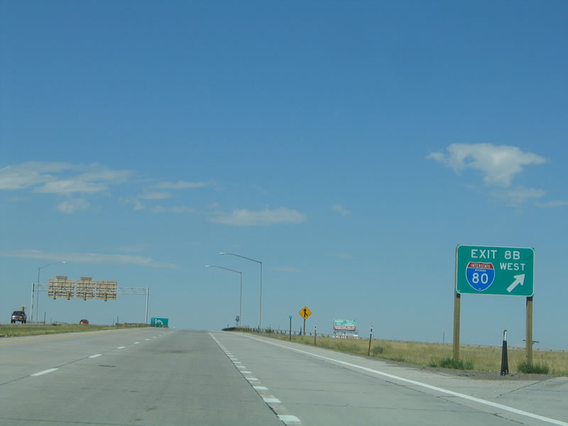
The next transition ramp conveys traffic from northbound Interstate 25 onto westbound Interstate 80 via Exit 8B. Interstate 80 west connects Cheyenne with the cities along the southern tier of Wyoming, such as Laramie, Rawlins, Rock Springs, Green River, and Evanston. Continue straight ahead for the next exit, which connects Interstate 25 with Business Loop I-80 and U.S. 30/Lincolnway at Exit 9. Photos taken 08/11/14 and 09/01/04. |
|
|
Another detailed gore point sign for Exit 8B, Interstate 80 east, is posted at the top of the loop ramp. The left two lanes continue north along Interstate 25 toward northern Cheyenne and Casper. Photos taken 08/11/14 and 09/05/05. |
|
|
An Interstate 25 and U.S. 87 shield assembly is posted as the freeway crosses over the Union Pacific Railroad and Lincolnway. Photos taken 08/11/14 and 09/05/05. |
|
|
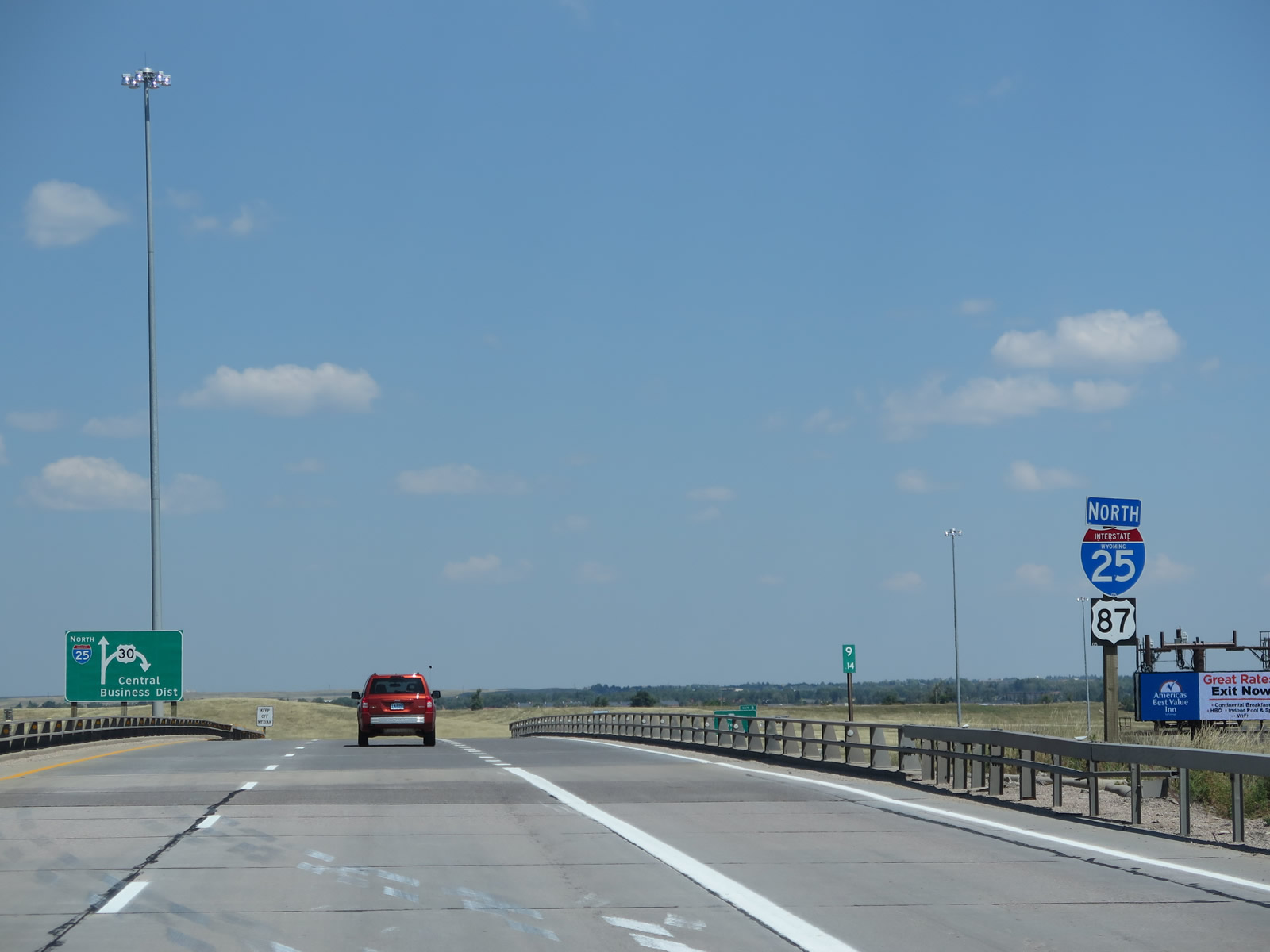
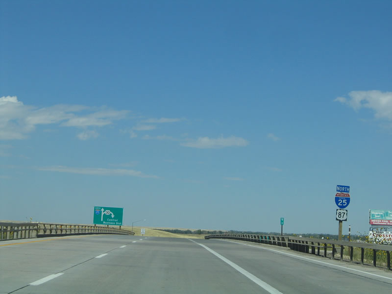
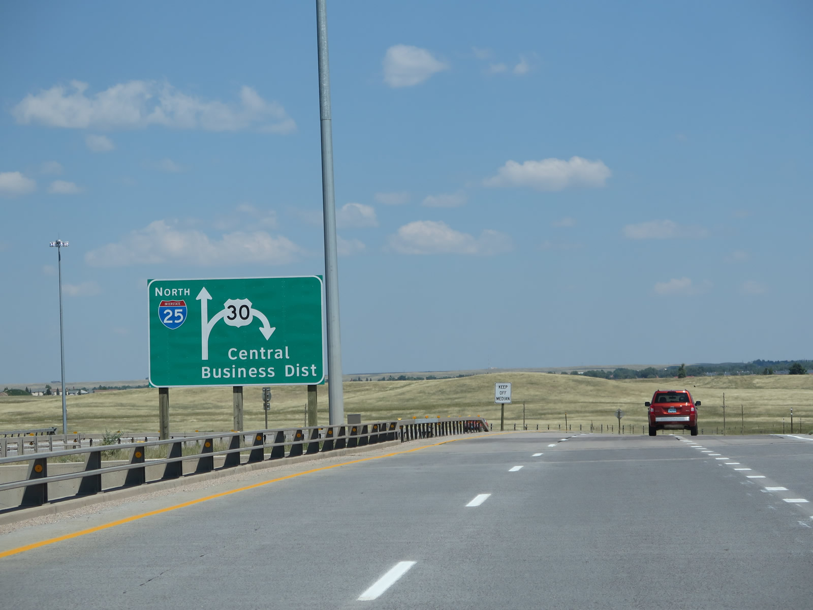
A diagrammatical sign is installed to show that the ramp from Interstate 25 north to U.S. 30 is a loop ramp with access to both east and west U.S. 30. Follow U.S. 30 and Business Loop I-80 east via Lincolnway into downtown Cheyenne. Business Loop I-80 is not signed from Interstate 25, in keeping with the theory that the business loop designation is only of use for travelers on the parent Interstate. Photos taken 08/11/14 and 09/05/05. |
|
|
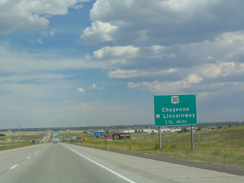
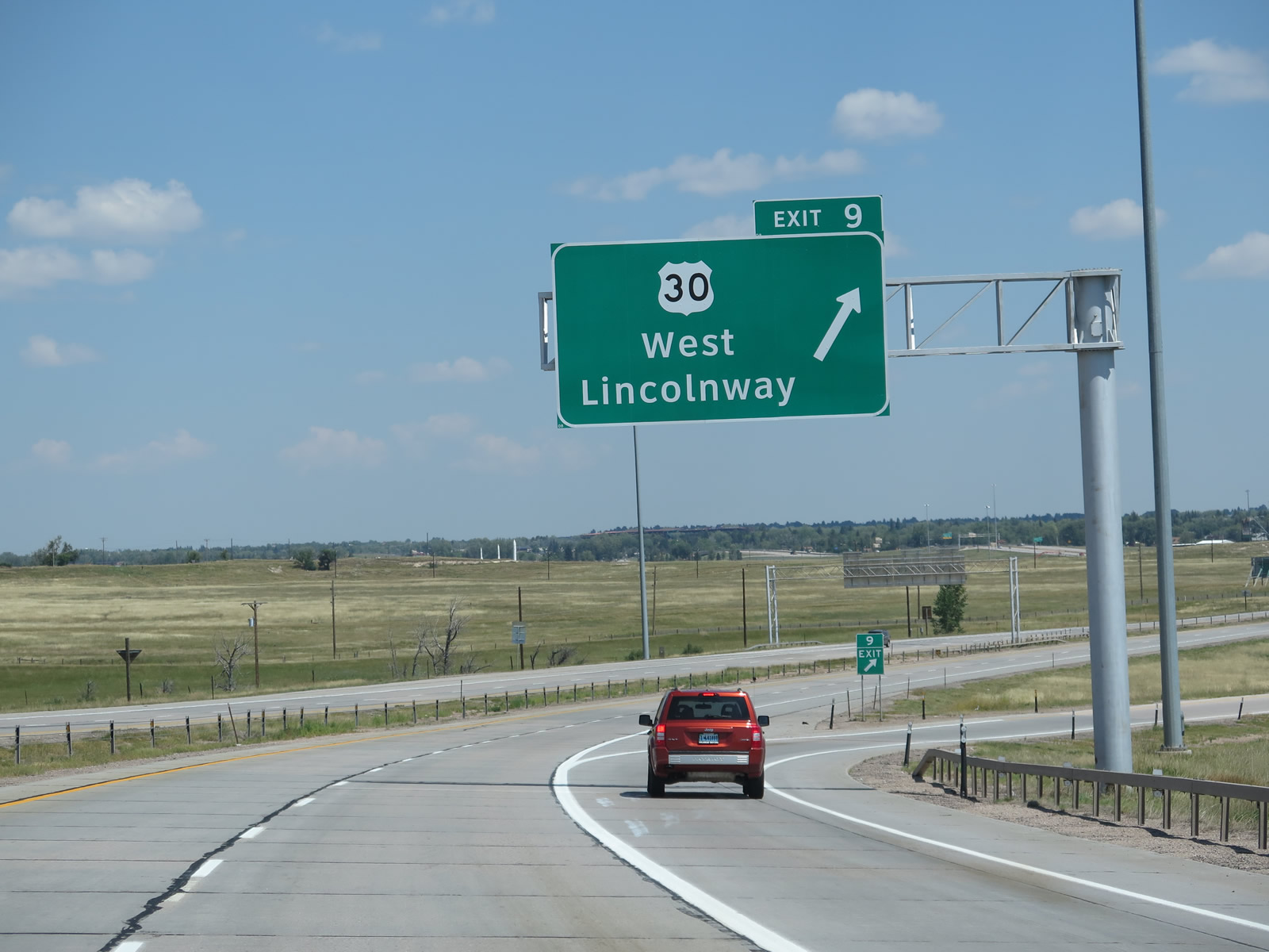
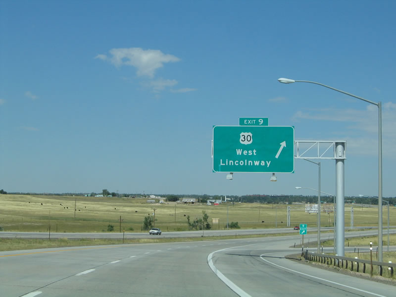
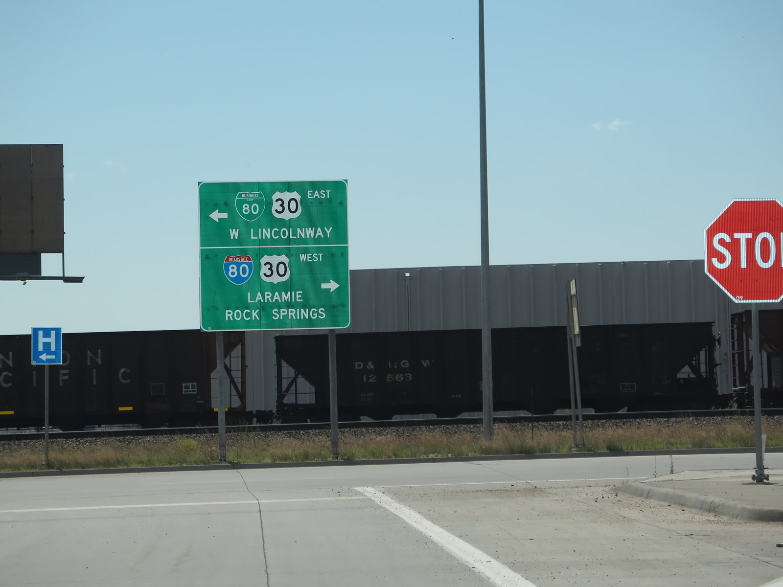
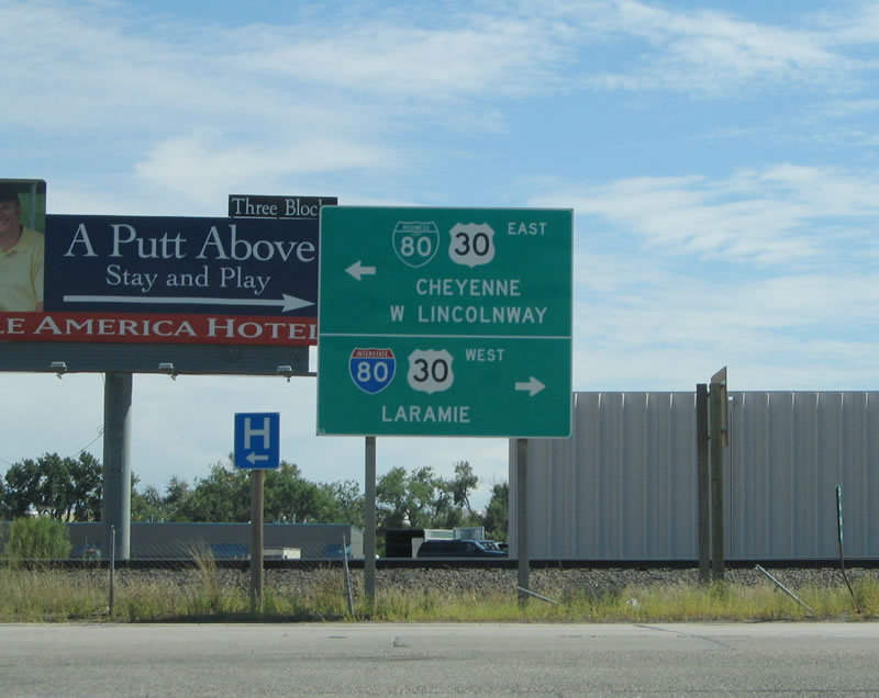
Northbound Interstate 25 and U.S. 87 reaches Exit 9, Junction Business Loop I-80 and U.S. 30 (Lincolnway). U.S. 30 shares pavement with the business loop between Interstate 80 and Wyoming 212 (College Drive); east of there, U.S. 30 follows Lincolnway on its own until rejoining Interstate 80 at Archer. This sign, along with many in this area, was replaced in 2008. Photos taken 08/11/14 and 09/05/05. |
|
|
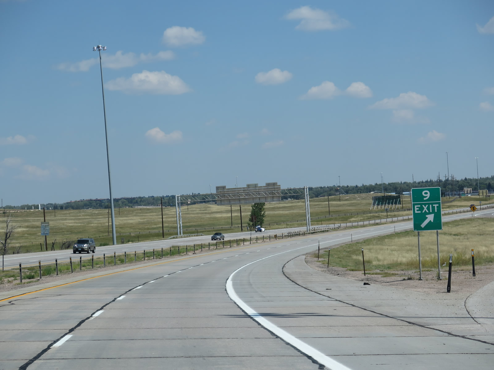
A more traditional gore point sign is posted for Exit 9. North of the U.S. 30 interchange, Interstate 25 continues north to form a barrier between developed Cheyenne and the Francis E. Warren Air Force Base, which covers hundreds of acres of land to the west of the freeway. Entry to the military base is prohibited unless authorized. Photos taken 08/11/14. |
|
|
At the base of the ramp from northbound Interstate 25 to Business Loop I-80 and U.S. 30/Lincolnway is this sign, which shows that Lincolnway turns left (east) to downtown and right (west) to return to Interstate 80 to Laramie. Since Exit 9 is a loop ramp, these directions may initially seem counter intuitive. The sign was slightly modified when it was replaced in 2010 to include Rock Springs as a control city for westbound Business Loop I-80 and U.S. 30 to Interstate 80. Photos taken 08/11/14 and 09/05/05. |
|
|
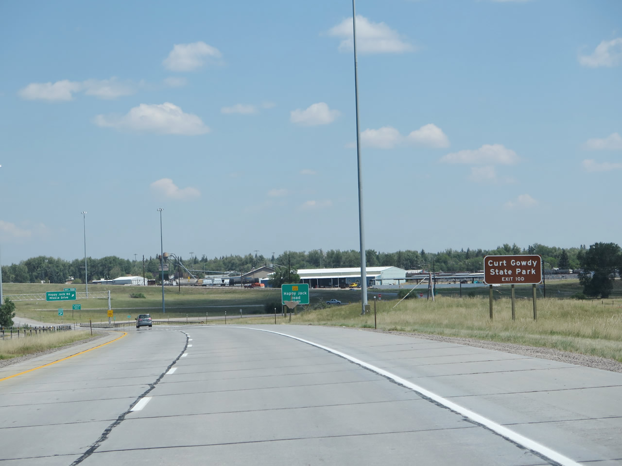
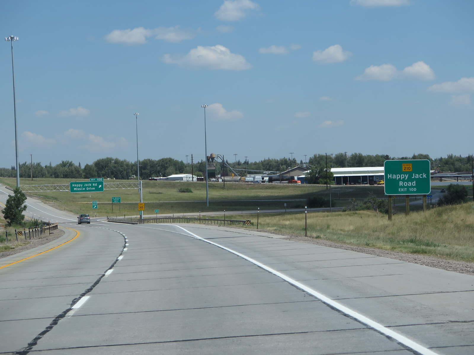
The next exit along Interstate 25 and U.S. 87 north is Exit 10D, Wyoming 210/Happy Jack Road west and Missile Drive east. The northbound side of the interchange was reconfigured from a cloverleaf interchange into a standard diamond interchange. This used to be one of two cloverleaf interchanges in the entire state of Wyoming; now the only such interchange is at Interstate 25 and Interstate 80. Photos taken 08/11/14 and 09/05/05. |
|
|
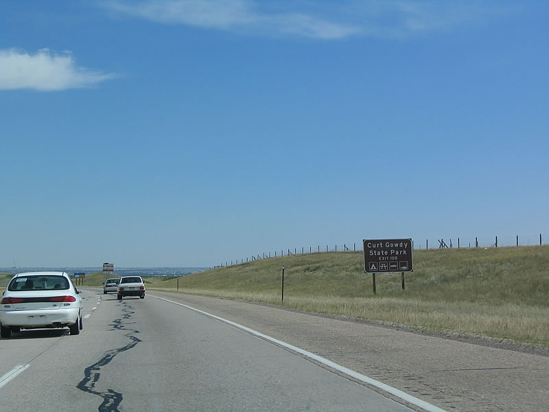
This guide sign for Curt Gowdy State Park is located along northbound Interstate 25 and U.S. 87 after the Lincolnway interchange (Exit 8). Curt Gowdy State Park is located in the Laramie Mountains along Wyoming 210/Happy Jack Road west of here. Photos taken 08/11/14 and 09/05/05. |
|
An auxiliary sign indicates that Exit 10D connects to Wyoming 210, a state highway that extends from the Interstate 25 interchange west to Interstate 80 and U.S. 30 via Curt Gowdy State Park. For westbound travelers, Wyoming 210 is a scenic alternative to Interstate 80 and U.S. 30 toward Sherman Hill and Telephone Canyon en route to Laramie. Photo taken 08/11/14. |
|
|
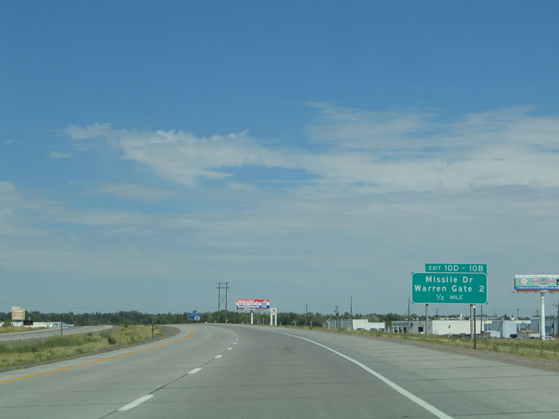
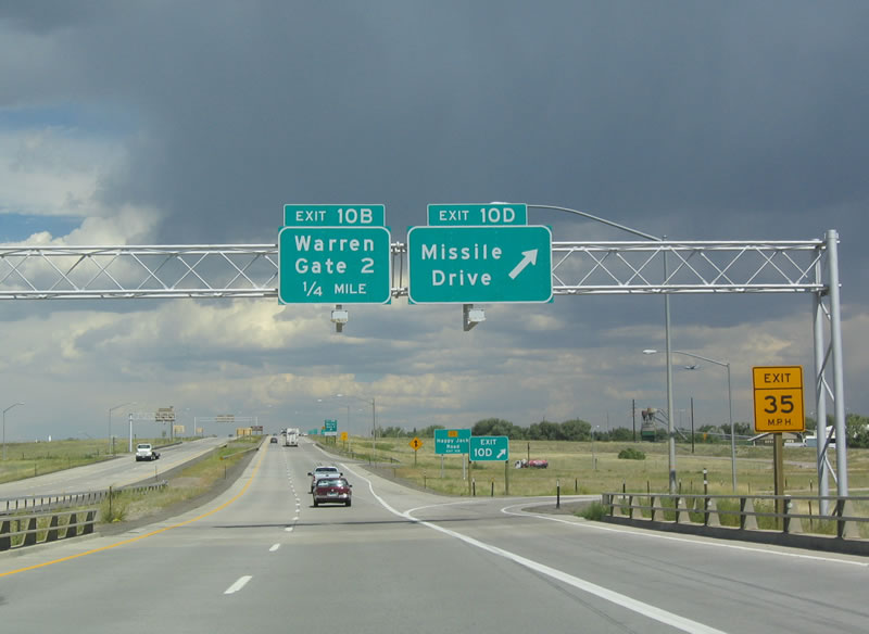
Northbound Interstate 25 and U.S. 87 meet Exit 10D, Wyoming 210/Happy Jack Road west to Curt Cowdy State Park, Missile Drive west to F.E. Warren Air Force Base Gate 2, and Missile Drive east to Business Loop I-80 and U.S. 30/Lincolnway in Cheyenne. Note that Exit 10B was eliminated when the interchange was modified from cloverleaf to diamond. At this point, Interstate 25 crosses over Crow Creek. Photos taken 08/11/14 and 09/05/05. |
|
Prior to the interchange conversion, this sign used to point the way to Wyoming 210, Happy Jack Road via former Exit 10B. At the base of the ramp, motorists could follow the signs to connect to Wyoming 210/Happy Jack Road west to Curt Gowdy State Park. Happy Jack Road follows the contours of the landscape as the highway slowly gains elevation. After passing by Curt Gowdy State Park, the highway winds between the popular Vedauwoo area and the Pole Mountain Wilderness within the Medicine Bow-Routt National Forest. Wyoming 210 merges with Interstate 80 at the Sherman Hill Summit Interchange. Photo taken 09/01/04. |
|
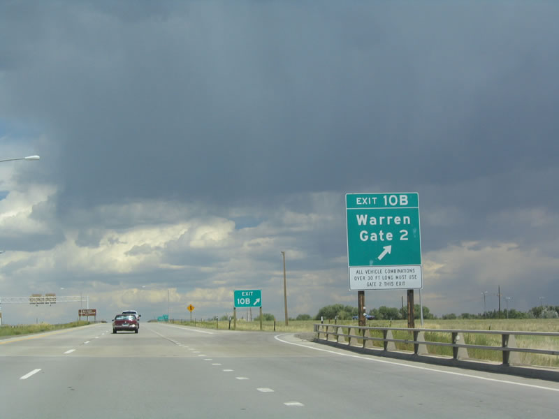
This offramp no longer exists due to the reconstruction of the Missile Drive and Happy Jack Road interchange. Prior to its elimination, this picture shows northbound Interstate 25 and U.S. 87 at the former offramp to Exit 10B, Missile Drive west to F.E. Warren Gate 2 and to Wyoming 210/Happy Jack Road west. Photo taken 09/01/04. |
|
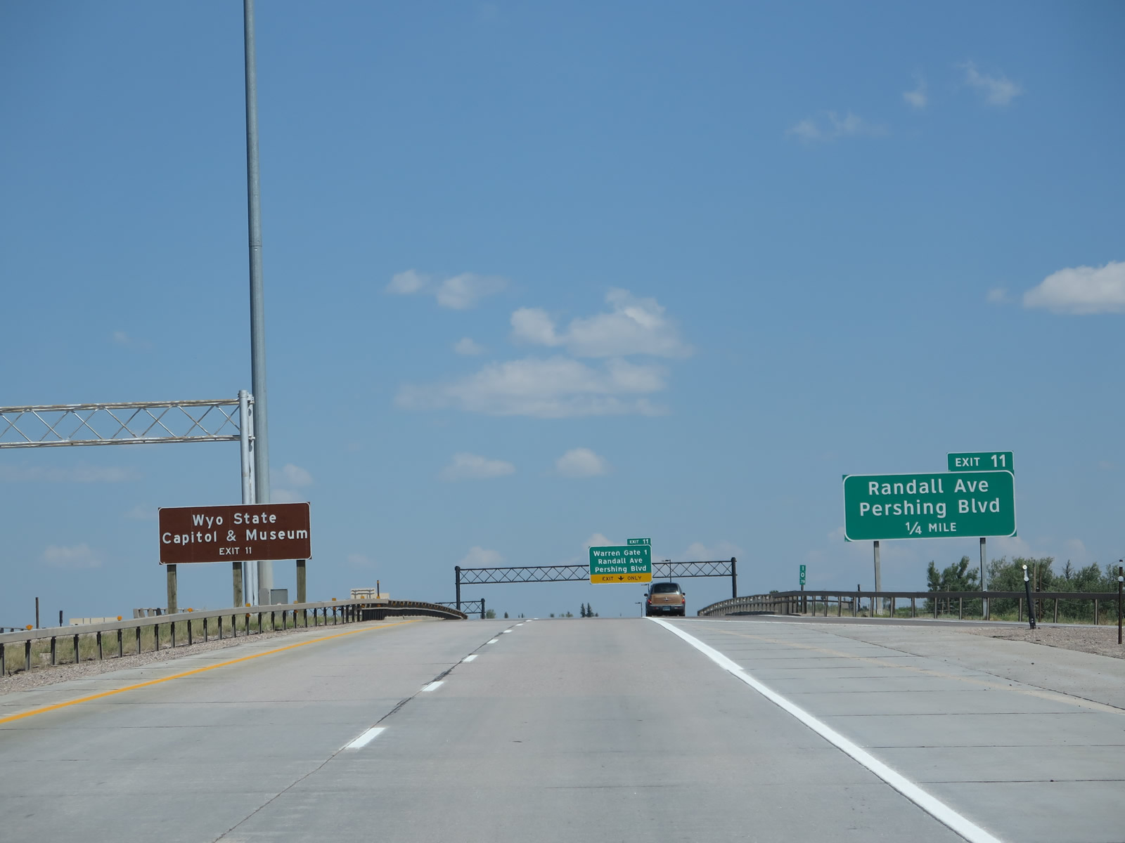
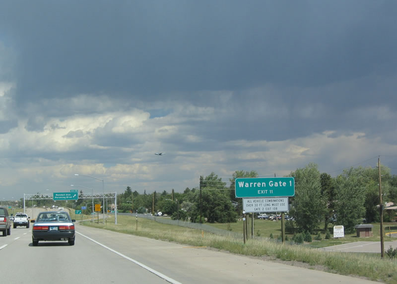
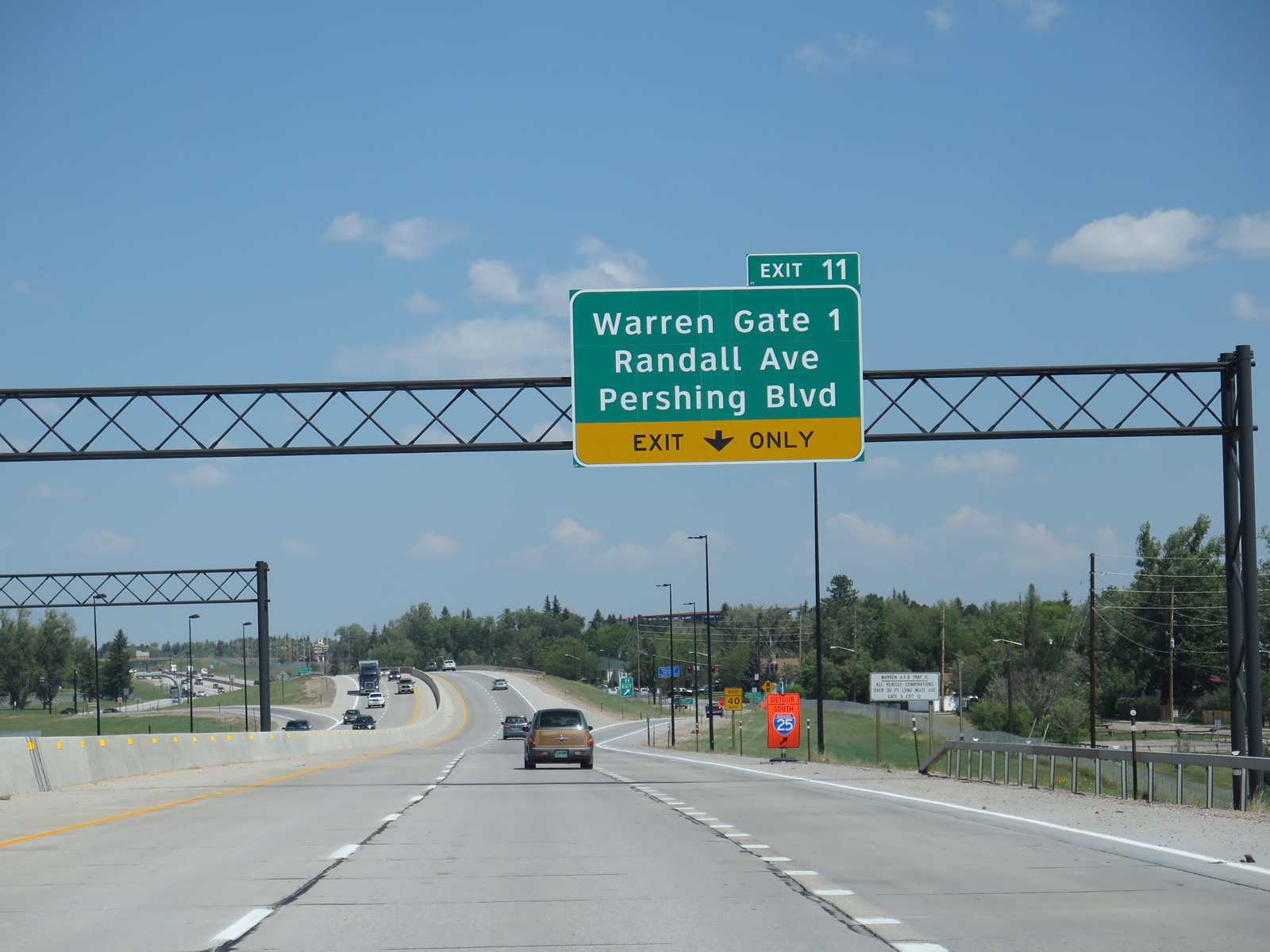
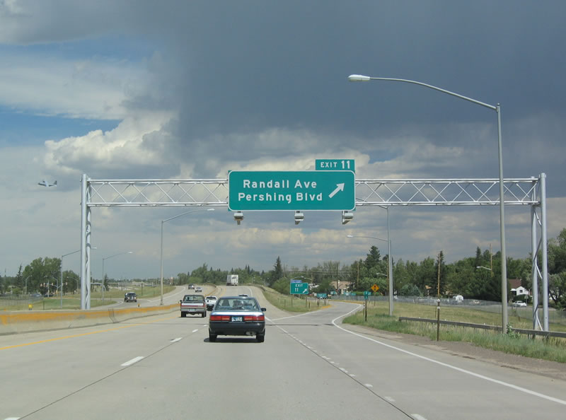
The next exit along northbound is Exit 11, Randall Avenue and Pershing Drive. To the Wyoming State Capitol, follow Pershing Drive east to Central Avenue (Business Loop I-25 and U.S. 85-87) south, then proceed south on Central Avenue to 24th Street west. The Wyoming State Capitol is located at the intersection of Capitol Avenue and 24th Street. Pershing Avenue is a major east-west route that connects Interstate 25 with Lincolnway in eastern Cheyenne, crossing most of the city. Randall Avenue begins at the northwestern corner of the four-block area that constitutes the state capitol and travels northwest to F.E. Warren Air Force Base, intersecting with both Interstate 25 and Pershing Drive at this interchange. Photo taken 08/11/14. |
|
Use Randall Avenue west to F.E. Warren Air Force Base Gate 1. There are no other public gates into the Air Force Base north of here along Interstate 25. This sign was gone by 2014, most likely as part of nearby interchange improvements. Photo taken 09/01/04. |
|
|
Northbound Interstate 25 and U.S. 87 reach Exit 11, Pershing Boulevard and Randall Avenue. As a result of interchange reconfiguration, the overhead exit sign was replaced and restyled. Photos taken 08/11/14 and 09/01/04. |
|
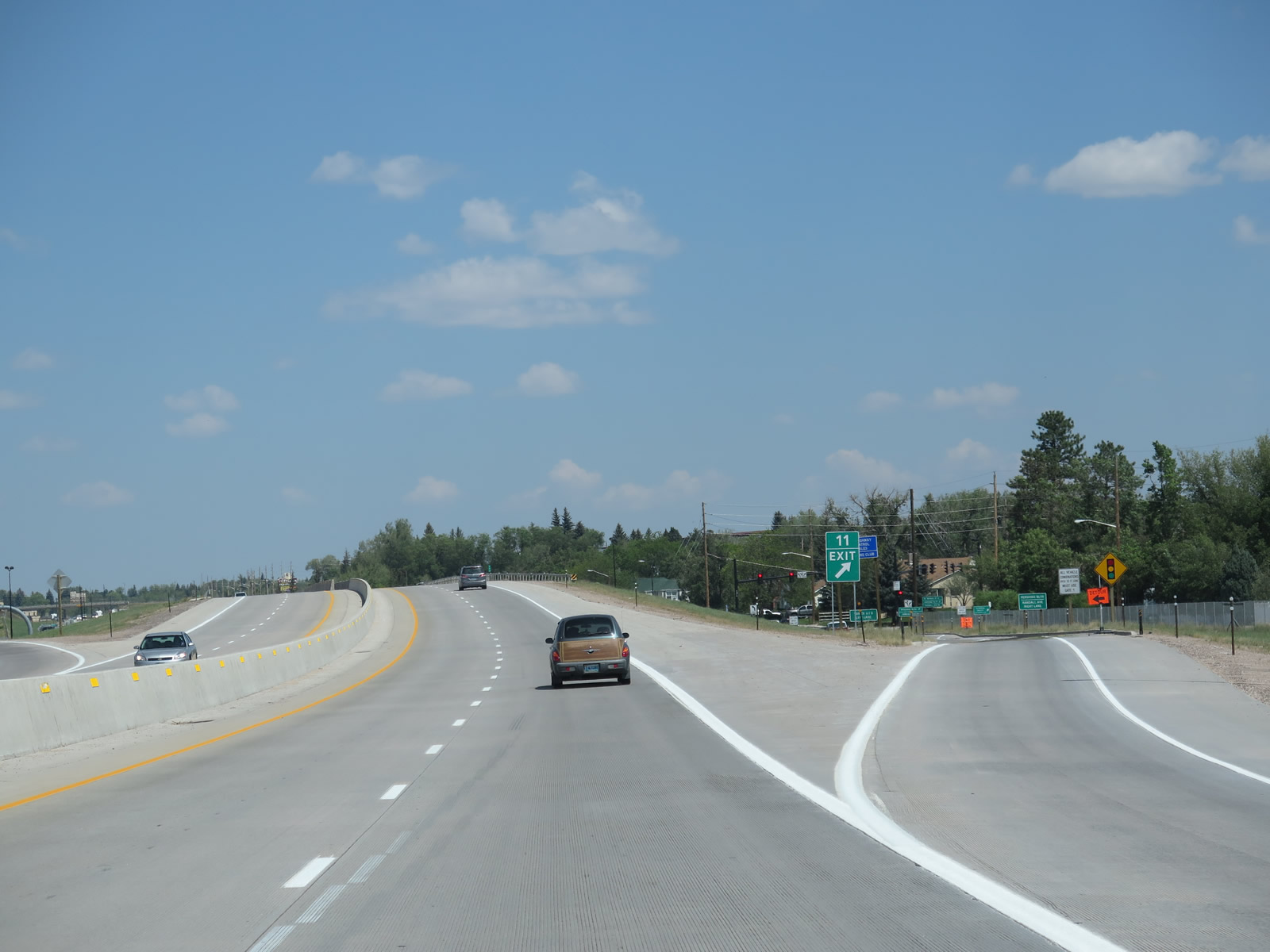
Exit 11 departs from the freeway to Randall Avenue and Pershing Boulevard. Notice the limited space for the freeway here. Interstate 25 is sandwiched between the military base and the northwestern Cheyenne neighborhoods, so the two directions are separated only by a jersey barrier. The freeway will resume a more rural characteristic after the Central Avenue interchange. Photo taken 08/11/14. |
|
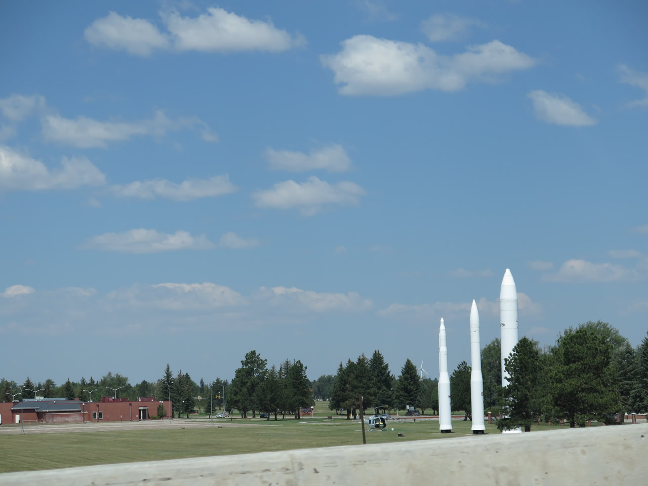
Three missiles are poised alongside Interstate 25 at the Exit 11 complex (Randall Avenue and Pershing Boulevard) adjacent to Gate 1 for F.E. Warren Air Force Base. Photo taken 08/11/14. |
|
The northbound direction is just wide enough to accommodate two lanes and a full shoulder through the Randall Avenue and Pershing Boulevard interchange (Exit 11). This is one of the narrowest segments of freeway in Wyoming's segment of the Interstate Highway System. Photo taken 08/11/14. |
|
|
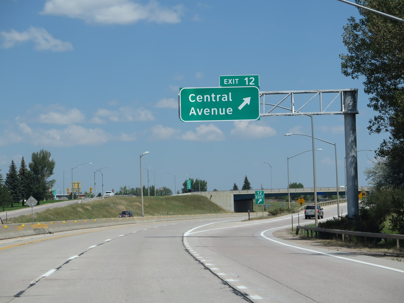
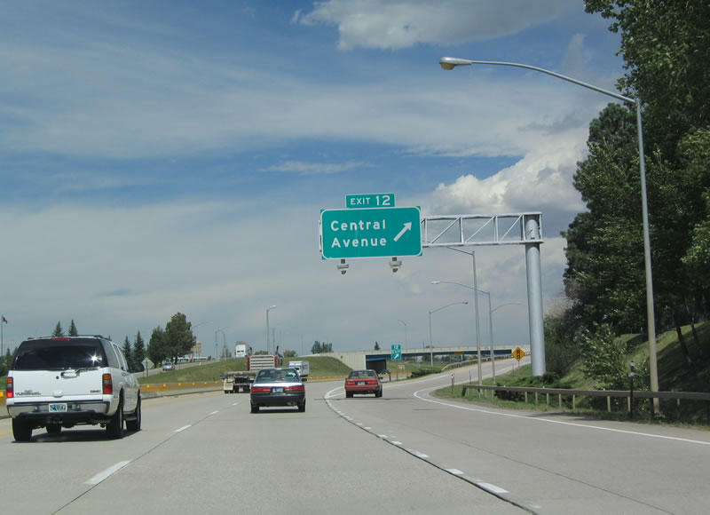
The next exit along northbound is Exit 12, Junction Business Loop I-25, U.S. 85, and Business U.S. 87/Central Avenue south and Wyoming 224/Central Avenue west to the Wyoming Department of Transportation Headquarters Complex. This interchange marks the northern terminus of the business route. To the north, U.S. 85 merges onto Interstate 25 and U.S. 87 for about five miles. Photos taken 08/11/14 and 09/05/05. |
|
An Interstate 25 and U.S. 87 north reassurance shield assembly posted after Exit 11. Photo taken 08/11/14. |
|
To the west of Interstate 25, Wyoming 224 is a short, unsigned route that connects Interstate 25 with several governmental buildings, such as the Wyoming Department of Fish and Game and the Department of Transportation. Photo taken 08/11/14. |
|
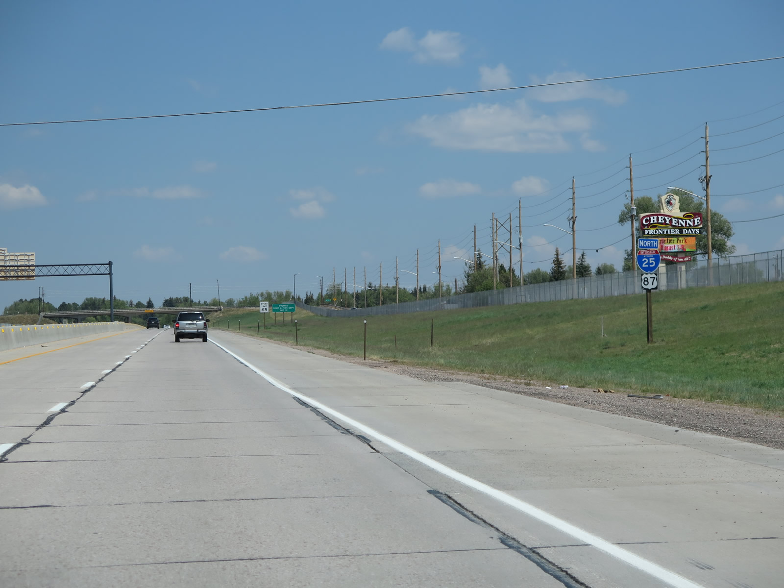
Annually, Cheyenne Frontier Days draws thousands to the Cheyenne area to partake in one of the country's largest rodeos and festivals. Lasting for several days in July, Cheyenne Frontier Days (CFD) often feature top entertainers and rodeo legends. Held at Frontier Park each July, Cheyenne Frontier Days is the biggest and most well-known event held annually in the Cheyenne metropolitan area. Photo taken 08/11/14. |
|
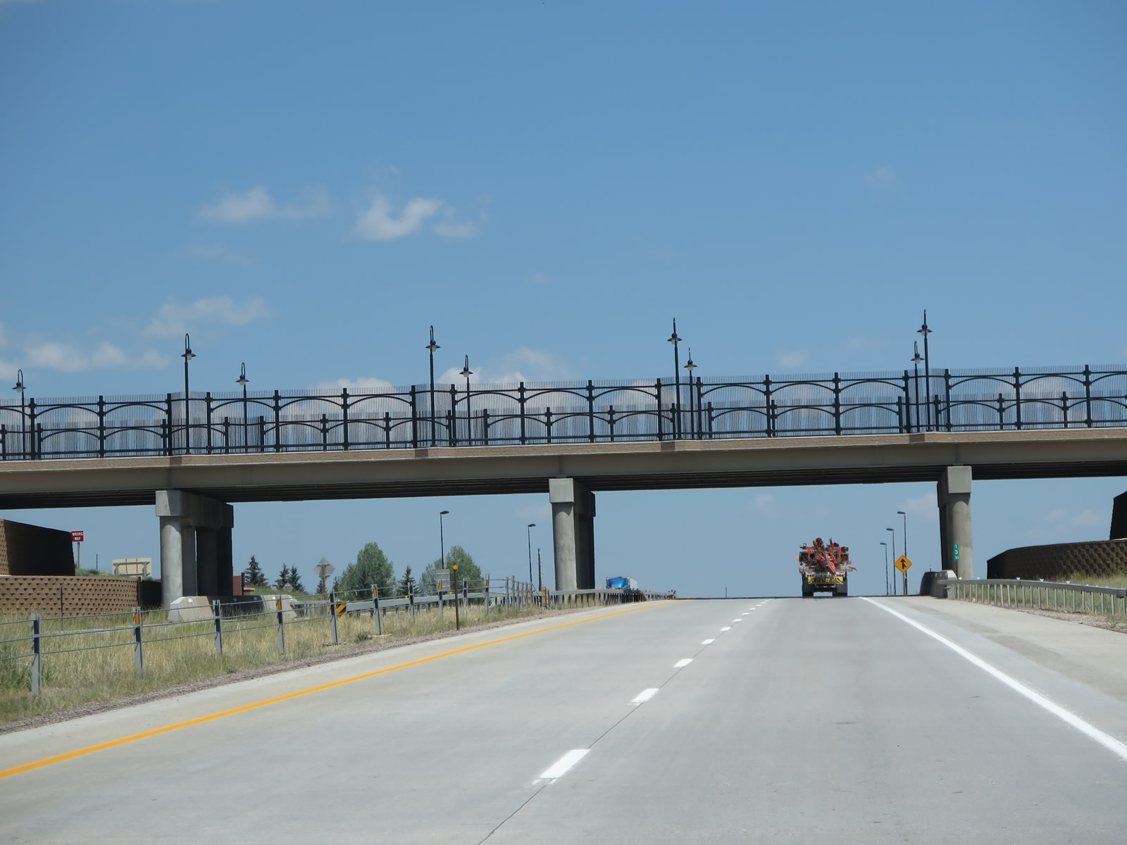
After passing under the Stinner Road overpass, Interstate 25 passes over a series of bridges that carry the freeway over Lake Absarraca, also known as Country Club Lake within Frontier Park. Cheyenne Frontier Days is hosted annually at Frontier Park; the lake is part of the larger complex that also includes an arena and concert venue. Photo taken 08/11/14. |
|
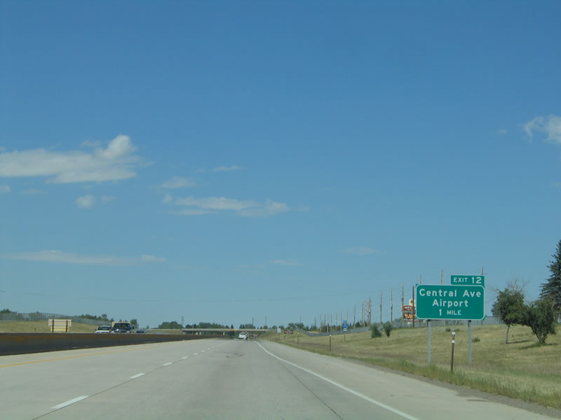
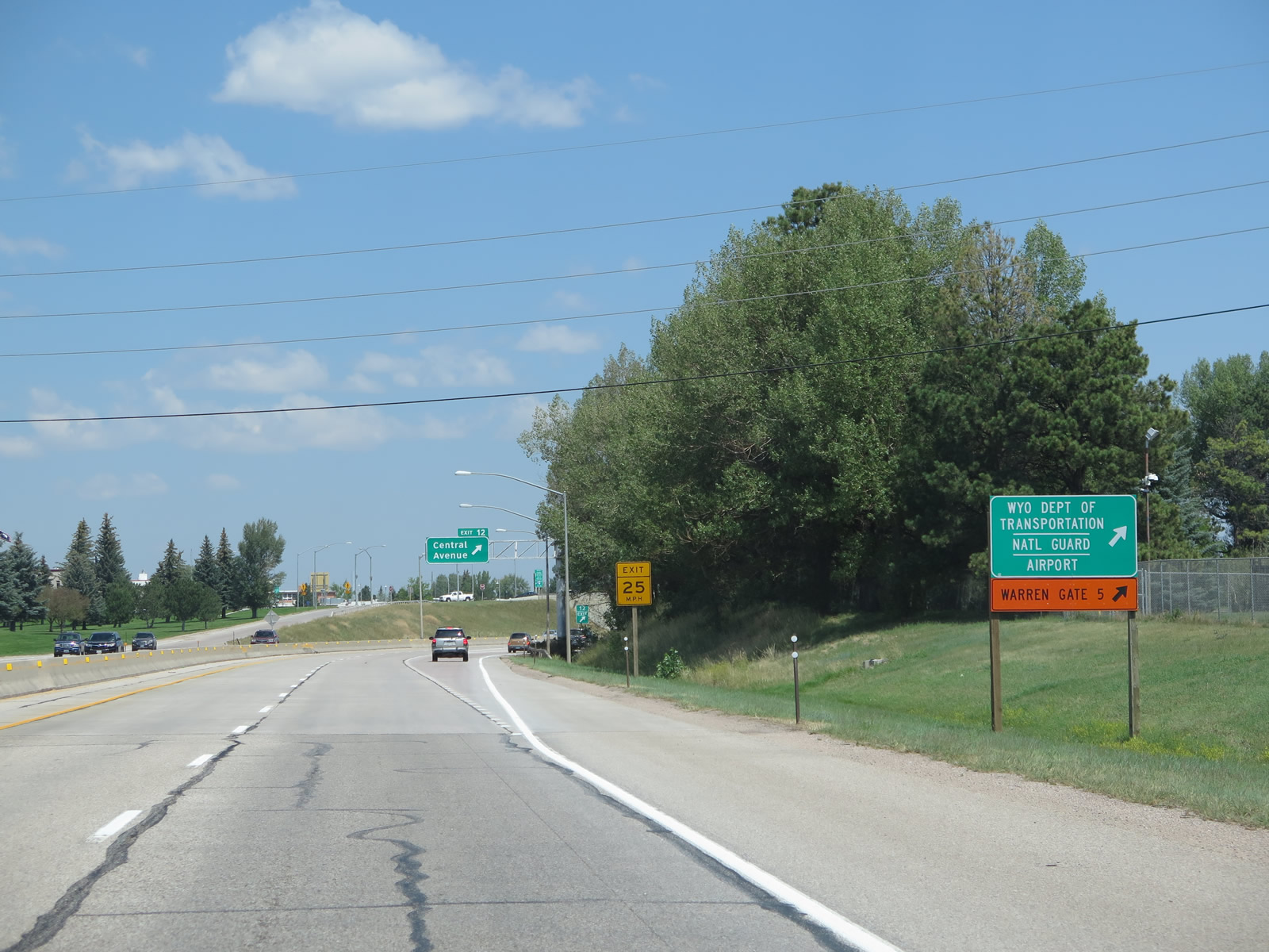
Business Loop I-25, U.S. 85, and U.S. 87 Business (Central Avenue) south to WYO 219 (Yellowstone Road) north leads to Dell Range Boulevard east for Cheyenne Regional Airport (Jerry Olson Field). The airport, along with the Wyoming National Guard offices, is located on the south side of Dell Range Boulevard. Photo taken 08/11/14. |
|
|
Northbound Interstate 25 and U.S. 87 meet Exit 12, Junction Business Loop I-25, U.S. 85, and Business U.S. 87 (Central Avenue) south to downtown and Wyoming 224 (Central Avenue) west to several government buildings. Photos taken 08/11/14 and 09/01/04. |
|
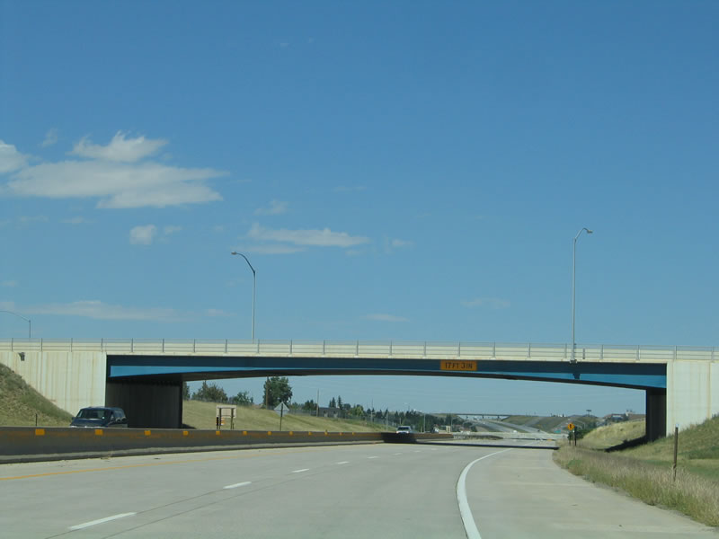
The concrete overpass for Central Avenue rests atop a decorative blue arch as Interstate 25 proceeds through northern Cheyenne. Photo taken 09/05/05. |
| Interstate 25 and U.S. 85-87 north |
|---|
|
|
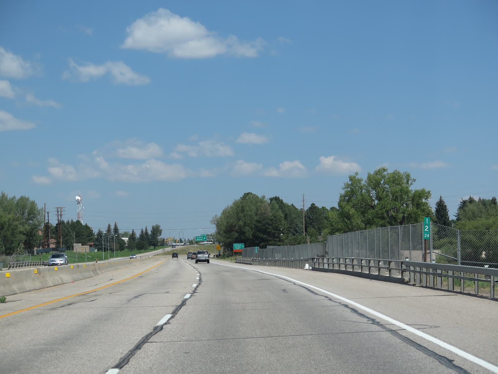
Interstate 25 is cosigned with both U.S. 85 and U.S. 87 after the Central Avenue interchange. Hynds Boulevard acts as the frontage road on the east side of Interstate 25 between Exit 12 and Exit 16. A pedestrian bridge spans the freeway north of Central Avenue. Note the subtle difference in the route marker design between 2004 and 2014. The numerals for 25 are larger in the 2014 edition. Photos taken 08/11/14 and 09/01/04. |
|
|
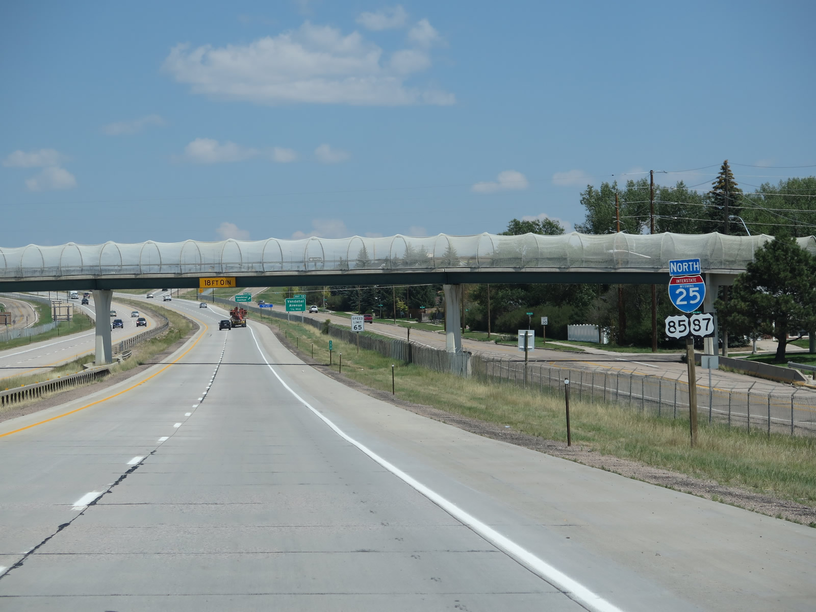
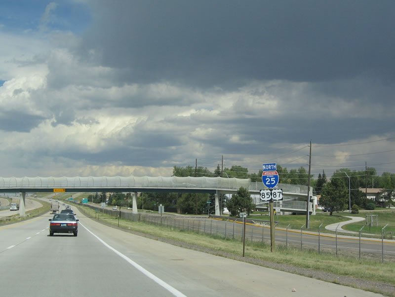
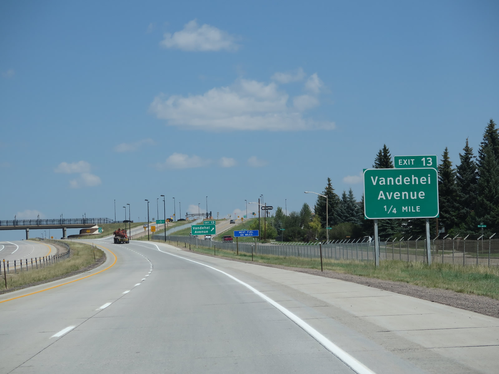
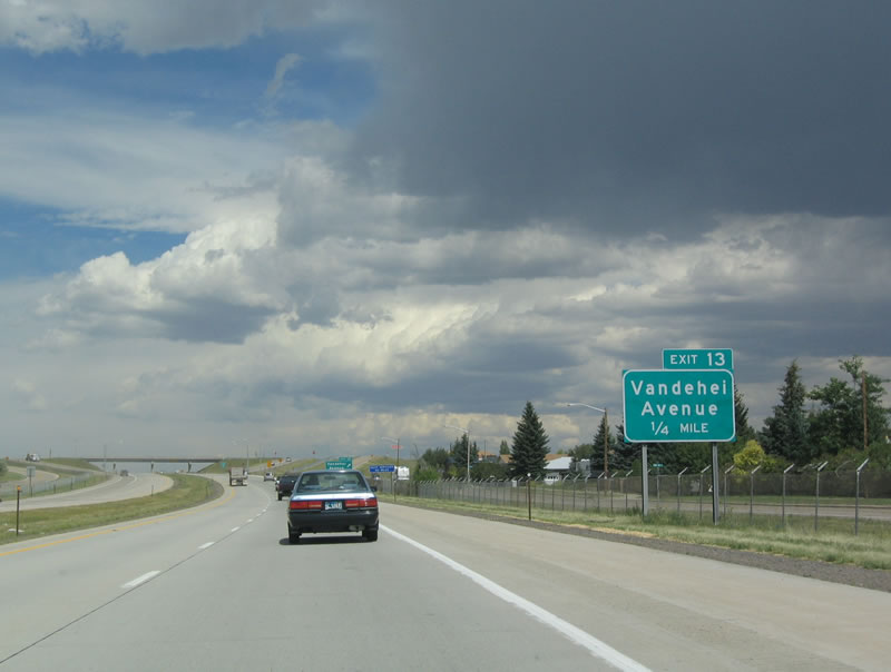
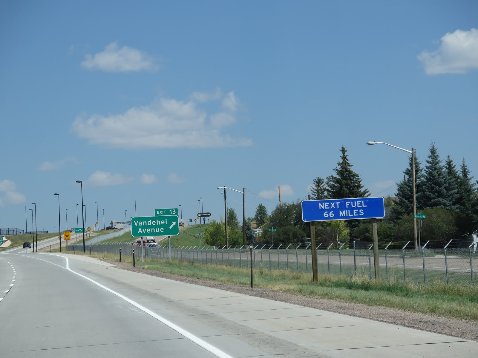
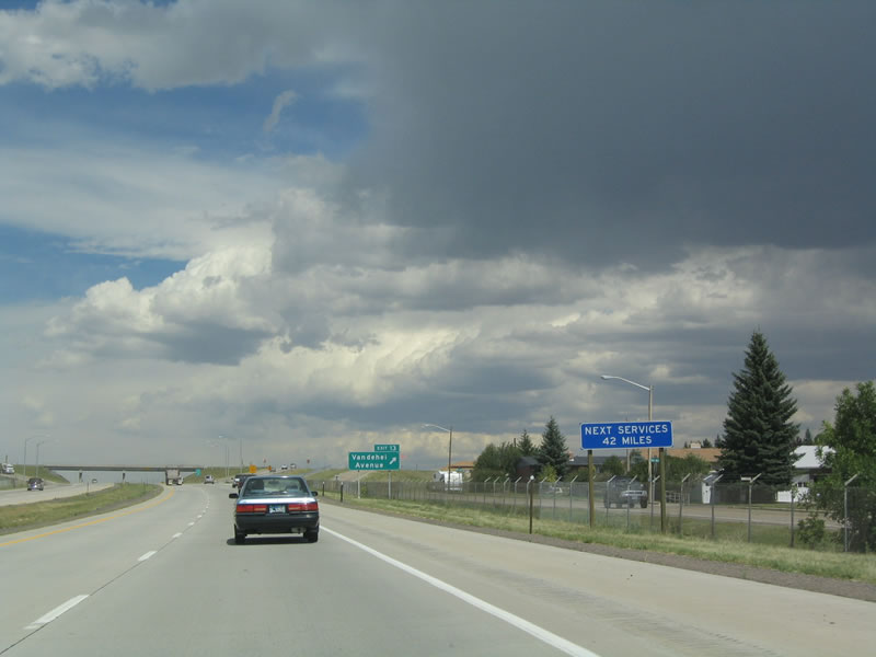
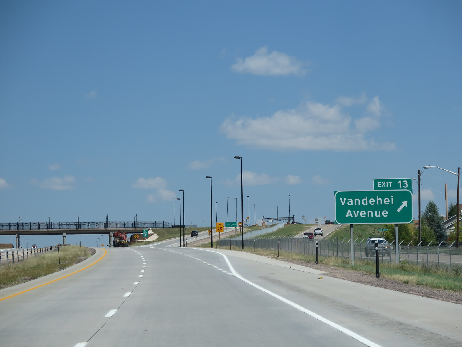
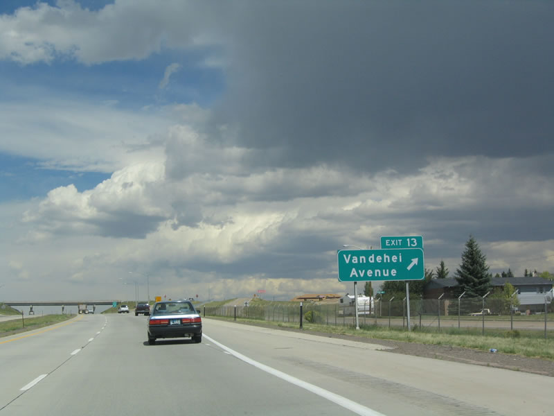
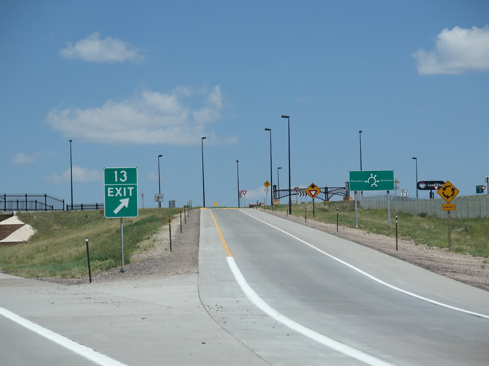
The next exit along northbound Interstate 25 and U.S. 85-87 is Exit 13, Vandehei Avenue. This east-west road serves the northern Cheyenne suburban developments. Photos taken 08/11/14 and 09/01/04. |
|
|
Exit 13 is the last exit to feature fuel for 66 miles! This used to be 42 miles but was lengthened due to the protracted closure of the gas station (Horton's Corner) at Chugwater as a result of an accident that destroyed the station (and adjacent convenience store) on December 30, 2012. It is unclear whether a new gas station will be built in its place, so the next gas on the freeway is in Wheatland. North of Cheyenne, development -- along with traffic counts on Interstate 25 -- begins to subside. Photos taken 08/11/14 and 09/01/04. |
|
|
Northbound Interstate 25 and U.S. 85-87 meet Exit 13, Vandehei Avenue. This is the final urban Cheyenne exit. This interchange was improved in 2011 to include roundabouts at the end of the offramps. Photos taken 08/11/14 and 09/01/04. |
|
|
Interstate 25 and U.S. 85-87 pass through the Vandehei Avenue interchange; note the decorative touches to the overpass and the eastern roundabout as shown here. Photos taken 08/11/14. |
|
Another reassurance shield assembly for Interstate 25 and U.S. 85-87 is posted after Vandehei Avenue. Photo taken 09/01/04. |
|
A late summer thunderstorm interrupted the steady flow of sunshine on this Labor Day weekend. The next exit along northbound Interstate 25 and U.S. 85-87 is Exit 16, Wyoming 211, Horse Creek Road. Photo taken 09/01/04. |
|
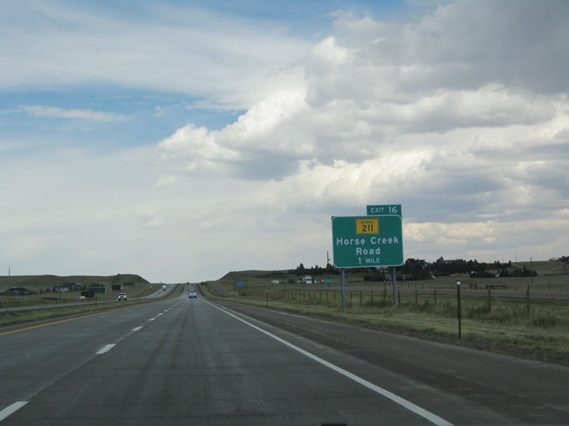
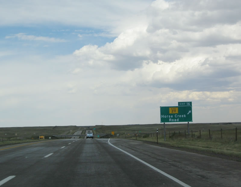
Northbound Interstate 25 and U.S. 85-87 reaches Exit 16, Wyoming 211, Horse Creek Road. Wyoming 211 follows the Burlington Northern Santa Fe Railroad alignment northwest to Federal and Horse Creek, then angles north to Iron Mountain, then returns to Interstate 25 at Exit 54 near Chugwater. At no time did Wyoming 211 follow any kind of U.S. Highway alignment; in 1926, U.S. 185 generally followed the route of Interstate 25 rather than Wyoming 211. Photo taken 09/01/04. |
|
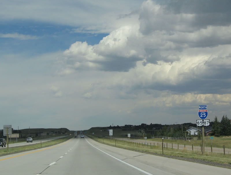
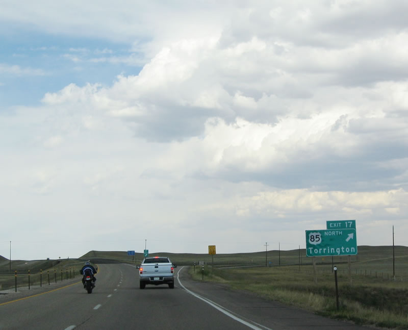
The next exit along northbound is the final separation between Interstate 25/U.S. 87 and U.S. 85. These three routes have been intertwined in some fashion since leaving northern New Mexico. U.S. 85 angles northeast toward Torrington, then travels north along the eastern spine of Wyoming toward Lusk and the Black Hills region of South Dakota. A connection to Sundance and Devils Tower is afforded via Wyoming 585. Interstate 25 and U.S. 87 continue north along the path of Historic U.S. 185 toward Chugwater, Wheatland, Glendo, and Orin Junction. Turning west, the freeway follows the North Platte River (and U.S. 20-26-87) into the second largest city of Casper, then turns north toward Buffalo. At Buffalo, Interstate 25 merges onto westbound Interstate 90 en route to Sheridan and the Treasure State of Montana (famously known as Big Sky Country). Photo taken 09/01/04. |
| Interstate 25 and U.S. 87 north |
|
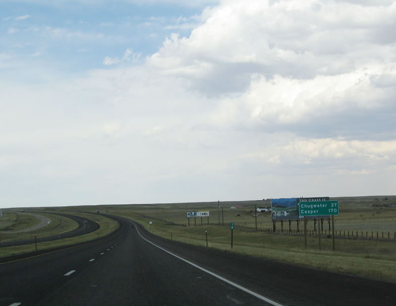
This mileage sign provides the distance to Chugwater (37 miles) and Casper (170 miles). It takes about three hours to drive from Cheyenne to Casper. Interstate 25 is the primary route connecting Wyoming's two largest cities. Photo taken 09/01/04. |
|
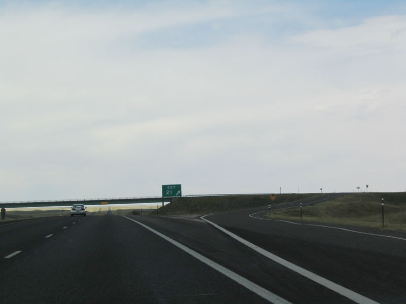
The next exit along northbound Interstate 25 and U.S. 87 is Exit 21, Junction Laramie County Route 220, Ridley Road. There are no services at this interchange; the county route provides ranch access. Photo taken 09/01/04. |
|
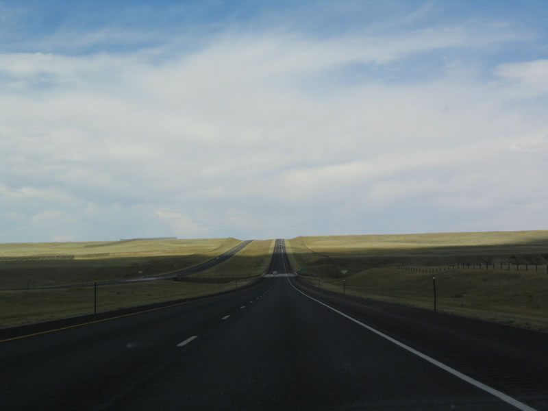
The shadow of a thunderhead cloud partially darkens part of Interstate 25 north. Photo taken 09/01/04. |
|
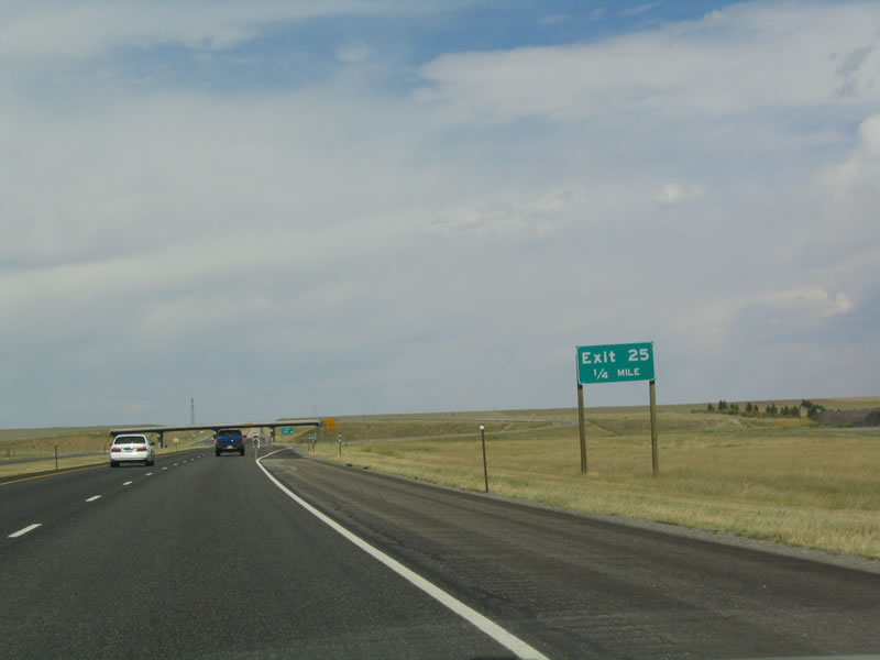
The next exit along northbound Interstate 25 and U.S. 87 is Exit 25, Junction Laramie County Route 224, Atlas Road. Photo taken 09/01/04. |
|
Northbound Interstate 25 and U.S. 87 reaches Exit 25, Junction Laramie County Route 224, Atlas Road. Again, no services are available at this exit; Atlas Road primarily serves ranch access. Photo taken 09/01/04. |
|
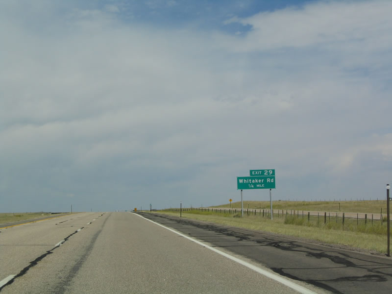
The next exit along northbound Interstate 25 and U.S. 87 is Exit 29, Junction Laramie County Route 228, Whitaker Road. Whitaker Road travels west to the Horse Creek Oil Field, which is where it ends. It does not connect with Wyoming 211, Horse Creek Road. Photo taken 09/01/04. |
|
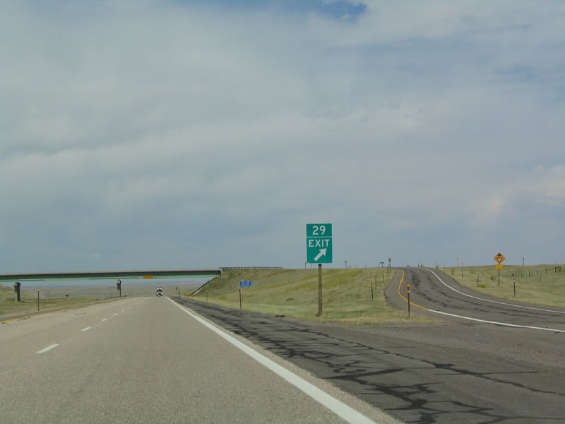
Northbound Interstate 25 and U.S. 87 reach Exit 29, Junction Laramie County Route 228, Whitaker Road. To the east, Whitaker Road connects to Laramie County Route 124, Old Yellowstone Road (former U.S. 87/185). The old alignment follows the freeway on the east side between Cheyenne and Little Bear. Photo taken 09/01/04. |
|
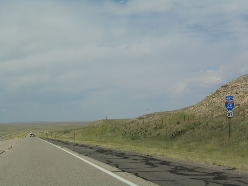
Interstate 25 and U.S. 87 are again cosigned on northbound. Photo taken 09/01/04. |
|
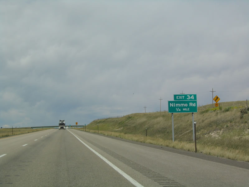
The next exit along northbound Interstate 25 and U.S. 87 is Exit 34, Junction Laramie County Route 232, Nimmo Road. Upon exiting here, follow the old Yellowstone Highway south to Nimmo Road. Nimmo Road travels east along Horse Creek to Indian Hill Road (Laramie County Route 128). Photo taken 09/01/04. |
|
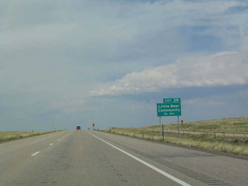
Following Nimmo Road, the next exit is Exit 39, Little Bear Community. Use Exit 39 to Hirsig Road and Moffett Road. Photo taken 09/01/04. |
|
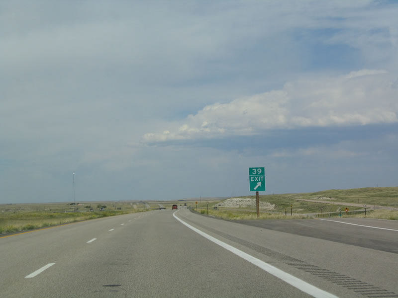
Northbound Interstate 25 and U.S. 87 reaches Exit 39, Little Bear Community. Photo taken 09/01/04. |
|
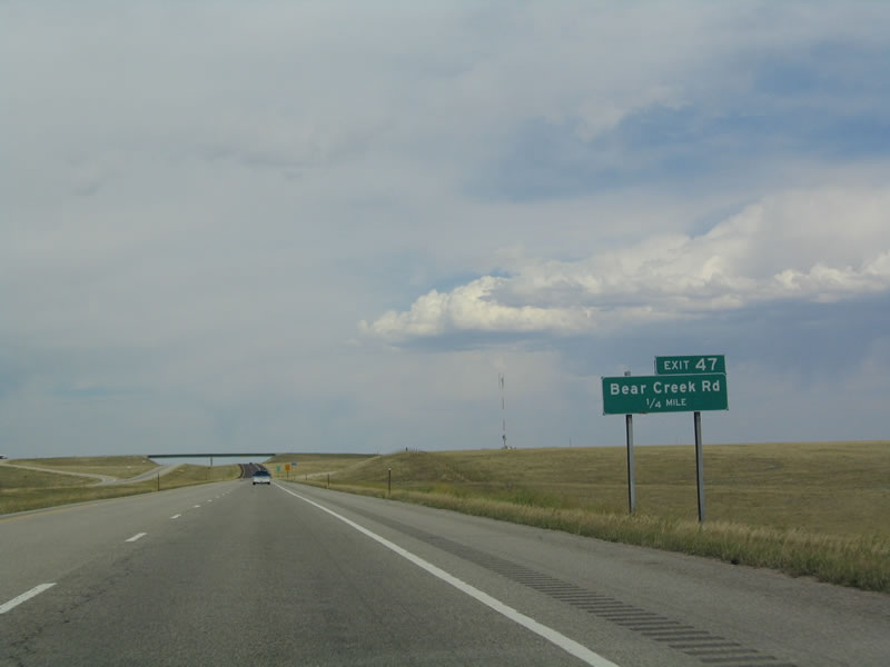
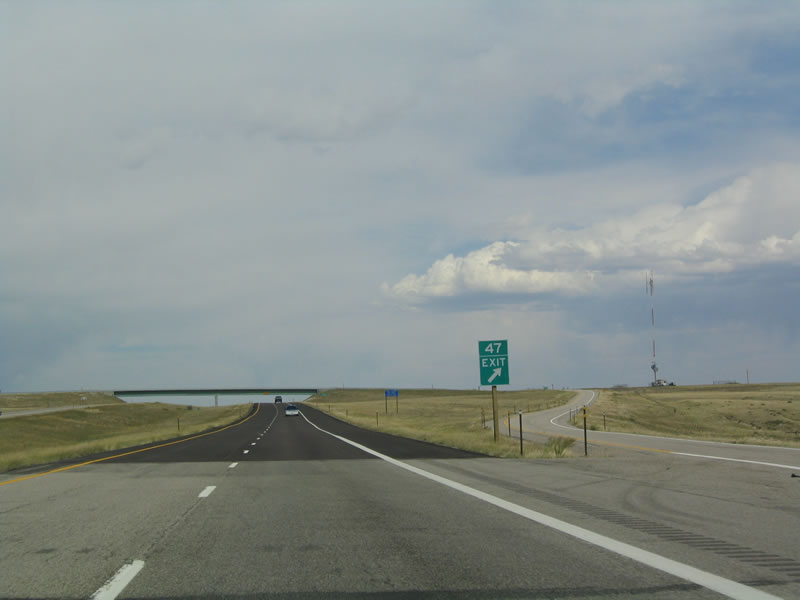
The next exit is Exit 47, Junction Laramie County Route 245, Little Bear Road. Little Bear Road serves as the county line between Laramie and Platte Counties. Photo taken 09/01/04. |
|
Northbound Interstate 25/U.S. 87 is Exit 47, Junction Laramie County Route 245, Little Bear Road. Photo taken 09/01/04. |
|
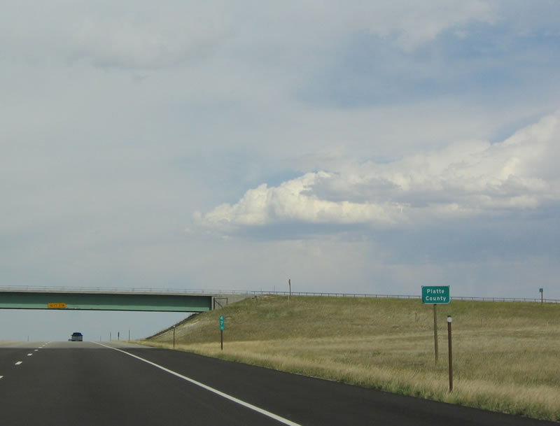
Interstate 25 and U.S. 87 leave Laramie County and enter Platte County upon reaching the overpass for Bear Creek Road. Photo taken 09/01/04. |
Page Updated September 4, 2014.