| Interstate 80 west and U.S. 95 south |
|---|
|
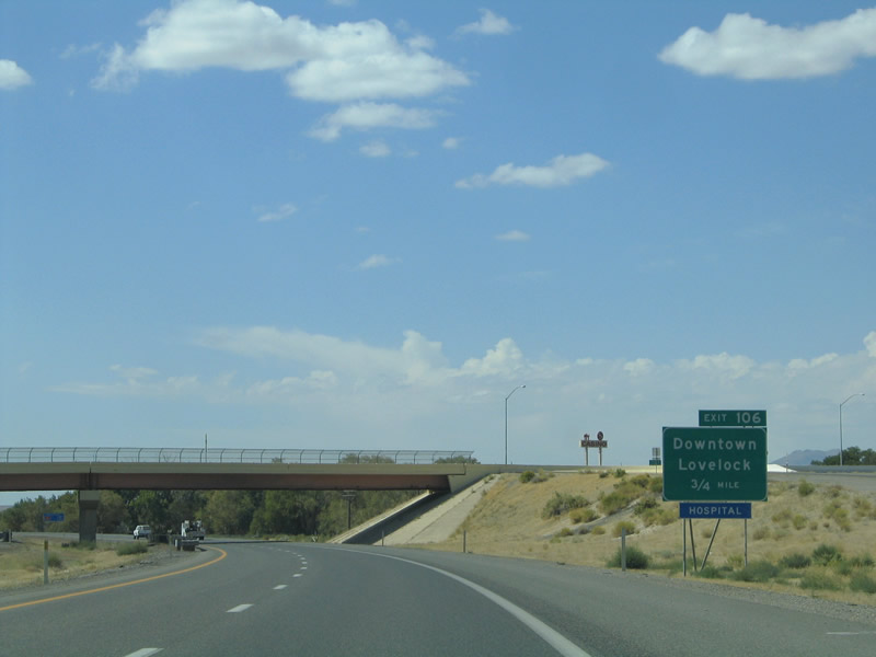
Still in Lovelock, we continue southwest at the Exit 107 interchange. Within the footprint of the interchange, we encounter this 0.75-mile guide sign for Exit 106, Nevada 398/Main Street west to downtown Lovelock. Nevada 398 (Business Loop I-80/Main Street) spurs west from the freeway to meet Business Loop I-80, Historic U.S. 40-95, and Nevada 396/Cornell Avenue. Nevada 398 uses northbound Central Avenue and Meridian Road to leave Lovelock, then meets Nevada 399/Pitt Road. Nevada 399 spurs west from Nevada 398 (North Meridian Road) 18.184 miles to the Eagle Picher Mine. At the intersection with Fairview Road, Nevada 398 turns 90-degrees east via Fairview Road to reconnect with Nevada 396 and Old U.S. 40-95/Upper Valley Road. The entire route runs for a total of 4.766 miles. Photo taken 09/09/05. |
|
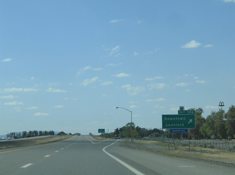
Westbound Interstate 80 and southbound U.S. 95 meet Exit 106, Nevada 398/Main Street at this diamond interchange. Use Exit 106 to Nevada 397/Amherst Avenue via Main Street approximately one block west of the freeway. Nevada 397 ventures 11.840 miles south from downtown to Derby Field Road southwest of Lovelock after initially paralleling Interstate 80, changing into Meridian Road upon separating from the freeway frontage. Photo taken 09/09/05. |
|
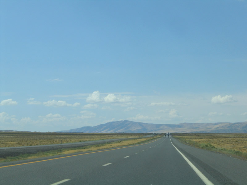
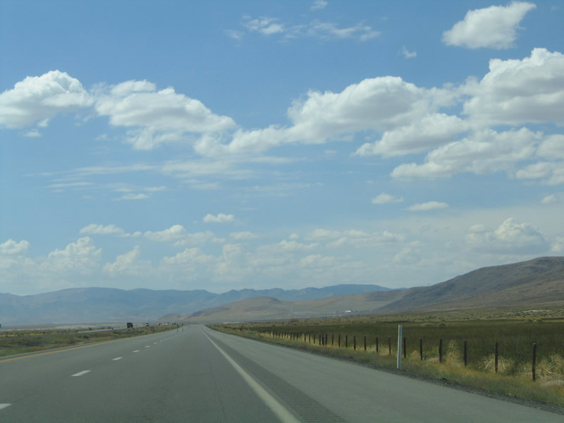
Interstate 80 and U.S. 95 depart Lovelock and continue 12 miles southwest to Toulon and the Humboldt State Wildlife Management Area. This area of southern Pershing County is known as the Humboldt Sink. The Great Basin Desert derived its name by explorer John C. Frémont for its internal drainage, meaning that all rivers that flow into or begin within the Great Basin end there as well; none flow to the sea. The Humboldt Sink, a pungent swamp, represents the finalé of the Humboldt River. Photo taken 09/09/05. |
|
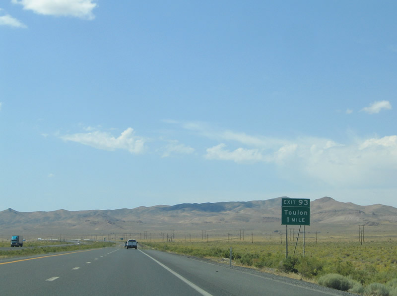
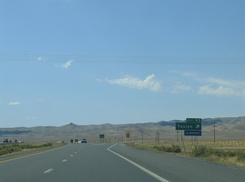
Leaving the Lovelock area (there is no access from Interstate 80 west to Exit 105, Junction Business Loop I-80 east to Lovelock), the next interchange along Interstate 80 west and U.S. 95 south is Exit 93, Ragged Top Road at Toulon. Ragged Top Road intersects a frontage road (Old U.S. 40-95) system on either side of the freeway. The southern frontage road connects Interstate 80 exit 93 to Toulon, Nevada 860/Derby Field Road, Nevada 397/Westergard Road, and Derby Field. Photo taken 09/09/05. |
|
|
|
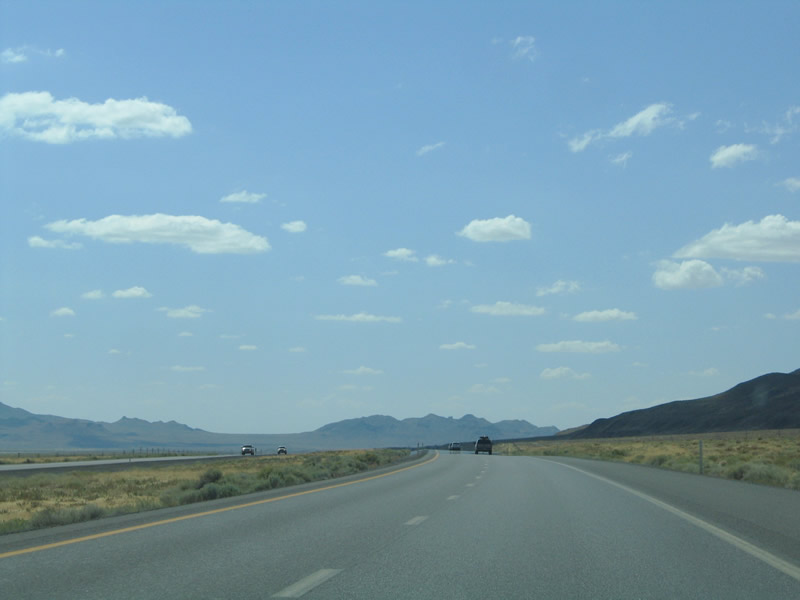
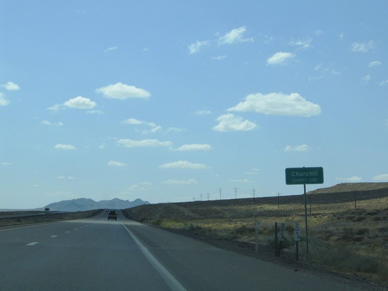
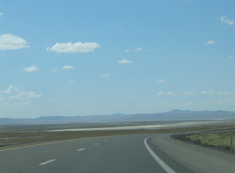
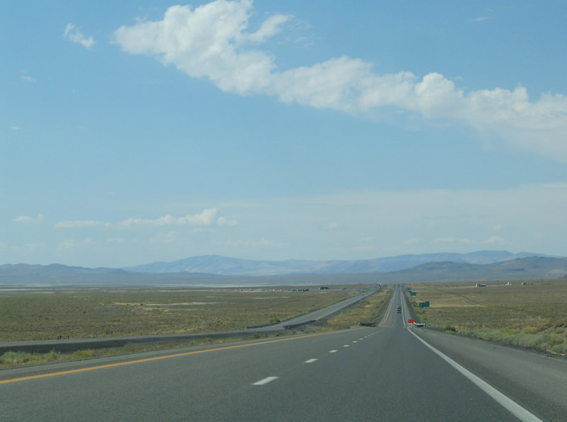
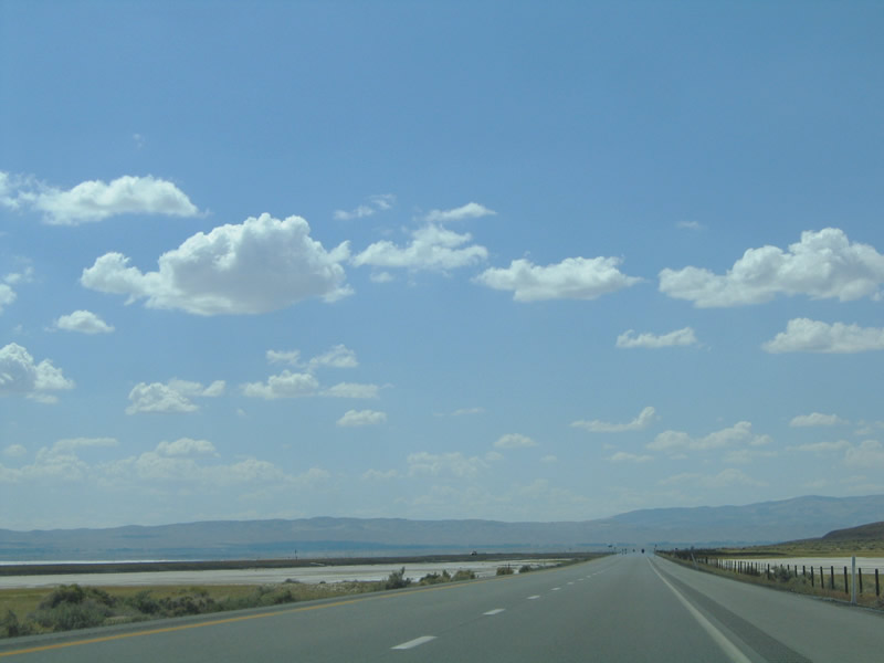
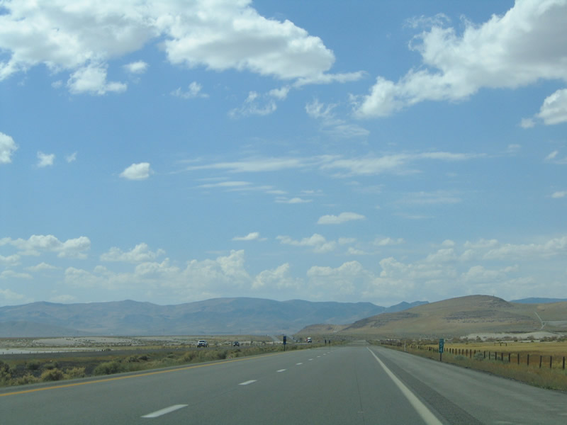
Interstate 80 and U.S. 95 continue to follow the Trinity Range southwest from Toulon to their split at Exit 83. The Churchill County line exists midway between Exits 93 and 83. The vast plain between the Trinity Range and Humboldt Range to the east represents the Humboldt Sink. Salt flats are visible to the south of the freeway. This area is known as the Forty Mile Desert and is desolate, with limited development, Photos taken 09/09/05. |
|
|
|
|
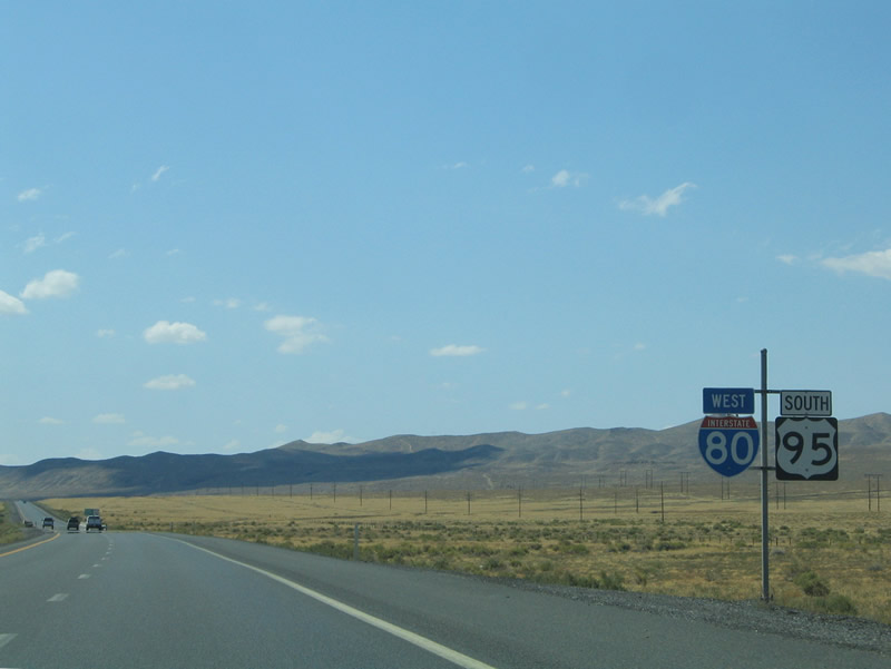
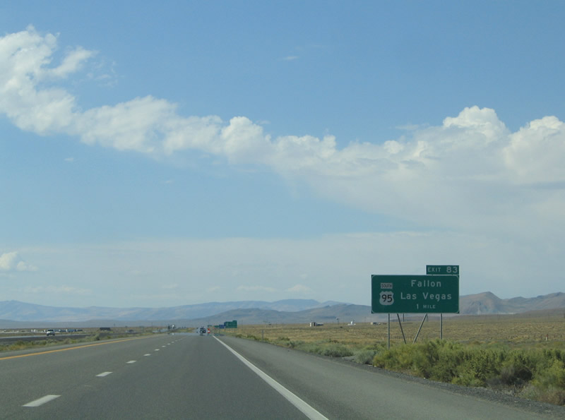
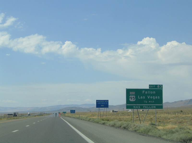
The next interchange along Interstate 80 west is Exit 83, U.S. 95 south to Hawthorne, Tonopah, and Las Vegas. U.S. 95 south prepares to part ways with Interstate 80 west at Trinity and Exit 83. The U.S. highway turns southward 32 miles from the freeway to the Churchill County seat of Fallon (U.S. 50). From there U.S. 95 meanders 380 miles throughout western and southern Nevada to Las Vegas. Photo taken 09/09/05. |
|
A trumpet interchange facilitates the movements between Interstate 80 and U.S. 95 at Exit 83. U.S. 95 enters the pervasive Carson Sink between Trinity and Fallon. The area is home to the Fallon National Wildlife Refuge, Stillwater Wildlife Management Area, and Fallon Naval Air Station. Photo taken 09/09/05. |
|
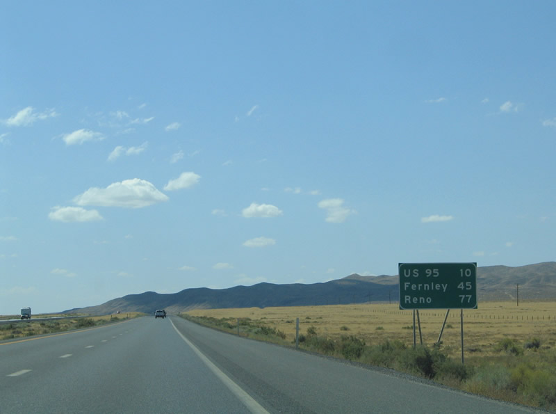
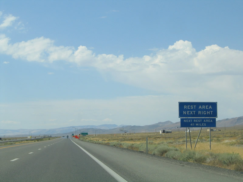
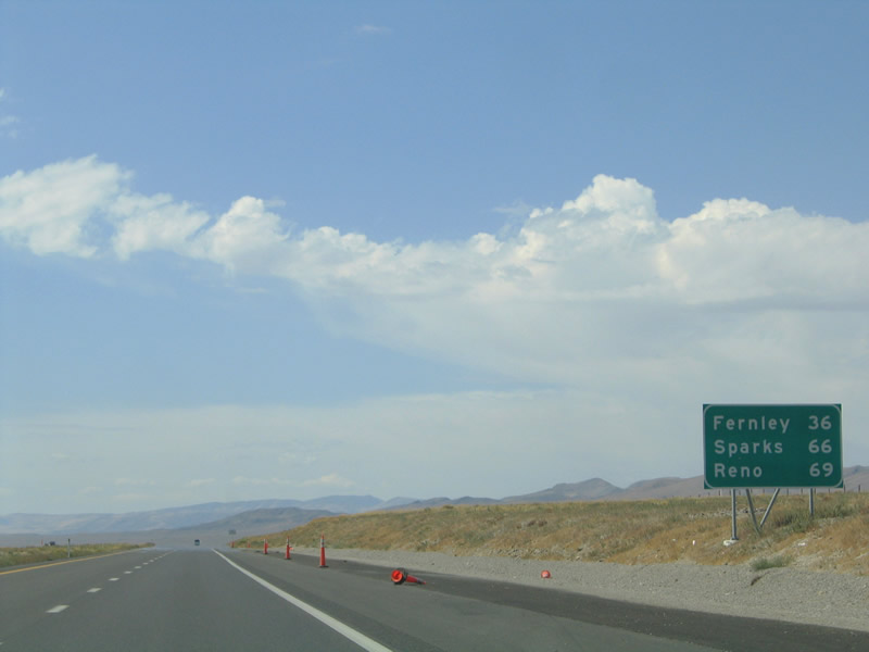
Road weary travelers should U.S. 95 southbound for a nearby rest area. The next mainline area lies 41 miles ahead between Fernley and Sparks. Photo taken 09/09/05. |
|
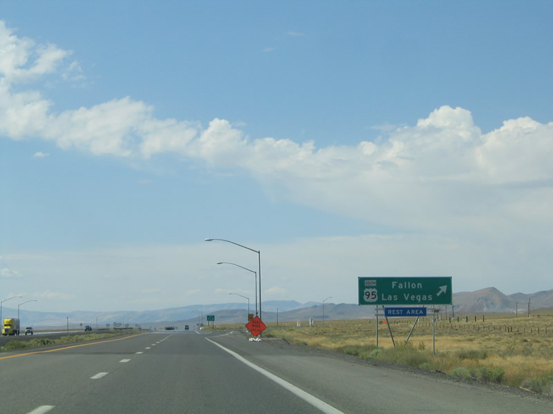
Westbound Interstate 80 reaches Exit 83, U.S. 95 south to Hawthorne, Tonopah, and Las Vegas. U.S. 95 southbound ventures through Fallon, Hawthorne, Tonopah, Goldfield, Beatty, and Indian Springs on its rural journey in western Nevada. The U.S. highway provides connections to the southern Sierra Nevada via Nevada 359 and U.S. 6 south of Schurz. Photo taken 09/09/05. |
| Interstate 80 west and U.S. 95 Alternate south |
|---|
|
|
|
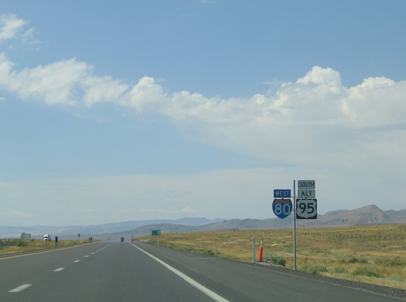
Interstate 80 westbound gains U.S. 95 Alternate southbound from Exit 83 to Exit 48 and Fernley, although no signs in advance of Exit 83 state this. The alternate route provides a bypass of Fallon through Silver Springs and Yerington. The freeway overlap enters the Carson Sink, like U.S. 95 does, from Trinity southwest toward Desert Peak (elevation 5,365 feet above sea level). Photos taken 09/09/05. |
|
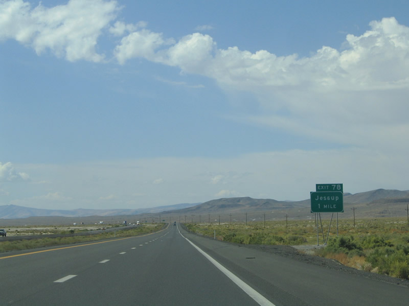
Pushing southwest on Interstate 80 and U.S. 95 Alternate ahead of the Exit 78 diamond interchange for Jessup in the Carson Sink. No services exist here. Photo taken 09/09/05. |
|
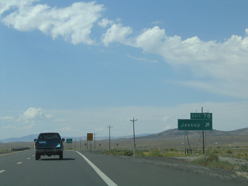
Interstate 80 west and U.S. 95 Alternate south meet Exit 78 off-ramp. A local road stems northwest 4.2 miles to Jessup in the adjacent Trinity Range. Photo taken 09/09/05. |
|
|
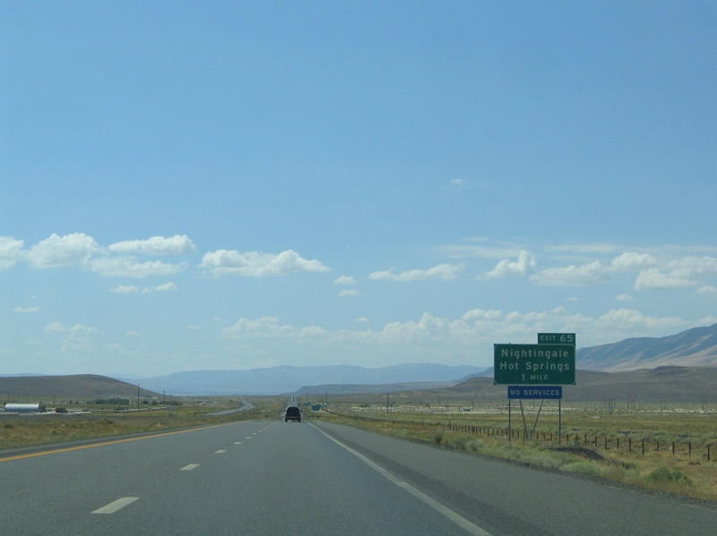
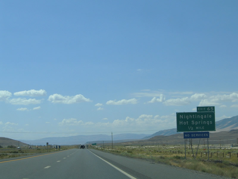
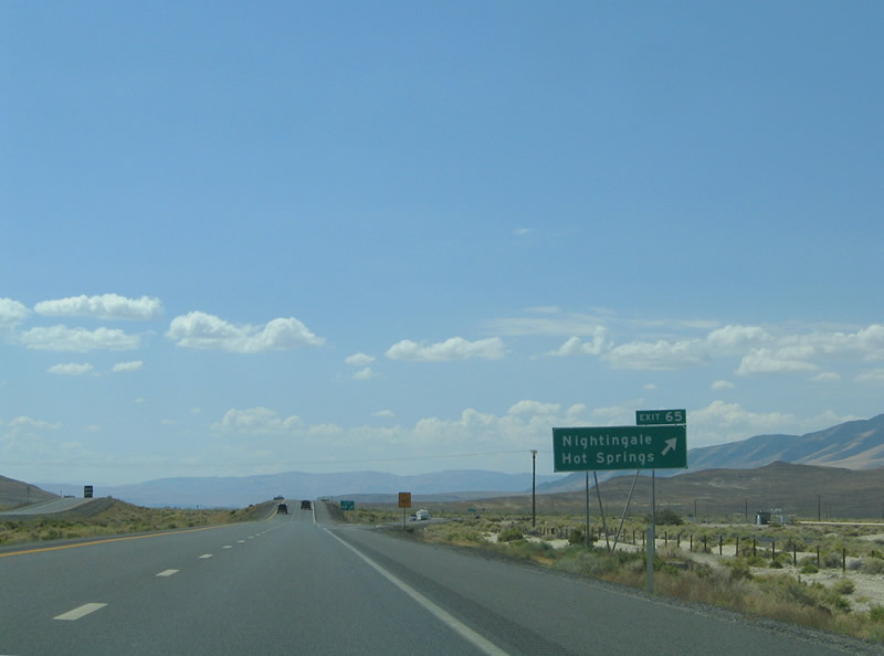
The next exit along Interstate 80 west and U.S. 95 Alternate south is Exit 65, Nightingale Hot Springs (diamond interchange). The valley location lies between Desert Peak and the Sahwave Mountains in northwestern Churchill County. No services exist here. Photos taken 09/09/05. |
|
|
Westbound Interstate 80 and southbound U.S. 95 Alternate reach Exit 65, Nightingale Hot Springs. This interchange links the freeway with adjacent frontage roads (including old U.S. 40-95) and other local roads at Nightingale Hot Springs. Photos taken 09/09/05. |
|
|
|
|
|
|
|
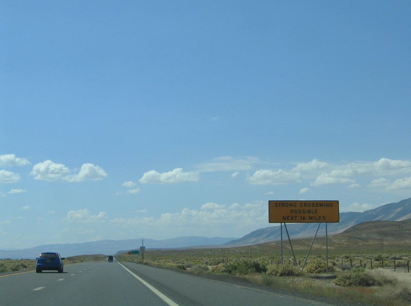
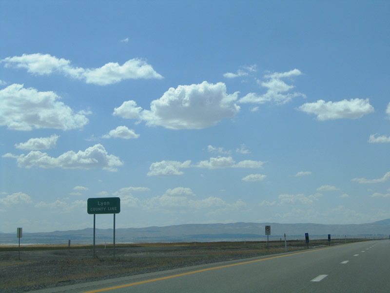
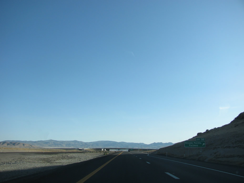
Wide open vistas stretch across the Fernley Sink on Interstate 80 west and U.S. 95 Alternate south between Exit 65 and Fernley. The sink lies south of Juniper Peak (elevation 7,209 feet above sea level) and west of Desert Peak, creating a narrow, geologically speaking, gap for which wind to flow. Therefore the stretch west of Nightingale Hot Springs is prone to strong gusty winds. The freeway nips the northern spoke of Lyon County at the Fernley Wildlife Management Area. The next exit along Interstate 80 west is Exit 50, Nevada Pacific Parkway, which opened to traffic on June 19, 2012. This exit provides a bypass route to connect to U.S. 50 Alternate. Photos taken 09/09/05. |
|
On the outskirts of Fernley, westbound Interstate 80 and southbound U.S. 95 Alternate meet Exit 50, Nevada Pacific Parkway, which travels south to meet U.S. 50 Alternate east of town. Photo taken 05/16/15 by Steve Hanudel and Erik Slotboom. |
|
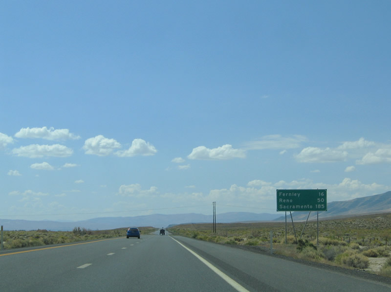
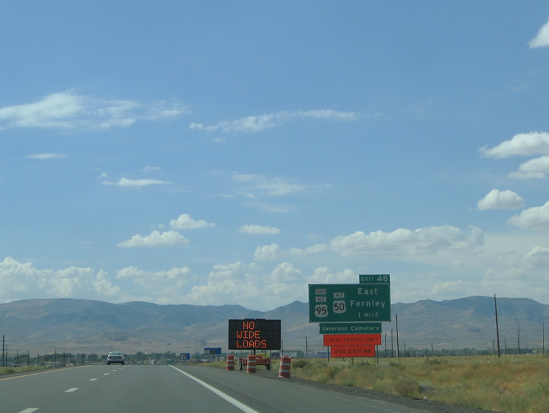
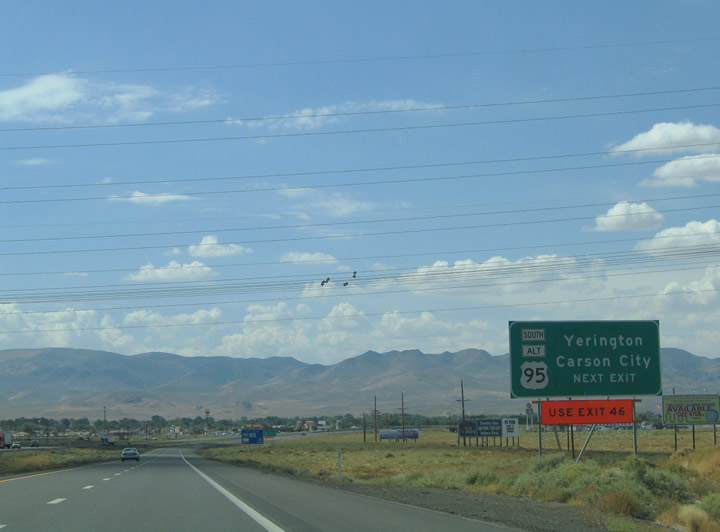
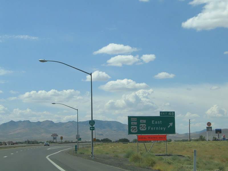
After the Nevada Pacific Parkway interchange (Exit 50), Interstate 80 and U.S. 95 Alternate approach their next interchange, where the two routes will split. Exit 48 connects Interstate 80 to Business Loop I-80/Commerce Way and U.S. 95 Alternate south into Fernley, where they meet U.S. 50 Alternate. The three routes (Business Loop I-80, U.S. 50 Alternate, and U.S. 95 Alternate) turn west into Fernley via Main Street. At the intersection of Main Street and East Street, U.S. 95 Alternate and U.S. 50 Alternate turn south for the 18-mile drive south to Silver Springs, where they will meet U.S. 50. U.S. 95 Alternate continues south from Silver Springs to return to U.S. 95 at Schurz in 73 miles. As for Business Loop I-80, it joins Nevada 427 to continue west on Main Street (Old U.S. 40) to loop back to Interstate 80. Photo taken 09/09/05. |
|
U.S. 95 Alternate south provides a good route into Carson City via U.S. 50 west of Silver Springs by avoiding metropolitan Reno-Sparks. The Silver State capital city lies 35 miles west of the junction with U.S. 95 Alternate. Yerington, the Lyon County seat, is a 50-mile drive to the south. Photo taken 09/09/05. |
|
Westbound Interstate 80 meets Exit 48, Junction Business Loop I-80/Commerce Way to Main Street (old U.S. 40) west through downtown Fernley between Exits 48 and 46. U.S. 50 Alternate enters Fernley from Hazen to the west along Main Street. U.S. 50 Alternate, U.S. 95 Alternate, and Business Loop I-80 share 1.5 miles of pavement through town. Photo taken 09/09/05. |
Page Updated July 8, 2012.