
U.S. 95 South - Las Vegas
| U.S. 95 south | |
|---|---|
 |
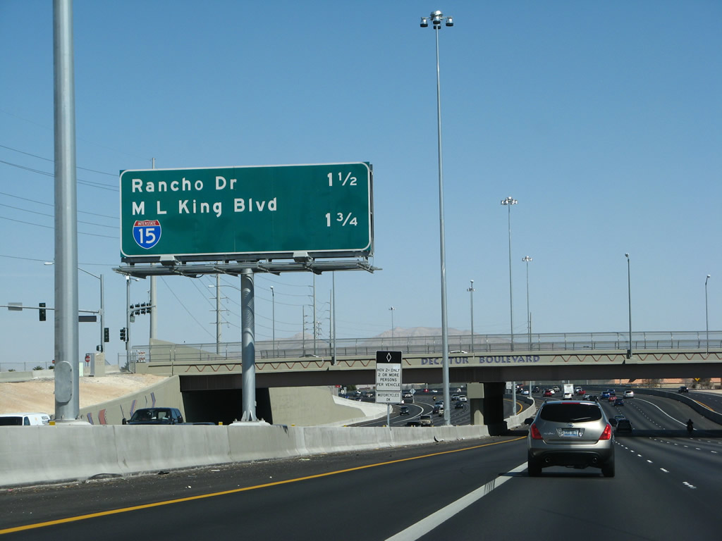
U.S. 95 Business (Rancho Drive) splits from U.S. 95 southbound at Exit 90B in North Las Vegas. The split however is not straight-forward, as motorists destined for Rancho Drive must first cross Ann Road before departing the freeway for U.S. 95 Business. Ann Road sees a diamond interchange with the freeway just north of U.S. 95 Business partition with U.S. 95 south. Pictured here is the Ann Road on-ramp to U.S. 95 southbound and its split with Rancho Drive. Photo taken 10/19/04. |
 |
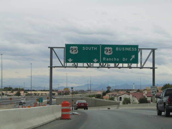
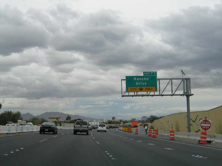
Traffic partitions between U.S. 95 south for downtown Las Vegas, and U.S. 95 Business & Nevada 599 (Rancho Drive) south to North Las Vegas Airport. Photo taken 10/19/04. |
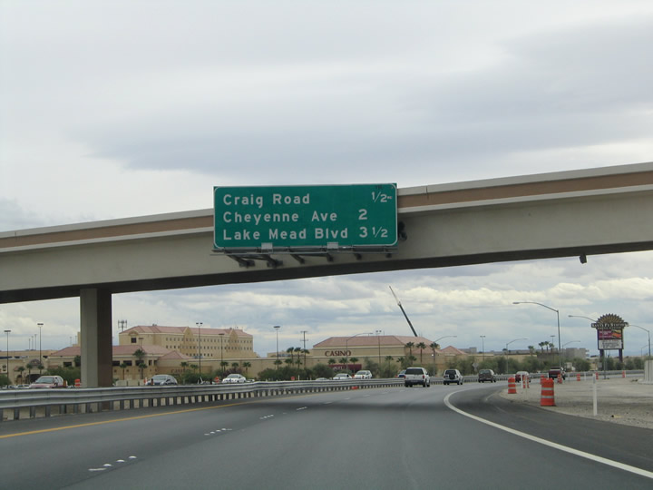 |
Attached to the U.S. 95 Business southbound off-ramp is an upcoming exits sign listing the distances to Craig Road (Exit 85), Cheyenne Avenue (Exit 83), and Lake Mead Boulevard (Exit 82). The exit numbers jump from 90 to 85 between Rancho Drive and Craig Road, a distance of one half mile. Photo taken 10/19/04. |
 |
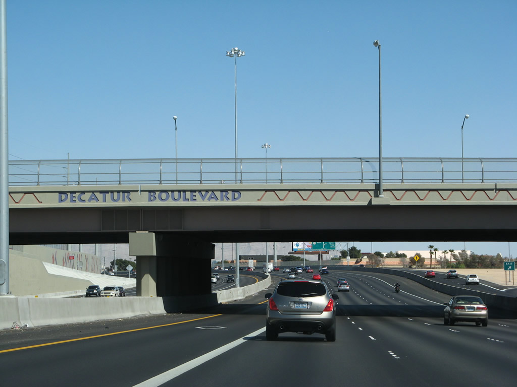
U.S. 95 (Las Vegas Expressway) southbound at the Exit 85 diamond interchange with Craig Road. Craig Road (Nevada 573) comprises an east-west arterial between Buffalo Drive and Clayton Street. Nevada 573 totals 10.920 miles along the road between U.S. 95 and Decatur Boulevard and again between Lossee Road and Nevada 604 (Las Vegas Boulevard). Photo taken 10/19/04. |
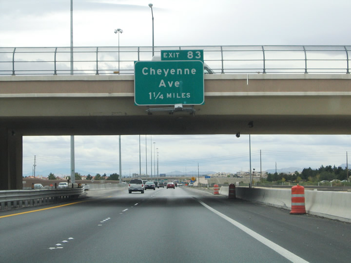 |
Next in line for southbound travelers is the Exit 83 diamond interchange with Cheyenne Avenue. Cheyenne Avenue carries Nevada 574 east from U.S. 95 to Nevada 612 (Nellis Boulevard), a distance of 10.350 miles. Photo taken 10/19/04. |
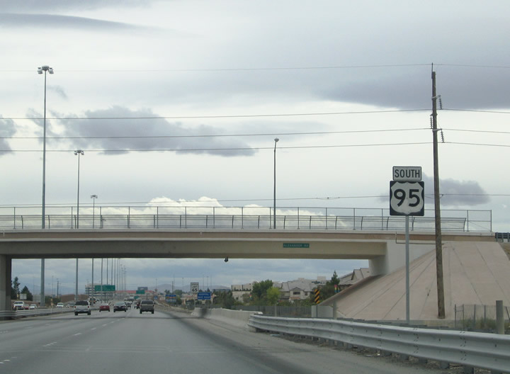 |
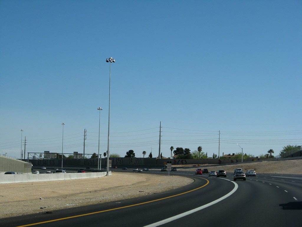
Southbound reassurance marker posted at the Alexander Road overpass. Alexander Road stems east from Buffalo Drive to Rancho Drive at Jones Boulevard. Jones Boulevard meets U.S. 95 at Exit 80. Photo taken 10/19/04. |
 |
U.S. 95 southbound nears the Gowan Road under crossing one half mile ahead of the Exit 83 off-ramp to Cheyenne Avenue (Nevada 574 east). Cheyenne Avenue continues 1.9 miles west to Rampart Boulevard and 4.6 miles to the Las Vegas Beltway. Photo taken 10/19/04. |
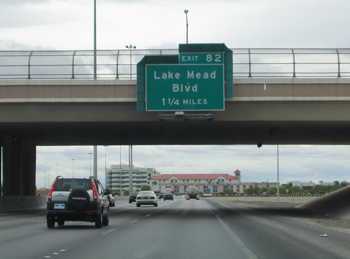 |
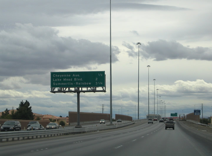
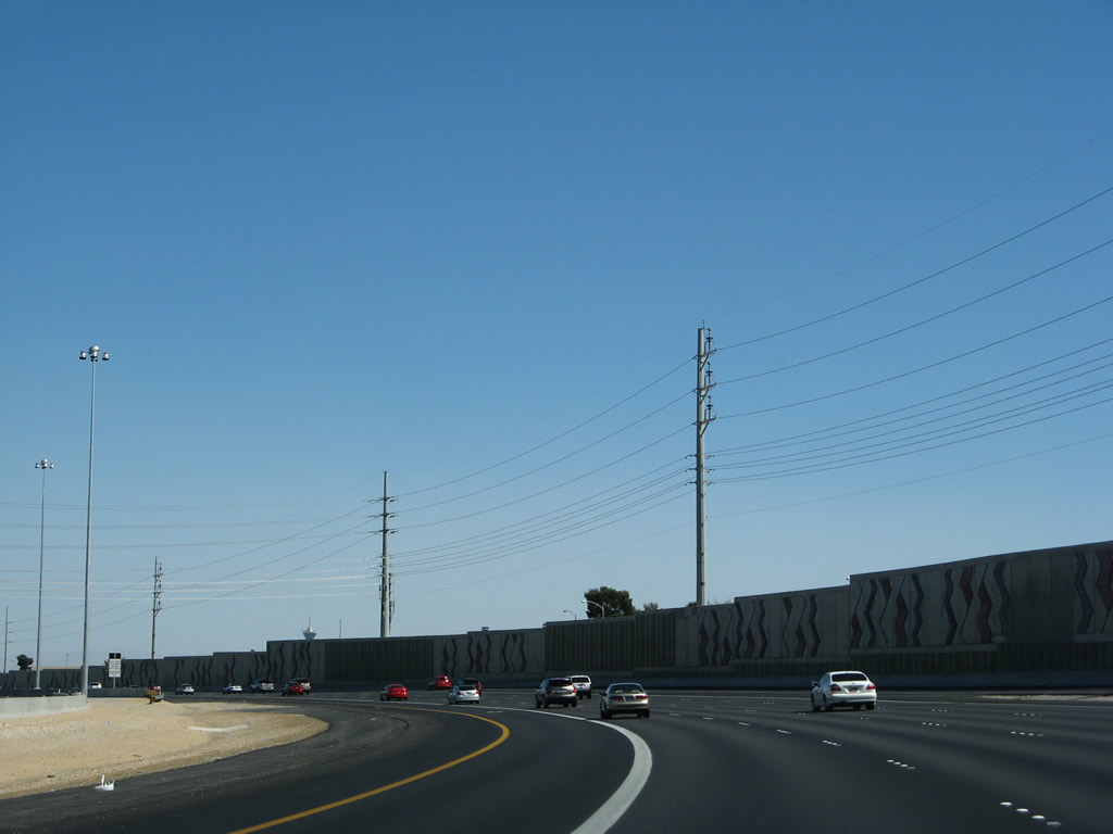
Lake Mead Drive intersects U.S. 95 at the Exit 82 six-ramp partial cloverleaf 1.25 miles south of the Cheyenne Avenue overpass. Lake Mead Boulevard heads 1.1 miles east to Jones Boulevard, 2.1 miles to Decatur Boulevard, and 2.7 miles to U.S. 95 Business (Rancho Drive). Photo taken 10/19/04. |
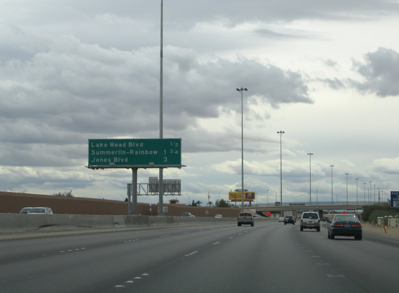 |
Drawing to within one half-mile of the Exit 82 off-ramp for Lake Mead Drive. The ramp actually joins U.S. 95 southbound with the parallel Rock Springs Drive ahead of its intersection with Lake Mead Drive. Lake Mead Boulevard intersects Buffalo Drive in 1.1 miles and Rampart Boulevard at Summerlin in 2.4 miles. Photo taken 10/19/04. |
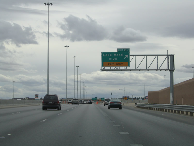 |
Exit 82 departs U.S. 95 southbound for Rock Springs Drive and Lake Mead Drive. Rock Springs Drive travels north from the off-ramp to Smoke Ranch Road and south to Vegas Drive and Washington Avenue. Photo taken 10/19/04. |
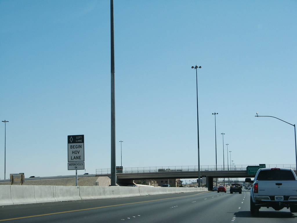 |
After the Exit 82 offramp, the high occupancy vehicle lane begins on U.S. 95 south. Photo taken 03/29/08. |
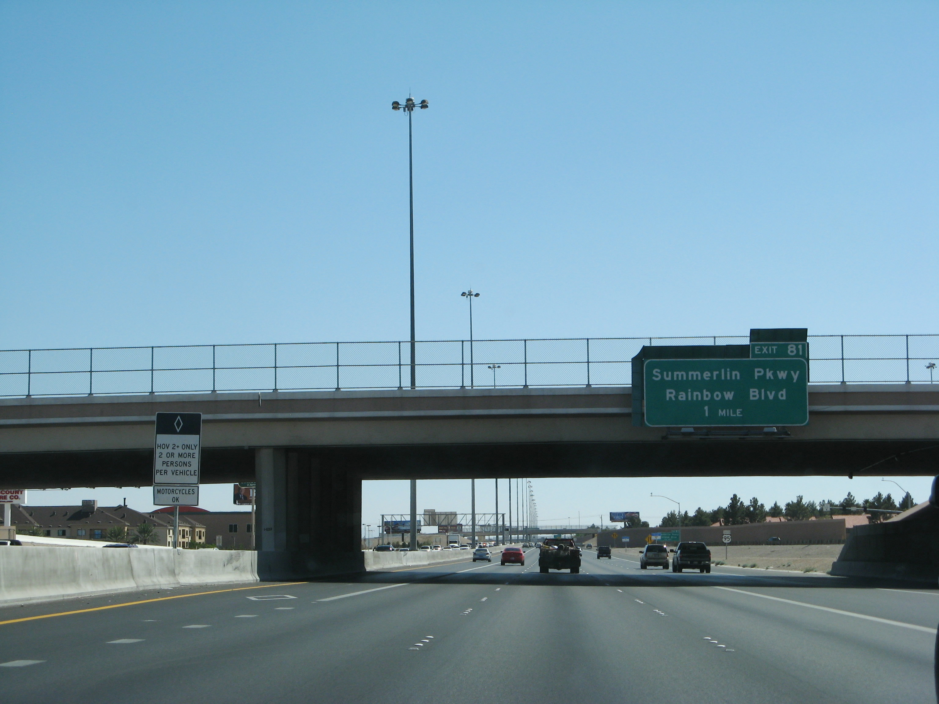 |
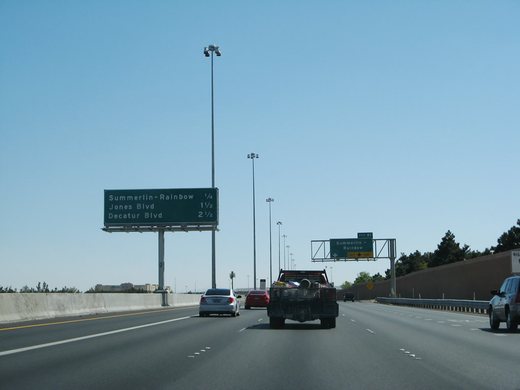
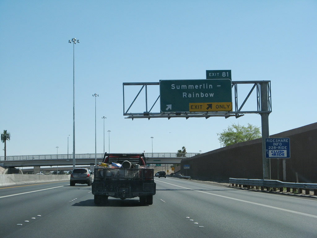
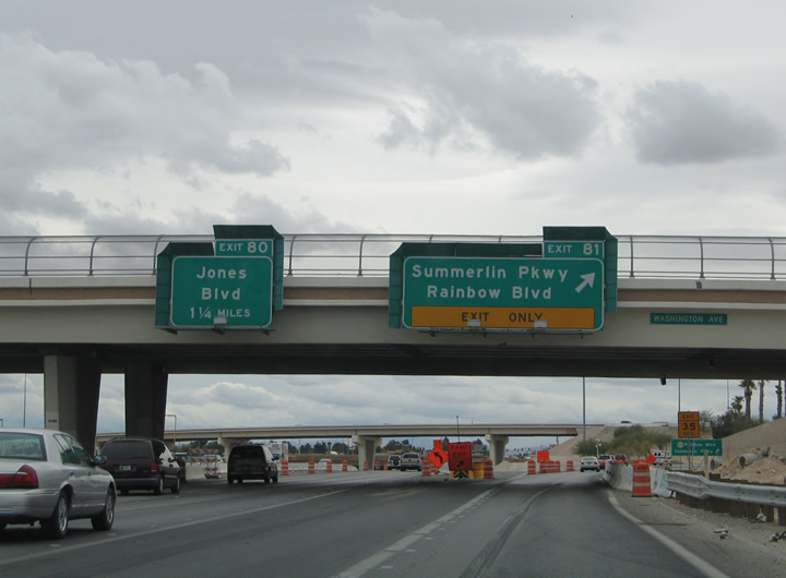
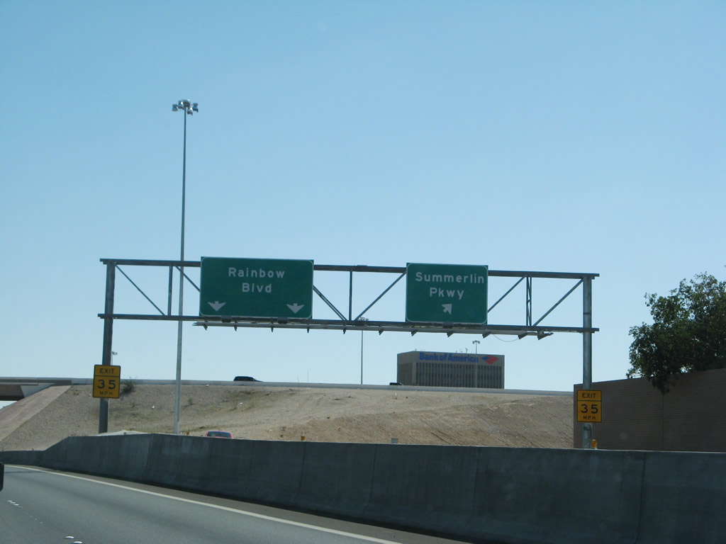
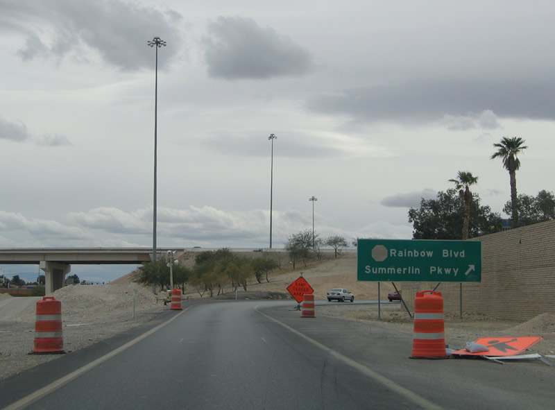
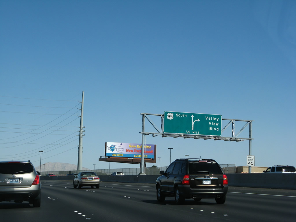
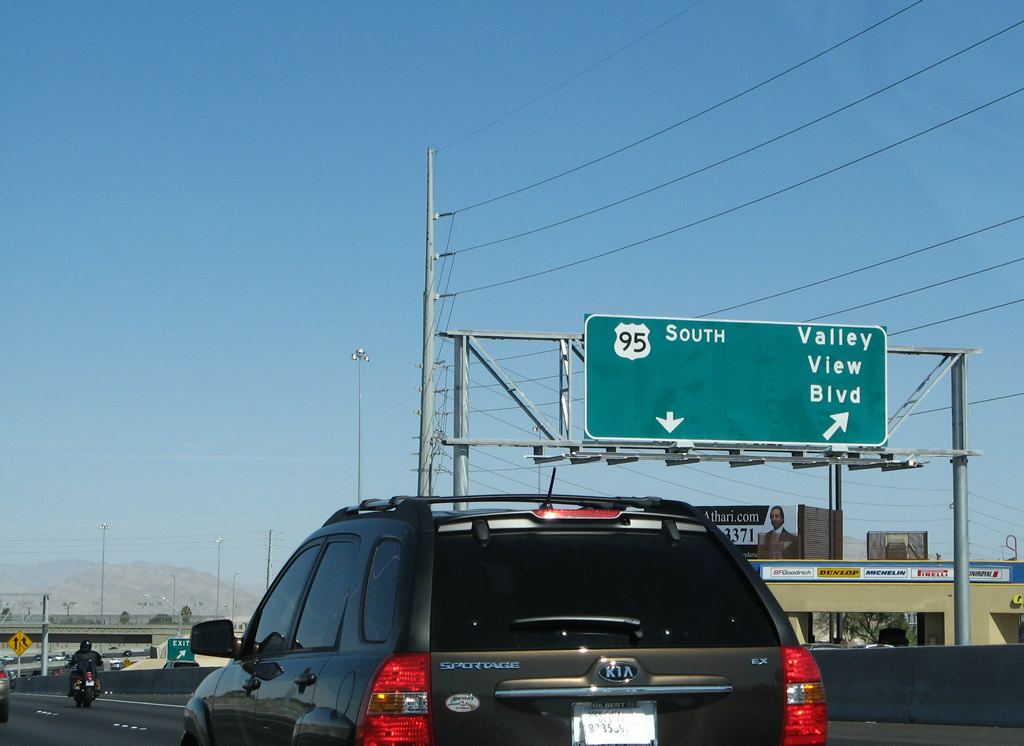
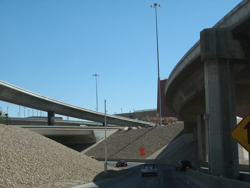
Southbound travelers next see the Exit 81 directional interchange with Summerlin Parkway west and Rainbow Boulevard (Nevada 595). Summerlin Parkway comprises a four-lane freeway between U.S. 95 and the community of Summerlin. Rainbow Boulevard parallels U.S. 95 south from Craig Road (Nevada 573) to Westcliff Drive. Photo taken 03/29/08. |
 |
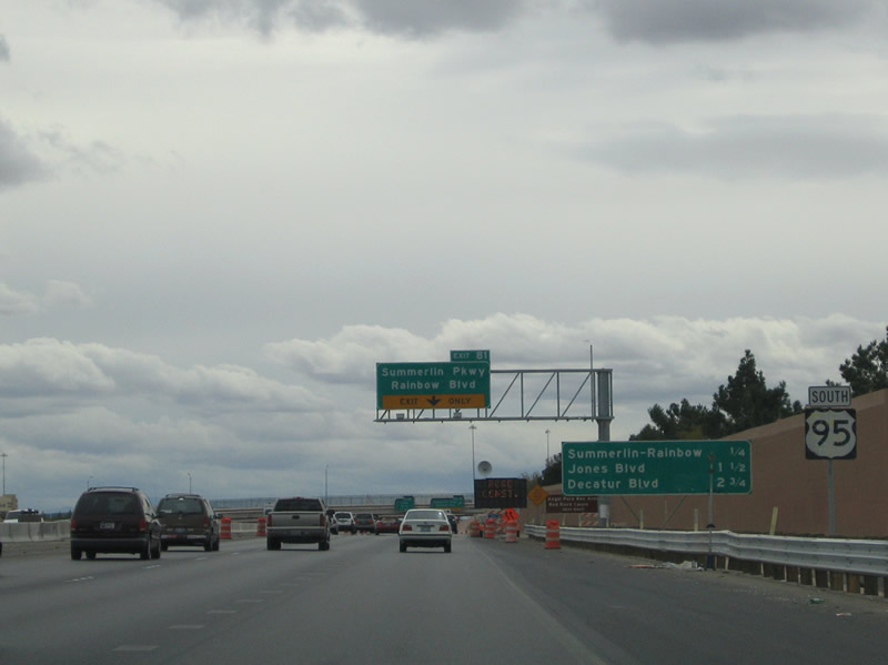 |
Three signs lie ahead of the Exit 81 ramp departure to Summerlin Parkway west and Rainbow Boulevard (Nevada 595). Summerlin Parkway ventures west six miles from U.S. 95 to Clark County 215 (Las Vegas Beltway). Rainbow Boulevard passes over U.S. 95 at the Las Vegas Expressway eastward turn. The crossing is known as the "Rainbow Curve". Photos taken 03/29/08 and 10/19/04. |
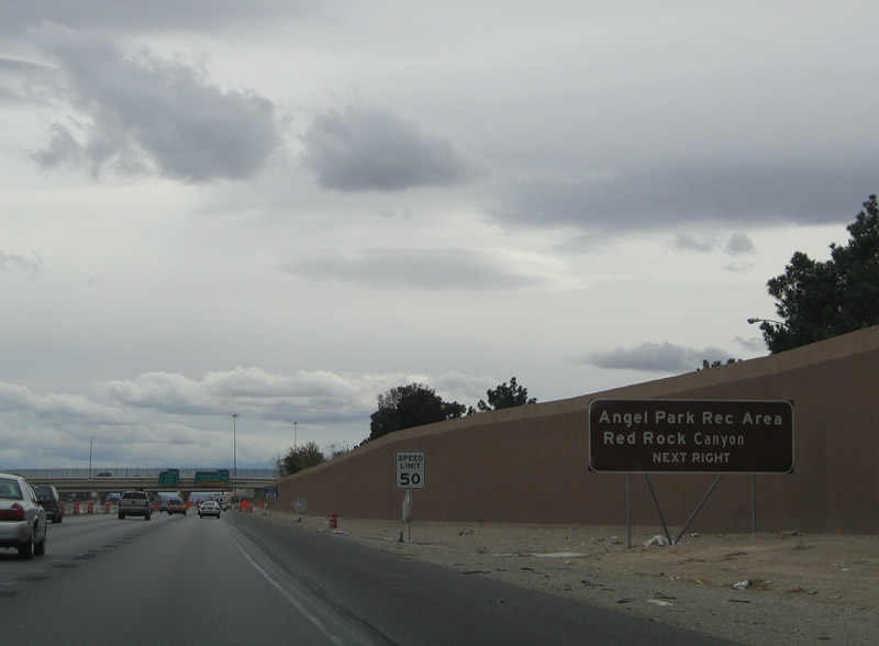 |
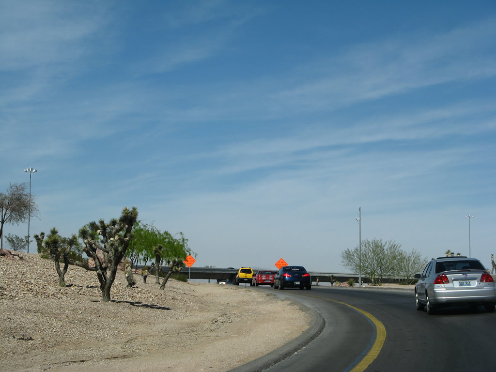
Use Summerlin Parkway westbound for its connections to the Las Vegas Beltway for the Angel Rock Recreation Area and Red Rock Canyon. The parks lie in the Spring Mountains to the west of Las Vegas along Nevada 159 (Charleston Boulevard). Photo taken 10/19/04. | |
 |
 |
U.S. 95 southbound at the Exit 81 ramp departure and Washington Avenue overpass. Summerlin Parkwa continues west one half mile to Buffalo Drive, 2.1 miles to Rampart Boulevard, and 3.4 miles to Town Center Drive at Summerlin itself. Summerlin Parkway will eventual extend all the way to Clark County 215 as a full freeway. Presently the road downgrades to a frontage road system at Anasazi Drive. Photos taken 03/29/08 and 10/19/04. |
 |
 |
Exit 81 partitions into ramps for Summerlin Parkway west and Rainbow Boulevard (Nevada 595). Nevada 595 continues Rainbow Boulevard south 1.2 miles to Nevada 159 (Charleston Boulevard), 2.2 miles to Nevada 589 (Sahara Avenue), and 10.7 miles to Nevada 160 (Blue Diamond Road). Photos taken 03/29/08 and 10/19/04. |
 |
 |
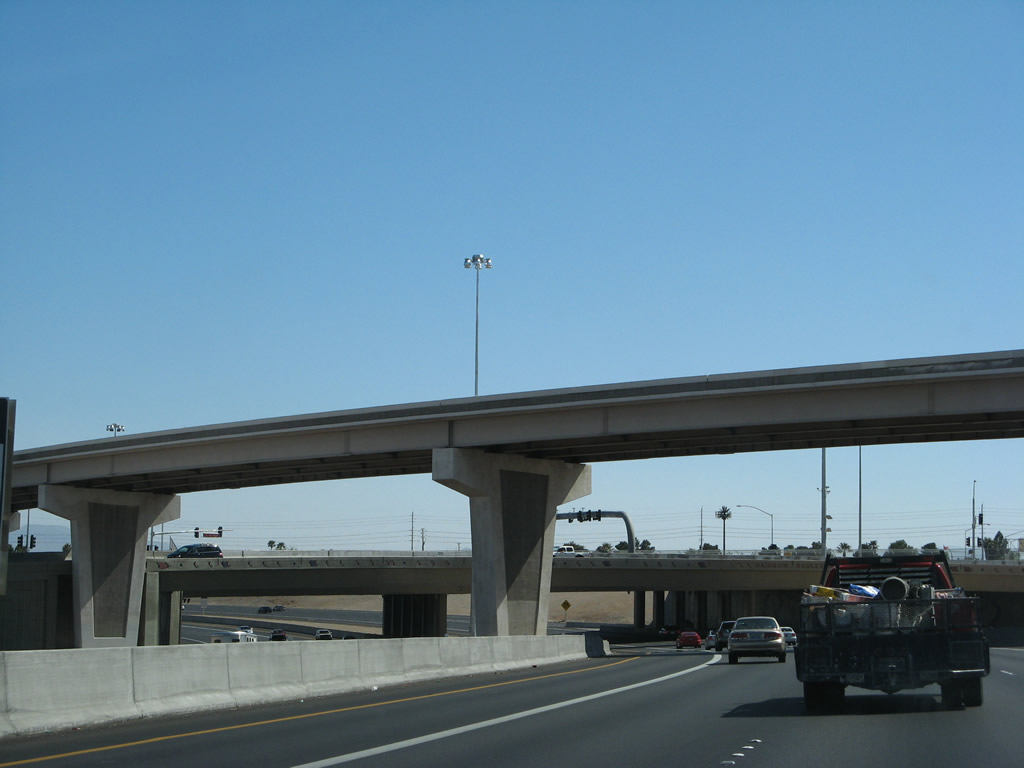
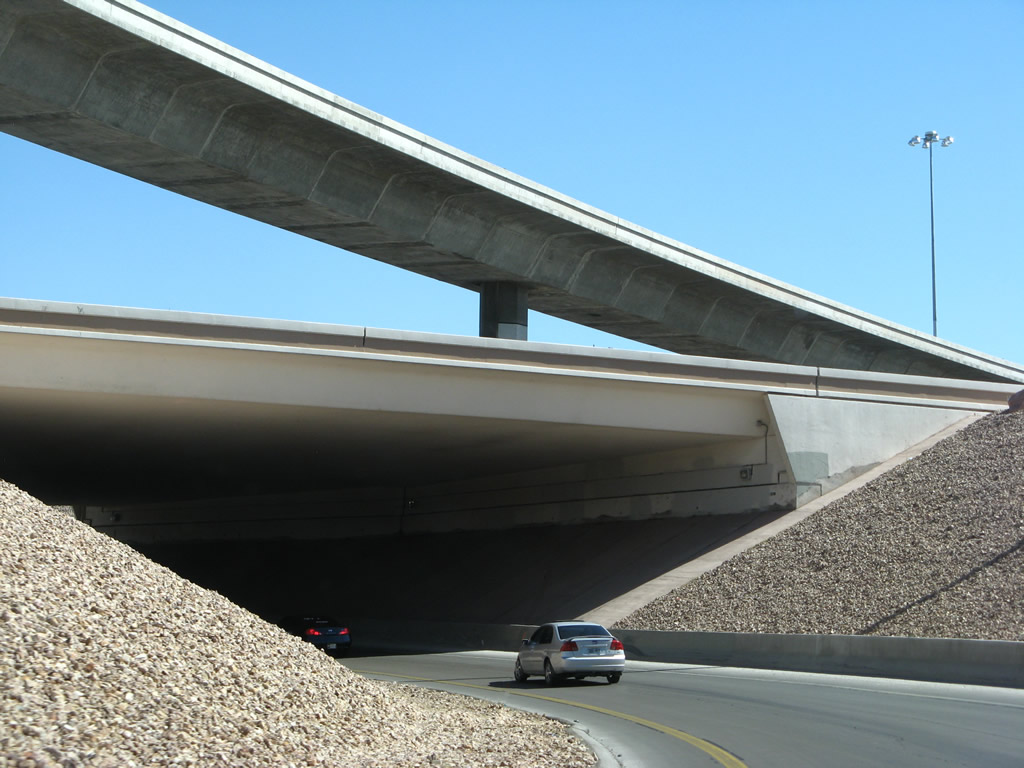
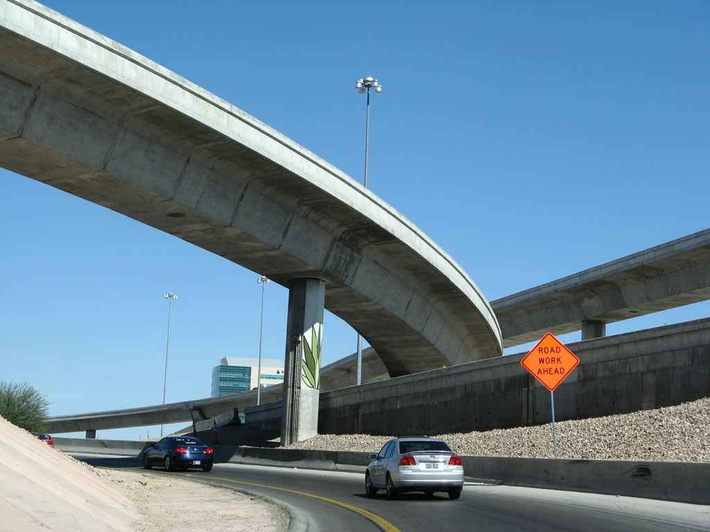
At Summerlin Parkway, U.S. 95 turns due east toward downtown Las Vegas. This section of freeway was recently completely reconstructed. The first bridge is the transition ramp from northbound U.S. 95 to Summerlin Parkway west, and the second bridge carries Rainbow Boulevard over the freeway. Photos taken 03/29/08. |
 |
 |
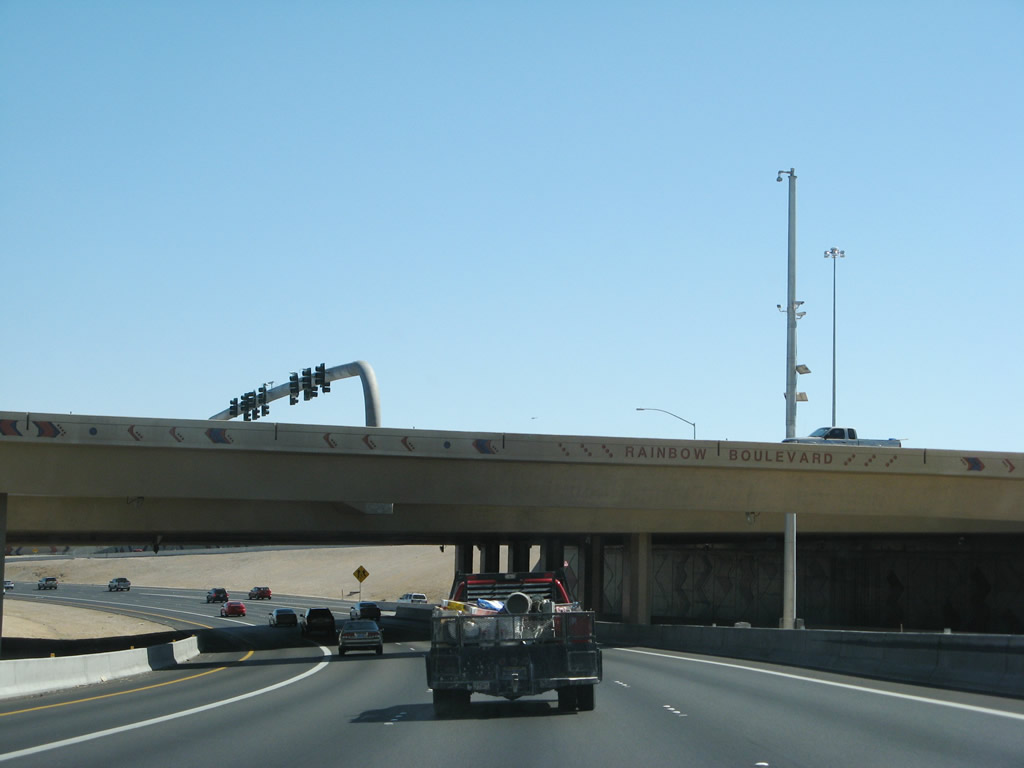
The five lanes of southbound U.S. 95 freeway turn east after the Rainbow Boulevard overpass. Photos taken 03/29/08. |
 |
 |
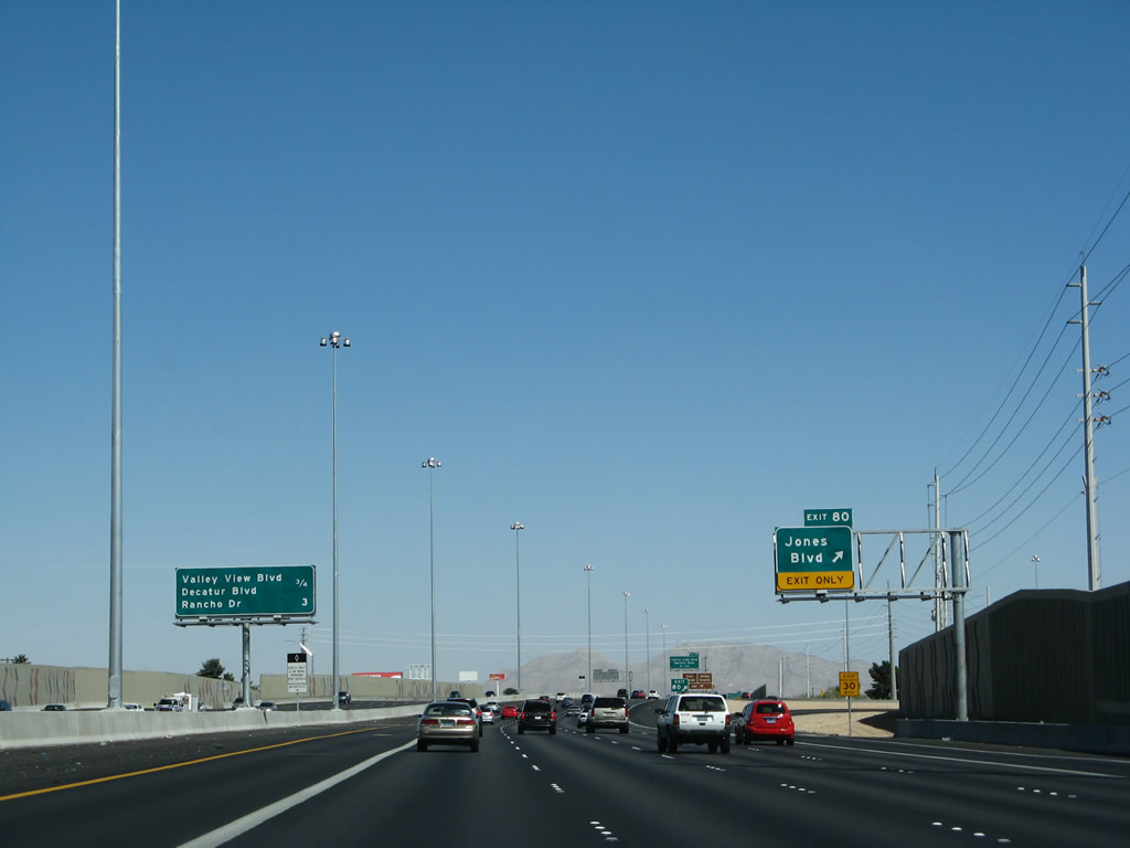
U.S. 95 turns eastward between Washington Avenue and Alta Drive. The six-lane freeway was upgraded to 12 lanes between Summerlin Parkway and the Interstate 15 interchange, including two HOV lanes. A marked improvement in U.S. 95 thus occurred between 2004 and 2008 as seen in these photos. Jones Boulevard intersects the freeway at the Exit 80 partial-cloverleaf interchange ahead; however, the 2004 sign is now gone. Photos taken 03/29/08 and 10/19/04. |
 |
 |
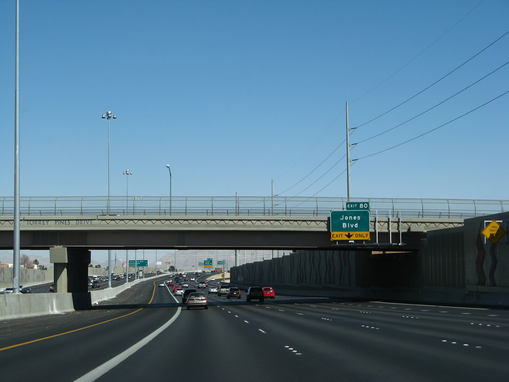
Another in the series of upcoming exits sign lies at the Torrey Pines Drive over crossing. A totally new bridge was in place by 2008 at Torrey Pines Drive. U.S. 95 sees interchanges with the north-south arterials of Jones Boulevard, Decatur Boulevard, and Valley View Boulevard between Summerlin Parkway and the return of U.S. 95 Business (Rancho Drive). Photos taken 03/29/08 and 10/19/04. |
 |
 |
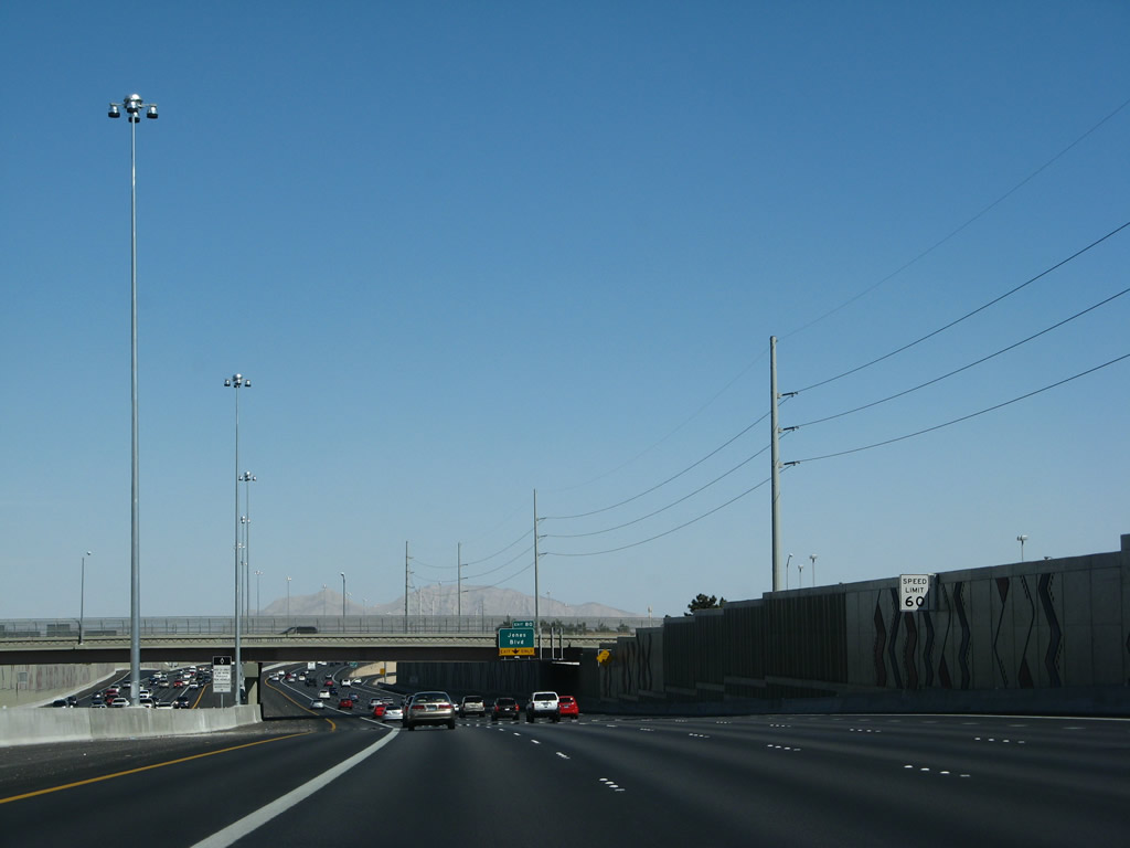
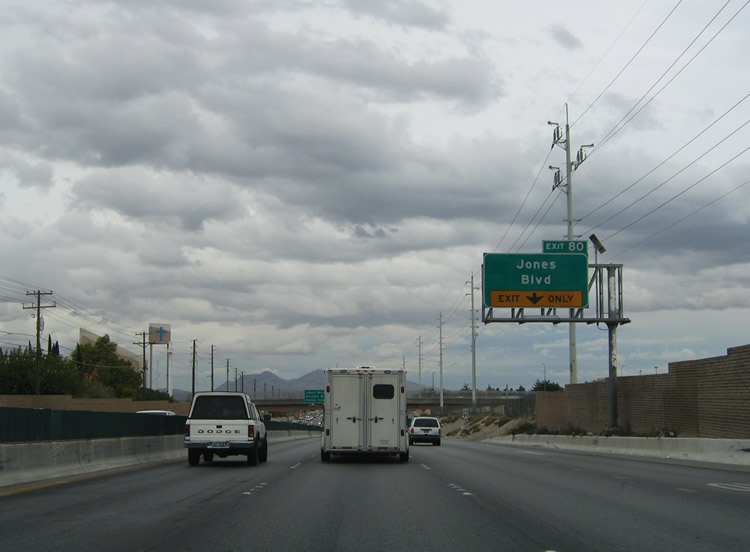
Southbound U.S. 95 reaches Exit 80, Nevada 596/Jones Boulevard. Jones Boulevard (Nevada 596) constitutes a north-south road traveling 9.3 miles between Tropicana Avenue and Rancho Drive (U.S. 95 Business). Nevada 596 comprises 6.087 miles of Jones Boulevard in two segments. Photos taken 03/29/08 and 10/19/04. |
 |
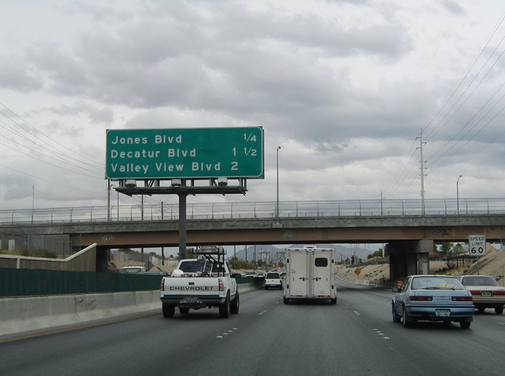
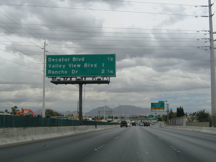
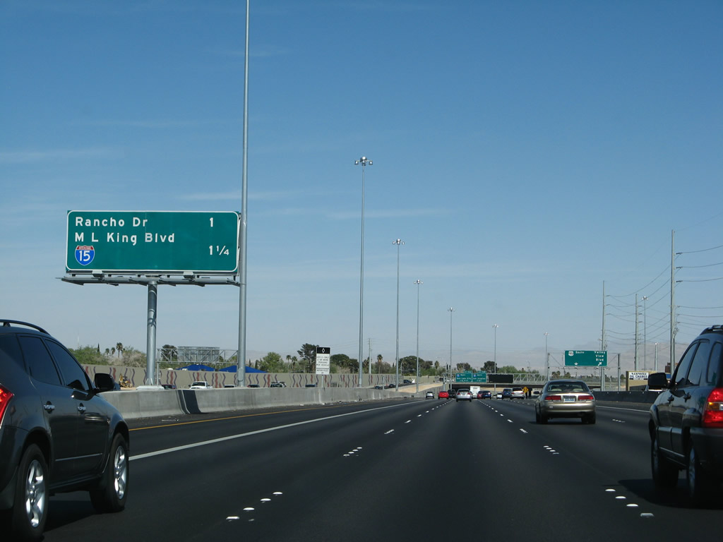
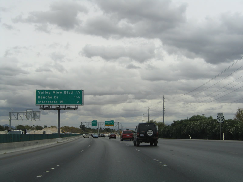
This mileage sign provides the distance to the next two exits along U.S. 95 south: Exit 79, Decatur Boulevard and Valley View Boulevard and Exit 77, Junction Business U.S. 95 (Nevada 599)/Rancho Drive. Photo taken 03/29/08. | |
 |
Use Exit 79 (Decatur Boulevard and Valley View Boulevard) to the springs preserve and state museum. Photo taken 03/29/08. | |
 |
 |
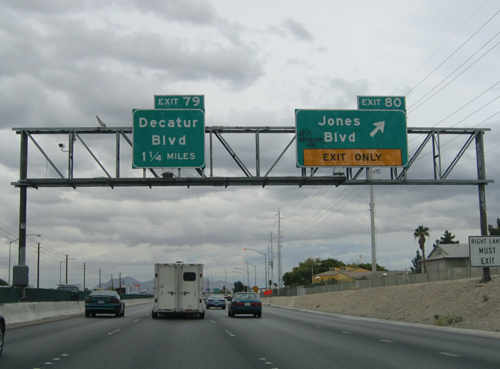
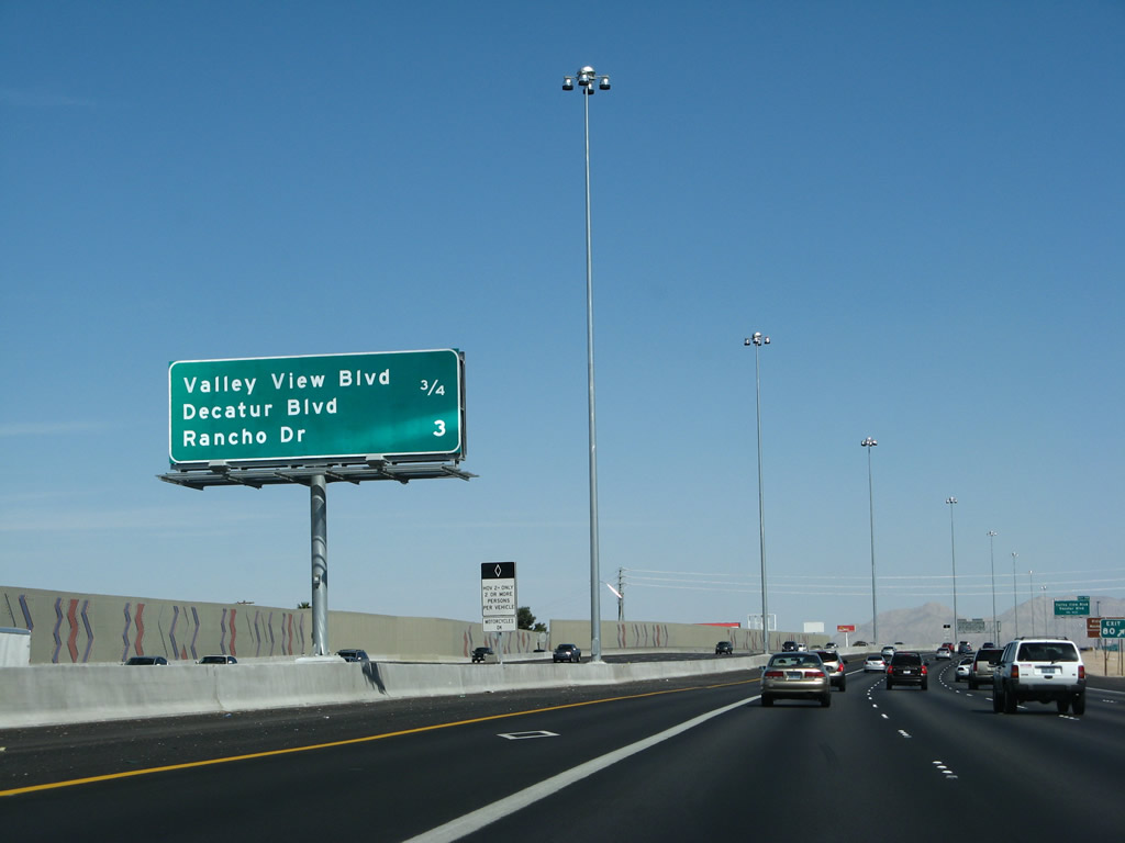
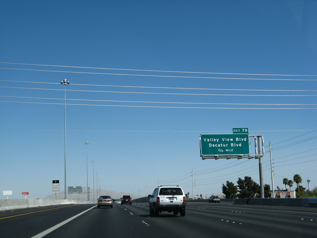
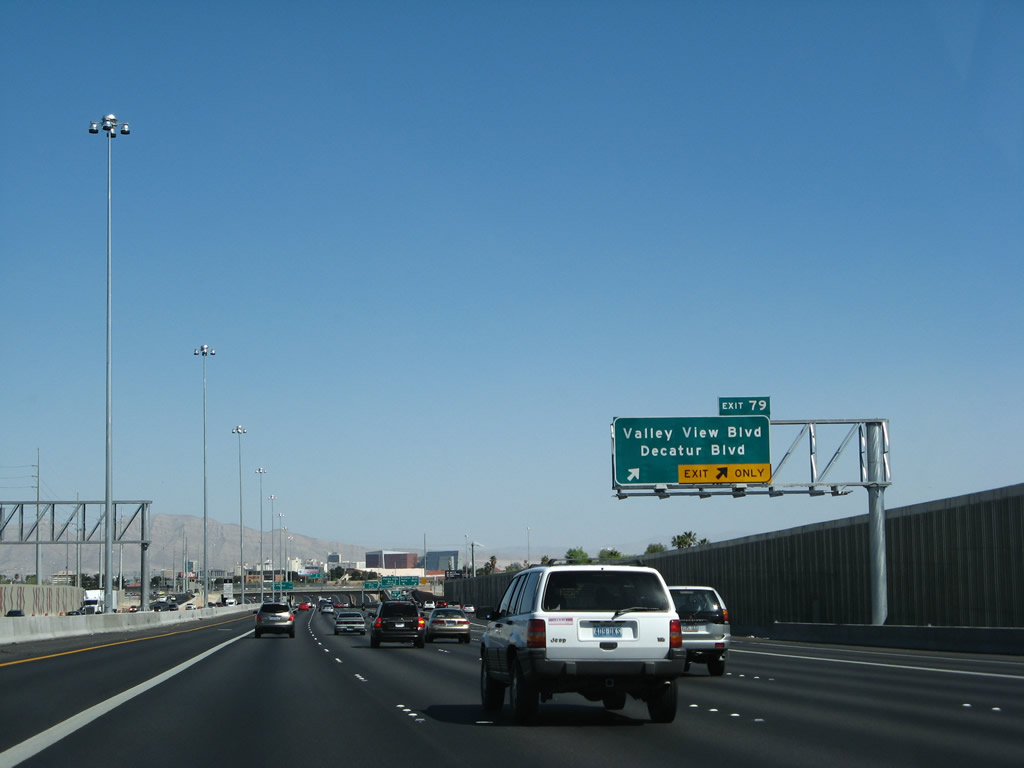
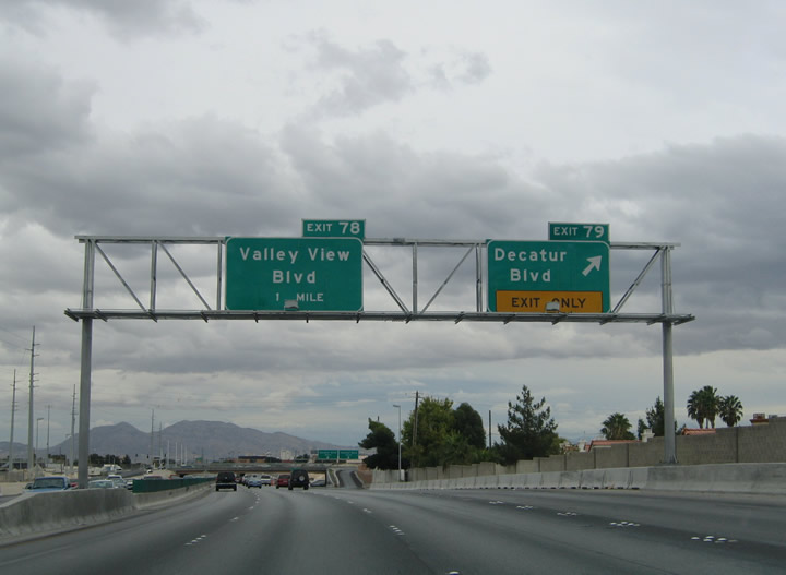
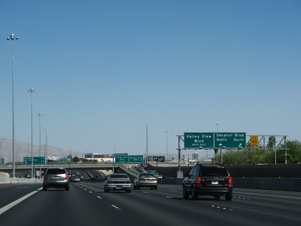
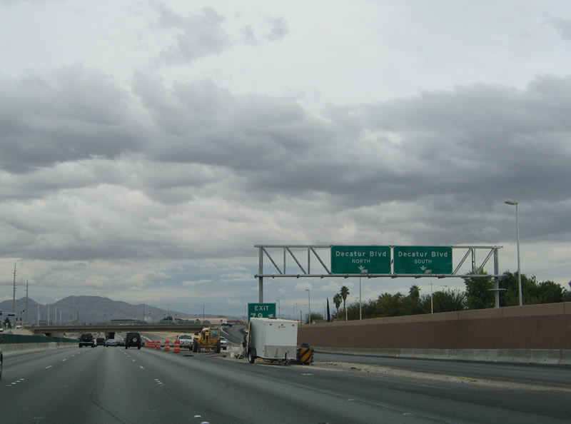
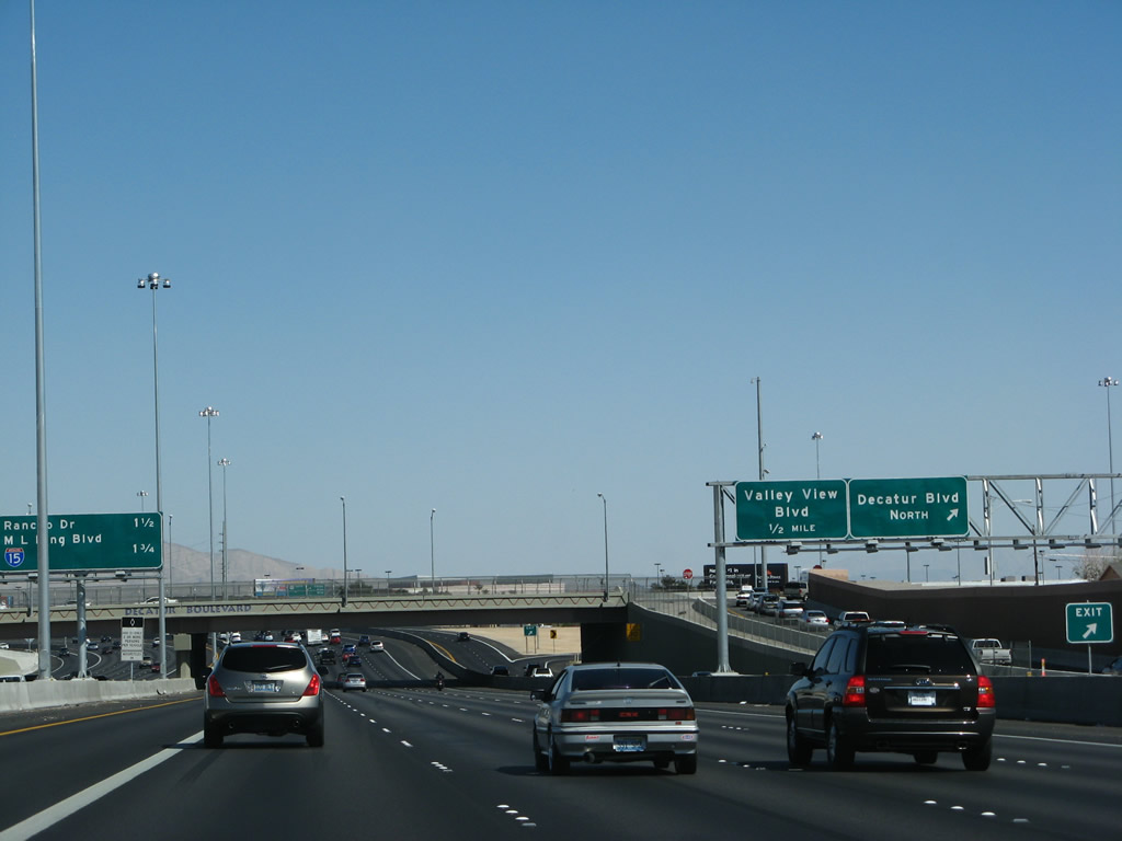
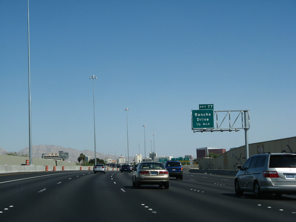
U.S. 95 continues a short distance to Exit 79, Decatur Boulevard and Valley View Boulevard. Prior to reconstruction, Decatur Boulevard and Valley View Boulevard were separate exits. Now they are combined at Exit 79, with a collector-distributor lane arrangement connecting the two roadways. Decatur Boulevard constitutes a north-south arterial between Nevada 593 (Tropicana Avenue) and U.S. 95 Business & Nevada 599 (Rancho Drive). Photos taken 03/29/08 and 10/19/04. |
 |
 |
Nearing the Exit 79 partial-cloverleaf interchange on U.S. 95 south. With the additional lanes on the reconstructed U.S. 95 south, the right two lanes connect to Exit 79. Decatur Boulevard ends 2.5 miles to the north at North Las Vegas Airport. The arterial continues south of the freeway 3.1 miles to Desert Inn Road and 4.3 miles to Flamingo Drive (Nevada 592). Photos taken 03/29/08 and 10/19/04. |
 |
 |
Southbound U.S. 95 reaches Exit 79, Decatur Boulevard and Valley View Boulevard. All the signs for this exit were changed with the reconstruction of the freeway. Photos taken 03/29/08 and 10/19/04. |
 |
 |
This view shows the collector-distributor lanes on U.S. 95 south for Exit 79. The first ramp connects to Decatur Boulevard south and the second ramp connects to Decatur Boulevard north, while the c/d lane continues east to connect with Valley View Boulevard. Photos taken 03/29/08 and 10/19/04. |
 |
Continuing east (south) on U.S. 95, the ramp to Decatur Boulevard north comes into view on the c/d lane. Photo taken 03/29/08. | |
 |
This upcoming exits mileage sign provides the distance to Exit 77, Rancho Drive (Junction Business U.S. 95 and Nevada 599) and Exits 76B-A, Interstate 15. Photo taken 03/29/08. | |
 |
A decorative overpass carries Decatur Boulevard over Interstate 15. Photo taken 03/29/08. | |
 |
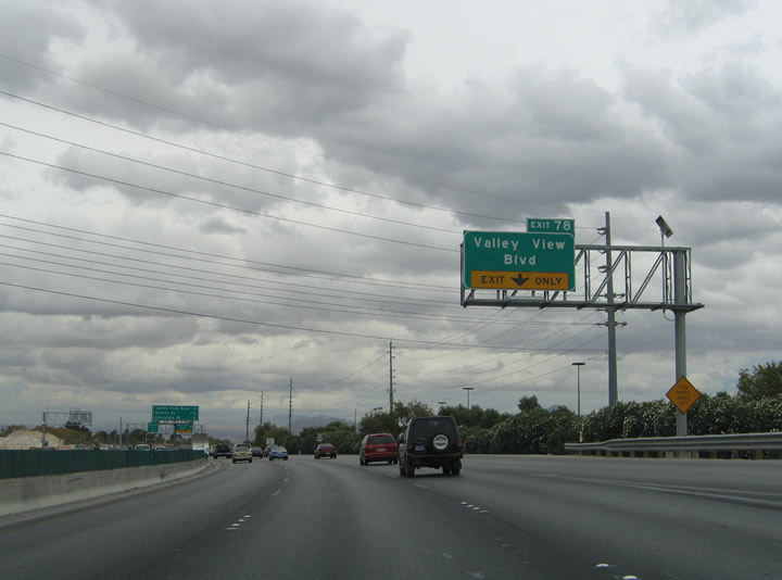 |
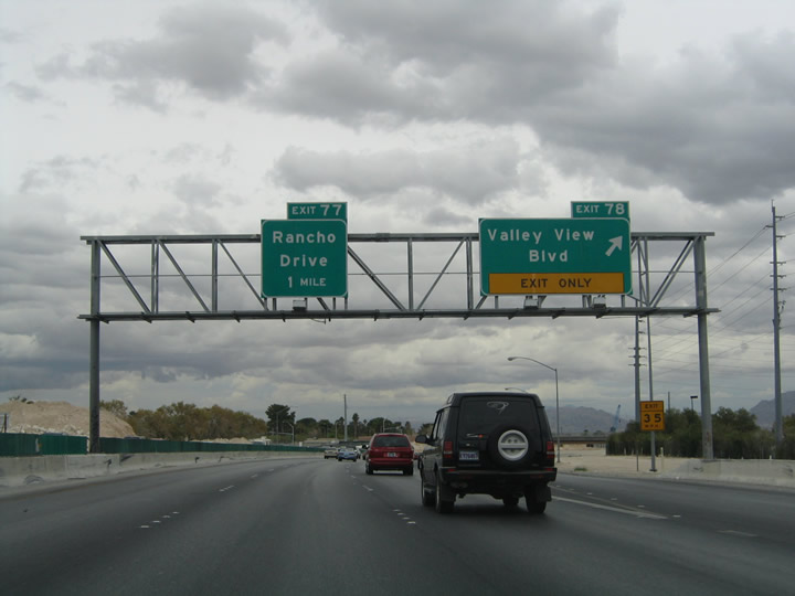
Looking at the c/d lanes, the next exit is the connection to Valley View Boulevard (former Exit 78). Prior to reconstruction, Exit 78 used to be a standalone, partial-cloverleaf interchange with Valley View Boulevard. Valley View Boulevard travels south to Meadows Mall on the 1.2 mile drive to Nevada 159 (Charleston Boulevard) and continues from there to Nevada 589 (Sahara Drive) and the Las Vegas city line in 2.2 miles. Photos taken 03/29/08 and 10/19/04. |
 |
 |
U.S. 95 continues another 1.25 miles to its junction with Interstate 15 & U.S. 93. The only intervening mainline interchange is with Rancho Drive (U.S. 95 Business & Nevada 599). The c/d lane exit to Valley View Boulevard (Exit 78) is visible ahead. Photos taken 03/29/08 and 10/19/04. |
 |
 |
Drives bound for Valley View Boulevard depart the U.S. 95 c/d lanes at this point. Valley View Boulevard crosses the freeway and ends nearby at Washington Avenue. Photos taken 03/29/08 and 10/19/04. |
 |
The next mainline sign bridge advises of the pending interchange with Exits 76B-A, Interstate 15. Photo taken 03/29/08. | |
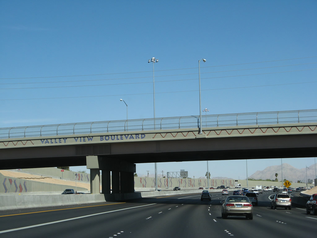 |
U.S. 95 south (east) passes under Valley View Boulevard. Photo taken 03/29/08. | |
 |
 |
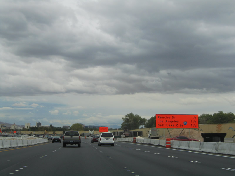
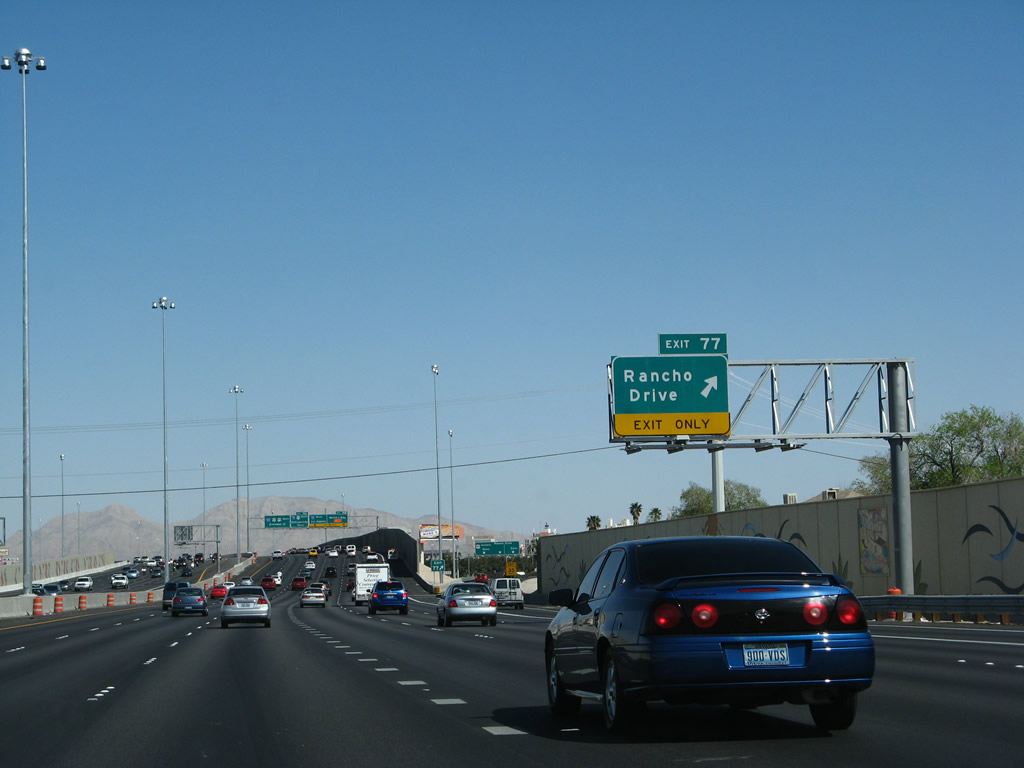
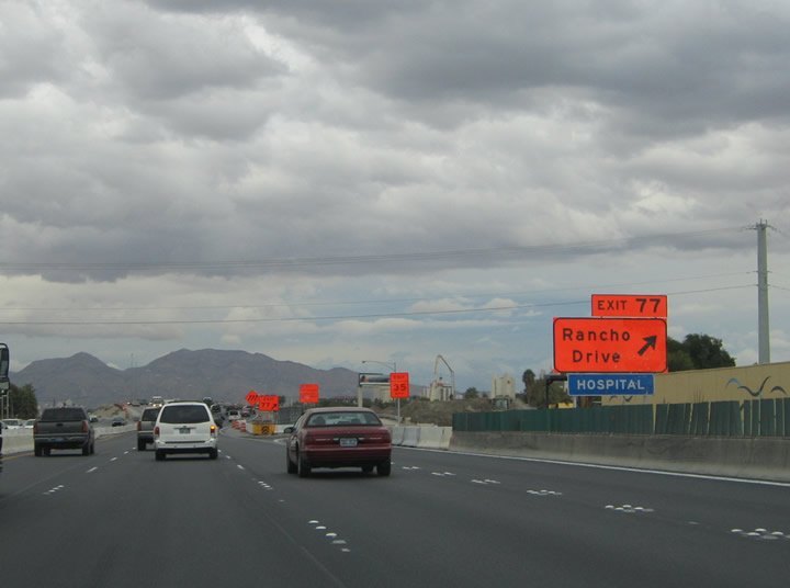
U.S. 95 Business (Rancho Drive) returns to U.S. 95 at the Exit 77 diamond interchange. Rancho Drive (Nevada 599) continues south of the freeway to Nevada 589 (Sahara Drive) near Interstate 15. Photos taken 03/29/08 and 10/19/04. |
 |
 |
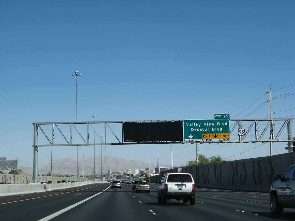
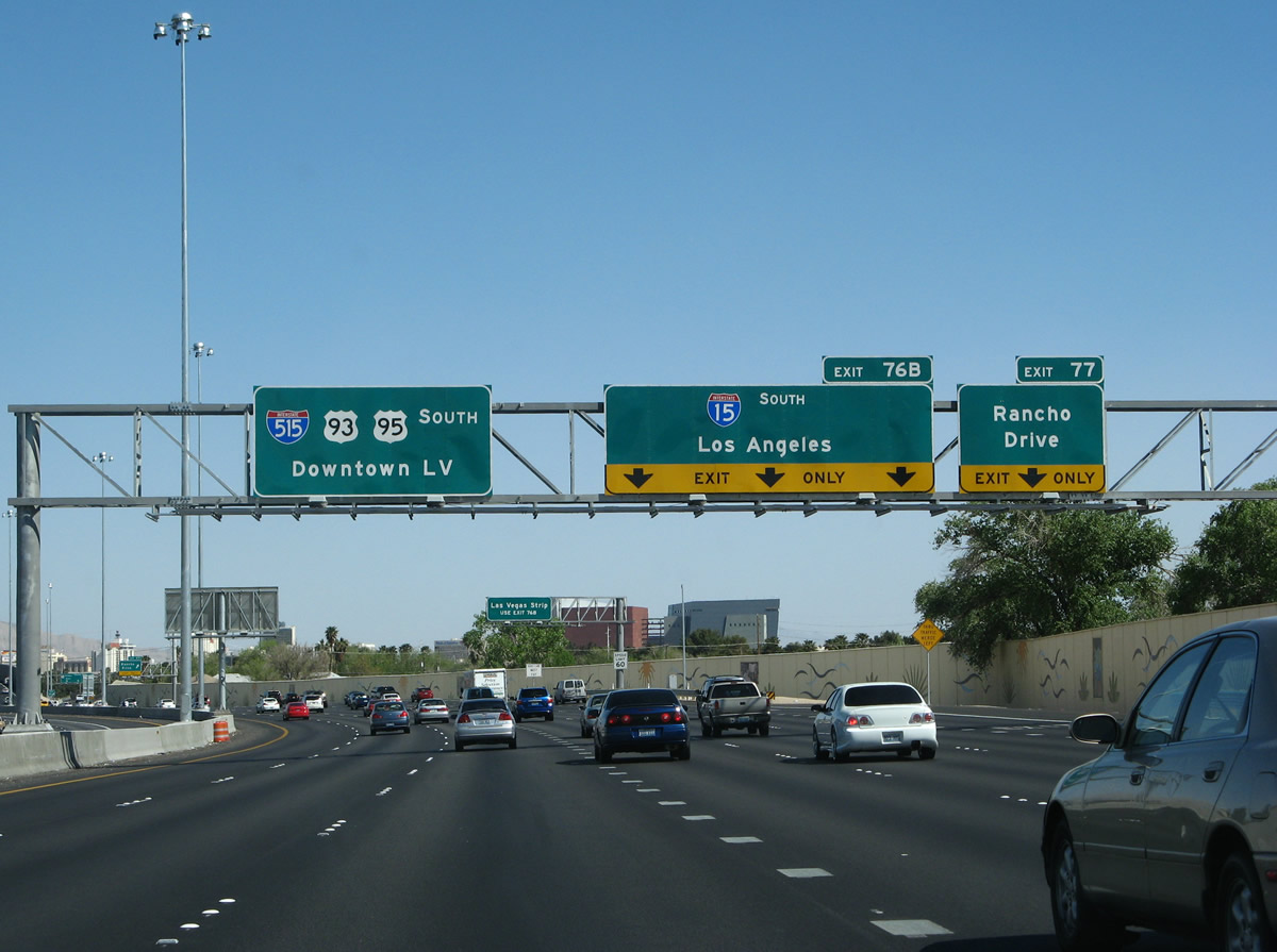
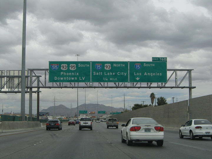
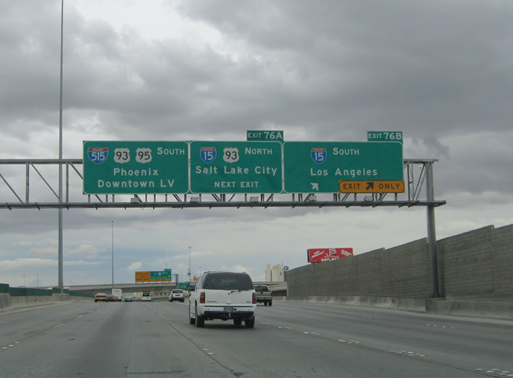
The right lane becomes exit only for Exit 77, Rancho Drive (Business U.S. 95 and Nevada 599). The middle three lanes connect to Interstate 15 south via Exit 76B. The left three lanes continue south on U.S. 93-95 and Interstate 515, which is shown on the overhead signs for the first time. The 2004 photo shows road work underway at that time, including bridge replacement and other structural work in anticipation of the now-completed expansion project. The $86 million freeway widening phase of this massive project commenced in November 2005 and was complete by late 2007.1 Photos taken 03/29/08 and 10/19/04. |
 |
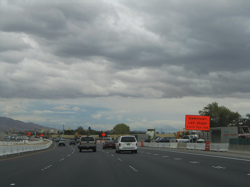 |
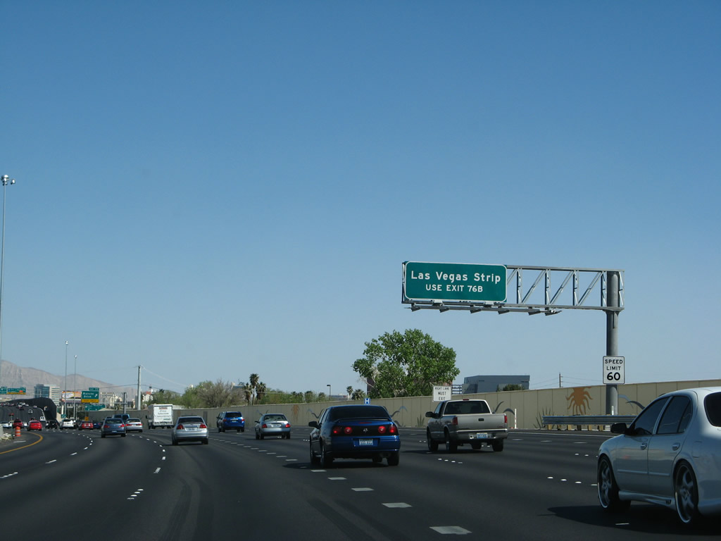
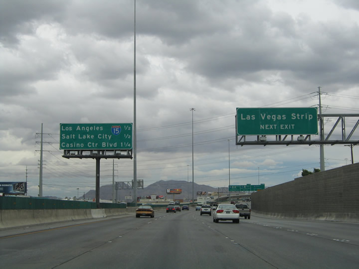
Traffic interests to downtown Las Vegas should remain on U.S. 95 southbound to Exits 75A/B (Casino Center and Las Vegas Boulevards). Use Interstate 15 south (Exit 76B) to the Las Vegas Strip. Photos taken 03/29/08 and 10/19/04. |
 |
 |
Southbound U.S. 95 reaches Exit 77, Rancho Drive (U.S. 95 Business & Nevada 599). Nevada 599 follows all of U.S. 95 Business between Exits 90B and 77. The state route continues the route southward 1.1 miles to Nevada 159 (Charleston Boulevard) and 2.2 miles to Nevada 589 (Sahara Avenue) before being absorbed into Interstate 15 south. Photos taken 03/29/08 and 10/19/04. |
 |
 |
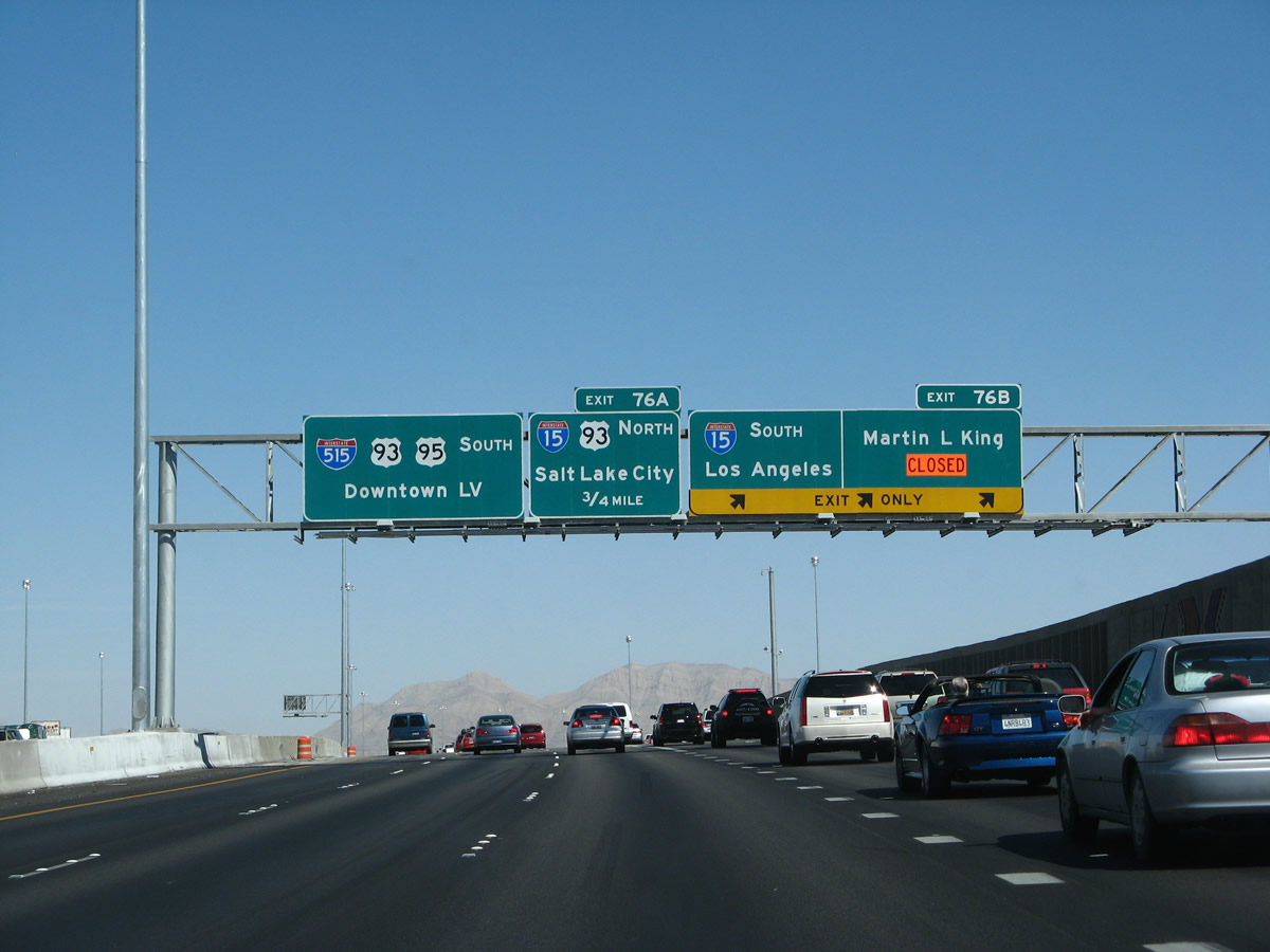
Immediately thereafter, the road again divides into a collector-distributor lane arrangement. Travelers bound for Interstate 15 southbound for Primm, Barstow, San Bernardino, and Los Angeles should exit onto the c-d lane. Follow U.S. 95 south to Interstate 15 & U.S. 93 north for North Las Vegas, Mesquite, and Caliente. The Las Vegas Expressway gains Interstate 515 & U.S. 93 south of Interstate 15. The trio continue south 21 miles through to the freeway end at Henderson. Phoenix appears as a second control city for the U.S. 93 trek south from Boulder City into Arizona. Note how the exit for Interstate 15 south comes much earlier now than it did in 2004. Photos taken 03/29/08 and 10/19/04. |
 |
This view shows the main lanes and collector-distributor lanes for U.S. 95 prior to the Spaghetti Bowl interchange with Interstate 15, Interstate 515, and U.S. 93. Interstate 15 reaches Barstow in 153 miles, the split with Interstate 215 near San Bernardino in 213 miles, and junction Interstate 10 east of Los Angeles in 227 miles. Photo taken 03/29/08. | |
 |
 |
This pair of photos shows the prior signage leading to Exit 76B; these signs are now gone. Photos taken 10/19/04. |
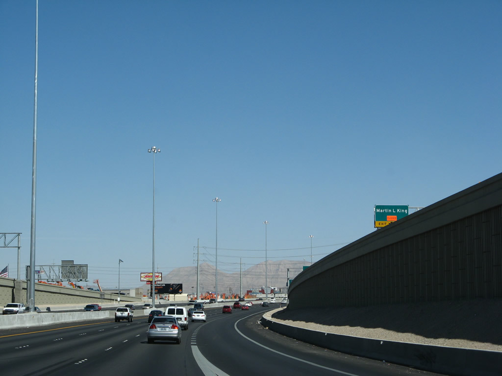 |
Looking at the c/d lanes again, an exit leads to Martin Luther King, Jr. Boulevard. Photo taken 03/29/08. |
 |
The c/d lanes split between Martin Luther King, Jr. Boulevard and Interstate 15 south. Photo taken 03/29/08. |
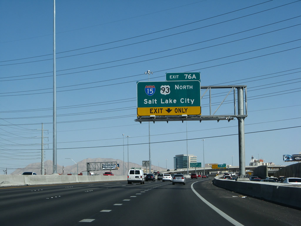 |
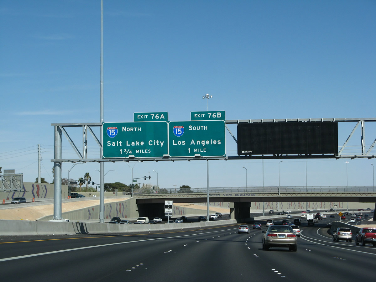
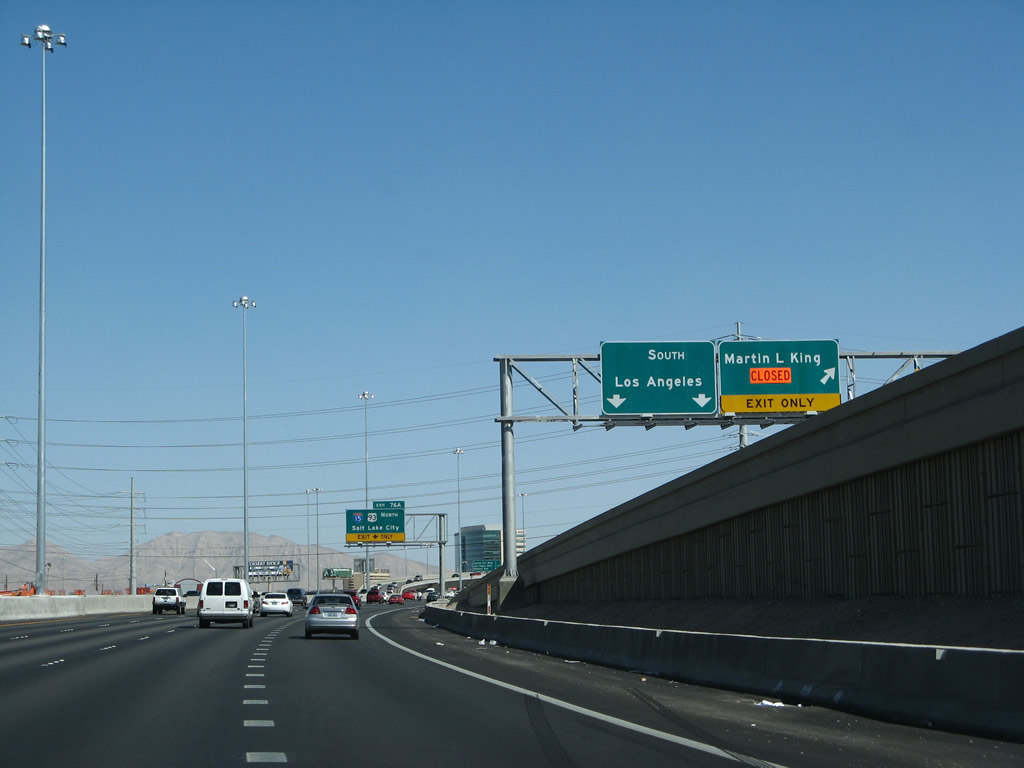
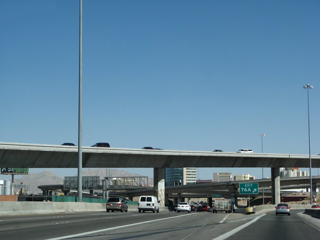
The next exit along U.S. 95 south is Exit 76A, Interstate 15 and U.S. 93 north to Salt Lake City and Ely. The two routes overlap 21 miles northward from downtown Las Vegas to Exit 64. There U.S. 93 branches north toward Caliente, Pioche, and Ely. Interstate 15 meanwhile continues on a northeasterly trajectory to Mesquite, crosses into Arizona to pass through the Virgin River Gorge, then enters Utah and serves cities such as St. George, Cedar City, Provo, and Salt Lake City. Salt Lake City lies 415 miles north of Las Vegas. Photo taken 03/29/08. |
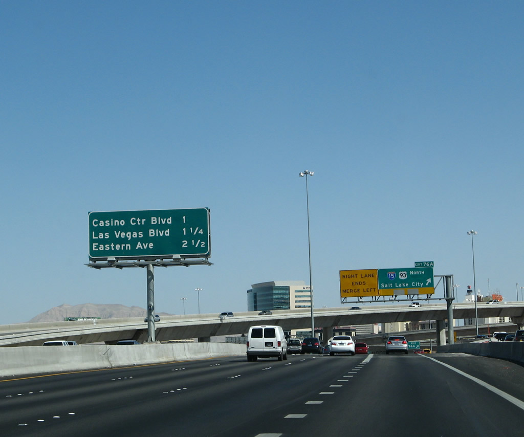 |
This mileage sign provides the distance to the next three exits along Interstate 515 and U.S. 95 south: Exit 75B, Casino Center Boulevard; Exit 75A, Las Vegas Boulevard; and Exit 73, Eastern Avenue. Photo taken 03/29/08. |
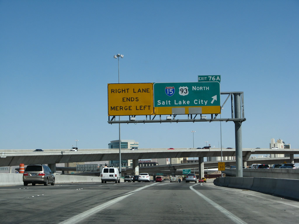 |
Now in the Spaghetti Bowl, southbound U.S. 95 reaches Exit 76A, Interstate 15 and U.S. 93 north to Salt Lake City and Ely. The left three lanes continue south on Interstate 515 and U.S. 93-95. Photo taken 03/29/08. |
 |
The ramp from U.S. 95 south to Interstate 15 and U.S. 93 north is a bit convoluted, as it has a sharp curve that makes it look like a hook from the air. Photo taken 03/29/08. |
 |
 |
 |
Decorative artwork adorns the bottom of the freeway support bents. This view is seen from the transition ramp from U.S. 95 south to Interstate 15 and U.S. 93 north. The ramp lowers to pass underneath the two mainline freeways. Photos taken 03/29/08. |
 |
 |
 |
This series of photos continues following the transition ramp from U.S. 95 south to Interstate 15 and U.S. 93 north along its "hook" path in the Spaghetti Bowl. Photos taken 03/29/08. |
 |
 |
 |
 |
Sources:
- U.S. 95.Net.
http://www.us95.net
Page Updated February 15, 2010.
|
About Contact FAQ |
Spotlights Interstate Guide |
Social Media:
 |
|
© 2000-25 AARoads.com | All Rights Reserved | Privacy Policy / Terms of Use
|
||