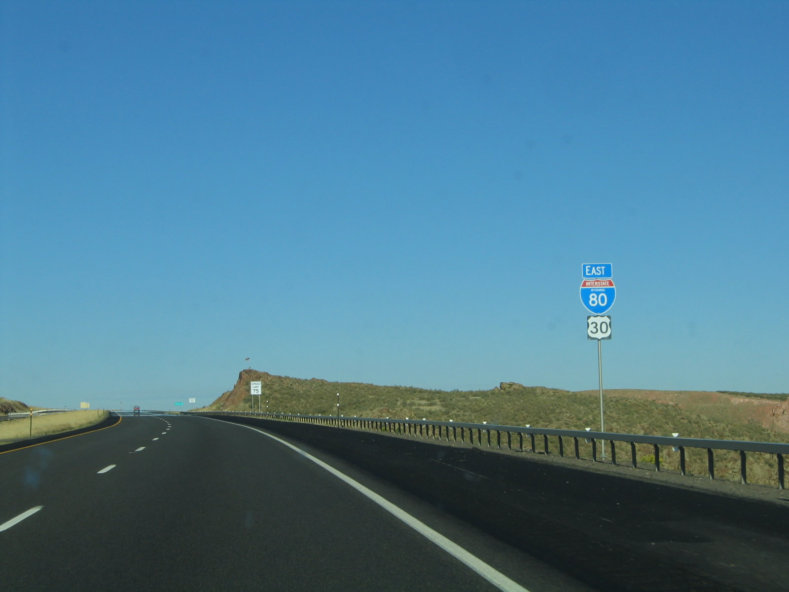
| Interstate 80 and U.S. 30 east |
|
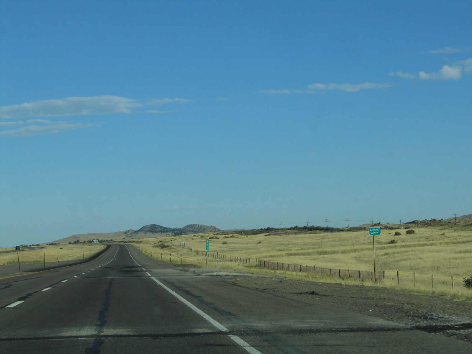
Interstate 80 and U.S. 30 pass the Albany-Laramie County Line near Milepost 337. The county marker sign here is so tiny that it is indistinguishable at 75 miles per hour. The county line marker used to be so tiny it was nearly impossible to read at 75 miles per hour. This sign has since been replaced. Photo taken 09/06/05. |
|
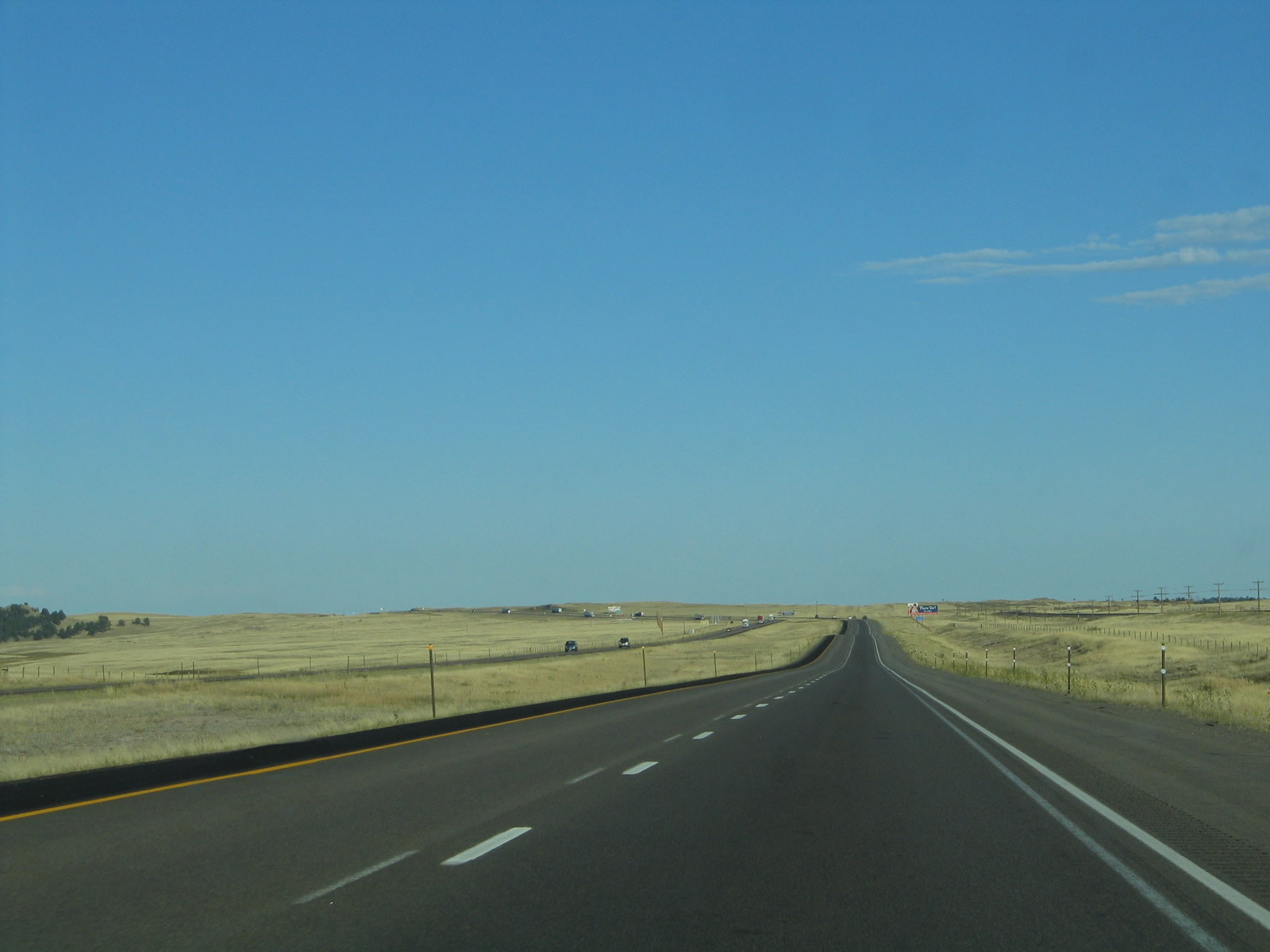
The high rolling plains continue as we descend from the Laramie Mountainsbthrough the foothills toward the capital city of Cheyenne. Photo taken 09/06/05. |
|
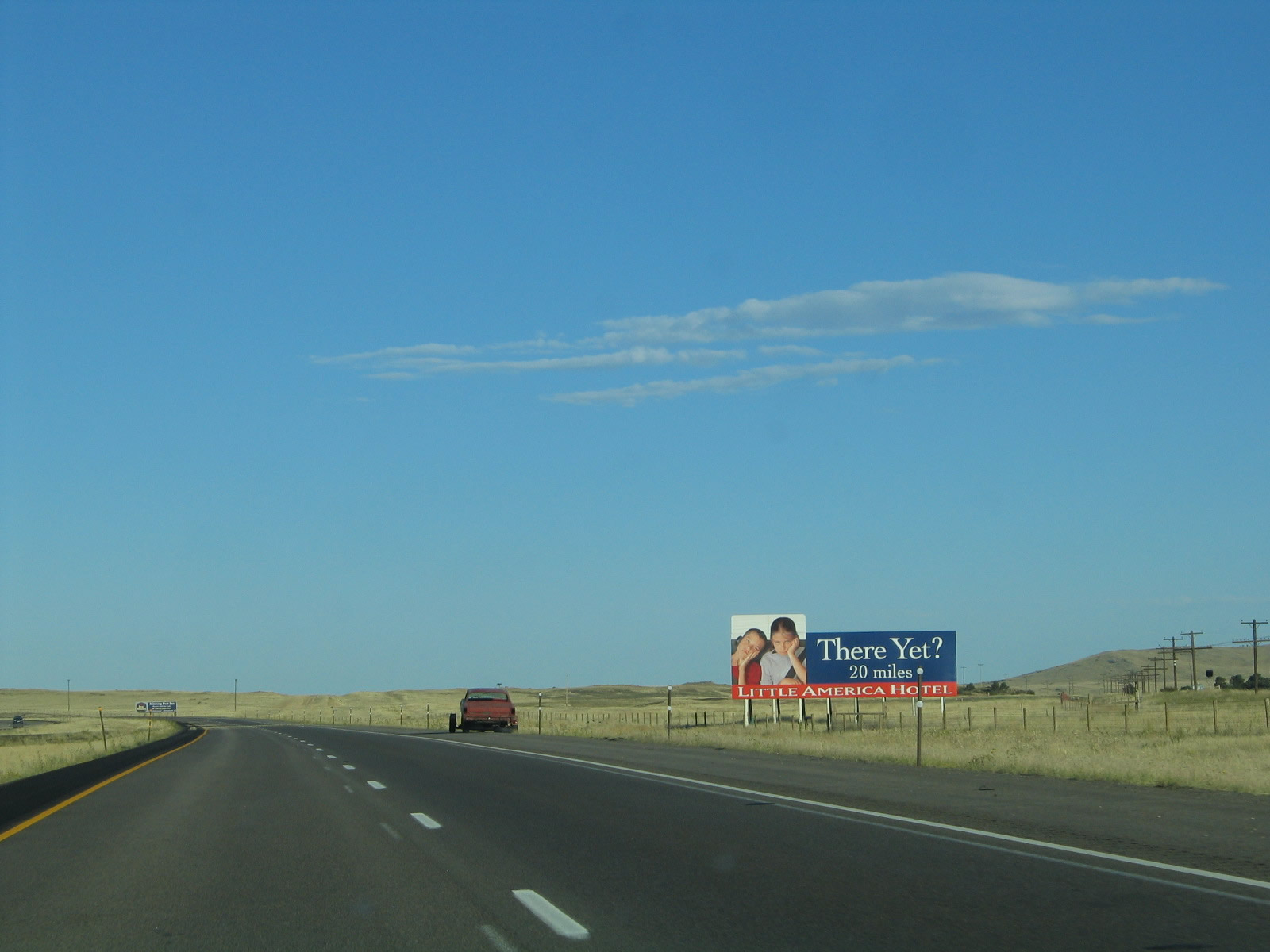
In Cheyenne, Business Loop I-80 and U.S. 30/Lincolnway connect to Little America, a hotel that features a golf course. Billboards like this one are scattered along Interstate 80 to guide motorists to the hotel and resort. Little America has another hotel and travel center along Interstate 80 west of here in Little America, Wyoming, about 300 miles west of Cheyenne (midway between Green River and Lyman). Photo taken 09/06/05. |
|
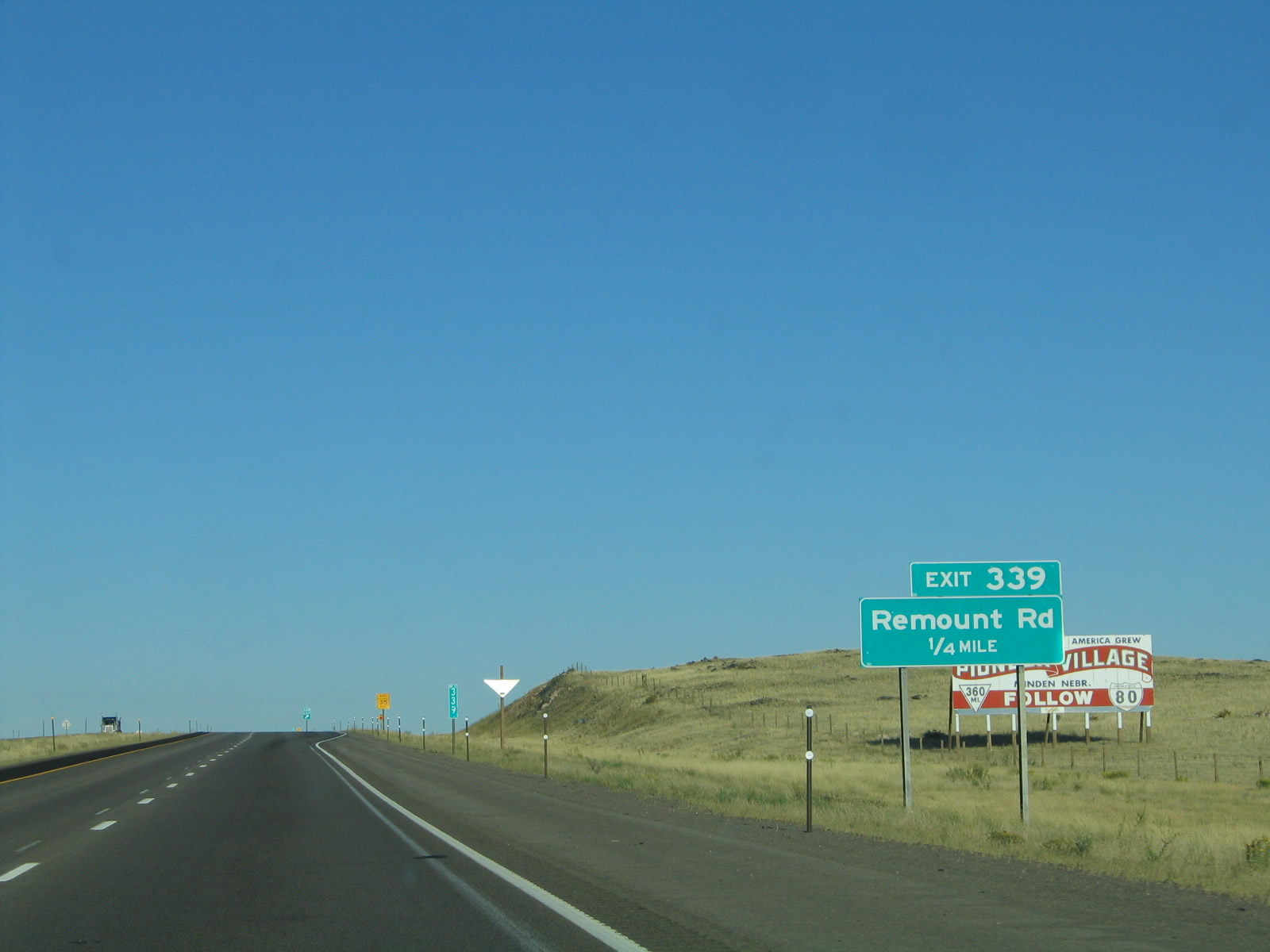
The next exit along eastbound Interstate 80 and U.S. 30 is Exit 339, Junction Laramie County Route 206, Remount Road. Remount Road travels southwest and changes into Albany County Route 234, Monument Road. From there, Monument Road connects to Albany County Route 241, Pumpkin Vine Road and Albany County Route 222, Hermosa Road. Both of these county routes are unpaved, but they ultimately connect to U.S. 287 southeast of Laramie. Photo taken 09/06/05. |
|
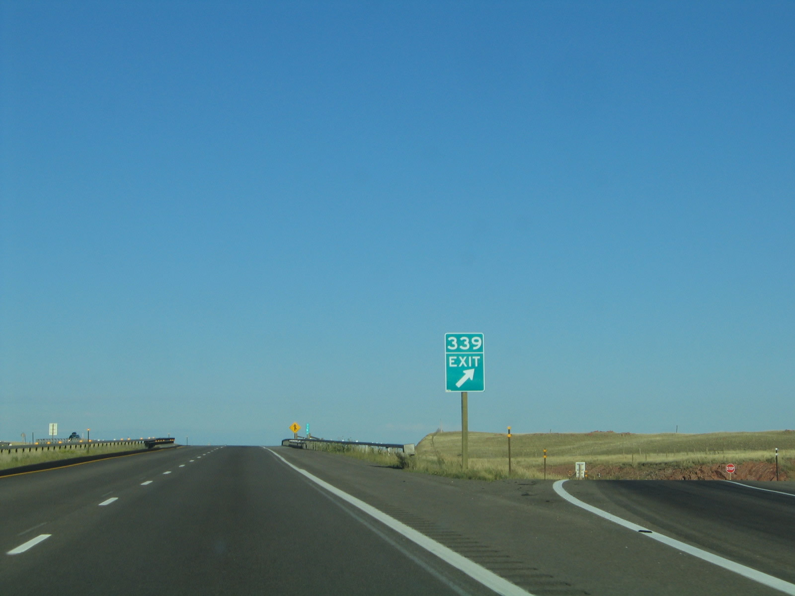
Eastbound Interstate 80 and U.S. 30 reach Exit 339, Junction Laramie County Route 206, Remount Road. Photo taken 09/06/05. |
|
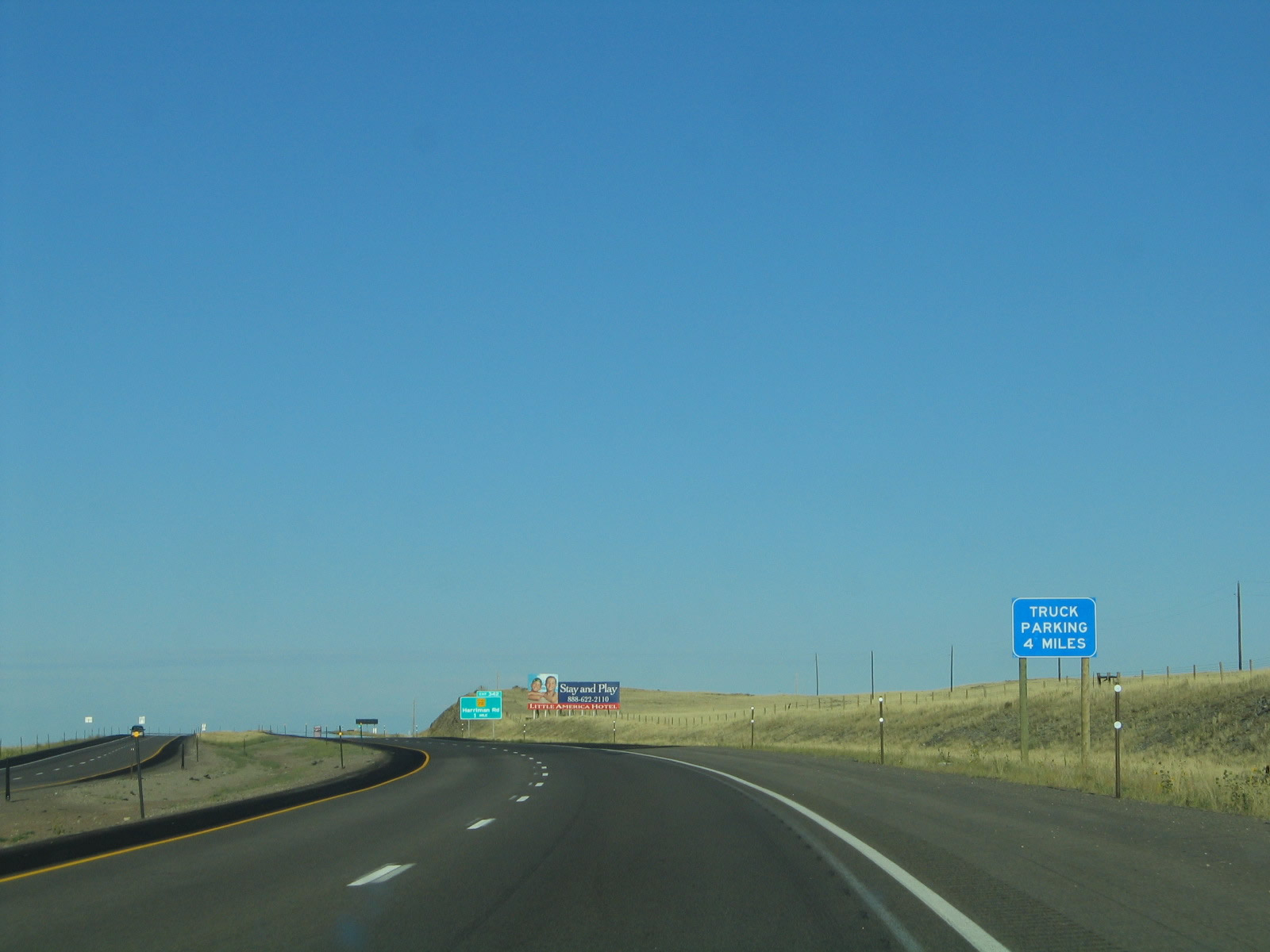
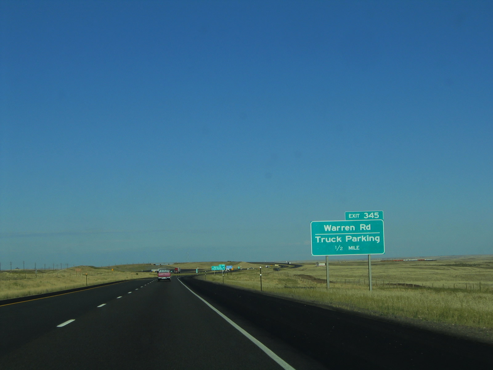
A truck parking area is located six miles east of the Remount Road interchange at Exit 345, Warren Road. Photo taken 09/06/05. |
|
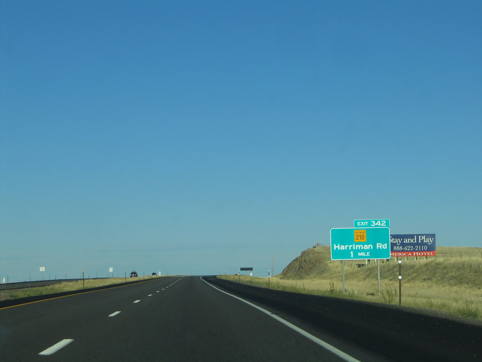
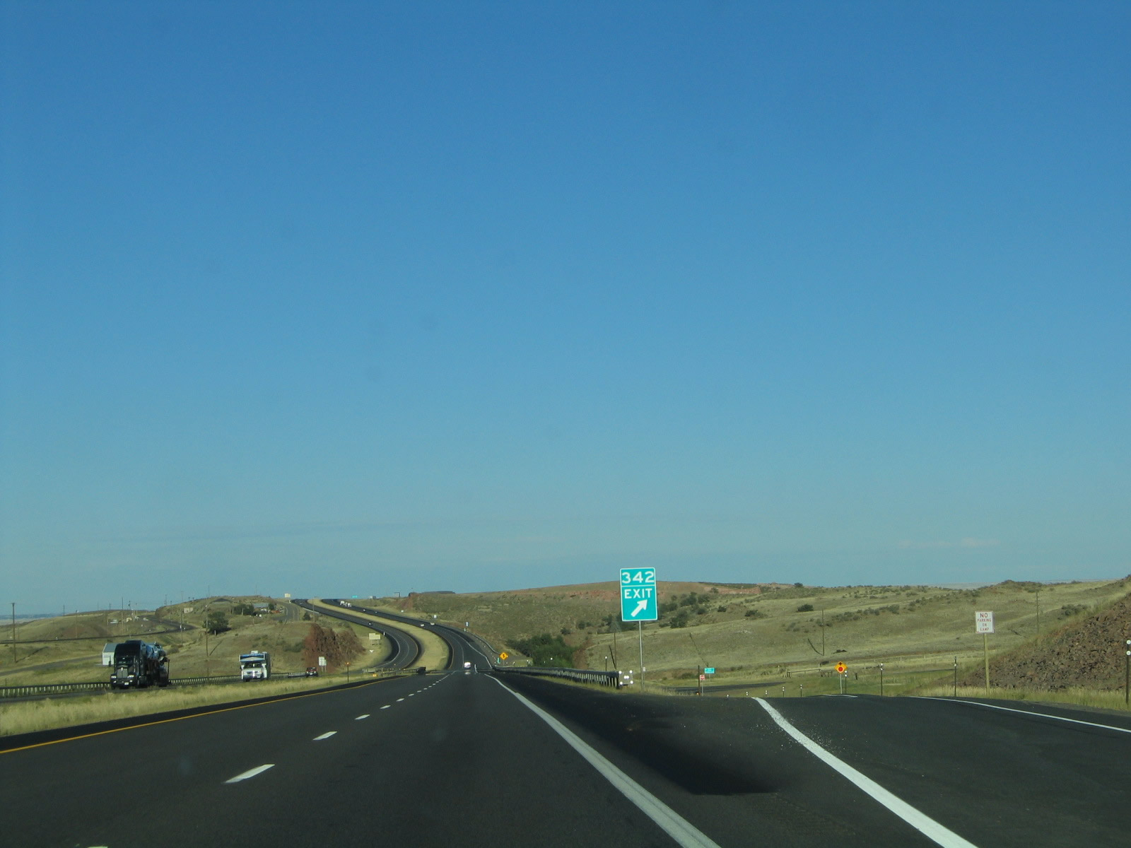
The next exit along eastbound Exit 342, Junction Former Wyoming 218, Harriman Road. This county road travels south from Interstate 80 to the settlement of Harriman near the Colorado State Line. Between Dale Creek and Otto, the Union Pacific Railroad splits into two branches. The northern branch stays close to Interstate 80 east of Buford, while the southern branch comes close to Colorado before merging with the northern branch near Wyoming 225/Otto Road. The distance of Harriman Road separates the two branches at the point where there is the greatest distance between them. Photo taken 09/06/05. |
|
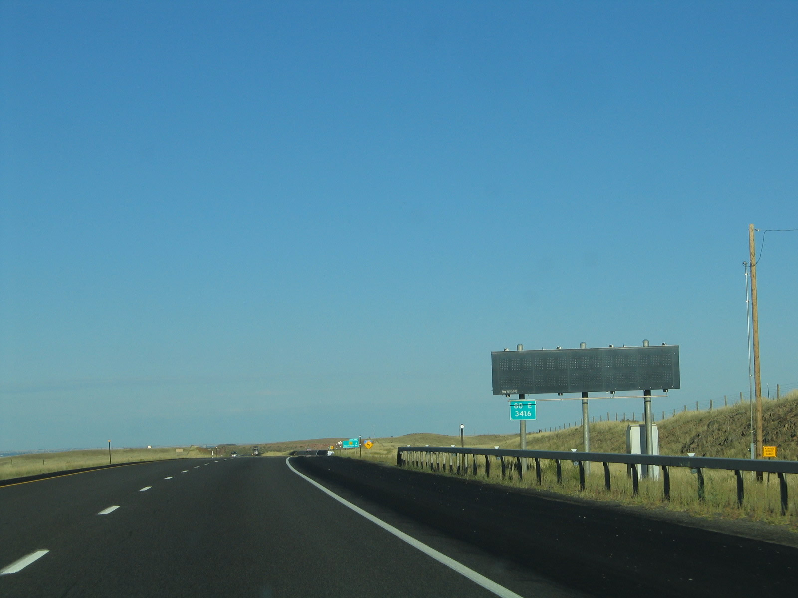
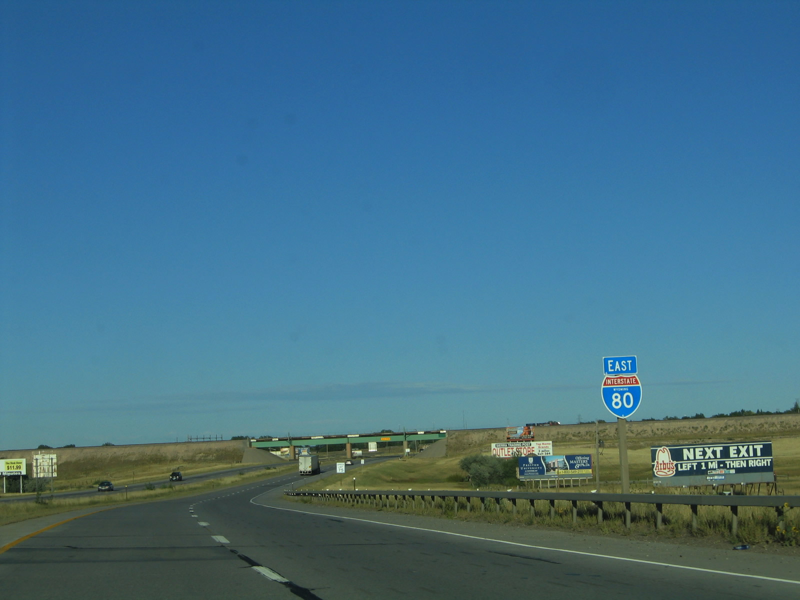
Variable (dynamic) message signs have been appearing all over the state of Wyoming on its freeways. One is placed here on eastbound Interstate 80 and U.S. 30 near the Harriman Road interchange. Photo taken 09/06/05. |
|
Prior to 2003, the Harriman Road interchange was not signed on the advance signs as a state highway. That changed with some sign replacements that occurred between 2003 and 2005. Wyoming 218 used to exist only for a short distance south of Interstate 80; the highway changes into Laramie County Route 102 prior to reaching Harriman. In 2009, Wyoming 218 was decommissioned and removed from the state system. The 218 shield was removed from the guide sign in 2009. Photo taken 09/06/05. |
|
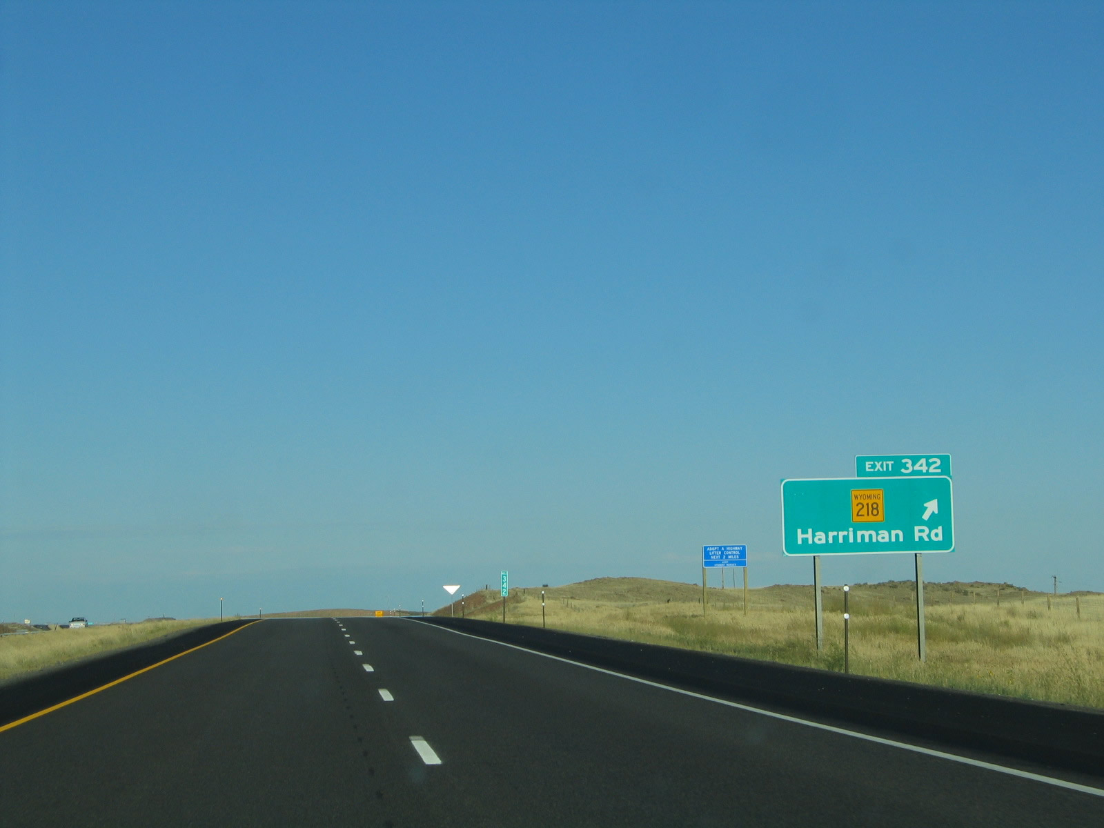
Eastbound Interstate 80 and U.S. 30 reach Exit 342, Harriman Road (Former Wyoming 218). Wyoming 218 was a very short state route, becoming Laramie County Route 102 before reaching Harriman. The two routes follow the original route of the Lincoln Highway, which parallels the Union Pacific Railroad en route to Tie Siding and thence onto Laramie. The railroad does not proceed over to Sherman Hill, and it has been realigned south of Interstate 80. The Lincoln Highway comes very close to entering Colorado at the town of Harriman. Photo taken 09/06/05. |
|
This reassurance shield assembly for Interstate 80 and U.S. 30 is posted after the Harriman Road interchange. Photo taken 09/06/05. |
|
This mileage sign provides the distance to Cheyenne (20 miles) and Sidney, Nebraska (121 miles). Pine Bluffs and Kimball, Nebraska, are omitted from this sign. This is the first time Sidney is listed as a destination city on a mileage sign. Photo taken 09/06/05. |
|
Wyoming uses signs such as this one to list the radio stations that serve major urban areas in the state. The intent is to advise which radio stations carry weather information, but the sign also helps newcomers to find a local radio station to enjoy in the urban areas of the state. Cheyenne and Casper have the most diverse and numerous radio markets in the state. Photo taken 09/06/05. |
|
The next exit along eastbound Interstate 80 and U.S. 30 is Exit 345, Warren Road. A large parking area is located on the north side of Interstate 80 for trucks. Photo taken 09/06/05. |
|
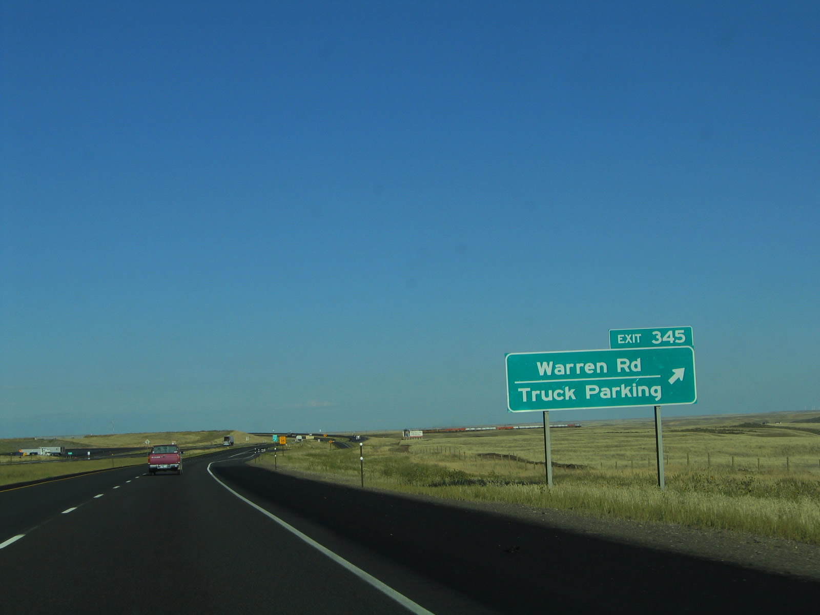
Eastbound Interstate 80 and U.S. 30 reach Exit 345, Warren Road. The freeway continues east toward Cheyenne. Photo taken 09/06/05. |
|
A train passes under Interstate 80 as the freeway crosses over the Union Pacific Railroad immediately after the Warren Road interchange. Photo taken 09/06/05. |
|
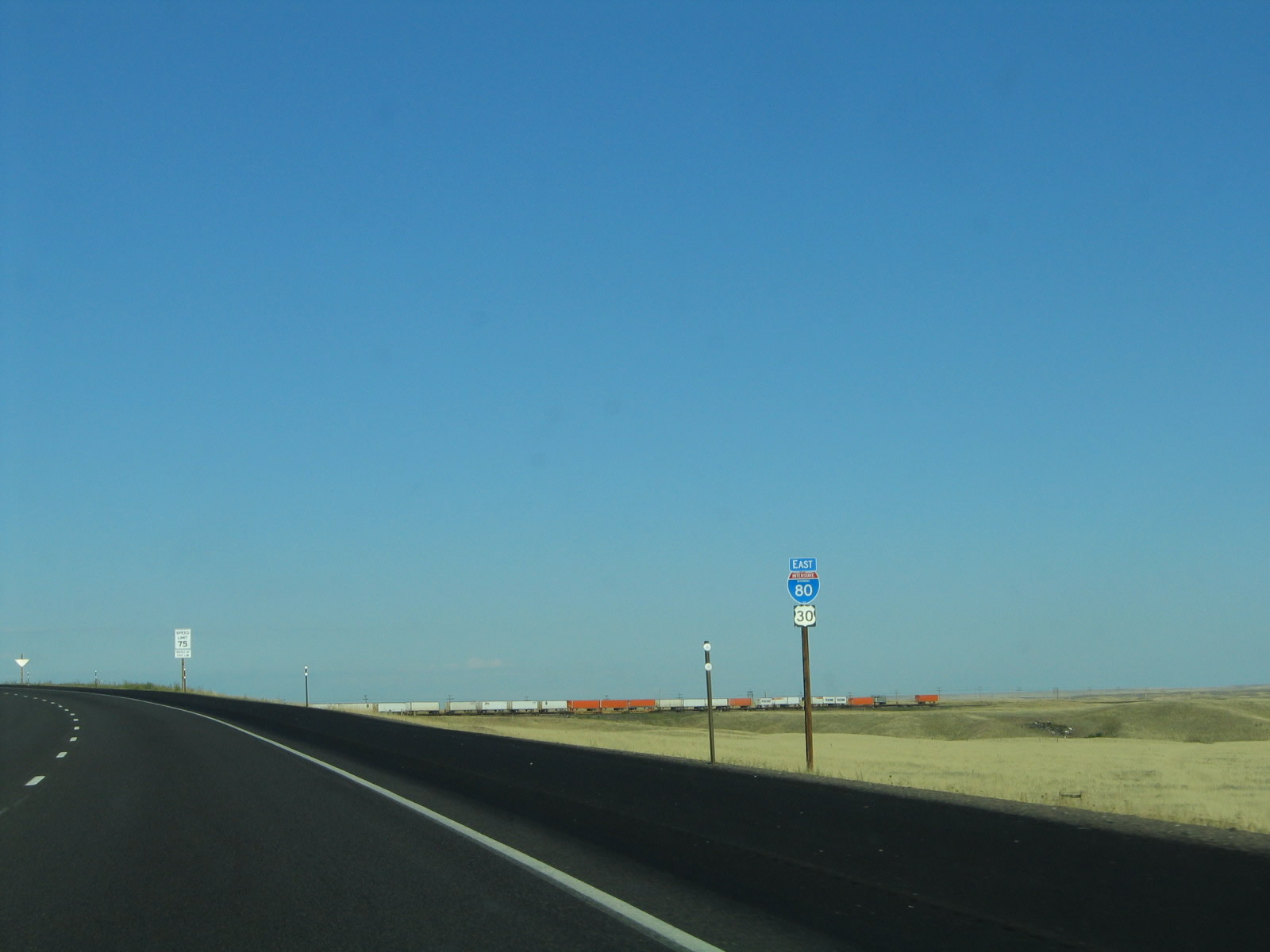
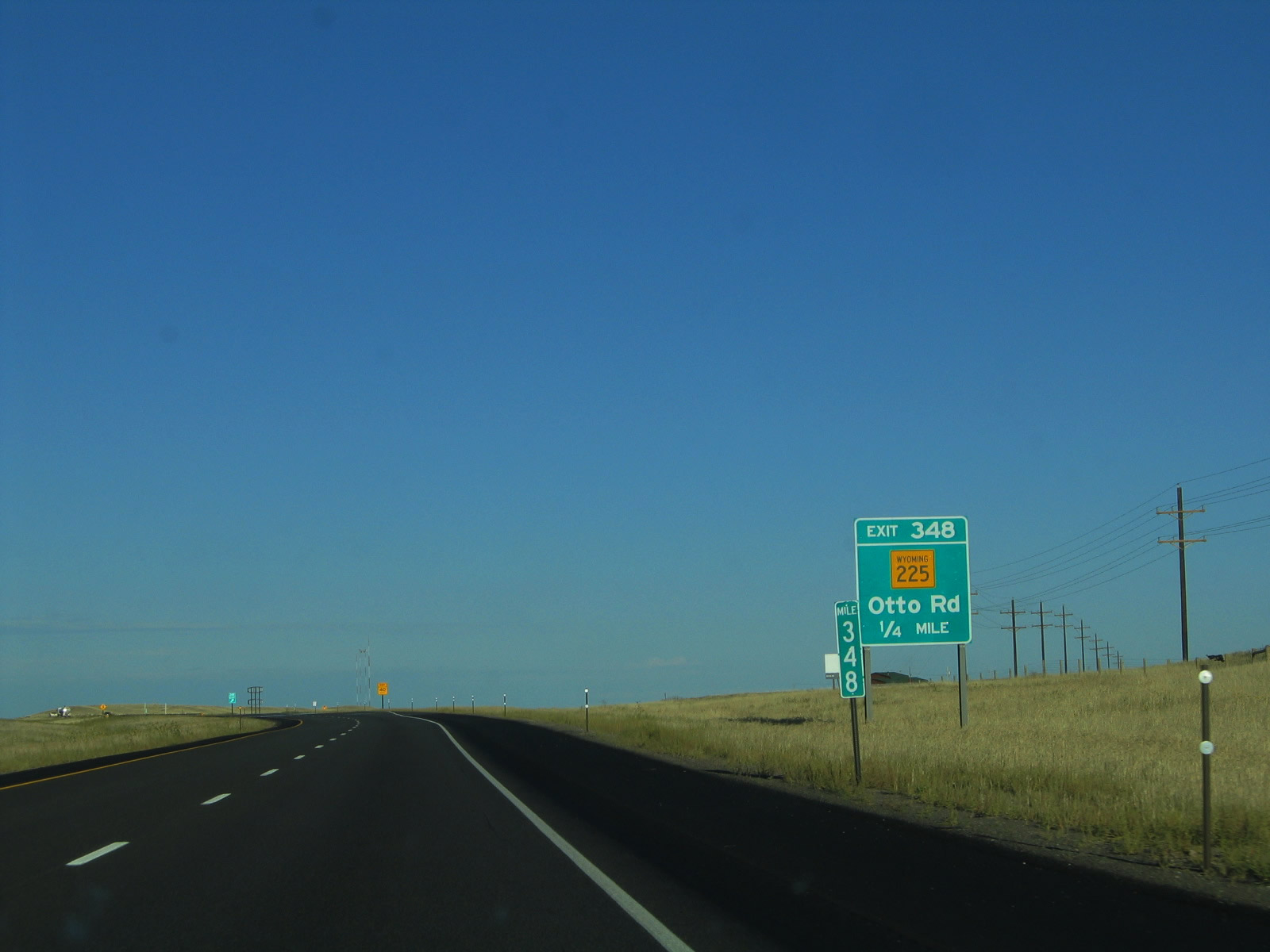
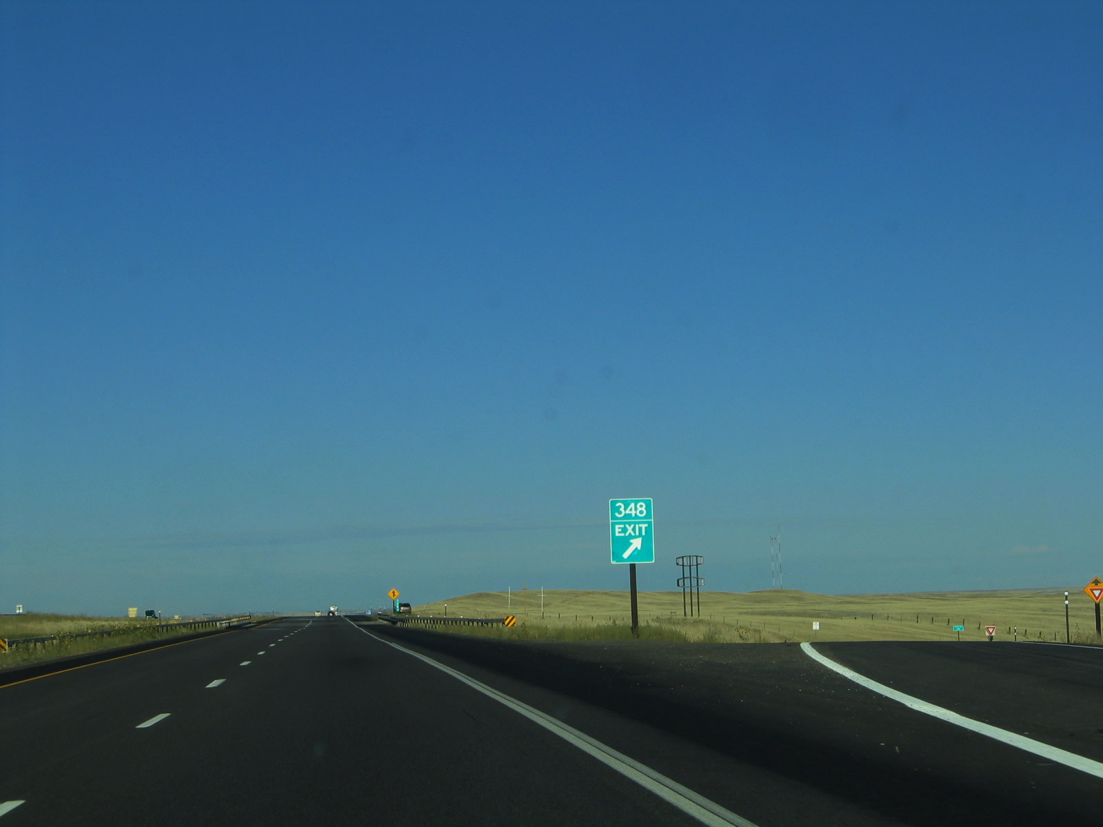
The next exit along eastbound Interstate 80 and U.S. 30 is Exit 348, Wyoming 225/Otto Road (Old Lincoln Highway). Otto Road is another old alignment of the Lincoln Highway that provides local and ranch access. The state highway was formerly part of U.S. 30. From here, it travels southeast and then northeast past a cement plant parallel to the Union Pacific Railroad. It rejoins Interstate 80 and U.S. 30 at the main business loop (Lincolnway) interchange in West Cheyenne. Photo taken 09/06/05. |
|
Eastbound Interstate 80 and U.S. 30 reach Exit 348, Wyoming 225/Otto Road (Old Lincoln Highway). Photo taken 09/06/05. |
|
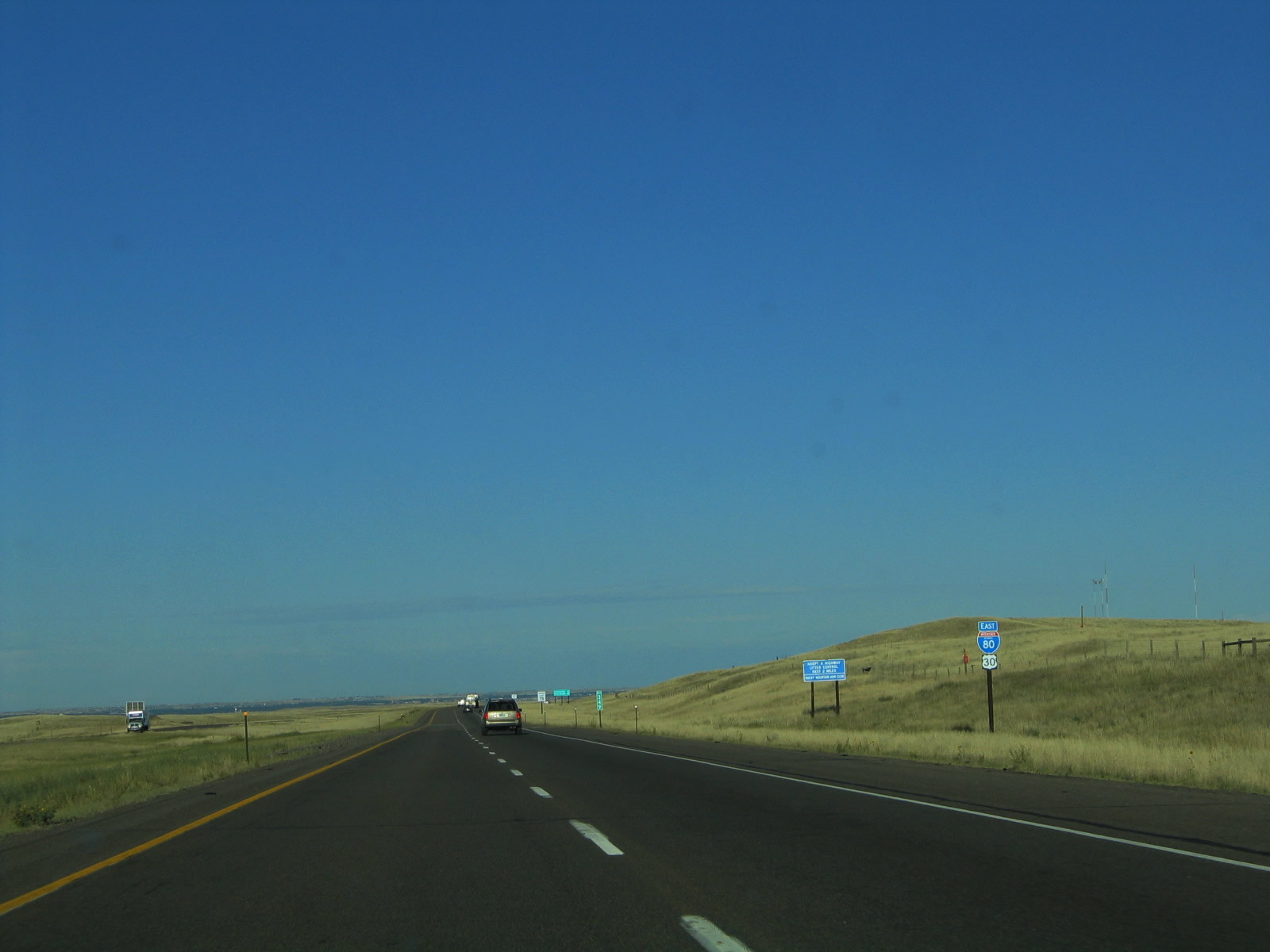
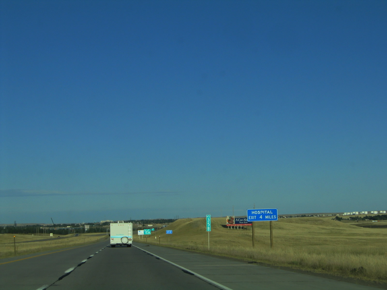
Another set of reassurance shields is posted after the Otto Road interchange. It is another ten miles from here to the next exit, which is the business loop into Cheyenne (Exit 358). Photo taken 09/06/05. |
|
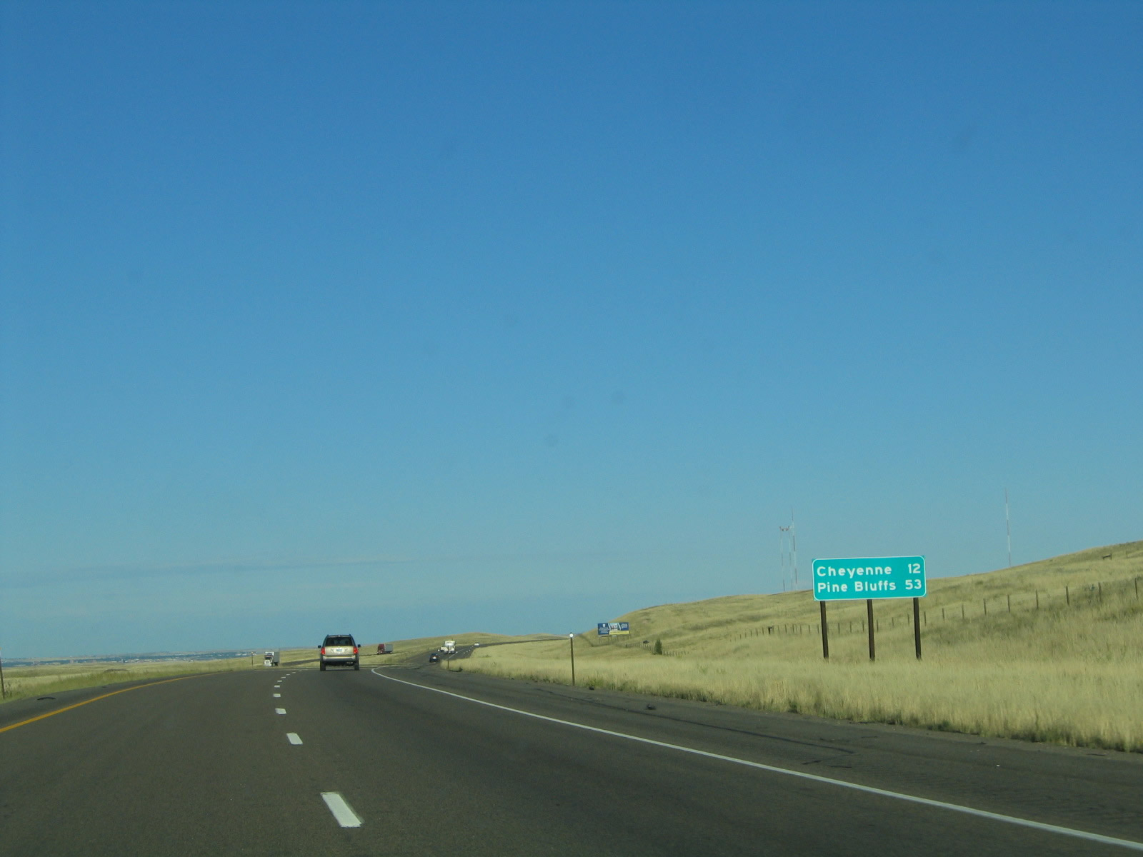
This mileage sign provides the distance to Cheyenne (12 miles) and Pine Bluffs (53 miles). Photo taken 09/06/05. |
|
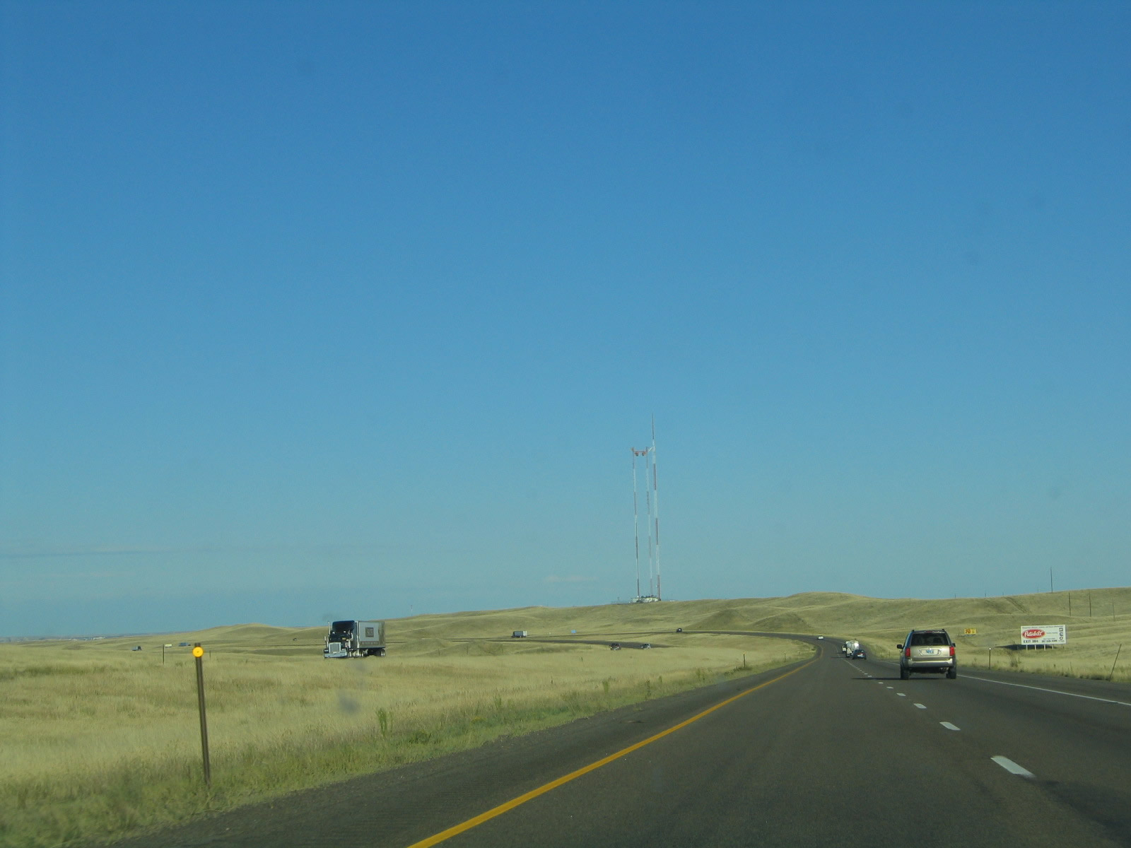
Interstate 80 crests over this ridge and then prepares to descend into Cheyenne. The trees and urban areas of Cheyenne come into view in the distance as the freeway continues to get closer to the capital city. Photo taken 09/06/05. |
|
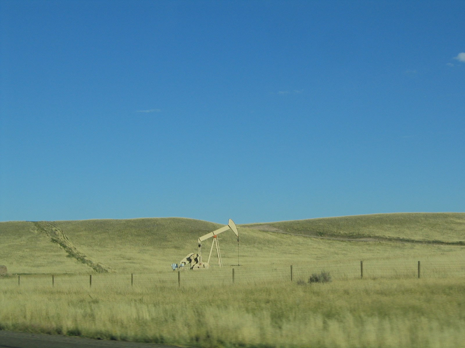
Wyoming's slogan of wide open spaces is apt even when within ten miles of downtown Cheyenne. A few oil derricks dot the ranchland. Photo taken 09/06/05. |
|
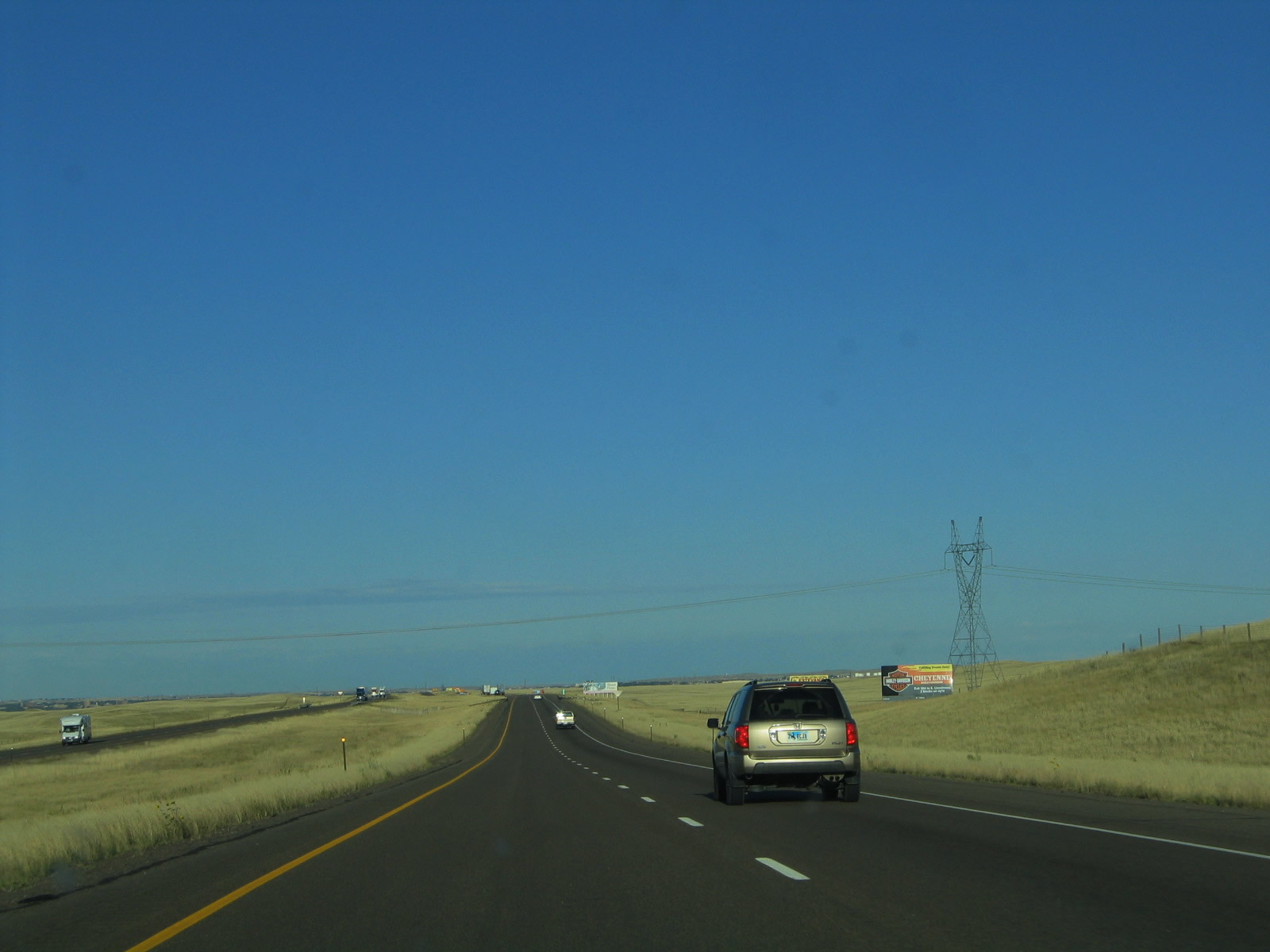
A 345kV power line transmission corridor passes over Interstate 80; this line likely transmits hydroelectric power generated from the various North Platte River reservoirs and/or electricity from nearby coal power generating stations. Much of this electricity travels south toward the Front Range of Colorado, which partially relies on electricity generated by the water, coal, and winds of Wyoming. Photo taken 09/06/05. |
|
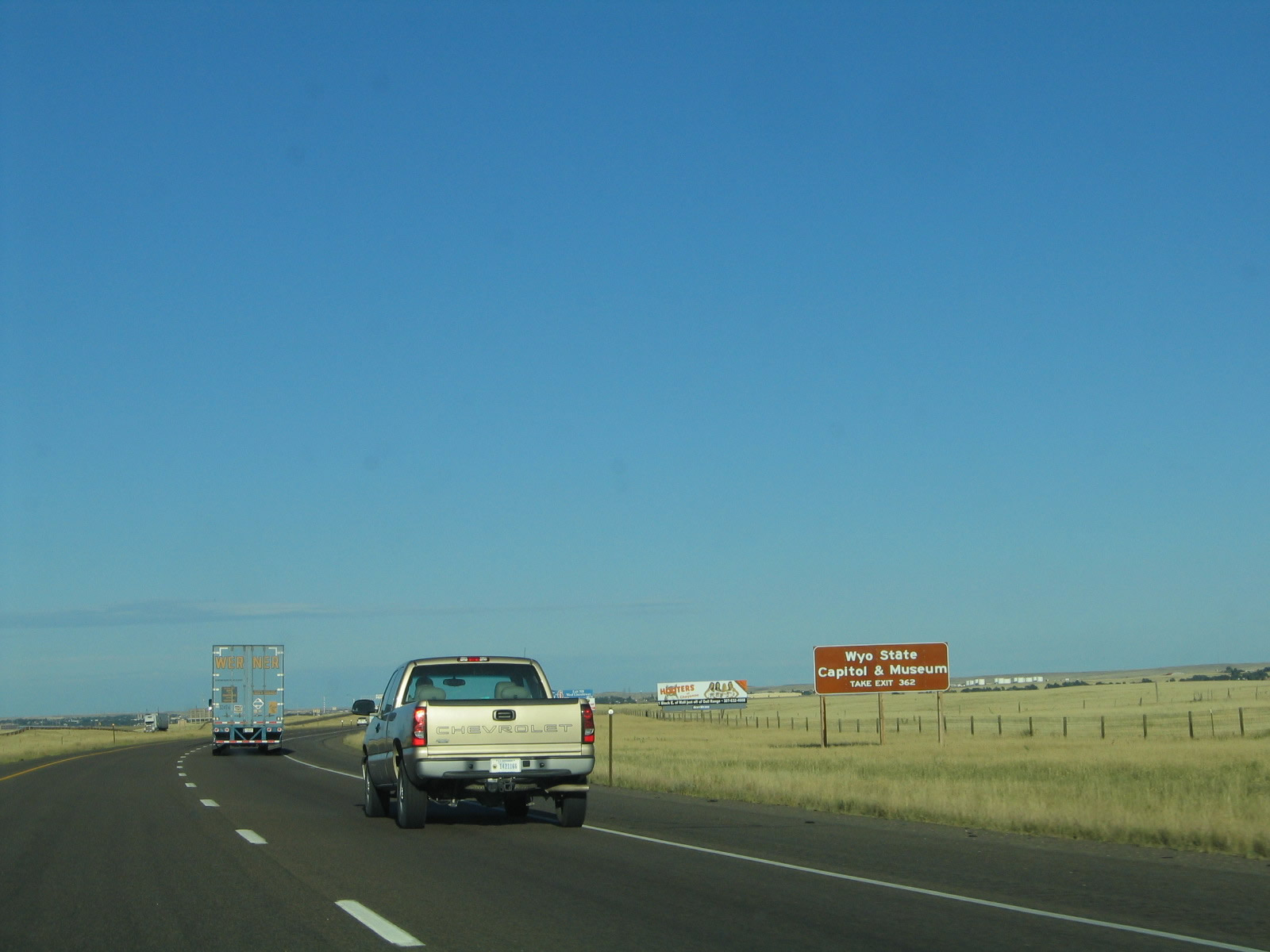
To reach the Wyoming state capitol, follow Interstate 80 east to Interstate 180 north. At 24th Street, turn west to the capitol. An alternate route is to take Business Loop I-80 and U.S. 30 east to Capital Avenue north. Photo taken 09/06/05. |
|
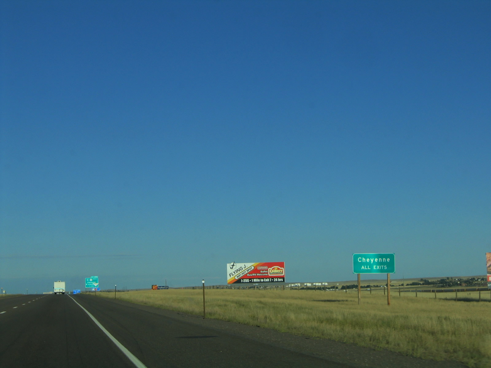
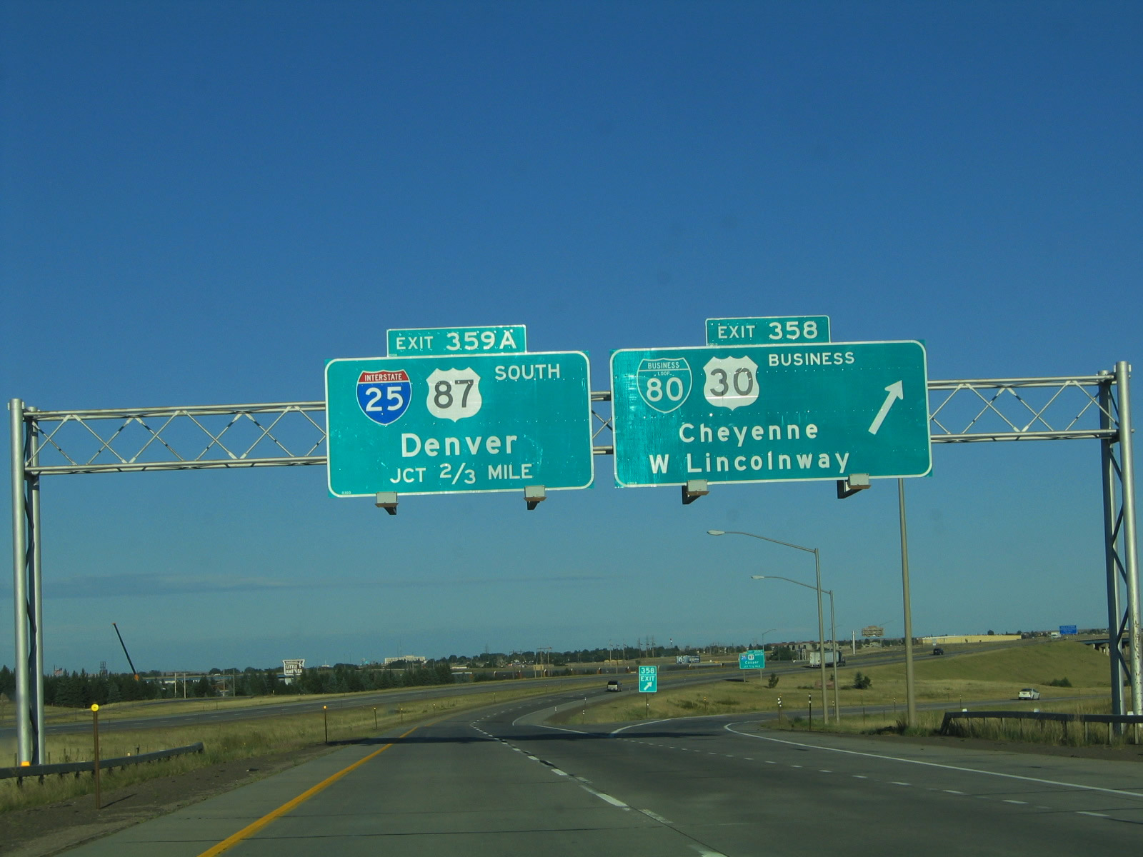
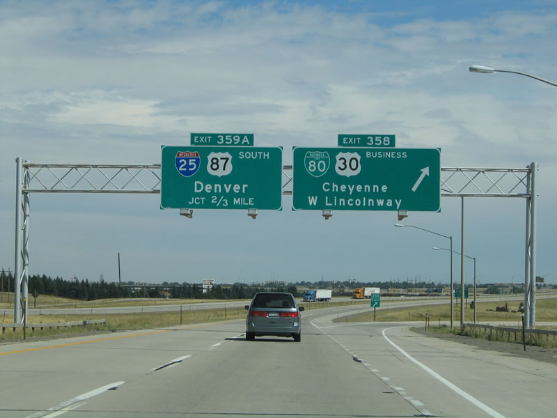
The first advance guide sign for Wyoming's capital city is the "Cheyenne All Exits" sign. There are actually five exits that serve Cheyenne: Exit 357, Wyoming 222/Roundtop Road; Exit 358, Junction Business Loop I-80 and U.S. 30/Lincolnway; Exit 359, Interstate 25 and U.S. 87; Exit 362, Interstate 180, U.S. 85, Business Loop I-25, and Business U.S. 87/Central Avenue; and Exit 364, Junction Business Loop I-80 and Wyoming 212/College Drive. It would be more appropriate for this sign to read "next five exits" rather than "all exits." Photo taken 09/06/05. |
| In 2007, an interchange between Interstate 80 and Wyoming 222/Roundtop Road opened to traffic as Exit 357. At this time, we do not have pictures of the Exit 357 diamond interchange, which is situated less than a mile west of the Lincolnway interchange (Exit 358). Signage through here has changed. Wyoming 222/Roundtop Road travels north to Wyoming 210/Happy Jack Road and south to Wyoming 225/Otto Road. Roundtop Road continues north of Happy Jack Road as a county road, traversing the western edge of the F.E. Warren Air Force Base and linking with High Plains Arboretum (Cheyenne Botanic Gardens). A Wal-Mart distribution center is located just north of this interchange, and wind farms become visible alongside the freeway. |
|
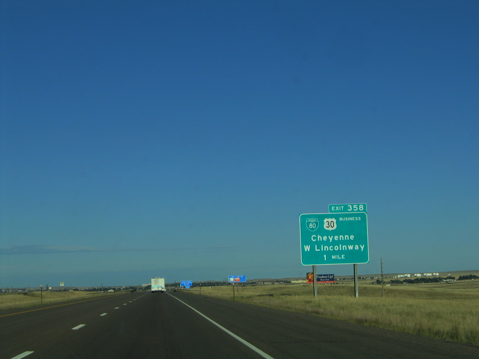
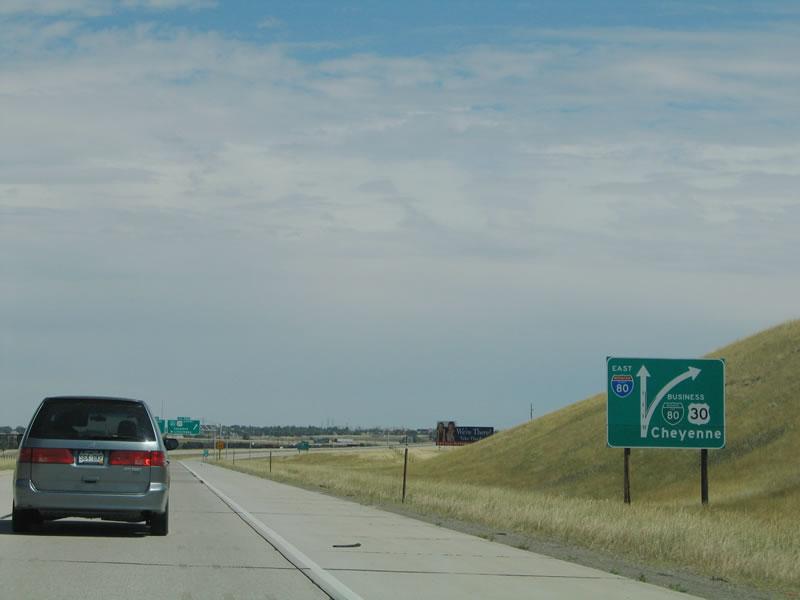
And so, the first Cheyenne exit along eastbound Interstate 80 and U.S. 30 is Exit 358, Junction Business Loop I-80 and U.S. 30. There are plans to construct an interchange at Wyoming 222 (Roundtop Road); that will eventually become the new first interchange for Cheyenne. Photo taken 09/06/05. |
|
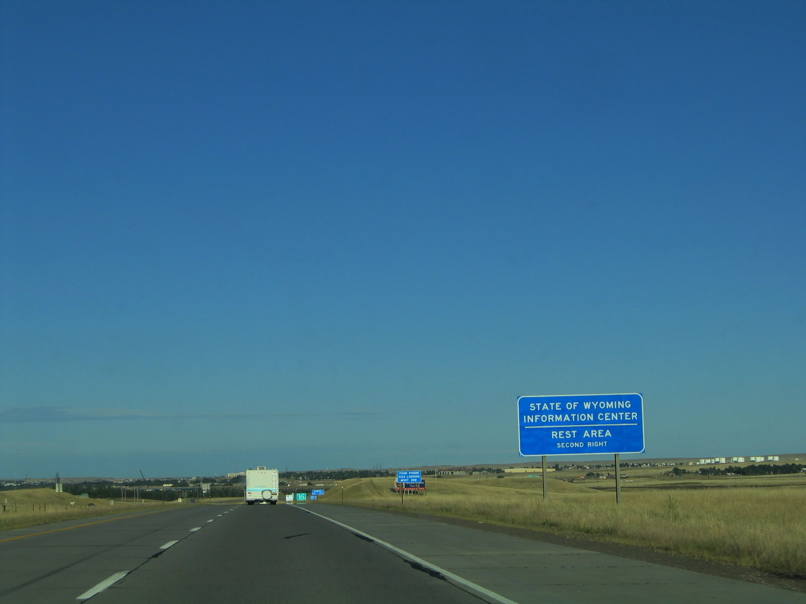
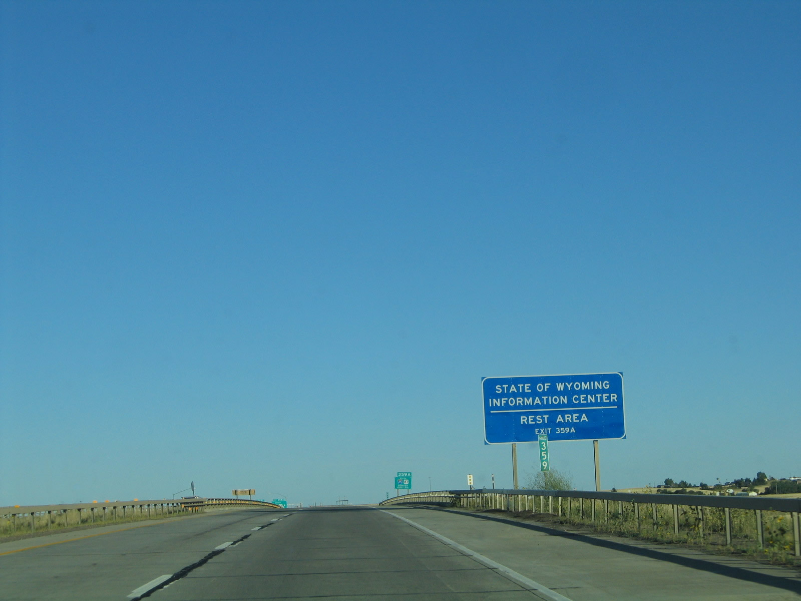
A state of Wyoming visitors center and welcome center is located off Interstate 25 at Exit 4 (High Plains Road) to reach the welcome center. Tourist information is also available at the Cheyenne visitors center downtown at the railroad depot as well as the state capitol and state museum. Photo taken 09/06/05. |
|
To drive to either of the two hospitals in Cheyenne, follow Interstate 180/Central Avenue north (Exit 362) to Pershing Avenue, then turn east on Pershing Avenue to the UMC Hospital or VA Hospital. Photo taken 09/06/05. |
|
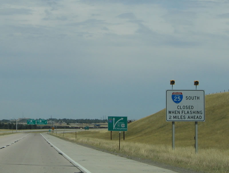
In cases when Interstate 25/U.S. 87 south of Exit 7 is closed, these lights will advise of this fact. More than likely, traffic on Interstate 80 would already know if a weather condition causes such a closure, since this freeway would quite possibly be closed or require tire chains. Photo taken 09/06/05. |
|
|
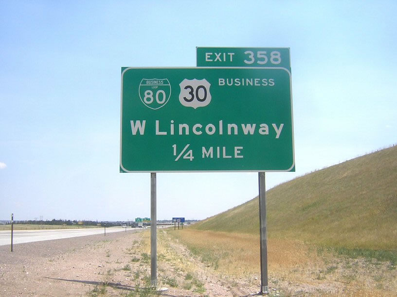
The next sign along eastbound Interstate 80 is a roadside sign for Exit 358, Junction Business Loop I-80 and U.S. 30 (Lincolnway). This sign was replaced between 2005 and 2007; it used to show a diagram of the exit ramp. In both photos, the overhead exit sign is visible in the distance. Photos taken 09/05/05 and by David Backlin (07/26/07). |
|
|
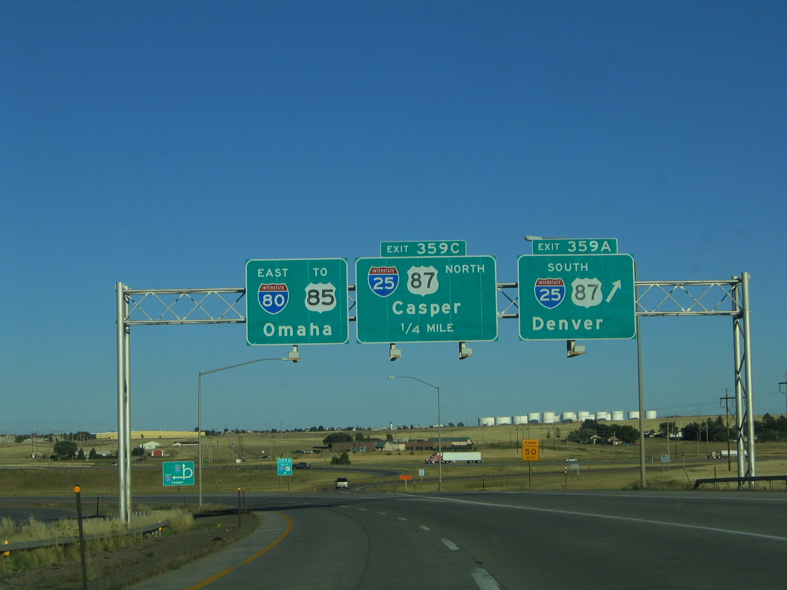
Eastbound Interstate 80 and U.S. 30 reach Exit 358, Junction Business Loop I-80 and U.S. 30. Depending on the shield assembly, U.S. 30 is signed both as Business U.S. 30 and as regular U.S. 30 through Cheyenne. This sign seems to imply that regular U.S. 30 continues on Interstate 80, but there are no more U.S. 30 shields along Interstate 80 until after the Archer exit. The next exit is Exit 359A, Interstate 25 and U.S. 87 south to Denver. Photos taken 09/06/05. |
| Interstate 80 east |
|
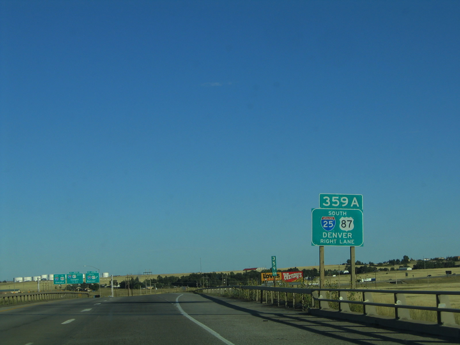
The second ramp in the Interstate 25/Interstate 80 cloverleaf interchange is Exit 359A, Interstate 25/U.S. 87 north to Wheatland, Douglas, and Casper. This interchange is the one of two cloverleafs in the entire state of Wyoming. (The other cloverleaf interchange connects Interstate 25 with Missile Drive and Happy Jack Road.) Photo taken 09/06/05. |
|
A welcome center is located four miles south of Interstate 80 by taking Interstate 25 south to Exit 4, High Plains Road. This sign indicates that travelers may use Interstate 25 southbound to reach Exit 4, a distance of approximately four miles. At this time this picture was taken, the welcome center was located at Exit 7 (College Drive), but the center was relocated a bit further south. Photo taken 09/06/05. |
|
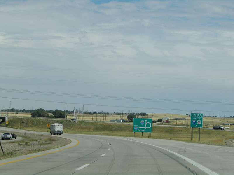
This signage, located along eastbound Interstate 80 as it approaches Interstate 25 and U.S. 87 (Exits 359A-C) looks more like a gore point sign than an advance sign. It should be a full-size sign, indicating that the southbound exit is the next right. Instead, it uses small shields and a sign that is only a little bigger than a typical gore point exit sign. The next picture shows the overhead signs at Exit 359A. Photo taken 09/06/05. |
|
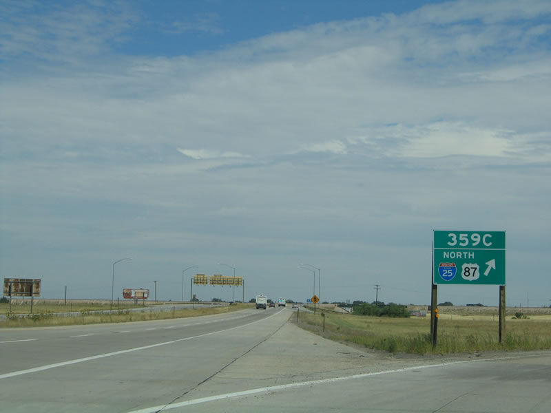
Eastbound Interstate 80 reaches Exit 359, Interstate 25 and U.S. 87. Exit 359A leads to Denver (south) and Exit 359C leads to Casper (north). In addition, Interstate 25 is the best route to the northern portions of Cheyenne, including Pershing and Dell Range Road. Photo taken 09/06/05. |
|
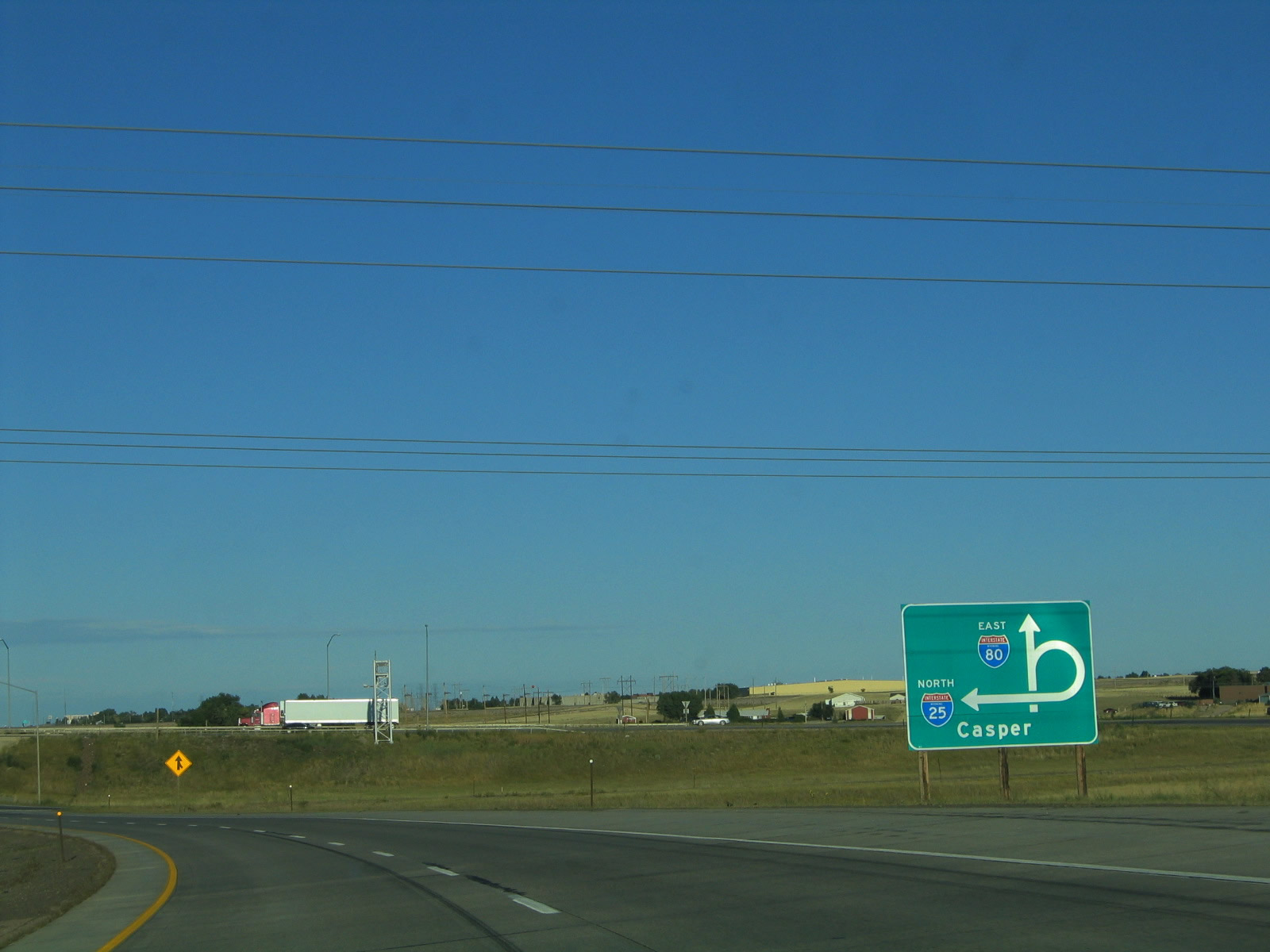
Gore point signage on the transition from eastbound Interstate 80 to southbound Interstate 25 and U.S. 87. A directional sign showing the cloverleaf loop used for the transition from eastbound to northbound is shown in the distance behind the gore sign. The bridge carrying Interstate 25 over Interstate 80 is visible behind both signs. Photo taken 09/06/05. |
|
A diagrammatical sign is used to show the connection between eastbound Interstate 80 and northbound Interstate 25 and U.S. 87. Since cloverleaf loop ramps are relatively rare in Wyoming, this sign is helpful to motorists unfamiliar with the concept to make that connection. Photo taken 09/06/05. |
|
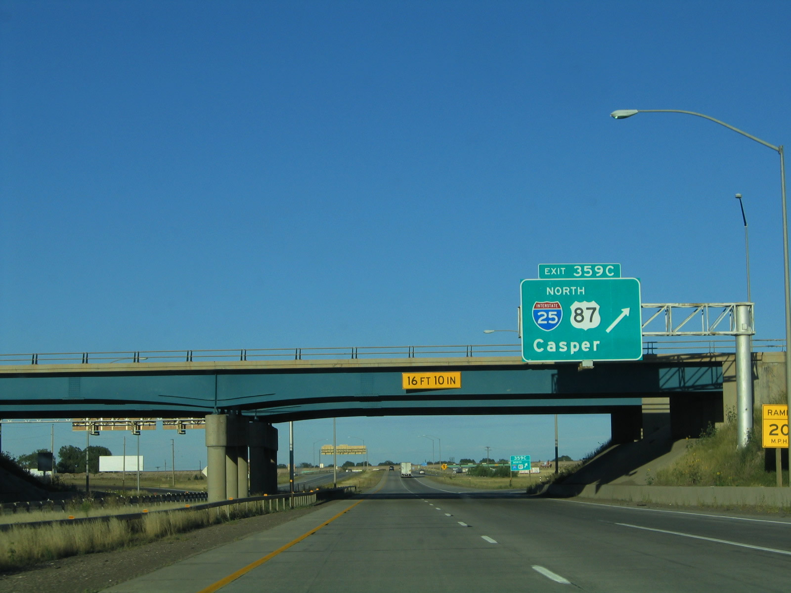
Eastbound Interstate 80 reaches Exit 359C, Interstate 25 and U.S. 87 north to Casper. Beyond Casper, Interstate 25 reaches its northern terminus at Interstate 90 in Buffalo. U.S. 87 continues north of Buffalo along with Interstate 90, separating from the Interstate Highway System finally in Billings, Montana. Photo taken 09/06/05. |
|
The gore point signage to northbound Interstate 25 and U.S. 87 again reads like a regular advance sign. Photo taken 09/06/05. |
|
For the first time since the Laramie Marginal route, Interstate 80 is signed alone. The Cheyenne Marginal, which follows Interstate 80 to the south of the city center, reconnects with Business Loop I-80 at College Drive and with U.S. 30 at Archer. Photo taken 09/06/05. |
|
The Burlington Northern and Santa Fe Railroad, which travels north-south along the Interstate 25 corridor in southeastern Wyoming, crosses over Interstate 80. This north-south railroad section does not share the large, east-west railroad yard operated by Union Pacific Railroad, but it is still a major player in the movement of freight and goods through Wyoming. Photo taken 09/06/05. |
|
|
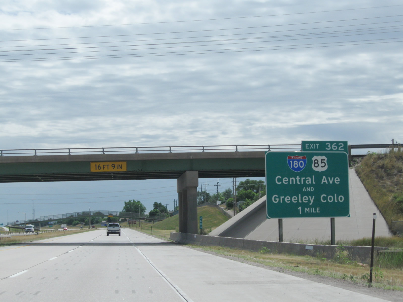
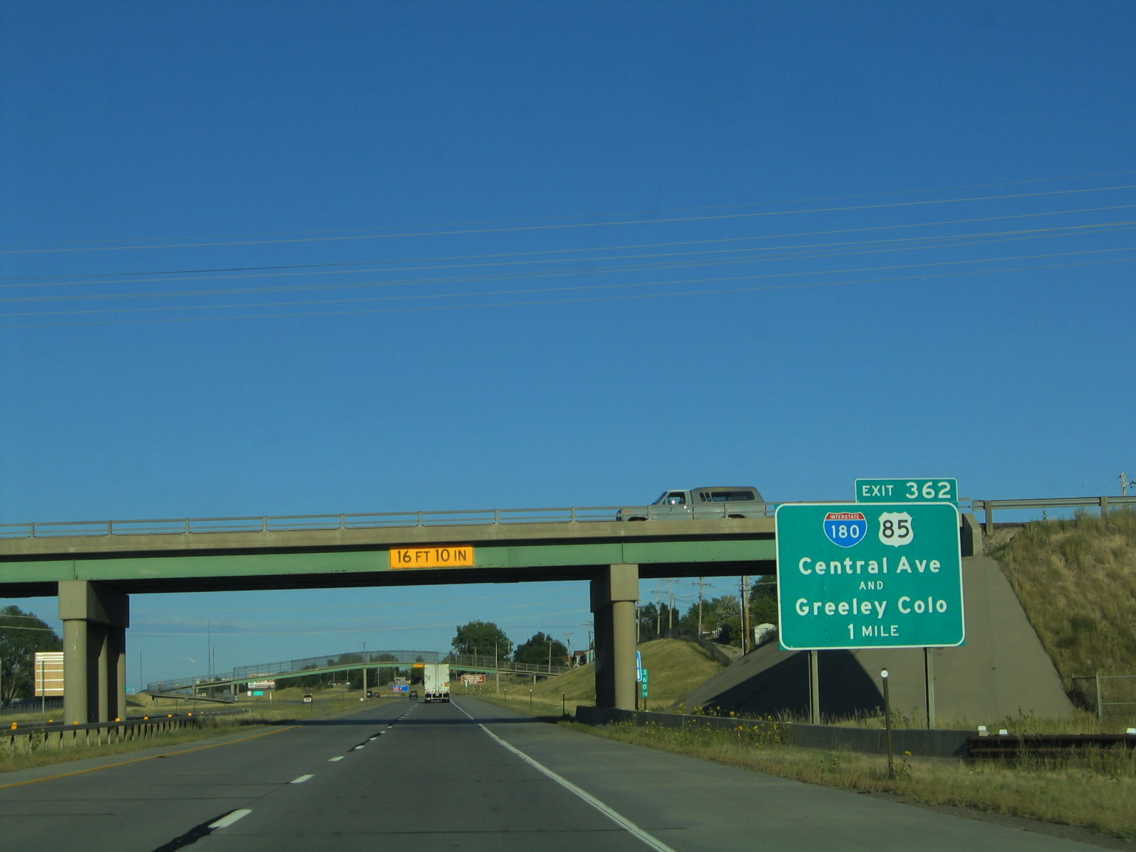
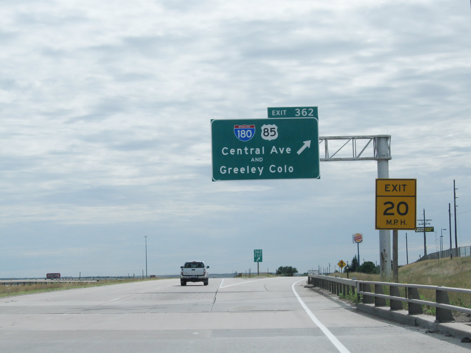
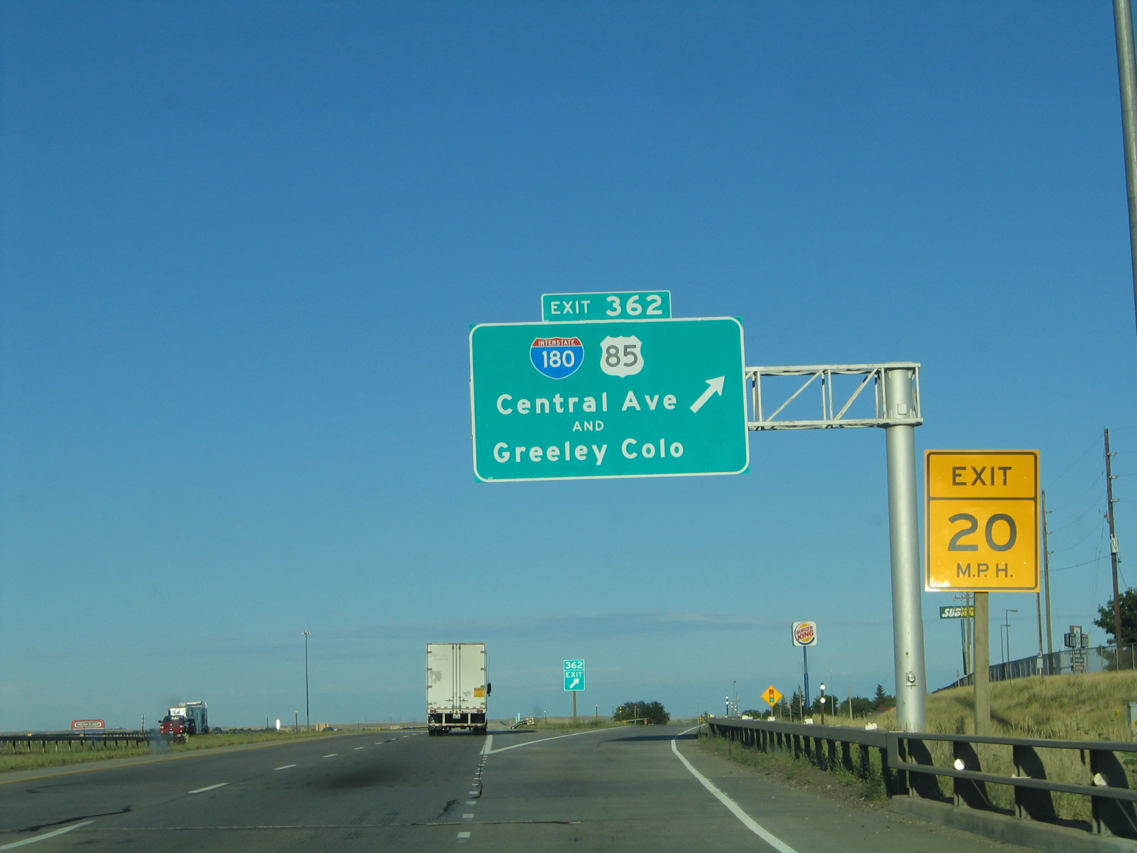
Continuing east, Interstate 80 next approaches Exit 362, Interstate 180, Business Loop I-25, U.S. 85, and Business U.S. 87 (Central Avenue). Despite the designation, Interstate 180 is not a freeway; instead, it is an expressway with access control governed by traffic signals and two single span viaducts over the Union Pacific Railroad yards. Use Interstate 180 north to downtown Cheyenne. Business Loop I-25, U.S. 85, and Business U.S. 87 all follow Interstate 180 north into downtown Cheyenne via Central Avenue, which changes into Warren Avenue north of Lincolnway. These three routes angle northwest to rejoin Interstate 25 at Exit 12. This sign was replaced with a Clearview guide sign around 2008. Photos taken 08/02/10 and 09/06/05. |
|
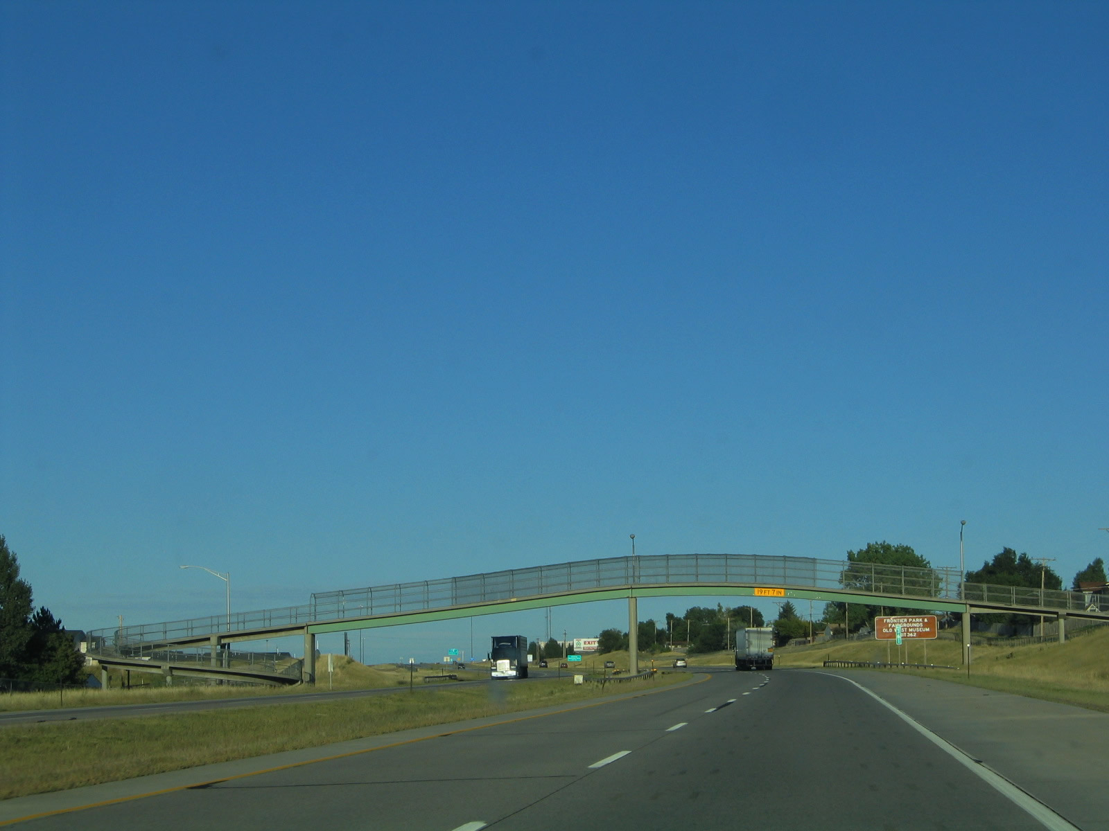
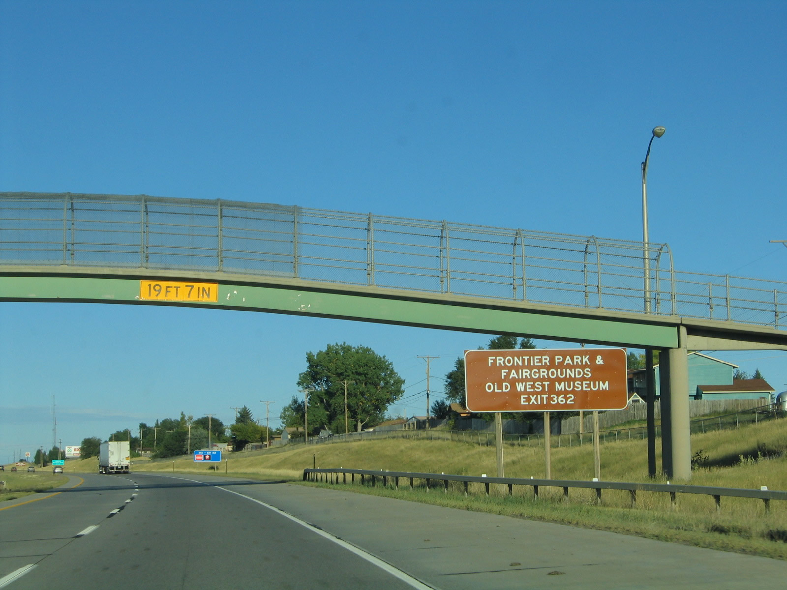
An arched pedestrian bridge connects the communities separated by Interstate 80 in south Cheyenne. On the day prior to when this photo was taken, three pedestrians and a bicyclist were using the bridge. Photo taken 09/06/05. |
|
To Frontier Park, county fairgrounds, and Old West Museum, follow Interstate 180/Central Avenue north. Cheyenne is well known for its annual Frontier Days celebration, which occurs every July at Frontier Park. This event is known as the "Daddy of 'Em All" cowboy rodeo. Photo taken 09/06/05. |
|
Use Interstate 180, Business Loop I-25 and U.S. 85-87B north to the central business district of Cheyenne. The city of Cheyenne, the "Magic City of the Plains," was founded in 1867 when surveyors from the Union Pacific Railroad constructed the transcontinental railroad. The original downtown area was laid out by General Grenville Dodge so that the city could maximize its exposure to sunlight, especially during the cold winter months. At the time the city was founded, it was part of the Dakota Territory. Once the state of Wyoming was born in 1890, Cheyenne became the nascent state's capital. Photo taken 09/06/05. |
|
Home to 59,466 as of the 2010 Census and 53,010 people as of the 2000 Census, Cheyenne is the largest city in Wyoming. This is a distinction that is commonly challenged by Casper, a comparably sized city northwest of Cheyenne on the banks of the North Platte River. Cheyenne rests on the Crow Creek, which is a smaller river. While at one time Cheyenne's economy was based primarily on cattle and its place on the Texas Trail. Today, Cheyenne's economy is based on the military base (F.E. Warren Air Force Base), state government, transportation of goods via rail and truck, and tourism. An oil refinery dominates the southeastern quadrant of the city, and some commuters live in Cheyenne and travel to jobs in Colorado due to the lower cost of living in Cheyenne than in the Front Range. Photo taken 09/06/05. |
|
|
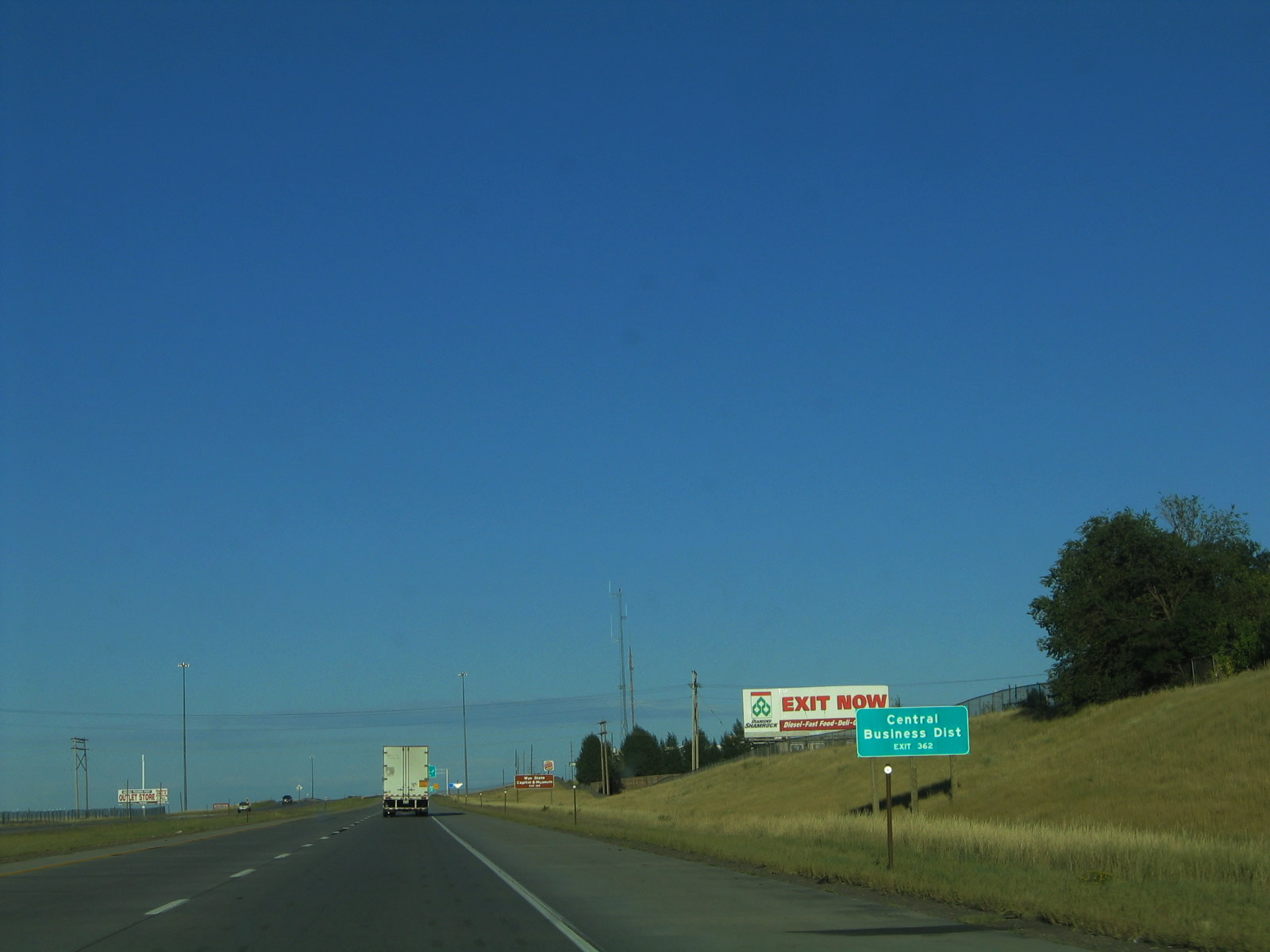
Eastbound Interstate 80 reaches Exit 362, Interstate 180, U.S. 85, Business Loop I-25, and Business U.S. 87 (Central Avenue to the north and Greeley Highway to the south). To the state capitol and museum, follow Interstate 180 north, which changes into Business Loop I-25/U.S. 85-87B after Lincolnway (Junction Business Loop I-80 and U.S. 30). At 24th Street, turn west to the capitol or park at the state museum on Central Avenue. The gold dome of the state capital is visible as part of the city's skyline. Photos taken 08/02/10 and 09/06/05. |
|
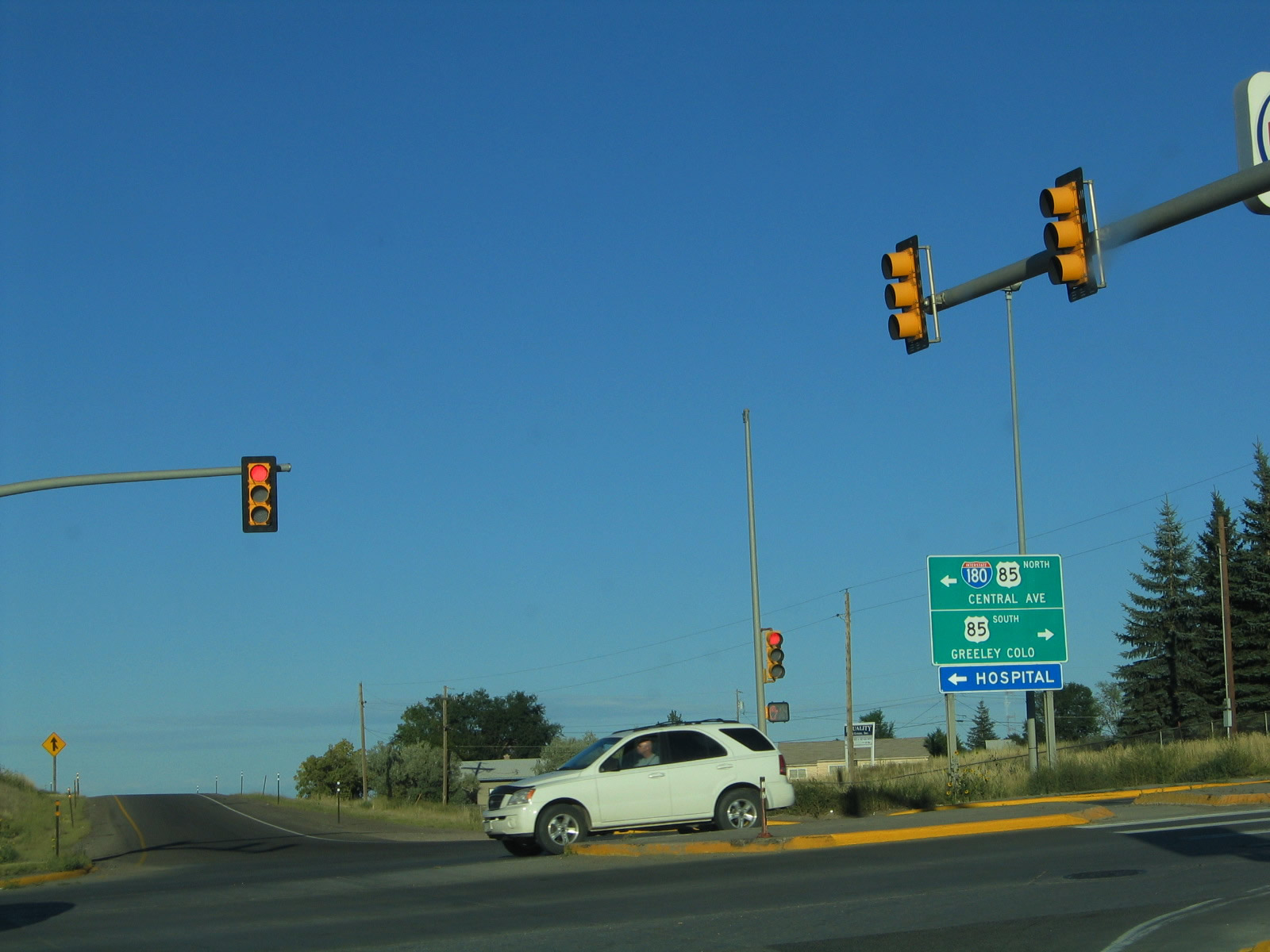
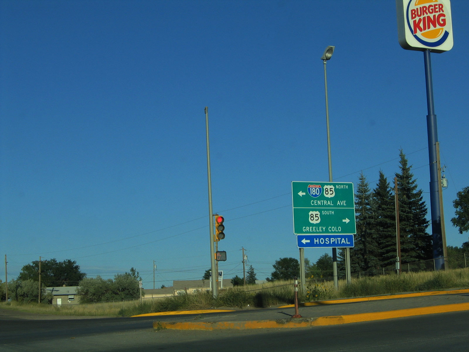
Since the interchange between Interstate 80 and Interstate 180/U.S. 85 is a diamond, traffic signals govern all movements. There is not enough room here to establish a freeway to freeway connection unless houses and/or businesses are removed. Photo taken 09/06/05. |
|
Here is a close-up of the signage for Interstate 180/U.S. 85 north and U.S. 85 south. Note that neither Business Loop I-25 nor Business U.S. 87 are mentioned on any of the advance signs for Central Avenue, even though all four routes are listed on reassurance shields. Photo taken 09/06/05. |
|
This is part of the "transition" from one Interstate highway to another, and it is interrupted by a traffic light. In fact, this interchange is not even a cloverleaf, which at least would have allowed unrestricted access from Interstate 80 to northbound Interstate 180. But it does not matter; Interstate 180 is regulated by five traffic signals between here and its northern terminus at Business Loop I-80 and U.S. 30 (Lincolnway) in downtown Cheyenne. Photo taken 09/06/05. |
|
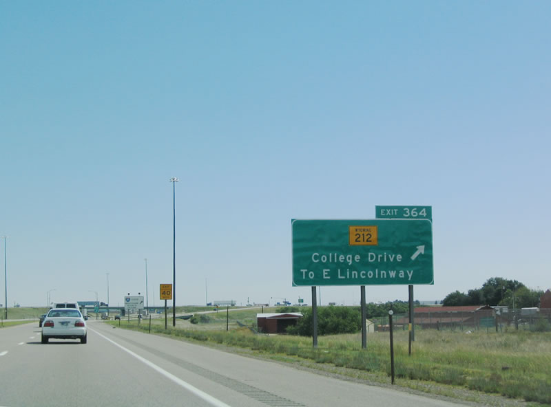
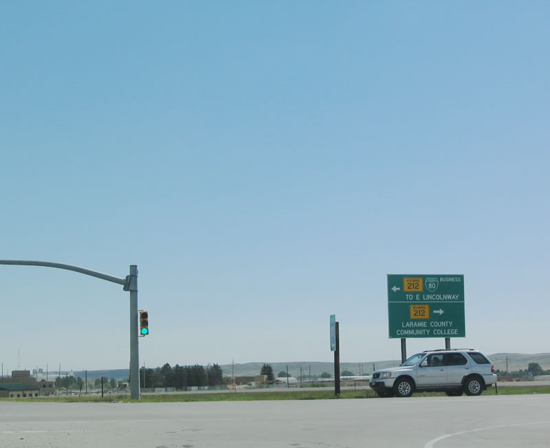
Back on eastbound Interstate 80, the next exit is Exit 364, Junction Business Loop I-80 and Wyoming 212/College Drive. Wyoming 212 serves as a bypass route around Cheyenne. It follows College Drive to the south and east of the city, then connects to Four Mile Road on the north side of town. Photo taken 09/06/05. |
|
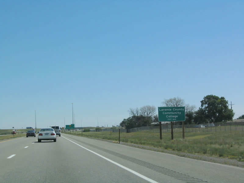
Laramie County Community College is a large two year college located on the southeastern corner of Wyoming 212 (College Drive). Follow Wyoming 212 south to the college. Photo taken 09/06/05. |
|
Eastbound Interstate 80 reaches Exit 364, Wyoming 212 and Business Loop I-80, College Drive. To Lincolnway, follow Wyoming 212 north to U.S. 30. The business loop follows U.S. 30 west into Cheyenne. Photo taken 09/06/05. |
|
At the top of the ramp is this sign for Business Loop I-80 and Wyoming 212, College Drive. Photo taken 09/06/05. |
| Interstate 80 and U.S. 30 east |
|
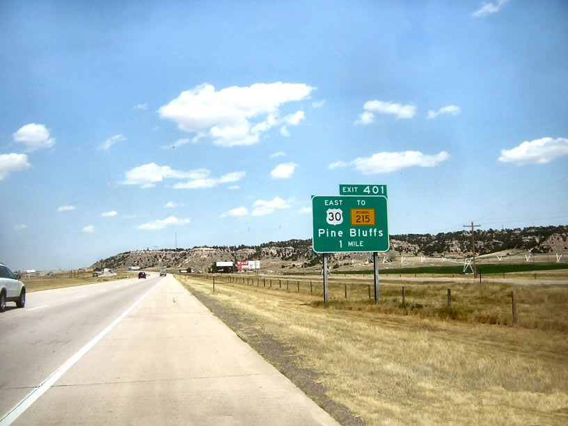
Closing on the Nebraska state line, eastbound Interstate 80 and U.S. 30 approach the small eastern Wyoming town of Pine Bluffs. At Exit 401, the final eastbound exit in Wyoming, Business Loop I-80, Business U.S. 30, and Wyoming 215 depart from the freeway. The business route will share an alignment from Exit 401 to the state line, and Business Loop I-80 will return to Interstate 80 at Exit 1. U.S. 30 departs from Interstate 80 at Exit 1, and it will keep its own alignment east through the Cornhusker State. Photo taken by David Backlin (07/26/07). |
|
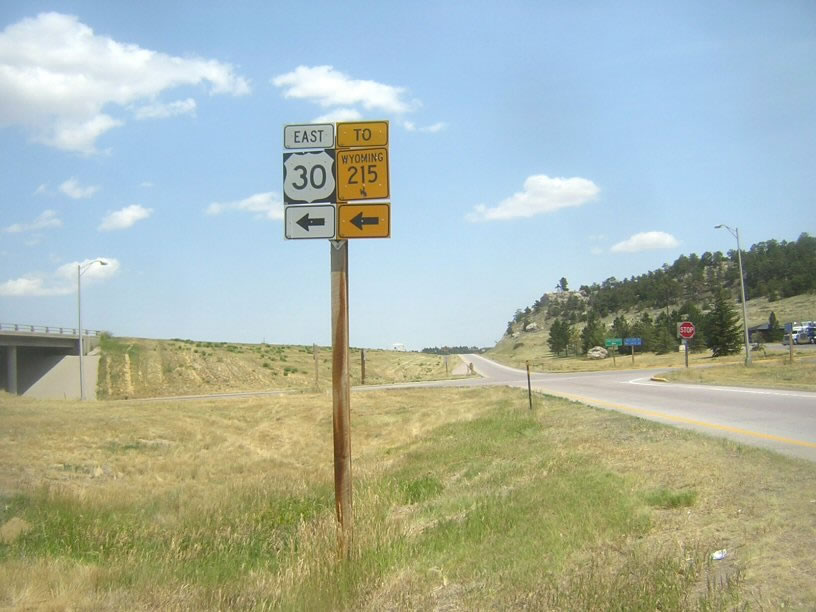
Upon departing the freeway at Exit 401, U.S. 30 and Wyoming 215 make a left turn. To the State of Wyoming Welcome Center, turn right at the stop light. Although not signed here, Business Loop I-80 also turns left at this intersection. Photo taken by David Backlin (07/26/07). |
Page Updated September 14, 2014.