
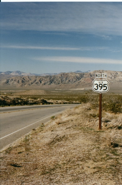
U.S. 395

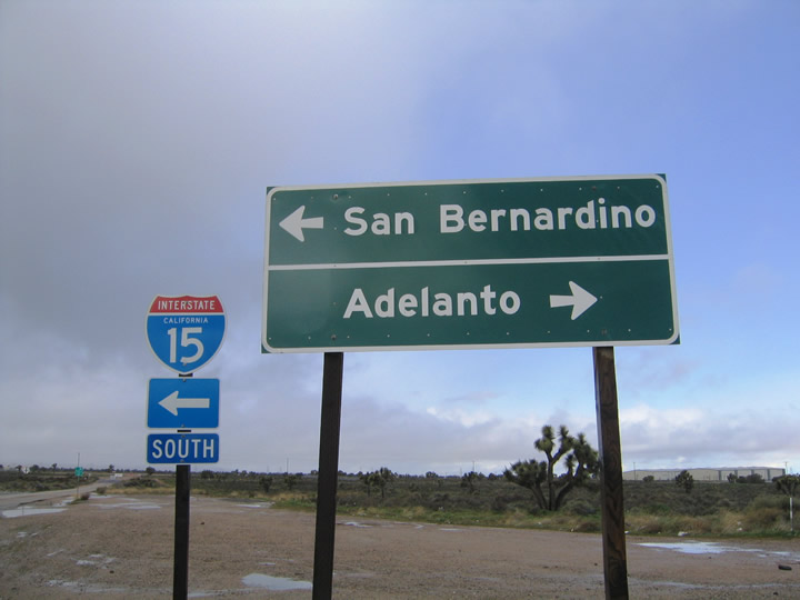
On a rainy afternoon in the Mojave Desert, a rainbow crests in the distance beyond U.S. 395 near Adelanto and the Interstate 15 interchange during a particularly wet winter. - 02/20/2005
U.S. 395 is a major highway that traces the eastern slope of the Sierra Nevada and Cascade Mountains through California and Nevada. U.S. 395 begins at Exit 141 along Interstate 15 in Hesperia and travels north along Three Flags Highway to the Eastern Sierra. The highway enters the state of Nevada to serve Carson City and Reno-Sparks, then reenters California southeast of Hallelujah Junction. Beyond there, U.S. 395 continues north toward Susanville and Alturas, then leads into Oregon and Washington state before reaching the Canadian border.
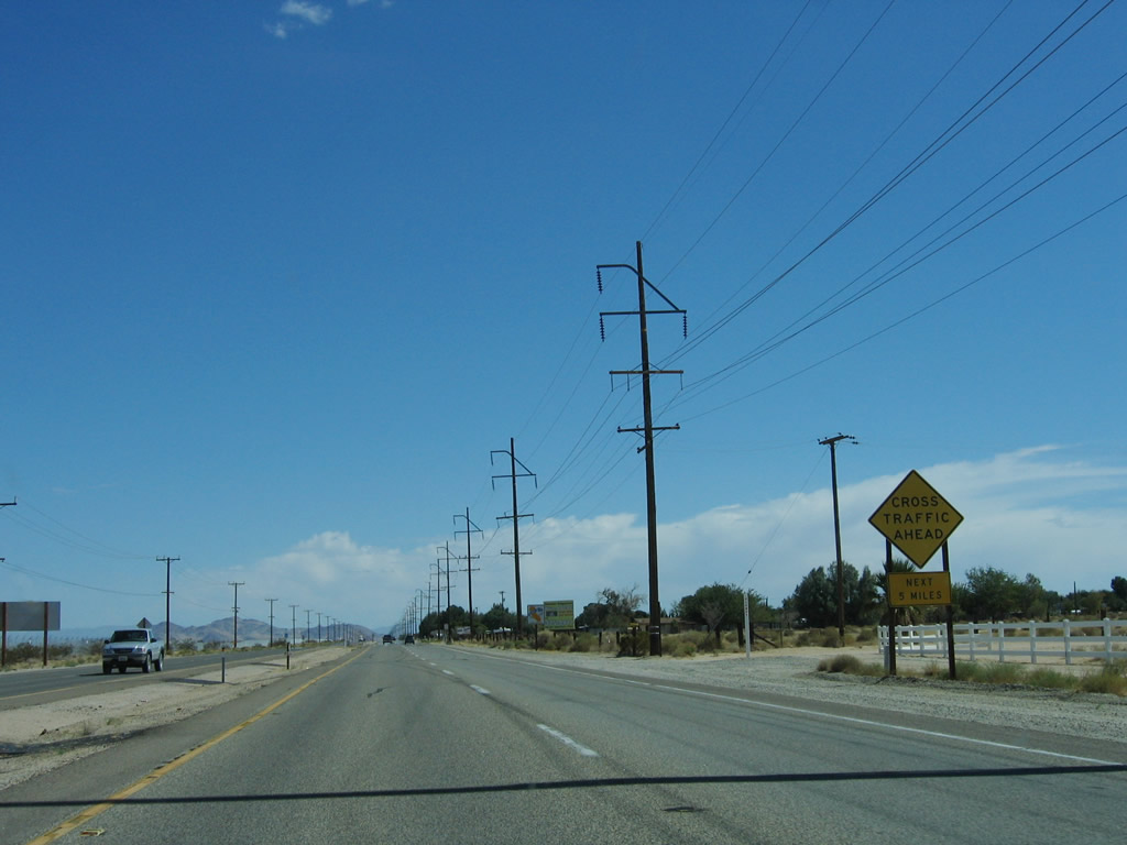
Much of U.S. 395 is only two lanes wide, but increasing traffic demands resulted in expansion of U.S. 395 to four lanes in many areas, especially between SR 14 near Inyokern and SR 203 at the popular resort Mammoth Lakes area.
Business Routes
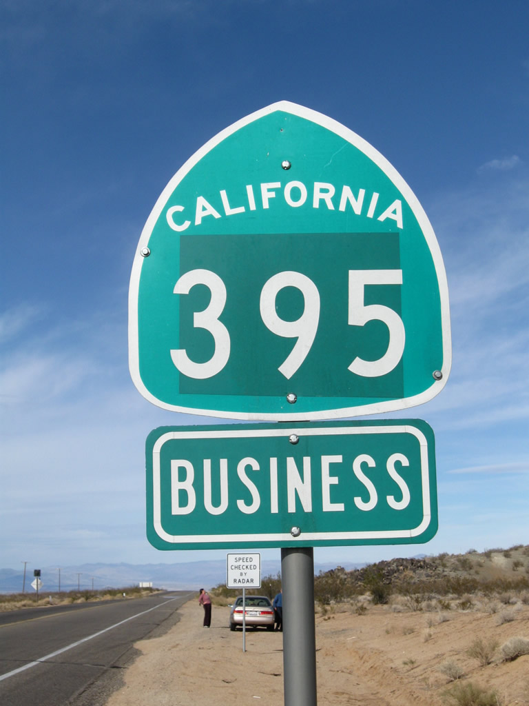
Only one business loop is assigned for U.S. 395, and it connects the highway with the city of Ridgecrest in eastern Kern County. It follows S China Lake Boulevard north into Ridgecrest, then returns west alongside SR 178 to U.S. 395 near Inyokern. AASHTO approved the designation of U.S. 395 Business from an application by the state of California on June 7, 1989.
An old business route through San Bernardino and Colton was created with the construction of a freeway alignment It was eliminated when U.S. 395 was retracted to Adelanto and Hesperia. Former U.S. 395 Business is not a designated business loop of Interstate 215, but the old alignment remains part of the urban street network in those two cities.
U.S. 395 California Guides
North
South
U.S. 395 was originally a route wholly in Washington that was extended south in 1935. It replaced portions of several existing state routes: Former SR 71 from San Diego to Lake Elsinore, SR 74 from Lake Elsinore to Perris, Former SR 18 from Riverside to San Bernardino, SR 95 from Hesperia to Inyokern, and SR 7 from Inyokern north to Bishop. It also overlapped U.S. 66 and U.S. 91 between San Bernardino and Hesperia. U.S. 6 was also extended into California in 1937, making route continuity through the Eastern Sierra.
At its longest, U.S. 395 extended south all the way to San Diego. However, U.S. 395 was replaced by Interstate 15, with most signs being removed south of Hesperia in 1973. The point of truncation was its interchange with Interstate 15 in Hesperia (Exit 141). The route originally started at the intersection of Market Street and 12th Avenue (now Park Boulevard) in downtown San Diego (along a shared segment with U.S. 80). With the construction of Interstate 15 and Interstate 215 through San Diego and the Inland Empire, U.S. 395 was decommissioned in San Diego and Riverside Counties in the 1980s.
In the city of San Diego, U.S. 395 had several alignments:
- The original routing of U.S. 395 (1935-1938) started at the intersection of U.S. 101 (Morena Boulevard) and Linda Vista Road. It then turned northeast along Linda Vista Road, joining the Interstate 15 corridor near Miramar.
- In 1938, U.S. 395 was rerouted again, and this alignment lasted until the opening of the Cabrillo Freeway (current California 163) in 1948. On the 1938-1948 alignment, U.S. 395 started in downtown San Diego, followed U.S. 80 along Market Street, Park Boulevard (including former 12th Avenue), and El Cajon Boulevard to the Fairmount Avenue intersection. From there, U.S. 395 turned north on Fairmount Avenue, crossed the San Diego River via the Ward Road bridge, and followed today's Interstate 15 (former California 103) alignment through Murphy Canyon north to Miramar.
- The Cabrillo Freeway was constructed between 1942 and 1947. By 1948, U.S. 395 was moved to the Cabrillo Freeway (today's California 163) between downtown and Kearny Mesa via Balboa Park, Mission Valley, and Linda Vista. U.S. 395 remained on this alignment until the route was decommissioned in 1973.
We have pages dedicated to the historic U.S. 395 route, including both directions of the route in San Diego County. For a great deal more on Historic U.S. 395 through San Diego, Riverside, and San Bernardino Counties, including the old alignments of the route through San Diego, Riverside, and San Bernardino Counties, visit Three Flags Highway (U.S. 395) by Cameron Kaiser.
Lake Hodges Bridge
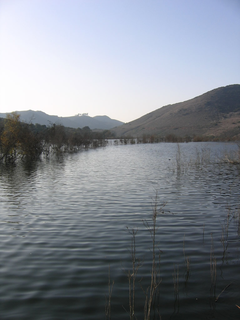
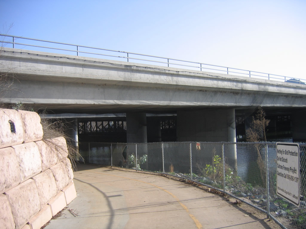
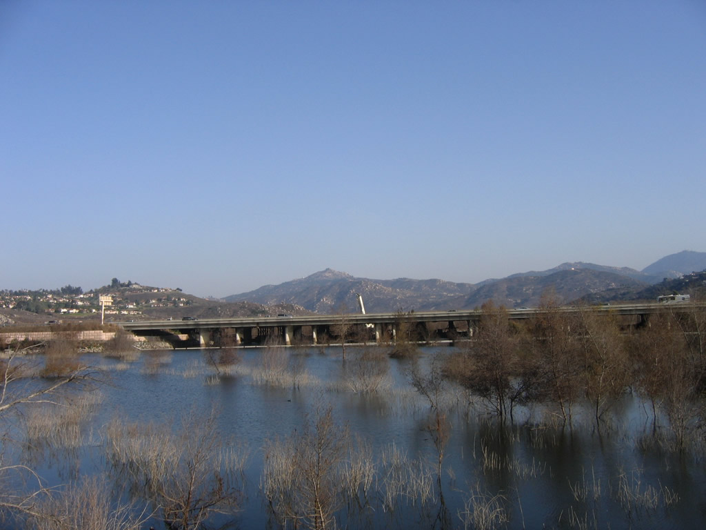
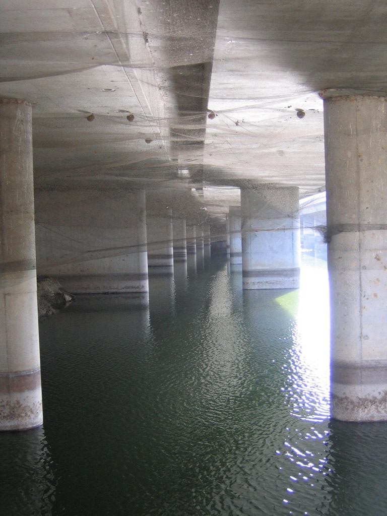
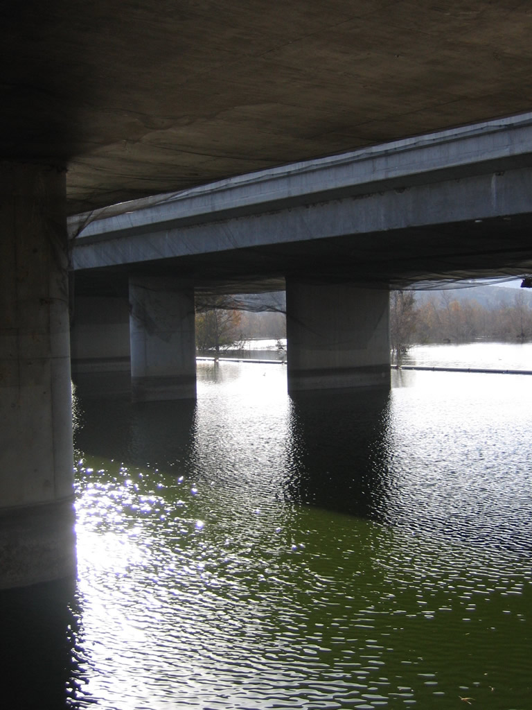
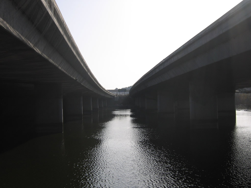
This series of photos from January 8, 2006 shows the Interstate 15 bridge over Lake Hodges, which was under construction to incorporate the Managed Express Lanes at the time this pictures were taken. The first crossing over Lake Hodges was built in 1919, which eventually became part of California 71 and then U.S. 395. With growth in suburban areas north of San Diego, the span was replaced with a more direct bridge in the late 1960s as part of U.S. 395, and again replaced with the current structure in 1981 as I-15 was finished in San Diego County. Expansion activities were completed in 2009 with the new bridge carrying the managed express lanes.
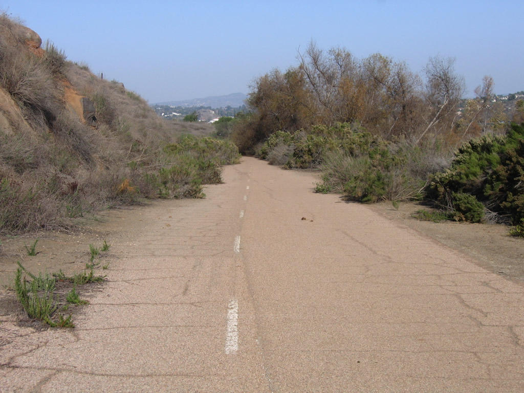
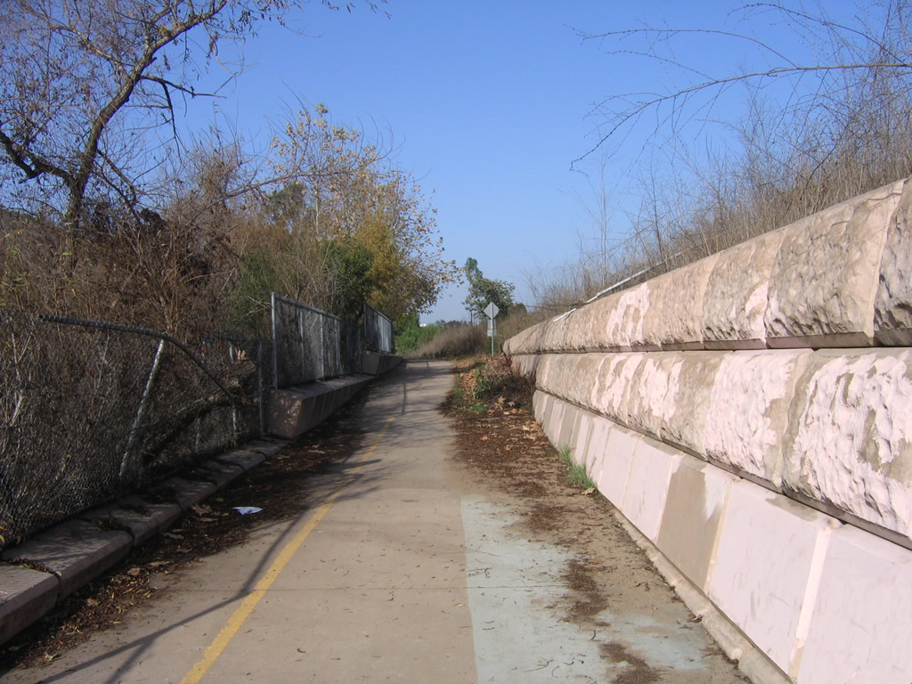
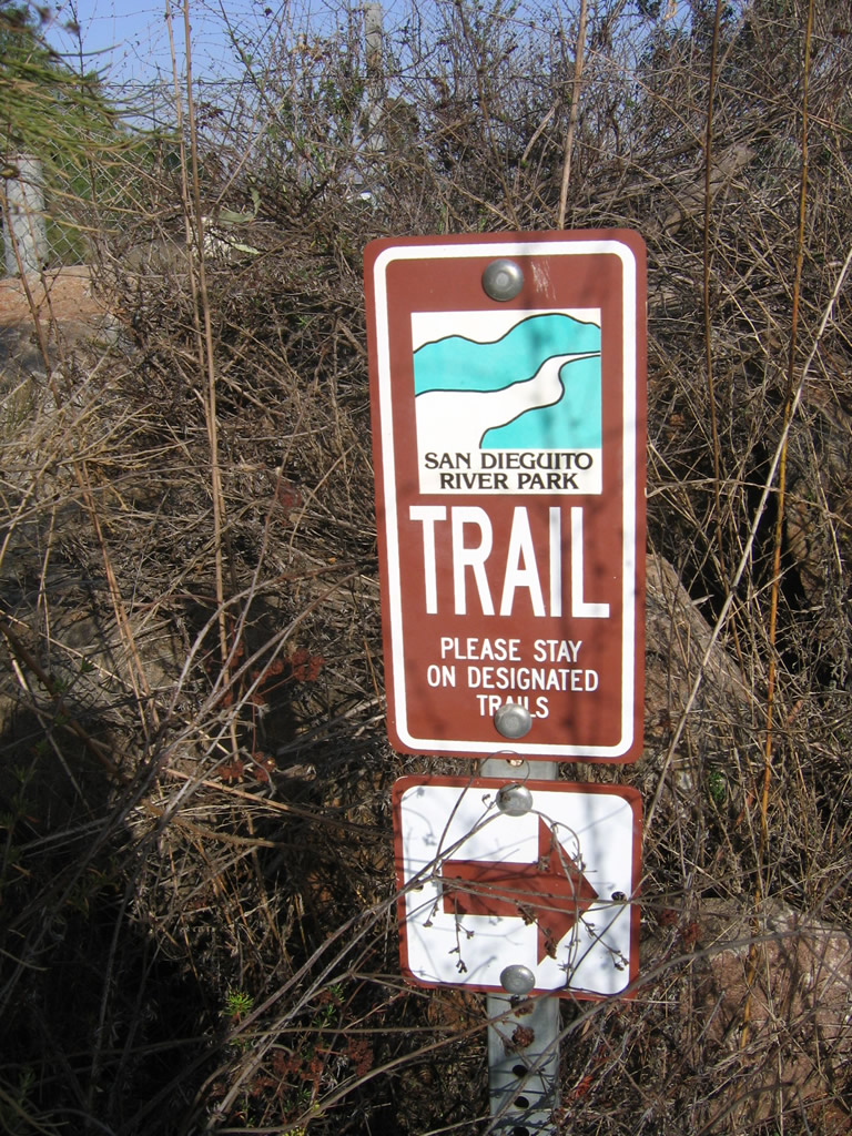
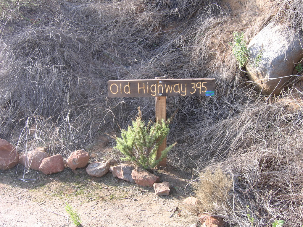
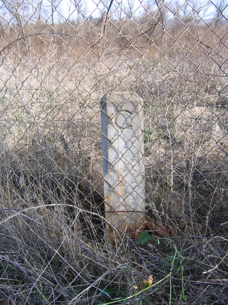
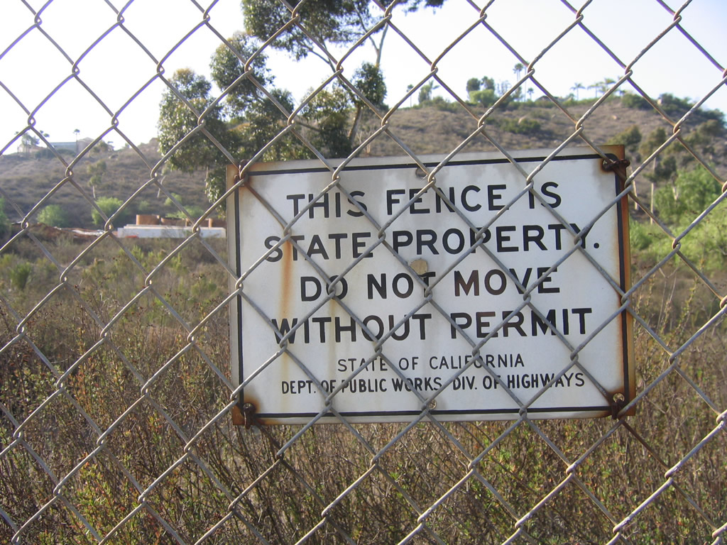
A C Block monument is located on a right of way on the east side of Interstate 15 to the north of Lake Hodges near a bicycle/pedestrian path; it was placed back when this road was U.S. 395 ... or possibly old California 71. An extant section of Old U.S. 395 was converted to a bicycle and pedestrian path. This path includes a connection to a 2009-built Lake Hodges Bridge
U.S. 395 Expansion
The following list provides the opening dates for the various segments of modern U.S. 395 between Hesperia and the Nevada state line near Topaz Lake (based on information provided by C.J. Moon). Note that widening of U.S. 395 to four lanes in and around Independence was still underway in September 2009:
- Interstate 15 Separation to Phelan Road/Main Street - Circa 1955 (widened March 16th, 2000)
- Phelan Road/Main Street to Airbase Road - Circa 1955
- Airbase to Adelanto - Circa 1955 (widened September 17th, 1976)
- Adelanto to Crippen Avenue - Circa 1955
- Crippen Avenue to El Mirage Road - Circa 1955 (widened June 17th, 1997)
- El Mirage Road to 2 miles north of Kramer Hills - Circa 1955
- 2.00 miles north of Kramer Hills to 2.00 miles south of California 58 - Circa 1955 (widened August 16th, 1977)
- 2.00 miles south of California 58 to 0.10 mile south of California 58 - Circa 1955
- 0.10 mile south of California 58 to Beecher Railroad Crossing - Circa 1955 (widened September 29th, 1976)
- Beecher Railroad Crossing to San Bernardino and Kern Counties Line - Circa 1955
- San Bernardino and Kern Counties Line to Johannesburg - Circa 1955 (widened May 25th, 1979)
- Johannesburg to one-half mile north of Johannesburg - Circa 1955
- 0.50 mile north of Johannesburg to 1.50 mile south of GX-Rand Railroad Crossing - Circa 1955 (widened January 18th, 1978)
- 1.50 mile south of GX-Rand Railroad Crossing to Garlock Road - Circa 1955
- Garlock Road to 0.20 mile north of Garlock Road - Circa 1955 (widened May 25th, 1979)
- 0.20 mile north of Garlock Road to 0.50 mile south of China Lake Road - Circa 1955
- China Lake Road to Brown Road Overhead - November 3rd, 1966
- Brown Road overhead to 0.50 mile north of Brown Road - Circa 1955 (widened November 3rd 1966)
- 0.50 mile north of Brown Road to California 14 - Circa 1955 (widened May 2nd, 1994)
- California 14 to Kern and Inyo County Line - Circa 1947 (widened May 2nd, 1994)
- Kern and Inyo County Line to SIX-85- X 54- CMPA - December 23rd, 1970
- SIX-85- X 54- CMPA to 1.00 mile north of GX-Narka Springs south Railroad Crossing - December 23rd, 1970 (widened October 31st, 1991)
- 1.00 mile north of GX-Narka Springs south Railroad to 1.50 mile north of GX-Narka Springs north Railroad Crossing - December 23rd, 1970
- 1.50 miles north of GX-Narka Springs north Railroad Crossing to 0.50 mile north of Coso Junction - August 19th, 1971
- 0.50 mile north of Coso Junction to 2.00 miles north of Los Angeles Aqueduct - July 11th, 1984
- 2.00 miles north of Los Angeles Aqueduct to 3.33 miles south of California 190 - Circa 1953 (widened June 19th, 1987)
- 3.33 miles south of California 190 to 0.10 mile south of Los Angeles Aqueduct - Circa 1953 (widened December 22nd, 1993)
- 0.10 mile south of Los Angeles Aqueduct to 1.00 mile north of Cottonwood Creek Bridge - Circa 1953
- 1.00 mile north of Cottonwood Creek Bridge to 4.00 miles north of Cottonwood Power House Road - Circa 1953 (widened March 16th, 1992)
- 4.00 miles north of Cottonwood Power House Road to 6.00 miles north of Cottonwood Power House Road - Circa 1953 (widened September 13th, 1984)
- 6.00 miles north of Cottonwood Power House to 1.00 mile south of California 136 - Circa 1953 (widened March 16th, 1992)
- One mile south of California 136 to California 136 - Circa 1953
- California 136 to 1/10 mile north of California 136 - Circa 1953 (widened October 12th, 1971)
- 0.10 mile north of California 136 to 1.00 mile north of California 136 - Circa 1953
- 1.00 mile north of California 136 to 0.10 mile south of Los Angeles Aqueduct - Circa 1953 (widened September 27th, 1999)
- 0.10 mile south of Los Angeles Aqueduct to Thibaut Creek Concrete Pipe - Circa 1948
- Thibaut Creek Concrete Pipe to Aberdeen Road - October 18th, 1966
- Aberdeen Road to Big Pine - Circa 1948
- Big Pine to California 168 East - Circa 1948 (widened September 28th, 1972)
- California 168 east to 1.00 mile north of California 168 east - Circa 1948 (widened December 5th, 1978)
- 1.00 mile north of California 168 east to 3.00 miles south of Sunland Drive - Circa 1948 (widened July 11th, 1986)
- 3.00 miles south of Sunland Drive to 0.50 mile south of Via Main Street - Circa 1948 (widened June 23rd, 1982
- 0.50 mile south of Via Main Street to Via Main Street - Circa 1948 (widened December 26th, 1979
- Via Main Street to South Street - Circa 1948 (widened December 3rd, 1979)
- South Street to West Elm Street - Circa 1948
- West Elm Street to U.S. 6 east - Circa 1948 (widened April 4th, 1979)
- U.S. 6 east to 1.00 mile north of Wye Road - Circa 1948 (widened October 18th, 1979)
- 1.00 mile north of Wye Road to Brockman Lane - Circa 1948 (widened June 17th, 1971)
- Brockman Lane to Ed Power Road - Circa 1948 (widened October 13th, 1975)
- Ed Power Road to Inyo/Mono County Line - October 13th, 1975
- Inyo/Mono County Line to Vista Point - August 5th, 1974
- Vista Point to 0.25 mile north of Sherwin Summit - Circa 1948
- 0.25 mile north of Sherwin Summit to 0.25 mile south of Rock Creek Road - July 27th, 1970 (widened August 18th, 1977)
- 0.25 mile south of Rock Creek Road to 2.50 mile north of McGee Creek Road - July 27th, 1970
- 2.50 mile north of McGee Creek Road to 1.00 mile north of California 203 - Circa 1948 (widened October 9th, 1969)
- 1.00 mile north of California 203 to 0.50 mile south of Crestview - Circa 1948 (widened August 14th, 1991)
- 0.50 mile south of Crestview to 0.25 mile south of Deadman Summit - Circa 1948 (widened October 17th, 1988)
- 0.25 mile south of Deadman Summit to 1.50 mile south of Truck Pull Out - Circa 1948 (widened November 25th, 1980)
- 1.50 mile south of Truck Pull Out to End of Truck Pull Out - November 25th, 1980
- End of Truck Pull Out to south California 158 - Circa 1948 (widened November 25th, 1980)
- California 158 to 0.25 mile north of LADWP Aqueduct - June 10th, 1997
- 0.25 mile north of LADWP Aqueduct to Old California 120 West - Circa 1936
- Old California 120 West to 0.10 mile north of Old California 120 West - Circa 1936 (widened August 5th, 1964)
- 0.10 mile north of Old California 120 West to 1.33 miles north of Lee Vining - Circa 1936 (widened October 11th, 1986)
- 1.33 miles north of Lee Vining to 3.50 miles north of Lee Vining - Circa 1936
- 3.50 miles north of Lee Vining to 0.20 mile south of California 167 - Circa 1936 (widened August 13th, 1993
- 0.20 mile south of California 167 to Conway Maintenance Station - Circa 1936
- Conway Maintenance Station to Chain Off/On Area - Circa 1936 (widened November 16th, 1993)
- Chain Off/On Area to 1.50 miles south of California 270 - Circa 1936 (widened August 26th, 1977)
- 1.50 miles south of California 270 to California 182 - Circa 1936
- California 182 to Bridgeport - Circa 1961
- Bridgeport to Rickey Ditch Overflow - Circa 1934 (widened December 21st, 1992)
- Rickey Ditch Overflow to South Bridge Buckeye Creek - Circa 1934
- South Bridge Buckeye Creek to North Bridge Buckeye Creek - Circa 1934 (widened December 21st, 1992)
- North Bridge Buckeye Creek to 6.00 miles north of north Bridge Buckeye Creek - Circa 1934
- 6.00 miles north of north Bridge Buckeye Creek to 0.75 mile south of Swauger Creek Road - Circa 1934 (widened October 7th, 1968)
- 0.75 mile south of Swauger Creek Road to 0.40 mile north of Devils Gate - Circa 1934 (widened September 22nd, 1978)
- 0.40 mile north of Devils Gate to 2.00 miles north of Sonora Maintenance Station - Circa 1934
- 2 miles north of Sonora Maintenance Station to 0.25 mile north of West Walker River - Circa 1934 (widened August 29th, 1988)
- 0.25 mile north of West Walker River to 0.25 mile south of Boot leg CG - Circa 1934 (widened September 27th, 1973)
- 0.25 mile south of Boot leg CG to 0.25 mile north of Boot leg CG - Circa 1934
- 0.25 mile north of Boot leg CG to 1.50 mile north of Boot leg CG - Circa 1934 (widened November 10th, 1987)
- 1.50 mile north of Boot leg CG to 4 miles north of Bootleg CG - Circa 1934
- 4 miles north of Bootleg CG to 4.50 miles north of Bootleg CG - Circa 1934 (widened June 10th, 1975)
- 4.50 miles north of Bootleg CG to 0.75 mile south of Mill Creek Bridge - Circa 1934
- 0.75 mile south of Mill Creek Bridge to 0.50 mile north of Mill Creek Bridge - Circa 1934 (widened July 2nd, 1996)
- 0.50 mile north of Mill Creek Bridge to 2.33 miles north of Antelope Valley - Circa 1934
- 2.33 miles north of Antelope Valley to 0.33 mile north of Coleville - Circa 1934 (widened December 17th, 1997)
- 0.33 mile north of Coleville to 0.50 mile north of Coleville - Circa 1934
- 0.50 mile north of Coleville to 1.67 milea north of Coleville - Circa 1934 (widened December 10th, 1976)
- 1.67 miles north of Coleville to 2.33 miles California 89 west - October 16th, 1980
- 2.33 miles California 89 west to California-Nevada state line - Circa 1934
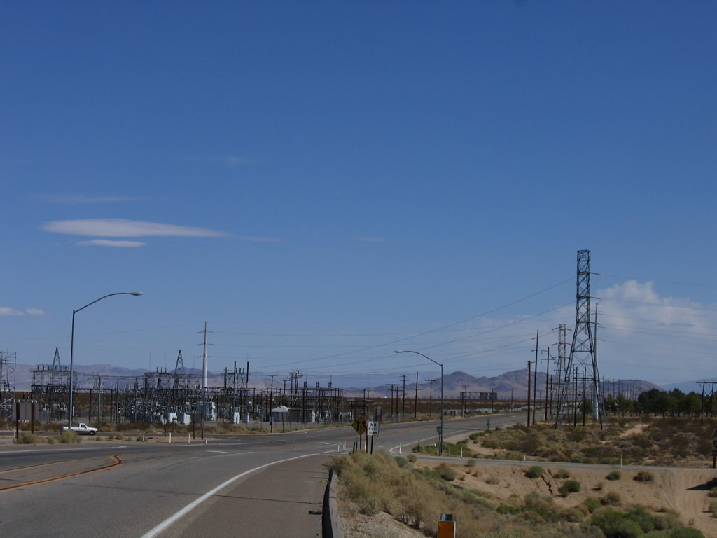
 China Lake Boulevard - North
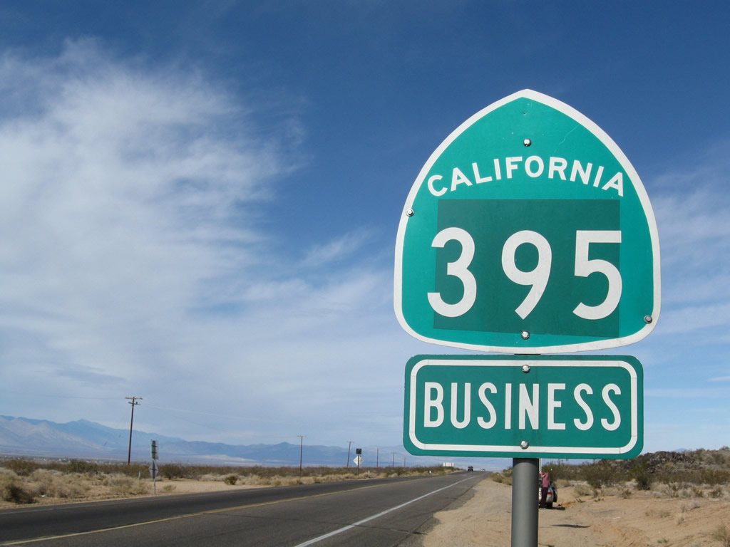
The first reassurance shield for U.S. 395 Business north is an erroneous state route marker. The business route is locally maintained on the north-south leg and part of SR 178 on the east-west leg. Overall U.S. 395 Business is well-signed.
11/10/08

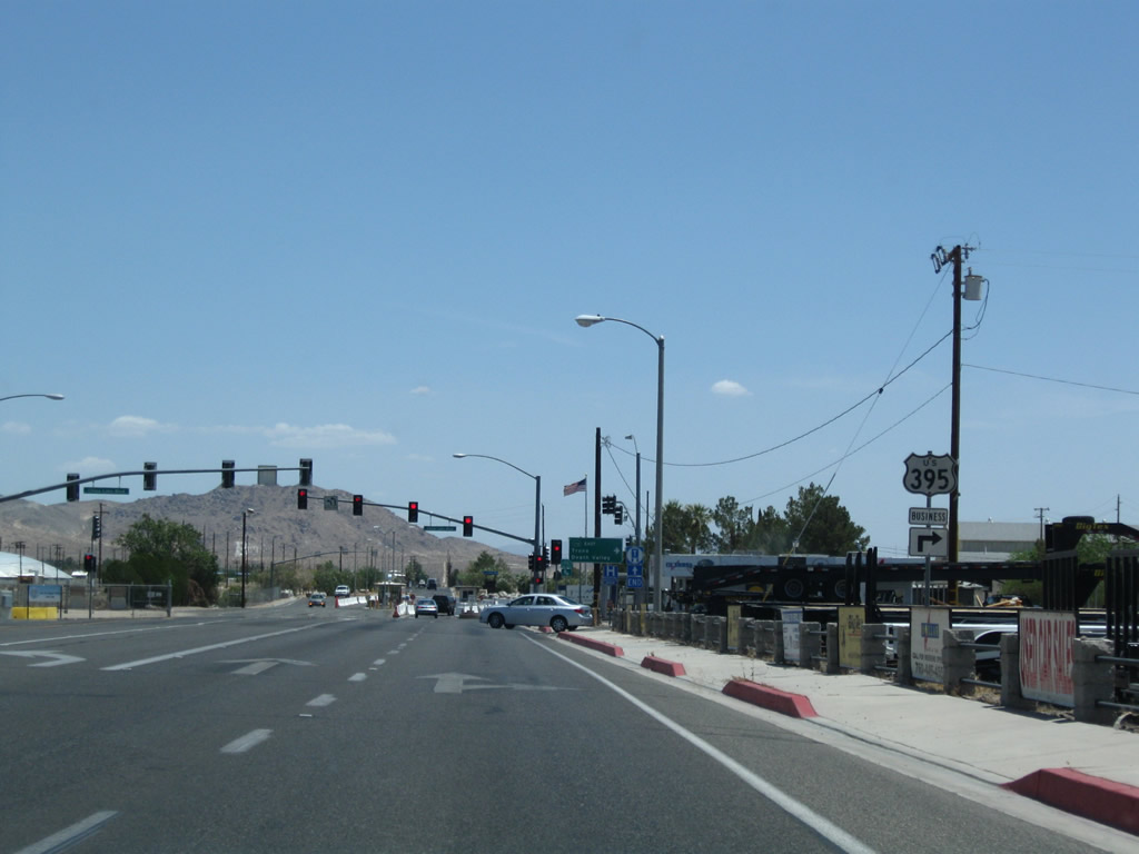
Northbound U.S. 395 Business meets its junction with SR 178 in Ridgecrest. U.S. 395 avoids Ridgecrest, but U.S. 395 Business connects to the city via a county route from U.S. 395 north to SR 178 and via SR 178 from downtown Ridgecrest west to U.S. 395. This business route was shown on Rand McNally maps in the late 1990s, but it has disappeared from those maps even though the signage remains. There are at least two erroneous SR 395 Business shield assemblies along the county-maintained (north-south) portion of the highway.
01/20/02
South  East
East
A two lane bridge carries SR 178 over the two lane U.S. 395 freeway.
10/08/06
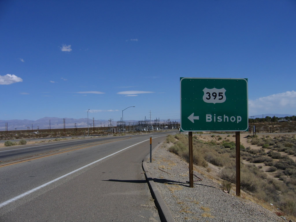
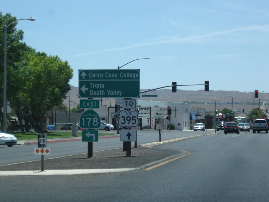
The next left connects eastbound SR 178 with U.S. 395 north to Bishop. Ahead, SR 178 and U.S. 395 Business motor east toward China Lake and Ridgecrest.
10/08/06
This view looks east along SR 178 and U.S. 395 Business toward the power substation. There are no motorist services at this interchange; one must travel east into Ridgecrest or west to Inyokern.
10/08/06
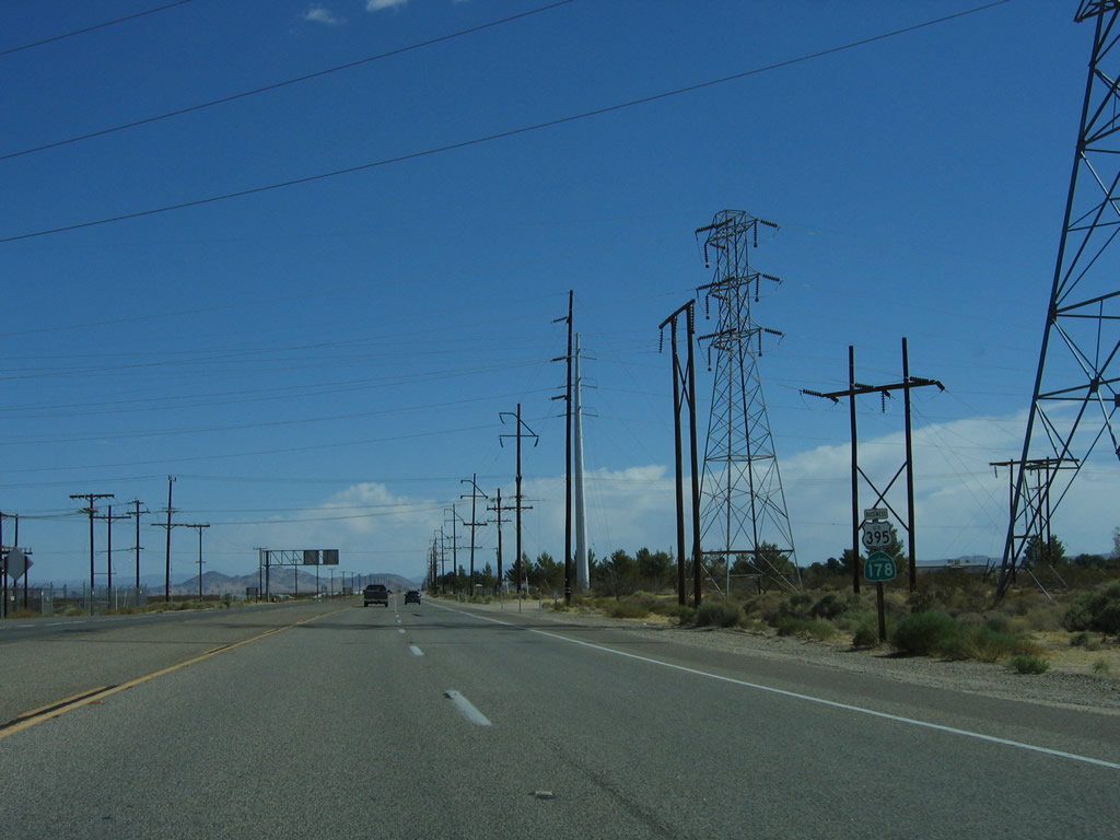
SR 178 east and U.S. 395 Business south confirming markers posted near a power substation ahead of China Lake.
10/08/06
A bevy of power lines criss-cross SR 178 and U.S. 395 Business east of the U.S. 395 interchange.
10/08/06
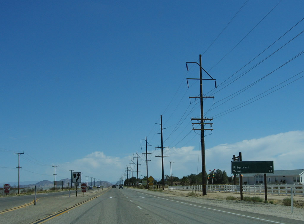
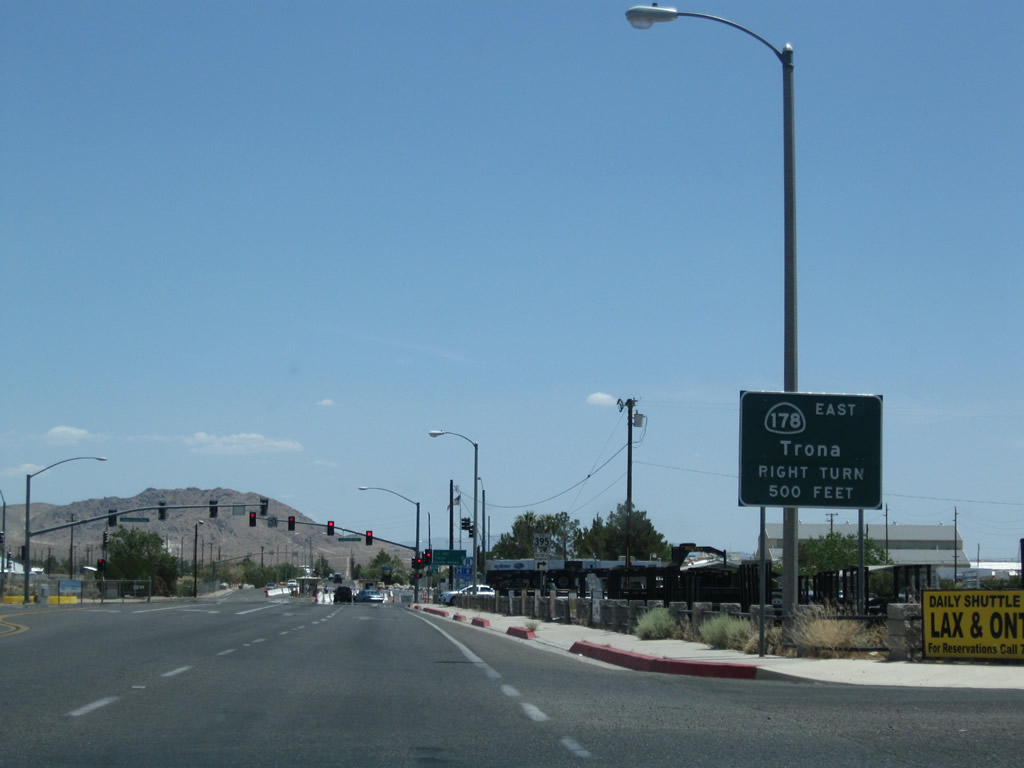
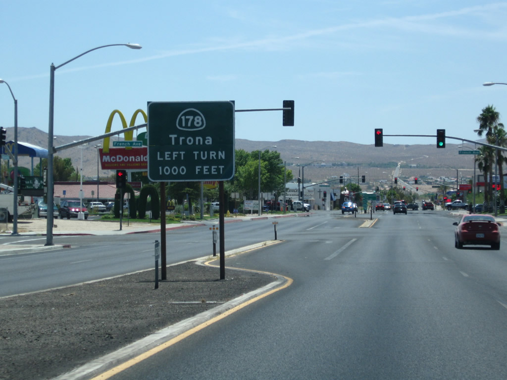
A distance sign along SR 178 east and U.S. 395 Business south provides the distance to Ridgecrest (9 miles) and Trona (34 miles).
10/08/06
SR 178 and U.S. 395 Business carry four lanes east en route to Ridgecrest. This route is at expressway standards with intersections evenly spaced and a 65 mile per hour speed limit.
10/08/06

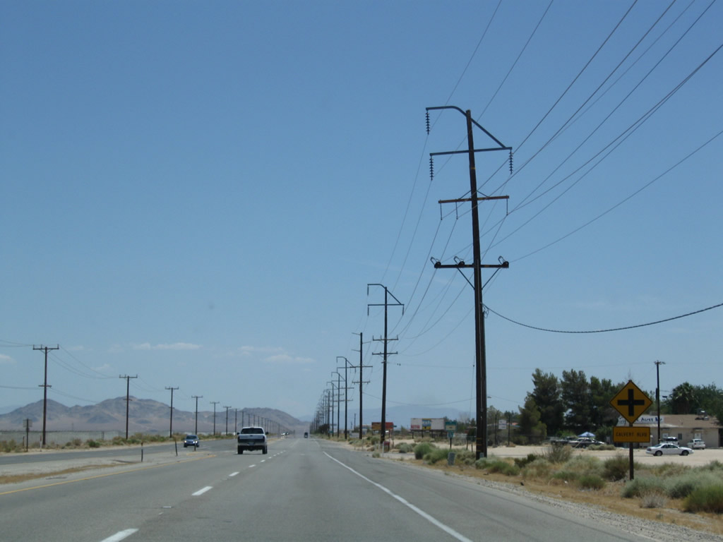
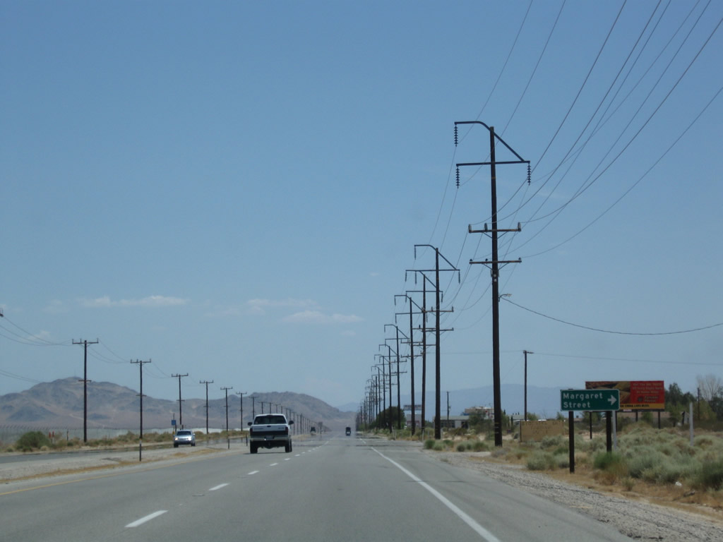
Eastbound SR 178 and U.S. 395 Business (Inyokern Road) approach and pass by several intersections, including Saguaro Street, Calvert Boulevard, Margaret Street, and Jacks Valley Road.
07/26/09
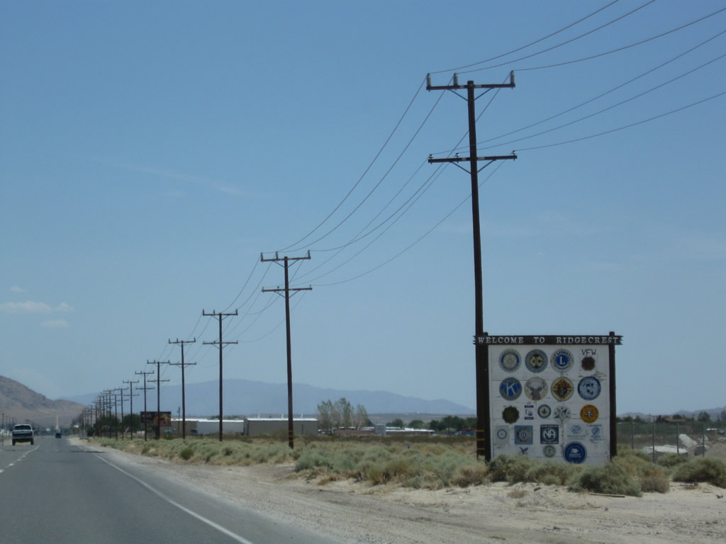
Eastbound SR 178 and U.S. 395 Business enter the city of Ridgecrest, nestled in the sprawling Indian Wells Valley. Incorporated on November 29, 1963, Ridgecrest was originally known as Crumville and sits at an elevation of 2,290 feet. The city had a population of 24,927 people as of the 2000 Census. With its high desert location, summers are hot and winters are cool; precipitation is uncommon through much of the year. One of the main employers of the region is the Naval Air Weapons Station China Lake.
07/26/09
A U.S. 395 Business reassurance shield is posted after the Downs Street intersection. No companion SR 178 shield is posted here.
07/26/09
Eastbound SR 178 and southbound U.S. 395 Business approach Norma Street (next traffic signal) in Ridgecrest.
07/26/09
Coming close to the entrance to Naval Air Weapons Station China Lake, SR 178 and U.S. 395 Business will turn south onto China Lake Boulevard.
07/26/09
A separate U.S. 395 Business trailblazer is posted after the initial SR 178 guide sign. All non-military traffic must turn right; continue straight ahead into the naval base guard station.
07/26/09
U.S. 395 Business and SR 178 turn right (south) onto China Lake Boulevard, leaving Inyokern Road behind.
07/26/09
Following China Lake Boulevard southbound, motorists see a SR 178 reassurance shield. Omitted is U.S. 395 Business.
07/26/09
SR 178 and U.S. 395 Business split at the Ridgecrest Boulevard and China Lake Boulevard intersection. This sign is posted in the median of China Lake Boulevard southbound prior to French Avenue three blocks north of Ridgecrest Boulevard.
07/26/09
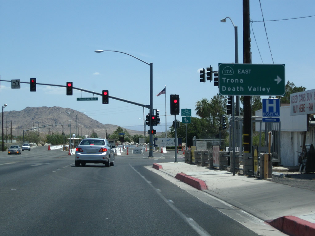
A pair of trailblazers are posted between French Avenue and Ridgecrest Boulevard. Turn left for the continuation of SR 178 east to Trona and Death Valley; continue straight to follow U.S. 395 Business (China Lake Boulevard) to return to U.S. 395 south to San Bernardino. The remainder of the business route is maintained by the city of Ridgecrest and Kern County.
07/26/09
China Lake Boulevard - South
U.S. 395 Business reassurance shield (erroneously showing SR 395 Business) located along southbound China Lake Boulevard as the business route leaves the city of Ridgecrest.
07/26/09
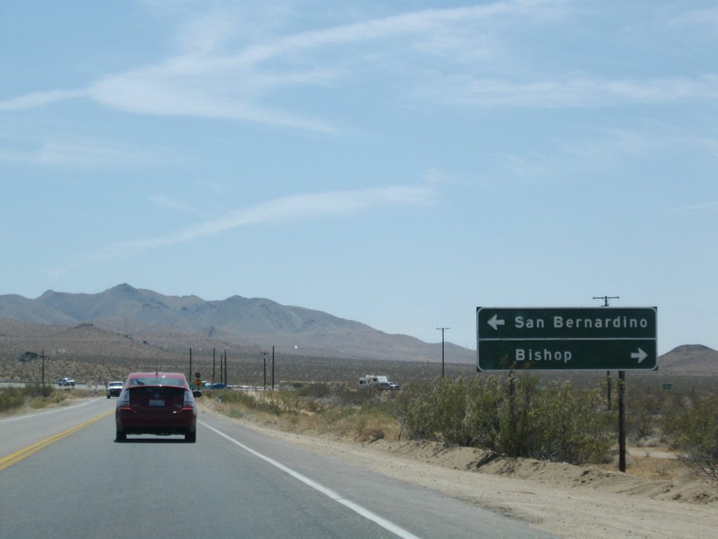
U.S. 395 Business approaches U.S. 395 southwest of Ridgecrest. Turn left for U.S. 395 south to San Bernardino and San Diego; turn right for U.S. 395 north to Bishop and Reno.
07/26/09
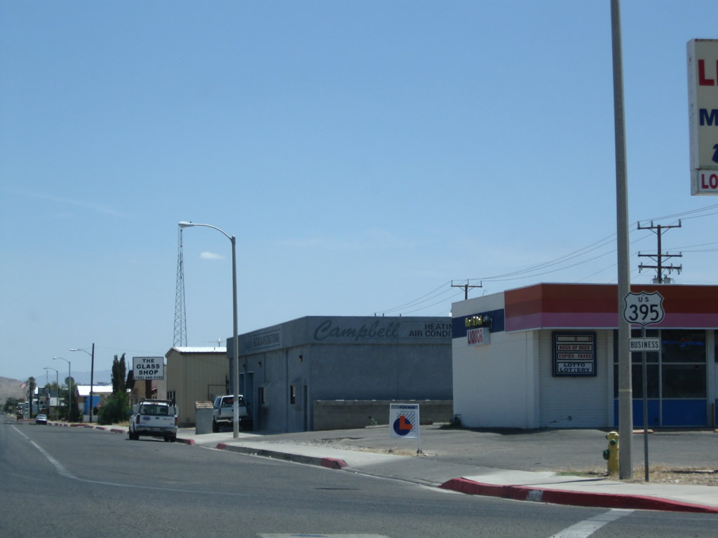
Southbound U.S. 395 Business (China Lake Boulevard) ends at its junction with U.S. 395. Continue straight ahead to follow Brown Road (Old U.S. 395) northwest to Inyokern.
07/26/09
 scenes
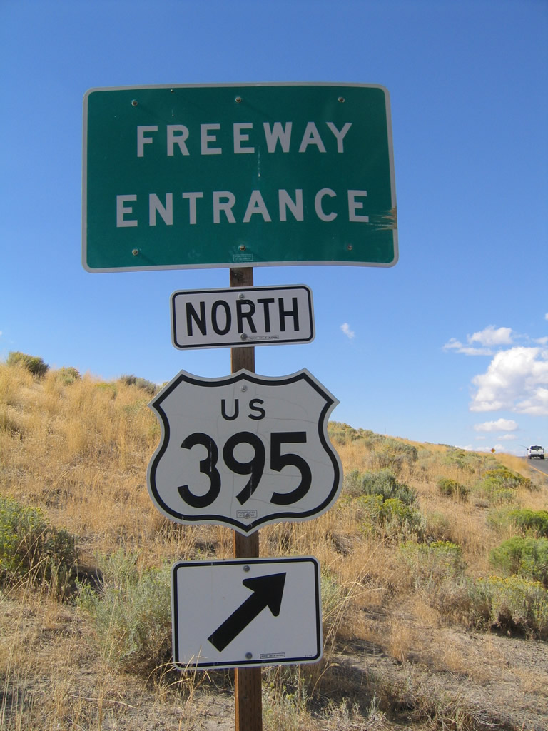
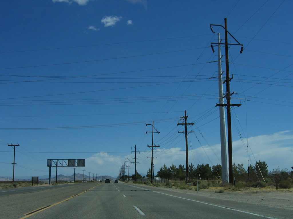
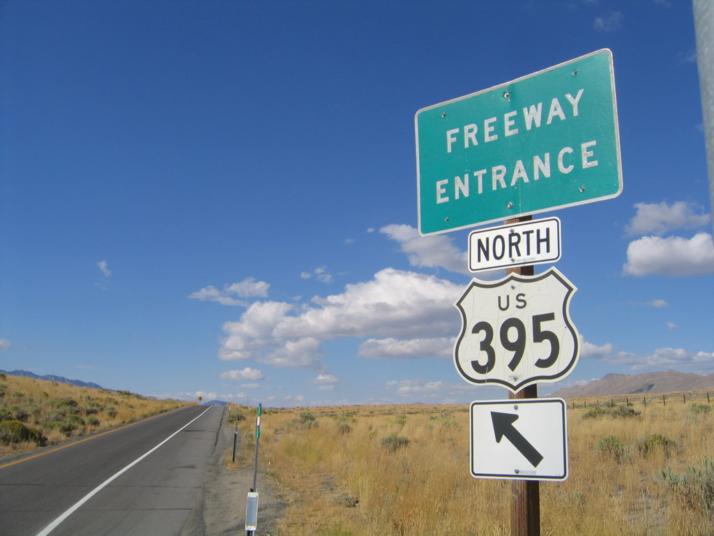
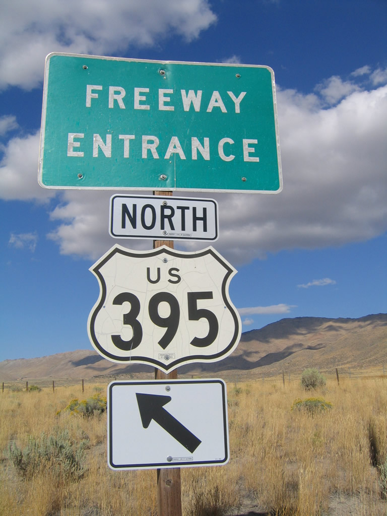
Freeway entrance assembly for U.S. 395 north from SR 70 north at Hallelujah Junction.
09/09/05
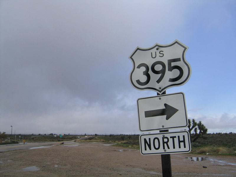
U.S. 395 begins from a wye interchange with Interstate 15 north in the city of Hesperia. A half diamond interchange connects I-15 south with U.S. 395 north via Joshua Street west.
02/20/05
Eastbound Joshua Street meets U.S. 395 in Hesperia. To the right is the southbound on-ramp to Interstate 15 toward San Bernardino. Straight ahead is the U.S. 395 northbound connection to Interstate 15 via a half diamond interchange at Joshua Street.
02/20/05
Motorists continuing east on Joshua Street cross over Interstate 15 ahead of the northbound on-ramp to Victorville and Barstow.
02/20/05
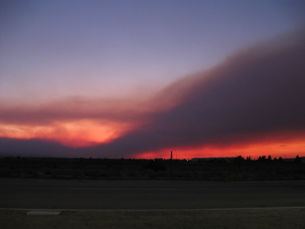
Near the intersection with Joshua Street, this view looks west across U.S. 395 toward the San Gabriel Mountains and the smoke caused by treacherous Station Fire of 2009. This blaze, which began on August 26, 2009, consumed large sections of Angeles National Forest (160,577 acres). The fire was contained on October 16, 2009.
09/04/09
Typical landscape found along northbound U.S. 395 through the eastern Sierra Nevada.
2000

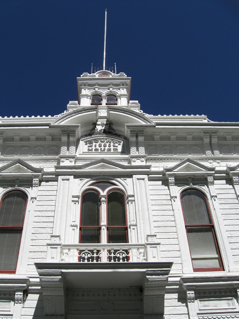
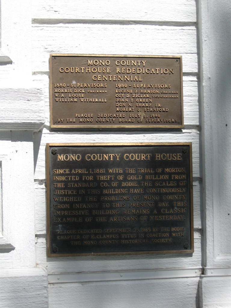
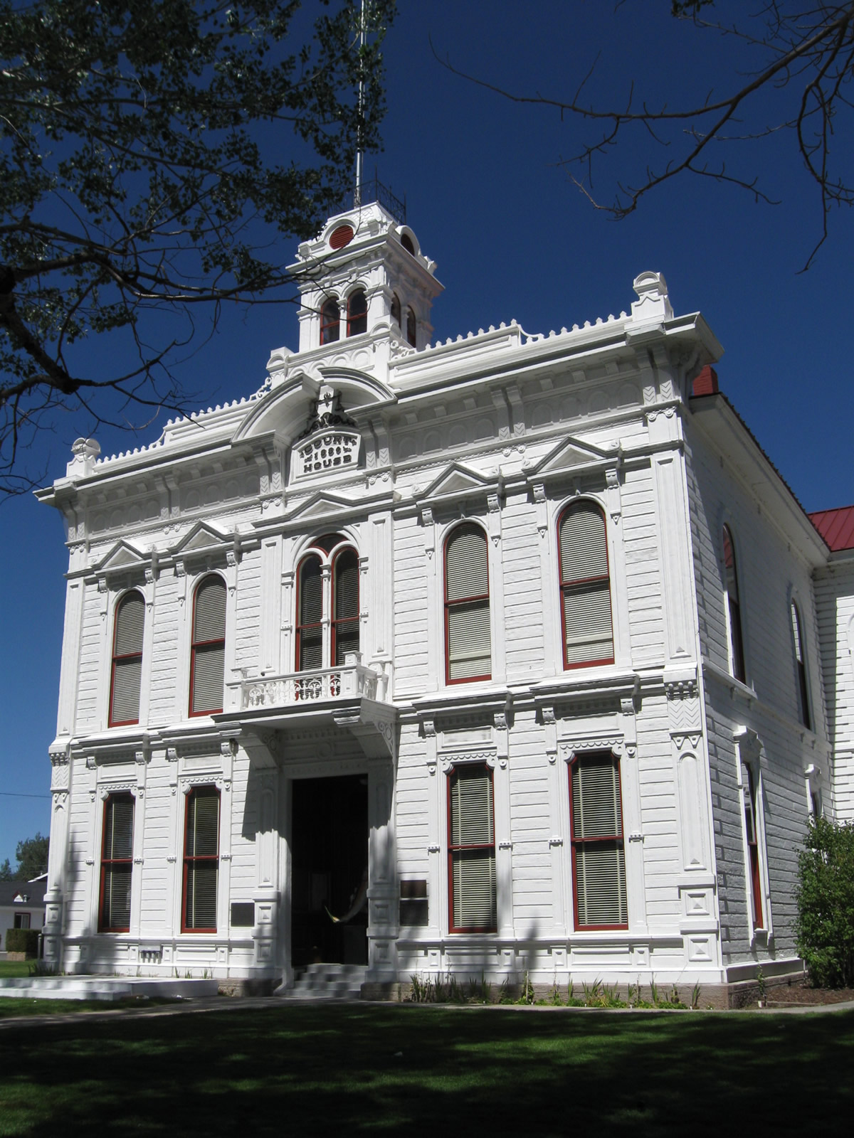
The historic Mono County Courthouse, located north of U.S. 395 in Bridgeport. A ceremonial plaque provides a brief history of this old building.
09/07/09
Photo Credits:
- Andy Field: 01/20/02, 09/09/05, 10/08/06, 11/10/08, 07/26/09, 09/04/09, 09/07/09
- AARoads: 09/09/05, 11/10/08
- Alex Nitzman, Justin Cozart: 02/20/05
- Jeff Royston: 2000
Connect with:
Page Updated Thursday February 21, 2013.