
Various entry monuments, arches, and other signage unique to the San Diego experience
Black Mountain Ranch – Santaluz
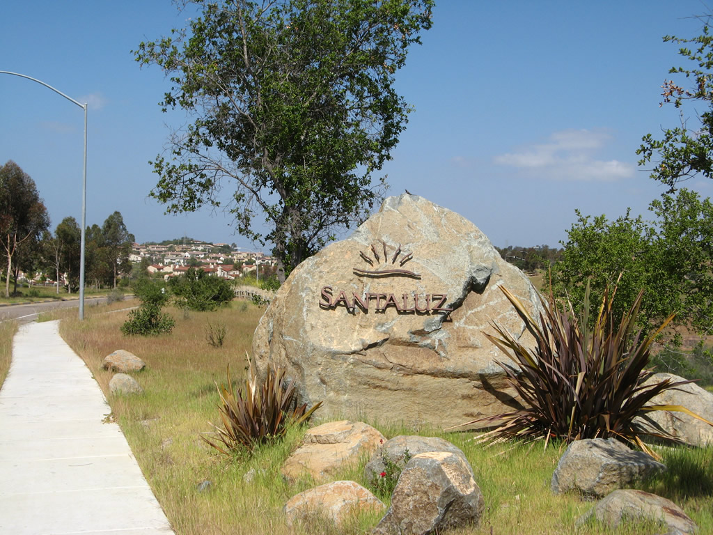
Northbound Camino del Sur passes by the Santaluz neighborhood entry monument sign. Photo taken 04/16/
Del Mar Terrace
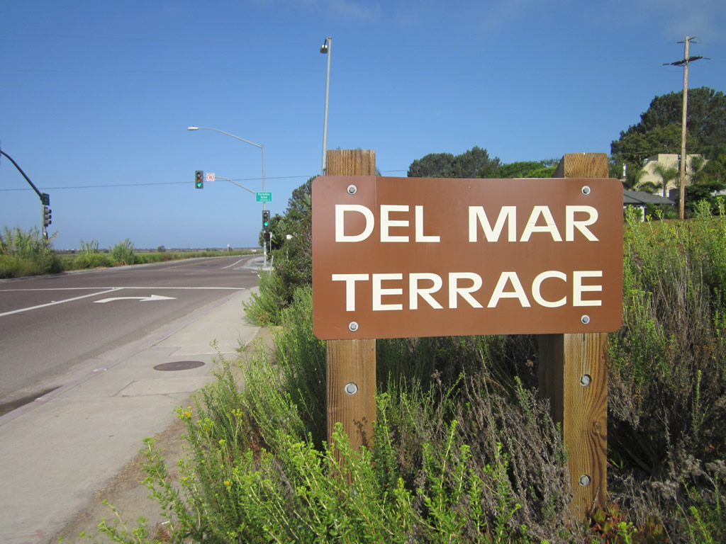
West of Interstate 5, Carmel Valley Road travels west as a two-lane highway along the northern edge of the Peñasquitos Lagoon through the Del Mar Terrace neighborhood. Just before reaching the ocean and Old U.S. Highway 101, Carmel Valley Road will leave the city of San Diego and enters the city of Del Mar. Photo taken 09/01/12.
Gaslamp – Downtown San Diego

The Historic Heart of San Diego is the Gaslamp Quarter. This gateway arch is located on northbound Fifth Avenue after the San Diego Trolley tracks and the Martin Luther King, Jr. Promenade near Petco Park. Photo taken 03/24/08.
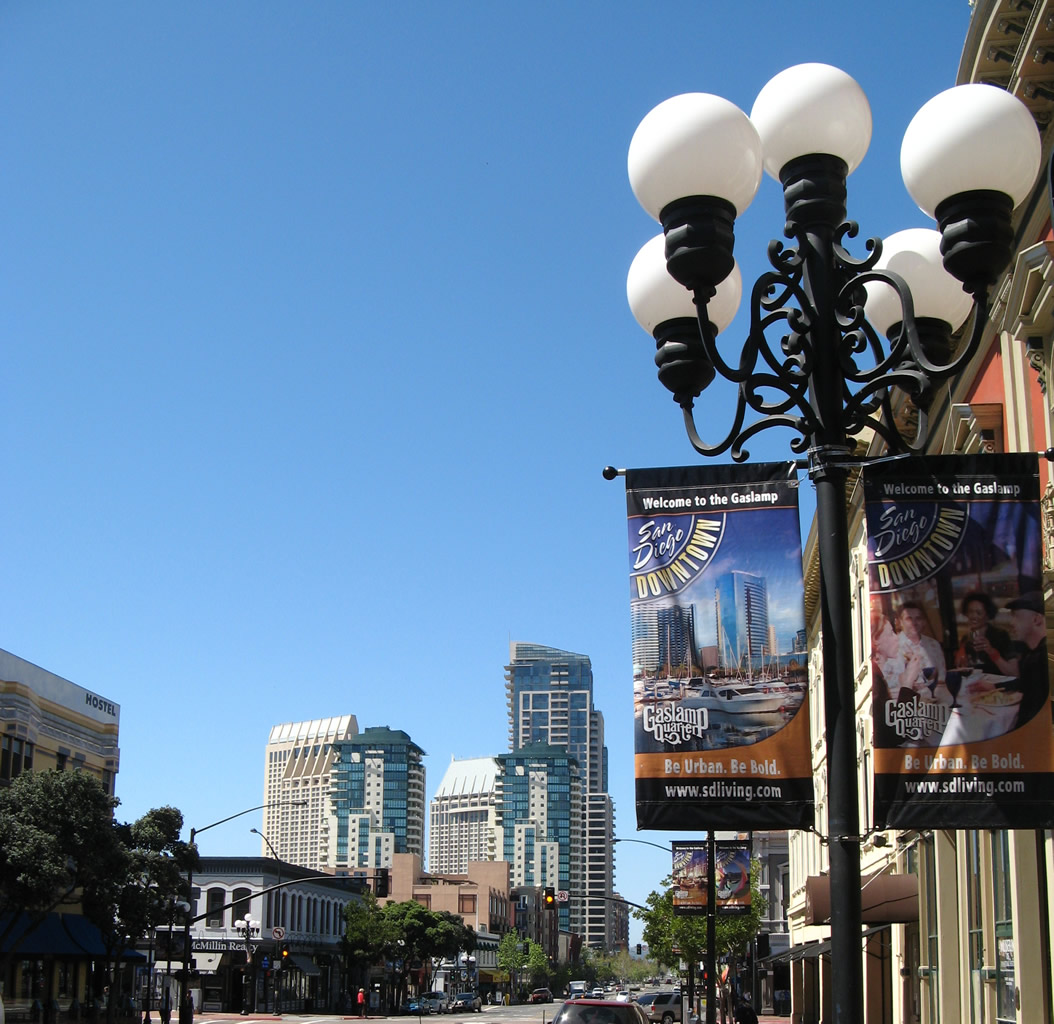
This street light feature is unique and emblematic to the Gaslamp Quarter. Photo taken 03/24/08.
College Grove
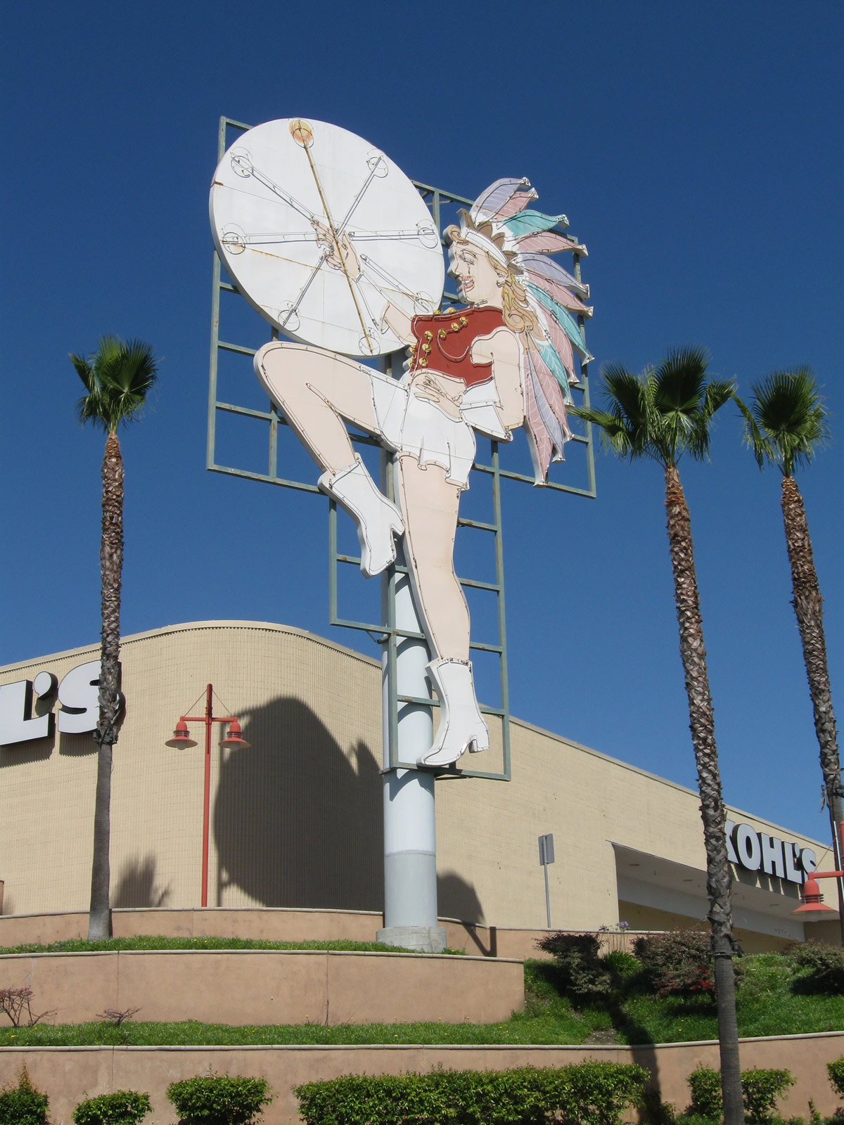
The College Grove Majorette is located at the College Grove Shopping Center (at intersection of College Avenue and California 94 (Martin Luther King, Jr. Freeway)). The majorette used to be located at the Campus drive-in theater (installed in 1948 at the theater located at 61st Street and El Cajon Boulevard) but was moved its current location (near a Kohls store) as part of the shopping center redevelopment. The majorette is seen as a logo for the College Grove neighborhood. Photo taken 06/05/11.
Hillcrest
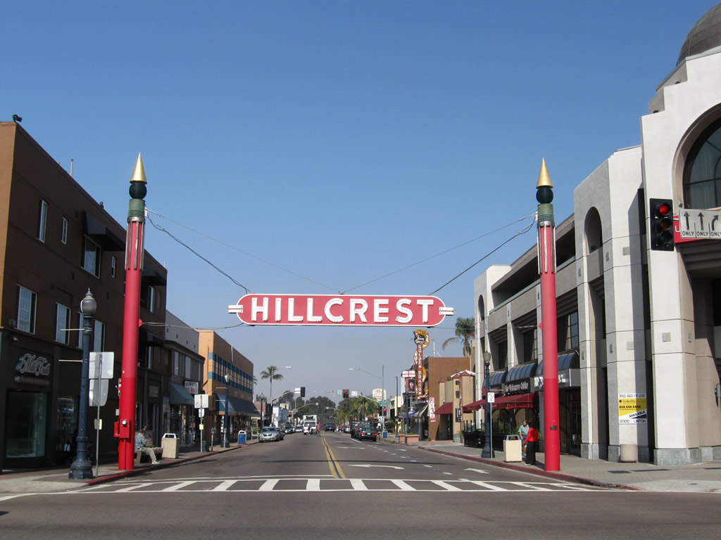
The Hillcrest sign is suspended by cables from two red poles on either side of University Avenue at the Sixth Avenue intersection. Photo taken 05/08/09.
Linda Vista
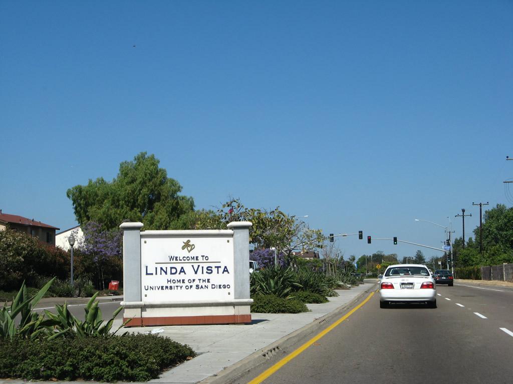
This entry monument sign for Linda Vista is located in the median of Genesee Avenue west of the California 163 (Cabrillo Freeway) interchange. Photo taken 05/30/08.
Little Italy
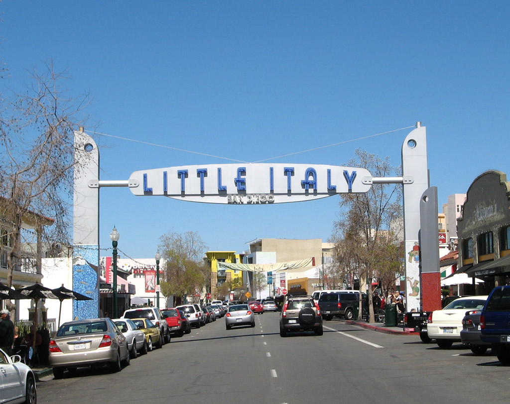
India Street enters the Little Italy neighborhood; this arch is located north of Date Street. Photo taken 03/24/08.
Mira Mesa
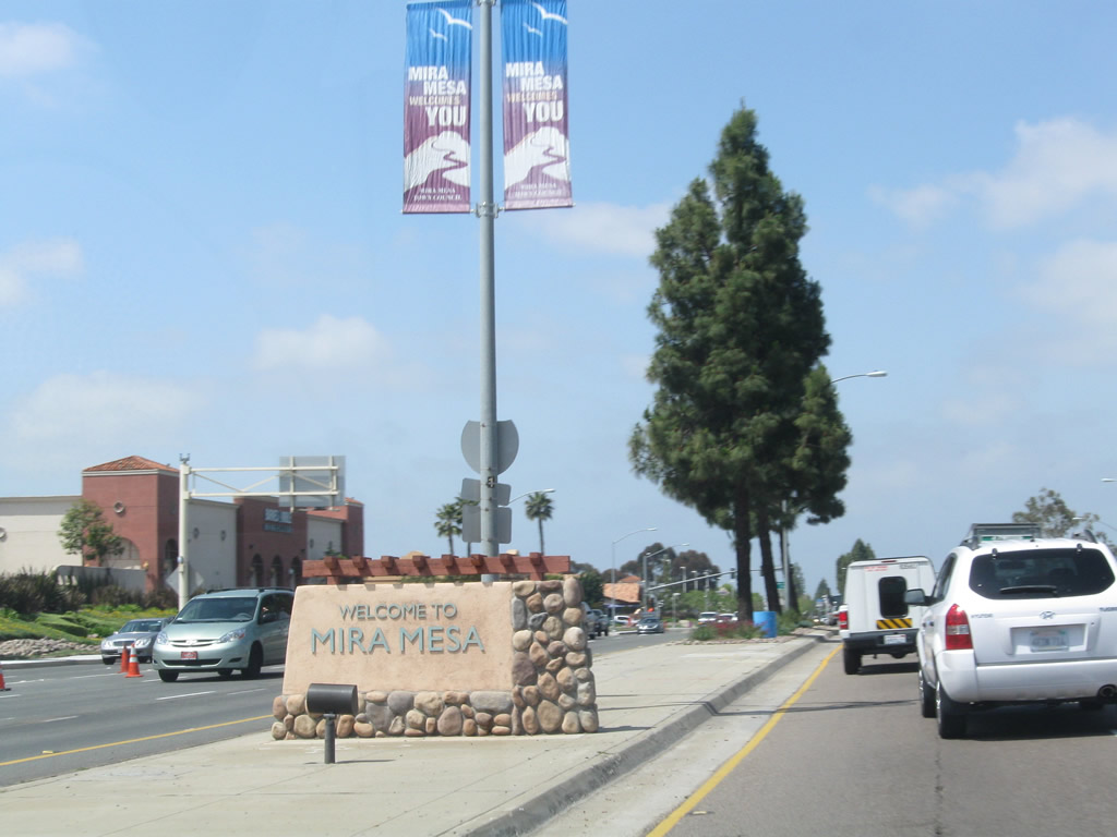
An entry monument for the community of Mira Mesa is posted in the median of Mira Mesa Boulevard between Interstate 15 and Westview Parkway. Photo taken 04/12/11.
Mission Beach
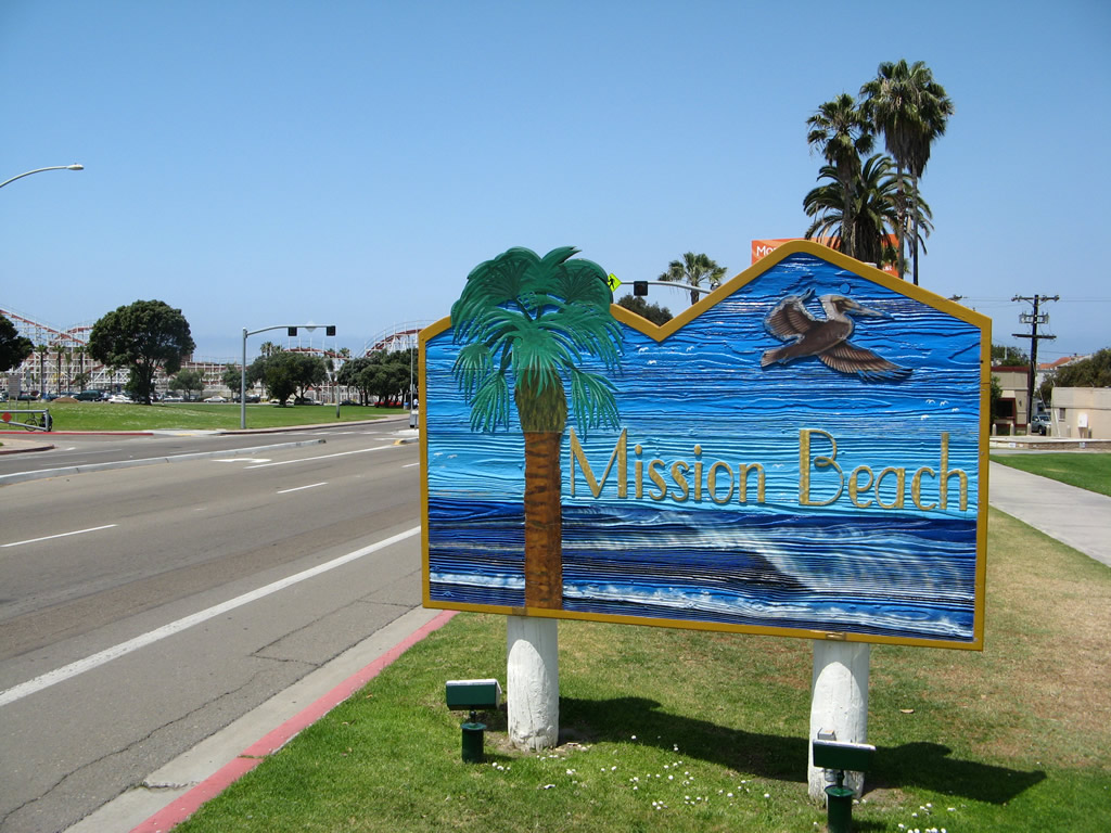
Pacific Beach entry monument signs are posted in two locations currently: one on westbound West Mission Bay Drive after the Glen Rick Bridge and another on southbound Mission Drive south of the Catamaran Hotel. Photo taken 05/15/08.
Mission Valley
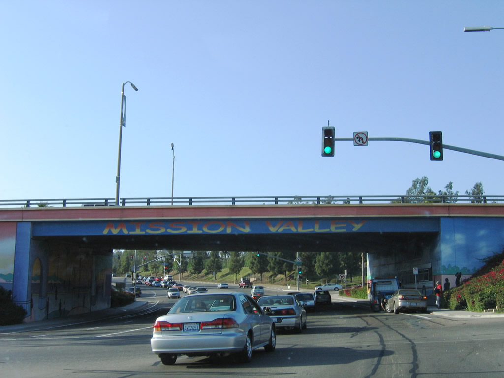
Northbound Mission Center Road approaches its interchange with Friars Road in the Mission Valley community. A mural painted into the highway bridge serves as an entry monument. Photo taken 06/16/06.
North Park
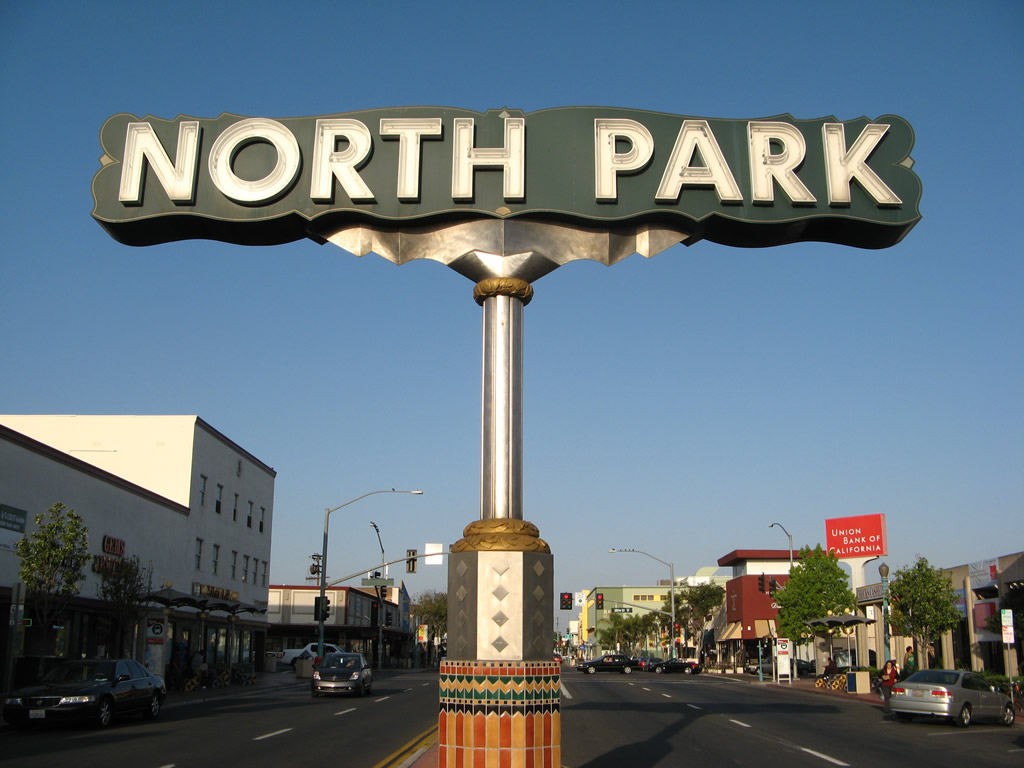
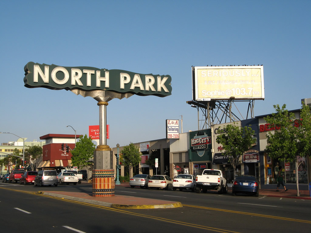
In downtown North Park, this sign is erected in the median of University Avenue near the 30th Street intersection. Photos taken 05/15/08.
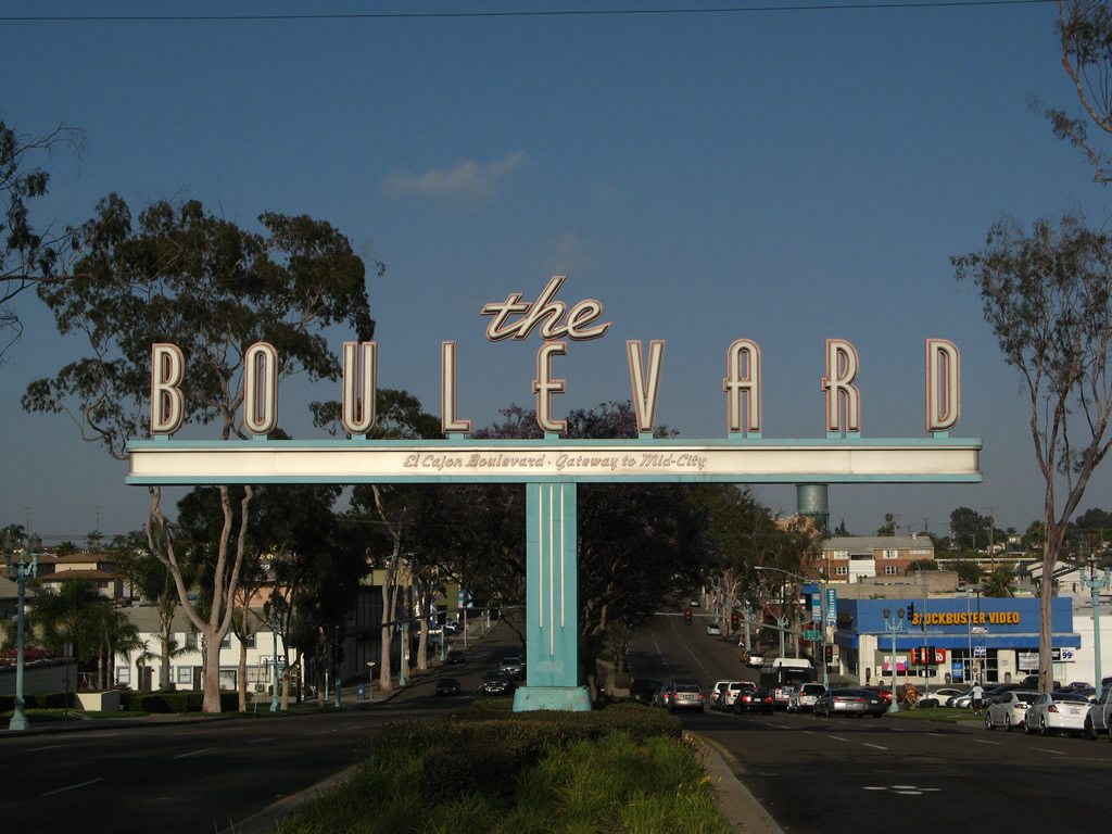
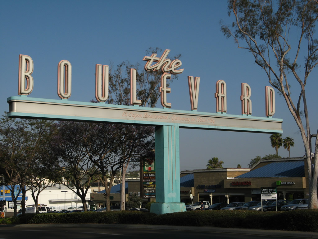
“The Boulevard: El Cajon Boulevard – Gateway to Mid-City” is posted on this art-deco neon lighted sign located on El Cajon Boulevard (Old U.S. 80) between Park Boulevard and Florida Street. At this point, El Cajon Boulevard and U.S. 80 enter the community of North Park. Photos taken 05/15/08.
Pacific Beach
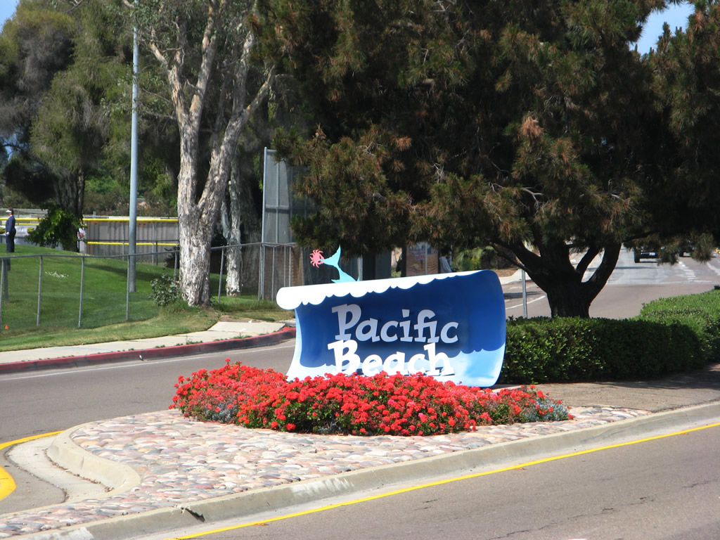
Pacific Beach entry monument signs are posted in two locations currently: one on westbound Grand Avenue after the Mission Bay Drive (Business Loop 5/Old U.S. 101) intersection and one on southbound Business Loop 5/Old U.S. 101, Mission Bay Drive north of the Rose Canyon Creek bridge. Photo taken 05/15/08.
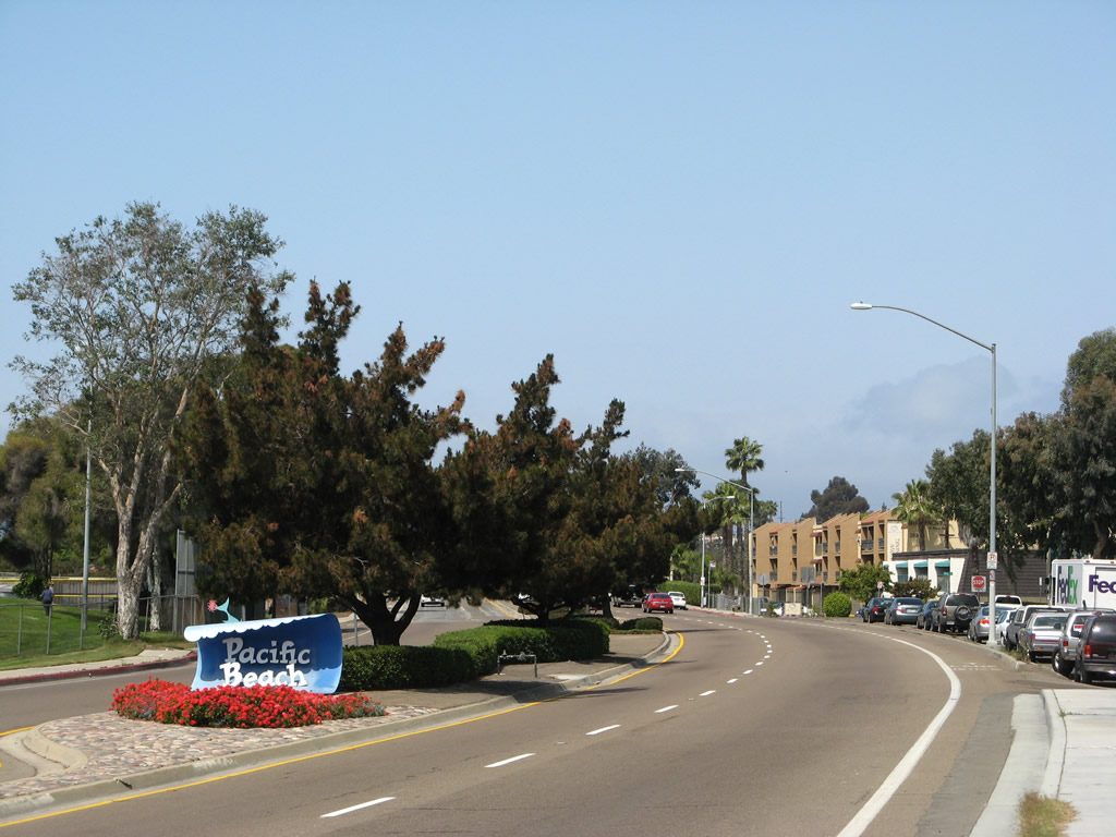
This particular Pacific Beach entry sign is located on Grand Avenue west after the Figueroa Boulevard turnoff. Photo taken 05/15/08.
Pacific Beach – Crystal Pier
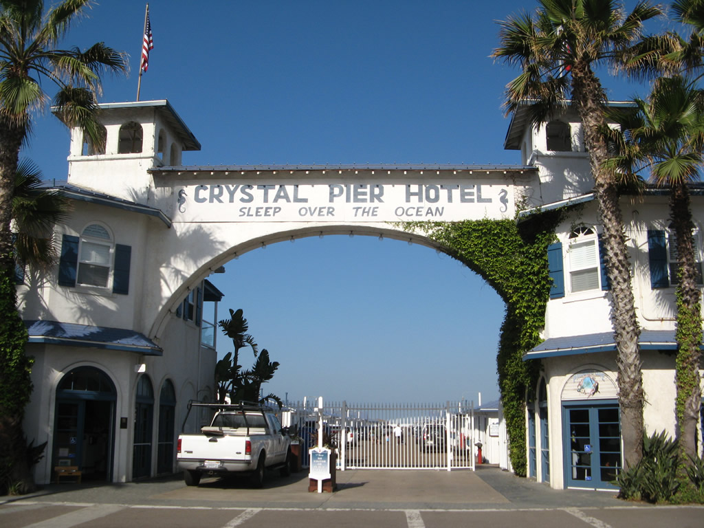
The Crystal Pier Hotel is located at the western end of Garnet Avenue in Pacific Beach. Its arch gracefully extends over the entrance to the pier, which is partially privately owned and partially owned by the city of San Diego. The pier is open for public use from sunrise to sunset; visitors may stay overnight in one of the Crystal Pier Hotel’ famous cottages that sit over the beach and ocean. Photo taken 05/15/08.
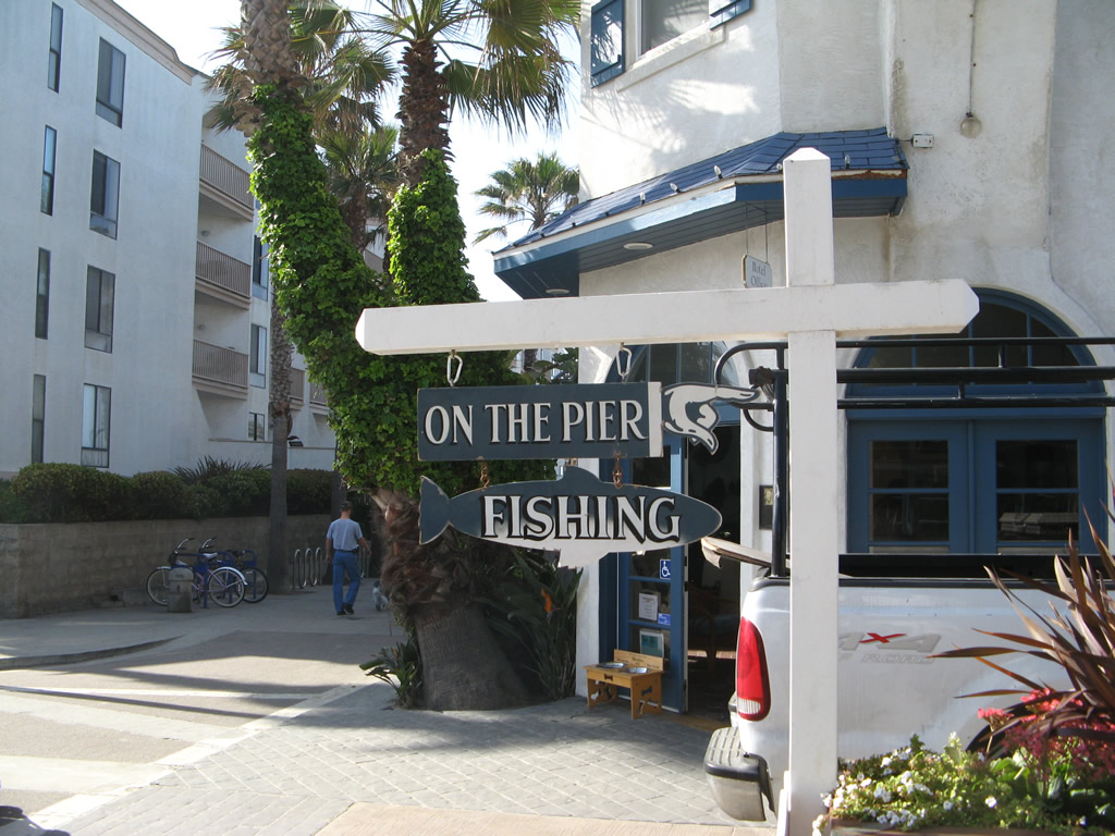
A fishing sign is posted from the Beach Walk at the base of the Crystal Pier arch. Photo taken 05/15/08.


Cottages line the Crystal Pier before narrowing into a more traditional fishing pier. The pier was built in 1927, and cottages first appeared on the pier in 1937. Photos taken 05/15/08.
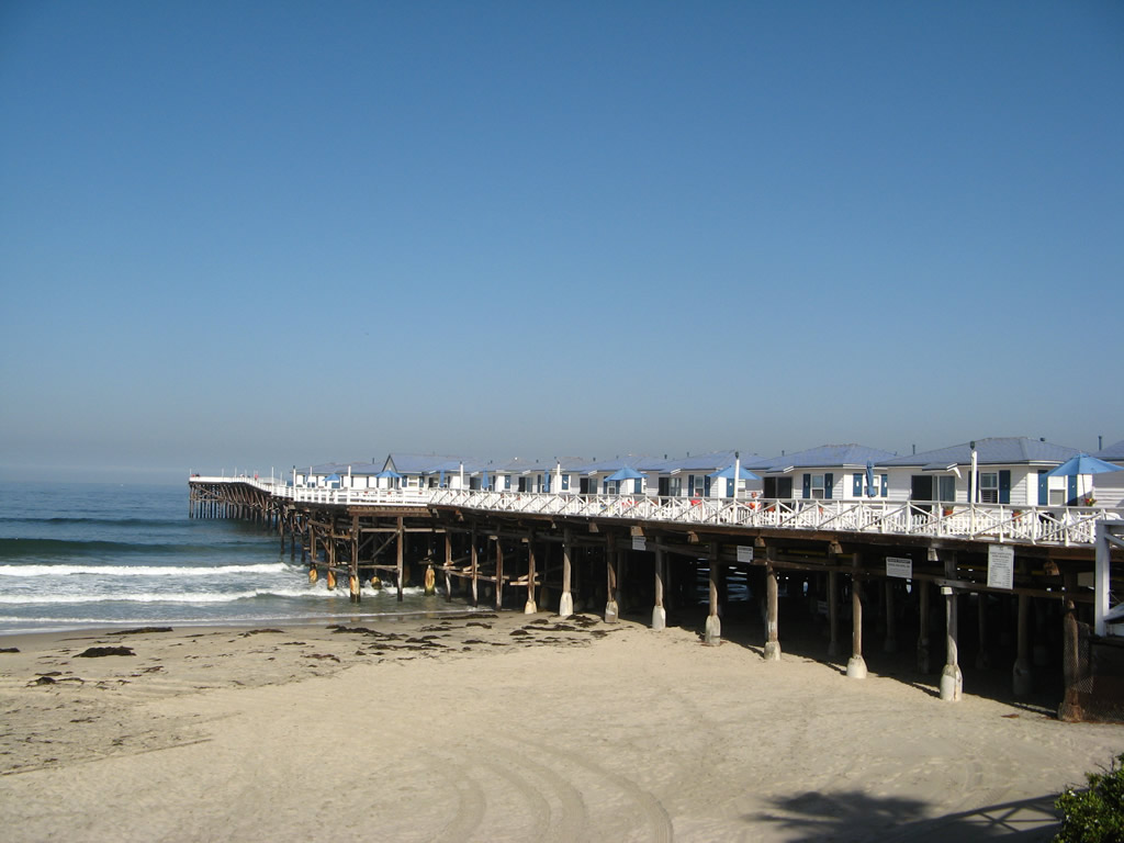
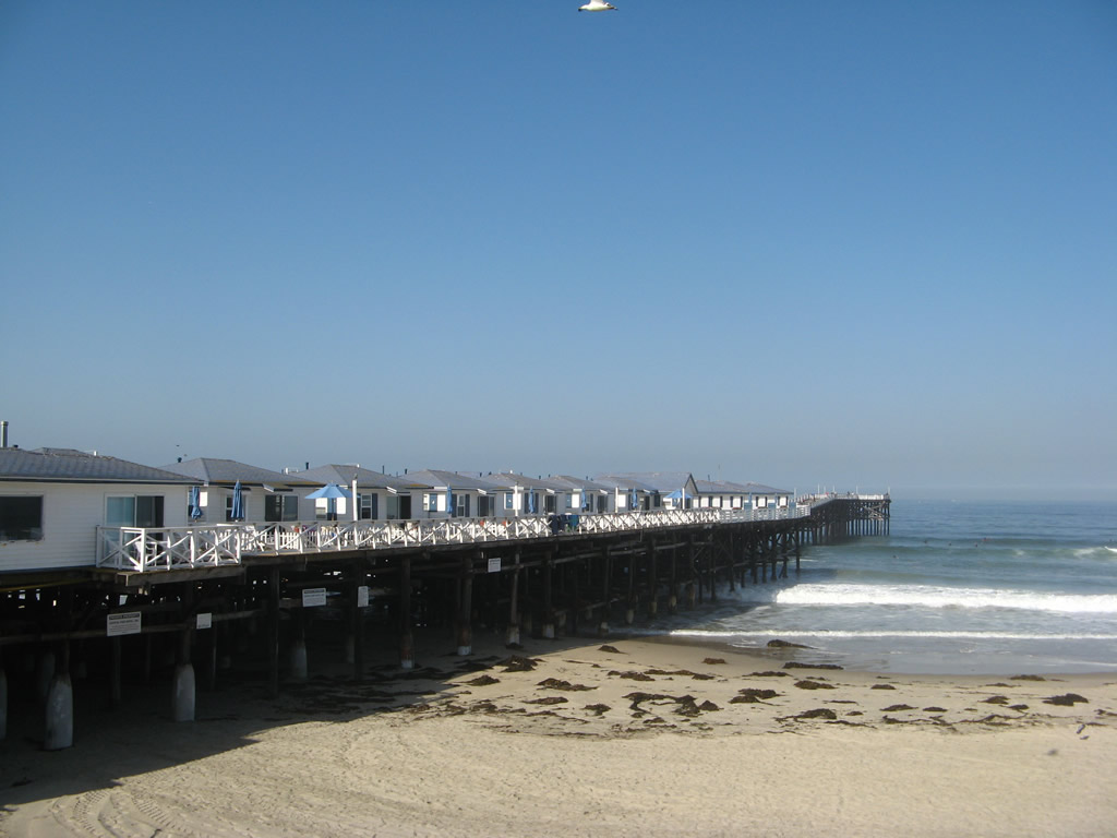
Crystal Pier as seen from the south and the north in Pacific Beach in the city of San Diego. Photos taken 05/15/08.
Seaport Village
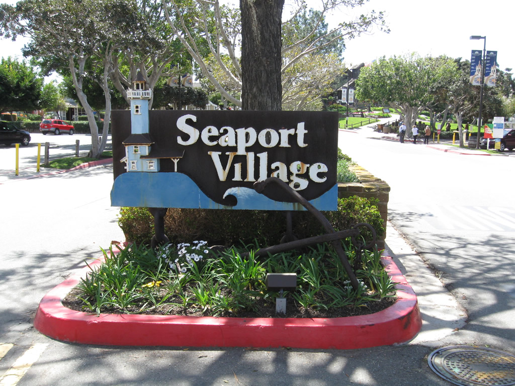
At the south end of Kettner Boulevard and Pacific Highway is Seaport Village, a notable tourist attraction that includes restaurants, stores, and bayfront views. This sign is located on Kettner Boulevard. Photo taken 03/22/11


In the neighborhood of Talmadge (north of El Cajon Boulevard between 54th Street and Fairmount Avenue), a series of metal gates erected at the time the community was developed in the 1920s. These gates identify the neighborhood and are generally located mostly along the south side of Monroe Avenue or east side of 49th Street. This pictures show some samples of historic gates, including along Madison Avenue (looking west toward 49th Street) and along the south side of Monroe Avenue. Photos taken 10/08/10.
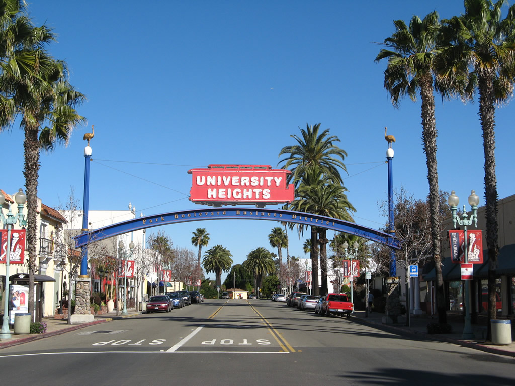
University Heights
Park Boulevard passes under the University Heights Business District arch. This gateway arch is located north of El Cajon Boulevard and Normal Street in the city of San Diego. Photo taken 05/15/08.
Page Updated September 7, 2012.