
Florida’s State Road system was laid out in 1917 under the supervision of George Barnes. The numbering system was haphazard with roads numbered according to the order in which they were built. Northernmost roads were numbered first. Route numbers were legislatively defined starting in 1923.1
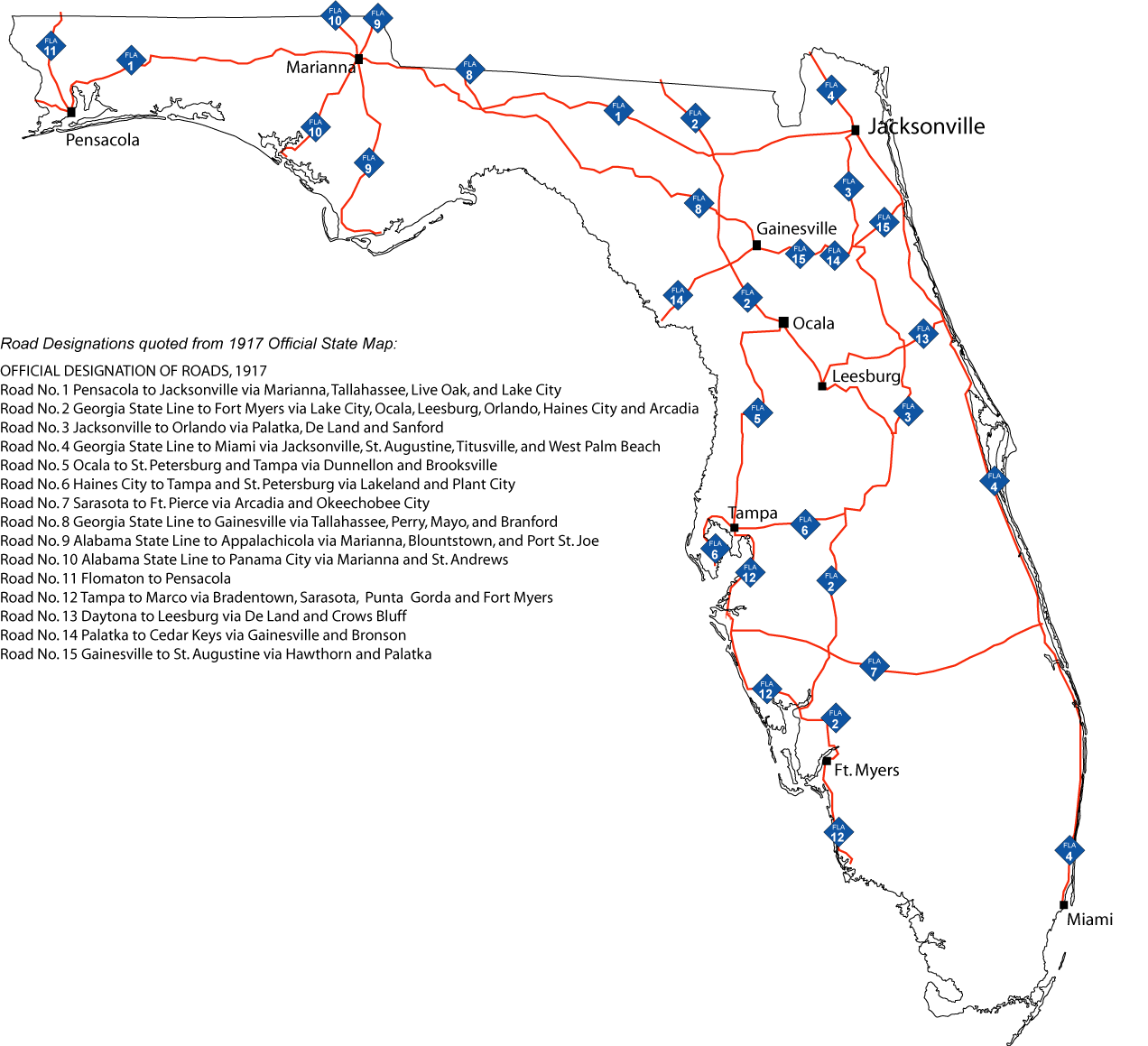
The original state road marker consisted of a blue diamond sign with the state abbreviated as “FLA” above the road number. Posted by the early to mid-1920s, the shields remained unchanged for the remainder of that decade.
By the 1930s, the state road marker was redesigned to include a black state outline on a white square. Further modifications were made to the sign style over the ensuing decades, leading to the current marker, which debuted in 1977.

1917-1930s

1930s-1940s

1940s-1950s

1960s-1977

1977-present
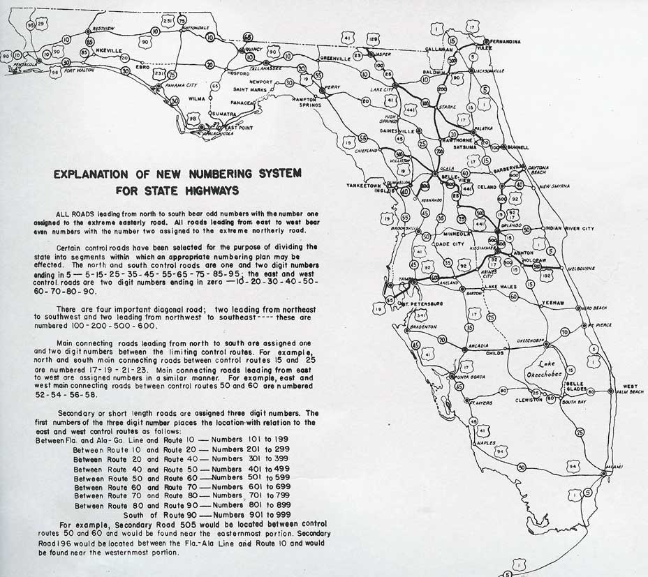
Since several officials found the original state road system to be “utterly confusing,” in 1941, Florida decided to create a new state numbering system. Laid out in a grid pattern, the replacement system made traveling easier by grouping similar-numbered roads around the same city. However because of World War II, renumbering of most roads across the state did not occur until 1946.
The 1946 numbering system combines the grid pattern with a clustering system. All major north-south routes used an odd numerical designation, while all major east-west routes would use an even numerical designation. The east-west highways would separate the state into zones, with like-numbered three-digit routes serving as connectors or secondary routes. For instance, three-digit routes located between SR 2 and SR 10 were numbered as SR 1xx. Three-digit routes designated between SR 12 and SR 20, were numbered as SR 2xx. Routes falling within the strata of SR 22 and SR 40 were numbered as Route 3xx. The pattern repeated between SR 42 and SR 50, SR 52 and SR 60, etc.
Crisscrossing the state, seven diagonal routes were also numbered a primary state roads. They were SR 100, 200, 300, 400, 500, 600 and 700.
Florida Secondary State Road System
Florida state roads were partitioned between two systems from 1955 to 1977. The primary state roads were identified by the state as routes for heavier traffic and higher maintenance. With lower traffic demands and requiring less maintenance, the secondary state roads were identified by the respective counties. Each system had a mileage cap of 11,000 miles – giving the total state road system a total of 22,000 miles.
Route numbers posted wihtin the state secondary system were designated with a prefix of S-. A subtle difference in the state road shield helped classify secondary roads from their primary counterparts. The state outline on state secondary road signs omitted Cape Canaveral and rounded the western panhandle. Shielding at the end points of these roads often accompanied placards indicating that the road was maintained as a secondary road.
When the secondary system was retired in 1977, existing signs were slowly replaced with county pentagons or altered so that the “S-” prefix was changed to “C-” for county, or a county decal was affixed to the bottom left of the shield face. Some exceptions in the secondary system remained state maintained through to 1982 for federal funding purposes.
Sources:
- Blue Diamonds: The Old Florida State Road System (1917-1946).
http://www.us-highways.com/oldfl.htm”,