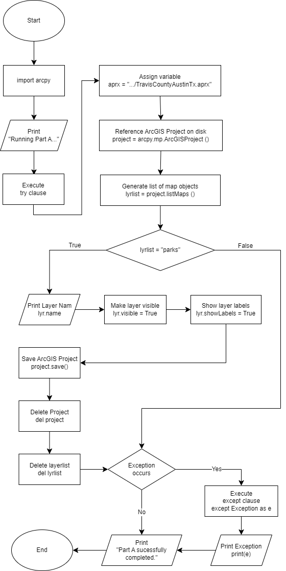
Geoprocessing with Python scripts and Models in GIS
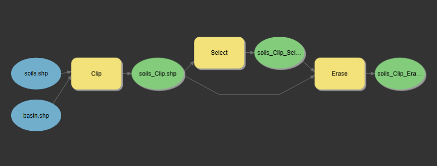
The two main focuses of this week's Lab assignment in GIS Programming was an introduction to Model Builder in ArcGIS Pro and coding a geoprocessing script from scratch. The lessons show that Geoprocessing Tools can be run solely with Python scripts and the process be automated using models. Both use the ArcPy package, which contains several modules and other elements that add functionality to Python. Geoprocessing is a series of [...]