|
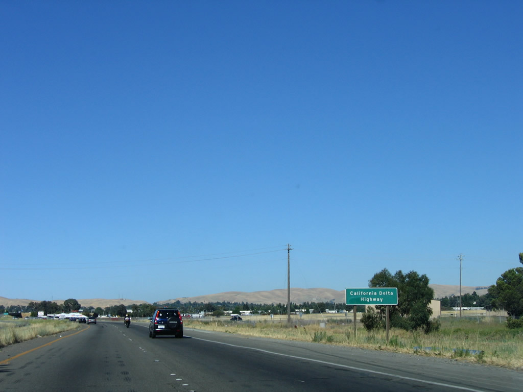
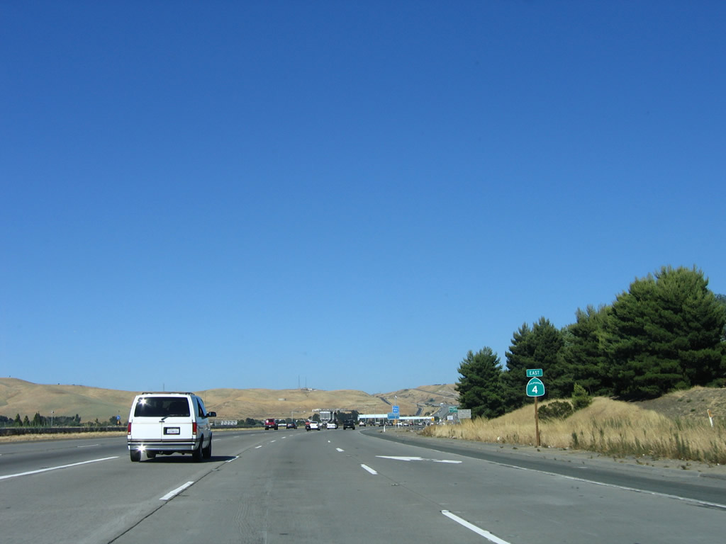
| SR 4 shifts from the John Muir Parkway to the California Delta Highway east from I-680. A notable change in topography occurs as there are fewer trees and more wide open spaces. 07/18/09 |
|
| SR 4 was named the California Delta Highway since it parallels the Carquinez Strait and Suisun Bay, then enters the California Delta Region formed by the confluence of the Sacramento River from the north and the San Joaquin River from the south. 07/06/06 |
|
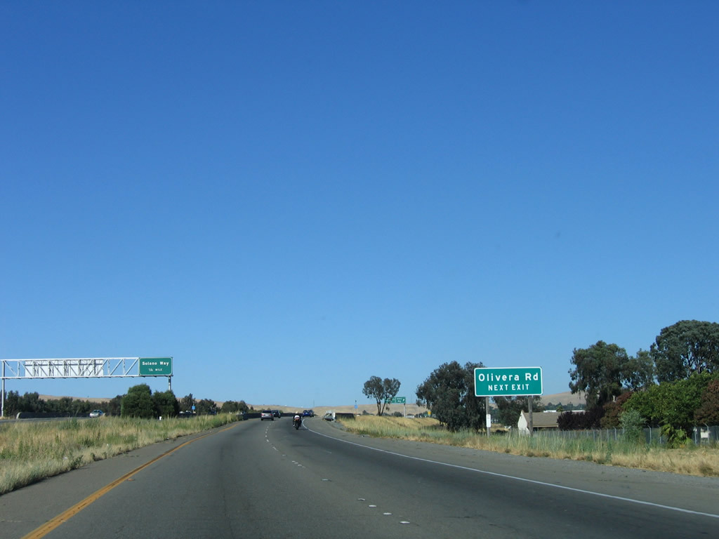
| SR 4 runs just north of Buchanan Field Airport (CCR) ahead of Exit 13 to adjacent Arnold Industrial Place to Solano Way and Olivera Road. 07/06/06 |
|
| Exit 13 is the first of three to serve the city of Concord, which is the largest in Contra Costa County. Home to over 122,000, Concord spreads across 31.31 square miles and was incorporated as a town in February 1905. Solano Way travels southeast toward Downtown Concord, while Olivera Road travels east past Hillcrest Community Park, then turns southeast to meet Willow Pass Road near Willow Pass Community Park. 07/06/06 |
|
| SR 4 eastbound spans both Walnut Creek and Solano Way leading into the folded diamond interchange (Exit 13) with Arnold Industrial Way. The freeway proceeds east 0.75 miles to the north end of the SR 242 freeway. 07/06/06 |
|
| An auxiliary lane opens eastbound along SR 4 to the three-wye interchange (Exit 15A) with SR 242 south to Downtown Concord and Pleasant Hill. 07/06/06 |
|
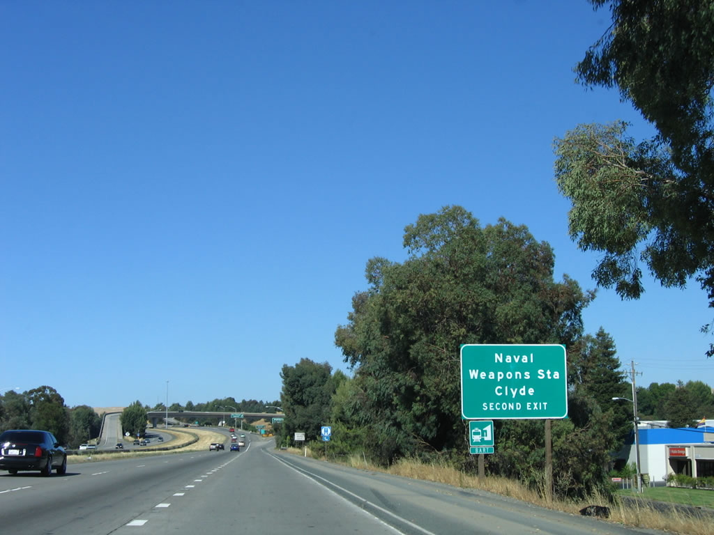
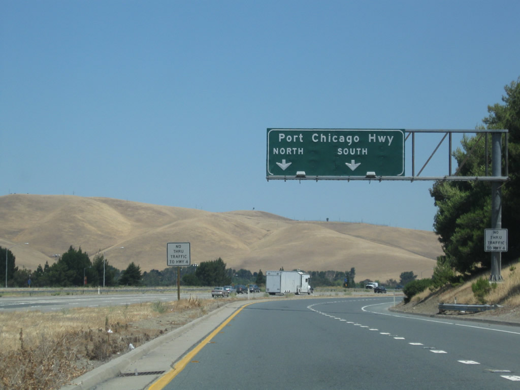
| The succeeding exit after SR 242 connects to Port Chicago Highway. Prior to 2007, the Concord Naval Weapons Station was located north of Port Chicago Highway and the unincorporated community of Clyde via Kinney Boulevard. The base was decommissioned with a portion of the land repurposed as Concord Hills Regional Park. 07/06/06 |
|
| The SR 242 control city of Oakland dates back to the original designation of the freeway as an extension of SR 24, but that designation changed in 1991. SR 242 replaced SR 24 southward, reflecting the unconstructed leg of SR 24 extending 15 miles east from I-680 to SR 4 near Pittsburg. 07/06/06 |
|
| A flyover ramp (Exit 15B) departs from within the systems interchange with SR 242 south for a collector distributor roadway leading east to Port Chicago Highway. 07/06/06 |
|
| Taking the c/d roadway, motorists approach a six-ramp parclo interchange (Exit 15B) with Port Chicago Highway. 07/18/09 |
|
| Port of Chicago Highway leaves the Concord city limits through the small community of Clyde en route to Kinney Boulevard and the former Naval Weapons Station. Trucks are restricted along Port Chicago Highway south from SR 4. 07/18/09 |
|
| Eastbound at the off-ramp for Port Chicago Highway south toward Downtown Concord. 07/18/09 |
|
| The collector distributor lanes meet the loop ramp to Port Chicago Highway north to the Diablo Creek Golf Course, Military Ocean Terminal - Concord and Concord Hills Regional Park. 07/18/09 |
|
| Reassurance marker for SR 4 east, posted along the mainline after the merge with SR 242 north. 07/06/06 |
|
| A Bay Area Rapid Transit (BART) accompanies California Delta Highway east through northern reaches of Concord. The BART occupies the freeway median east into Pittsburg and Antioch. 07/18/09 |
|
| SR 4 climbs up toward Willow Pass and Exit 17 with Willow Pass Road. Much of the undeveloped land along the ensuing stretch fell within the former Concord Naval Weapons Station. 07/06/06 |
|
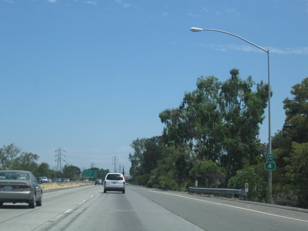
| California Delta Highway leads SR 4 another eight miles east to Pittsburg and 13 miles to Antioch. 07/06/06 |
|
| The next three exits serve the community of Bay Point, which is located north of SR 4 and generally west of the city of Pittsburg. 07/06/06 |
|
| Leaving the Concord city limits, drivers along SR 4 east reach the diamond interchange (Exit 17) with Willow Pass Road. 07/06/06 |
|
| Willow Pass Road links SR 4 with parallel Evora Road east to Bay Point and Avila Road east to west Pittsburgh. 07/06/06 |
|
| The succeeding exit connects SR 4 (California Delta Highway) with Willow Pass Road east into Bay Point. Bay Point was known as East Pittsburg until a vote changed the name in 1993. Over 20,000 live in the community. 07/18/09 |
|
| The freeway reaches a high point in the hills between Concord and Pittsburg, then descends toward Downtown Pittsburg. On clear days, the delta extends into the horizon, offering a stellar view and dramatic change from the nearby hills. Due to this open exposure to the delta, winds are more common here than along other sections of the freeway. 07/18/09 |
|
| Straddling the Pittsburg city line, SR 4 advances east to a pair of six-ramp parclo interchanges with western reaches of the municipality. 07/18/09 |
|
| Exit 19 is the first of five interchanges serving the city of Pittsburg along the California Delta Highway eastbound. Pittsburg sits along the southern edge of the San Joaquin-Sacramento River Delta at an elevation of 26 feet above sea level. 07/18/09 |
|
| A set of Pacific Gas & Electric (PG&E) power transmission lines cross over SR 4. The higher of the two towers likely carries 230kV, but the design structure is relatively rare in PG&E's system. Other locations for this tower design include a route that roughly follows SR 84 in the East Bay near Livermore and another arcs through southwestern San Jose, starting from a large substation near U.S. 101 south of SR 85. 07/18/09 |
|
| Incorporated on June 25, 1903, Pittsburg has an industrial past including a large power plant located along the delta. Smokestacks from the power generating station appear along the northern horizon in this scene. 07/18/09 |
|
| Construction of the SR 4 freeway directly overlaid a portion of Willow Pass Road east from Exits 17 to 19. A wye with a left exit previously separated Willow Pass Road from SR 4 east here. 07/18/09 |
|
| Eastbound SR 4 at Exit 19 for San Marco Boulevard south into Pittsburg and Willow Pass Road, the main east-west route through Bay Point. 07/18/09 |
|
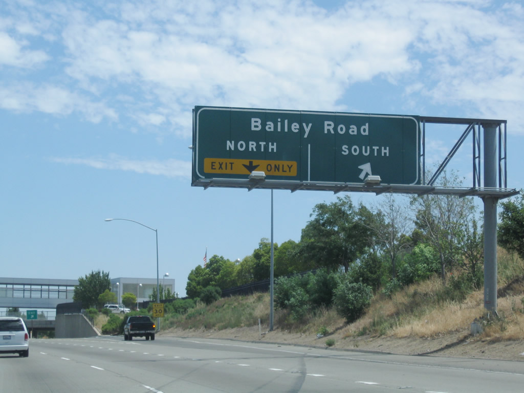
| The ensuing exit links SR 4 (California Delta Highway) with Bailey Road south into Pittsburg and north to Bay Point. 07/18/09 |
|
| Auxiliary lanes expand SR 4 to eight overall lanes between Exit 17 (San Marco Boulevard) and Exit 19 (Bailey Road). 07/18/09 |
|
| Exit 20A departs SR 4 east for Bailey Road south to Leland Road east to Deltaview Golf Course and Clayton Valley in Concord. 07/18/09 |
|
| The Pittsburg / Bay Point BART station is located within the freeway median just west of Bailey Road. This station marked the eastern terminus of the transit line prior to the 2010 extension into Antioch. 07/18/09 |
|
| Exit 20B loops onto Bailey Road north to Willow Pass Road in Bay Point. The four lane alignment of SR 4 along this stretch dates back to at least 1953. 07/18/09 |
|
| The next two interchanges along SR 4 (California Delta Highway) east fall wholly within the city of Pittsburg. 07/18/09 |
|
| The aforementioned PG&E power transmission lines again cross SR 4 and then briefly parallel the freeway en route to the large Calpine Pittsburg Power Generating Station. Seven other double-circuit power lines cross the freeway en route to the power plant. 07/18/09 |
|
| A two lane off-ramp connects SR 4 east with Railroad Avenue north to Downtown Pittsburg and the Pittsburg Marina. 07/18/09 |
|
| The HOV lanes previously ended at the split diamond interchange (Exit 23) with Railroad Avenue and Harbor Street. Railroad Avenue extends south through Pittsburg to become Kirker Pass Road en route to Concord and Clayton. 07/18/09 |
|
| A parclo interchange (Exit 24) joins SR 4 with Loveridge Road a mile east beyond the Railroad Avenue overpass. 07/18/09 |
|
| An auxiliary lane opens east from the Railroad Avenue entrance ramp to Exit 24 with Loveridge Road. Construction underway in 2011 built a new five lane eastbound roadway for SR 4 southward to accommodate the extension of BART within the freeway median. 07/18/09 |
|
| Loveridge Road stems north from Buchanan Road and residential areas of Pittsburgh to industrial plants along New York Slough by Pittsburgh Point. 07/18/09 |
|
| Progressing southeastward, SR 4 passes between big box retail areas and Los Medonos College and enters the city of Antioch. Sacramento lies 64 miles to the northeast via SR 160. 07/18/09 |
|
| The succeeding five interchanges along SR 4 east serve the city of Antioch. Topping 110,000 per 2016 census populations, Antioch was incorporated on February 6, 1872 and lies 43 feet above sea level. 07/18/09 |
|
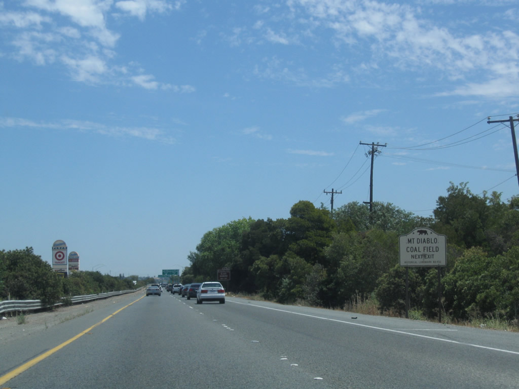
| Points of interest found along Somersville Road south from Exit 26A include Black Diamond Mines Regional Park, which includes the site of Mount Diablo Coal Field. 07/18/09 |
|
| Somersville Road and Auto Center Drive constitute a heavily developed commercial arterial. Somersville Town Center mall and several other big box stores line the arterial within close proximity to SR 4. 07/18/09 |
|
| Expansion of California Delta Highway in 2011 eliminated the loop ramp (Exit 26B) onto Auto Center Drive north. 07/18/09 |
|
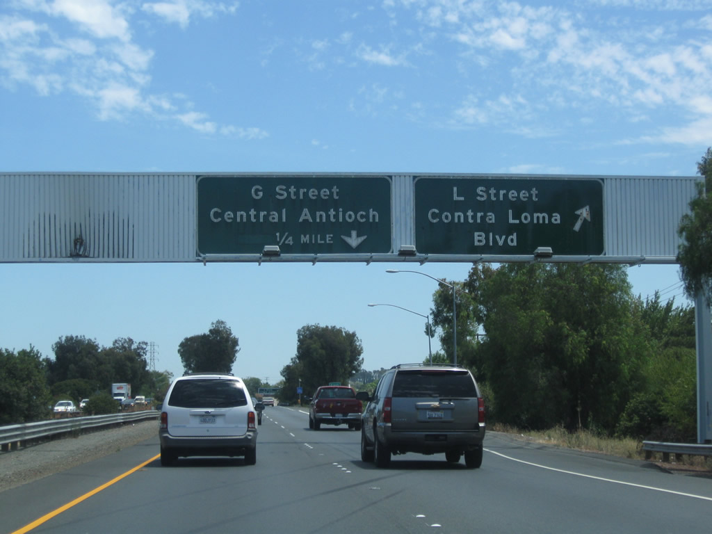
| L Street south and Contra Loma Boulevard north come together at Exit 27 along SR 4. 07/18/09 |
|
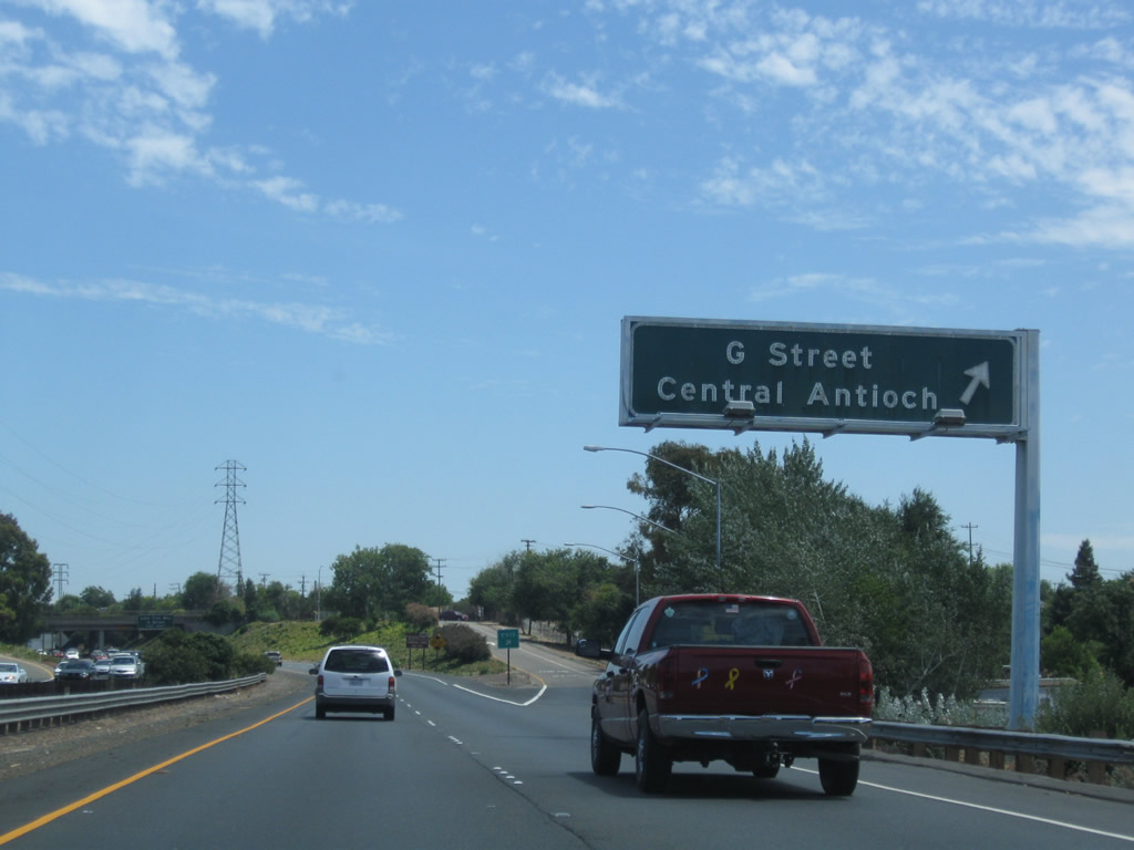
| The half diamond interchange with G Street was removed in favor of expanding the preceding partial exchange with L Street during widening of SR 4. 07/18/09 |
|
| SR 4 eastbound was expanded to five lanes, including carpool and auxiliary lanes, to the off-ramp (Exit 27) for L Street and Contra Loma Boulevard in Antioch. The eastbound roadway was shifted southward to accommodate the BART line extension. 07/18/09 |
|
| Exit 27B formerly departed from SR 4 east for G Street. There is no direct access to the north-south street from California Delta Highway now. 07/18/09 |
|
| SR 4 continues east from the G Street overpass with eight overall lanes to a diamond interchange (Exit 28) with Lone Tree Way south and A Street north. 07/18/09 |
|
| Lone Tree Way arcs southeast along a four lane, divided arterial through south Antioch to meet SR 4 again at the city of Brentwood. A Street extends north from Exit 28 along a five lane boulevard into central Antioch. 07/18/09 |
|
| Passing over A Street, SR 4 advances east one mile to a parclo interchange (Exit 28) with Hillcrest Avenue. 07/18/09 |
|
| Sound walls separate the eastbound lanes of SR 4 with neighborhoods along adjacent Tregallas Road. 07/18/09 |
|
| Exit 29 departs in half mile for Hillcrest Avenue. SR 160 follows in 2.25 miles. Construction in 2014-15 widened SR 4 here from four to eight lanes. 07/18/09 |
|
| Eastbound SR 4 reaches Exit 29 for Hillcrest Avenue north to 18th Street and south to Deer Valley Road in eastern Antioch. 07/18/09 |
|
| Passing through the exchange with Hillcrest Avenue, a pair of double circuit Pacific Gas & Electric power lines cross over the freeway. 07/18/09 |
|
| Continuing east, SR 4 (California Delta Highway) next meets the south end of SR 160. SR 160 travels north across the Antioch Bridge over the San Joaquin River to Sherman Island and SR 12 by the city of Rio Vista. 07/18/09 |
|
| Main Street east from SR 160 at Bridgehead represents the former alignment of SR 4 leading into Downtown Oakey. 07/18/09 |
|
| The freeway extension of SR 4 south overtook what was previously referenced as the Bypass Road. The six-year widening of SR 4 east from Loveridge Road in Pittsburg to just west of SR 160 included adding missing ramps at the directional T interchange between the two routes. A ribbon cutting ceremony celebrated completion of the $362 million project on July 20, 2016.1 07/18/09 |
|
| Sign changes made at Exit 30 redirected traffic bound for Stockton onto the SR 4 freeway leading south through Brentwood. Costing $103 million to build, the State Route 4 Bypass stretches 12.4 miles, with a six lane freeway extending south to Laurel Road, a four lane freeway from Laurel Road to Lone Tree Way, and a two lane expressway from there to Marsh Creek Road.2 07/18/09 |
Page Updated 07-19-2018.

 East
East