
California State Route 371 connects SR 79 at Aguanga with SR 74 in the San Bernardino National Forest via the Cahuilla Indian Reservation, Lake Riverside and Anza. It is part of an east-west corridor formed by parts of SR 79, SR 371, and SR 74 between Temecula and the Palm Springs-Coachella Valley area. The same east-west corridor serves as a popular short cut for motorists traveling between San Diego County and Palm Springs-Coachella Valley regions for the spectacular scenery and shorter distance (by 25 miles) versus the heavily congested freeway route via Interstates 10, 15 and 215.
SR 371 is a remnant of a much longer SR 71, back when that route used to extend southeast from Corona via the current Interstate 15 to Lake Elsinore and Temecula, and then turned east along SR 79. When SR 71 was decommissioned in favor of I-15 between Temecula and Corona (in 1973-1974), the shared alignment became solely known as SR 79, and the remnant alignment was given the new SR 371 designation.
 East East |
 | SR 371 eastbound leaves SR 79 in Aguanga. Ahead, SR 371 will serve Anza en route to its junction with SR 74. 08/25/07 |
 | Eastbound SR 371 approaching the terminus at SR 74. SR 74 travels west to Lake Elsinore, where it links with Interstate 15. 06/07/08 |
 | SR 74 leads east from SR 371 to Palm Desert. 06/07/08 |
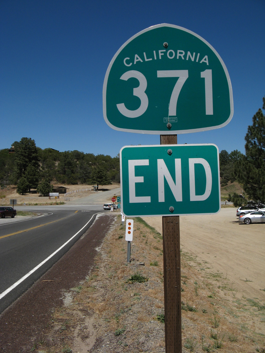
 | An end SR 371 route marker is posted prior to the intersection with SR 74. 06/07/08 |
 | SR 74 west connects SR 371 with SR 243 near Idyllwild, then proceeds to Hemet, Perris and Lake Elsinore. 06/07/08 |
| West |
 | Leading away from SR 74, SR 371 begins its westbound route toward Anza, Aguanga and Temecula. 06/07/08 |
 | Anza lies six miles to the west of SR 74 along SR 371. Aguanga and SR 79 follow in 20 miles. San Diego is 96 miles away via SR 79 north to Interstate 15 south. 06/07/08 |
 | SR 371 reaches its west end at SR 79. SR 79 travels south to Julian and Cuyamaca Rancho State Park and northwest to Temecula and Interstate 15. October 2000 |
 | Historically, SR 71 turned north from this stop sign to combine with SR 79 northwest en route to Temecula. 08/25/07 |
 | A second end sign appears for SR 371 at the intersection with SR 79. SR 79 heads south to Warner Springs and Santa Ysabel. 08/25/07 |
Photo Credits:
October 2000, 08/25/07, 06/07/08 by AARoads
Page Updated 05-11-2012.