|
| This distance sign is found along northbound Interstate 805 after the SR 94 offramp. It provides the distance to the next three exits: Exit 13B, Home Avenue; Exit 14, SR 15; and Exit 15, University Avenue. 04/09/06 |
|
| This view of the SR 94 stack interchange is seen from northbound Interstate 805. The bents (supports) have been earthquake retrofitted. Note the extra wide supports. 01/18/09 |
|
| Northbound Interstate 805/Dekema Freeway reaches Exit 13B, Home Avenue. Replacement signage was installed in 2008, yet the new signs do not have exit numbers. Wasn't that the reason why new signs were being installed in California??? 01/18/09, 04/09/06 |
|
| This distance sign along northbound Interstate 805 provides the distance to the next three exits: Exit 14, SR 15 north; Exit 15, University Avenue; and Exit 16, Junction Business Loop I-8/El Cajon Boulevard. 04/09/06 |
|
| Only northbound SR 15 may be accessed from northbound Interstate 805. SR 15 passes through City Heights before emerging at the east end of Mission Valley. At its interchange with Interstate 8, SR 15 becomes Interstate 15. The word "JUNCTION" covers up "40th Street." 07/28/14 |
|
| Northbound Interstate 805 (Jacob Dekema Freeway) reaches Exit 14, Junction Northbound SR 15 (Escondido Freeway). Both right lanes exit only to northbound SR 15, while the four left lanes continue north on Interstate 805. 07/28/14 |
|
| Passing by the "RAMP 14" gore point sign, the right two lanes transition from Interstate 805 north onto SR 15 north. 07/28/14 |
|
| Two lanes carry traffic between Interstate 805 north and SR 15 north. The main lanes of Interstate 805 are visible from the transition roadway. 07/28/14 |
|
| A distance sign on the transition ramp provides the distance to the next three exits along SR 15 north: Exit 5A, University Avenue to the City Heights Transit Plaza; Exit 5B, Junction Business Loop I-8/El Cajon Boulevard and Historic U.S. 80-395 to the Boulevard Transit Plaza; and Exit 6A, Adams Avenue. 07/28/14 |
|
| The transition ramp finally merges onto mainline SR 15 north. The next two exits are: Exit 5A, University Avenue to the City Heights Transit Plaza and Exit 5B, Junction Business Loop I-8/El Cajon Boulevard and Historic U.S. 80-395 to the Boulevard Transit Plaza. 07/28/14 |
|
| Back on the mainline Interstate 805 north freeway, the next exit is Exit 15, University Avenue, which travels west toward North Park and east into City Heights. This major arterial roadway generally parallels the El Cajon Boulevard corridor. University Avenue travels east all the way to La Mesa and west to Hillcrest before ending at the Washington Street interchange in Mission Hills. 04/09/06 |
|
| This distance sign along northbound Interstate 805 provides the distance to the next three exits: Exit 15, University Avenue; Exit 16, Business Loop I-8/El Cajon Boulevard; and Exit 17, Junction Interstate 8. 04/09/06 |
|
| University Avenue is a major east-west commercial corridor through Mid-City; to the west, it travels into the downtown area of North Park. It is locally referred to as "Main Street," as University Avenue in North Park has been a commercial corridor since North Park was founded as a "suburb" of downtown San Diego years ago. 01/18/09 |
|
| Use University Avenue or El Cajon Boulevard to reach destinations in Mid-City or City Heights. 04/09/06 |
|
| Northbound Interstate 805 reaches Exit 15, University Avenue. 04/09/06 |
|
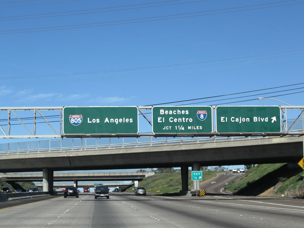
| The next three exits along northbound Interstate 805 are Exit 16, Junction Business Loop I-8/El Cajon Boulevard; Exit 17, Junction Interstate 8 (Mission Valley [Alvarado] Freeway), and Exit 18, Murray Ridge Road/Phyllis Place. 01/18/09 |
|
| Northbound Interstate 805 reaches Exit 16, Junction Business Loop I-8/El Cajon Boulevard. Business Loop I-8, which is poorly signed, follows the original route of historic U.S. 80 through San Diego between SR 163 and the city of La Mesa. 01/18/09 |
|
| The next exit along northbound is Exit 17, Interstate 8, the Mission Valley (Alvarado) Freeway. 11/19/05 |
|
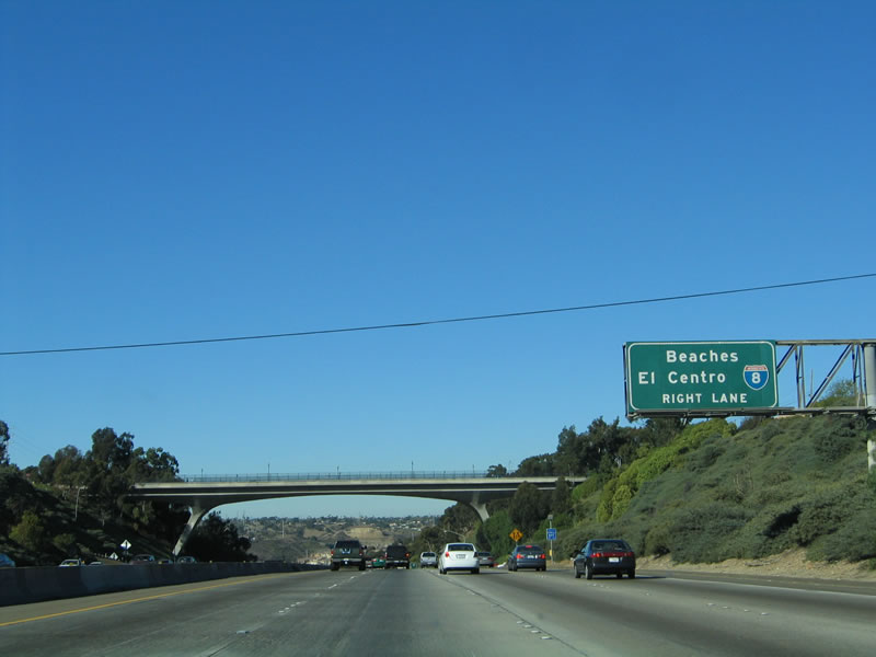
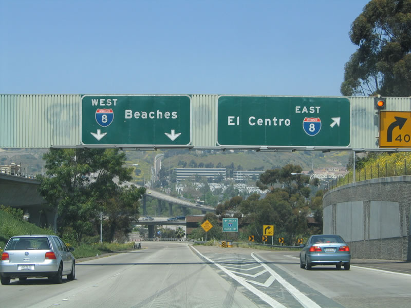
| Interstate 8 heads west to the beaches and Mission Bay, while eastbound Interstate 8 heads toward the east county suburbs of La Mesa and El Cajon before passing over the Laguna Mountains en route to the Imperial Valley and the city of El Centro. 11/19/05 |
|
| The tall arch bridge ahead carries Adams Avenue over Interstate 805 via the Roscoe E. Hazard Bridge; it provides a gateway from North Park and City Heights to Mission Valley. There is no access from northbound to Adams Avenue. The exit for Interstate 8 is just ahead, and down at the floor of Mission Valley. 11/19/05 |
|
| The right lane becomes exit only to Interstate 8, while the number four lane is a optional lane, providing access to either northbound Interstate 805 or Interstate 8. 11/19/05 |
|
| Northbound Interstate 805 reaches Exit 17, Interstate 8/Mission Valley (Alvarado) Freeway. Interstate 805 now crosses Mission Valley on this massive bridge, which stays high above the valley floor. 11/19/05 |
|
| This gore point sign along northbound Interstate 805 for Exit 17/Interstate 8 was the first exit number gore point sign posted on the entire route. Ironically, it was knocked down and replaced with a non-numbered sign since this photo was taken. Other exit number signs have since appeared along both directions of Interstate 805, notably at the Olympic Parkway interchange (Exit 4) and at the Local Bypass (Sorrento Valley Road offramp on northbound). 04/14/05 |
|
| Now on the transition ramp from northbound Interstate 805 to Interstate 8, the two left lanes transition to westbound Interstate 8, while the right lane transitions to eastbound Interstate 8 (with a direct connection to Interstate 15 northbound). 04/14/05 |
|
| As part of the transition ramp from Interstate 805 north to Interstate 8, the two lane ramp passes under the massive Jack Schrade Bridge, which carries Interstate 805 over 200 feet above the floor of Mission Valley. This symmetrical stack design is inspired from the original Four-Level Interchange in Los Angeles, where U.S. 101 (Hollywood Freeway north and Santa Ana Freeway south) meets SR 110 (Harbor Freeway south and Pasadena Freeway north). However, this particular interchange is spread over a larger area within a wide valley. 04/14/05 |
|
| The eight lane Jack Schrade Bridge crosses over Mission Valley. Named for Senator Jack Schrade, the bridge (also called a viaduct) was constructed along with the majority of Interstate 805 north of City Heights in 1973. 11/19/05 |
|
| Distance sign on the Mission Valley bridge for the next three exits: Exit 18, Murray Ridge Road/Phyllis Place; Exit 20A, Kearny Villa Road/Mesa College Drive; and Exit 20B, SR 163 north. 11/19/05 |
|
| The next exit along northbound Interstate 805 is Exit 18, Murray Ridge Road/Phyllis Place. This interchange is located at the north end of the Jack Schrade Bridge, as Interstate 805 climbs out of Mission Valley and enters the community of Serra Mesa. 11/19/05 |
|
| Northbound Interstate 805 reaches Exit 18, Murray Ridge Road. There is no access to Mission Valley via this interchange, even though early plans called for such a connection to be constructed. 11/19/05 |
|
| Like the Roscoe E. Hazard Bridge at the south end of Mission Valley, the Phyllis Place bridge features unique design features. The understructure of this concrete bridge has supports shaped like a "Y." 11/19/05 |
|
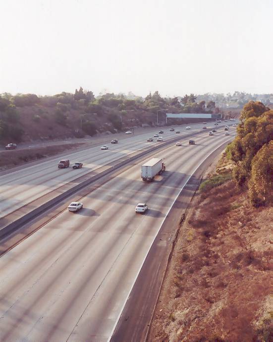
| This view of northbound Interstate 805 is afforded from the overpass of Murray Ridge Road (Exit 18). 10/01/00 |
|
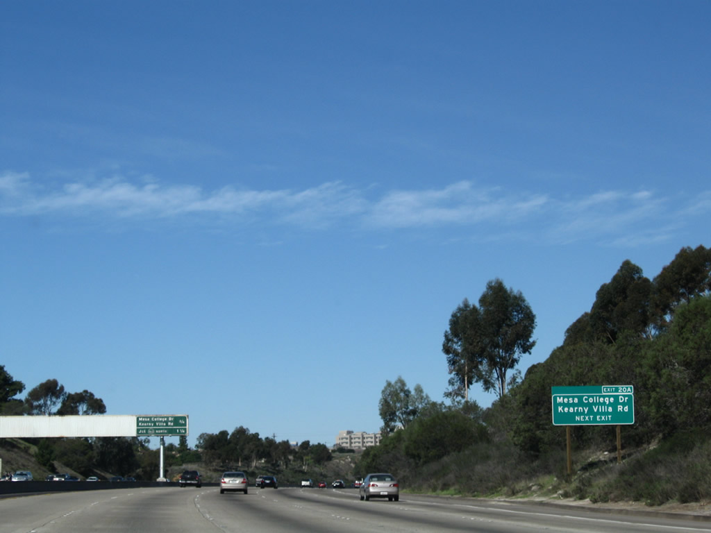
| The next exit along northbound Interstate 805/Dekema (Inland) Freeway is Exit 20A, Kearny Villa Road/Mesa College Drive. 01/18/09 |
|
| This distance sign along northbound Interstate 805/Dekema (Inland) Freeway provides the distance to the next two exits: Exit 20A, Kearny Villa Road/Mesa College Drive and Exit 20B, SR 163/Cabrillo Freeway. 01/18/09 |
|
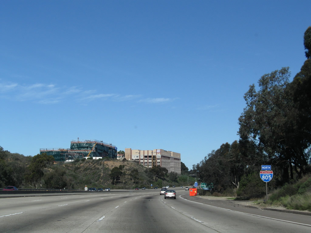
| An Interstate 805 north reassurance shield is posted soon thereafter. 01/18/09 |
|
| Exit 20A leads to Kearny Villa Road and Mesa College, a community college located in the Linda Vista community. 01/18/09 |
|
| Briefly, this sign was posted after the sign bridge collapsed (see next photobox for details). By 2008, this sign was gone. 04/23/06 |
|
| Northbound Interstate 805 reaches Exit 20A, Kearny Villa Road/Mesa College Drive; the next exit is Exit 20B, SR 163//Cabrillo Freeway. This sign bridge collapsed on January 23, 2006, when a recycling truck with its bin raised hit the sign bridge. Caltrans indicated that the 34-year-old sign bridge weighed over 18 tons and will likely be replaced with a lighter structure than the one that preceded it. Only one person was injured, and no one was killed. As a result of the accident, traffic was snarled for hours. Sources: San Diego Union-Tribune articles by Elizabeth Fitzsimons: "Sign falls on I-805, snarls commute" (01/24/06) and "Caltrans works on replacing freeway sign" (01/25/06). A new sign was installed about a year after the accident; the new sign features exit numbers and is on a more modern kind of sign bridge support structure. 01/18/09, 04/23/06, 11/19/05 |
|
| SR 163 (Cabrillo Freeway) angles northeast from here along the old alignment of U.S. 395 to meet Interstate 15 near Miramar Marine Corp Air Station. Interstate 15 in turn heads north to the northern communities of San Diego and the city of Escondido. 01/18/09 |
|
| Northbound Interstate 805 reaches Exit 20B, SR 163/Cabrillo Freeway. There is only a connection from northbound Interstate 805 to northbound SR 163 at this interchange, with the assumption that no one would want to go the opposite direction. 01/18/09 |
|
| The Interstate 805 and SR 163 interchange has only two connections, both of which are served by flyover ramps. The bottom level of the interchange is Interstate 805, and the second level is SR 163 (former U.S. 395). 11/19/05 |
|
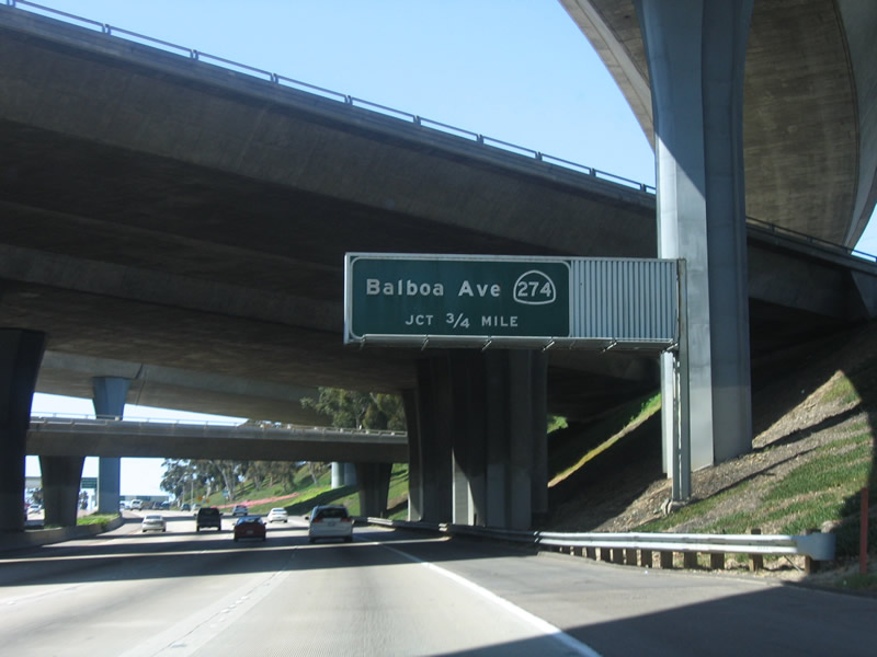
| Although decommissioned in 2001, signs remained in April 2006 for SR 274, which used to follow Balboa Avenue between Interstate 5 and Interstate 15 from Pacific Beach east to Tierrasanta via Clairemont and Kearny Mesa. 04/23/06 |
|
| The next three exits along northbound Interstate 805 are Exit 21, SR 274/Balboa Avenue; Exit 22, Clairemont Mesa Boulevard; and Exit 23, SR 52 (Soledad Freeway). 01/18/09 |
|
| Northbound Interstate 805 reaches Exit 21, Junction Former SR 274, Balboa Avenue. SR 274 was decommissioned by the state and accepted into city responsibility during a period between 1999 and 2001. As of April 2006, these signs remain. 01/18/09 |
|
| Northbound Interstate 805 reaches Exit 21, Junction Former SR 274, Balboa Avenue. 01/18/09 |
|
| The interchange between Interstate 805 and SR 274 is a modified cloverleaf. This picture provides a view of the signage for Balboa Avenue as seen along northbound. 11/19/05 |
|
| This distance sign along northbound Interstate 805 provides the distance to the next two exits: Exit 22, Clairemont Mesa Boulevard and Exit 23, SR 52. 11/19/05 |
|
| Northbound Interstate 805/Dekema Freeway reaches Exit 22, Clairemont Mesa Boulevard. 01/18/09 |
|
| Now on the collector distributor lanes on the northbound side of Interstate 805, this ramp connects to westbound Clairemont Mesa Boulevard into the Clairemont community of the city of San Diego. 02/16/05 |
|
| This distance sign along northbound Interstate 805 provides the distance to the next three exits: Exit 23, SR 52; Exit 24, Governor Drive; and Exit 25A, Nobel Drive. 11/19/05 |
|
| The next exit along northbound is Exit 23, SR 52 (Soledad Freeway). 01/18/09 |
|
| Northbound Interstate 805 reaches Exit 23, SR 52/Soledad Freeway. The first constructed segment of SR 52 consisted of only the section between Interstate 805 and Interstate 5, but the freeway was extended in stages during the 1980s and 1990s to its current eastern terminus at SR 125. The SR 52 freeway is planned for extension to SR 67 by 2008. 04/09/06 |
|
| Now on the transition ramp, the left two lanes connect to west SR 52, while the right lane has an exit to east SR 52 en route to Mission Trails and Santee. 04/23/06 |
|
| Most of the stack interchange with SR 52 is not visible from Interstate 805; however, it can be seen from the transition ramp connecting northbound Interstate 805 to westbound SR 52. Note the spring wildflowers, which add color to the interchange landscaping. 04/23/06 |
|
| Northbound Interstate 805 approaches Exit 24, Governor Drive. This exit only lane was created by traffic entering from the SR 52 interchange (Exit 23). 11/19/05 |
|
| Northbound Interstate 805/Dekema Freeway approaches Exit 24, Governor Drive. This exit only lane was created by traffic entering from the SR 52 interchange (Exit 23). 01/14/07 |
|
| This distance sign along northbound Interstate 805 provides the distance to Exit 24, Governor Drive; Exit 25A, Nobel Drive; and Exit 25B, La Jolla Village Drive west and Miramar Road east. This sign was replaced in 2001 as a result of the construction of the then-new Nobel Drive Exit 25A (which is shown on this new sign). 01/14/07 |
|
| Northbound Interstate 805 reaches Exit 24, Governor Drive. 01/14/07 |
|
| The next exit along northbound Interstate 805 is Exit 25A, Nobel Drive. The property to the east (right) of the freeway is part of the Miramar Marine Corps Air Station (Miramar was a Naval property until the late 1990s). 01/14/07 |
|
| Northbound Interstate 805/Dekema Freeway approaches Exit 25A, Nobel Drive (next right). This new interchange was completed in 2001 as an additional access from Interstate 805 into the "Golden Triangle," a cluster of banking and investment institutions in the University community (which is frequently considered as part of the community of La Jolla by local San Diegans). The development of the Golden Triangle funded construction of this new interchange. 03/24/06 |
|
| Northbound Interstate 805 meets Exit 25A, Nobel Drive. Nobel Drive east connects to Miramar Road, but it avoids the busy La Jolla Village Drive/Miramar Road interchange (Exit 25B). Follow Nobel Drive east to the Miramar National Cemetery, which was dedicated on January 30, 2011. Nobel Drive west leads into the heart of the University community, connecting to the "downtown" portion of the Golden Triangle as well as a variety of shops and homes. 01/14/07 |
|
| Use Miramar Road east to the Marine Corps Air Station (MCAS) Miramar. This large air station was formerly occupied by the U.S. Navy (Naval Air Station (NAS) Miramar) until 1997 when the U.S. Marines took command of the sprawling facility. This military base is generally bounded by Interstate 805 on the west, Miramar Road on the north, Interstate 15 and Kearny Villa Road on the east, and SR 52 and Miramar Landfill on the south. 09/18/11, 01/14/07 |
|
| The next exit along northbound Interstate 805 is Exit 25B, La Jolla Village Drive/Miramar Road. A new sign, complete with exit number, was added in late summer 2011 to accompany the revision of the interchange at Exit 25B. The interchange was changed from a modified cloverleaf to a parclo. 09/18/11 |
|
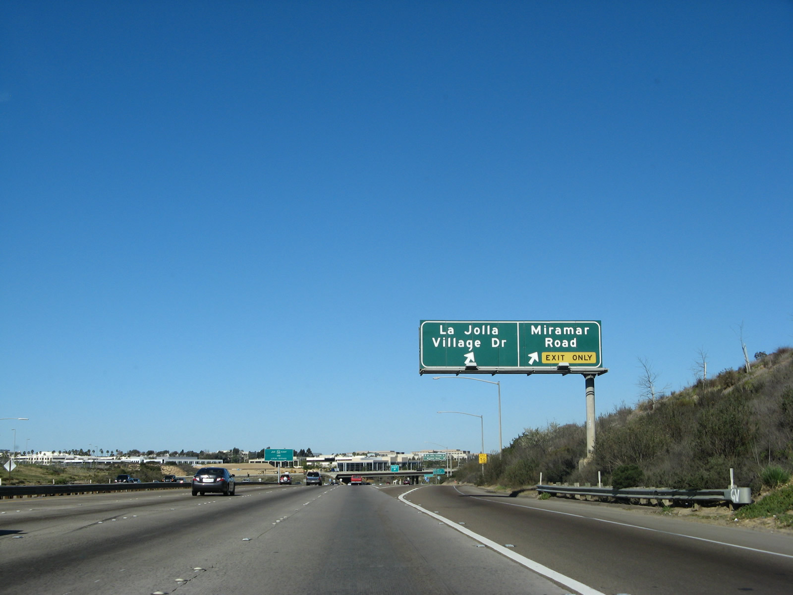
| This distance sign mounted on the Nobel Drive overpass provides the distance to two of the next three exits along Interstate 805 north: Exit 25B, La Jolla Village Drive west and Miramar Road east; Exit 27A, Mira Mesa Boulevard and Vista Sorrento Parkway; and Exit 27B, Sorrento Valley Road. This entire road was known as Miramar Road until the Golden Triangle (North University City) was developed. At that time, the section of Miramar Road through the University community (so named due to proximity to the University of California at San Diego) was renamed La Jolla Village Drive. This six- to eight lane divided highway is very busy, especially during commute hours. Miramar Road, meanwhile, continues east of this point, following the northern border of the Miramar Marine Corps Air Station all the way to Interstate 15. The roadway passes by a variety of shops and serves the Mira Mesa community. 01/14/07 |
|
| Northbound Interstate 805 meets Exit 25B, La Jolla Village Drive and Miramar Road. This parclo (formerly a modified cloverleaf) interchange is extremely busy during commuting areas, and the quantity of vehicles passing through this interchange is enough to overwhelm it on any given weekday afternoon. 08/18/12, 03/24/06 |
|
| Prior to the interchange reconstruction, an overhead sign on the offramp to Exit 25B used to split between La Jolla Village Drive west and Miramar Road east. In the median, northbound traffic on Interstate 805 sees its first guide sign advising those headed for eastbound SR 56 to use the "Local Bypass" ramps. 01/14/07, 03/24/06 |
|
| Now exiting Interstate 805 north, the offramp quickly widens to four lanes. Two lanes connect to La Jolla Village Drive west, while the two right lanes connect to Miramar Road east to MCAS Miramar and southern Mira Mesa. Much of Miramar Road is a busy commercial corridor with dozens of businesses that line this busy, six lane street. 09/18/11 |
|
| Back on the mainline, the next exit along northbound Interstate 805 is Exit 27A, Mira Mesa Boulevard/Vista Sorrento Parkway, three-quarters of a mile. This sign is mounted on the La Jolla Village Drive/Miramar Road overpass and was replaced as part of the Local Bypass project at the Interstate 5/Interstate 805 Merge. In the old version of this sign, Interstate 5 was listed as the next exit, and Exit 27B (Sorrento Valley Road) was omitted as the last exit along northbound Interstate 805. 03/24/06, 11/19/05 |
|
| Interstate 805 will merge with Interstate 5 in three miles. The next exit is Exit 27A, Mira Mesa Boulevard and Vista Sorrento Parkway. The Eastgate Mall overpass, a concrete arch bridge, comes into view in the background. 03/24/06 |
|
| This is an unobstructed view of the Eastgate concrete arch bridge overcrossing, as seen from northbound Interstate 805. This is one of two overpasses in San Diego County with this unique design; the other is on Interstate 15 at Lilac Road. 03/24/06 |
|
| For access to Exit 32, Carmel Mountain Road, use the "Local Bypass" lanes. 08/18/12 |
|
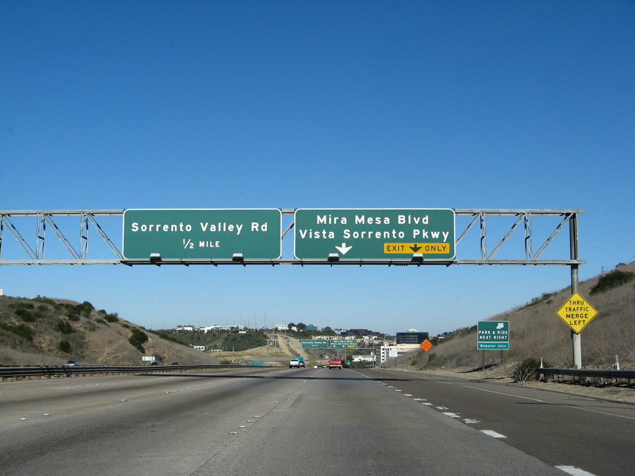
| Use the two right lanes to connect to Exit 27A, Mira Mesa Boulevard/Vista Sorrento Parkway. The next exit is Exit 27B, Sorrento Valley Road. This exit is one of the busiest on Interstate 805 as a result of the cluster of high-tech companies that have established a Sorrento Valley or Mira Mesa Boulevard address. Major construction to add a direct access ramp from Interstate 805 to Carroll Canyon Road has resulted in changes to this area by 2011. Check back later for updated pictures. 01/14/07 |
|
| Northbound Interstate 805 (Dekema Freeway) reaches Exit 27A, Mira Mesa Boulevard east, Vista Sorrento Parkway north, and Mira Sorrento Place east. 01/14/07 |
|
| Passing through Sorrento Valley, Interstate 805 serves one of the primary employment centers in the city of San Diego. A variety of companies, including several technology companies (led by Qualcomm), have campuses on Mira Mesa Boulevard east of Interstate 805. 03/24/06, 11/19/05 |
|
| The next exit along northbound Interstate 805 is Exit 27B, Sorrento Valley Road. Due to environmental concerns associated with the Los Peñasquitos Lagoon, there is no connection to Carmel Valley Road via Sorrento Valley Road. Use Vista Sorrento Parkway or Interstate 5 instead to connect to Carmel Valley Road. 01/14/07, 11/19/05 |
|
| A temporary construction sign provided information on the construction project at the Interstate 5/805 merge. At the time this picture was taken, the northbound local bypass had just opened, but the southbound local bypass had not. 03/24/06 |
|
| This is the final northbound Interstate 805 shield. 03/24/06, 01/14/07 |
|
| Interstate 805 splits into the through lanes and "local bypass." The through lanes merge onto northbound Interstate 5, while the local bypass lanes connect to Exit 32, Carmel Mountain Road, and Exit 33A, SR 56 East. Use the main lanes to Carmel Valley Road and destinations from that point northward. Trucks are encouraged but not required to use the local bypass. 03/24/06 |
|
| A new left lane is added to northbound Interstate 805: a high occupancy vehicle lane. The lane travels through the merge, and it rejoins mainline Interstate 5 traffic at Via de la Valle. Plans call for this lane to be extended both north and south of its current extent. 03/24/06, 01/14/07 |
|
| Northbound Interstate 805 splits, with the four left lanes connecting onto mainline Interstate 5 and the right two lanes transitioning onto the "local bypass." The overpass in the distance is Interstate 5, which will merge onto Interstate 805 from the right. 03/24/06, 01/14/07 |
|
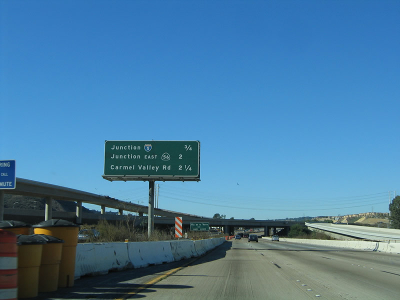
| This distance sign provides the distance to Exit 29, Junction Interstate 5; Exit 33B, Carmel Valley Road; and Exit 34, Del Mar Heights Road. 03/24/06, 11/19/05 |
|
| Prior to 1999, there was an "END Interstate 805" shield assembly here, but it was removed at the beginning of the construction of the carpool/high occupancy vehicles. Unfortunately, that shield assembly was not replaced (and we don't have a picture of it). 03/24/06 |
|
| Interstate 805 carries four lanes under the Interstate 5 flyover ramp. These four lanes will become the main lanes for northbound Interstate 5. Trucks in the right lane should be mindful of the merging traffic incoming from northbound Interstate 5. All four right lanes (incoming from Interstate 5) either end or become exit-only, so that only five lanes remain north of Del Mar Heights Road. This interchange is planned for conversion into a dual freeway, which will provide for a truck bypass (dedicated truck lanes) as well as separation of local and express traffic. 03/24/06 |
|
| The new high occupancy vehicle lane appears on the left lane of the freeway. 03/24/06 |
|
| Interstate 805 north ends here, at the point where Interstate 5 merges onto Interstate 805. This merge point is frequently backed up during commute hours, and delays may be likely when the road is expanded into a dual freeway. The explosion of traffic along Interstate 5 north of SR 56 is due to the growth of new housing in previously undeveloped portions of the county. So much growth has occurred that talk has resurfaced about not only expanding existing road and rail facilities but also consideration of a third parallel north-south freeway (likelihood: very unlikely). Such a new freeway would be very expensive and would be very, very controversial. It all depends on the severity of traffic jams along Interstates 5 and 15. 03/24/06 |
10/01/00, 02/16/05, 04/14/05, 11/19/05, 03/24/06, 04/09/06, 04/23/06, 01/14/07, 01/18/09, 09/18/11, 08/18/12, 07/28/14 by AARoads
Page Updated 10-16-2014.

 North
North