|
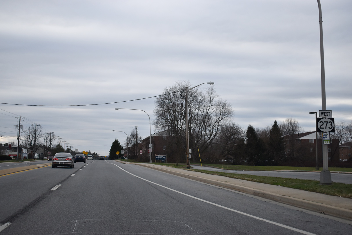
| Begin SR 273 shield assembly posted along Frenchtown Road west from SR 141 (Basin Road) north and SR 9 (Washington Street) south. The truck route for SR 9 coincides with SR 273 west to Hares Corner, U.S. 13 (Dupont Highway) south to Tybouts Corner and Hamburg Road east back to SR 9. 12/23/18 |
|
| Centerpoint Boulevard spurs south from SR 273 (Frenchtown Road) to Centerpoint Business Complex. The industrial park is the historic site of Bellanca Airport. 12/23/18 |
|
| The rural stretch along the north side of Frenchtown Road concludes as SR 273 intersects Trader Lane north to the New Castle Farmers Market and Quigley Boulevard south to Airport Industrial Park. 12/20/16 |
|
| Continuing west, SR 273 reaches the crossroads with U.S. 13/40 (Dupont Highway) at Hares Corner. 12/24/17 |
|
| U.S. 13/40 (Dupont Highway) combine for 3.56 miles along an eight lane stretch from I-295 at Farnhurst southwest to State Road. U.S. 13 ventures south to Smyrna and Dover. U.S. 40 west follows Pulaski Highway west to Bear, Glasgow and Elkton, Maryland. 12/26/20 |
|
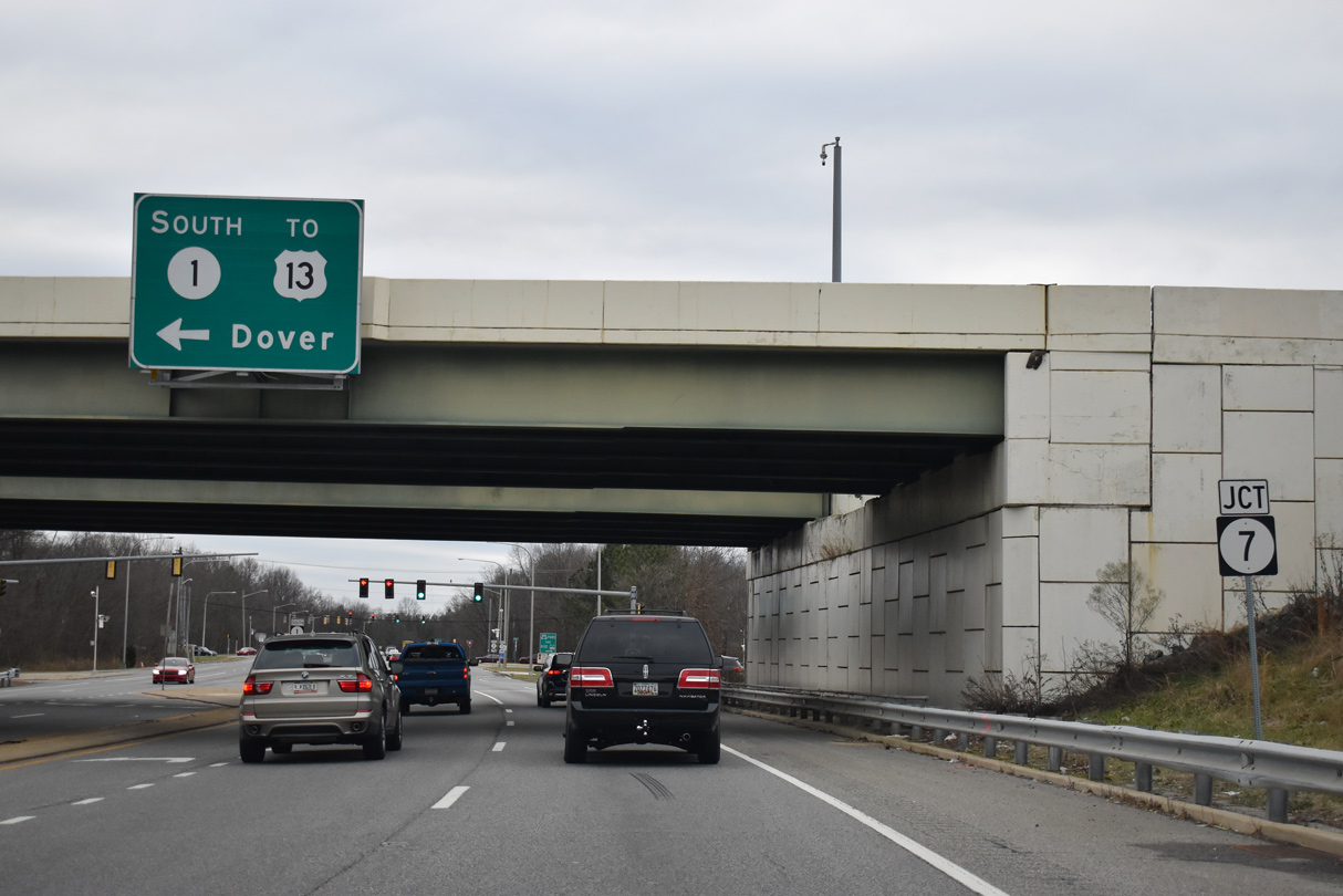
| SR 273 (Christiana Road) leads away from Hares Corner and New Castle County Airport (ILG) three miles to Christiana and eight miles to Newark. 12/26/20 |
|
| SR 58 (Churchmans Road) angles northwest from the ensuing intersection to an industrial park area west of New Castle County Airport (ILG) and Churchmans Crossing. 12/26/20 |
|
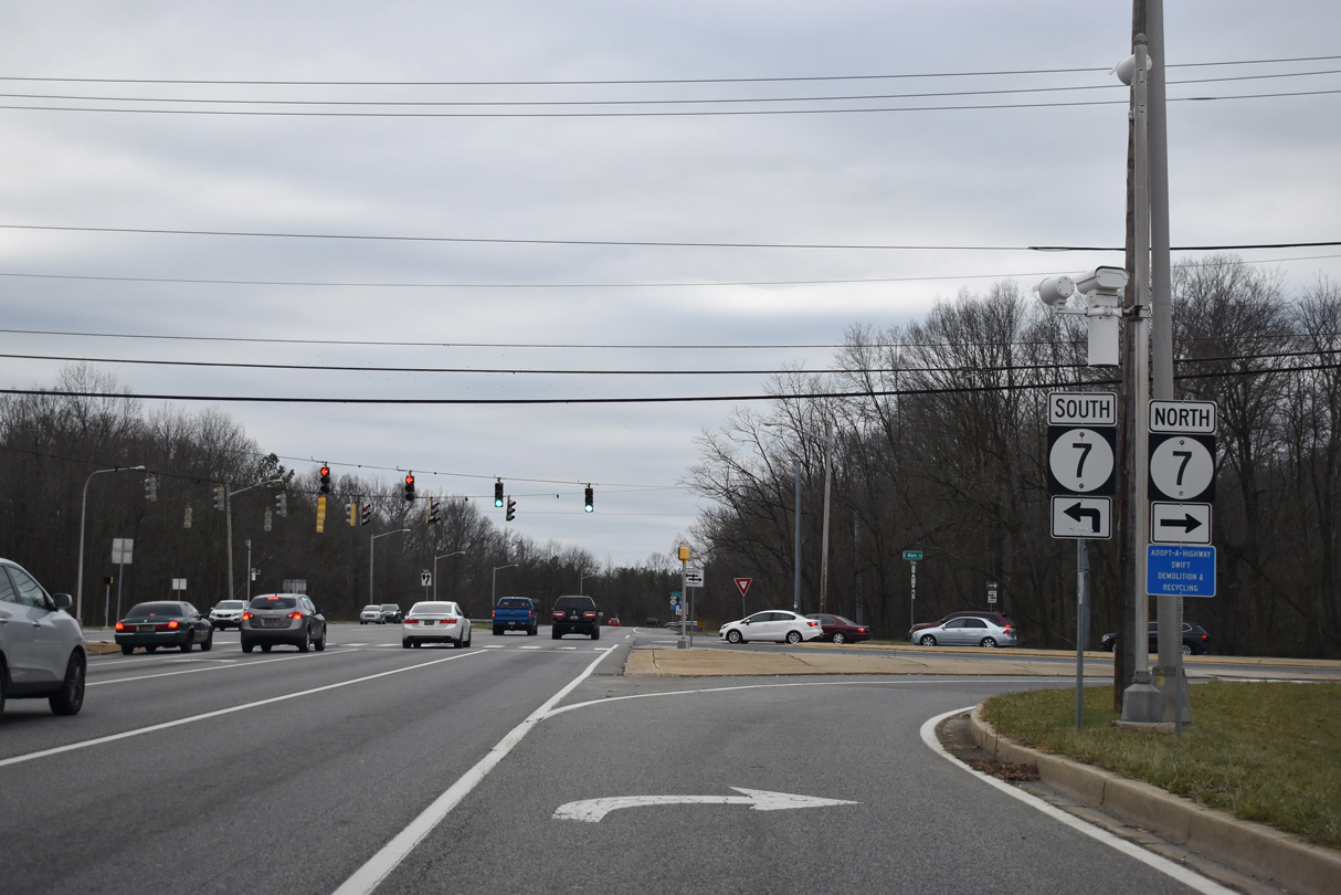
| SR 58 stems west from SR 273 (Christiana Road) across from Churchmans Industrial Center to SR 7 at the Stanton Campus of Delaware Technical & Community College (DTCC), and SR 4 by Christiana Hospital. 12/23/22 |
|
| Christiana Road advances west from SR 58 to the south of Churchmans Corporate Center. 12/26/20 |
|
| The first in a series of traffic lights with adjacent residential streets is located at Rambleton Acres Shopping Center with Pranges Lane south. 12/26/20 |
|
| A remaining agricultural area spreads to the north across from Rambleton Acres to Churchmans Road (SR 58). 12/26/20 |
|
| Scottie Lane north from the Melanie Woods subdivision and Pleasant Place south from Pleasantville Elementary come together at the next signal along SR 273 west. 12/26/20 |
|
| Reassurance shield for SR 273 posted west of Pleasant Place on Christiana Road. 12/26/20 |
|
| The intersection with Edinburgh Drive north to the Straford community was reconstructed in 2014. 12/26/20 |
|
| Westbound SR 273 after Edinburgh Drive. 12/26/20 |
|
| Installed in Fall 2017, HAWK pedestrian signals operate along SR 273 at Freedom Trail and Georgetown Manor Apartments. 12/26/20 |
|
| Airport Road (SR 37) angles southwest between the Stratford and Whitehall communities to intersect SR 273 (Christiana Road) at Community Plaza shopping center. 12/26/20 |
|
| SR 37 travels northeast to the New Castle Corporate Commons business park and SR 141 (Basin Road) near the exchange with I-95/295. 12/26/20 |
|
| This confirming marker for SR 273 west was previously posted between SR 37 and Appleby Road south. 12/22/12 |
|
| Appleby Road links SR 273 (Christiana Road) with the Wilton community and U.S. 40 (Pulaski Highway) east of Bear. Villas Drive ties in from an adjacent apartment complex to the north. 12/26/20 |
|
| A small guide sign references the upcoming diamond interchange with SR 1 along SR 273 west by Lewden-Greene Park. 12/26/20 |
|
| SR 1 constitutes a commuter freeway south to Bear and north to SR 58 at Churchmans Crossing. SR 7 joins SR 1 north from Christiana en route to Stanton. 12/26/20 |
|
| The northbound entrance ramp for SR 1 joins the freeway ahead of Christiana Mall and the multi level interchange with Interstate 95. 12/26/20 |
|
| SR 1 travels 103.02 miles overall from I-95 at Churchmans Crossing south to Smyrna, Dover, Milford and Fenwick Island. Future work at SR and SR 273 will improve the interchange and traffic pattern with adjacent SR 7. 12/26/20 |
|
| The second of three succeeding traffic lights operate at the southbound ramps with SR 1. The freeway south to U.S. 13 at Tybouts Corner opened to traffic in 1991. 12/26/20 |
|
| SR 1 replaced parallel SR 7 (Bear Christiana Road) as the through route from I-95 south to Bear and Red Lion. 12/30/18 |
|
| SR 7 serves local traffic north to the unincorporated community of Christiana along E Main Street and commuter traffic south to U.S. 40 (Pulaski Highway) along Bear Christiana Road. 12/26/20 |
|
| Constructed in the early 1980s, SR 273 circumvents Christiana to the south and west along the controlled access Christiana Bypass. 12/18/22 |
|
| Old Baltimore Pike (Road 26) extends 0.31 miles west from SR 7 and Christiana to meet SR 273 (Christiana Bypass) west at the succeeding traffic light. Old Baltimore Pike constitutes a three lane suburban boulevard west to SR 896 at Iron Hill. 12/18/22 |
|
| An access road connects SR 273 (Christiana Bypass) with the Christiana Town Center retail area and W Main Street (former SR 273) leading back into Christiana. 12/18/22 |
|
| The Christiana Bypass concludes at the commercialized intersection with Chapman Road (Road 347) west and Eagle Run Road north, one quarter mile ahead of the directional cloverleaf interchange with I-95. A greenout corrected the one quarter mile distance for the loop ramp to I-95 south. 12/19/22 |
|
| Eagle Run Road spurs north to the Christiana Promenade retail development. Chapman Road (Rd 347) heads 1.39 miles west from SR 273 and University Plaza Shopping Center to Christiana High School and Salem Church Road. 12/18/22 |
|
| A reassurance marker for SR 273 west appears just ahead of the northbound entrance ramp for Interstate 95. 12/18/22 |
|
| I-95 (John F. Kennedy Memorial Highway) heads east from SR 273 to split with I-295 north to the Delaware Memorial Bridge near Newport. A succeeding separation with I-495 divides traffic to Philadelphia through Wilmington. 12/19/22 |
|
| Future improvements at I-95/SR 273 outline converting the exchange to a DDI. 12/18/22 |
|
| The final 6.63 miles of I-95 south in Delaware connect with SR 896 at south Newark prior to the Newark Toll Plaza. 12/18/22 |
|
| Originally a diamond interchange, work in 1979 upgraded the exchange at I-95/SR 273 with two loop ramps and two flyover ramps. 12/18/22 |
|
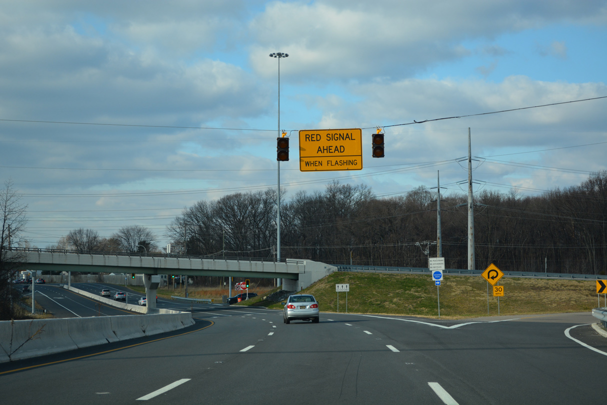
| Addressing weaving traffic between I-95 south and Harmony Road, a HSIP Project from Winter 2021 to Fall 2022 realigned the southbound exit ramp to a signalized intersection with SR 273. 12/18/22 |
|
| SR 273 (Christiana Road) meets Harmony Road (Road 355) north and Gerald Drive south at the Birchwood Park and Hillside Heights communities. Harmony Road is a popular commuter route north to SR 4 (Stanton Ogletown Road) and SR 2 (Old Capitol Trail). Chicanes and traffic islands were added along the major collector to discourage through traffic in 1997. 12/18/22 |
|
| Brownleaf Road intersects SR 273 (Christiana Road) westbound at the ensuing traffic light. The residential street connects Christiana Road with the adjacent Birchwood Park and Hillside Heights neighborhoods. 12/23/20 |
|
| Construction completed in 1997 realigned SR 273 west onto an expressway across SR 4 at Ogletown. The former alignment along Christiana Road was repurposed as Cedarwood Road by the what was the MBNA complex. 12/23/20 |
|
| Cedarwood Road connects SR 273 west with SR 4 (Ogletown Road), as does the adjacent loop ramp. 12/26/20 |
|
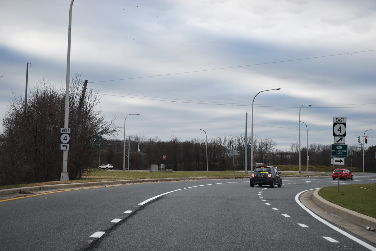
| SR 4 follows Chestnut Hill Road west from Ogletown to Brookside and south Newark. East from SR 273, SR 4 constitutes a principal arterial with over 30,000 vehicles per day to Christiana Hospital, Delaware Park and Churchmans Crossing. 12/23/20 |
|
| Additional ramps connecting SR 4 and Salem Church Road (Rd 348) with SR 273 tie into the expressway at a signalized intersection. 12/23/20 |
|
| HEP NCC, SR 273 and Red Mill Road Connector Intersection Improvements from April 2019 to October 2019 realigned Red Mill Road (Rd 352) and added a second left turn lane from Bala Road (Rd 91) to SR 273 eastbound. 12/23/20 |
|
| Bala Road (Rd 91) links SR 273 with Ogletown Road (Rd 18C) west at the Chestnut Hill Estates community and parallel Red Mill Road by Harmony Woods. 12/23/20 |
|
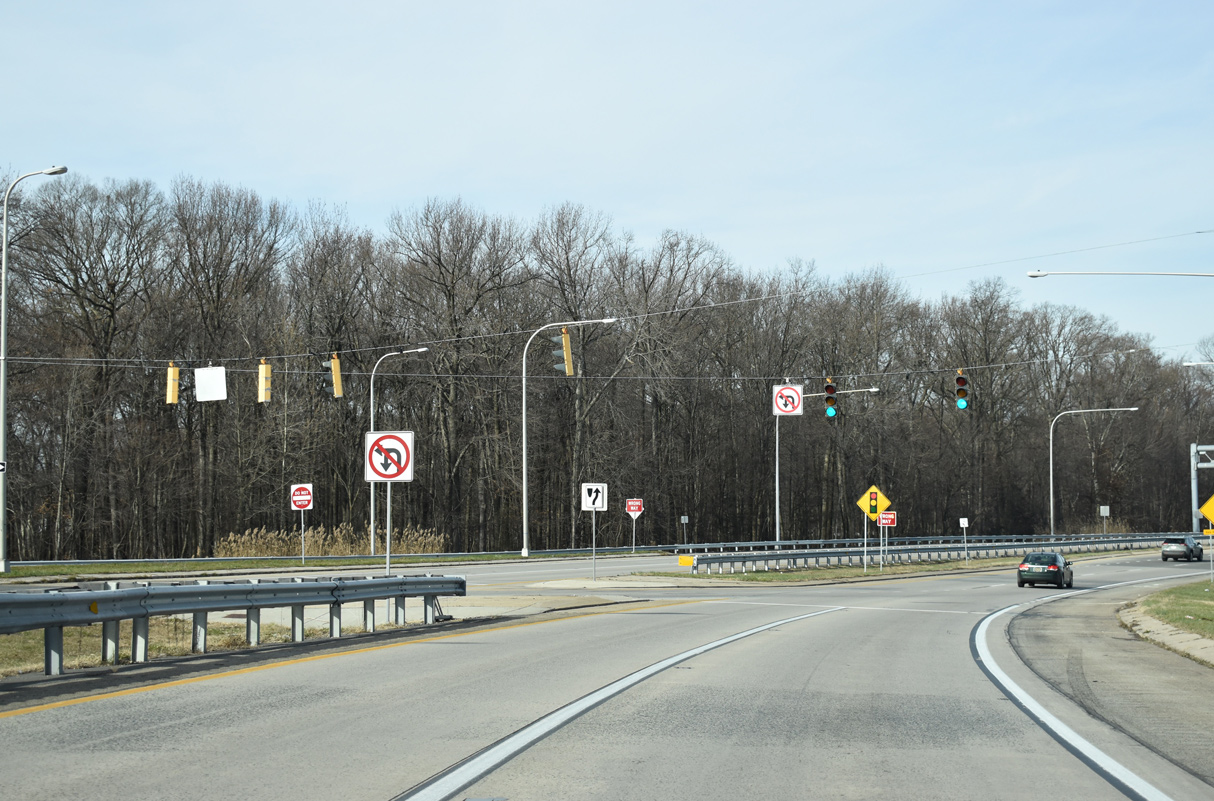
| The expressway along SR 273 traverses White Clay Creek area wetlands northward parallel to bridges across the AMTRAK Northeast Corridor. 12/24/22 |
|
| Curving west across AMTRAK, SR 273 enters the jug handle intersection with Ruthar Drive east to Harmony Industrial Park. 12/24/22 |
|
| Ruthar Drive (Road 65) provides a second route to Red Mill Road north as it connects with SR 2 and Polly Drummond Hill Road to the Upper Pike Creek Valley. 12/24/22 |
|
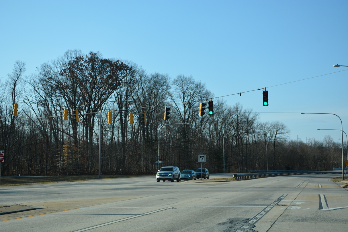
| Expansion from two to four lanes along SR 273 west to Marrows Road in Newark was completed by 1998. The widening resulted in three signalized intersections, the first with the former Avon Products plant. 12/26/20 |
|
| Ogletown Road, the former alignment of SR 273 through the Avon Underpass (AMTRAK Northeast Corridor), ties into the state route from the south at this signal. 12/26/20 |
|
| White Clay Center Drive north and Stafford Way south come together at SR 273 (Ogletown Road) by the White Clay Center business park. 12/26/20 |
|
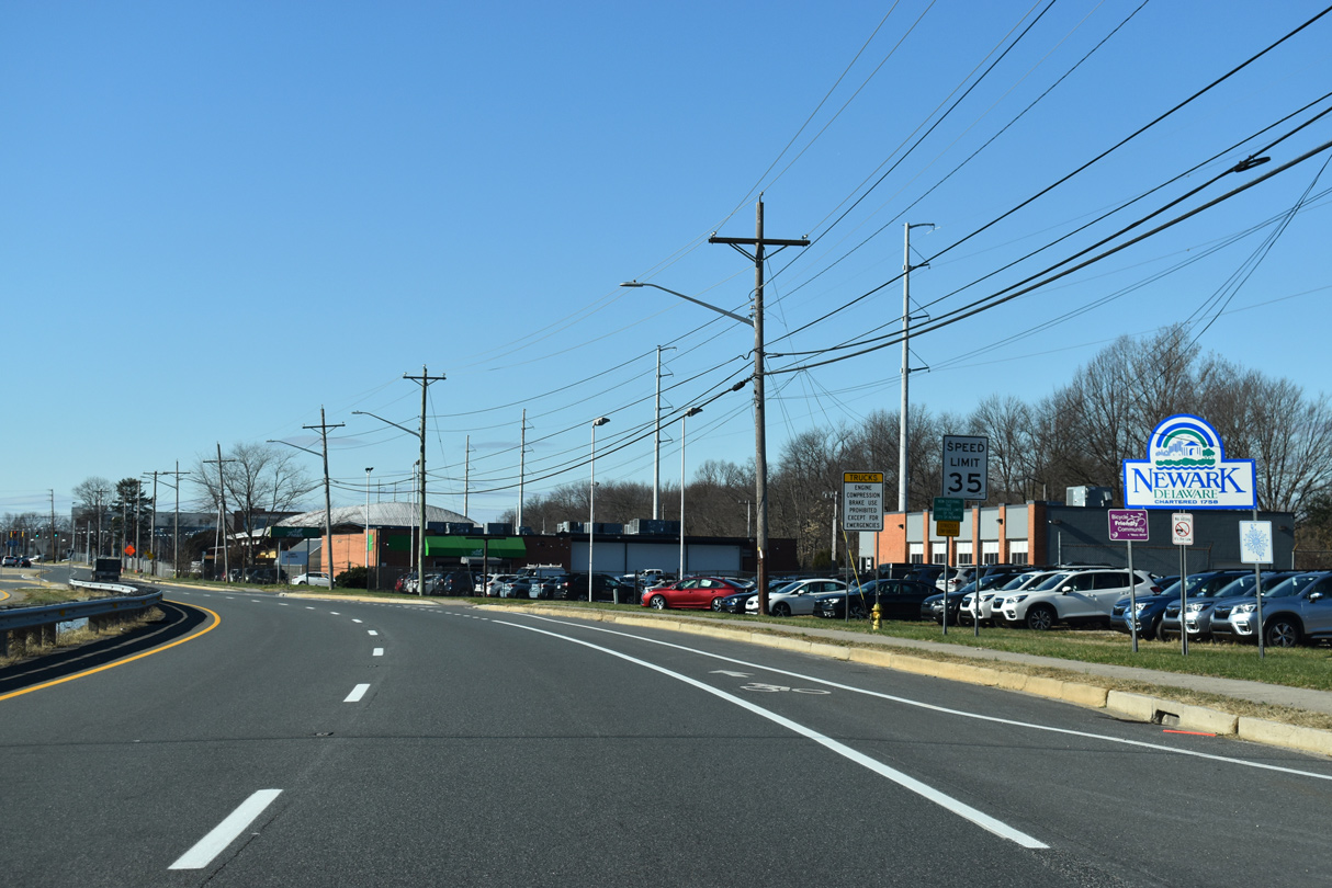
| The speed limit reduces to 35 miles per hour as SR 273 (Ogletown Road) enters the city limits of Newark just beyond the FMC plant. 12/26/20 |
|
| Marrows Road (Rd 351) runs along the back side of College Square to Wyoming Road and Delaware Technology Park. Spanning the AMTRAK Northeast Corridor, Marrows Road continues south to the Kimberton and Brookside communities and SR 4 (Chestnut Hill Road). 12/26/20 |
|
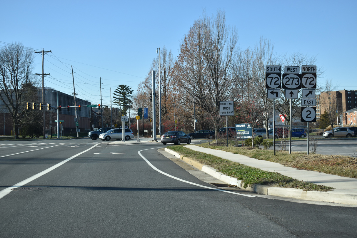
| SR 273 advances west to meet SR 2/72 at Library Avenue and E Main Street. SR 2 (Old Capitol Trail) commences a 10.81 mile route east to Prices Corner, Elsmere and Wilmington alongside SR 72 north. Prior to Fall 2013, SR 2 continued south along Library Avenue to SR 4 (Chestnut Hill Road) west. 12/26/20 |
|
| Ogletown Road west transitions into E Main Street as SR 273 advances to Downtown Newark. This route was also SR 2 Business until 2013.
SR 72 (Library Avenue) provides one of two routes from the University of Delaware south across the AMTRAK Northeast Corridor en route to the Bear-Glasgow area. SR 72 north travels to SR 7 in the Upper Pike Creek Valley. 12/26/20 |
|
| Old Capitol Trail becomes Library Avenue south from SR 273 (E Main Street) to the Newark Free Library and College Square Shopping Center. Commuter traffic occasionally backs up along the arterial from the nearby intersection with Cleveland Avenue. 01/04/19 |
|
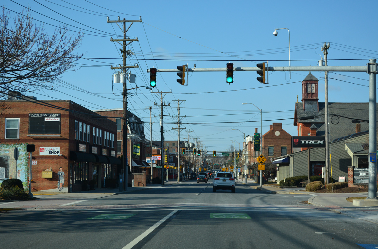
| SR 273 partitions into a one way couplet beyond SR 72 (Library Avenue). Westbound follows Main Street through the Newark business district while eastbound follows Delaware Avenue through portions of the University of Delaware (UD) campus to the south. 01/04/19 |
|
| A ramp provides direct access from the ending SR 2 west and SR 72 (Old Capitol Trail) south onto SR 273 (East Main Street). 12/24/22 |
|
| Traffic from Old Capitol Trail and Ogletown Road west converges ahead of a pedestrian signal at the Main Towers driveway. 12/24/22 |
|
| Tyre Avenue is a residential street linking E Main Street with Delaware Avenue (SR 273 east) by Newark High School. The traffic light with SR 273 west was expanded in 1999 to serve the adjacent Market East Plaza retail area to the north. 12/24/22 |
|
| Pomeroy Lane serves a bus depot and municipal parking lot as it flows north from Delaware Avenue to a signalized end at E Main Street. The driveway replaced a portion of an abandoned railroad line. 12/24/22 |
|
| SR 273 (E Main Street) west reaches Downtown Newark at Chapel Street. Prior to the 1979 construction of Library Avenue over the AMTRAK Northeast Corridor, Chapel Street was designated as SR 72 north to Paper Mill Road and south across an at-grade railroad crossing to SR 4 (Chestnut Hill Road). 12/24/22 |
|
| Academy Street heads south from E Main Street to the University of Delaware campus, E Park Place and Lewis Park. 12/24/22 |
|
| An additional pedestrian signal was added along Main Street at The Green on the UD Campus in 2018. 12/24/22 |
|
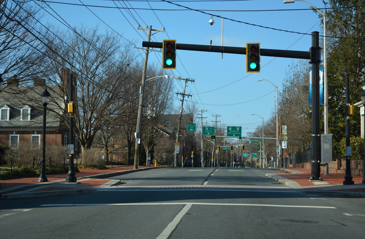
| SR 896 north combines with SR 273 along W Main Street from SR 273 (W Delaware Avenue) east, and a one block segment on S College Avenue. S College Avenue carried all of SR 896 south to I-95 until 1988, when it was realigned to move through traffic away from UD along overlaps with SR 4 (Christina Parkway) and newly designated SR 2 Business on Elkton Road. 12/24/22 |
|
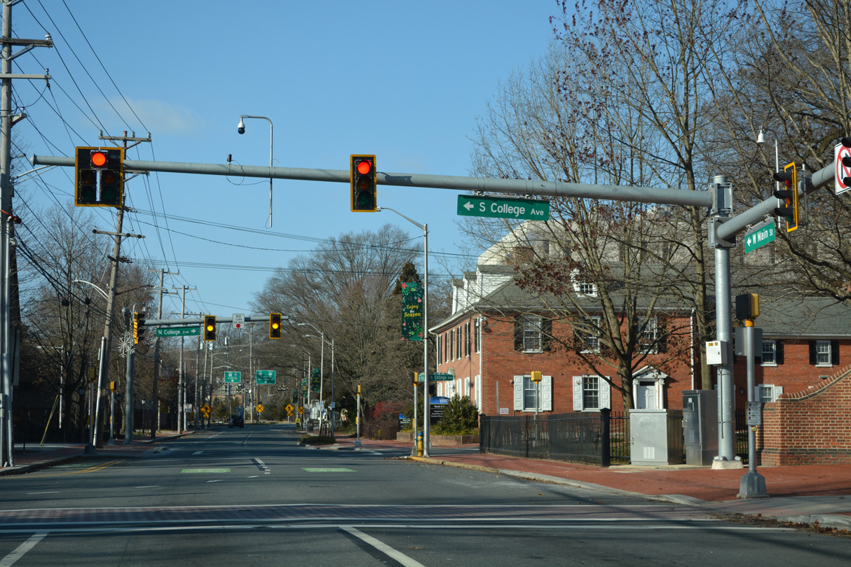
| Back to back intersections link S and N College Avenues with Main Street as it crosses the UD campus Green. 12/24/22 |
|
| N College Avenue connects W Main Street with northern reaches of the UD campus, Cleveland Avenue and Creek Road north into White Clay Creek State Park. 12/24/22 |
|
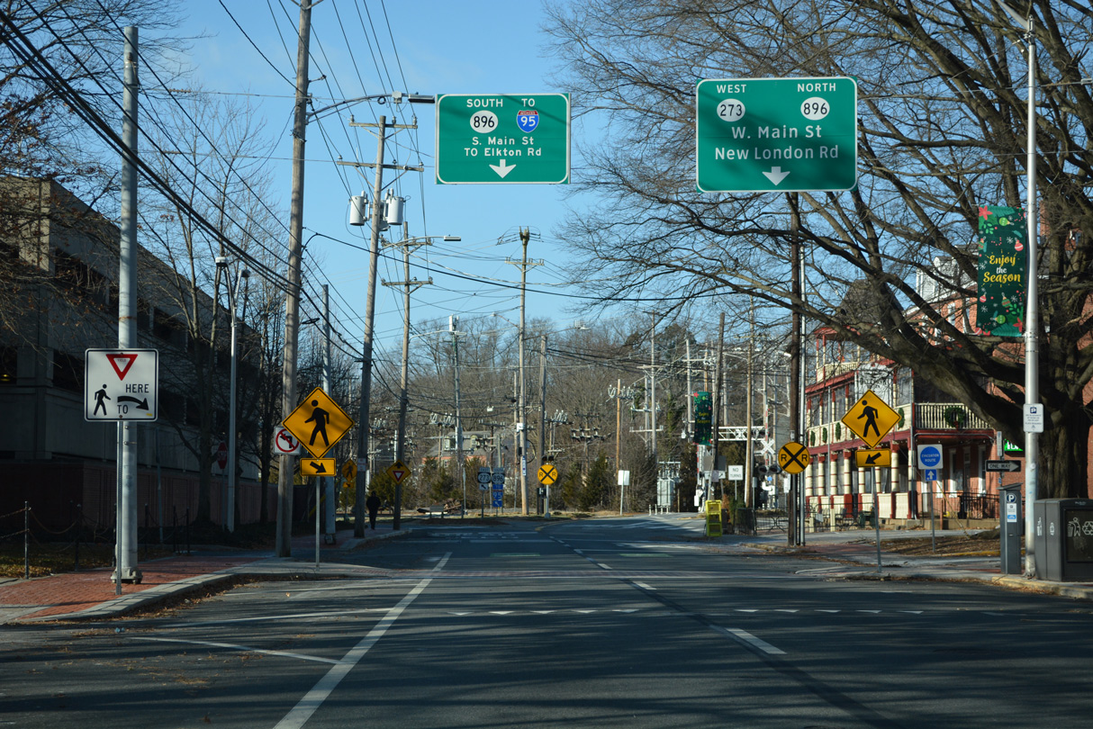
| SR 273 (W Main Street) passes by the historic Deer Park Tavern ahead of the split with SR 896 (New London Road) north and the turn off to S Main Street (SR 896 south / SR 273 east). 12/24/22 |
|
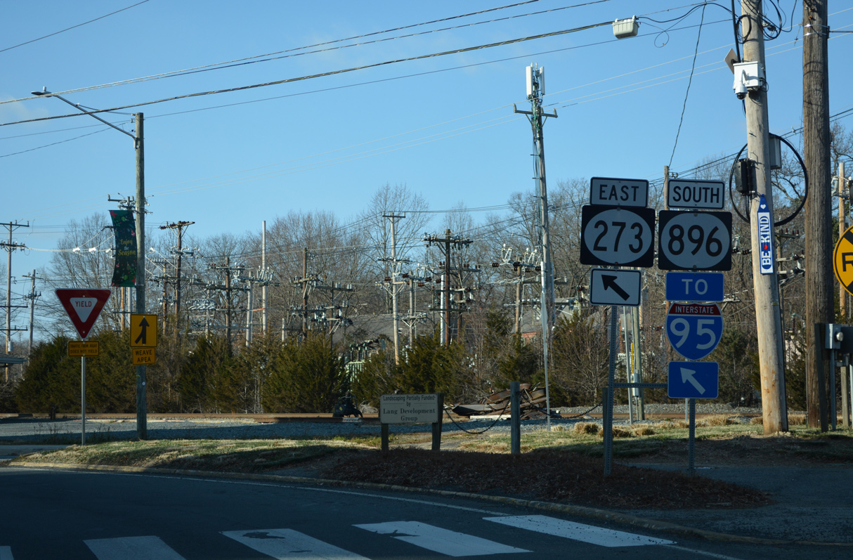
| SR 273 east briefly joins S Main Street to make the connection with Delaware Avenue east while SR 896 lines S Main Street and Elkton Road to SR 4 (Christina Parkway) east. S Main Street and Elkton Road provide a direct route from Downtown Newark to I-95 south in Cecil County, Maryland. 12/24/22 |
|
| New London Road carries the northbound component of SR 896 from W Main Street as a one way street to Hillside Road and Cleveland Avenue. The multi state route travels to White Clay Creek State Park, the northeastern tip of Maryland and New London, Pennsylvania. 12/24/22 |
|
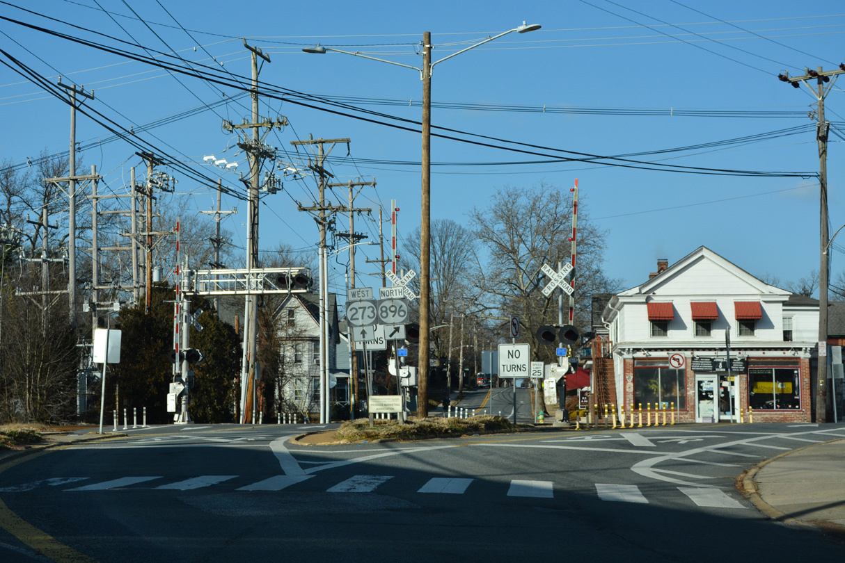
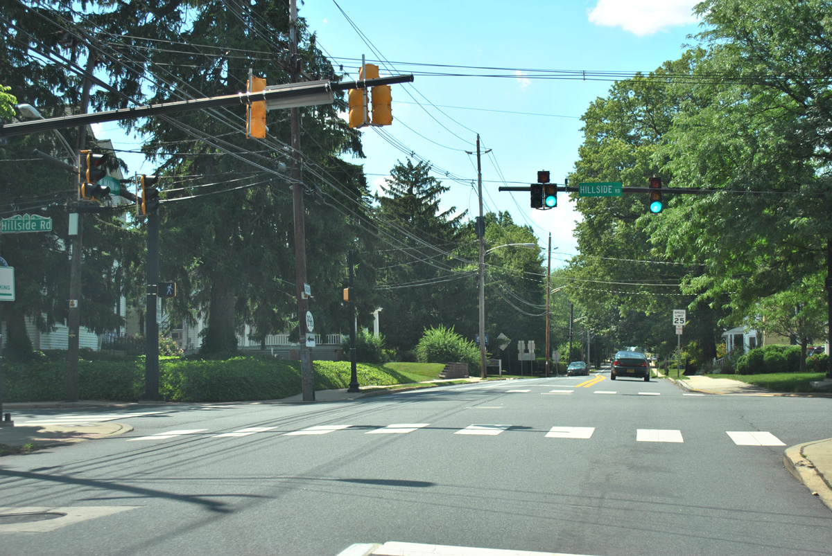
| Progressing a short distance beyond the CSX Railroad crossing, SR 273 (West Main Street) meets Hillside Road. Hillside Road carries SR 896 south from New London Road to West Main Street. West from SR 273, Hillside Road becomes Barksdale Road through residential areas of west Newark to Barksdale, Maryland. 06/23/12 |
|
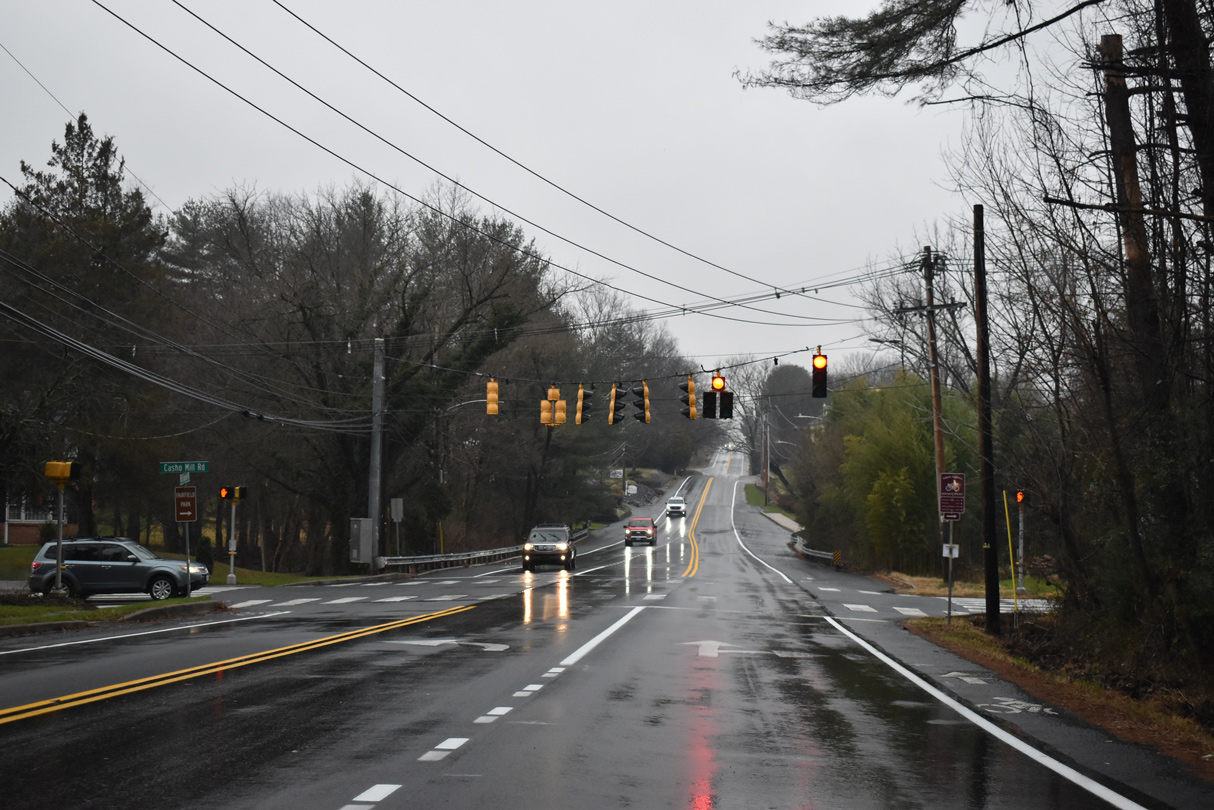
| Lowering into a valley fed by the upper reaches of the Christina River, SR 273 (Nottingham Road) intersects Casho Mill Road. Casho Mill Road (Road 361) provides a through route south to Barksdale Road and SR 896 (Elkton Road). Delrem Drive ties in from the Fairfield neighborhood to the north. 12/22/22 |
|
| A staggered intersection brings Wedgewood Road south from SR 896 (New London Road) and Jackson Hall School Road east from Cowentown, Maryland at SR 273 next to the Maryland state line. 12/21/07 |
12/21/07, 06/23/12, 12/22/12, 12/20/16, 12/24/17, 12/23/18, 12/30/18, 01/04/19, 12/23/20, 12/26/20, 12/18/22, 12/19/22, 12/22/22, 12/23/22, 12/24/22 by AARoads
Page Updated 01-03-2023.

 West
West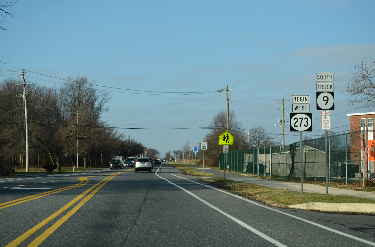


 North
North