|
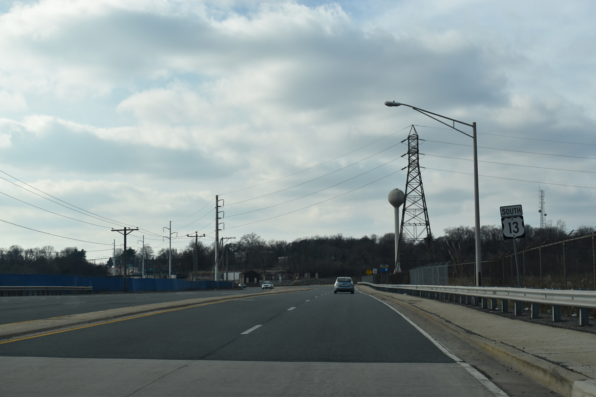
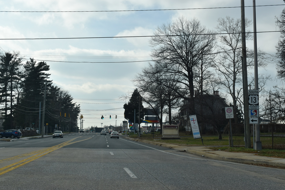
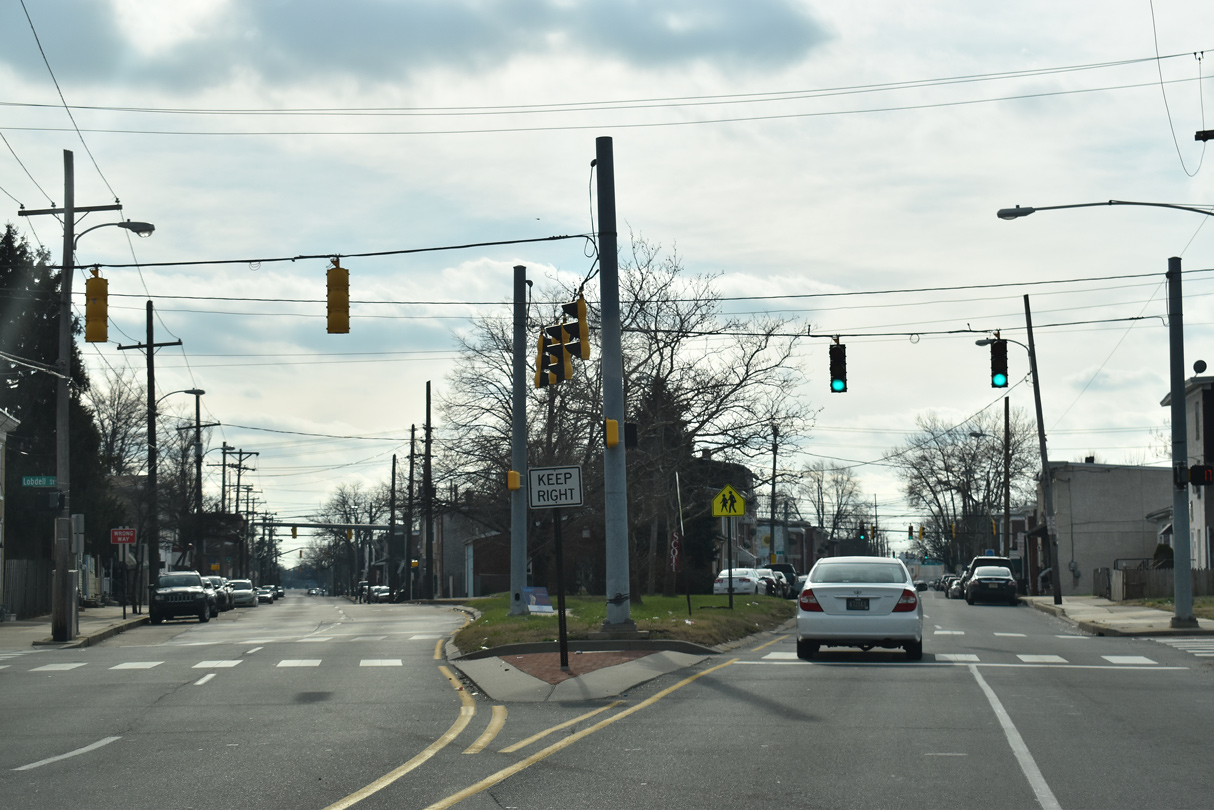
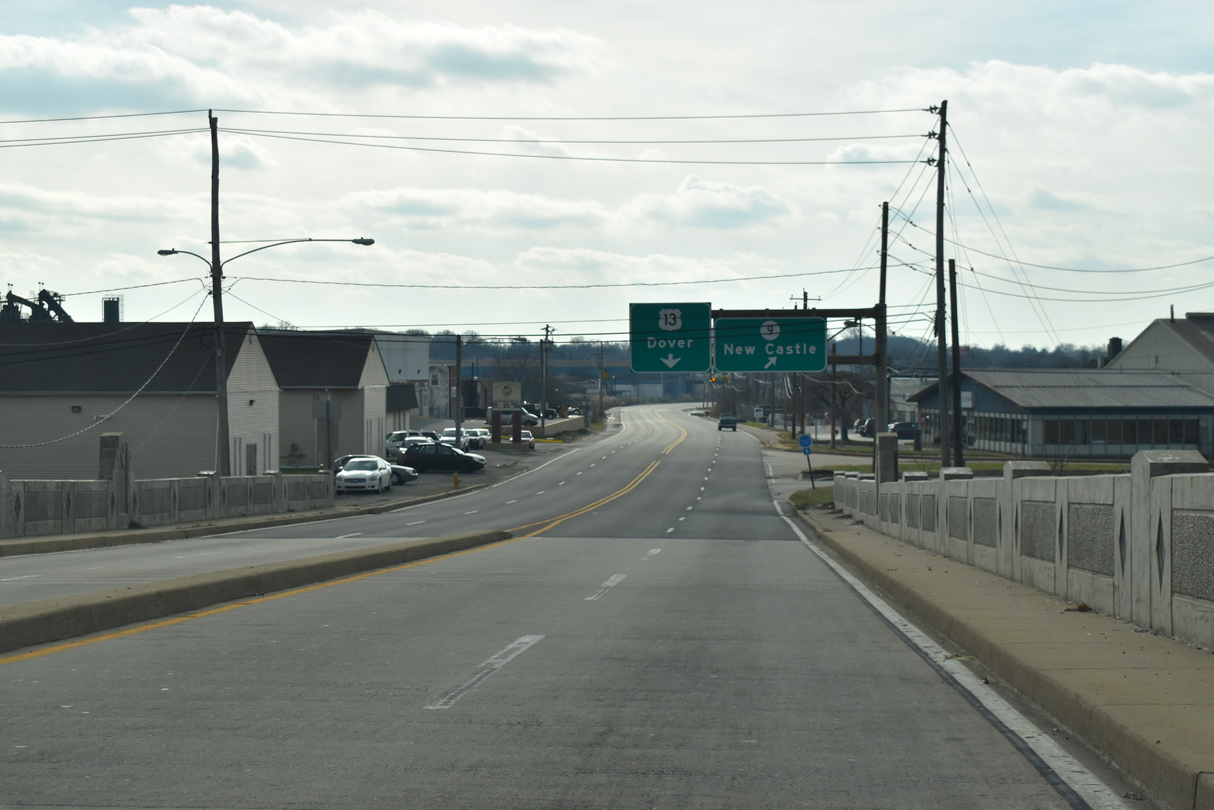
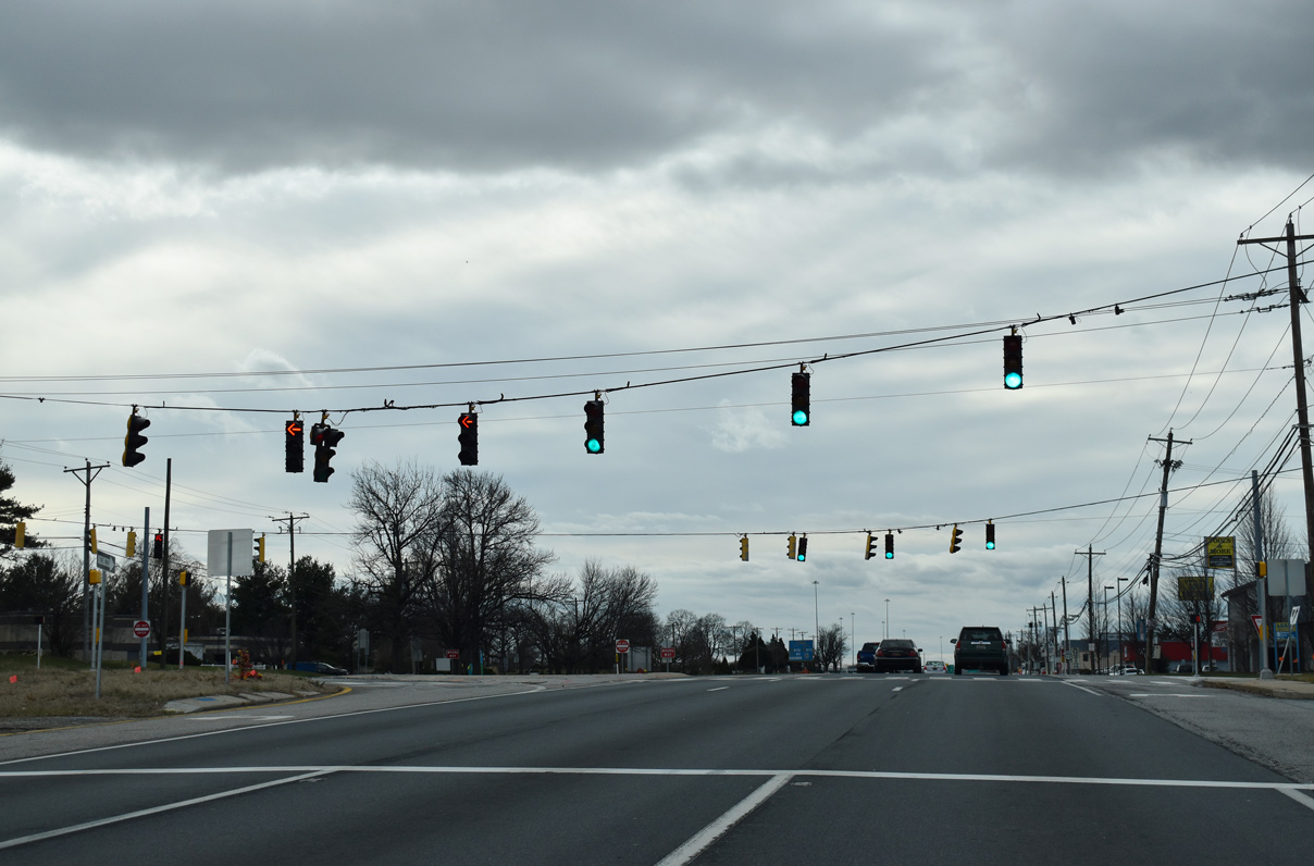
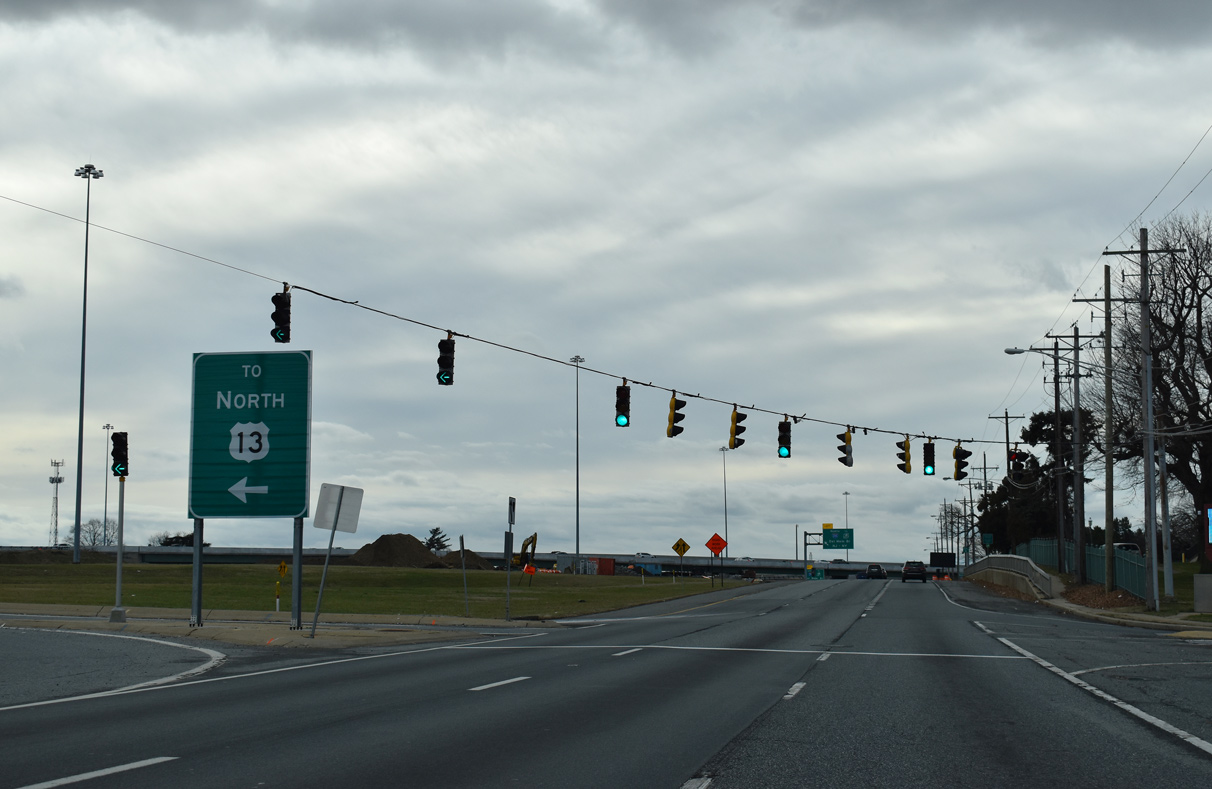
| U.S. 13 (Philadelphia Pike) enters Delaware through the industrial north side of Claymont. 12/21/16 |
|
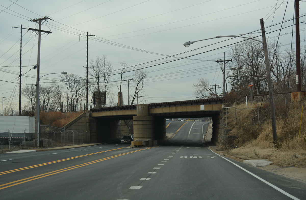
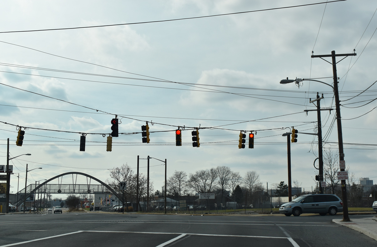
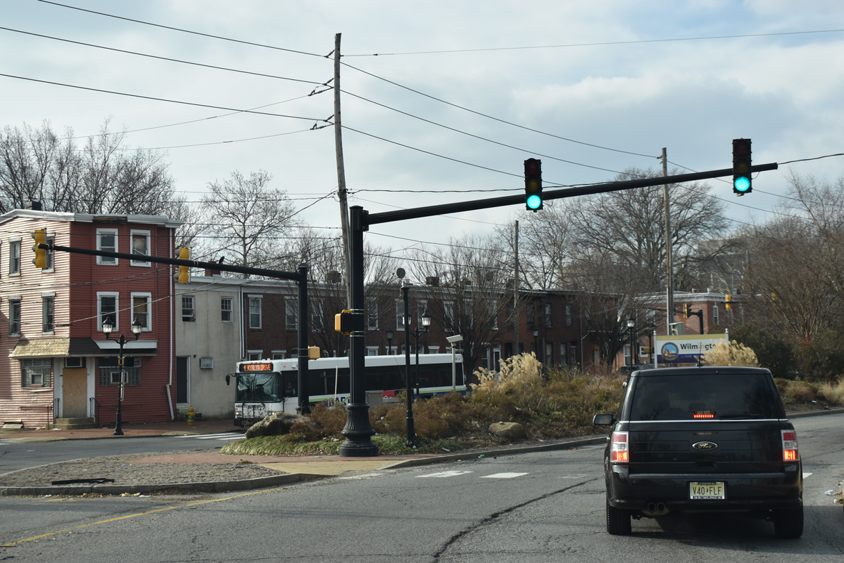
| A lane drop occurs for SR 92 (Naamans Road) west as U.S. 13 sinks below the AMTRAK Northeast Corridor overpass. 12/21/16 |
|
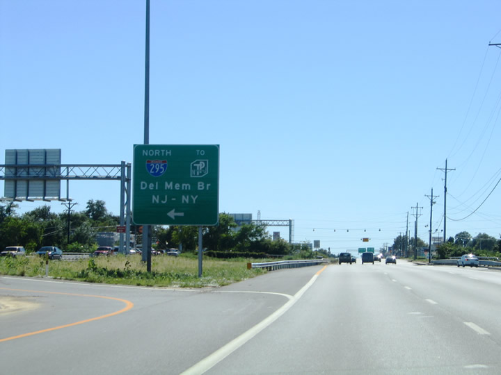
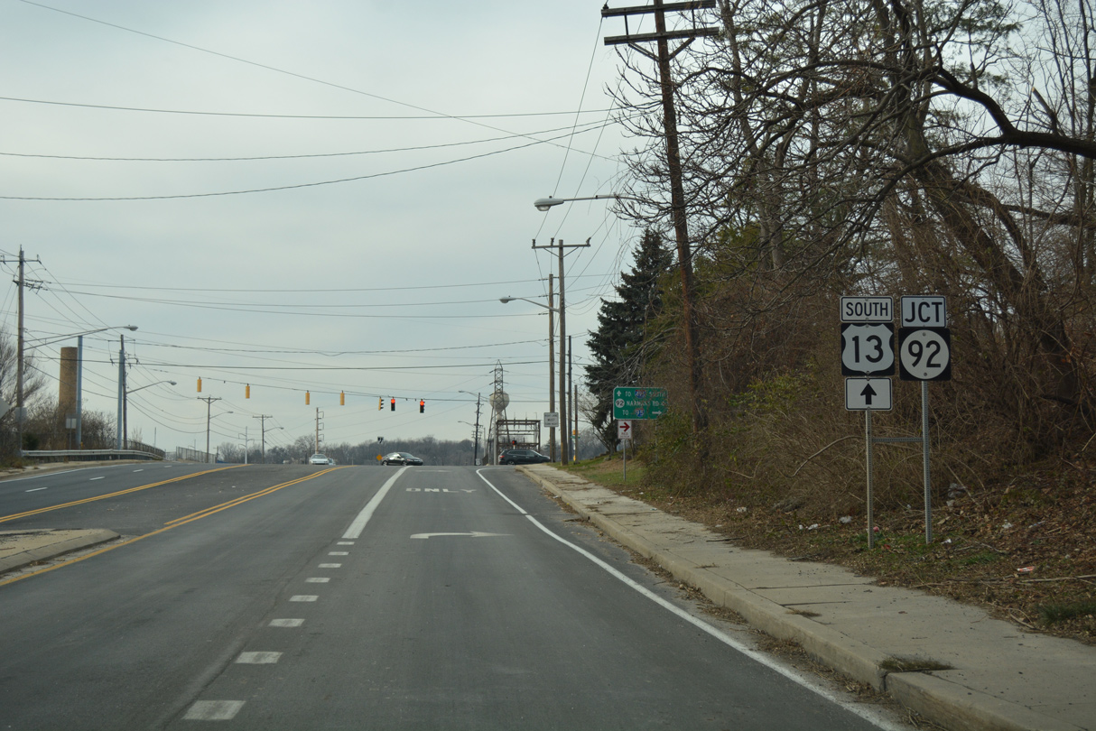
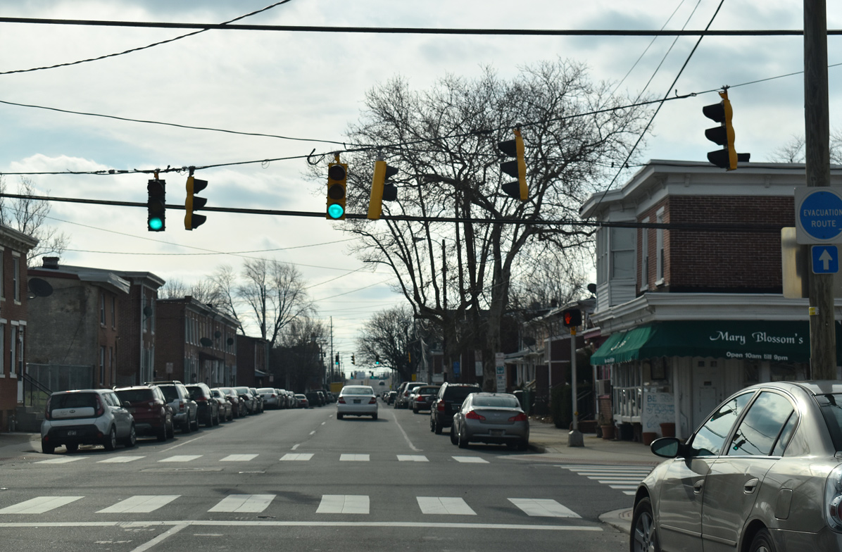
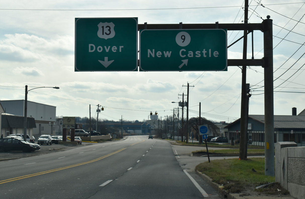
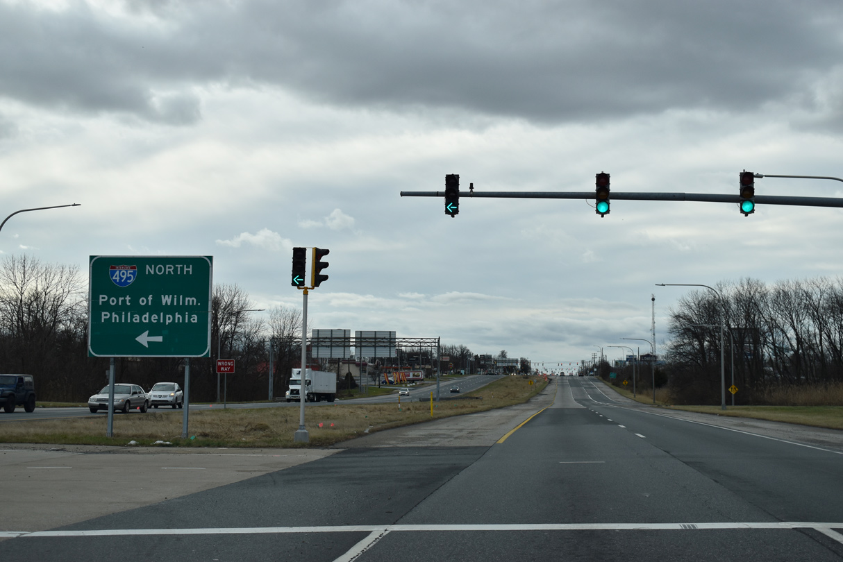
| SR 92 commences a nearly nine mile route from U.S. 13 (Philadelphia Pike) west to SR 100 at Brandywine Creek State Park. 12/21/16 |
|
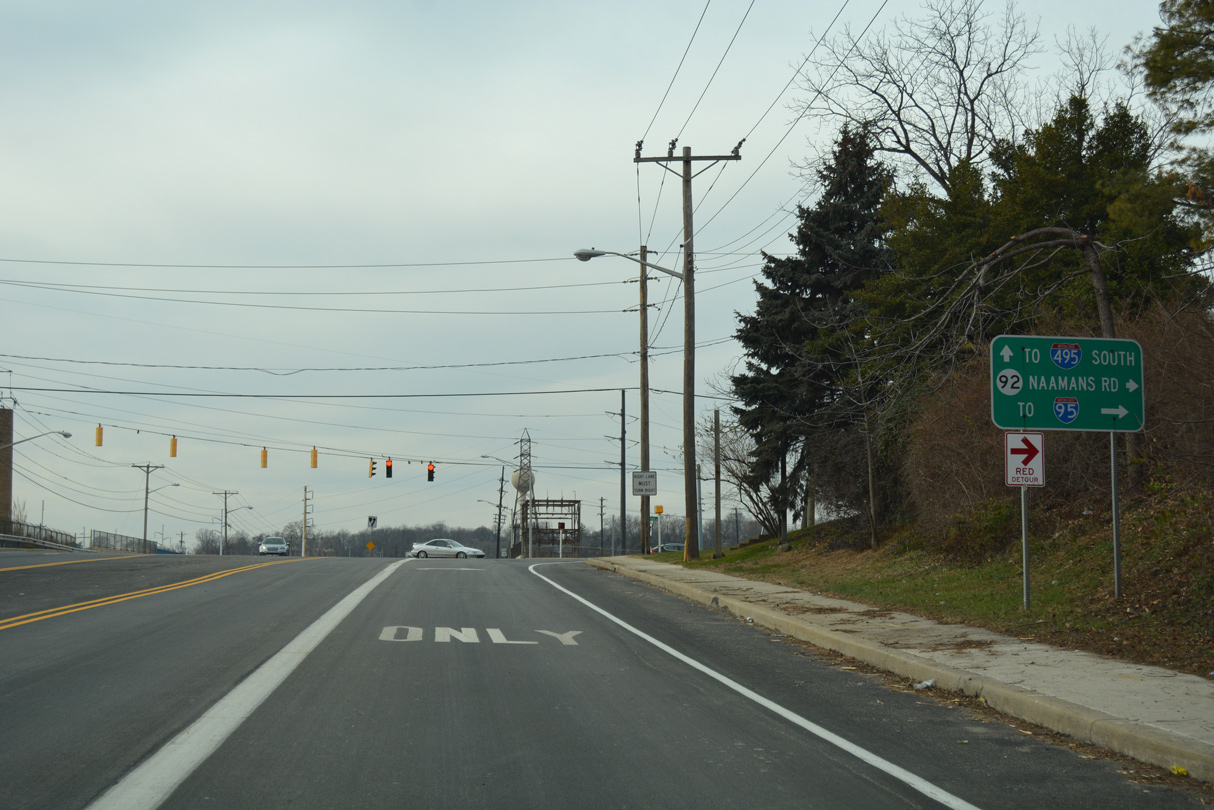
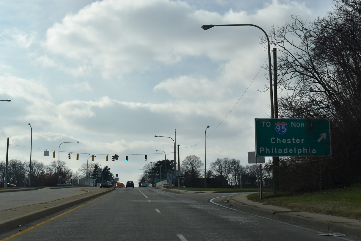
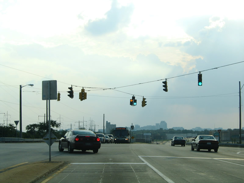
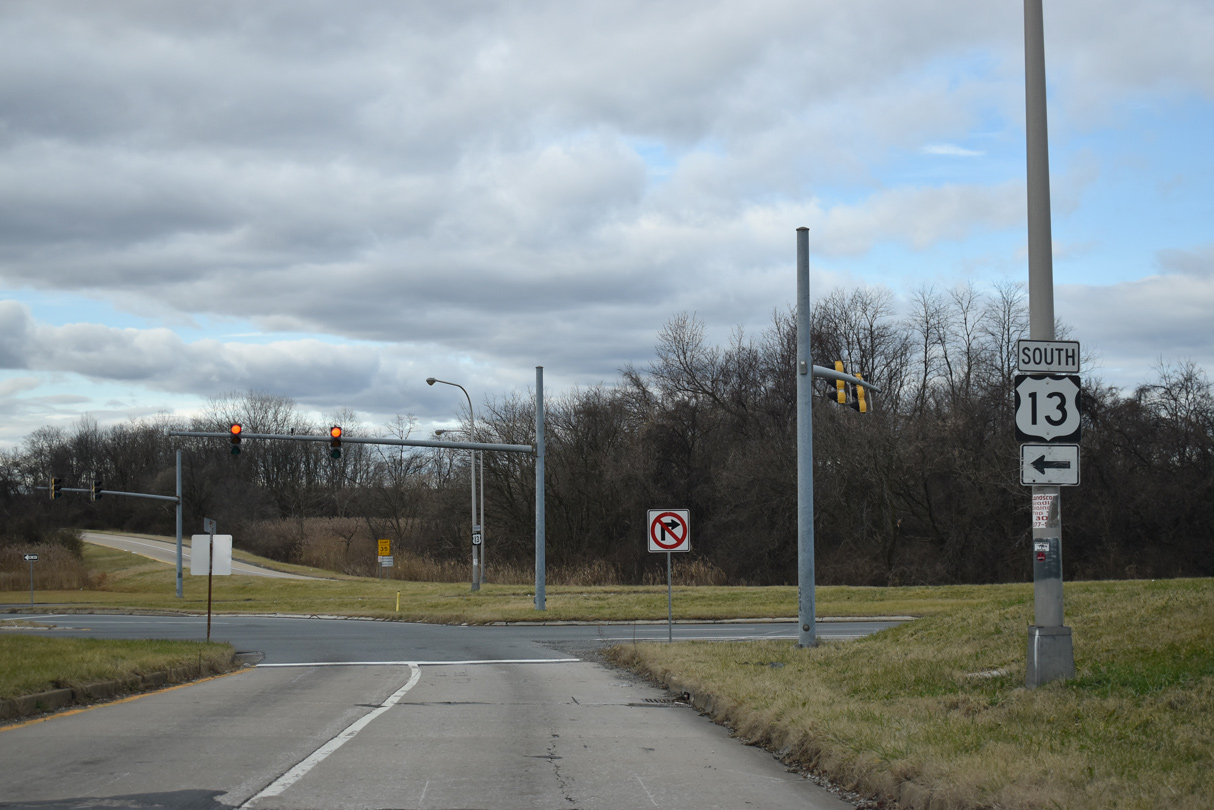
| SR 92 (Naamans Road) is an often overcrowded commuter route west from Claymont to U.S. 202 (Concord Pike) across northern reaches of the Brandywine Hundred community. Naamans Road links with I-95 a short distance west of Philadelphia Pike at the north end of I-495. U.S. 13 meets I-495 directly. 12/21/16 |
|
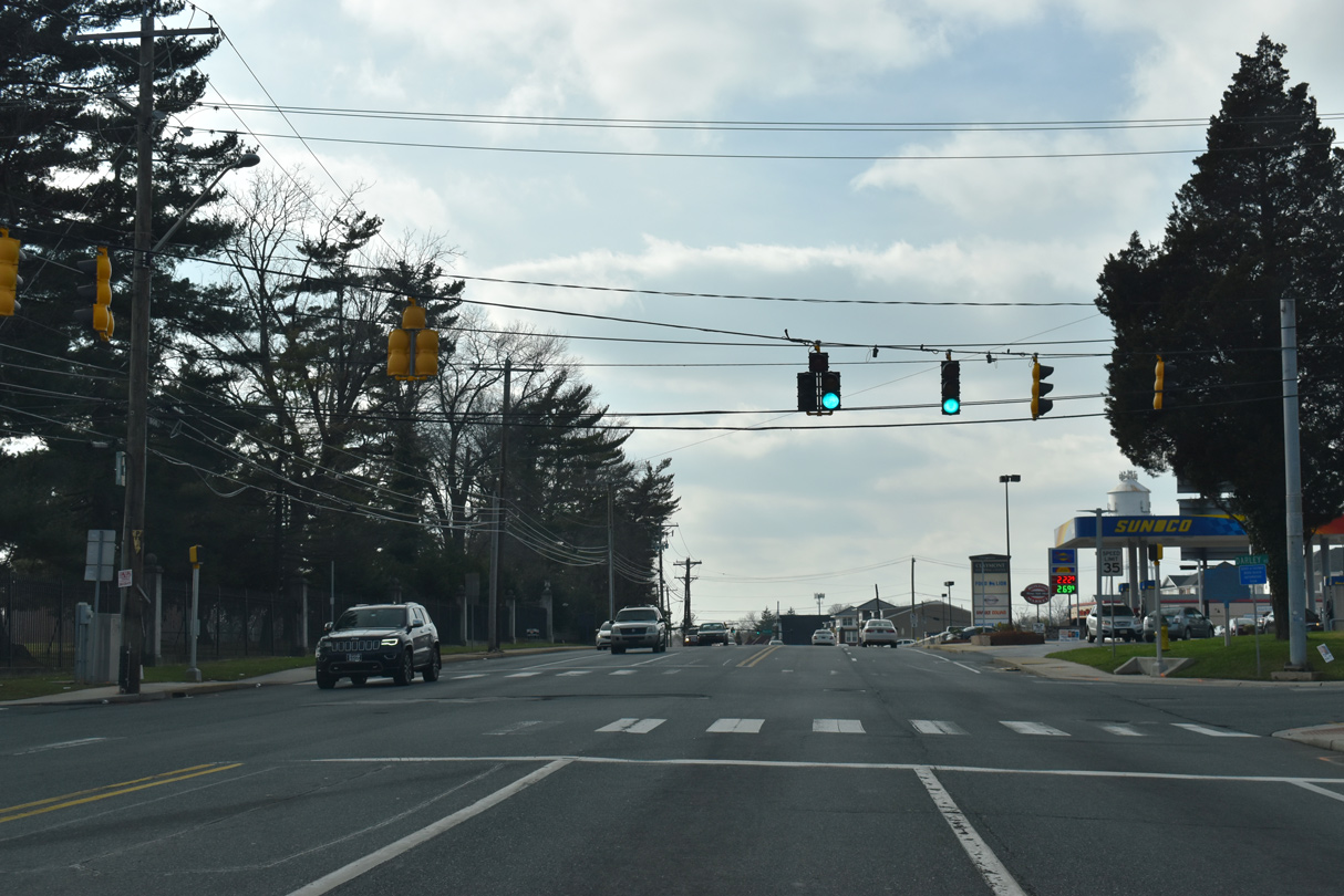
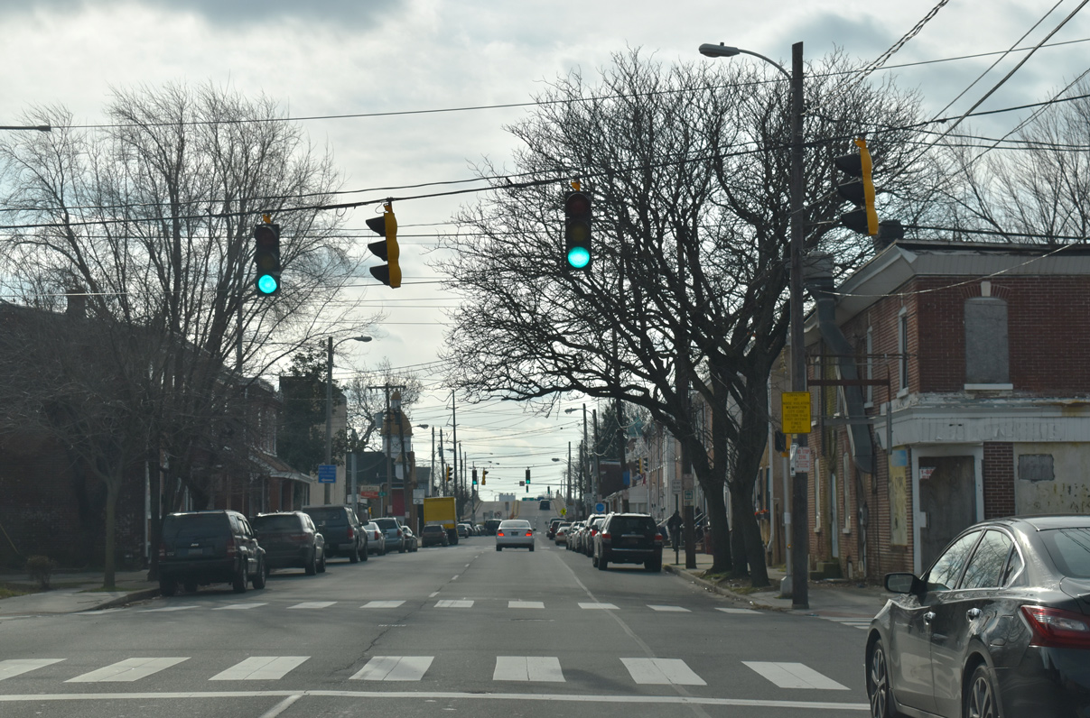
| U.S. 13 (Philadelphia Pike) crosses Naaman Creek south from the intersection with SR 92 west. 12/30/18 |
|
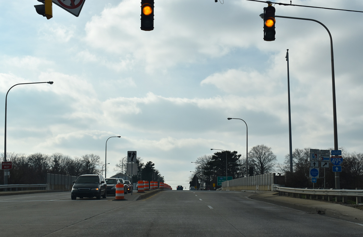
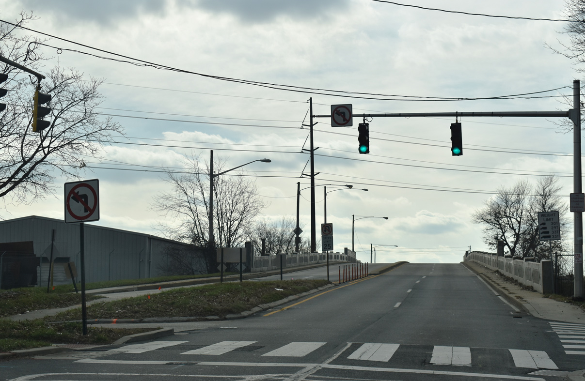
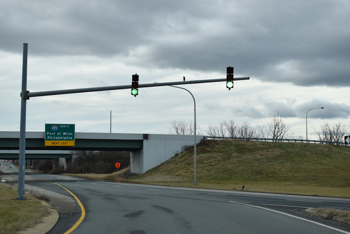
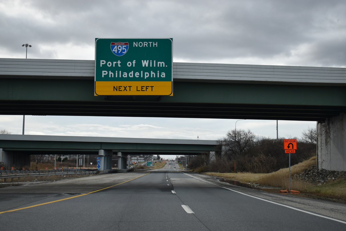
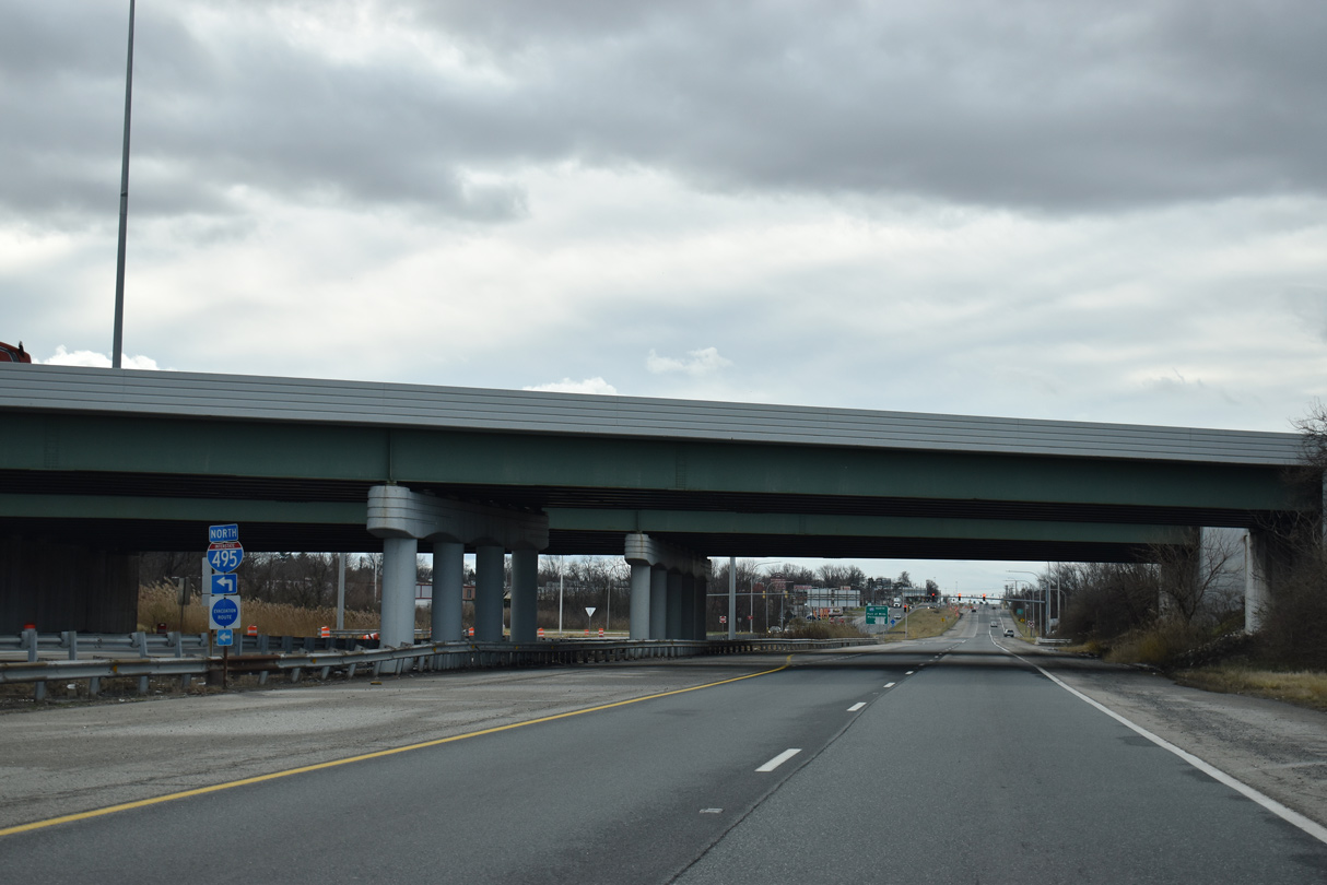
| A parclo interchange joins U.S. 13 (Philadelphia Pike) and Interstate 495 south of Alcott Avenue. Signs for the northbound on-ramp reference I-95, as I-495 ends nearby. 12/30/18 |
|
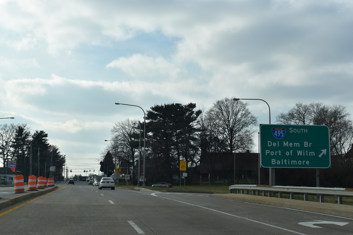
| A loop ramp allows trucks serving the industrial areas of Delaware County, Pennsylvania easy access onto the southbound freeway for the Port of Wilmington, New Castle and Baltimore, Maryland. 12/30/18 |
|
| SEPTA Claymont Station lines I-495 at the end of forthcoming Myrtle Avenue east from U.S. 13. 12/30/18 |
|
| Darley Road, a through road northwest to SR 92 (Naamans Road) in the Brandywine Hundred community, ties into the signal with Myrtle Avenue in Claymont. 12/30/18 |
|
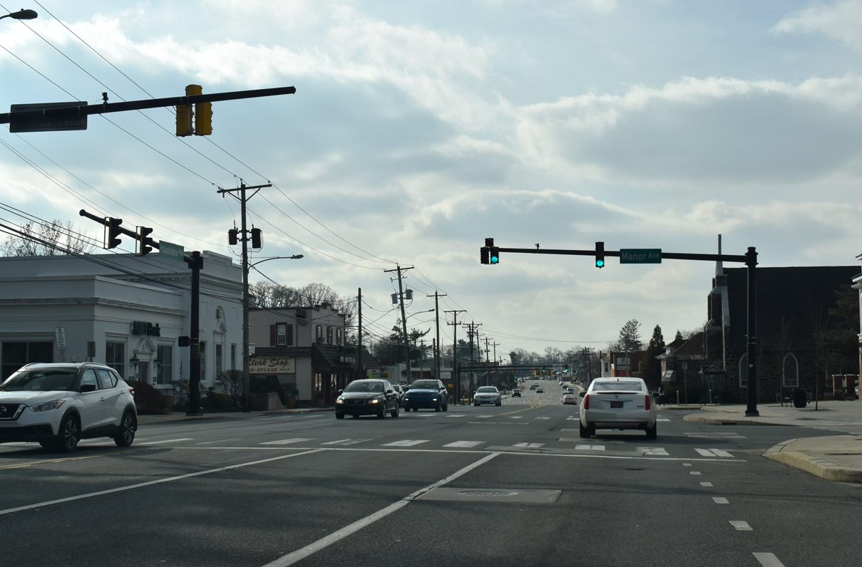
| Manor Avenue intersects U.S. 13 (Philadelphia Pike) from the Darley Green development and Archmere Academy. 12/30/18 |
|
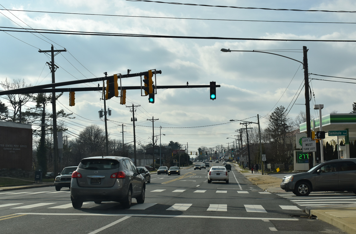
| Seminole Avenue and Wiltshire Road come together at the succeeding signal along U.S. 13 south near Claymont Elementary. 12/30/18 |
|
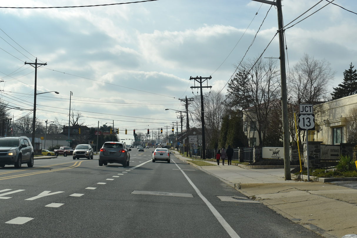
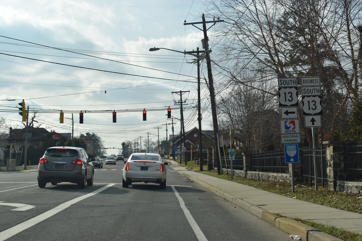
| U.S. 13 leaves Philadelphia Pike at the split with U.S. 13 Business for Governor Printz Boulevard. 12/30/18 |
|
| Governor Printz Boulevard acts as a bypass of the built-up areas along Philadelphia Pike between Claymont and Wilmington. Philadelphia Pike (U.S. 13 Business) continues south into northeast Wilmington. 12/30/18 |
|
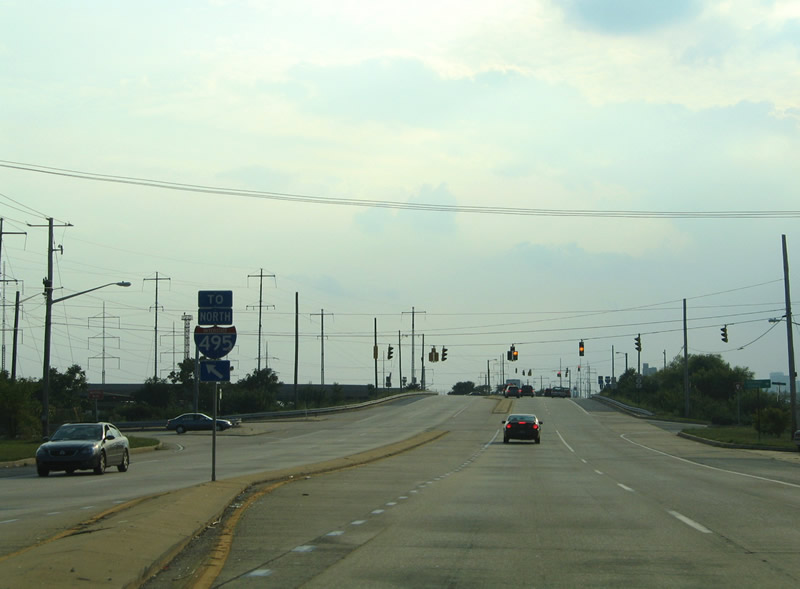
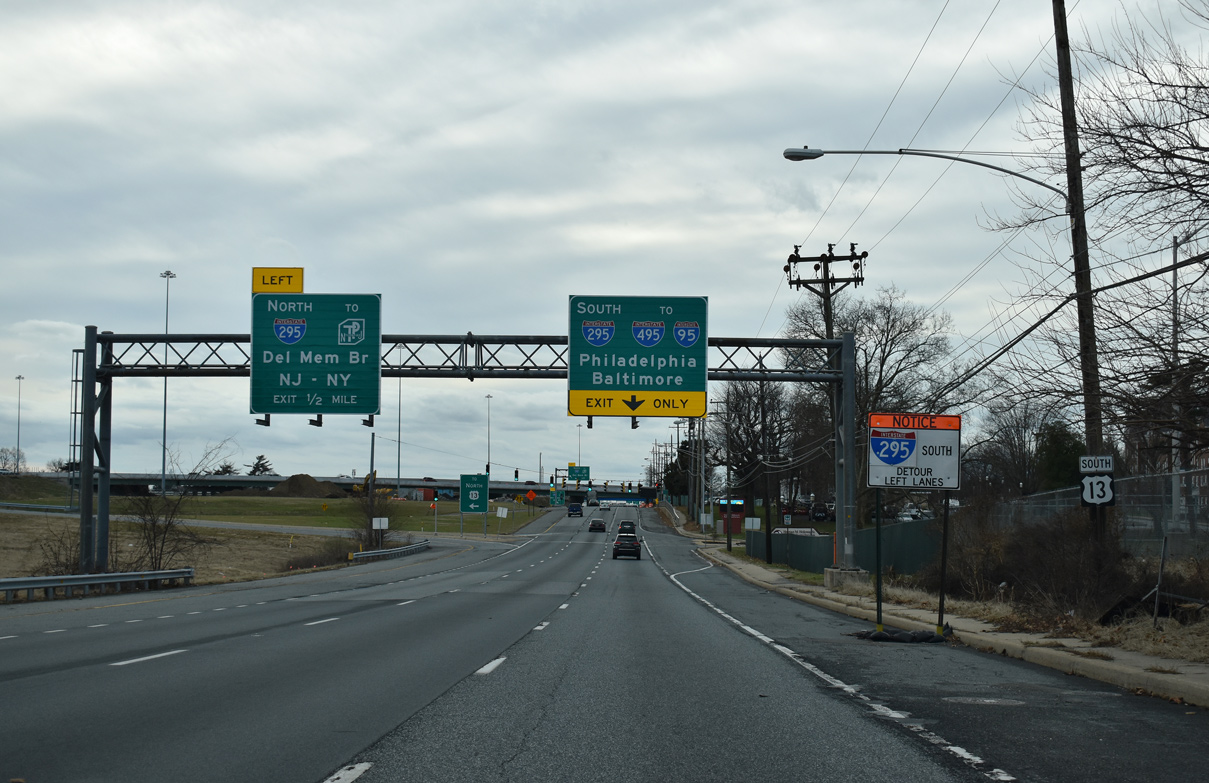
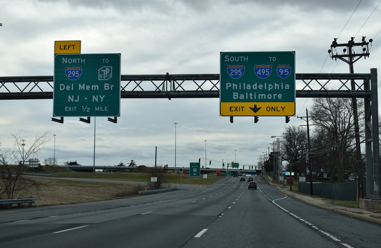
| U.S. 13 runs directly alongside Interstate 495 to Edgemoor, where an interchange joins the freeway with Governor Printz Boulevard and SR 3 (Edgemoor Road). 08/18/05 |
|
| The entrance ramp for I-495 south for U.S. 13 (Governor Printz Boulevard) departs from SR 3 (Edgemoor Road). SR 3 ends at Hay and Lighthouse Roads, an industrial road parallel to the freeway between Fox Point Park and 12th Street. 08/18/05 |
|
| A wye interchange joins U.S. 13 with Interstate 495 north back to Claymont, Marcus Hook and Philadelphia directly from the Governor Printz Boulevard intersection with Stuvesant Drive. 08/18/05 |
|
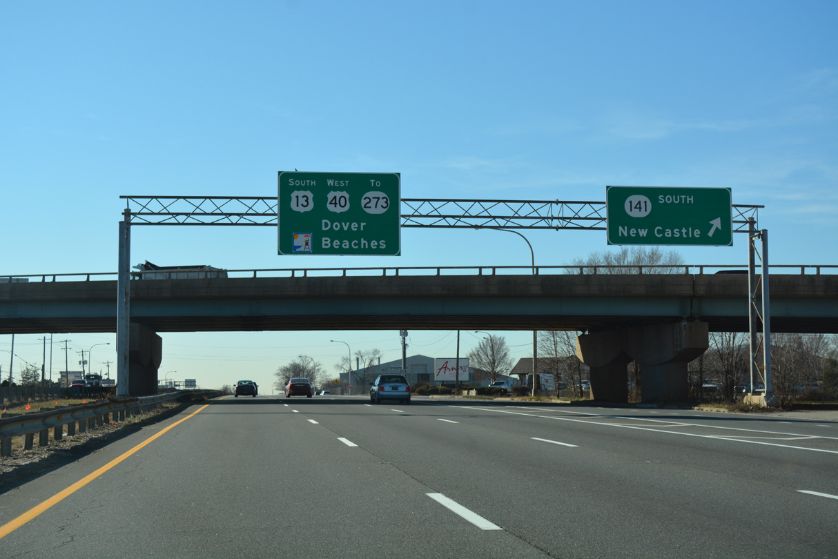
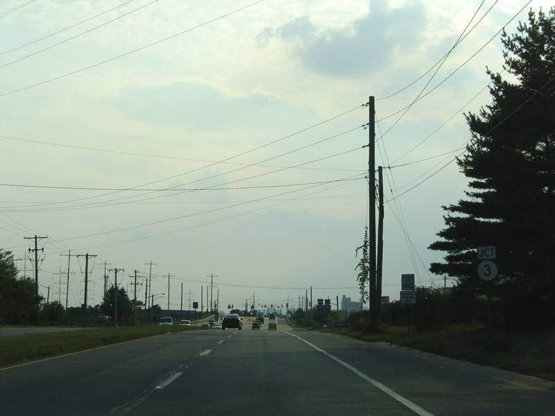
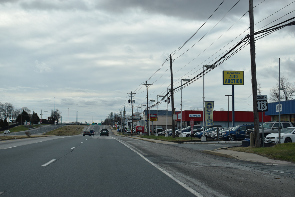
| U.S. 13 south at SR 3. SR 3 travels overall between Edgemoor and the Brandywine Hundred community at SR 92 (Naamans Road). Edgemoor Road also provides a direct connection to U.S. 13 Business (Philadelphia Pike) and northeast Wilmington. 08/18/05 |
|
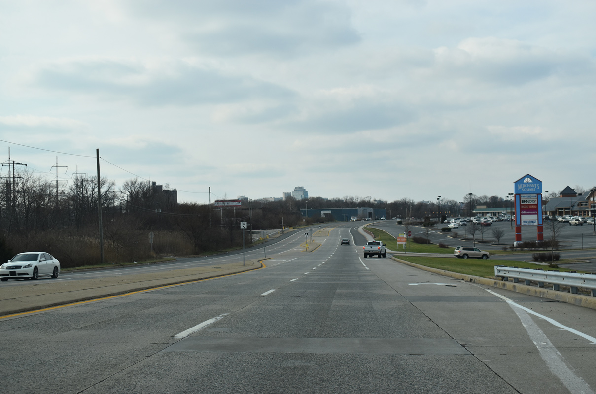
| Lowering from Edgemoor Road (SR 3), the Wilmington skyline appears on the horizon as U.S. 13 (Governor Printz Boulevard) passes by Merchants Square shopping center. 12/30/18 |
|
| Lea Boulevard branches north from Governor Printz Boulevard ahead of Shellpot Creek. Lea Boulevard forms a through route to Market Street (U.S. 13 Business), Washington Street in Brandywine Hills, Wilmington and Miller Road. 12/30/18 |
|
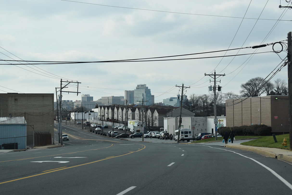
| Crossing the Wilmington city line at E 35th Street and the Eastlawn neighborhood, U.S. 13 (Governor Printz Boulevard) becomes Northeast Boulevard. 12/30/18 |
|
| U.S. 13 (Northeast Boulevard) at 30th Street in northeast Wilmington. 30th Street runs west through the Eastlawn neighborhood and east to the Riverside community. 12/30/18 |
|
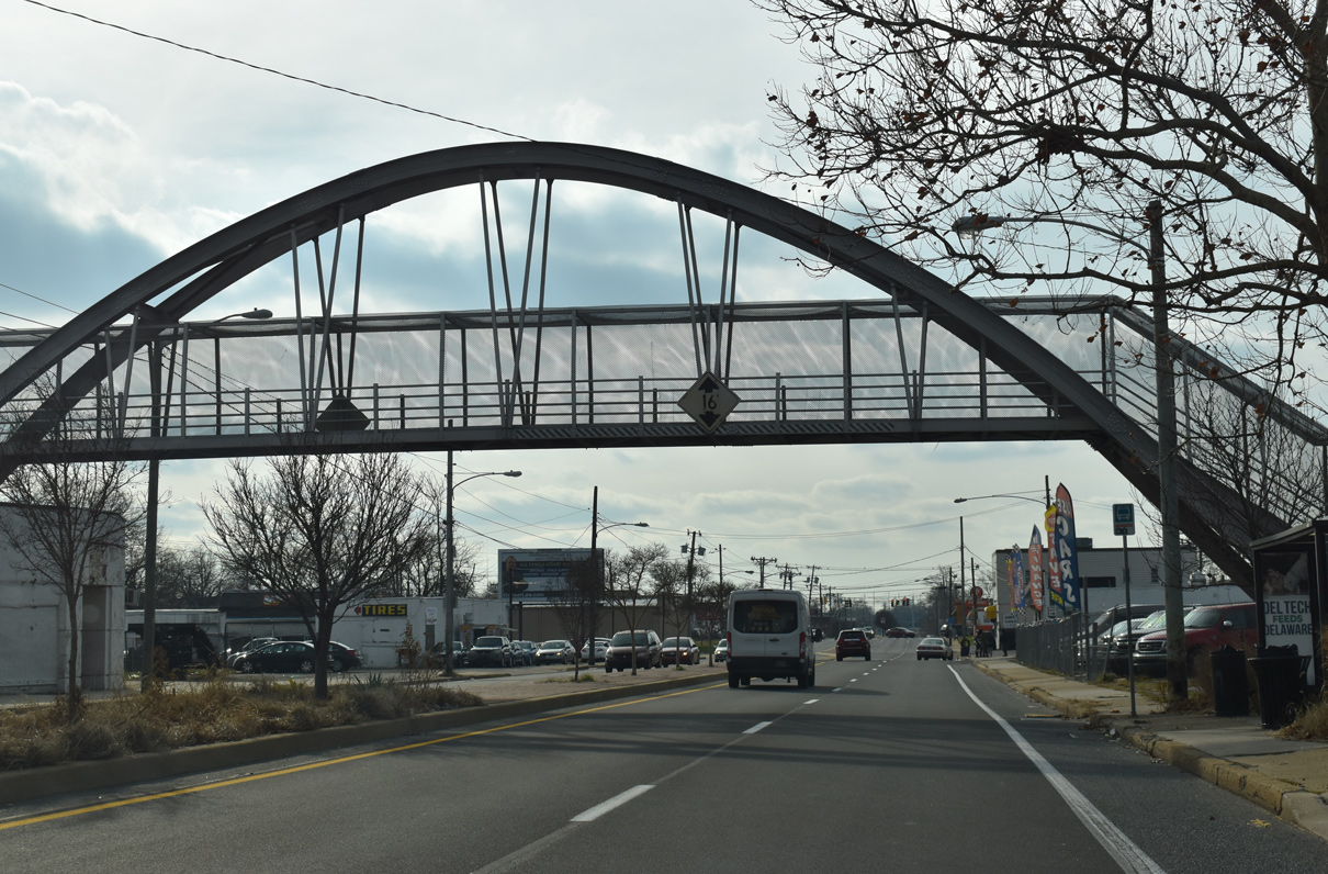
| Built in 1972, a pedestrian bridge spans U.S. 13 (Northeast Boulevard) at E 29th Street. 12/30/18 |
|
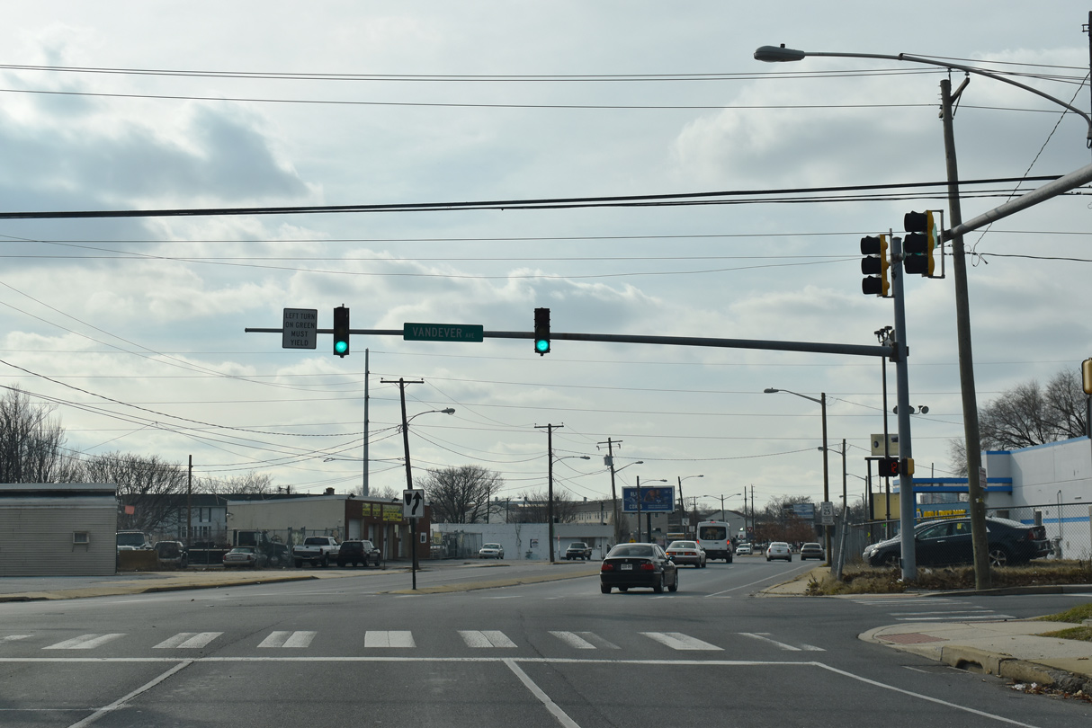
| The next signal along U.S. 13 (Northeast Boulevard) south operates at E 26th Street. 26th Street, 30th Street and Vandever Avenue accommodate two way traffic. The remainder of the northeast Wilmington city street grid consists of one way streets. 12/30/18 |
|
| Northeast Boulevard underwent a transformation from a five lane boulevard into a four lane, divided arterial during the early 2000s. The Interstate 495 trailblazer here references forthcoming 12th Street east. 12/30/18 |
|
| The redesign of Northeast Boulevard included adding mast arm traffic light assemblies at the intersection with Vandever Avenue. Vandever Avenue provides a truck route through the Eastlake neighborhood to U.S. 13 Business (Market Street) at SR 202 (Concord Avenue). 12/30/18 |
|
| Until sometime after 2008, an I-495 trailblazer was posted along U.S. 13 (Northeast Boulevard) at the five-point intersection with Thatcher Street and E 14th Street. Heald Street, one block prior, provides an alternate to 12th Street for I-495. 08/07/04 |
|
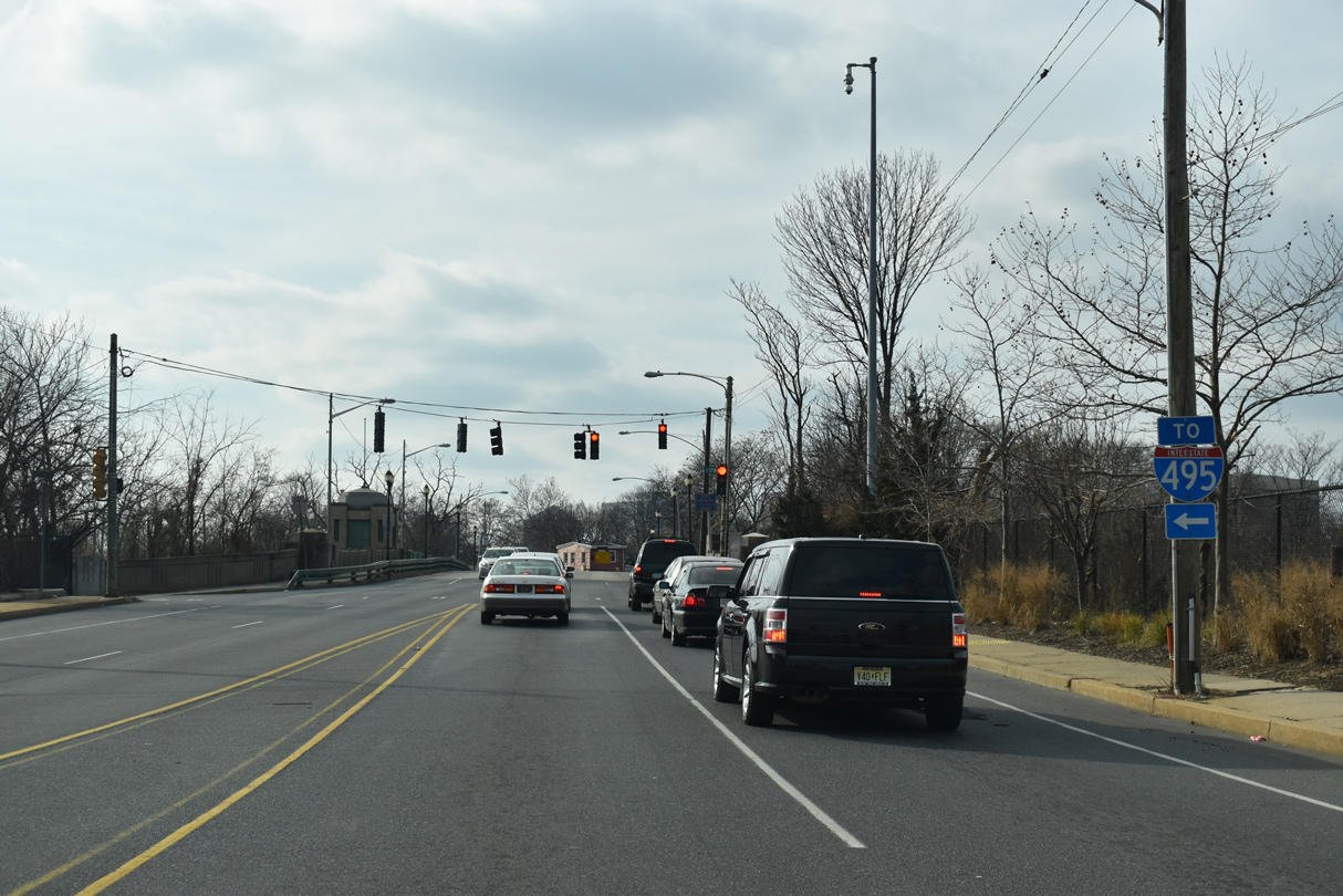
| U.S. 13 (Northeast Boulevard) reaches 12th Street and Brandywine Creek. 12th Street heads east through the 11th Street Bridge community to a diamond interchange with Interstate 495 by Cherry Island. 12/30/18 |
|
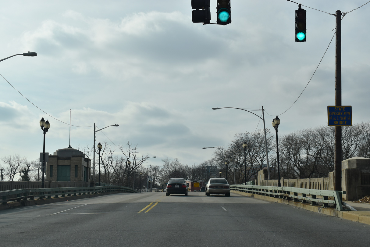
| Northeast Boulevard crosses the State Representative Dr. Al O. Plant, Sr. Bridge over Brandywine Creek. 12/30/18 |
|
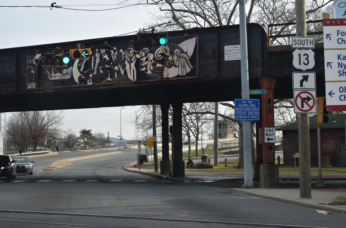
| U.S. 13 separates into a one way couplet along 11th Street west / Spruce Street south and Church Street north at the end of Northeast Boulevard. 12/30/18 |
|
| Southbound U.S. 13 provides a gateway into central Wilmington along 11th Street by Kirkwood Park, where streetscaping was completed in 2003. 12/30/18 |
|
| Curving south onto Spruce Street from 11th Street. 11th Street extends west into the Upper East Side. 12/30/18 |
|
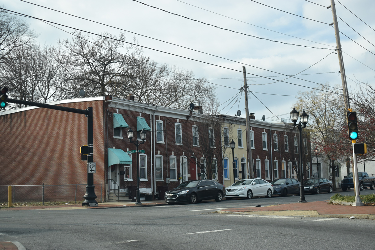
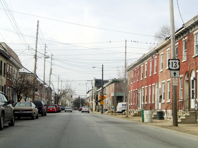
| Continuing into the East Side neighborhood, U.S. 13 (Spruce Street) south intersects E 10th Street. An SR 52 trailblazer here was replaced with a signal by 2016. SR 52 begins at 12th and Walnut Streets (U.S. 13 Business), eight blocks to the northwest. 12/30/18 |
|
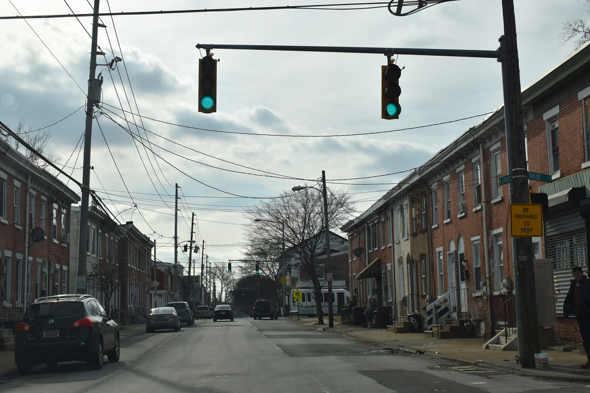
| Spruce Street south at Taylor Street. Row homes line many of the streets throughout the city of Wilmington, and this intersection is representative of how much of the city looks. 12/30/18 |
|
| A shield for U.S. 13 south was posted south of Taylor Street. It was missing by 2012. 04/10/04 |
|
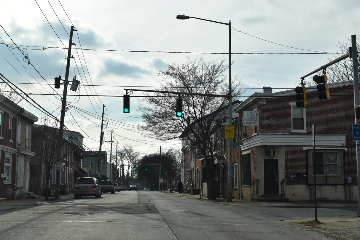
| 8th Street flows west from U.S. 13 (Spruce Street) and East Side at this traffic light to Downtown. 12/30/18 |
|
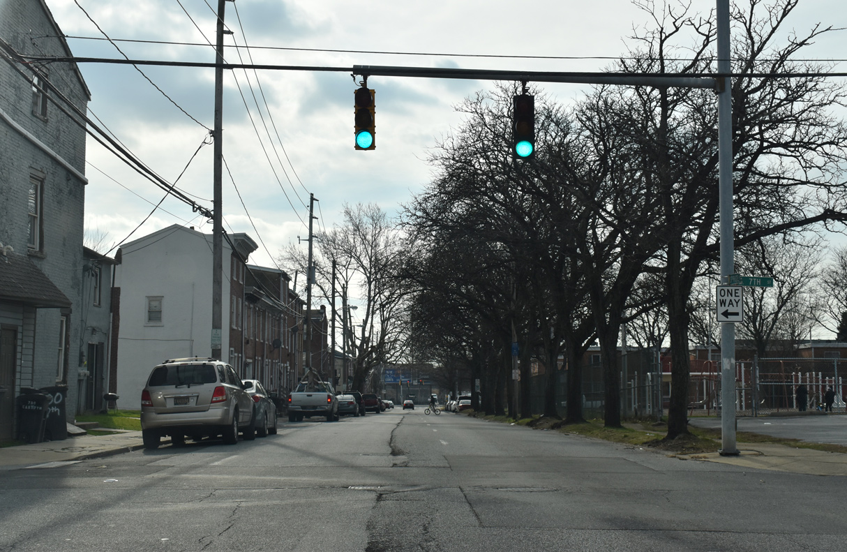
| 7th Street spurs east from U.S. 13 to Wilmington Industrial Park and Mayor John E. Babiarz Park at the mouth of Brandywine Creek. 12/30/18 |
|
| U.S. 13 turns east from Spruce Street onto Fourth Street (SR 9) to cross the Christina River. 12/30/18 |
|
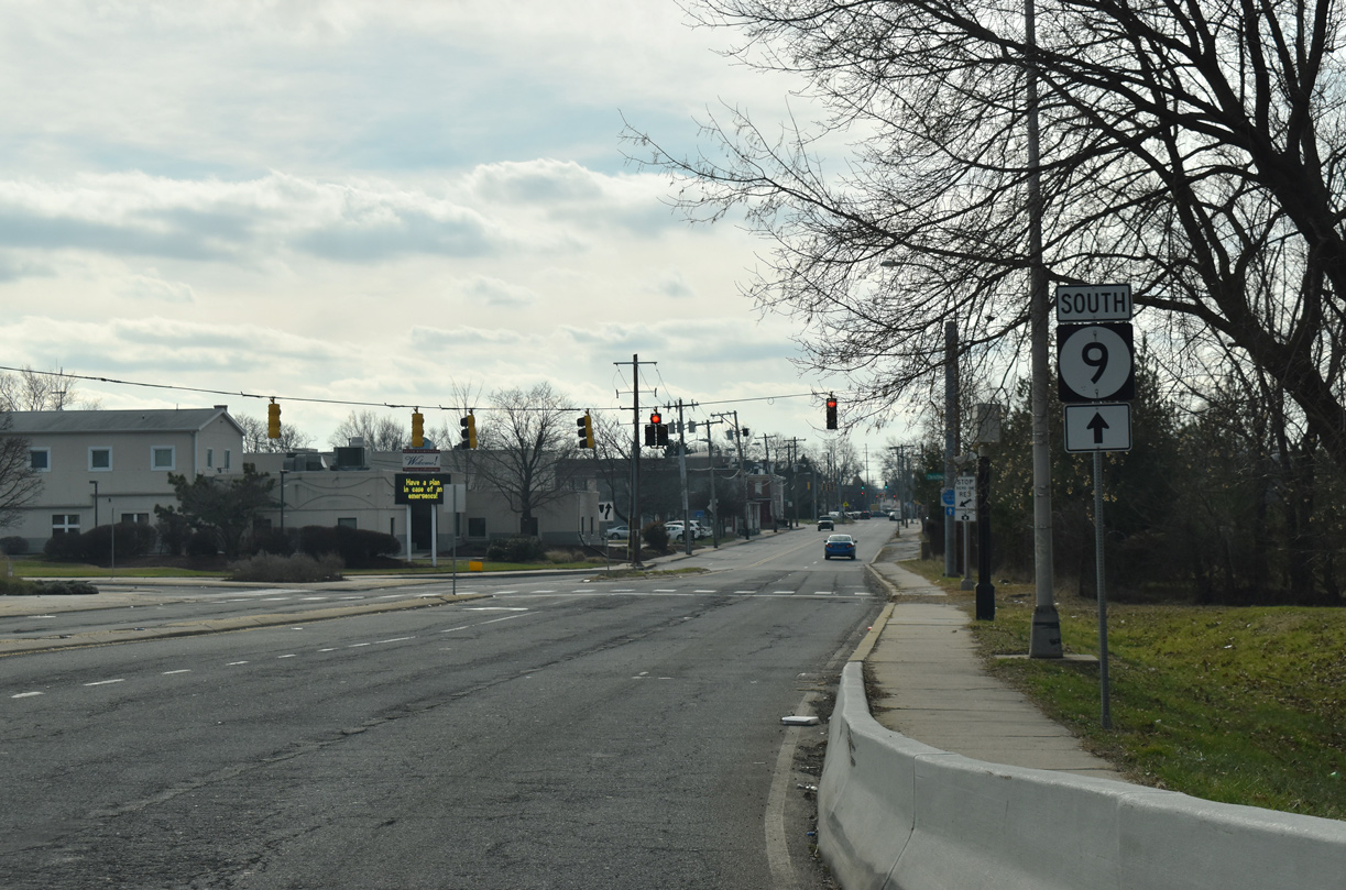
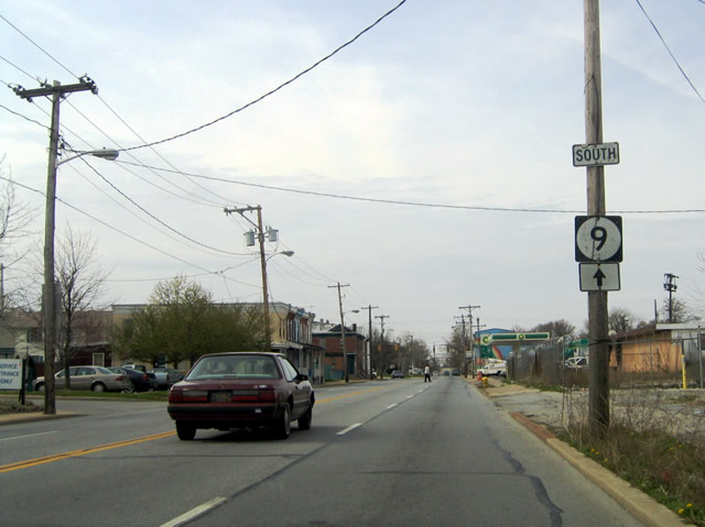
| U.S. 13/SR 9 south combine to the Southbridge neighborhood of Wilmington. SR 9 north travels four blocks westward to Walnut Street (U.S. 13 Business north) and five blocks to King Street (U.S. 13 Business south) at the LOMA neighborhood. Fourth Street provides one of two main routes from Downtown Wilmington to the Hill Top and Little Italy neighborhoods west of I-95. 12/20/17 |
|
| U.S. 13/SR 9 (4th Street) south intersect Church Street (U.S. 13 north) just ahead of the AMTRAK Northeast Corridor overpass. 12/20/17 |
|
| Continuing beyond the AMTRAK overpass, U.S. 13/SR 9 turn southeast by Christina Park to Heald Street through Southbridge. 12/30/18 |
|
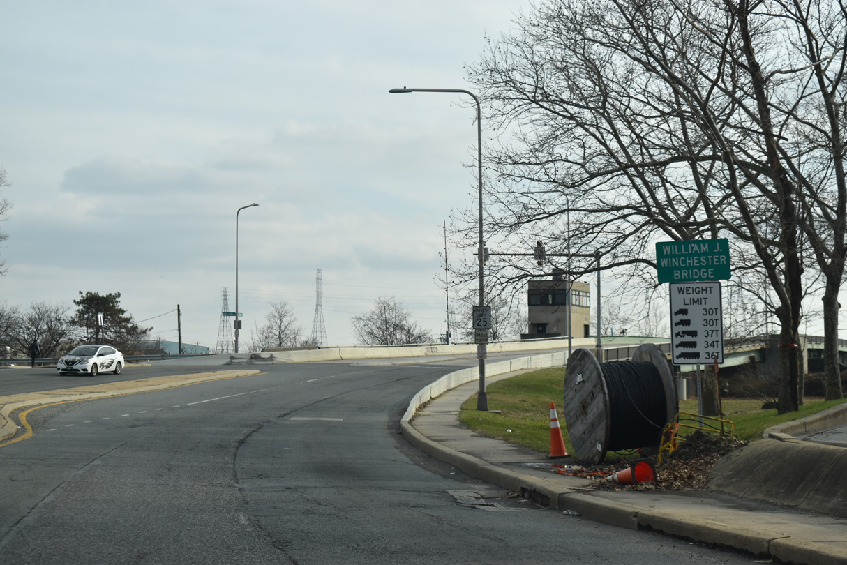
| The William J. Winchester Bridge, a double leaf bascule span, carries U.S. 13/SR 9 across the Christina River. 12/30/18 |
|
| U.S. 13/SR 9 meet the north end of SR 9A (Christina Avenue) just beyond the Christina River. SR 9A forms a short loop east from Heald Street and New Castle Avenue to the Port of Wilmington and I-495. The SR 9A shield here was missing by 2008. 12/30/18 |
|
| SR 9A lines Christina Avenue southeast to Terminal Avenue and the Port of Wilmington.
Christina Avenue once was a part of MSR 48. The state route used to connect the city of Wilmington with Penns Grove, New Jersey by way of a ferry crossing over the Delaware River. When the Delaware Memorial Bridge opened to traffic in 1951, ferry service was discontinued. SR 48 later was truncated and Christina Avenue redesignated SR 9A. 12/30/18 |
|
| A marker for U.S. 13 was missing from the confirming assembly south of SR 9A. This set of signs was removed entirely by 2007. 04/10/04 |
|
| U.S. 13/SR 9 separate into a one way couplet at Lobdell Street. Southbound traffic continues along Heald Street while northbound traffic follows New Castle Avenue to the east. 12/30/18 |
|
| Heald Street southbound at A Street in Southbridge. The alphabet series of streets in Wilmington lies entirely south of the Christina River. The grid runs through D Street, while E, F and G Streets were planned but never built. A Street is the only of the four to connect with Market Street (U.S. 13 Business) to the west. 12/30/18 |
|
| B, C and D Streets consists of short streets serving industrial type businesses or public housing communities. Pictured here is the signal southbound at B Street. 12/30/18 |
|
| C Street travels a total of four blocks between Buttonwood and Claymont Streets. The two way street intersects U.S. 13/SR 9 northbound one block to the east. 12/30/18 |
|
| Heald Street transitions back to two way traffic at the D Street turn off of U.S. 13 northbound. 12/30/18 |
|
| U.S. 13/SR 9 south ascend across the Paul Livingston Bridge above a Norfolk Southern Railroad line and a loop ramp taking SR 9 to New Castle Avenue. 12/30/18 |
|
| SR 9 joins New Castle Avenue south to New Castle. U.S. 13 leaves the Wilmington city limits beyond adjacent Garasches Lane. 12/30/18 |
|
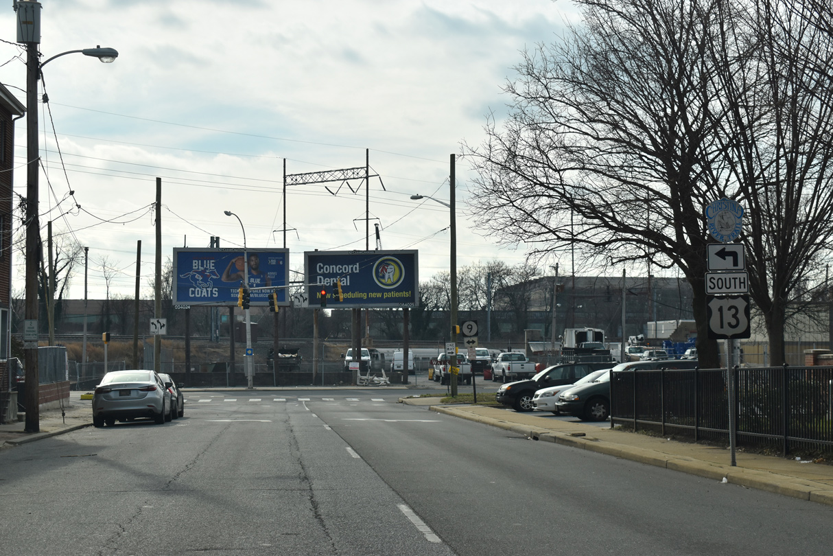
| Garasches Lane links U.S. 13 (S Heald Street) with Walnut Street at Delaware Blue Coats Stadium. 12/30/18 |
|
| Rogers Road angles northwest from SR 9 (New Castle Avenue) to meet U.S. 13 just ahead of the merge with U.S. 13 Business (S Market Street) northbound. 12/30/18 |
|
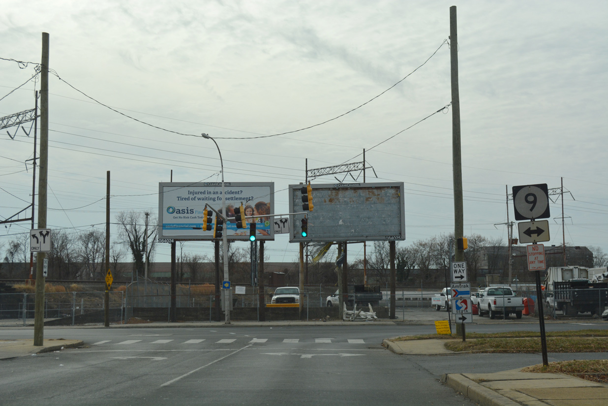
| U.S. 13 (Heald Street) and U.S. 13 Business (Market Street) converge a half mile south of the Wilmington city line by the exchange with Interstate 495. Their apex represents the start of Dupont Highway south. 01/01/19 |
|
| The directional cloverleaf interchange at I-495 was expanded in 2000. Ramps were added to link I-495 south with U.S. 13 north and from U.S. 13 south to I-495 north. These additions improved access to Wilmington during the major reconstruction and closure of I-95 north of the city at that time. 01/01/19 |
|
| Interstate 495 curves northeast from U.S. 13 (Dupont Highway) by the Port of Wilmington to Cherry Island and Edgemoor. 01/01/19 |
|
| Hessler Boulevard spurs north to big box retail and a Delaware DMV facility from the first of several signals along U.S. 13 (Dupont Highway) at Minquadale. 01/01/19 |
|
| Memorial Drive angles southeast from Minquadale to the Overview Gardens and Garfield Park neighborhoods and SR 9 (New Castle Avenue) near I-295. 01/01/19 |
|
| The emergency signals at Hazdell Avenue serve Minquadale Fire Company. 01/01/19 |
|
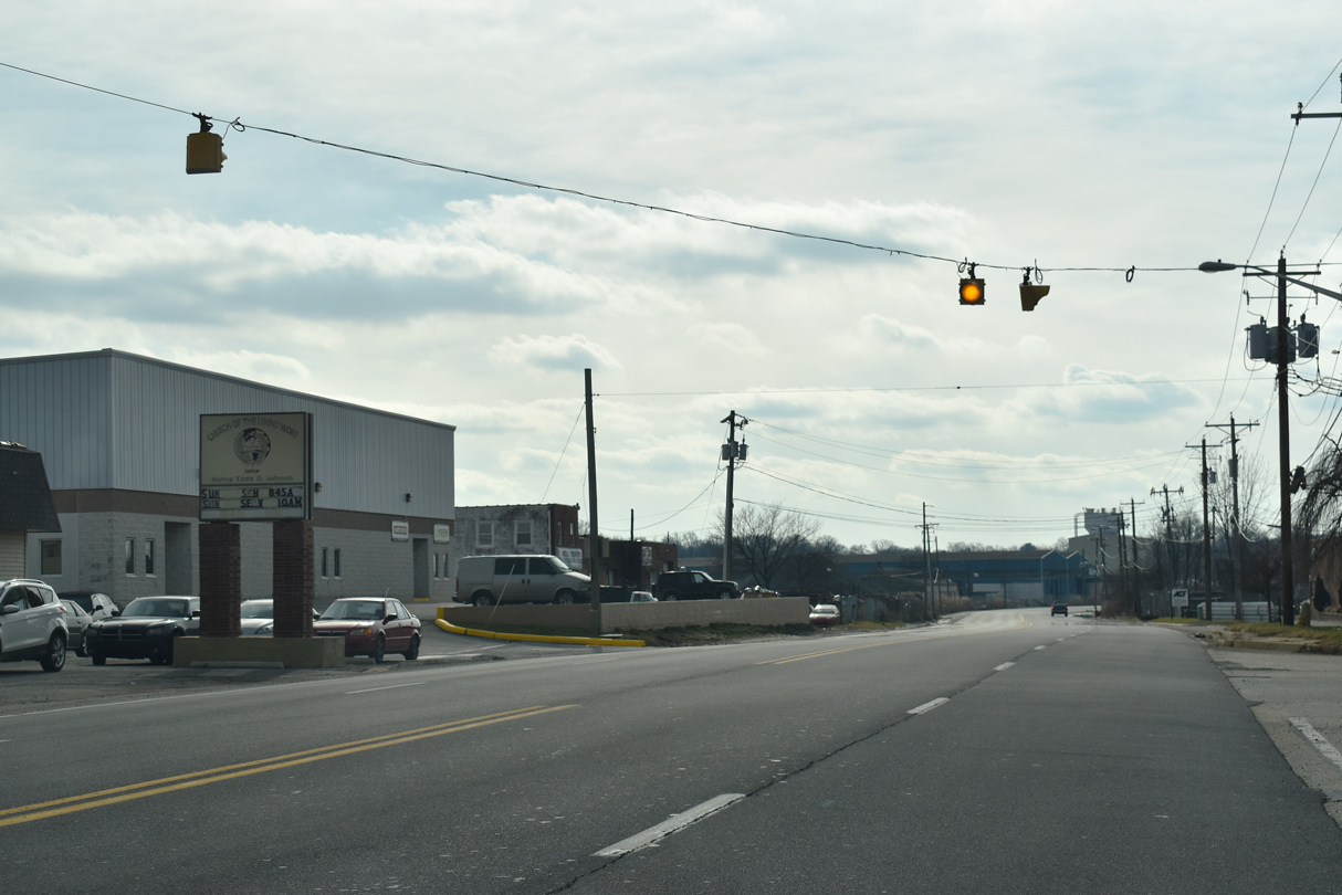
| Fernwood Avenue east Wildel Avenue north meet U.S. 13 at the last signal in Minquadale. This intersection was reconfigured in 2019 to eliminate the signals for the New Castle County Police Department entrance road. 08/07/04 |
|
| Reassurance marker posted south of Fernwood Avenue. Dupont Parkway continues with six lanes from I-495 and the community of Minquadale to Farnhurst. 01/01/19 |
|
| Advancing south between Delaware State Hospital and Gracelawn Memorial Park, U.S. 13 approaches the Farnhurst Interchange with I-295/U.S. 40. 01/01/19 |
|
| Delaware River and Bay Authority (DRBA) reconstructed the Farnhurst Interchange initially 2001-03 with the removal of the left exit ramp from U.S. 13 south to I-295/U.S. 40 north. The exchange was rebuilt again from February 2016 to April 2019. 01/01/19 |
|
| Southbound Interstate 295 concludes just west of U.S. 13 (Dupont Highway) at the sprawling interchange joining I-95 (Delaware Turnpike), I-495 and SR 141 (Newport Freeway / Basin Road). 01/01/19 |
|
| Also included in the 2001-03 DRBA improvement project at I-295 was the addition of a U-turn ramp for U.S. 13 north opposite the Health and Social Services campus entrance. A northbound turnaround was also added for motorists to access U.S. 13 south from I-295 north. 01/01/19 |
|
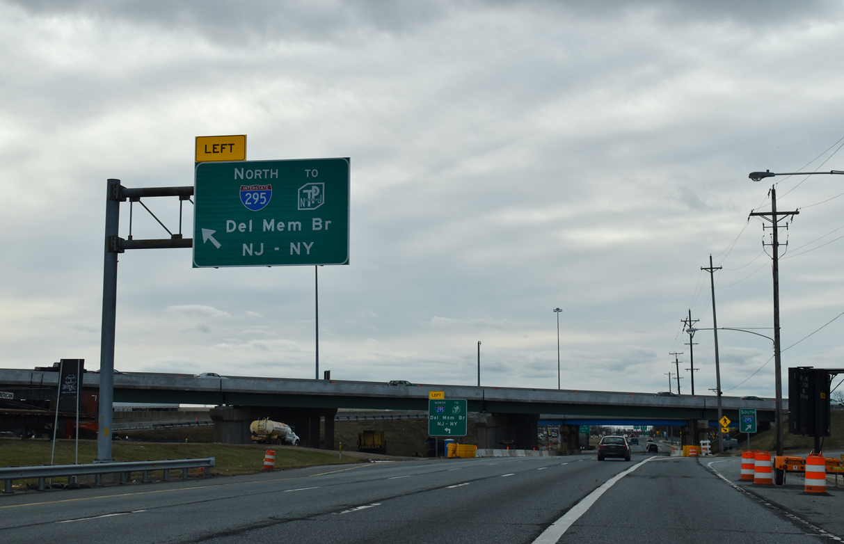
| A left turn connects U.S. 13 south with the northbound entrance ramp from U.S. 13 to I-295 north / U.S. 40 east to the Delaware Memorial Bridge and New Jersey Turnpike. The adjacent overpass for I-295 south was replaced during 2016-19 reconstruction of the Farnhurst Interchange. 01/01/19 |
|
| A left side ramp brings U.S. 40 west onto U.S. 13 south below the I-295 mainline at Farnhurst. The succeeding left turn links with I-295/U.S. 40 northbound. 01/01/19 |
|
| Interstate 295 north / U.S. 40 east overlap from Farnhurst to Deepwater, New Jersey, where I-295 turns north from the NJ Turnpike to Carneys Point. U.S. 40 proceeds east from the Turnpike to Woodstown and Atlantic City. 09/19/04 |
|
| U.S. 13/40 enter the Wilmington Manor community along a commercialized stretch of Dupont Parkway running southwest. McMullen Avenue ties into the southbound lanes just beyond the New Castle Industrial Trail underpass. 06/02/12 |
|
| Bacon Avenue connects with Dupont Parkway at this signal from Leedom Estates and other neighborhood areas to the west opposite Boulden Boulevard east to Southgate Industrial Park. 06/02/12 |
|
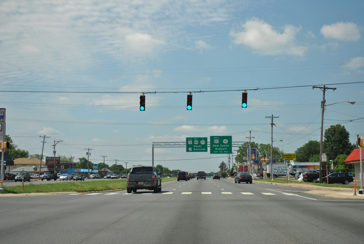
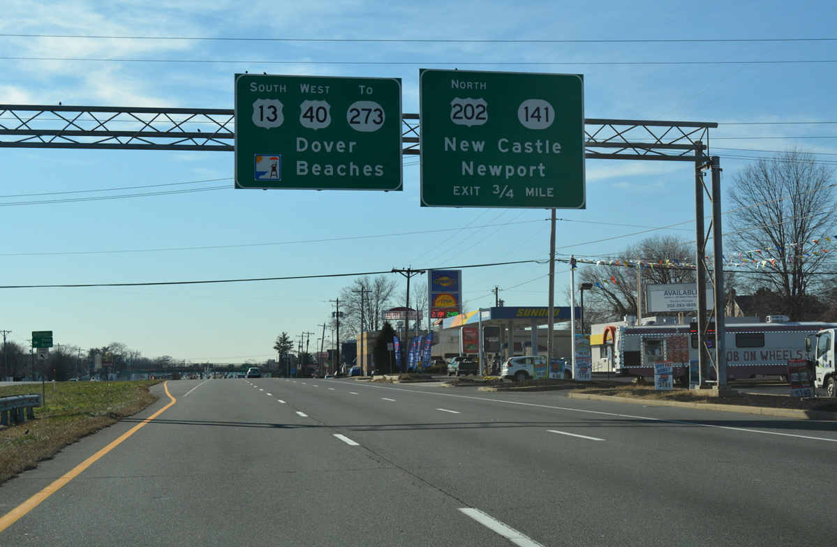
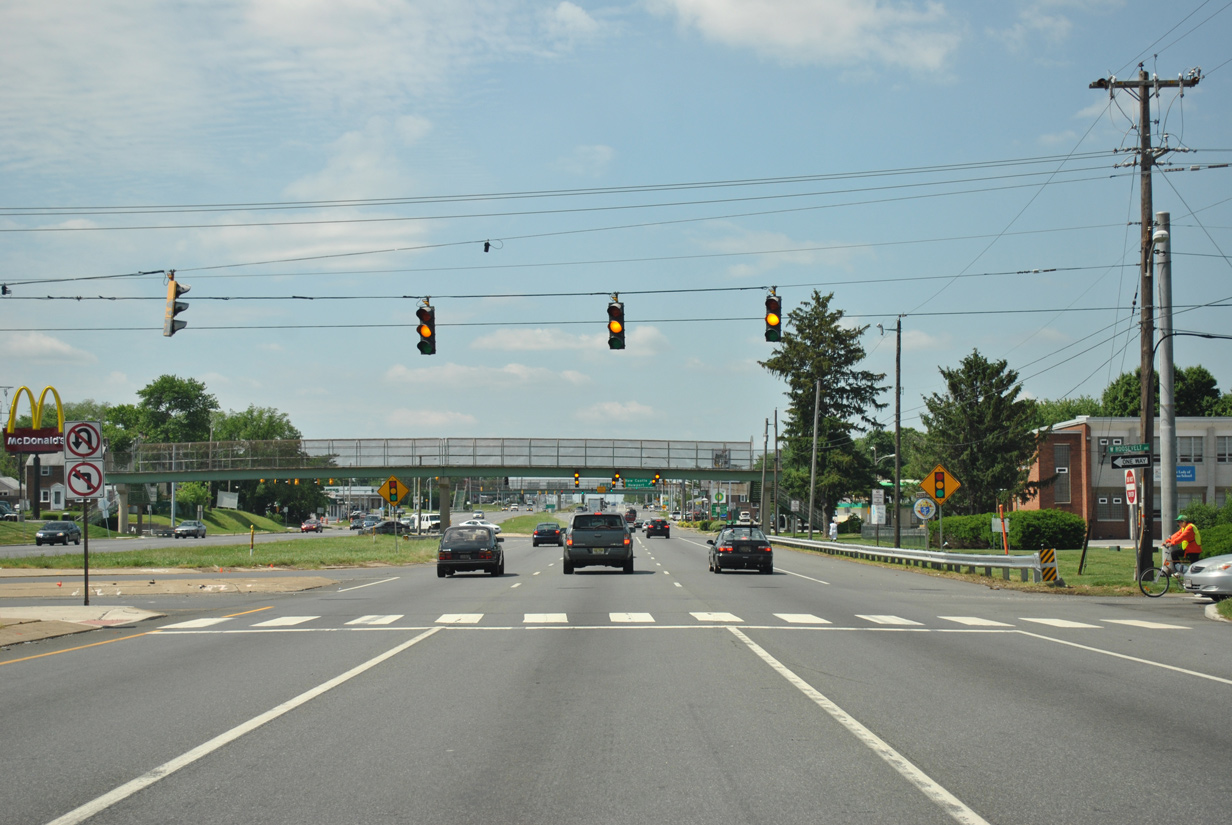
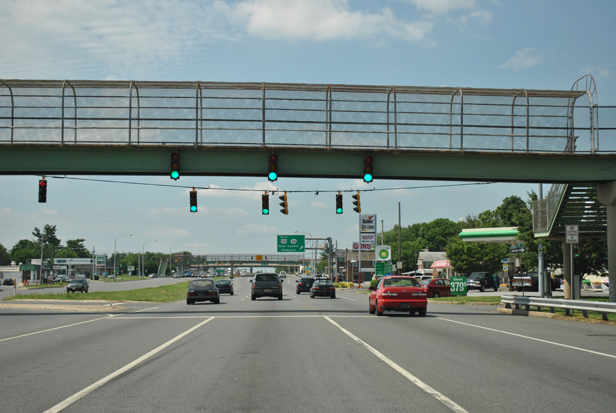
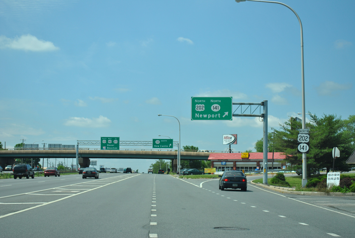
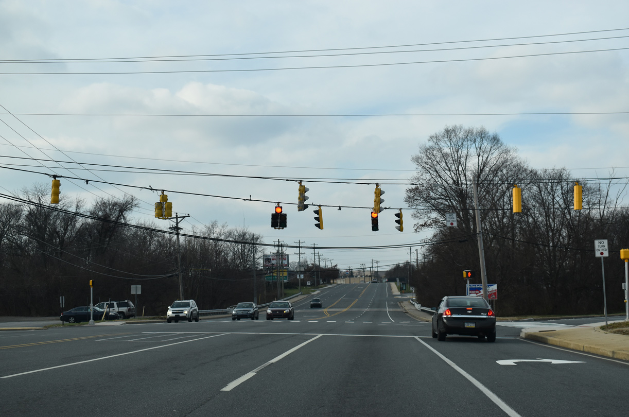
| Dupont Parkway advances southwest 0.75 miles to a three quarter cloverleaf interchange with U.S. 202 north and SR 141 (Basin Road). U.S. 202 commences a 630 mile route from Basins Corner north to Bangor, Maine at the upcoming exchange. 12/20/16 |
|
| A J-turn intersection connects Dupont Parkway with Wilmington Manor side streets from Franklin Avenue south to Harrison Avenue. Midway through the J-turn is a signal connecting Roosevelt Avenue east with Dupont Parkway north and U.S. 13 north with Roosevelt Avenue west. 06/02/12 |
|
| A pedestrian overpass spans U.S. 13/40 at the J-turn for Roosevelt Avenue east at Stahl Avenue. 06/02/12 |
|
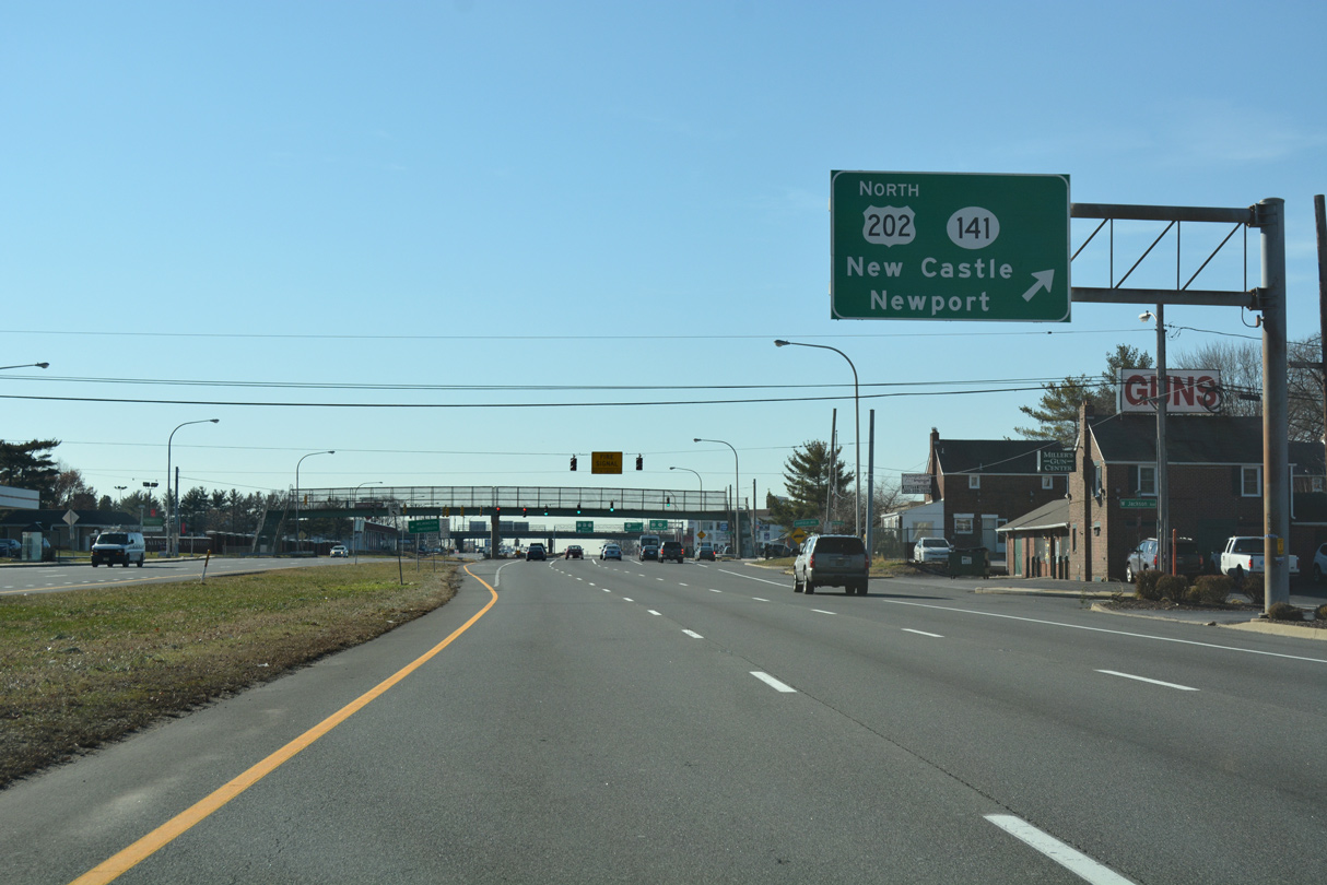
| A collector distributor roadway for U.S. 202 and SR 141 (Basin Road) begins at the U.S. 13/40 intersection with Jackson Avenue. U.S. 202 was extended south from Wilmington to Basins Corner in 1984. The US highway overlaps with SR 141 north to I-95 and the Newport Freeway. 12/20/16 |
|
| A second pedestrian overpass spans Dupont Parkway as U.S. 13/40 intersect Lincoln Avenue by the Penn Acres community. 12/20/16 |
|
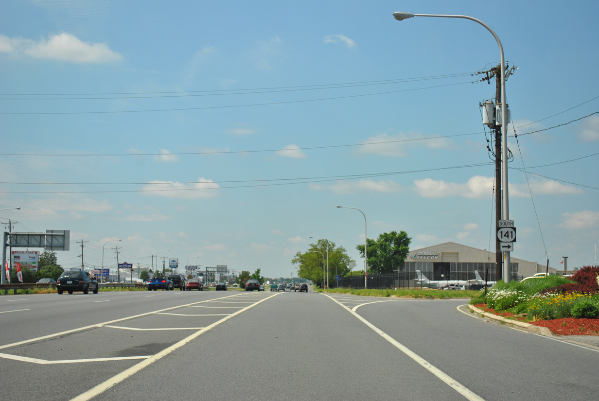
| Three lanes continue through the exchange with U.S. 202 and SR 141 as the c/d roadway travels with two. Departing in this scene is the northbound off-ramp to Basin Road. SR 141 forms an 11.34 mile route encircling Wilmington from New Castle to Elsmere, Greenville and Blue Ball. 06/02/12 |
|
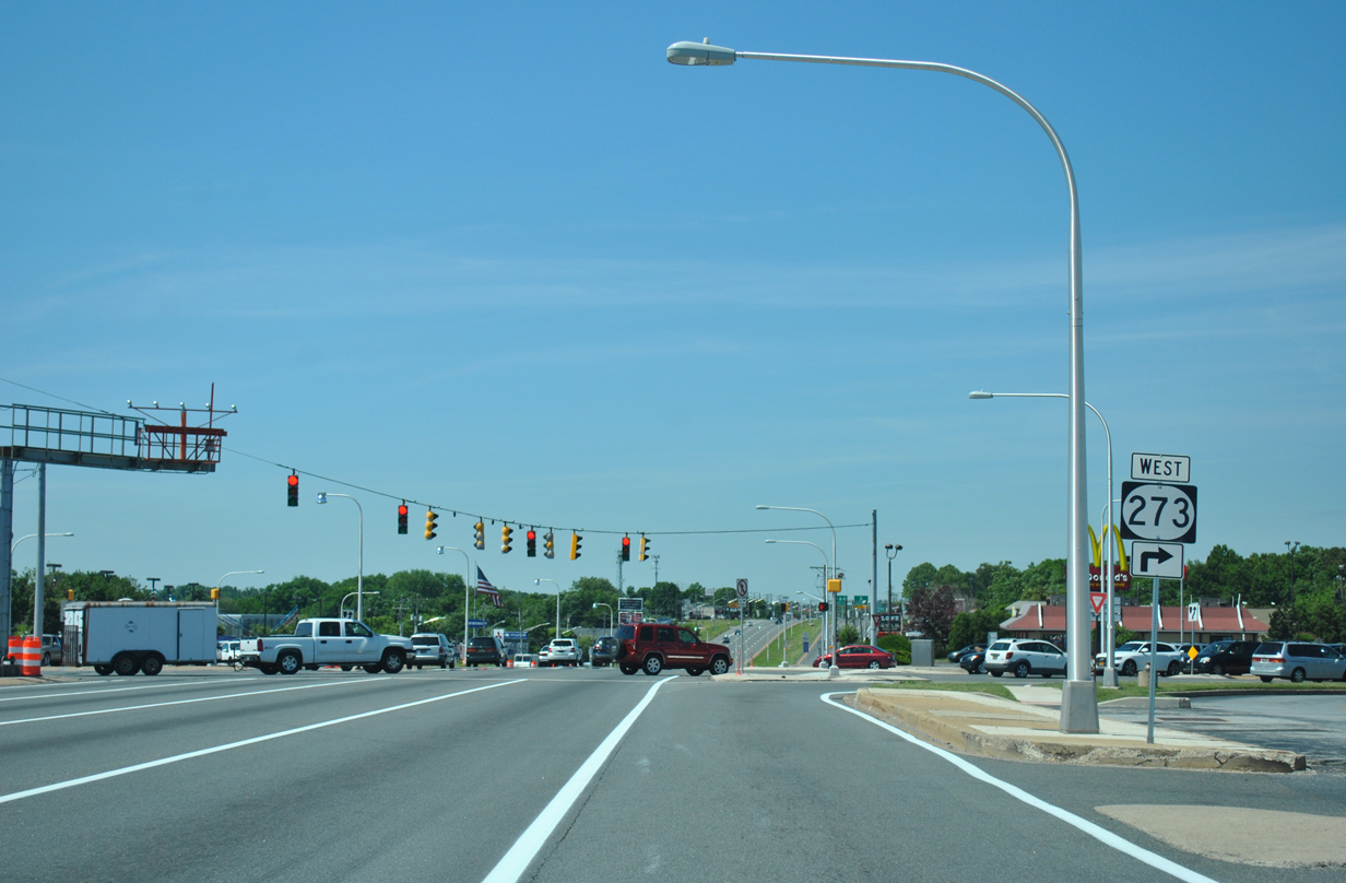
| SR 141 ends 1.25 miles to the southeast at the junction of SR 9 (Delaware / Washington Street) and 273 (Frenchtown Road) west at the city of New Castle. 12/20/16 |
|
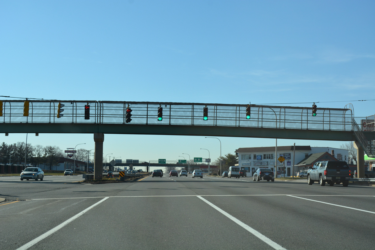
| The antiquated cloverleaf interchange between U.S. 13, U.S. 40, U.S. 202 and SR 141 includes businesses located within the three loop ramps. 06/02/12 |
|
| U.S. 13 south / U.S. 40 (Dupont Parkway) west intersect School Lane and an entrance to New Castle County Airport (ILG) at the next traffic light. 12/20/16 |
|
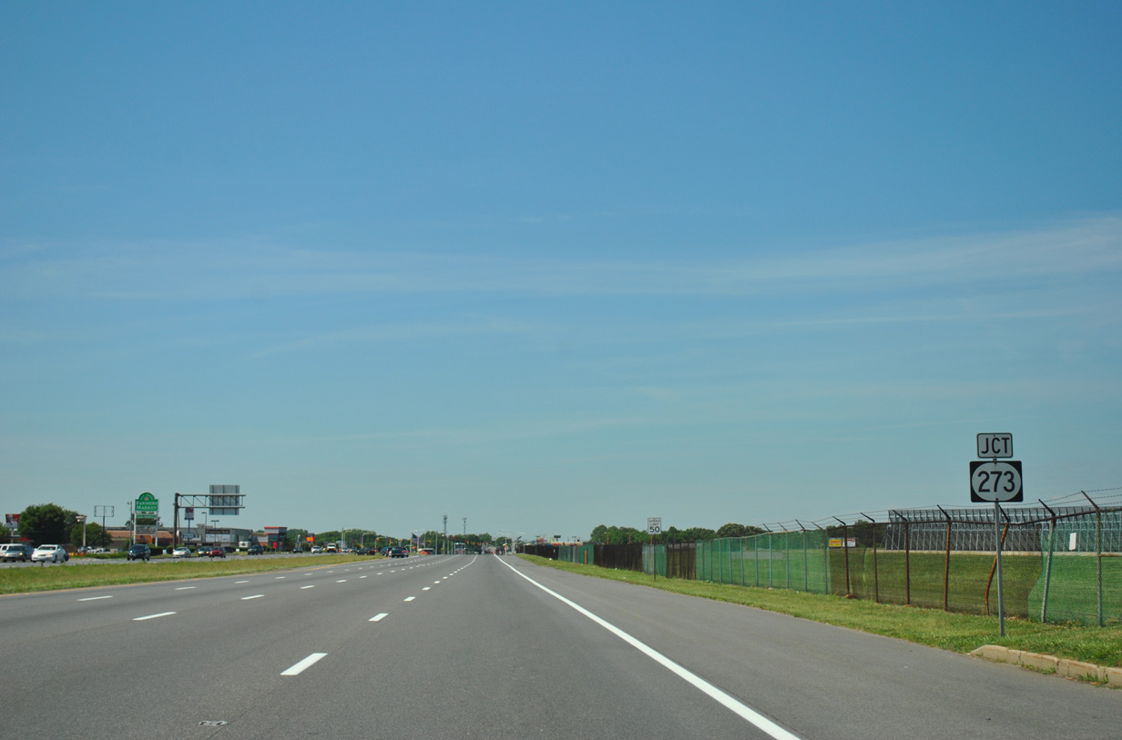
| Dupont Highway expands to eight overall lanes from SR 141 southwest to the U.S. 13 and 40 split at State Road. SR 273 crosses paths with the highway midway along the stretch at Hares Corner. 06/16/12 |
|
| SR 273 originates 1.3 miles to the east at New Castle and intersection of SR 9/141. The route formerly ended at Chestnut and 6th Streets in New Castle. 12/20/16 |
|
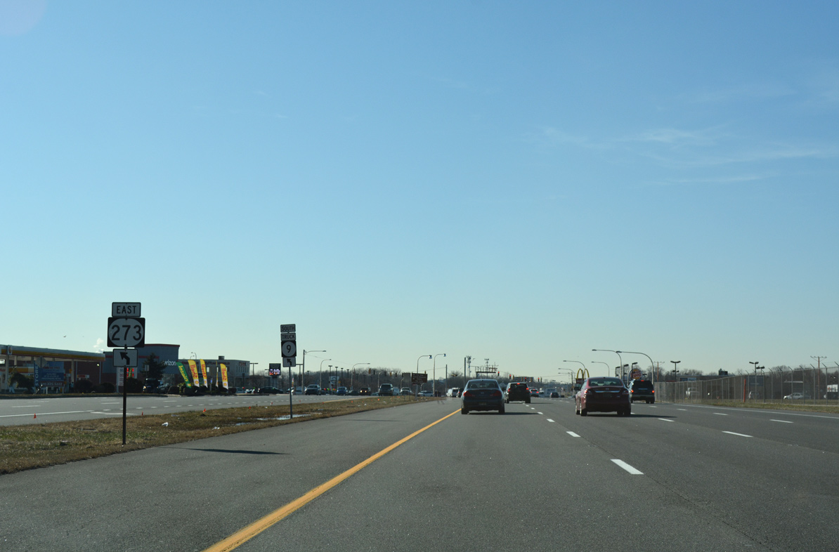
| Runway lighting for New Castle County Airport (ILG) appears above the expansive intersection with SR 273 (Christiana / Frenchtown Road). SR 273 forms a multi state route with MD 273 west from Hares Corner to Christiana, Ogletown, Newark and Rising Sun, Maryland.
The SR 273 marker here was removed by October 2012. 06/16/12 |
|
| U.S. 13 south / U.S. 40 (Dupont Highway) west advance from SR 273 and Hares Corner along a commercialized stretch with J-turns. 12/20/16 |
|
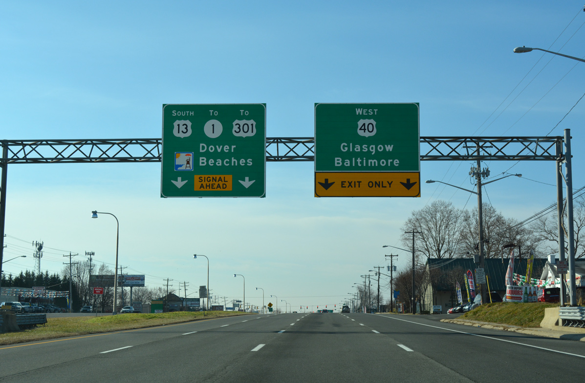
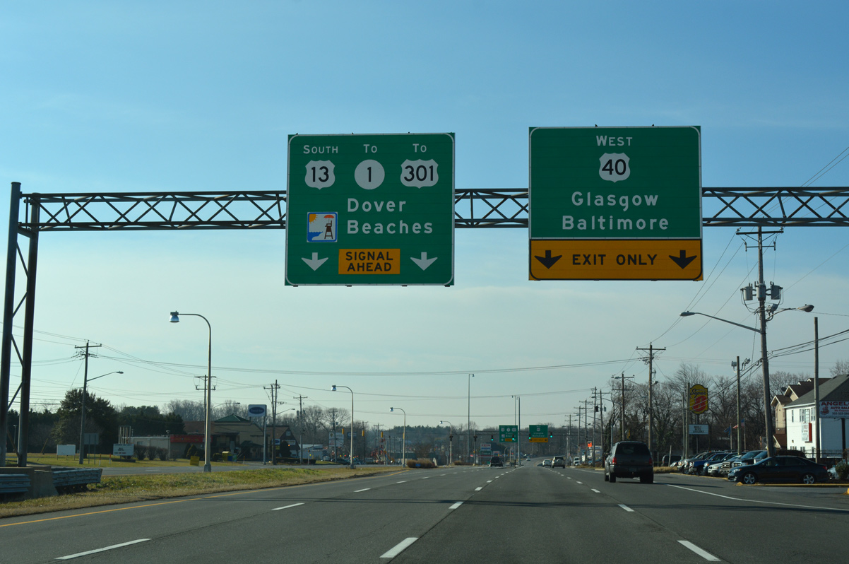
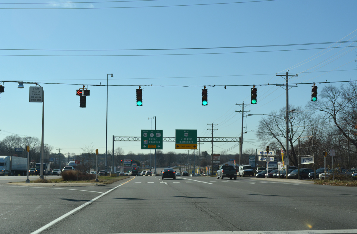
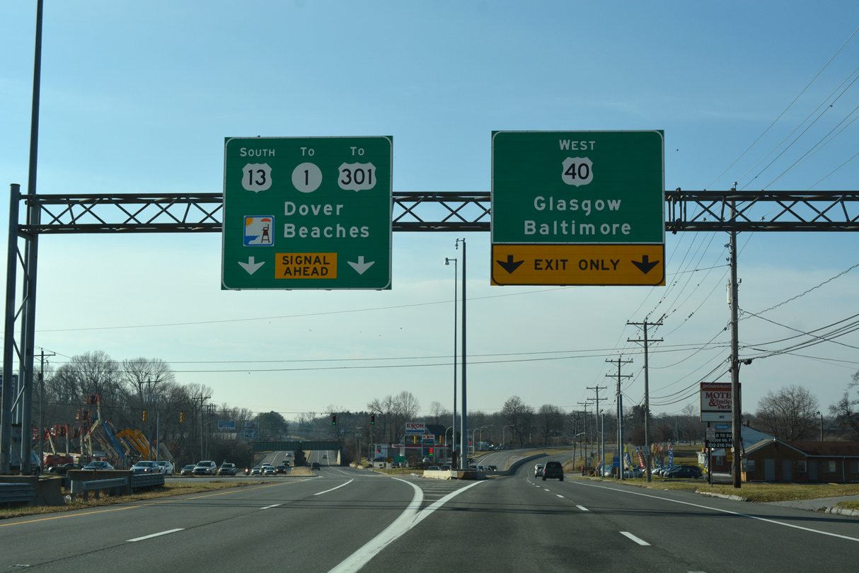
| A series of sign bridges precede the split of U.S. 40 west from U.S. 13 south at State Road. U.S. 40 branches west along Pulaski Highway to Bear and Glasgow while U.S. 13 remains southward on Dupont Highway to Tybouts Corner and the SR 1 freeway. 01/15/17 |
|
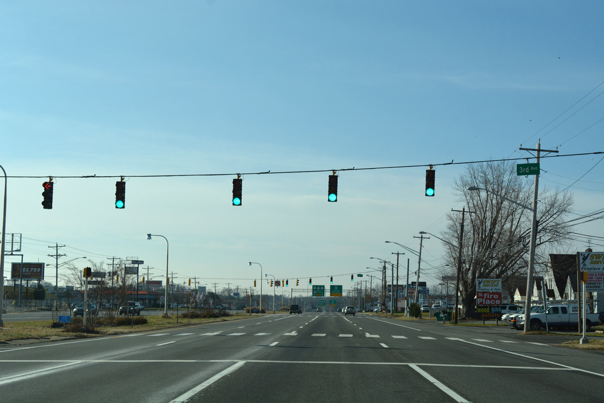
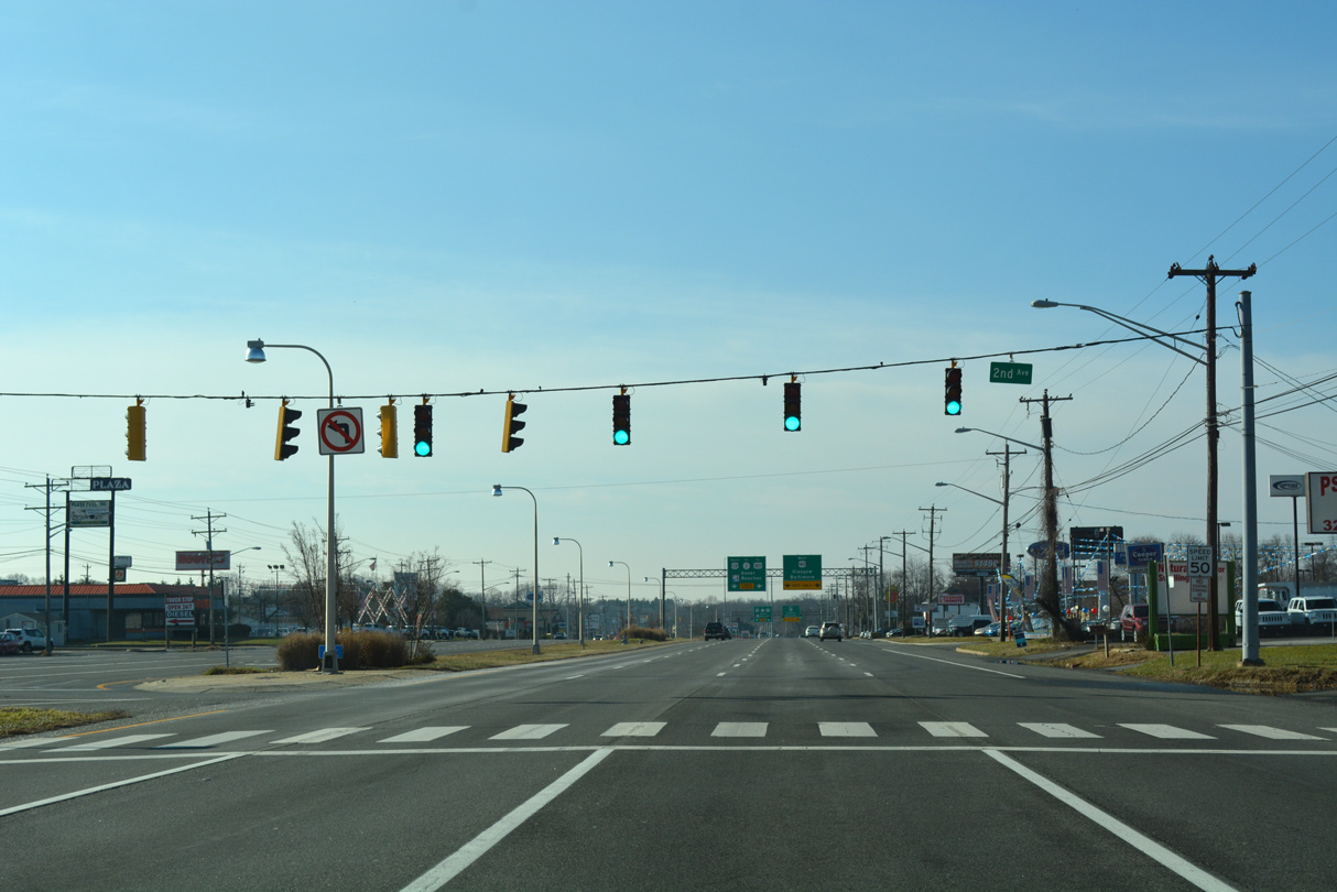
| A small street grid lines the west side of Dupont Highway at the Midvale community. J-turns are located at 3rd and 2nd Avenues. 01/15/17 |
|
| Prior to 1993, U.S. 301 followed U.S. 13 south from Farnhurst to Boyds Corner. The route was relocated then to begin in Glasgow and follow SR 896 south from U.S. 40 to Middletown. 01/15/17 |
|
| Another J-turn precedes the U.S. 13 (Dupont Highway) split with U.S. 40 (Pulaski Highway) west. 12/20/16 |
|
| Pulaski Highway carries U.S. 40 west from State Road to Baltimore, Maryland. Heavy suburban development lines the arterial west to Elkton, Maryland. 01/15/17 |
04/10/04, 08/07/04, 09/19/04, 08/18/05, 06/02/12, 06/16/12, 12/20/16, 12/21/16, 01/15/17, 12/20/17, 12/30/18, 01/01/19 by AARoads
Page Updated 06-20-2020.

 South
South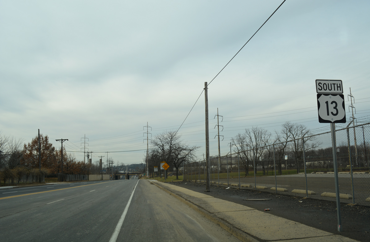

 South
South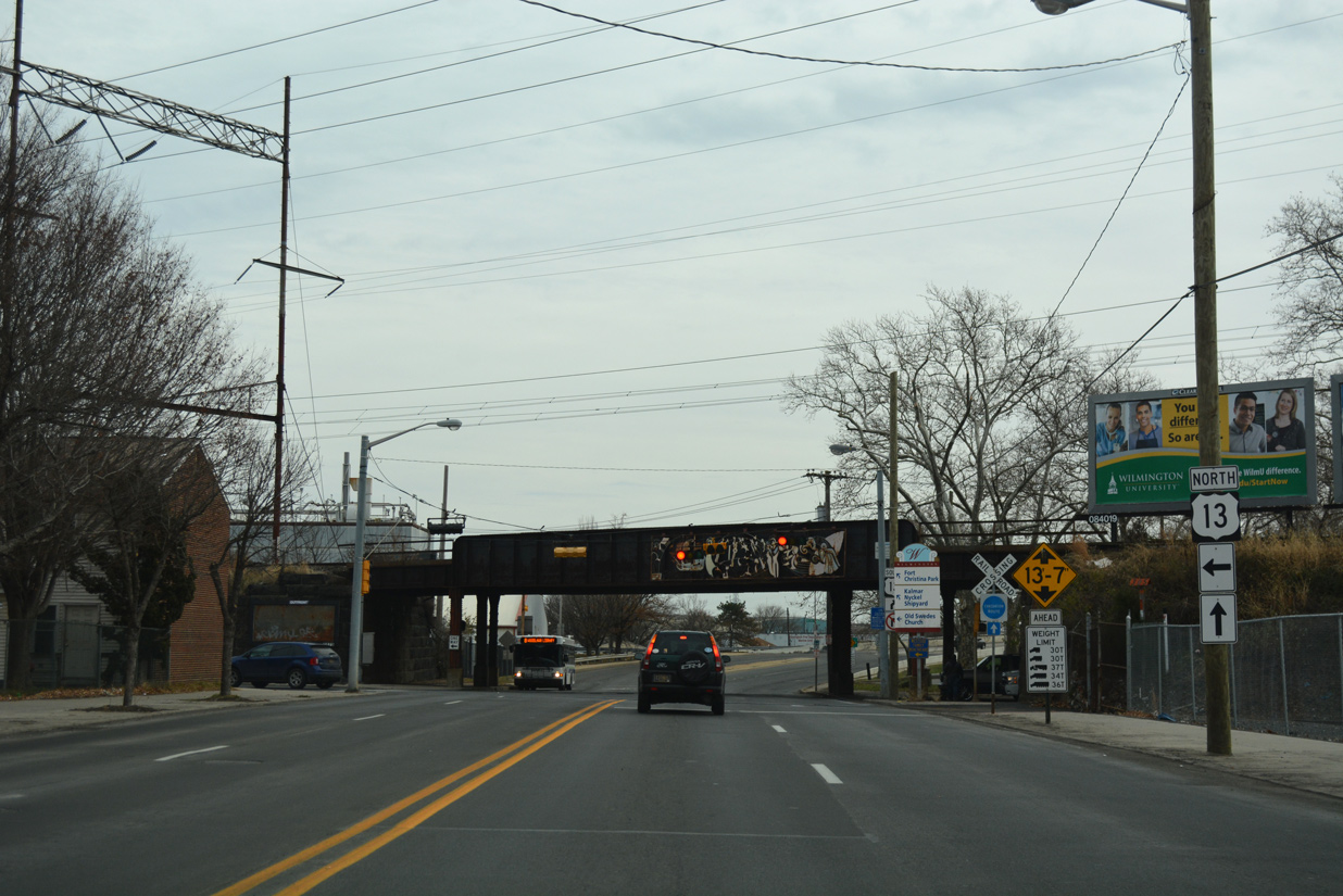


 West
West