County CB serves the western reaches of the Fox Cities from Wis 15 south to County JJ outside Neenah.
|
| County CB starts after Moon Shadow Drive, a block north of Wis 15. Future plans may extend the roadway northward. 04/07/16 |
|
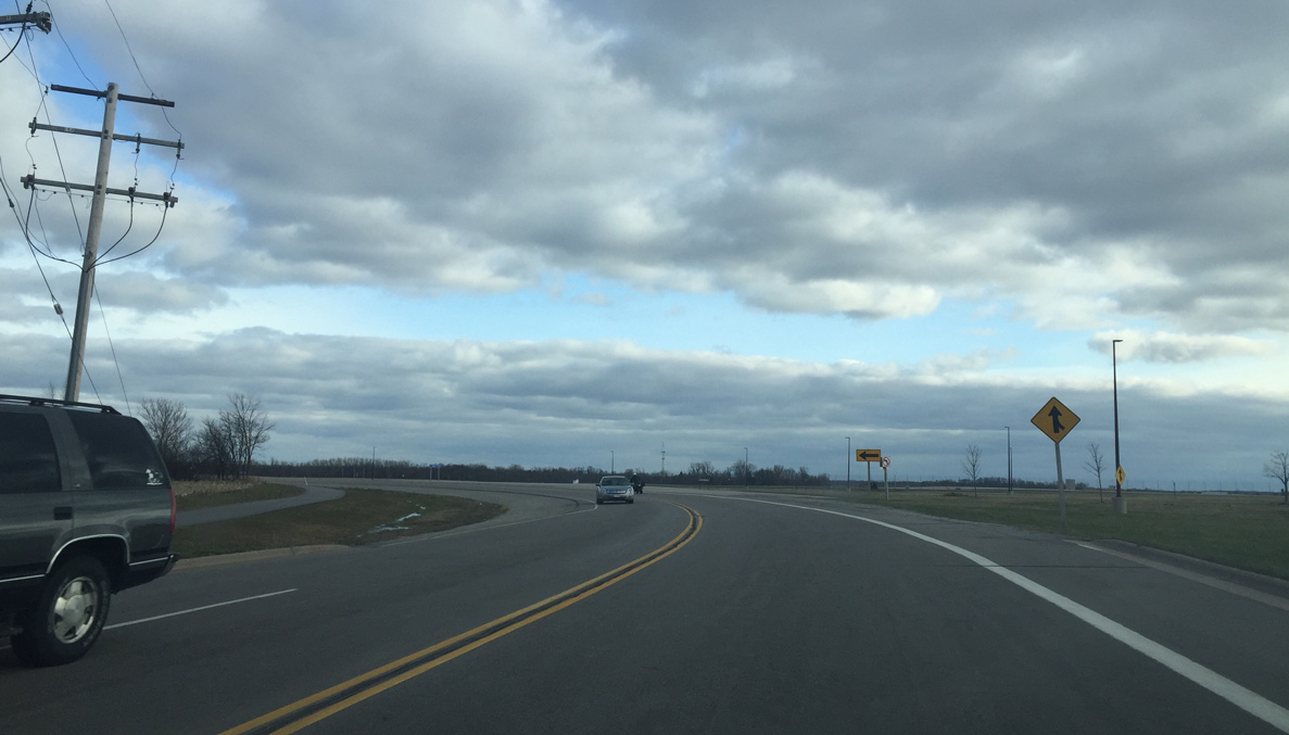
| A three lane roundabout replaced the signalized intersection with Wis 15 in 2012. Wis 15 is a four lane road built to bypass the Fox River Mall area to the east. The trunk highway also replaced a portion of U.S. 45 through Hortonville to the west. In the next few years, Wis 15 will be completely four lanes with a Hortonville bypass. 04/07/16 |
|
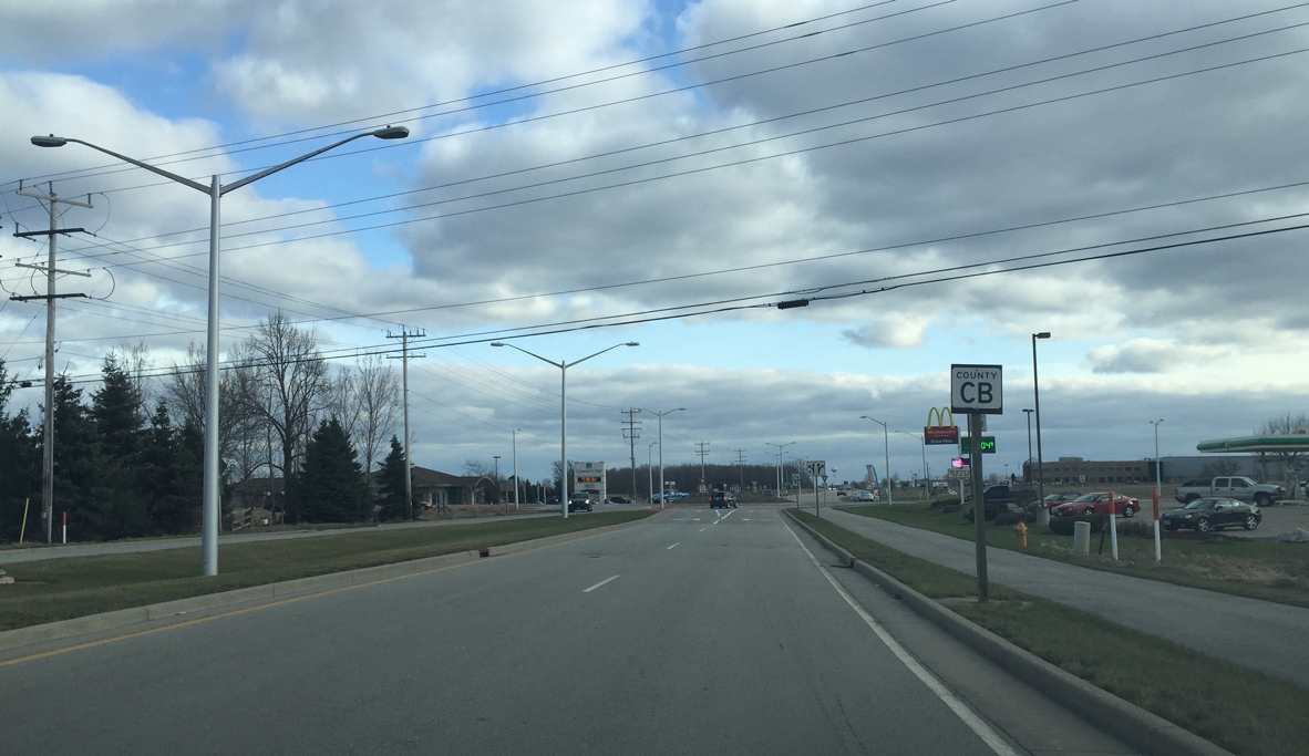
| The first reassurance sign for County CB appears south of Wis 15. 04/07/16 |
|
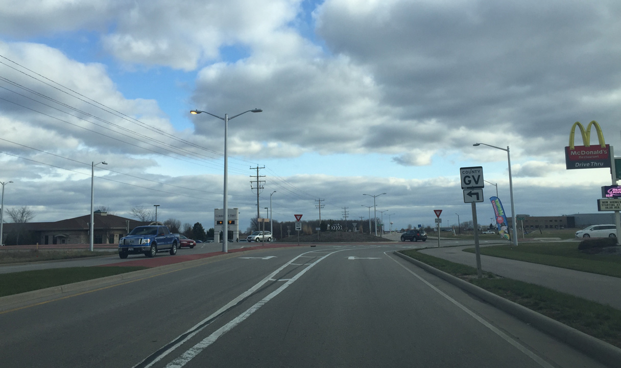
| A roundabout with County GV (Greenville Drive) and Wally Way quickly follows on County CB south. County GV replaced a portion of Wis 76 in 1997 when Wis 15 was built. GV stands for Greenville, the main township that it serves. 04/07/16 |
|
| County CB maintains four lanes south of the roundabout as it serves a wide spread industrial park area. 04/07/16 |
|
| Approaching Wis 96 on CTH-CB south. Wis 96 is a main east west roadway that passes by Fox River Mall and the northeastern portion of the Fox Cities. 04/07/16 |
|
| Wis 96 forms a four lane arterial to the east to the mall and I-41. The trunk highway reverts back to two lanes to the west, where it follows the former route of U.S. 10 to Fremont. 04/07/16 |
|
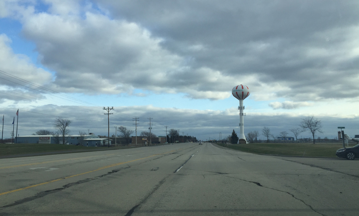
| County CB expands to five lanes past Appleton International Airport (ATW) and a Greenville water tower. 04/07/16 |
|
| Approaching the west end of County CA on County CB south. The CA stands for College Avenue, the main roadway that serves Downtown Appleton. 04/07/16 |
|
| The main Appleton International Airport (ATW) entrance, Challenger Drive, is to the right, while County CA east takes traffic from the airport to I-41 and Downtown Appleton. 04/07/16 |
|
| County CB becomes two lanes just south of County CA. The trunk highway angles southeast along the airport easement after Spencer Street. 04/07/16 |
|
| Returning to a due south heading, County CB next approaches County BB. County BB straddles the Outagamie/Winnebago County line and becomes Prospect Avenue in Appleton. 04/07/16 |
|
| Traffic lights control movements between CTH-CB and CTH-BB. A trailblazer guides motorists south along CTH-CB from ATW Airport to the U.S. 10 freeway. 04/07/16 |
|
| After County BB, County CB enters Winnebago County and the Village of Fox Crossing. Residents in the Town of Menasha voted on April 5, 2016 to become the Village of Fox Crossing to identify separate from the City of Menasha and to protect its borders from annexation from surrounding incorporated communities. 04/07/16 |
|
| County CB becomes a divided roadway north of Shady Lane. The Village of Fox Crossing government complex appears to the west. 04/07/16 |
|
| Shady Lane (former County U) travels west from in industrial area alongside Interstate 41 to bisect residential areas to County CB. West from the trunk highway, the road becomes more rural to its end at Pioneer Road in the town of Clayton. 04/07/16 |
|
| South from Shady Lane, County CB replaced County OO on parallel Irish Road when it was constructed. Motorists otherwise next intersect American Drive.
American Drive once represented the west end of Wis 441 at a T intersection. When the US 10 freeway was built in 1998, American Drive was rerouted to curve toward the west and parallel US 10 in hopes of attracting new business for the then Town of Menasha. Business was slow to develop as a traffic signal from 1998 still is not operating along American Drive. Area development is increasing however and is visible to the right in this scene with the crane and new building. 04/07/16 |
|
| Advancing south, County CB enters a diamond interchange with U.S. 10. About 1/2 mile to the east is the I-41 interchange and Wis 441. The interchange is partial, which may be why this part of Fox Crossing was slow to develop. In 2018, the U.S. 10 east to I-41 north and I-41 north to US 10 west ramps will open, giving freeway to freeway access to this area of Fox Crossing. 04/07/16 |
|
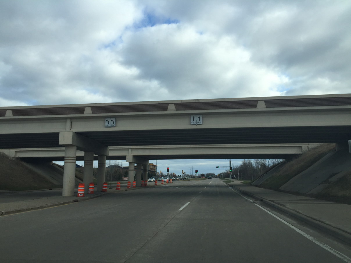
| Passing below the U.S. 10 freeway ahead of the eastbound on-ramp to Appleton. This section of County CB was constructed around the same time the U.S. 10 freeway was built. 04/07/16 |
|
| Crossing over the Canadian National roadway and a bridge named after a local veteran on County CB south of Jacobsen Road. 04/07/16 |
|
| County CB continues as a four lane divided roadway by an industrial and business park preceding County II (Winchester Road). 04/07/16 |
|
| Entering the intersection with County II (Winchester Road) on County CB south. CTH-II was formerly Wis 150. The state trunk highway was turned back to Winnebago County when the U.S. 10 freeway opened about 1 1/2 miles to the north. 04/07/16 |
|
| County CB narrows to two lanes and curves southwest after County II. 04/07/16 |
|
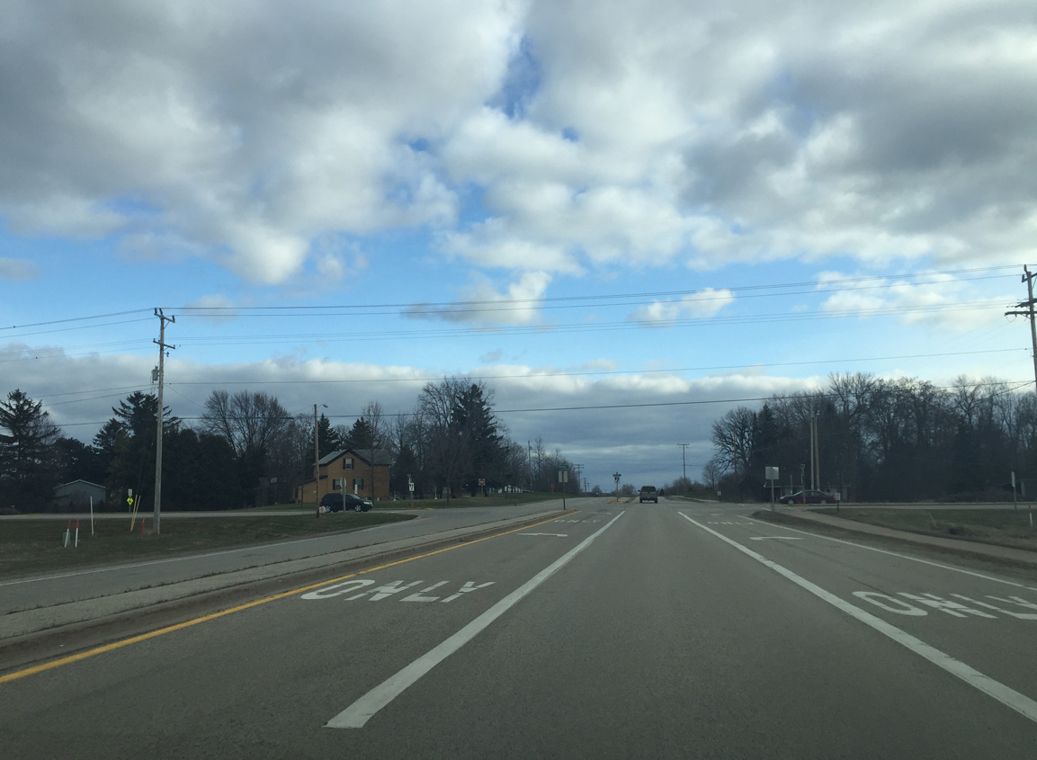
| Southbound CTH-CB at Oakridge Road. Oakridge Road east becomes Main Street once it enters Neenah and leads directly Downtown. This is the most crash prone intersection along County CB and there is a call for traffic signals or a roundabout to replace the intersection.
Historically Oakridge Road traveled just south of here as CTH-S. Construction of CTH-CB realigned the road to form a right angle with adjacent Larsen Road to eliminate what would have been an acute angled intersection with CTH-CB. 04/07/16 |
|
| Passing by a large quarry to the west, County CB approaches its southern terminus at County JJ (Winneconne Avenue). 04/07/16 |
|
| County JJ replaced Wis 114 between Wis 76 and I-41 in the mid 80s. To the east it leads to the main commercial corridor of Neenah. 04/07/16 |
Page Updated 06-06-2016.