
 East
East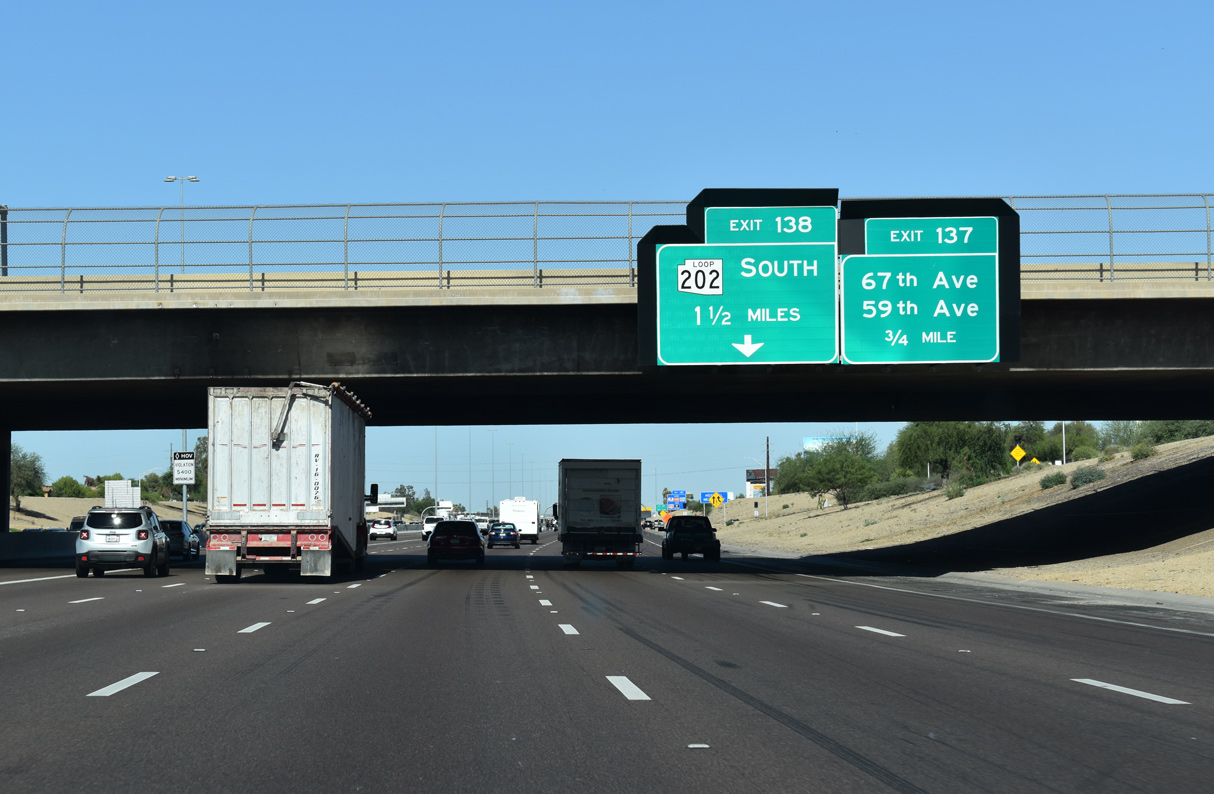
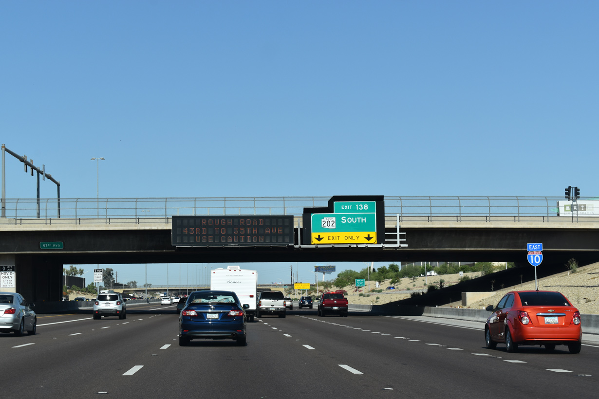
Construction of the exchange with Loop 202 (South Mountain Freeway) included consolidating Exit 138 for 59th Avenue with Exit 137 for 67th Avenue.
05/28/21

05/28/21

Loop 202 along the South Mountain Freeway opened to traffic southeast to I-10 at Chandler on December 21, 2009.
05/28/21
05/28/21

The South Mountain Freeway encircles South Mountain Village and the South Mountains along a 22.17 mile long course from Exit 138 to the four level interchange with I-10 at Exit 161.
05/28/21

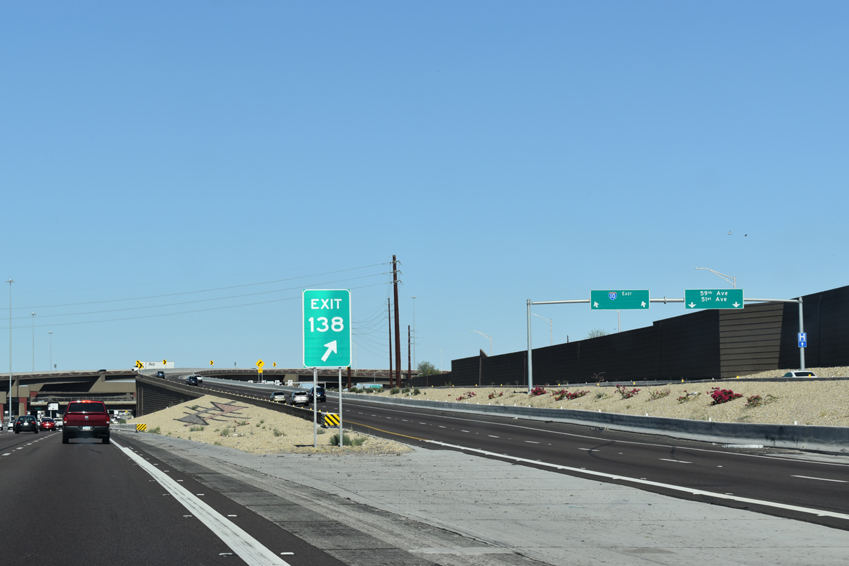
Exit 138 represents the western end of Loop 202. The 78.05 mile long beltway encircles Chandler, Gilbert, Mesa and Tempe to I-10 at Exit 147A.
05/28/21
What was Exit 139 for 51st Avenue was redirected onto a distributor roadway from Exit 137. 59th and 51st Avenues head north through Maryvale Village in Phoenix to the city of Glendale.
05/28/21

05/28/21

05/28/21
05/28/21
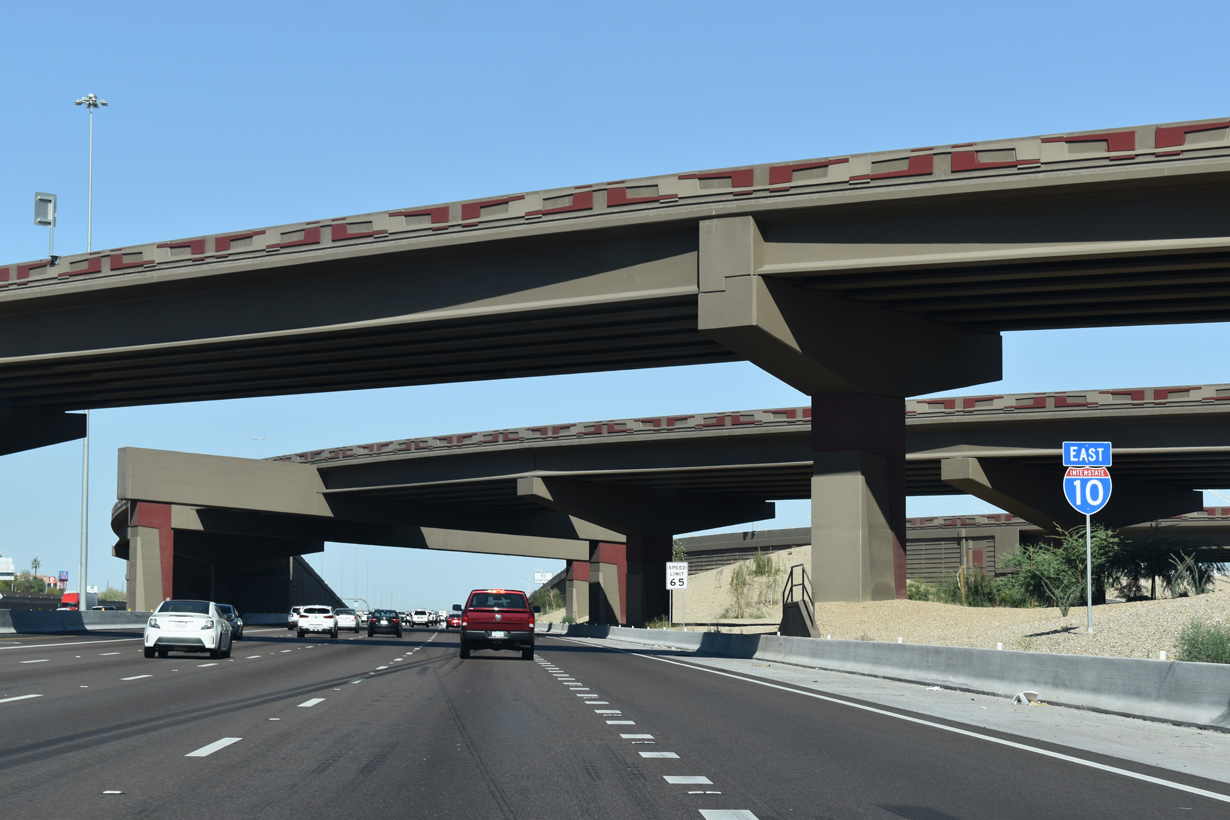
Corresponding with the primary roads on the Phoenix street grid, each exit along Interstate 10 is a mile apart.
05/28/21
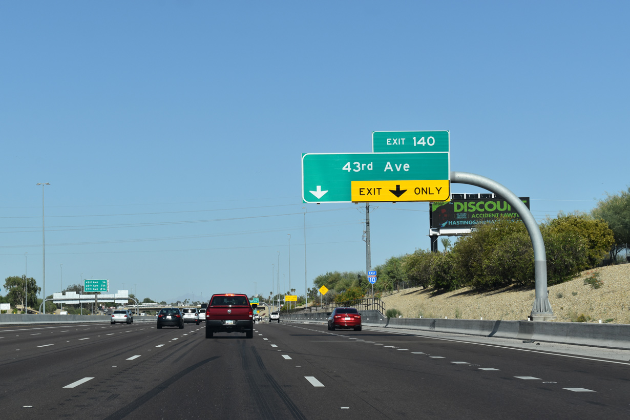
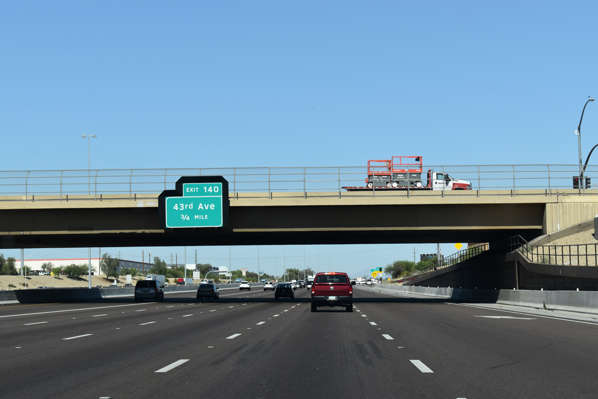
Passing below 51st Avenue, Interstate 10 advances east through suburbs developed in the 1950s to 43rd Avenue at Exit 140.
05/28/21

05/28/21

05/28/21

05/28/21

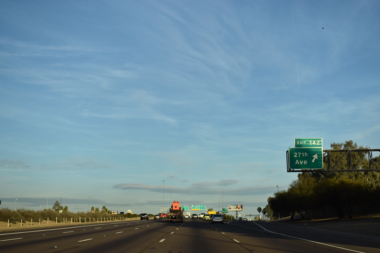
The ensuing exit from I-10 east is with 35th Avenue. The Stack interchange with I-17/U.S. 60 follows at Exit 143.
05/28/21

Hazardous cargo is not permitted on Interstate 10 (Papago Freeway) between I-17 at Exit 143 and the south end of I-17 at Exit 150 due to the Deck Park Tunnel.
05/28/21

ADOT recorded 236,003 vehicles per day between 43rd and 35th Avenues in 2019.
05/28/21

U.S. 60 combines with I-17 one mile north to Thomas Road and Grand Avenue.
03/01/19

05/28/21

05/28/21

Interstate 17 heads north from The Stack interchange (Exit 143) along the Black Canyon Freeway to Alhambra, North Mountain Village and Deer Valley through north Phoenix.
05/28/21

05/28/21
03/01/19

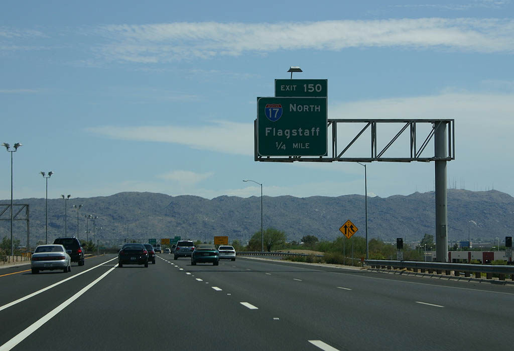
Interstate 17 travels 139 miles north to I-40/SR 89A at Flagstaff.
05/28/21

U.S. 60 overlaps with I-17 along the Black Canyon and Maricopa Freeways to Interstate 10 in southeast Central City.
05/28/21
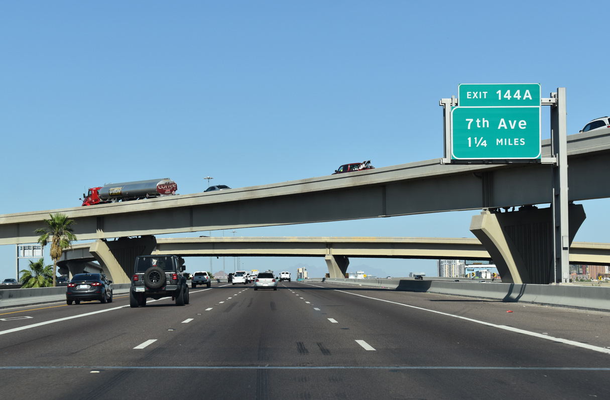
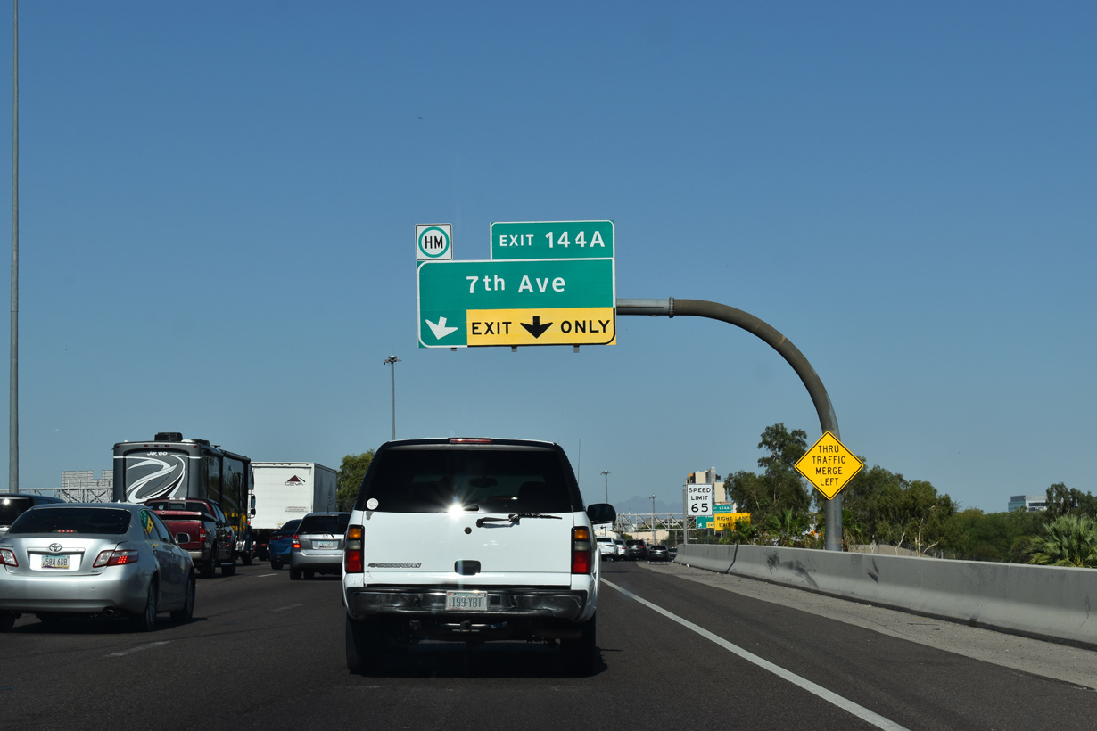
Interstate 10 continues from The Stack with I-17 along a long viaduct over 19th Avenue and Grand Avenue (old U.S. 60/89) to Exit 144A for 7th Avenue.
05/28/21
Interstate 10 continues from The Stack with I-17 along a long viaduct over 19th Avenue and Grand Avenue (old U.S. 60/89) to Exit 144A for 7th Avenue.
05/28/21

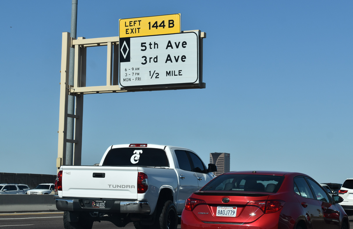
Left Exit 144B for 5th and 3rd Avenues departs from the HOV lane in one mile.
05/28/21

All vehicles with hazardous cargo must leave I-10 east at Exit 144A due to the restriction through the Deck Park Tunnel.
05/28/21
05/28/21
05/28/21
05/28/21

05/28/21
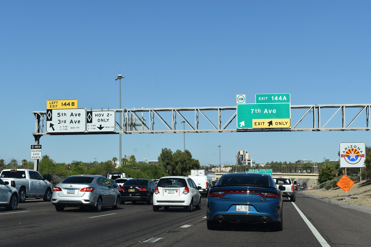
Left Exit 144A and Exit 144B depart simultaneously for 7th Avenue, 5th Avenue and 3rd Avenue to Downtown Phoenix.
05/28/21

05/28/21
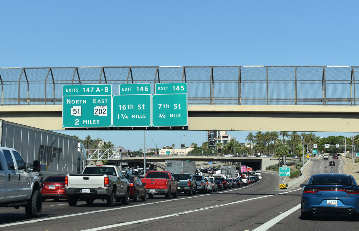
The succeeding three exits from the Papago Freeway east are for 7th Street, 16th Street at Garfield and SR 51 (Piestewa Freeway)/Loop 202 (Red Mountain Freeway).
05/28/21
The succeeding three exits from the Papago Freeway east are for 7th Street, 16th Street at Garfield and SR 51 (Piestewa Freeway)/Loop 202 (Red Mountain Freeway).
06/19/07

Prior to reach Exit 145 for 7th Street, I-10 enters a cut and cover tunnel. Located between 3rd Street and 3rd Avenue, the six block long tunnel passes below Margaret T. Hance Park. A bus station in the tunnel was designed within the freeway median with direct exits from the HOV lanes. Having never opened, gates block access to this area. A comparable tunnel is along SR 15 near University Avenue in San Diego, California.
06/19/07

Exit 145 departs I-10 eastbound within the Deck Park Tunnel. The Papago Freeway proceeds east 0.75 miles to a half diamond interchange (Exit 146) with N 16th Street.
06/19/07

SR 51 (Piestewa Freeway) south and Loop 202 (Red Mountain Freeway) west converge with I-10 at the Mini-Stack interchange (Exit 147). With 318,542 (vpd) recorded by ADOT in 2019, the Papago Freeway leading into this exchange is the busiest section of Interstate 10 in Arizona.
06/19/07

Two lanes join Loop 202 (Red Mountain Freeway) east at Exit 147A to north Tempe and Mesa. The belt route returns to I-10 via Gilbert and Chandler along the Santan Freeway.
06/19/07

Left Exit 147C separates from the I-10 HOV Lane onto the HOV lane along Loop 202 east.
06/19/07

SR 51 (Piestewa Freeway) runs 16.71 miles north from the Mini-Stack to Loop 101 and Black Mountain Road at Desert Ridge in North Phoenix.
06/19/07

Interstate 10 curves southward through the Mini-Stack and next meets the couplet of Jefferson Street east and Washington Street west at Exit 148.
07/22/07

A service road extends south from Exit 148 to Sky Harbor Circle for the consolidated Rental Car facility at Phoenix Sky Harbor Airport (PHX). Exit 149 connects I-10 with Sky Harbor Boulevard to the passenger terminal at PHX Airport.
07/22/07

Entering the split diamond interchange (Exit 148) with Washington and Jefferson Streets on I-10 (Papago Freeway) eastbound.
07/22/07

A wye interchange links I-10 eastbound with Sky Harbor Boulevard directly at Exit 149. The exit to Phoenix Sky Harbor International Airport (PHX) from I-10 west utilizes Buckeye Road.
07/22/07

Exit 149 departs I-10 east for Sky Harbor Boulevard, 0.75 miles from the south end of Interstate 17.
07/22/07
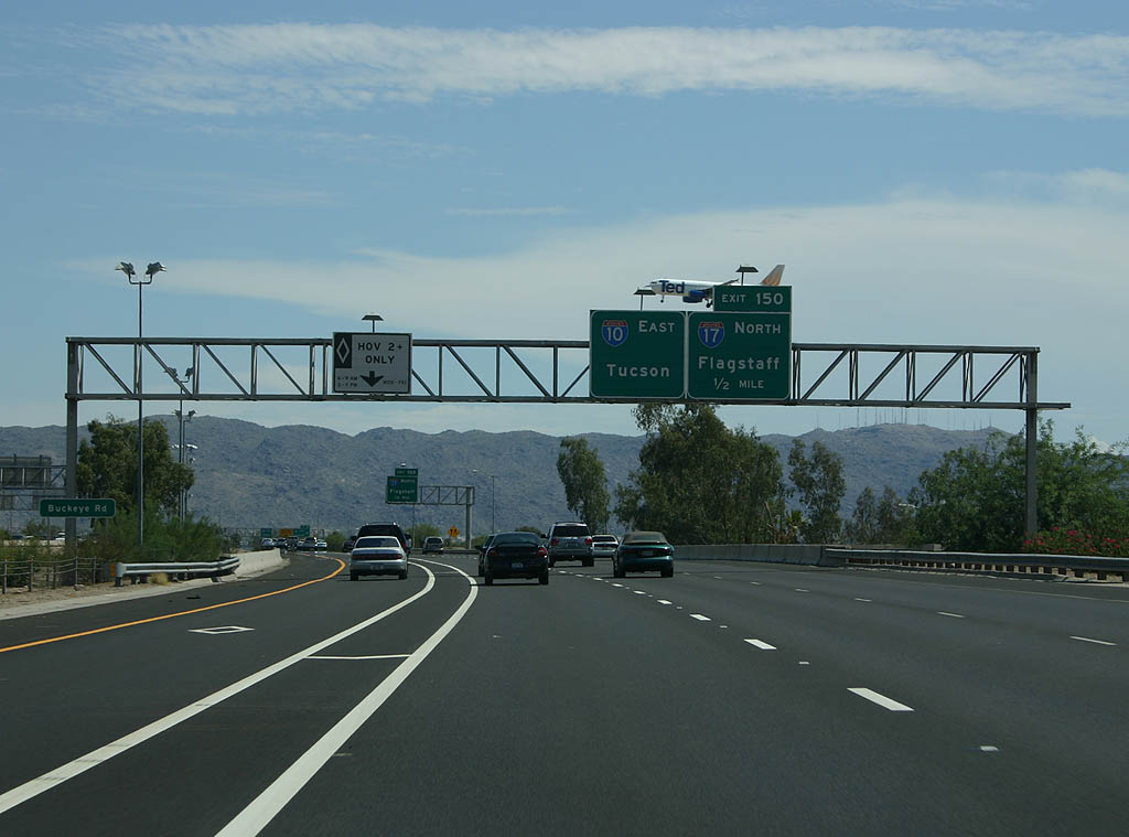
With a Ted (United) A320 landing at Sky Harbor in the background, I-10 runs along the west side of PHX Airport to Exit 150 with I-17 north and U.S. 60 west.
07/22/07
Interstate 17 commences west alongside U.S. 60 on the Maricopa Freeway to the Black Canyon Freeway north.
07/22/07

Unlike The Stack at the previous junction between I-10/17, the south end of Interstate 17 is a less impressive three-wye interchange.
07/22/07

U.S. 60 accompanies Interstate 10 southeast into Tempe. The ensuing exit is for 32nd Street south and University Drive north.
03/01/19
I-10/U.S. 60 cross the Salt River ahead of the diamond interchange at Exit 151. 32nd Street and University Drive are both discontinuous due to the Salt River and Sky Harbor Airport.
07/22/07

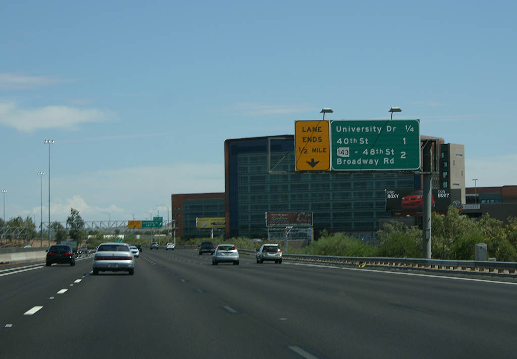
Exit 151 serves an array of office complexes and industrial parks.
07/22/07

A parclo interchange joins I-10/U.S. 60 with 40th Street at forthcoming Exit 152.
07/22/07
07/22/07

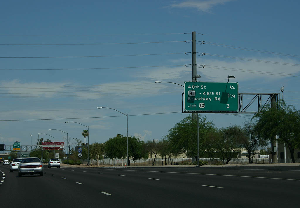
A cancelled extension of SR 153 south to Interstate 10 would have tied into the Maricopa Freeway at Exit 152. Since decommissioned, SR 153 previously followed 44th Street along the east side of Sky Harbor Airport (PHX).
07/22/07

Photo Credits:
- 06/19/07 by Kevin Trinkle.
- 07/22/07 by Kevin Trinkle.
- 03/01/19 by AARoads.
- 05/28/21 by AARoads.
Connect with:
Interstate 17
U.S. 60
State Route 51
State Route 143 - Hohokam Expressway
Loop 101
Loop 202
Page Updated 04-08-2022.