
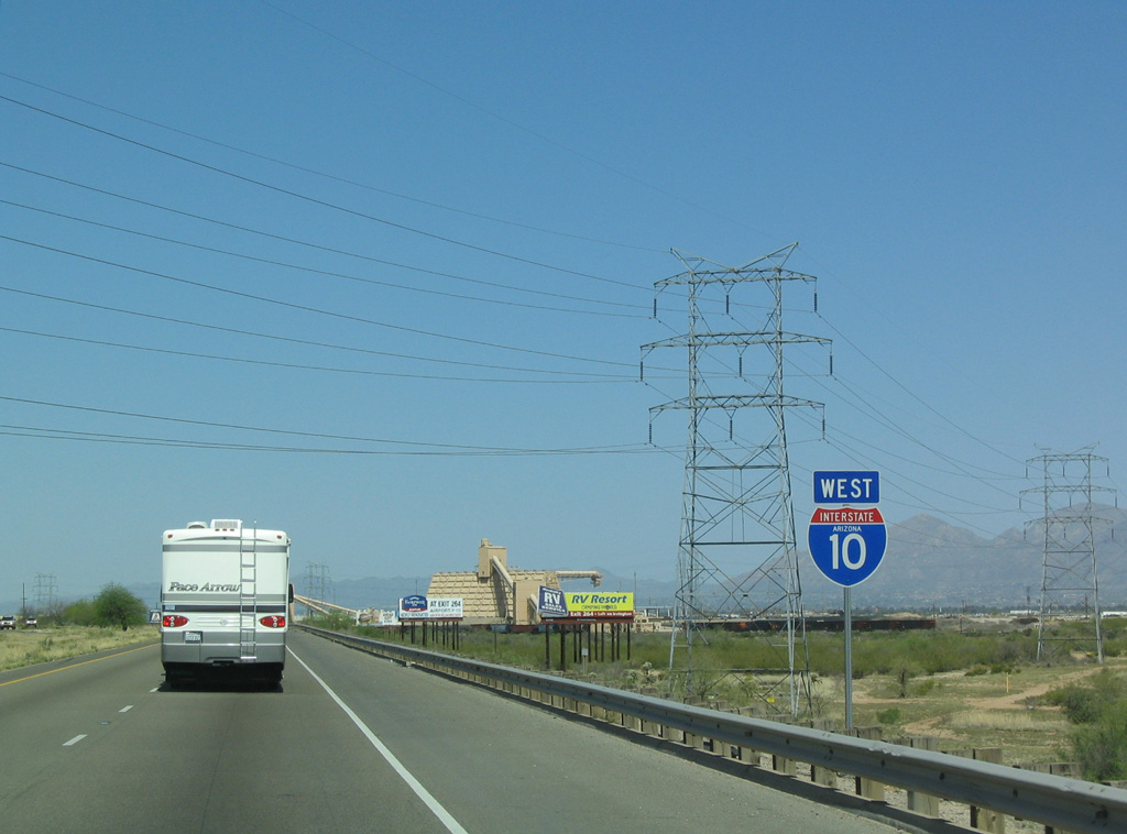
 West
West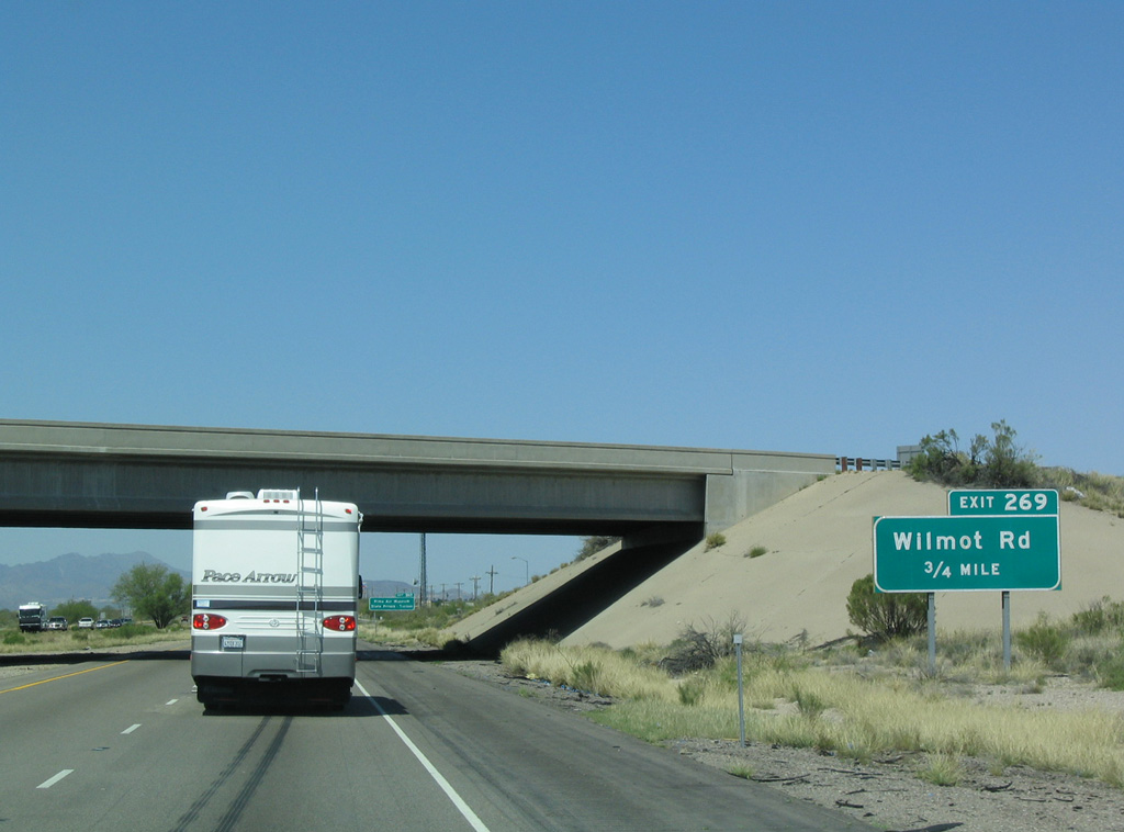
Interstate 10 runs alongside the Desert Stone, Vista Montaña Estates and Sycamore Point subdivisions leading to Exit 269 for Wilmot Road.
03/28/04

03/28/04
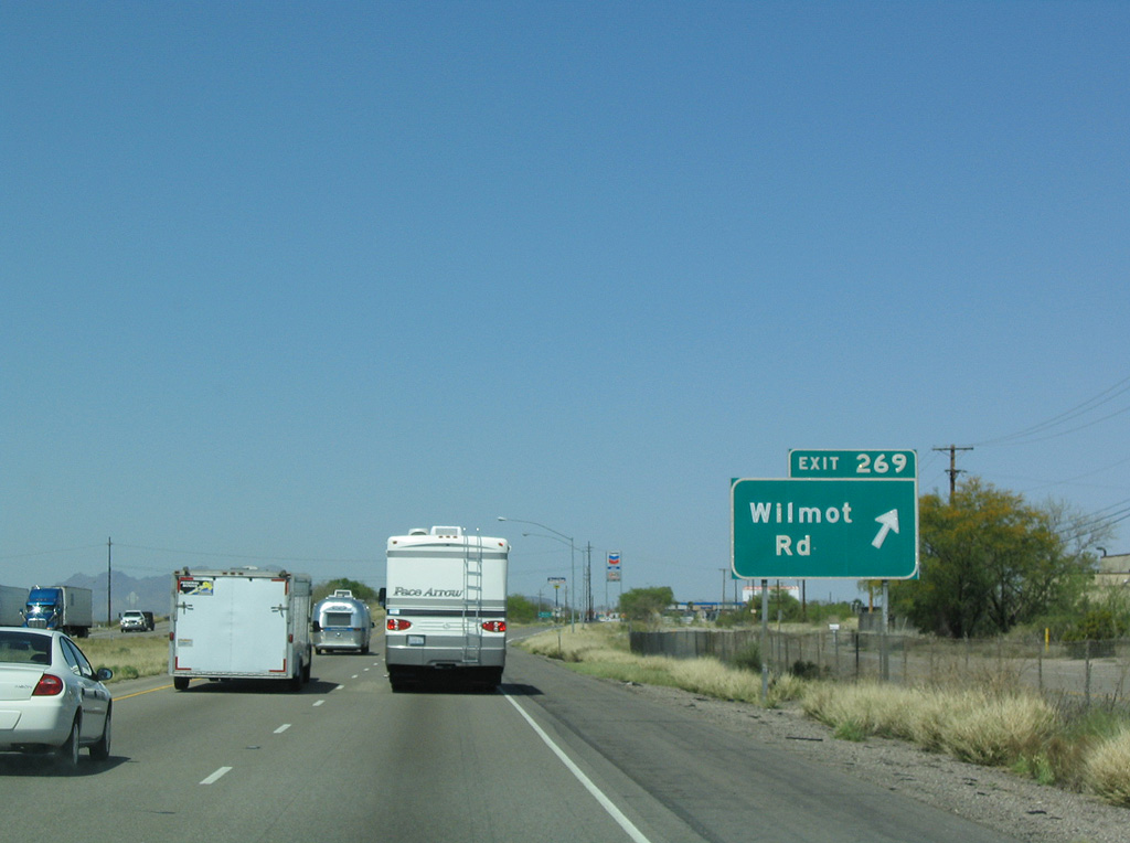
Wilmot Road heads north from the diamond interchange at Exit 296 to Valencia Road and Davis-Monthan Air Force Base. A discontinuous section of Wilmot Road extends north from the military base to Golf Links Road and 22nd Street.
03/28/04
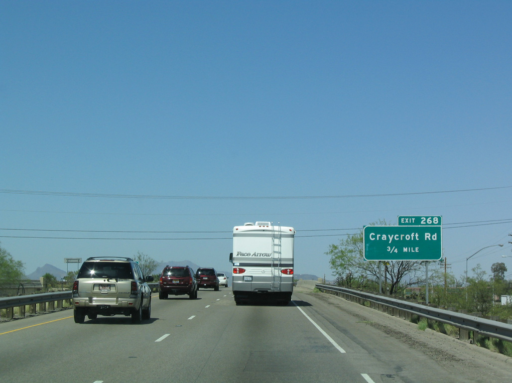
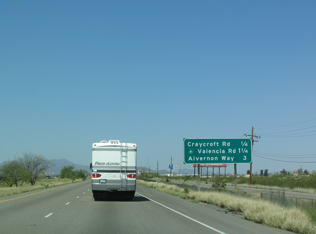
A modified diamond interchange utilizing the Benson Highway, the I-10 frontage roads, connects the freeway with Craycroft Road at forthcoming Exit 268.
03/28/04
03/28/04

Craycroft Road heads north into the Littletown community and south to Los Reales Road west to Tucson International Airport (TUS) and the Los Reales Landfill.
03/28/04
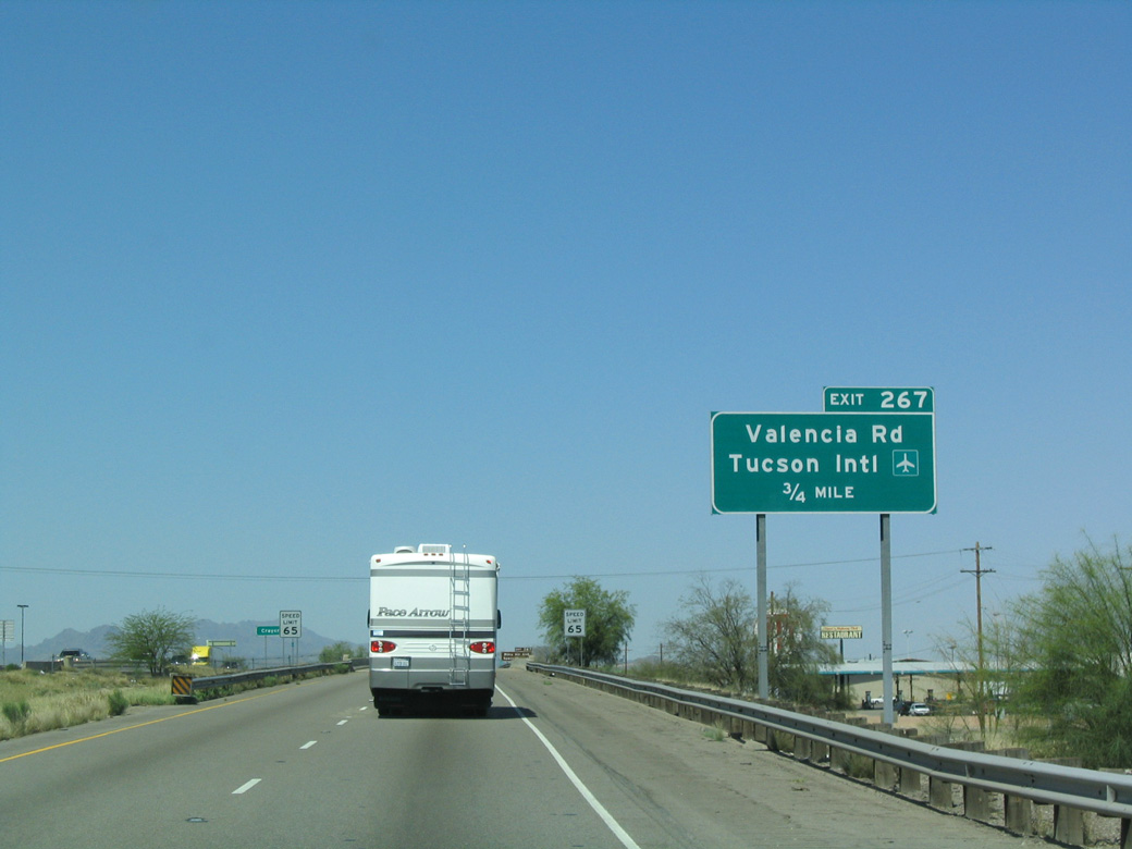
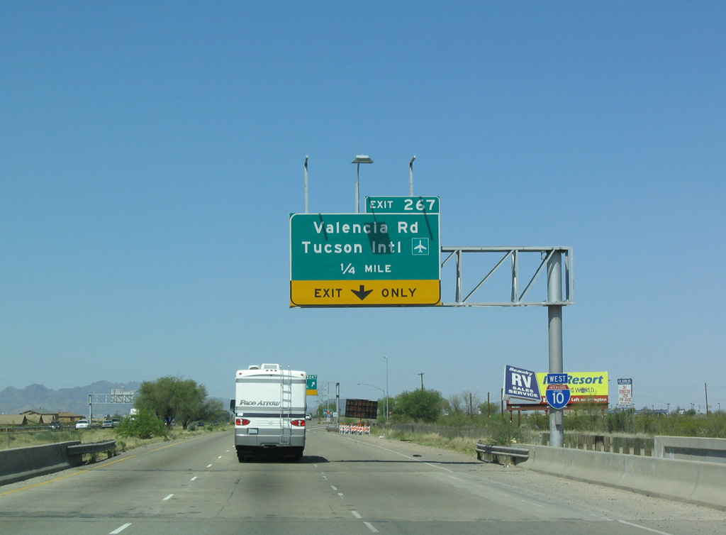
Valencia Road is an arterial running west from Littletown and Exit 267 to the northern boundary of the Tucson International Airport (TUS) and I-19 just north of the San Xavier Indian Reservation.
03/28/04
Valencia Road was formerly part of Business Loop I-10. Decommissioned in 2003, the business route followed Old U.S. 80 along Benson Highway northwest back to I-10 near Exit 262.
03/28/04
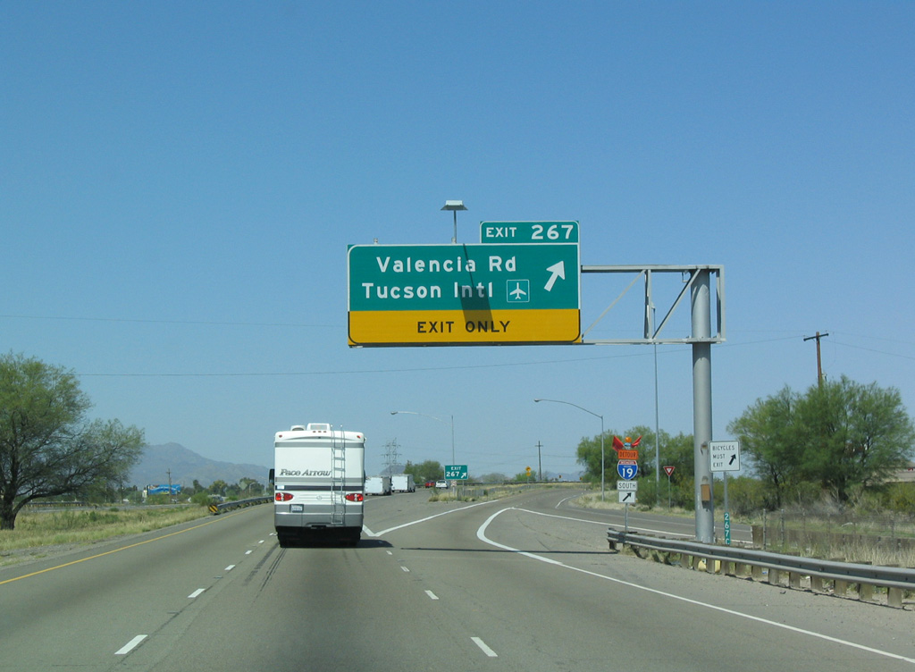
Valencia Road travels 2.8 miles west from the diamond interchange at Exit 267 to Tucson Boulevard south for the passenger terminal at Tucson International Airport (TUS).
03/28/04
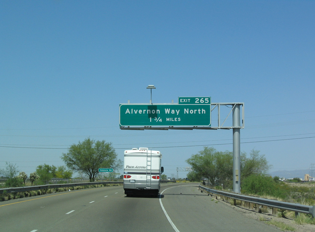
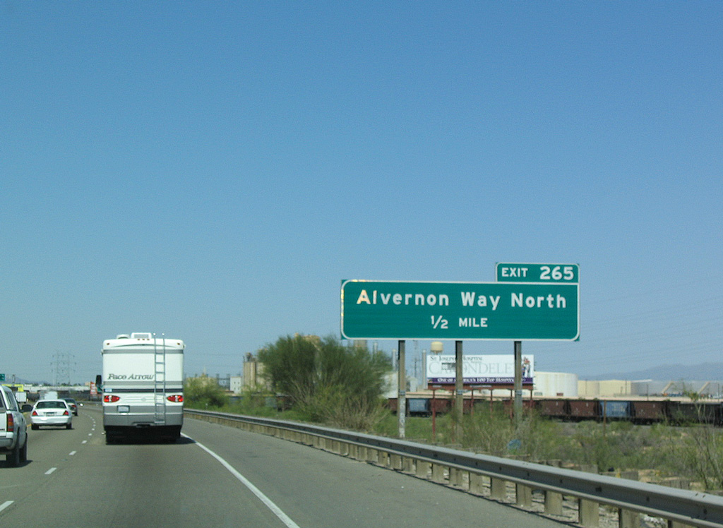
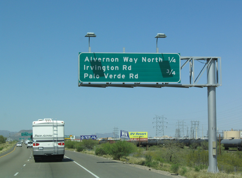
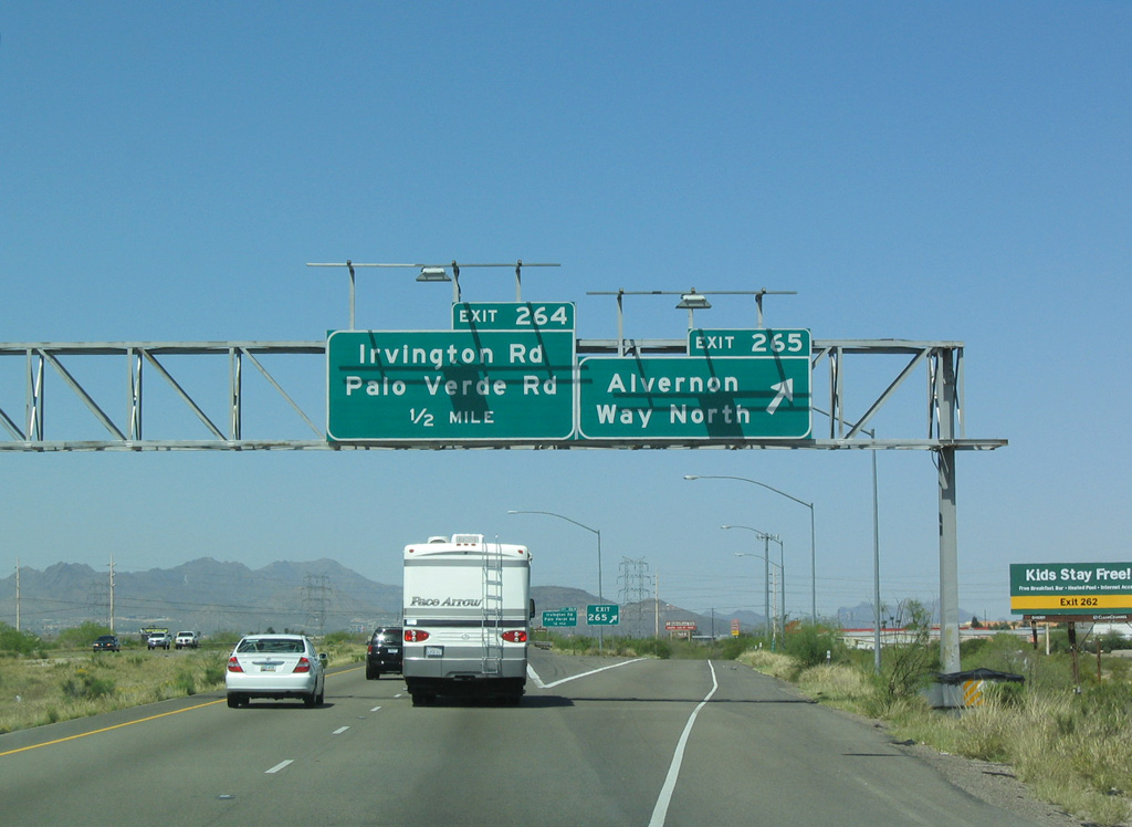
Turning more toward the north, Interstate 10 proceeds 1.75 miles to Exit 265 and Alvernon Way.
03/28/04
03/28/04
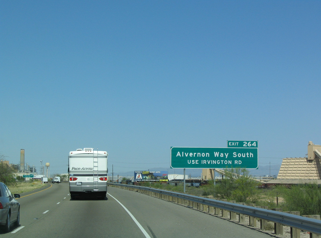
Exit 265 links westbound I-10 with Alvernon Way north. Traffic to Alvernon Way south is directed onto Irvington Road east from Exit 264.
03/28/04
Alvernon Way weaves north through an area of industrial parks west of Davis Monthan Air Force Base to an exchange with Aviation Parkway. Aviation Parkway (SR 210) is a controlled access expressway northwest to Downtown Tucson.
03/28/04
03/28/04
03/28/04
Exit 264 ties into Irvington Road at Hotel Drive, midway between Palo Verde Road and Alvernon Way. Palo Verde Road leads north to the east end of SR 210 along Aviation Parkway.
08/19/07
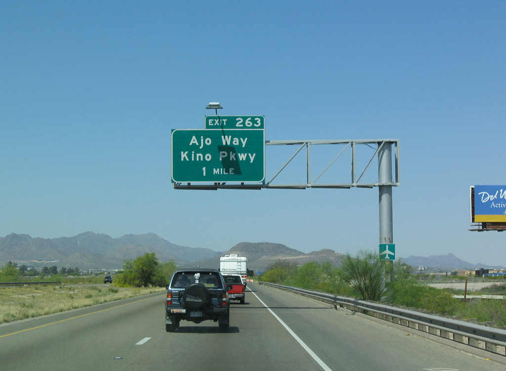
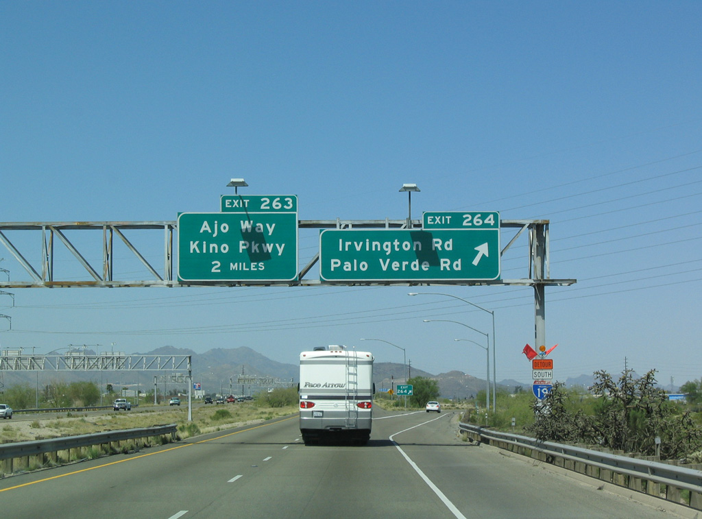
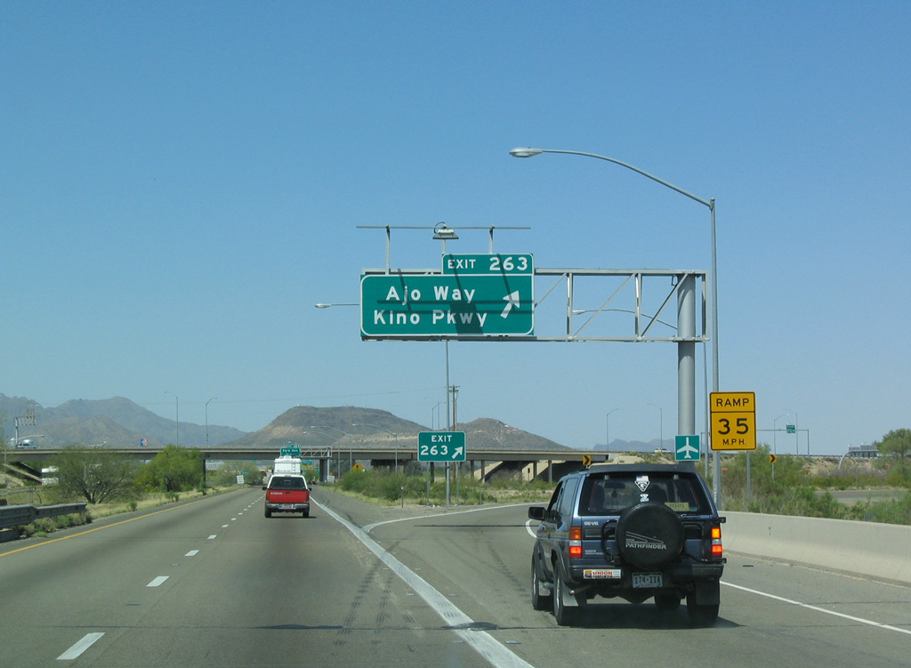
Interstate 10 becomes increasingly more urban northwest ahead of the cloverleaf interchange (Exit 263) at the junction of Ajo Way and Kino Parkway.
03/28/04
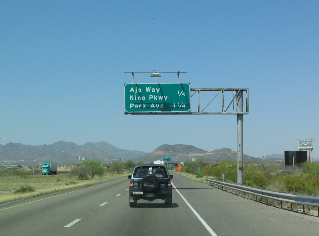
Exit 263 links I-10 west with Ajo Way directly across from the Kino Ajo Connection Ramp to Kino Parkway. Ajo Way runs east to Alvernon Way and west to Interstate 19, where it becomes SR 86.
03/28/04
Kino Parkway is the original planned alignment of Interstate 710 north to SR 210 (Aviation Parkway). Kino Parkway was instead built as a controlled access arterial parallel to Campbell Avenue.
03/28/04
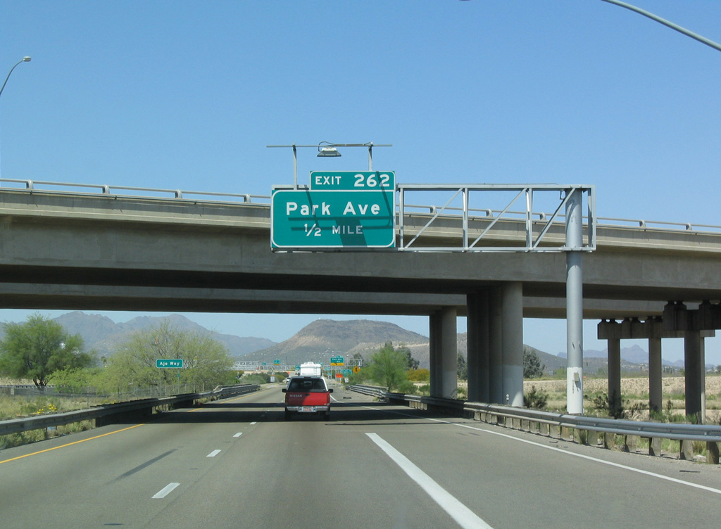
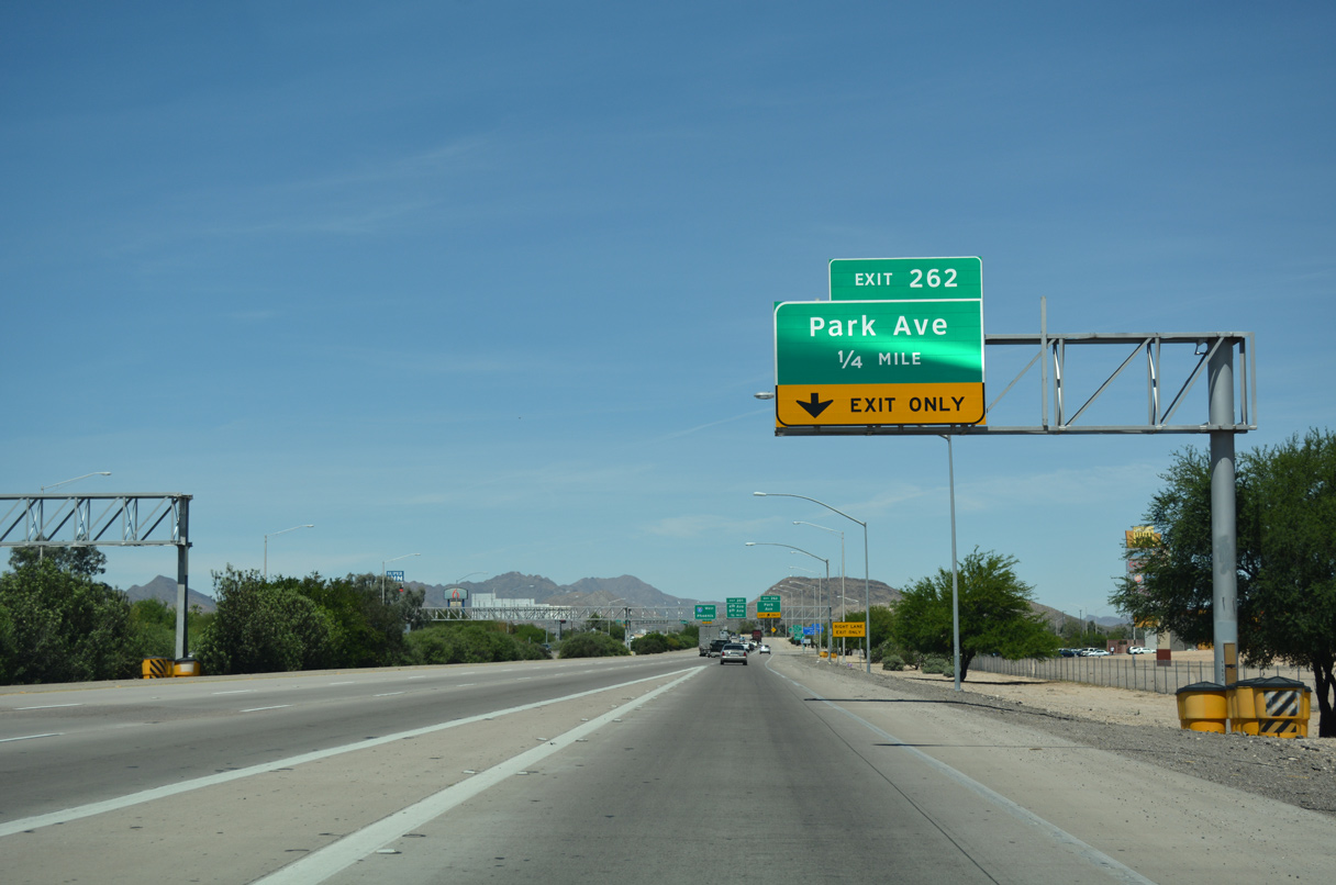
A parclo interchange at Exit 262 joins I-10 west with Park Avenue next by the Tucson Marketplace retail complex.
03/28/04
Park Avenue runs south to Emery Park and north to Euclid Avenue below SR 210 (Barraza Aviation Highway).
04/26/17
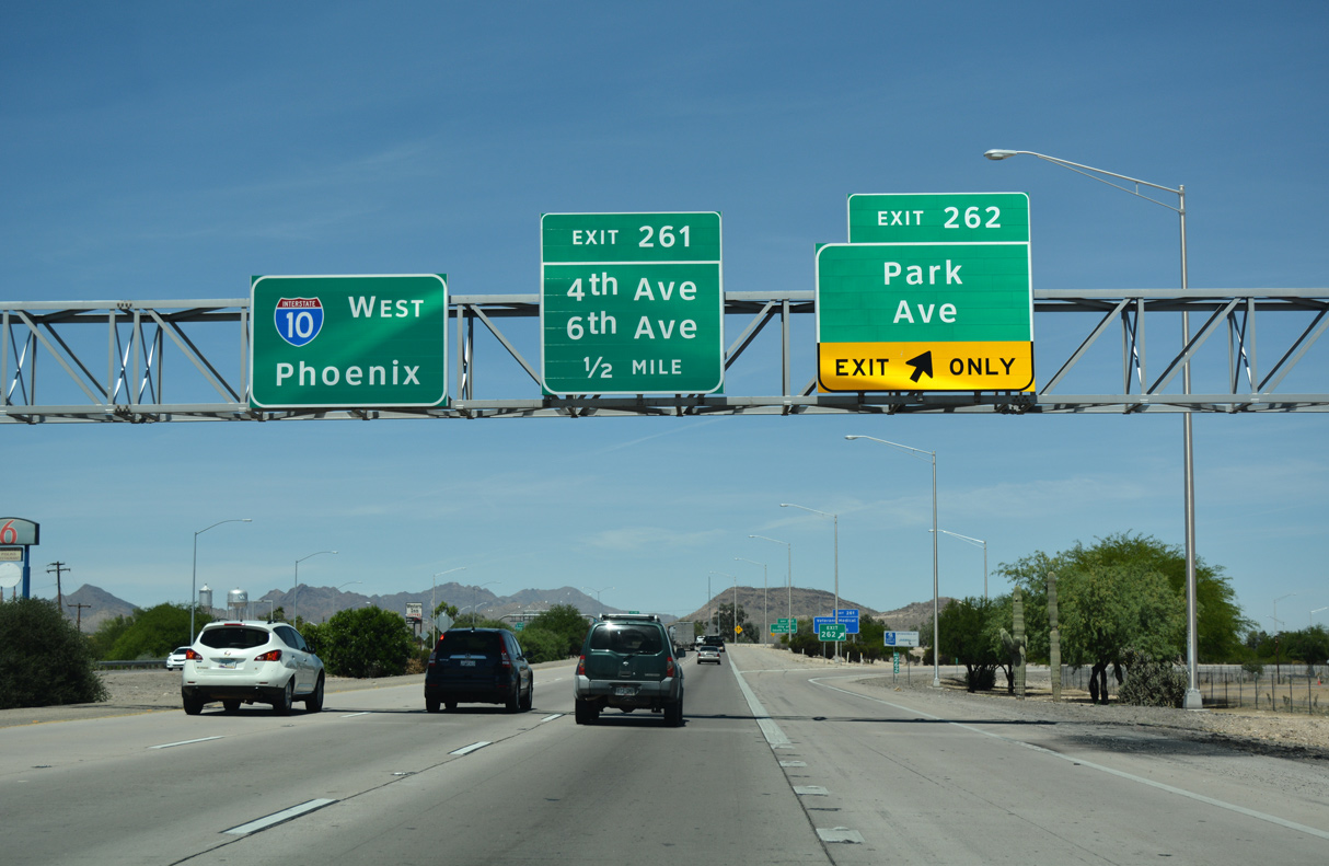
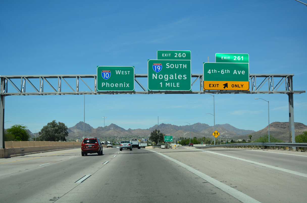
A split diamond interchange follows Park Avenue at Exit 261 for Benson Highway (old Business Loop I-10), 4th Avenue and 6th Avenue (former Business Loop I-19).
04/26/17

6th Avenue was historically part of U.S. 89 south from Stone Avenue through South Tucson and Nogales Highway at Rudy Garcia Park. Business Loop I-19 was established south from I-10 when U.S. 89 was decommissioned in 1991.
04/26/17
4th and 6th Avenues both pass through the city of South Tucson north en route to Downtown Tucson. Business Loop I-19, which paralleled Interstate 19 south through Summit and Sahuarita, was dropped after 2004.
04/26/17
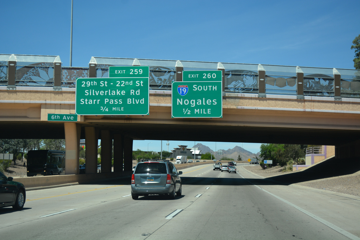
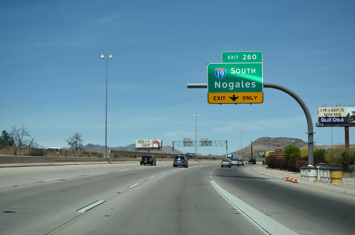
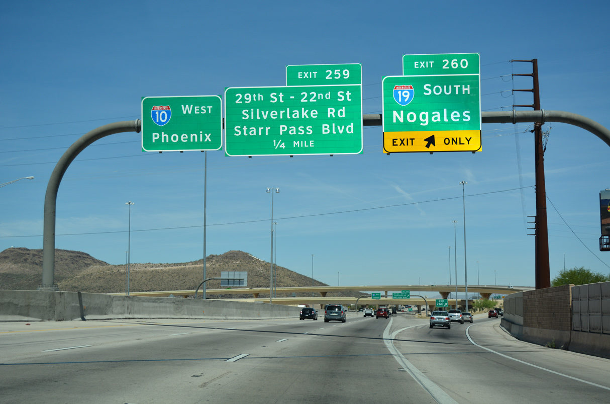
Interstate 19 commences south from The Crossing, a three level interchange (Exit 260) along the Tuscon and South Tucson city line.
04/26/17
Interstate 19 travels just 63.70 miles south to Green Valley, Rio Rico and Nogales.
04/26/17
The south end of Interstate 19 connects with Business Loop I-19 at West Street near Downtown Nogales where the International border crossing into Nogales, Mexico is located.
04/26/17
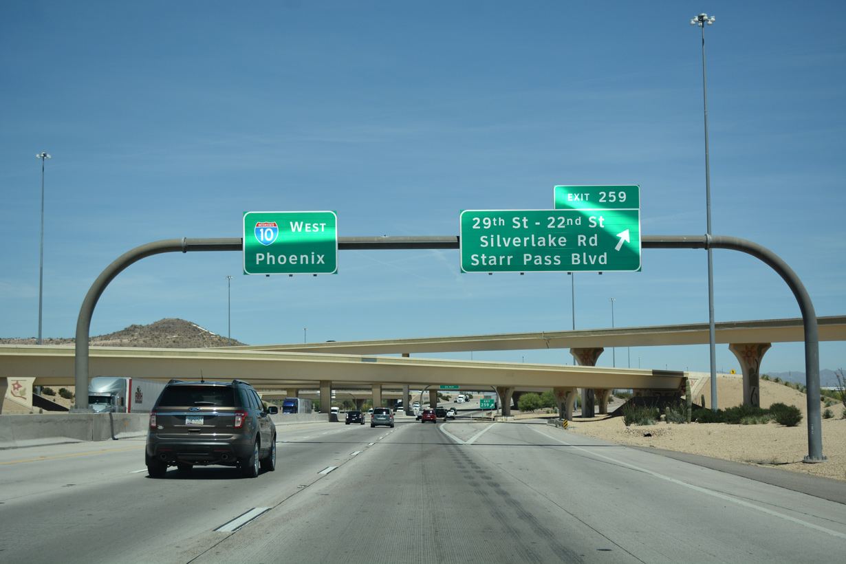
Exit 259 for 29th and 22nd Streets east to South Tucson departs from within the exchange at the north end of Interstate 19. Silverlake Road extends west fro 29th Street to Mission Road. 22nd Street west becomes Starr Pass Road to Sentinel Peak Park.
04/26/17
Costing $54.3 million, The Crossing project rebuilt the compact trumpet interchange at I-10/19 into a high speed, systems exchange. Work was completed on August 7, 2004.
04/26/17
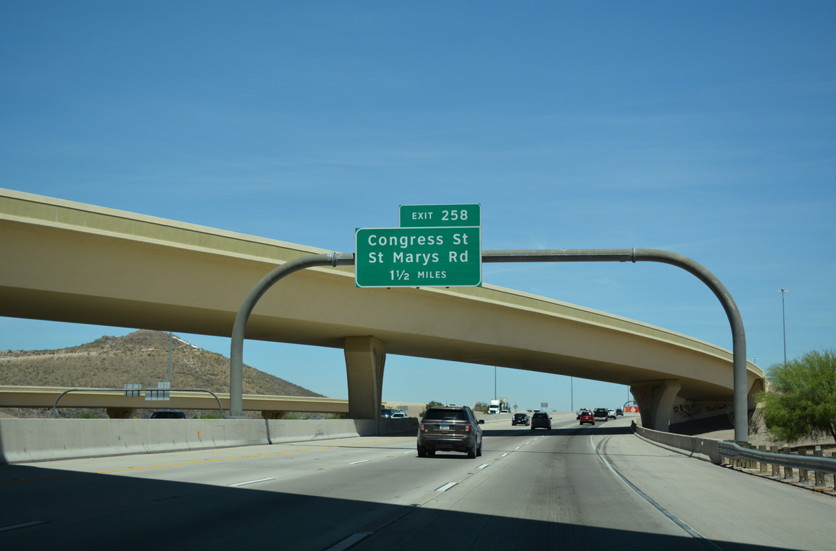
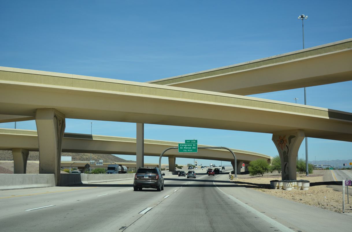
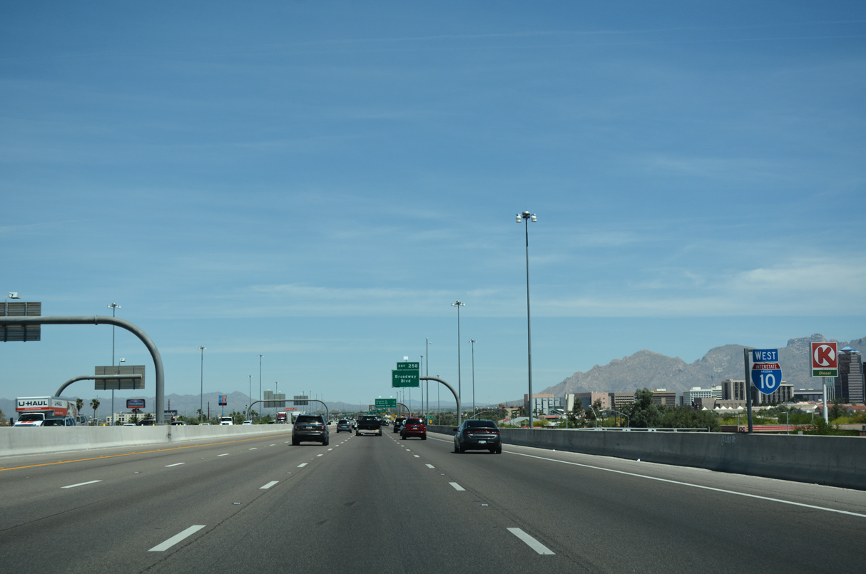
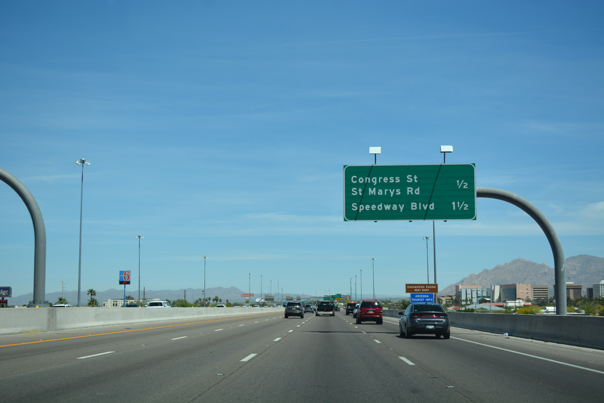
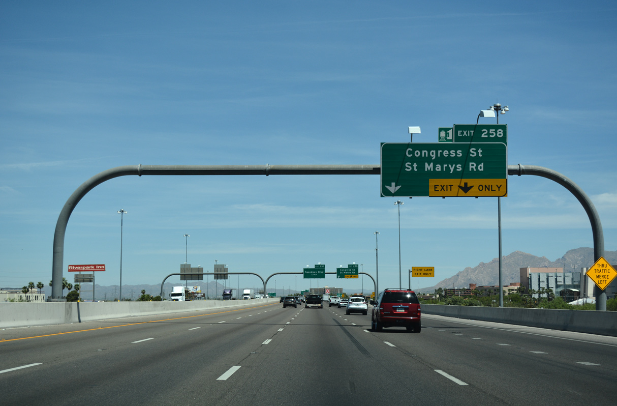
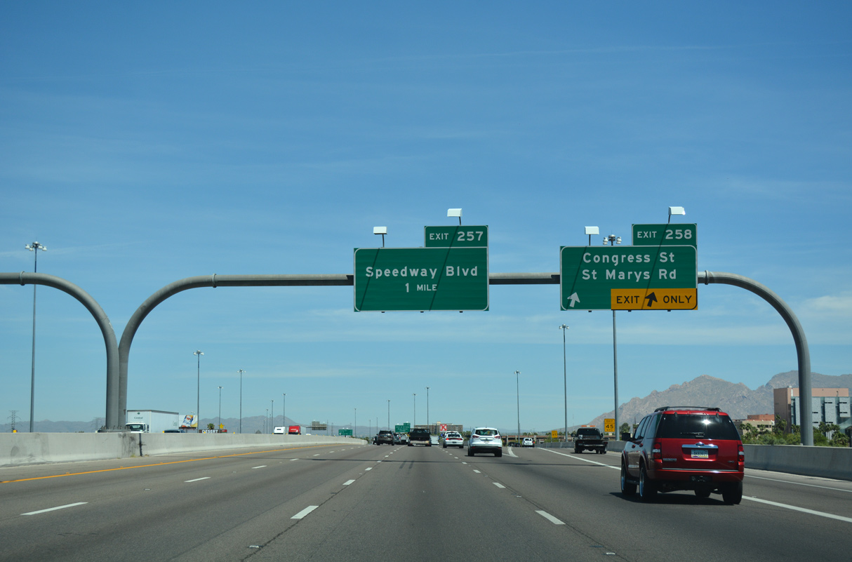
Advancing north from I-19, Interstate 10 continues 1.5 miles to Exit 258 for St. Marys Road and Congress Street to Downtown Tucson.
04/26/17
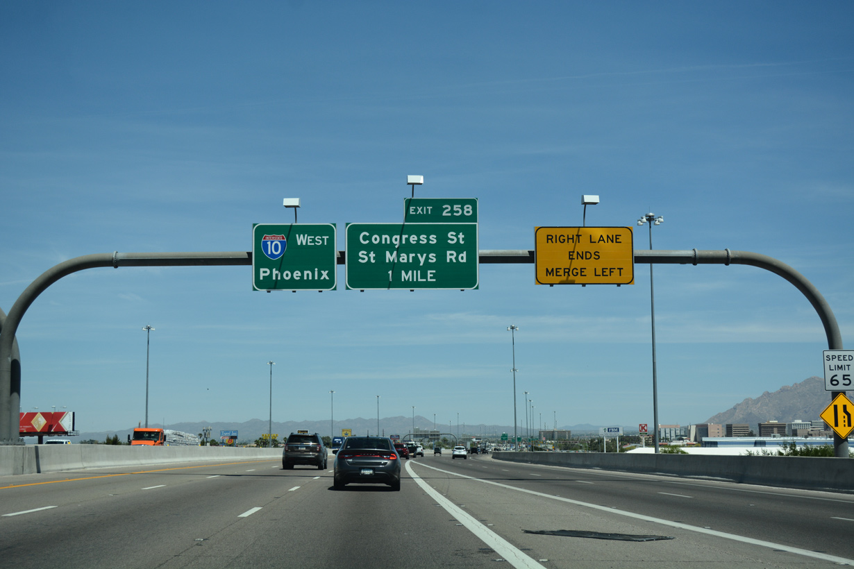
Exit 258 ties into the east side frontage road ahead of Congress Street, west of the Tucson Convention Center, which features Tucson Music Hall, the Fremont House, Little Theater and Tucson Arena/Exhibition Hall.
04/26/17
04/26/17
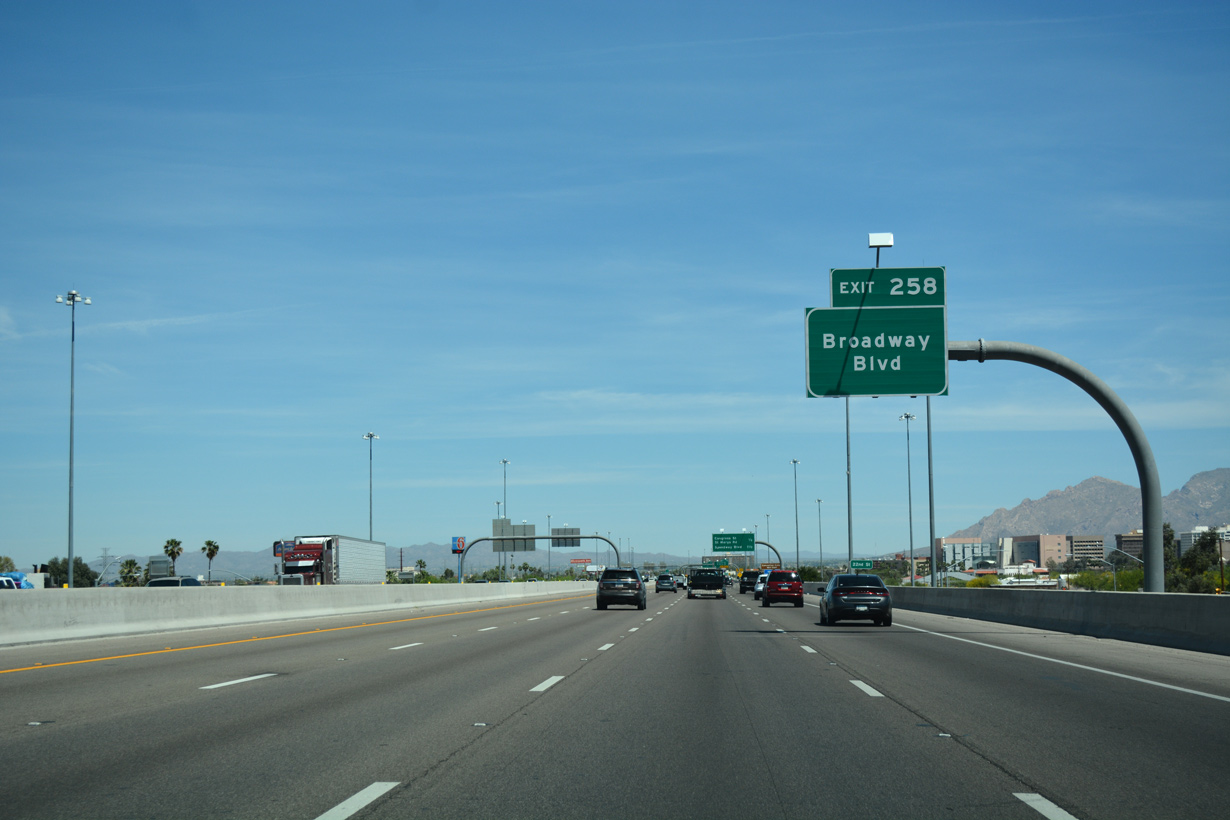
Congress Street east forms a couplet with Broadway Boulevard through Downtown Tucson. Points of interest for Exit 258 include the Federal Court House, the Old Southern Pacific Railway Depot, Arizona state governmental buildings, the Pima County Courthouse and Tucson City Hall.
04/26/17
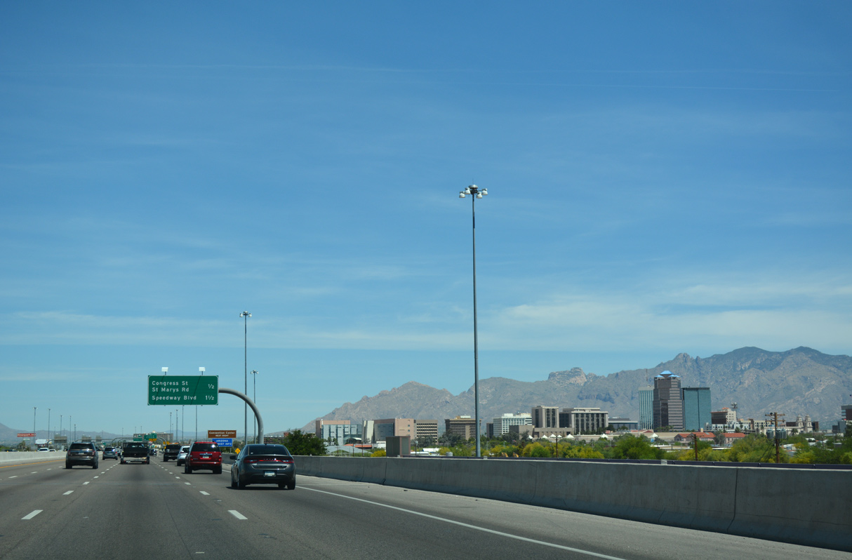
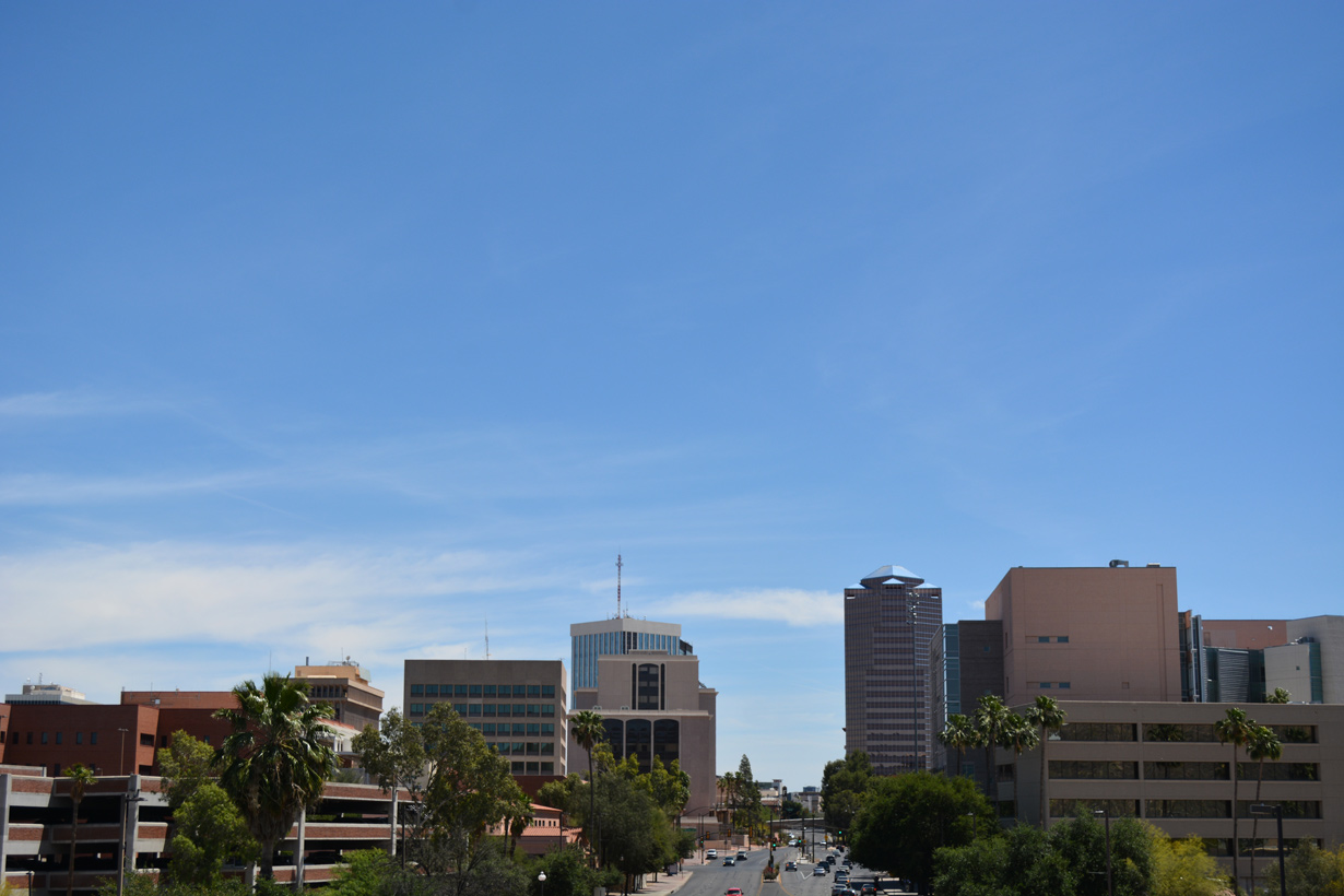
The Downtown Tucson skyline and the distant Front Range (Pusch Peak, Mount Kimball, and Rattlesnake Peak).
04/26/17
04/26/17
St. Marys Road extends west from 6th Street and the El Presidio Historic District north of Downtown Tucson to residential areas north of Tumamoc Hill.
04/26/17
04/26/17
04/26/17
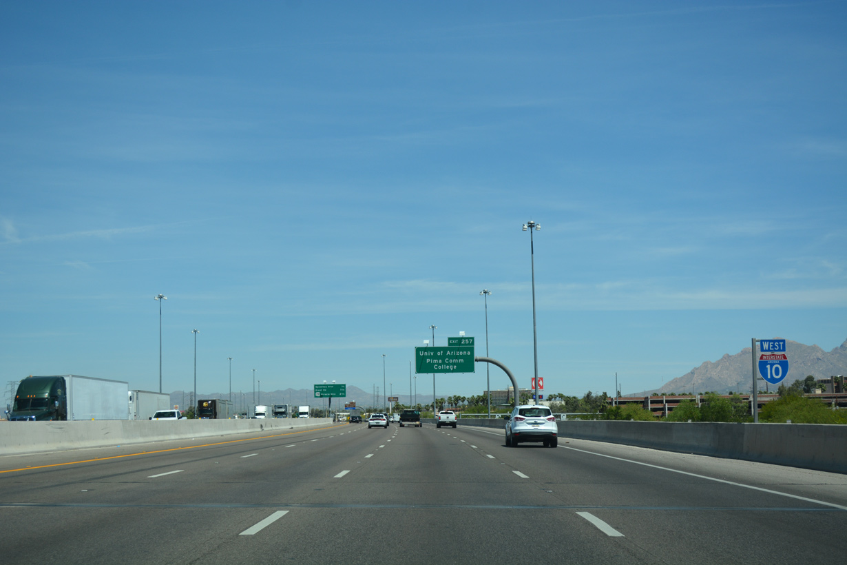
The University of Arizona is one of several four year universities located within the Grand Canyon State. The two largest, the University of Arizona and Arizona State University in Tempe, are frequent rivals, both for alumni and for the college sports teams, both of which compete in the Pacific-12 Conference.
04/26/17
04/26/17
04/26/17

04/26/17
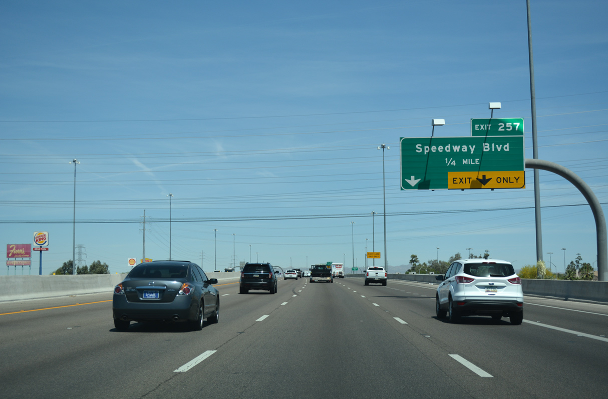
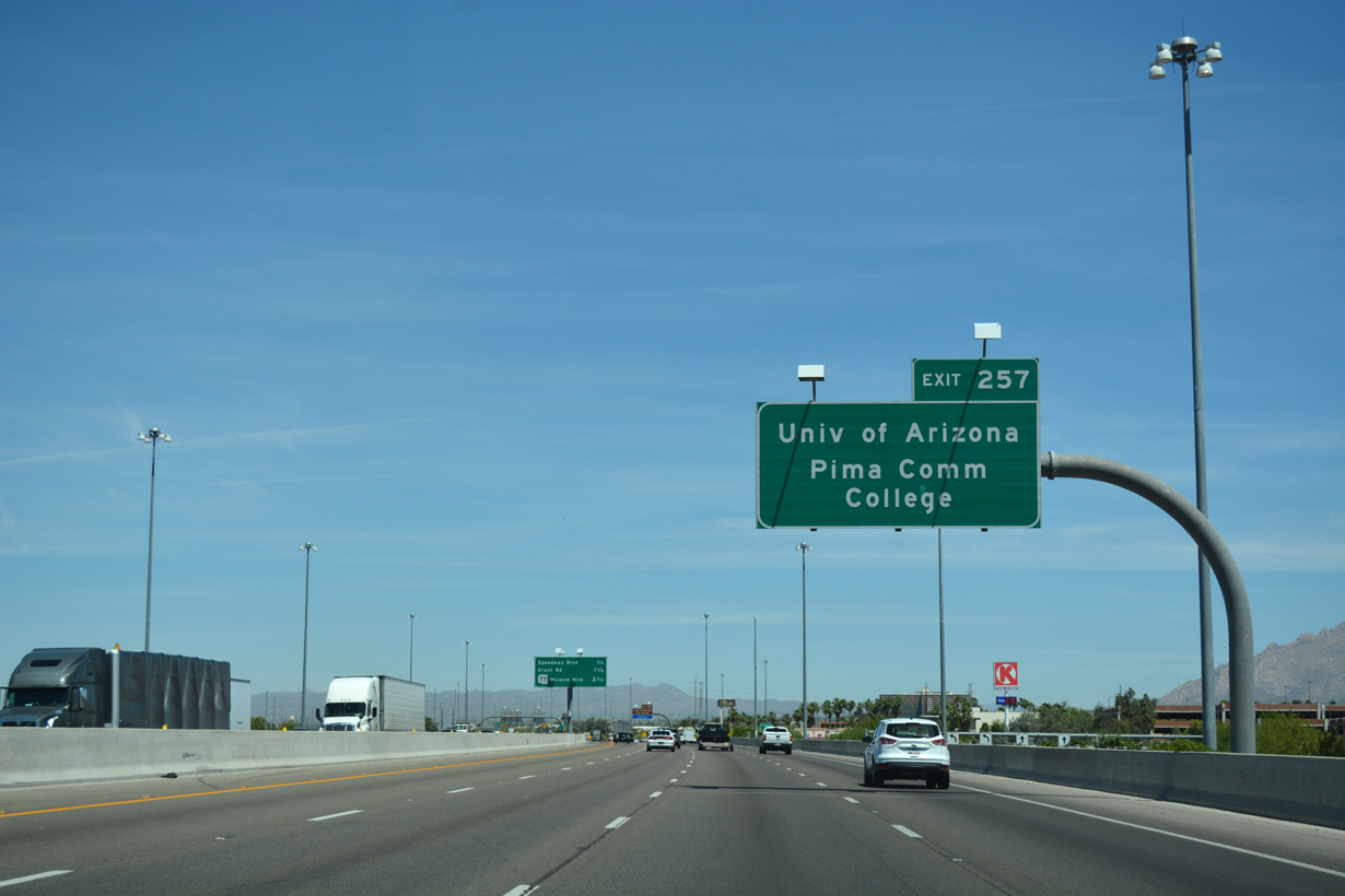
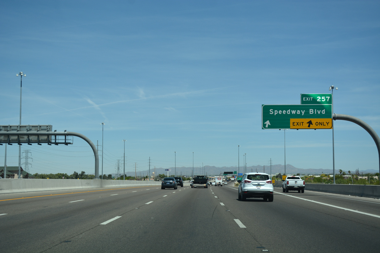
The University of Arizona campus lies east of Interstate 10 along Speedway Boulevard between Park Avenue and Campbell Avenue.
04/26/17
04/26/17
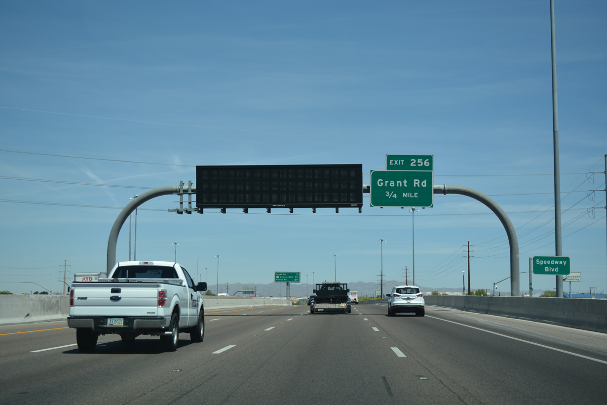
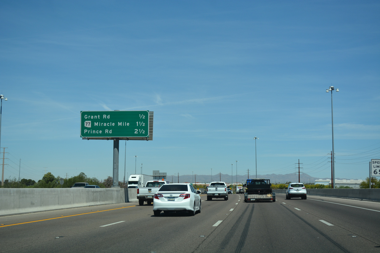
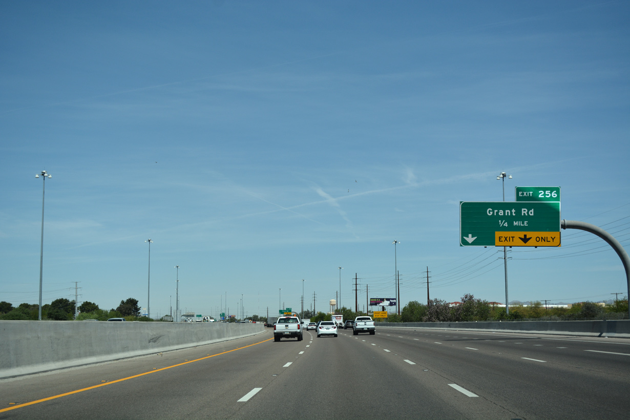
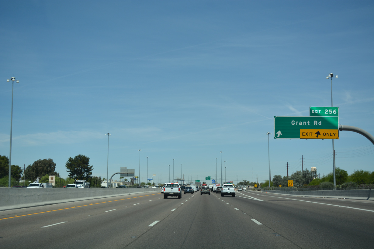
A diamond interchange joins I-10 at Exit 256 with Grant Road east to Tucson Botanical Gardens and Tucson Medical Center and west to Ironwood Hill Drive.
04/26/17
04/26/17
04/26/17
04/26/17
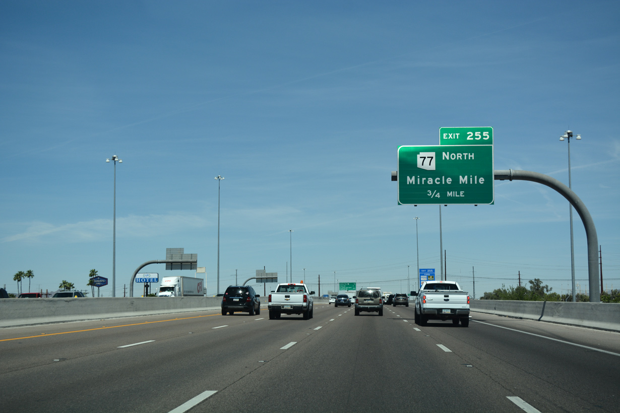
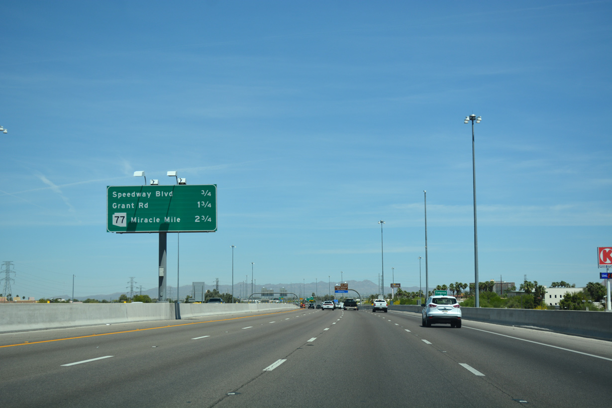
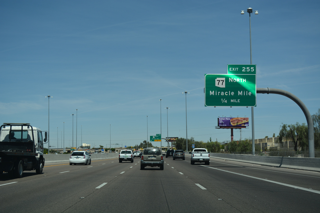
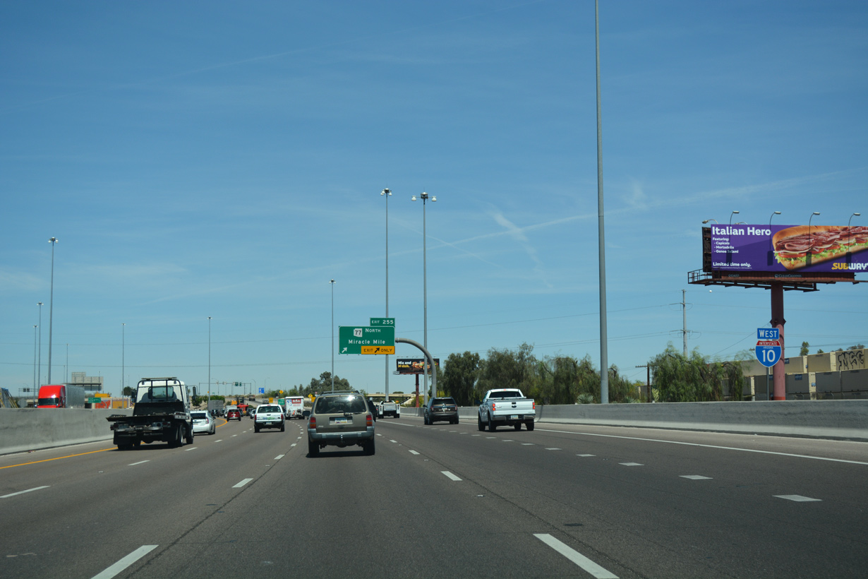
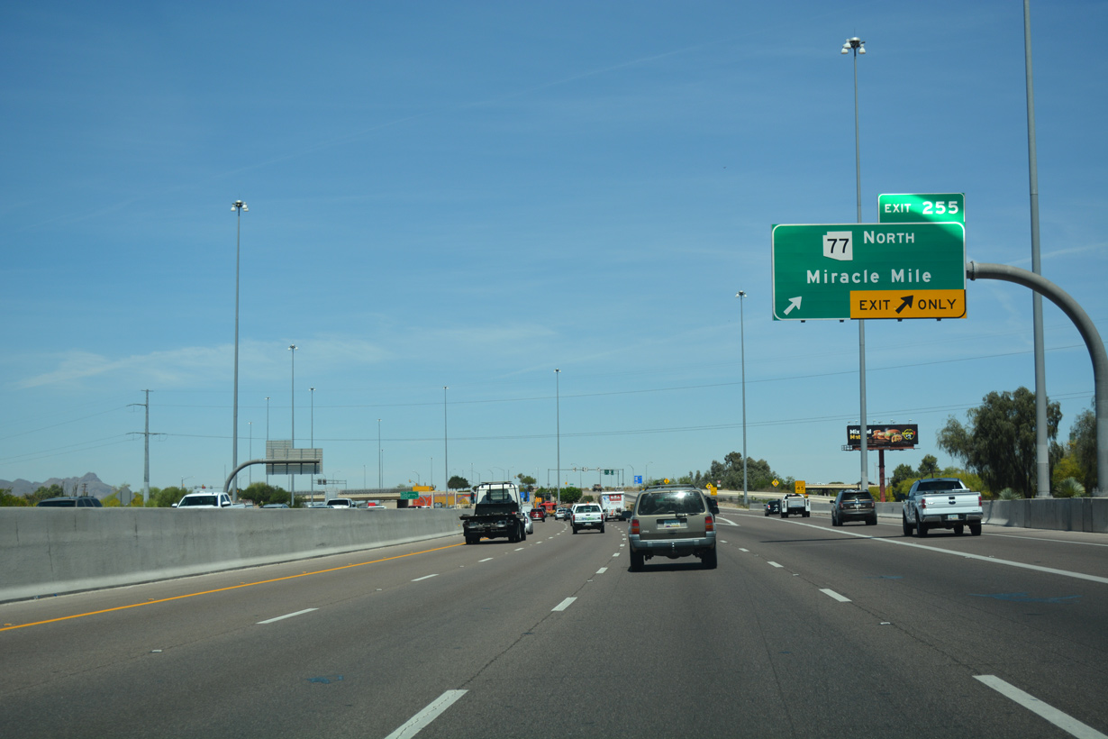
Forthcoming Exit 255 at Miracle Mile represents the south end of SR 77. SR 77 follows old U.S. 80/89 (Oracle Road) north to Casas Adobes, Oro Valley, Catalina and SR 79 at Oracle Junction.
04/26/17
Miracle Mile was previously part of Business Loop I-10, which was decommissioned in 1998. The route ran north from Exit 261 along 6th Avenue, Stone Avenue, Drachman Street and Oracle Road to SR 77.
04/26/17
SR 77 travels northeast from Tucson to Oracle, Mammoth and Globe. Combining with U.S. 60, SR 77 continues northeast to Show Low before branching north to Snowflake and Holbrook.
04/26/17
04/26/17
State Route 77 measures 238.79 miles overall from Exit 255 to the boundary of Navajo Nation north of Interstate 40 and Holbrook.
04/26/17
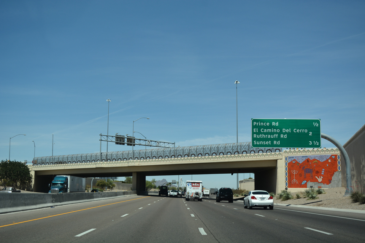
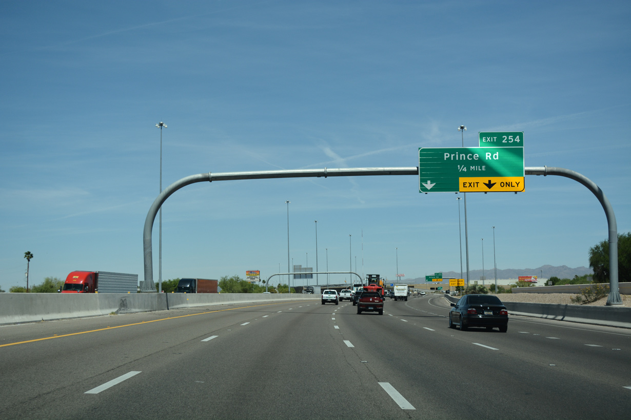
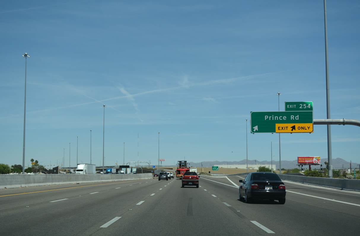
A decorative overpass carries Miracle Mile across Interstate 10 a half mile south of Exit 254 for Prince Road.
04/26/17
Prince Road forms part of the grid pattern of streets south of the Rillito River and north of Downtown Tucson.
04/26/17
Prince Road stems east from Business Center Drive just west of I-10 at Stockham, to Country Club Road near the Rillito River.
04/26/17
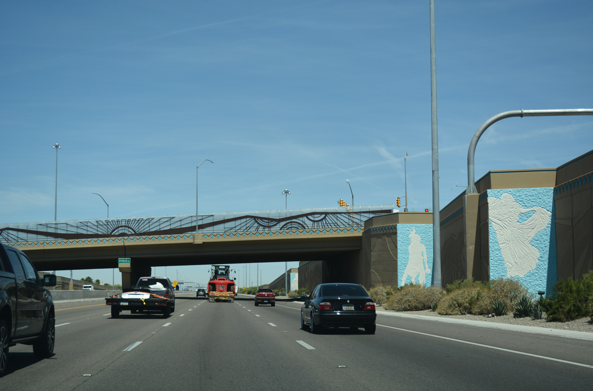
A series of mosaics appear along retaining walls within the diamond interchange (Exit 254) at Prince Road.
04/26/17
04/26/17
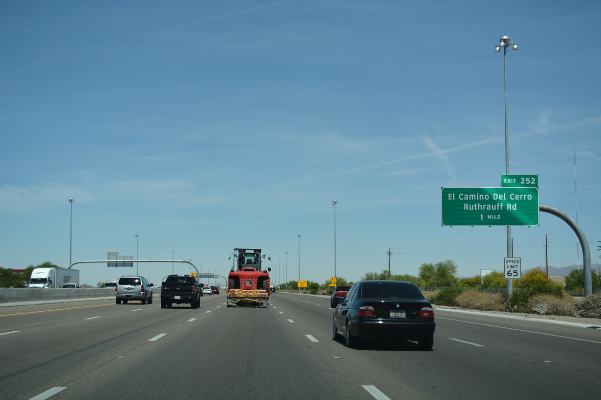
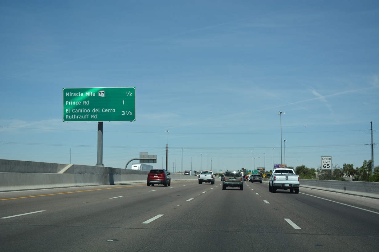
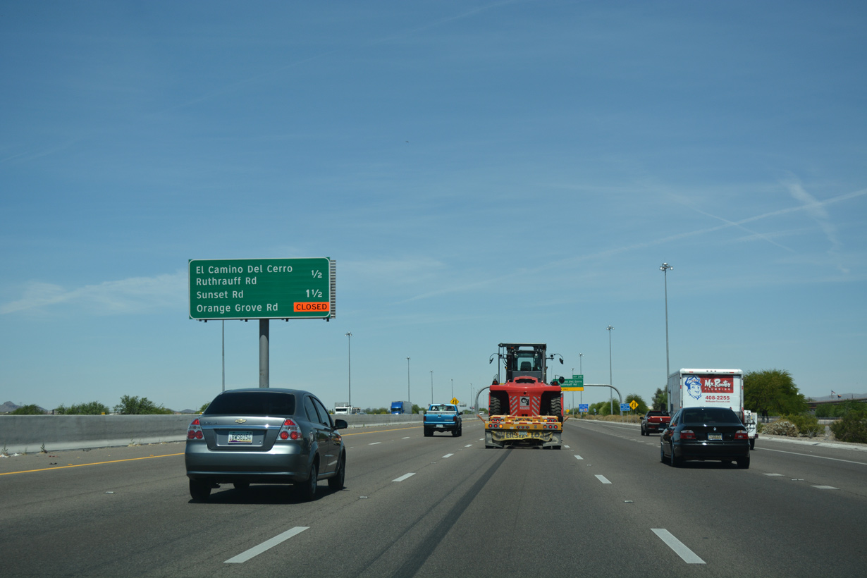
The succeeding exit from westbound I-10 is for Camino del Cerro west and Ruthrauff Road east.
04/26/17
04/26/17
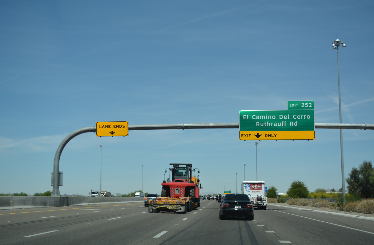
El Camino del Cerro heads west over the Santa Cruz River to the Rancho Del Cerro development.
04/26/17
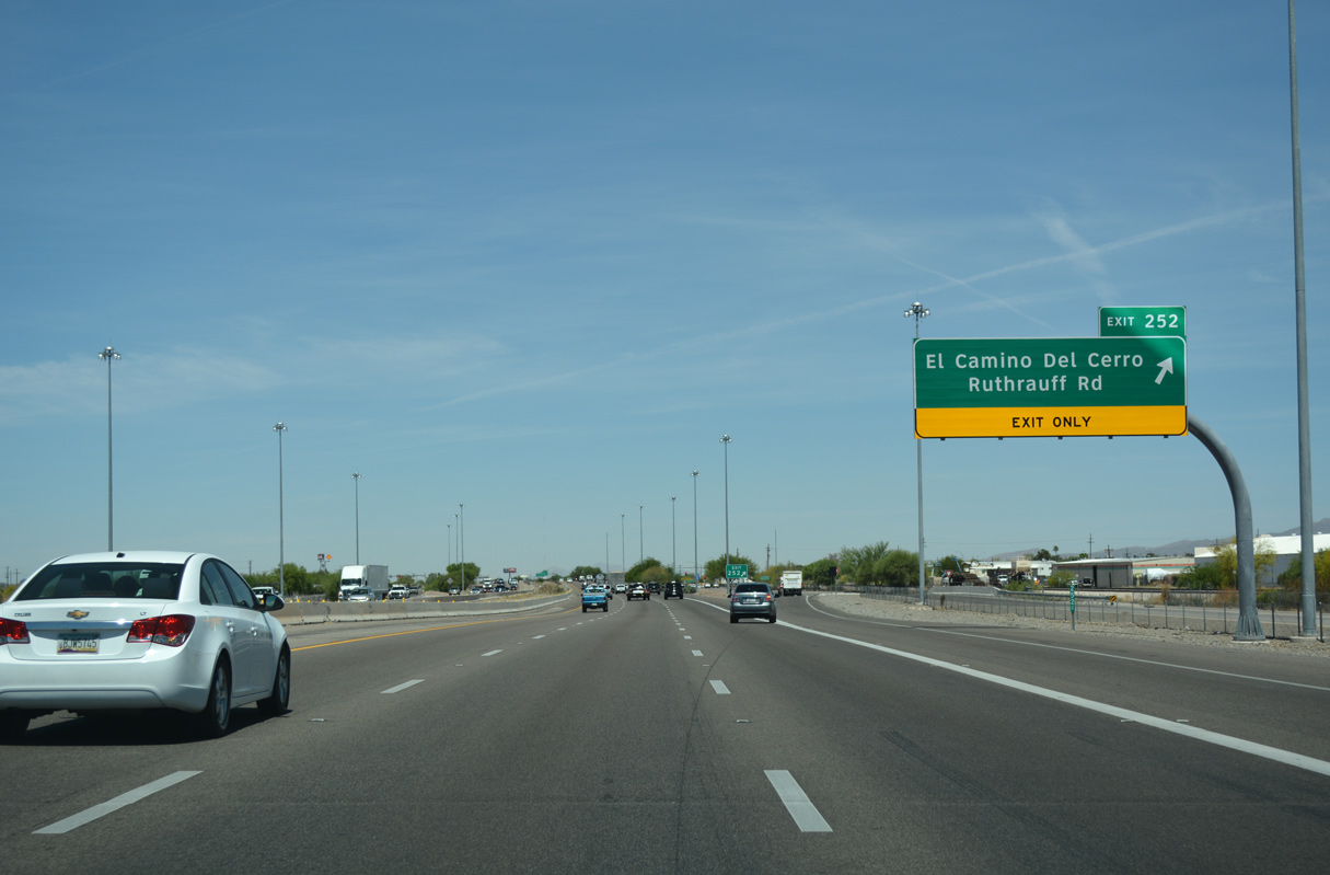
Ruthrauff Road heads east through the Tucson suburb of Flowing Wells to become Wetmore Road ahead of Tucson Mall.
04/26/17

04/26/17
04/26/17
04/26/17
04/26/17
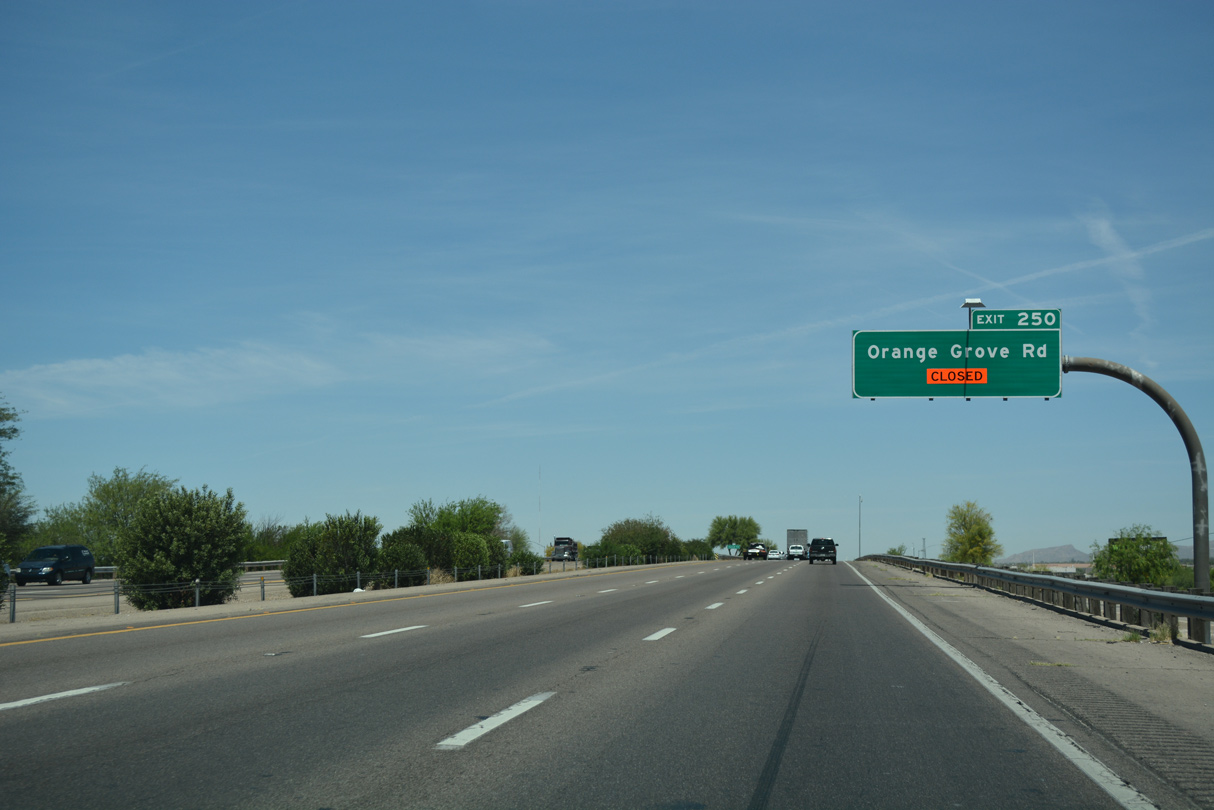
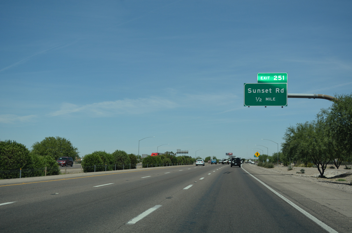
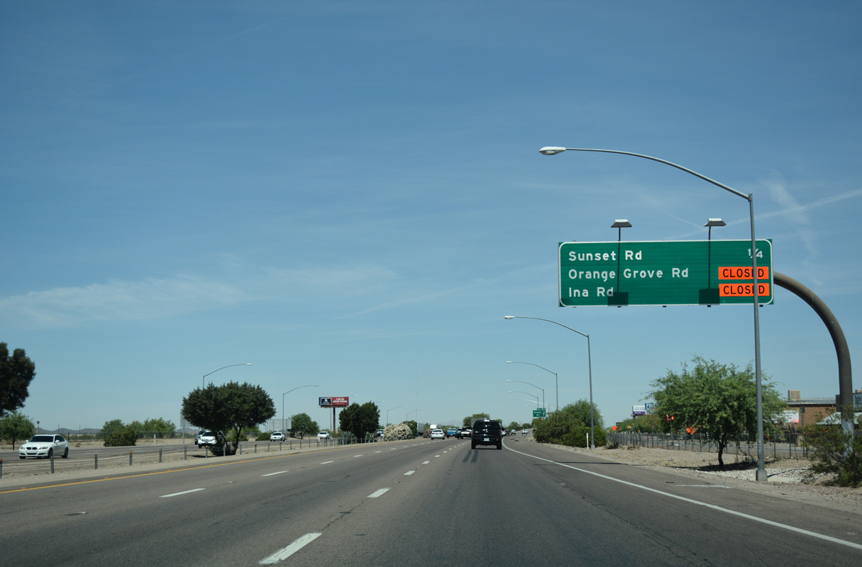
Orange Grove Road stems east from Exit 250 to Northwest Medical Center and the community of Casas Adobes.
04/26/17
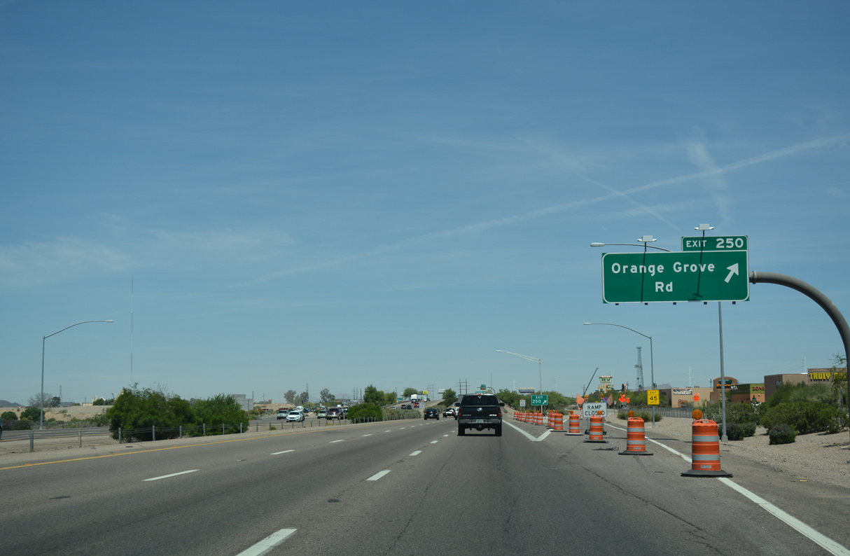
Crossing the Rillito River, Interstate 10 west enters the city of Marana at the diamond interchange (Exit 250) with Orange Grove Road.
04/26/17

Photo Credits:
- 03/28/04 by AARoads.
- 08/19/07 by Kevin Trinkle.
- 04/26/17 by AARoads.
Connect with:
Interstate 19
Former Business Loop I-10 - Benson Highway
State Route 77
Page Updated 04-13-2022.