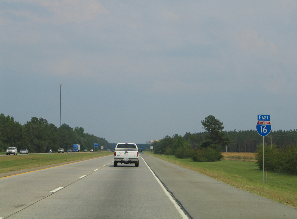
|
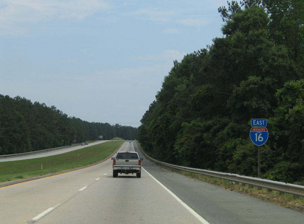
| Ramps from Interstate 75 to I-16 east come together at the Ocmulgee River. The 255 mile long waterway flows southward from Jackson Lake to combine with the Oconee River to form the Altamaha River near Uvalda. 05/25/21 |
|
| Phase 1 of the I-16/75 Interchange Improvement project through Summer 2021 constructs a c/d roadway along I-16 east to Exit 1A for U.S. 23/129 (Spring Street). Scheduled for bidding in 2021, Phase 4 will reconstruct the eastbound mainline. 05/25/21 |
|
| The first confirming marker for I-16 east stands beyond the Ocmulgee River. Phase 4 construction expands I-16 eastbound to four lanes plus a two lane distributor roadway to Exit 1B. 05/25/21 |
|
| U.S. 23/129 and SR 11-49-87 (Spring Street) combine across the Ocmulgee River from outside Downtown Macon to North Avenue and Emery Highway at Exit 1A. U.S. 129/SR 49 combine through Bibb County with U.S. 41 and split for Gray and Milledgeville northeast of Macon. 05/25/21 |
|
| U.S. 23 turns east nearby onto Emery Highway, combining with U.S. 80 and U.S. 129 Alternate to Lakeside before dropping south to Bullard. SR 49 follows Shurling Drive, a five lane arterial to the Jones County suburbs while U.S. 129/SR 11-22 head north 13 miles to Gray. 05/28/05 |
|
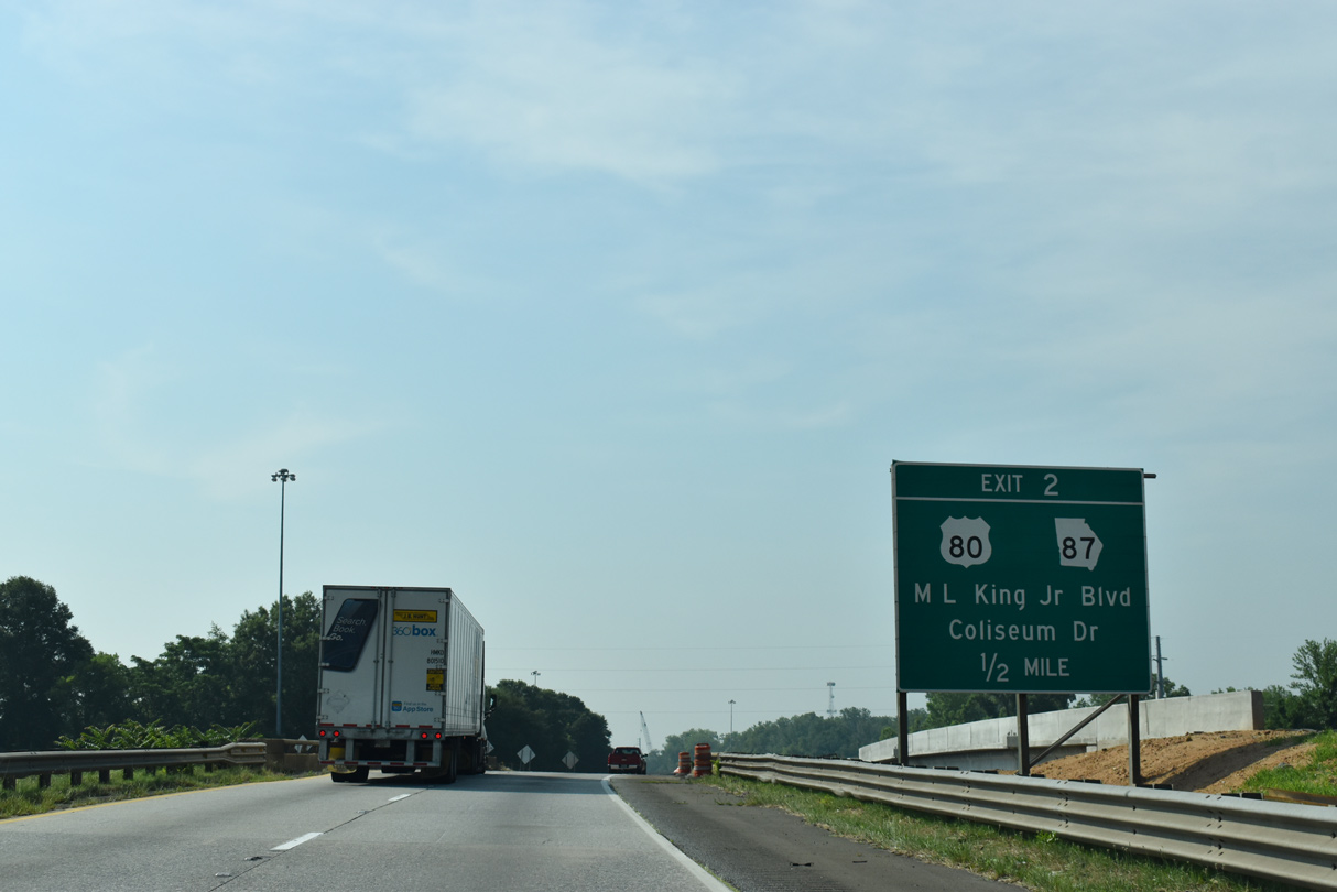
| A diamond interchange (Exit 2) joins Interstate 16 with U.S. 80/SR 87 (Coliseum Drive north / Martin Luther King, Jr. Boulevard south). 05/25/21 |
|
| Exit 2 for U.S. 80 west leads into Downtown for the Georgia Music Hall of Fame, Georgia Sports Hall of Fame and the Tubman Museum. U.S. 80 east heads to the Macon Coliseum, Ocmulgee National Park and Griswoldville Battlefield. 05/29/05 |
|
| U.S. 80/SR 87 west span the Ocmulgee River and combine with U.S. 129 through Downtown Macon along MLK Boulevard. Eastward U.S. 80/SR 87 join U.S. 23/129 ALT (Emery Highway) for two miles en route to Jeffersonville. U.S. 80 never directly meets I-16 again between Macon and Savannah. 05/29/05 |
|
| Interstate 16 transitions into a rural freeway southeast through Ocmulgee National Park. 05/25/21 |
|
| Dublin, 49 miles away, is the largest city along Interstate 16 between Macon and Savannah. Forthcoming U.S. 129 ALT is incorrectly referenced as U.S. 29 ALT here. 05/25/21 |
|
| Approaching Boggy Branch and the Georgia Central railroad under crossing along Interstate 16 east. 05/29/05 |
|
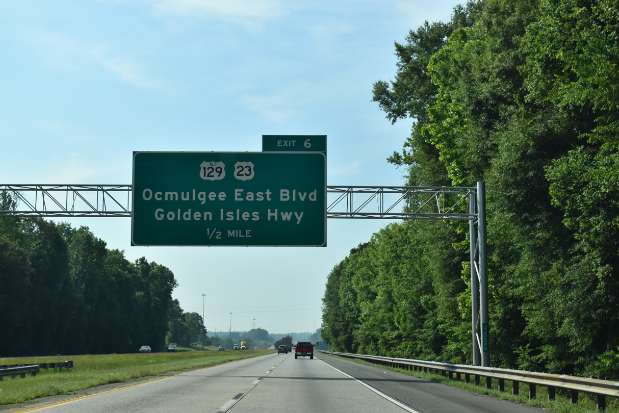
| U.S. 23-U.S. 129 ALT/SR 87 branch south from U.S. 80/SR 19-540 along Ocmulgee East Boulevard to a diamond interchange (Exit 6) with Interstate 16. 05/25/21 |
|
| Ocmulgee East Boulevard expands to as many as six lanes from Interstate 16 north to the 107 acre corporate campus for Geico and Macon Downtown (Herbert Smart) Airport (MAC). 05/25/21 |
|
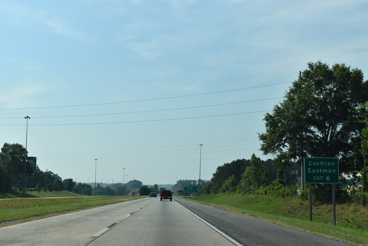
| U.S. 23 south leaves the I-75 corridor at Macon for Cochran and ultimately Jacksonville, Florida. SR 87 overlaps with U.S. 23 south to Eastman. 05/25/21 |
|
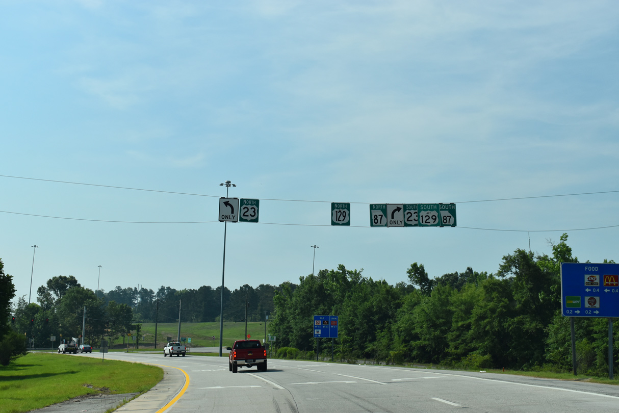
| Heading south from Exit 6, U.S. 23/129 ALT travel 33 miles to Cochran, where they separate for Eastman and Hawkinsville respectively. U.S. 23 extends Golden Isles Highway southeast. 05/25/21 |
|
| U.S. 23/129 ALT (Ocmulgee East Boulevard) run 0.75 miles north to SR 87CO at Riggins Mill Road. SR 87CO connects with U.S. 80/SR 19 and SR 540 (Fall Line Freeway) east to Gordon. 05/25/21 |
|
| Continuing more southerly, Interstate 16 traverses a hilly stretch, rising to 450 feet above sea level. 05/29/05 |
|
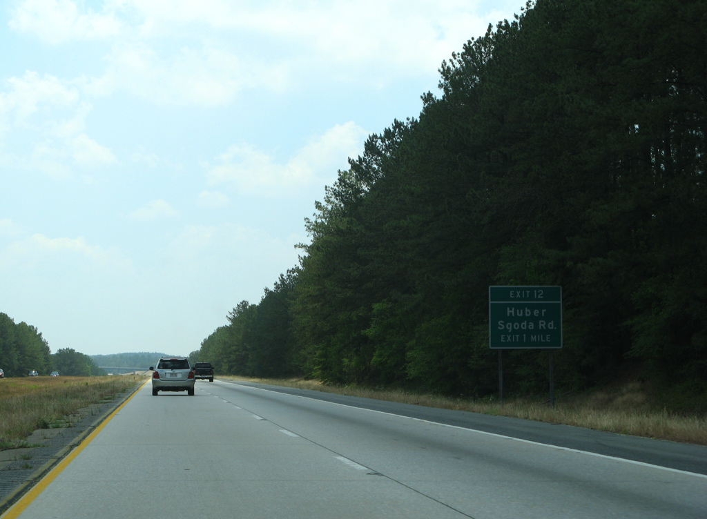
| Sgoda is the next exit in five miles while Savannah is reached in 159 miles. 05/29/05 |
|
| Interstate 16 takes a long straight away from the Twiggs County line southeast to Exit 12. 05/29/05 |
|
| Sgoda Road meets Interstate 16 at a rural diamond interchange (Exit 12) in one mile. Sgoda Road leads southwest to parallel U.S. 23/129 Alternate and the railroad siding of Huber. 05/29/07 |
|
| North of Exit 12 and Sgoda, Sgoda Road connects with Riggins Mill Road near U.S. 80/SR 19 (Jeffersonville Road). 05/29/05 |
|
| Huber Clay County Road passes over Interstate 16 beyond this reassurance marker. 12/20/08 |
|
| Savannah is 153 miles to the east. 05/29/05 |
|
| Advancing southeast ahead of Flat Creek along Interstate 16, 20,430 vehicles per day (vpd) recorded along this stretch by GDOT in 2012. 12/20/08 |
|
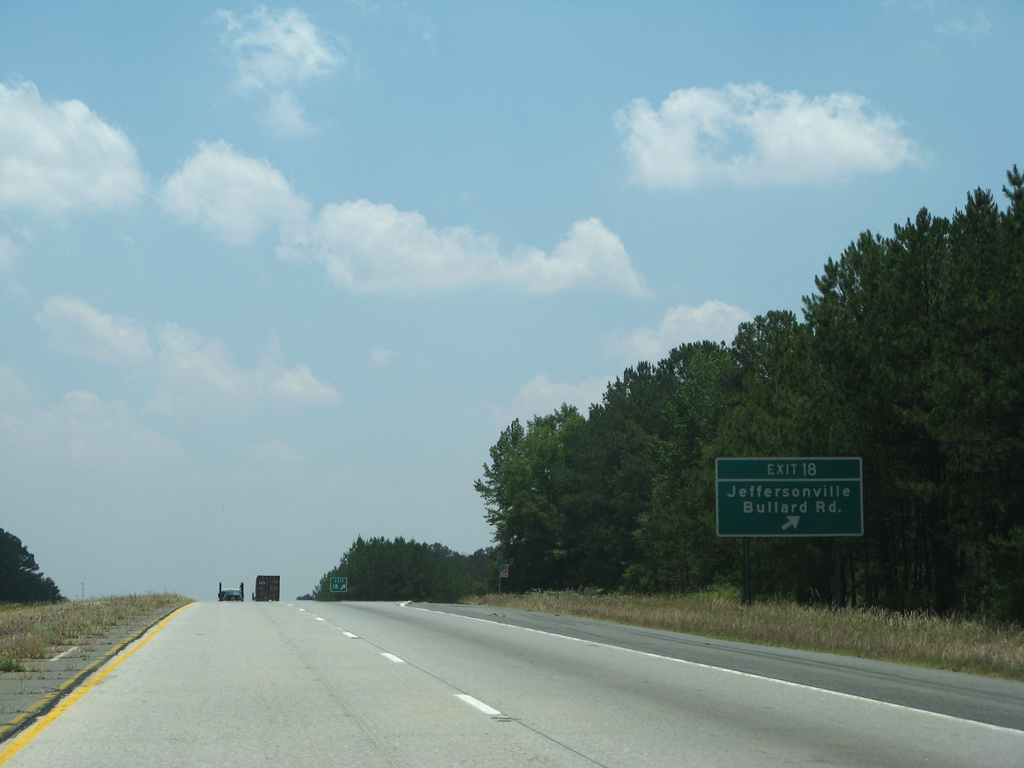
| Bullard Road stems east from U.S. 23/129 Alternate at Bullard to a diamond interchange (Exit 18) with Interstate 16. 05/29/05 |
|
| Beyond Exit 18, Bullard Road continues to Marion and U.S. 80 at the Twiggs County seat of Jeffersonville. 05/29/07 |
|
| Roadways of Interstate 16 separate as the freeway crosses both Savage and Turvin Creeks. 12/20/08 |
|
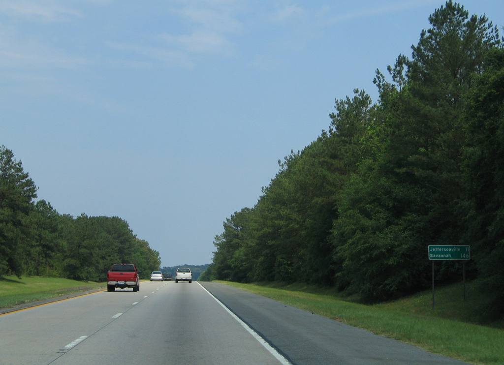
| East from Exit 18, Jeffersonville is 11 miles away via I-16 and SR 96 north. Savannah is 140 miles from the exchange with SR 96. 05/29/05 |
|
| SR 96 constitutes a 95 mile long highway from Geneva to U.S. 441 south of Irwinton. A diamond interchange (Exit 24) links SR 96 with I-16 in one mile. 05/29/05 |
|
| Exit 24 leaves Interstate 16 east for SR 96 north to Jeffersonville and southwest to Tarversville. 12/20/08 |
|
| The town of Danville is the next destination of Interstate 16 east in seven miles. Savannah is two hours away. 12/20/08 |
|
| SR 358 (Homer Chance Highway) branches 3.6 miles east from SR 96 to cross paths with Interstate 16 at a diamond interchange (Exit 27). 12/20/08 |
|
| East of Exit 27, SR 358 concludes in 2.8 miles at U.S. 80/SR 19 outside Danville. 05/29/07 |
|
| Kinking more eastward ahead of the Cool Spring Road overpass on I-16. 05/29/07 |
|
| SR 112, a 196 mile long route between Cairo and Milledgeville, converges with I-16 at a diamond interchange (Exit 32) in one mile. 05/29/05 |
|
| Interstate 16 nips the northern corner of Bleckley County between Exit 32 and Little Rocky Creek. The southern corner of Wilkinson County is a short drive to the north via SR 112. 05/29/07 |
|
| The town of Allentown lies just north of Interstate 16 along SR 112 (Main Street). Montrose, a town of around 200, is a four mile drive to the east via U.S. 80/SR 19. 05/29/07 |
|
| SR 112 leads 11 miles beyond Allentown to U.S. 441 at Nicklesville and southwest five miles from Exit 32 to Cary. 05/29/05 |
|
| Sinking toward Little Rocky Creek along Interstate 16 near Allentown. 05/29/07 |
|
| Cochran, seat of Bleckley County, is 23 miles out. SR 112 provides a more direct route to the city in lieu of forthcoming SR 26 west. 05/29/05 |
|
| Entering Laurens County along Interstate 16 east. Laurens is the fourth largest county in Georgia with 818.6 square miles. 05/29/05 |
|
| SR 26, a cross state route stretching 271 miles from Cusetta to Tybee Island on the Atlantic Coast, leads 15 miles east from Cochran to meet Interstate 16 at Exit 39. 05/29/07 |
|
| A diamond interchange (Exit 39) joins Interstate 16 with SR 26. SR 26 combines with U.S. 80 nearby, accompanying the remainder of the US highway east to Savannah and Tybee Island. 05/29/07 |
|
| Interstate 16 crosses Hogans Branch near this shield assembly. 05/29/05 |
|
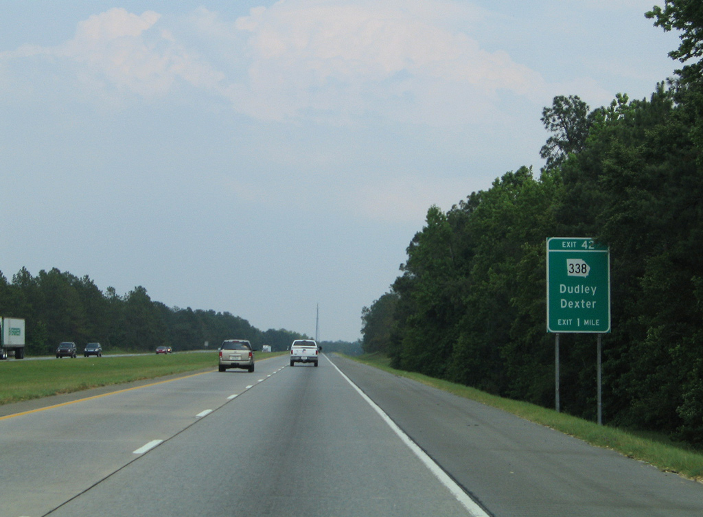
| SR 338 (2nd Street) connects Interstate 16 with the city center of Dudley and town of Dexter, seven miles to the south. 05/29/05 |
|
| Eastbound I-16 at the diamond interchange (Exit 42) with SR 338 in Dudley. SR 338 travels 22 miles overall between SR 17 at Caldwell and U.S. 441/SR 29 northwest of Dublin. 05/29/05 |
|
| A hurricane evacuation crossover follows along Interstate 16 east of Exit 42. 05/29/05 |
|
| The lone rest area along Interstate 16 east precedes milepost 49. 05/29/07 |
|
| I-16 crosses Little Rocky Creek ahead of the eastbound rest area. The westbound rest area lies nearby ahead of Turkey Creek. 05/29/07 |
|
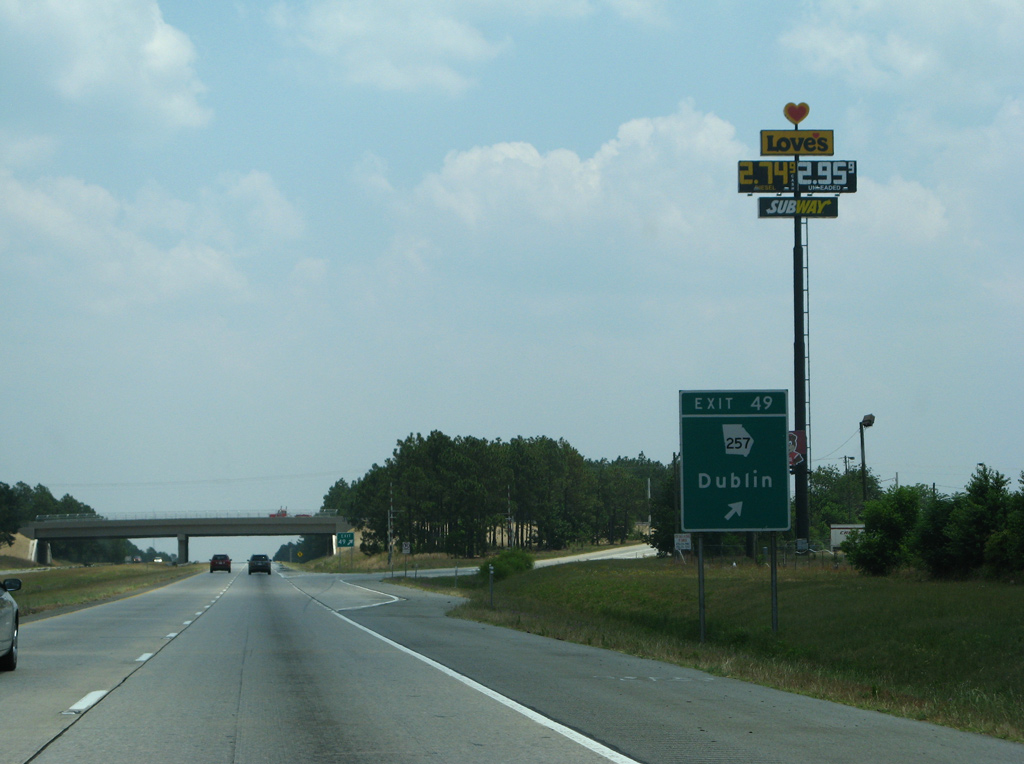
| SR 257 is the first of three exits for the city of Dublin along Interstate 16 east. The city was home to 16,201 per the 2010 census and named after Dublin, Ireland. Dublin is a growing industrial center due to its location midway between Savannah and Macon. 05/29/07 |
|
| Entering the diamond interchange (Exit 49) with SR 257 on Interstate 16 east. SR 257 concludes 4.8 miles to the east at U.S. 319/441 (Telfair Street) in Dublin. Southwest, the 69 mile long highway extends to Dexter and I-75 in Cordele. 05/29/07 |
|
| Interstate 16 stays south of the Dublin city limits for the most part to Exit 54. 05/29/05 |
|
| U.S. 319/441 combine at Dublin southward to the Telfair County seat of McRae. U.S. 319/SR 31 follow Telfair Street north to Downtown Dublin while U.S. 441 partitions into a Bypass and Business route through the city. 05/29/07 |
|
| Originating at Apalachicola, Florida, U.S. 319 leads northeast 304 miles to Tallahassee, South Georgia and U.S. 1 at Wadley. U.S. 441 follows a much longer course from Miami, Florida to Rocky Top, Tennessee, traveling the height of Georgia through Douglas, Dublin, Milledgeville and Athens. 05/29/07 |
|
| An array of traveler services line U.S. 319/441 by Exit 51. The pair split at U.S. 441 Bypass in one mile. With construction starting in summer 2007, the $59.8 million project was completed as part of an overall plan to four lane all of U.S. 441 in Georgia. The nine mile bypass opened to traffic on June 22, 2010. 1 12/20/08 |
|
| 19,860 vehicles per day traveled I-16 between Exits 51 and 54 in 2012. 05/29/05 |
|
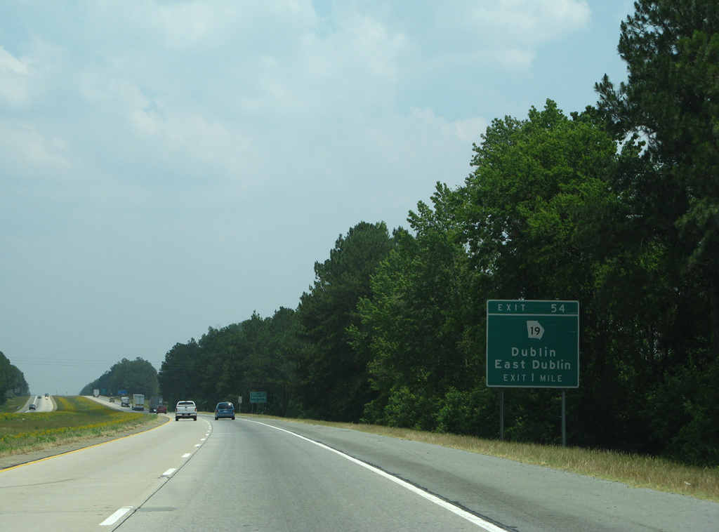
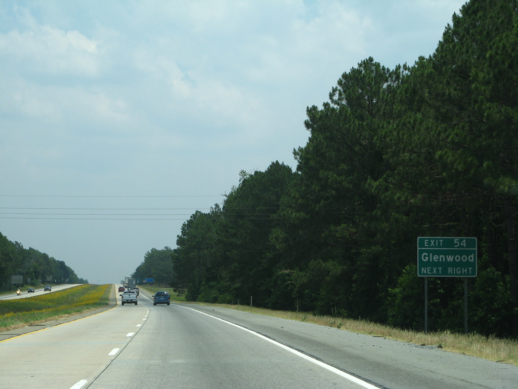
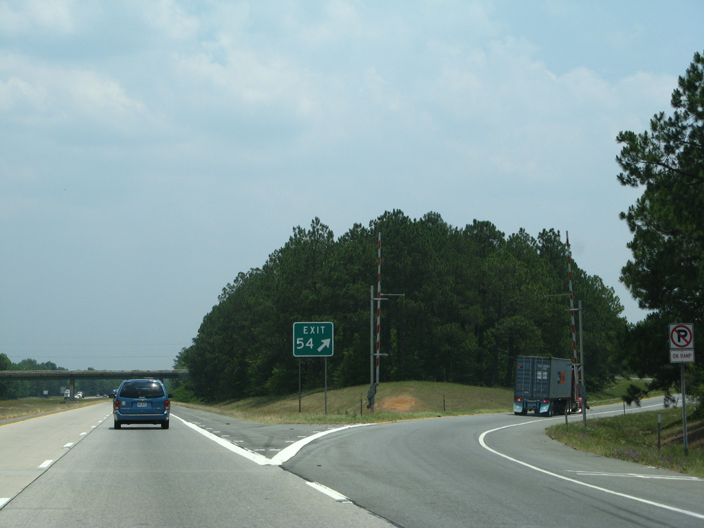
| SR 19 heads south from Downtown Dublin 3.7 miles to a diamond interchange (Exit 54) with Interstate 16. 05/29/07 |
|
| Beyond Exit 54, SR 19 advances 26 miles southeast to Glenwood and U.S. 280. 05/29/07 |
|
| Exit 54 leaves Interstate 16 east for SR 19 north to both Dublin and the city of East Dublin via U.S. 80/319 north. SR 19 mostly follows US highways as part of its 152 mile run from Forsyth southeast to Bacon County. 05/29/07 |
|
| Drop gates are positioned at interchanges along Interstate 16 to be used when the freeway switches to contraflow. 05/29/07 |
|
| Leaving the Dublin area, Interstate 16 proceeds east toward the River Bend Wildlife Management Area. 05/29/05 |
|
| Lothair, 13 miles to the southeast of Exit 58, is the ensuing destination of Interstate 16 east. Savannah is another 111 miles. 05/29/05 |
|
| Spanning the Oconee River along Interstate 16 east. The bridges here were constructed in 1963 and rebuilt in 2000-01. 05/29/07 |
|
| The final Laurens County interchange joins Interstate 16 with SR 199 in one mile. SR 199 extends 27 miles from East Dublin to U.S. 221, north of Mount Vernon. 05/29/07 |
|
| SR 199 angles six miles northwest from Exit 58 to SR 29 at East Dublin. The diamond interchange here was reconstructed in 2005. 05/29/07 |
|
| Soperton, seat of Treutlen County, is the subsequent destination of Interstate 16 east in 14 miles. 05/29/05 |
|
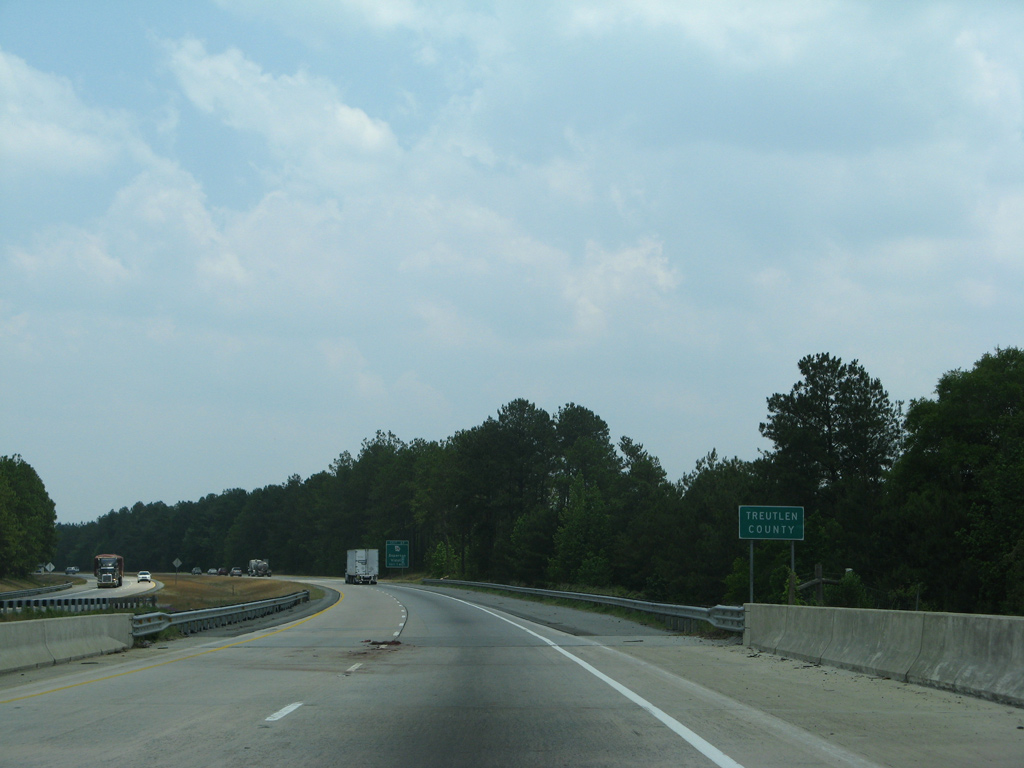
| Mercer Creek lines the boundary of Treutlen County across Interstate 16 east. 05/29/07 |
Page Updated 06-09-2021.

 East
East