|
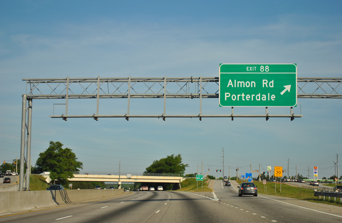
| Almon Road continues southeast through the community of Almon to a diamond interchange (Exit 88) with I-20/U.S. 278-SR 12. 04/13/12 |
|
| Crowell Road leads south from Almon Road and Exit 88 to the city of Porterdale and SR 81 (Broad Street) at Dr. Martin Luther King, Jr. Avenue, a southerly bypass of both Porterdale and Covington. 04/13/12 |
|
| Exit 88 parts ways with I-20/U.S. 278-SR 12 east to Almon Road north and Crowell Road south. 04/13/12 |
|
| I-20 and an adjacent service road cross the Yellow River east of Almon. Again the freeway directly overlays the original route of U.S. 278. Old Atlanta Highway emerges to the north along old U.S. 278 eastward into the city of Covington. 06/24/10 |
|
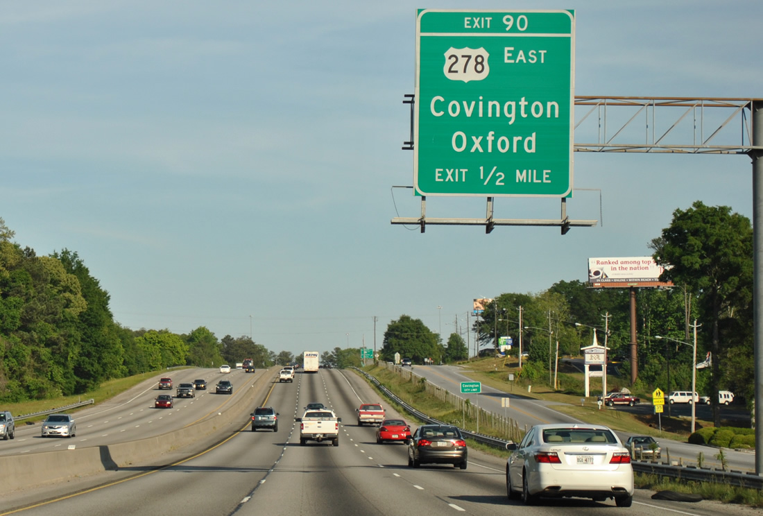
| U.S. 278/SR 12 split from Interstate 20 at a parclo interchange (Exit 90) in one mile. U.S. 278/SR 12 follow a commercial arterial through Covington to the south while Emory Street (SR 81) leads north to the adjacent community of Oxford. 04/13/12 |
|
| U.S. 278/SR 12 east take a loop ramp at Exit 90 onto the adjacent frontage road ahead of Turner Lake Road. Turner Lake Road links the three routes with SR 81 (Washington Street) south between Covington and Porterdale. 04/13/12 |
|
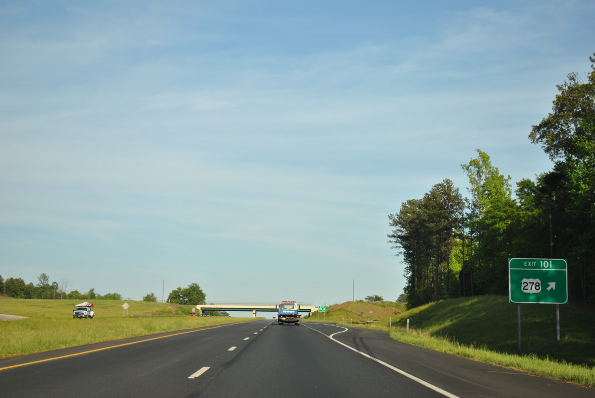
| U.S. 278/SR 12 branch east through the Newton County seat and return to Interstate 20 at Exit 101. SR 81 constitutes a 68.4 mile long highway from U.S. 19/41, north of Hampton, northeast to McDonough, Covington, Oxford, Walnut Grove Loganville and Winder. There is no direct access between SR 81 and I-20. 04/13/12 |
|
| Interstate 20 bypasses the core of Covington the north by Oxford. 04/13/12 |
|
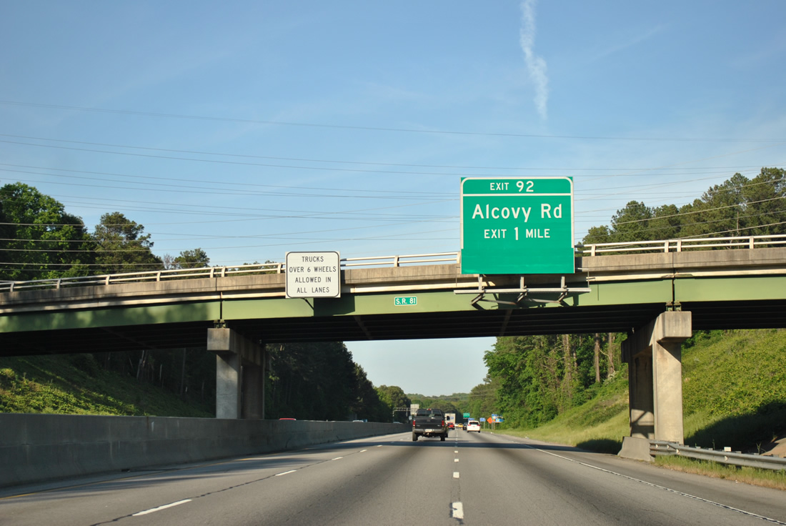
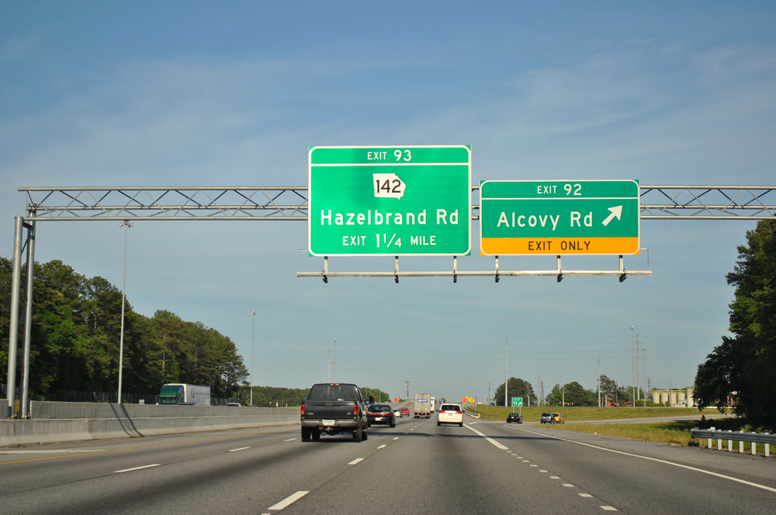
| Alcovy Road extends northeast from Elm Street in Covington to the parclo interchange at Exit 92. 04/13/12 |
|
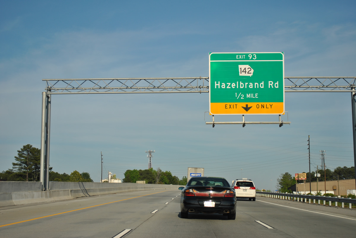
| Exit only placards on the advance signs for Exit 92 were removed when widening of Interstate 20 extended eastward to Exit 93 with SR 142. 04/13/12 |
|
| Alcovy Road continues northeast from the city of Covington along a rural course to Alcovy and north as Alcovy Station Road by Lake Varner to the town of Jersey. 04/13/12 |
|
| Industrial parks line both sides of Interstate 20 from Alcovy Road to SR 142 and Hazelbrand Road. 04/13/12 |
|
| SR 142 comprises a 36 mile long highway from SR 81 north of Dialtown to SR 16 at Willard. SR 142 combines with U.S. 278/SR 12, 2.3 miles east from Covington. 04/13/12 |
|
| SR 142 constitutes the northern half of an arterial bypass for Covington by Covington Municipal Airport (CVC). SR 36 follows the bypass (Martin Luther King, Jr. Avenue) south from U.S. 278/SR 12 to Monticello Street, where it turns to High Point and Stewart. 04/13/12 |
|
| Leaving Covington, Interstate 20 lowers into a valley to cross the Alcovy River beyond this reassurance marker. 04/13/12 |
|
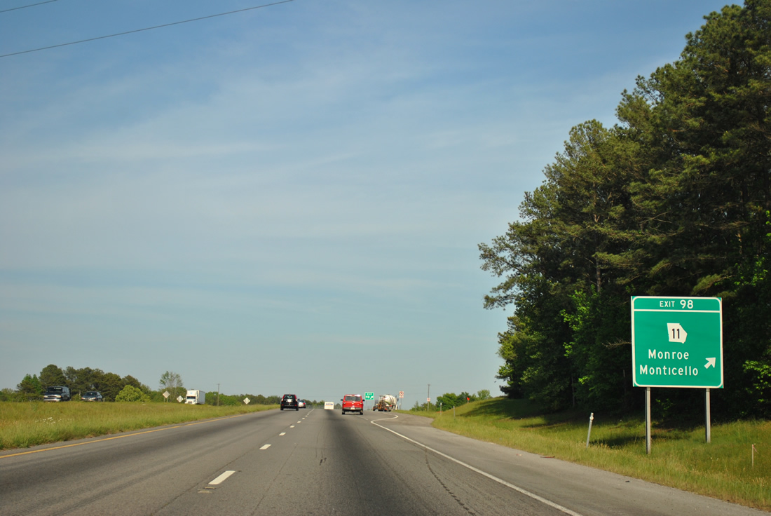
| SR 11 is a lengthy highway traveling the height of Georgia. SR 11 connects the county seats of Jefferson, Winder, Monroe, Monticello and Gray. 04/13/12 |
|
| Entering the diamond interchange with SR 11 at Exit 98. The city of Social Circle lies 3.5 miles to the north. Mansfield is 6.7 miles to the south. SR 11 travels 371 miles overall between Florida near Statenville and North Carolina near Ivy Log. Much of the route coincides with U.S. 129. 04/13/12 |
|
| The first distance distance sign posted since Atlanta, Interstate 20 reaches Madison in 17 miles and the city of Augusta in 105 miles. 04/13/12 |
|
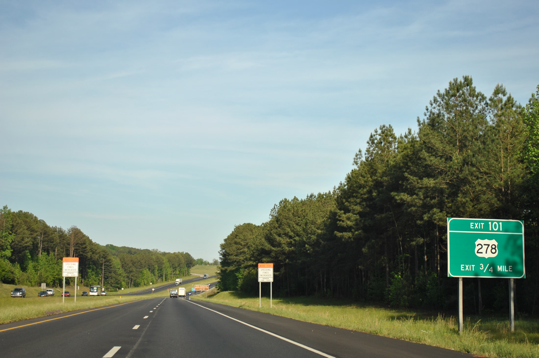
| U.S. 278/SR 12 head 2.9 miles east from SR 11 to cross paths with Interstate 20 again at Exit 101. 04/13/12 |
|
| Confirming marker posted beyond Nelson Creek and the Social Circle Road overpass. Forthcoming Exit 101 serves the State Headquarters Wildlife Resources Division and the Walton Fish Hatchery. 04/13/12 |
|
| U.S. 278/SR 12 continue 5.5 miles east from Exit 101 into the city of Rutledge. 04/13/12 |
|
| The Social Circle city limits spread across I-20 east from Exit 101 to the Morgan County line. Interstate 20 enters the southernmost notch of Walton County on this stretch. 04/13/12 |
|
| Interstate 20 rises from a crossing of Dennis Creek by the next reassurance marker. 04/13/12 |
|
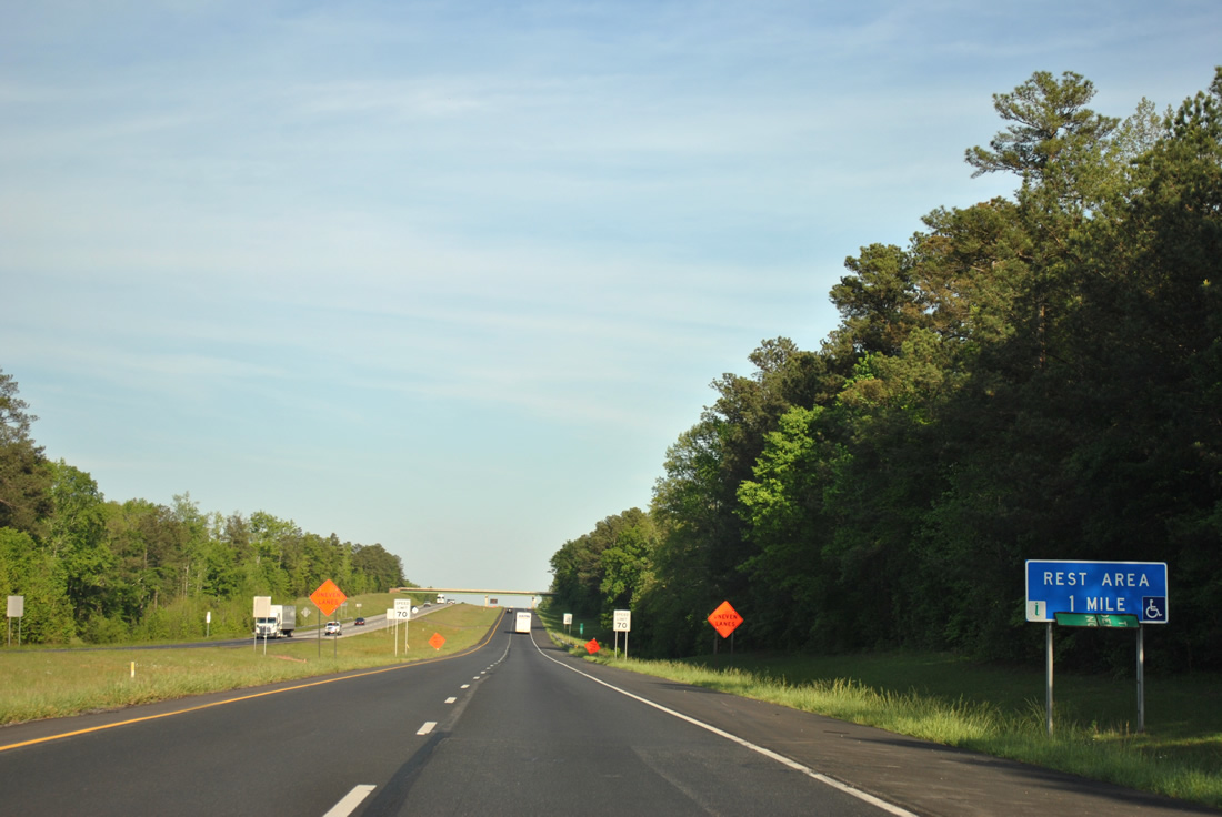
| A rest area, the first since the welcome center by the Alabama state line, follows in one mile. 04/13/12 |
|
| I-20 crosses Walton County for 1.4 miles before entering Morgan County near the Sewell Road over crossing. 04/13/12 |
|
| Eastbound at the rest area off-ramp. A third facility lies 80 miles to the east in Columbia County. 04/13/12 |
|
| Newborn Road connects Interstate 20 with Rutledge and U.S. 278 to the north via Exit 105. 06/24/10 |
|
| South from the diamond interchange at Exit 105, Newborn Road heads 6.7 miles to SR 142 (Main Street) in the town of Newborn. 06/24/10 |
|
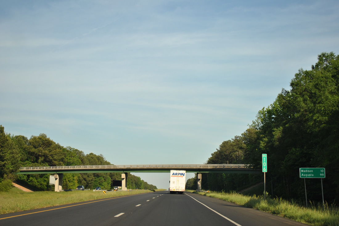
| Long distance travelers bound for Augusta will reach the Garden City in 99 miles. Madison, the seat of Morgan County, is next in ten miles. 04/13/12 |
|
| The diamond interchange (Exit 113) with SR 83 (Monticello Road) is the first of two for the city of Madison along Interstate 20. 04/13/12 |
|
| SR 83 is a 86.5 mile long highway from U.S. 341 near Strouds northeast to U.S. 78 near Monroe. North of Exit 113, SR 83 joins U.S. 278 for 1.7 miles along Main Street into Downtown Madison. 04/13/12 |
|
| The succeeding exit from I-20 east is for U.S. 129/441 (Eatonton Road). U.S. 129/441 overlap between Eatonton, 19 miles to the south, and Athens and the University of Georgia, 28 miles to the north. 04/13/12 |
|
| Interstate 20 curves east to span Fourmile Branch and a Norfolk Southern Railroad beyond this reassurance marker. 04/13/12 |
|
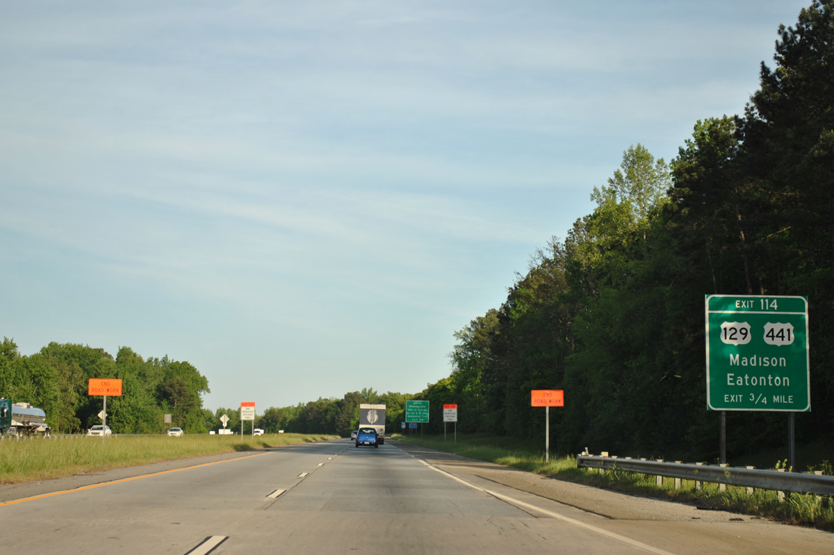
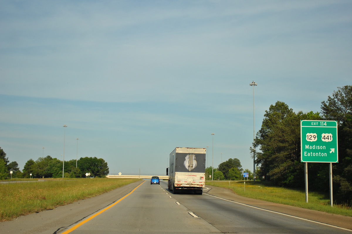
| Exit 114 parts ways with I-20 east for U.S. 129/441 (Eatonton Road). U.S. 441 south leads to Milledgeville, home of the Georgia College and State University. Portions of U.S. 129 and 441 double as the Antebellum Trail between Macon and Athens. U.S. 441 throughout the Peach State is also Heritage Highway 441. 04/13/12 |
|
| Numerous traveler services line Eatonton Road by Exit 114. U.S. 129/441 have a Bypass route around the east side of Madison that begins just north of I-20. The mainline travels through Beacon Heights along Eatonton Road to Main Street (U.S. 278) to Downtown. 06/24/10 |
Page Updated 12-12-2012.