|
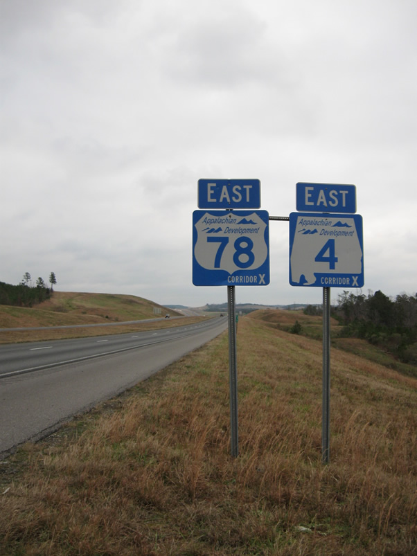
| Just east of the Mississippi state line along Interstate 22 is the first set of U.S. 78/SR 4 Corridor X reassurance shields. This style of marker is used throughout the Marion County segment of Interstate 22. 06/02/11 |
|
| A welcome sign for Alabama follows the U.S. 78/SR 4 shield. A tourist information center is not located along Interstate 22, though one may be constructed in the future. 06/02/11 |
|
| Signs for Future Interstate 22 appeared periodically along Corridor X through northwestern Alabama. 06/02/11 |
|
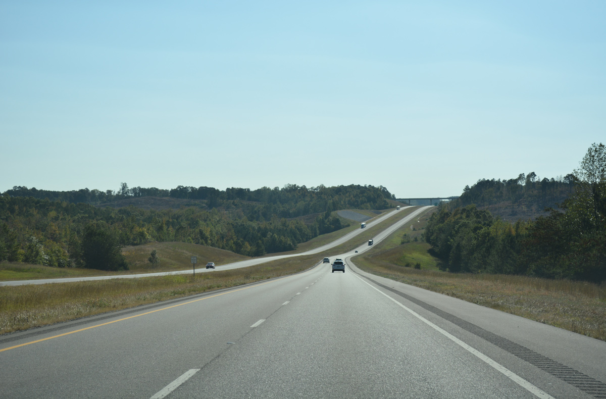
| Rolling hills along Interstate 22 & U.S. 78 ahead of Dry Creek and Marion County 301. The scenery along the 30 mile segment between the state line and Winfield is quite rustic. 06/02/11 |
|
| The first interchange (Exit 3) in Marion County joins Interstate 22 with County Road 33 in one mile. 06/02/11 |
|
| Interstate 22 lowers into a valley fed by Hurricane Creek ahead of the diamond interchange (Exit 3) with County Road 33. 06/02/11 |
|
| County Road 33 leads southwest from Exit 3 to County Road 94 (former U.S. 78) near Bexar, and south from there to SR 19. Northward the road ends at CR 11 nearby, with CR 11 continuing north to Shottsville. 06/02/11 |
|
| Marion County 11 passes over Interstate 22 from CR 33 south to CR 94. 10/08/16 |
|
| A sweeping curve leads Interstate 22 southward on the bypass of Hamilton. 06/02/11 |
|
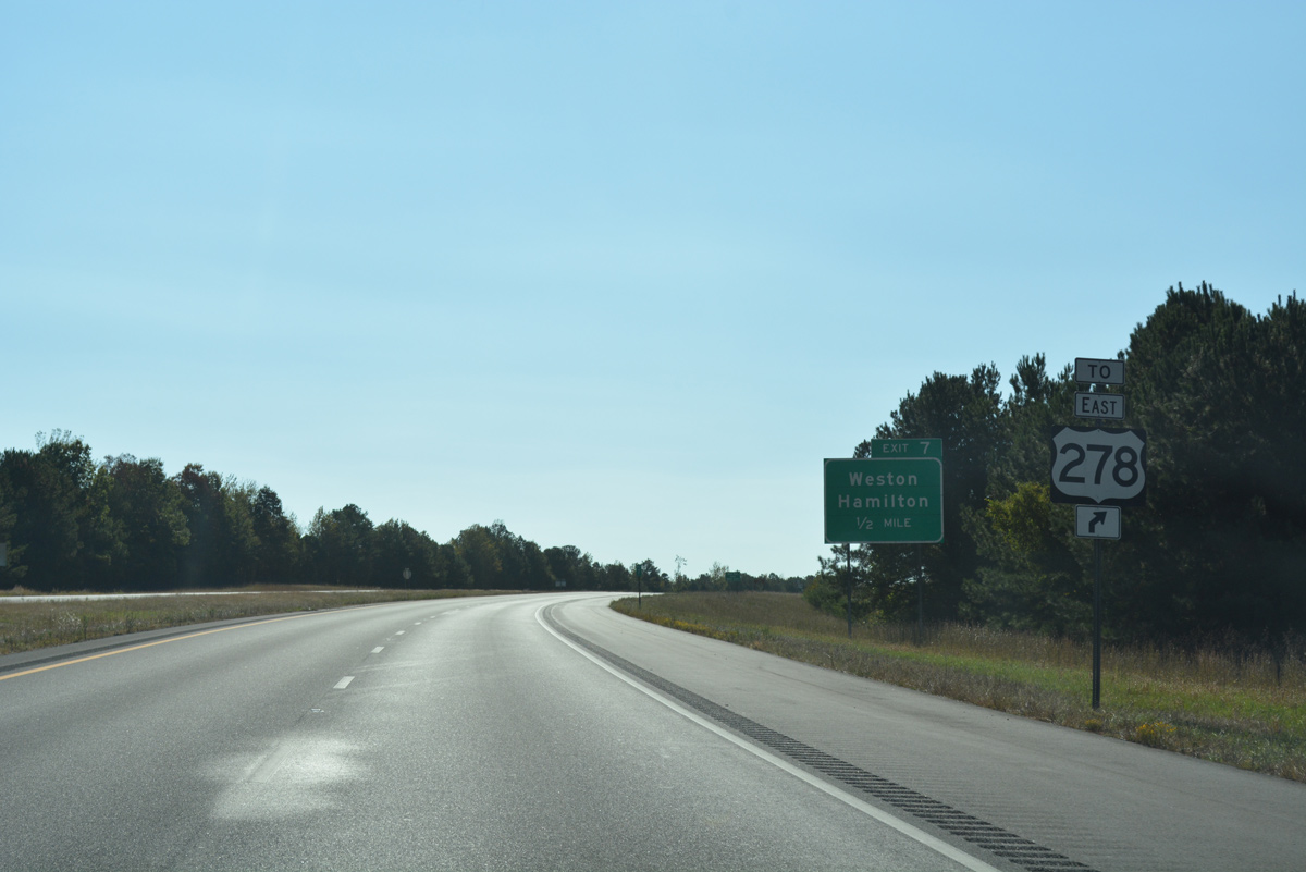
| Exit 7 joins Interstate 22 with SR 74 east to Weston and Hamilton, and County Road 94 west to Bexar. U.S. 278 trailblazers accompany Exit 7 signage to direct motorists bound for eastbound to Natural Bridge. The US highway travels north-south with U.S. 43 between Hamilton and Guin. 10/08/16 |
|
| SR 19 ties into SR 74 from just east of Exit 7. The state route leads north 17 miles to the small town of Vina and 24 miles to the city of Red Bay. 10/08/16 |
|
| U.S. 278 splits with U.S. 43 for SR 74 along Bexar Avenue in Downtown Hamilton. The highway continues east 15 miles to Whitehouse and 76 miles to Cullman. 10/08/16 |
|
| Entering the diamond interchange (Exit 7) along I-22/U.S. 78 east. SR 74 overlays former U.S. 78 five miles east to U.S. 43/278. The remainder of the route accompanies U.S. 278 to the Georgia state line. 10/08/16 |
|
| Heading south along Interstate 22, U.S. 78 and SR 4. The freeway passes over Watts Creek and parallels SR 19 south for the next mile. 10/08/16 |
|
| SR 19 appears on the horizon as it passes over Interstate 22 beyond this confirming marker. The state route arcs southwest from Hamilton to Byrd and an end at SR 17 near Detroit. 10/08/16 |
|
| SR 17 also travels southwest from Hamilton, meeting Interstate 22 at a diamond interchange (Exit 11), 11 miles northeast of Detroit. 10/08/16 |
|
| A lengthy state route at 346.56 miles, SR 17 travels almost the height of the state from the Tennessee state line, north of Florence, to the southern terminus of U.S. 45 in Mobile. Portions of the route are unsigned along U.S. 45 in Mobile and Washington Counties and U.S. 45 from Hamilton north to Florence. 10/08/16 |
|
| SR 17 combines with U.S. 43/278, 3.54 miles to the east. The three routes overlap along Military Street north through Downtown Hamilton. Southward SR 17 continues 21 miles to Sulligent and U.S. 278. 10/08/16 |
|
| Shields for U.S. 78/SR 4 and Interstate 22 precede the County Route 11 overpass east of Exit 11. CR 11 previously crossed the freeway near Exit 3. 10/08/16 |
|
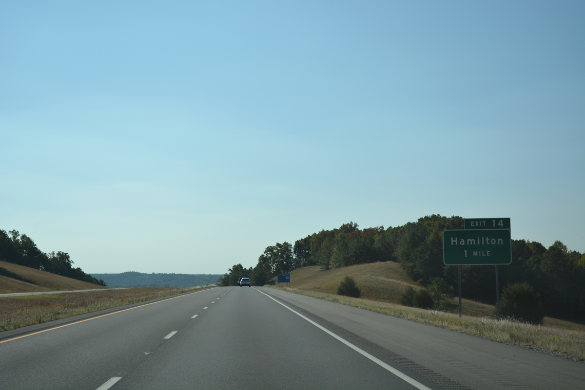
| The next exit for Hamilton exit joins Interstate 22 with Marion County Route 35 at a diamond interchange in one mile. 10/08/16 |
|
| CR 35 stems west from U.S. 43/278 (Military Street) to Interstate 22 at Fulton Bridge. The county route turns southwest at adjacent CR 11 to Henson Springs in Lamar County. 10/08/16 |
|
| Ext 14 departs Interstate 22 for CR 35 at the Buttahatchee River. CR 35 provides an alternate route between Hamilton and Sulligent. 10/08/16 |
|
| I-22/U.S. 78 turn more easterly along the south side of Hamilton. 10/08/16 |
|
| County Route 55 crosses the freeway beyond this confirming shield for Interstate 22 east. 10/08/16 |
|
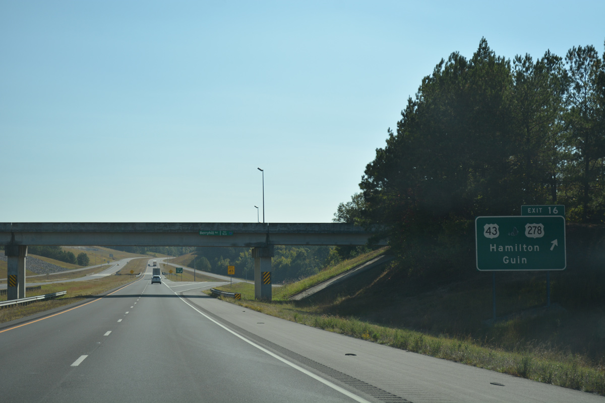
| U.S. 43/278 finally meet Interstate 22 at Exit 16 in one mile. 10/08/16 |
|
| U.S. 43/278 combine along Military Street five miles south from Downtown Hamilton to Interstate 22. The pair continue 8.37 miles southeast through Pikeville to Guin. 10/08/16 |
|
| I-22/U.S. 78 east enters the diamond interchange (Exit 16) with U.S. 43/278 at the Berryhill Road overpass. U.S. 43 enters Hamilton from Russellville and Florence to the north and continues south to Fayette and Tuscaloosa. 10/08/16 |
|
| I-22/U.S. 78-SR 4 enter the Sam R. Murphy Wildlife Management Area east of Exit 16. 10/08/16 |
|
| Leaving the wildlife management area along I-22 eastbound near County Route 37. 06/02/11 |
|
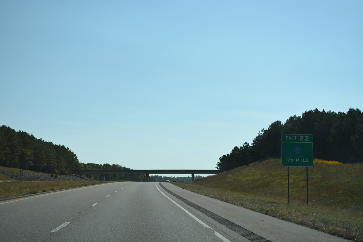
| One mile west of the diamond interchange (Exit 22) with Marion County Route 45 near Flurry Branch. 10/08/16 |
|
| CR 74 passes over Interstate 22 within a half mile of CR 45. Marion County Route 45 branches northeast from U.S. 43/278 to Stinson, Exit 22 and Pea Ridge. 10/08/16 |
|
| CR 45 provides part of a route north from I-22 to Pearces Mill and Brinn via SR 253. There is no direct access to SR 253 from the freeway. 10/08/16 |
|
| Interstate 22 passes northern reaches of the Guin city limits beyond this lone SR 4 shield. 10/08/16 |
|
| Scenery continues along Interstate 22 east ahead of the Scuffle Grit Road overpass. 10/08/16 |
|
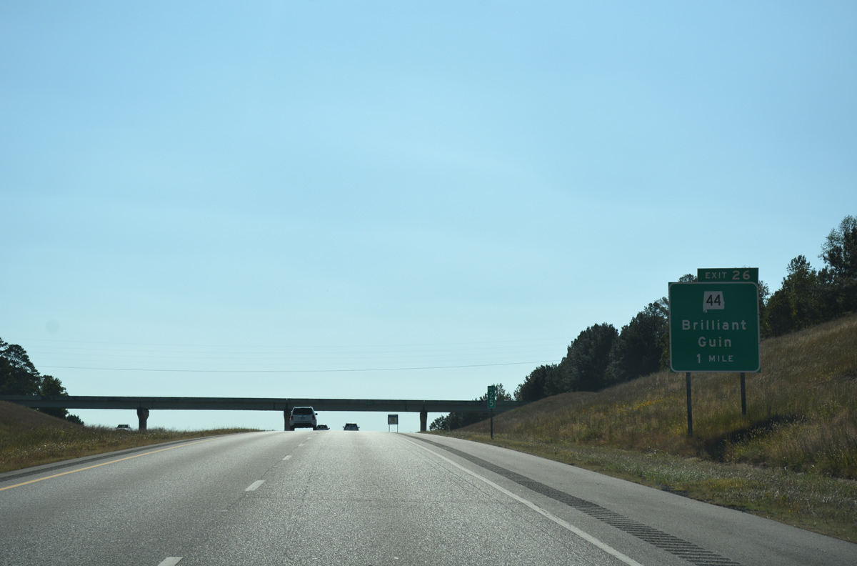
| SR 44, an east to west route stretching 10.02 miles between Guin and Brilliant, meets Interstate 22 at a diamond interchange (Exit 26). 10/08/16 |
|
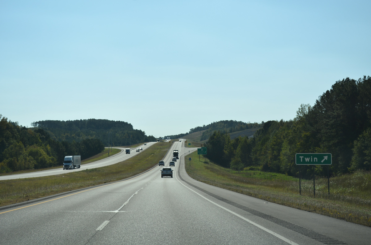
| SR 44 travels 1.14 miles west from Exit 22 to overlap with SR 253 for 0.45 miles the town of Twin. SR 253 continues southward into the city of Winfield. 10/08/16 |
|
| East from Exit 26, SR 44 continues 4.08 miles to SR 129 near Pull Tight in the town of Brilliant. 10/08/16 |
|
| Continuing east, I-22/U.S. 78-SR 4 cross County Route 61 and Dickenson Creek on the ensuing stretch. 10/08/16 |
|
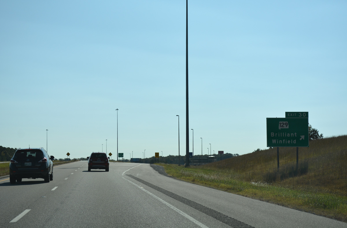
| Meeting the freeway next at Exit 30 is SR 129, a north to south route linking Brilliant and Winfield. 10/08/16 |
|
| One half mile west of the diamond interchange (Exit 30) with SR 129. SR 129 travels 41.19 miles overall between U.S. 43 near Lawrence Mill and Haleyville. 10/08/16 |
|
| Exit 30 represents the easternmost extent of Interstate 22 opened to traffic in 2001. U.S. 78 formerly departed the freeway here for SR 129 south to SR 118 east to Texas and Carbon Hill. 10/08/16 |
|
| Confirming shield for I-22 posted ahead of the County Route 63 overpass. 10/08/16 |
|
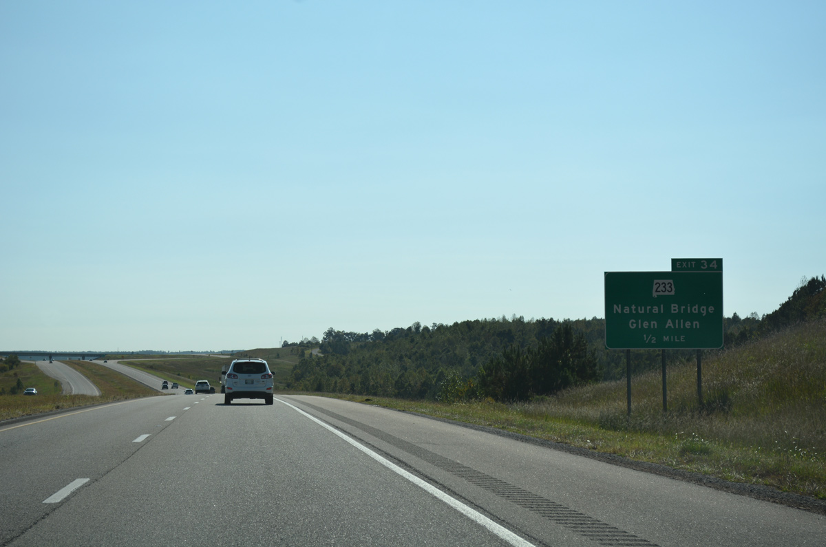
| The first distance sign along Interstate 22 east in Alabama references Glen Allen and Natural Bridge, destinations for SR 233 via forthcoming Exit 34. 10/08/16 |
|
| Two sets of bridges along Interstate 22 span Clifty Creek and then the New River. 10/08/16 |
|
| SR 233 begins at Glen Allen, 4.97 miles to the southwest at SR 129. The state route meets Interstate 22 at a diamond interchange (Exit 34). 10/08/16 |
|
| SR 233 ends 9.72 miles to the north of Exit 34 at U.S. 278 near the settlement of Sunny Home. 10/08/16 |
|
| The guide sign for Exit 34 at the off-ramp to SR 233 was missing by 2016. 08/08/10 |
|
| SR 233 south to SR 118 connects the freeway with Texas to the east and Winfield to the west. Old U.S. 78 remains south of I-22 to Exit 52. 10/08/16 |
|
| U.S. 78 and SR 4 shield assembly posted along the Interstate 22 mainline after Exit 39. 12/19/09 |
|
| ALDOT recorded 12,720 vehicles per day (vpd) along the easternmost stretch of Interstate 22 through Marion County in 2015. 10/08/16 |
|
| Spanning the New River along I-22/U.S. 78 east. 10/08/16 |
|
| Winding toward a crossing of Gulf Branch to the northeast of Texas along Interstate 22 east. 10/08/16 |
|
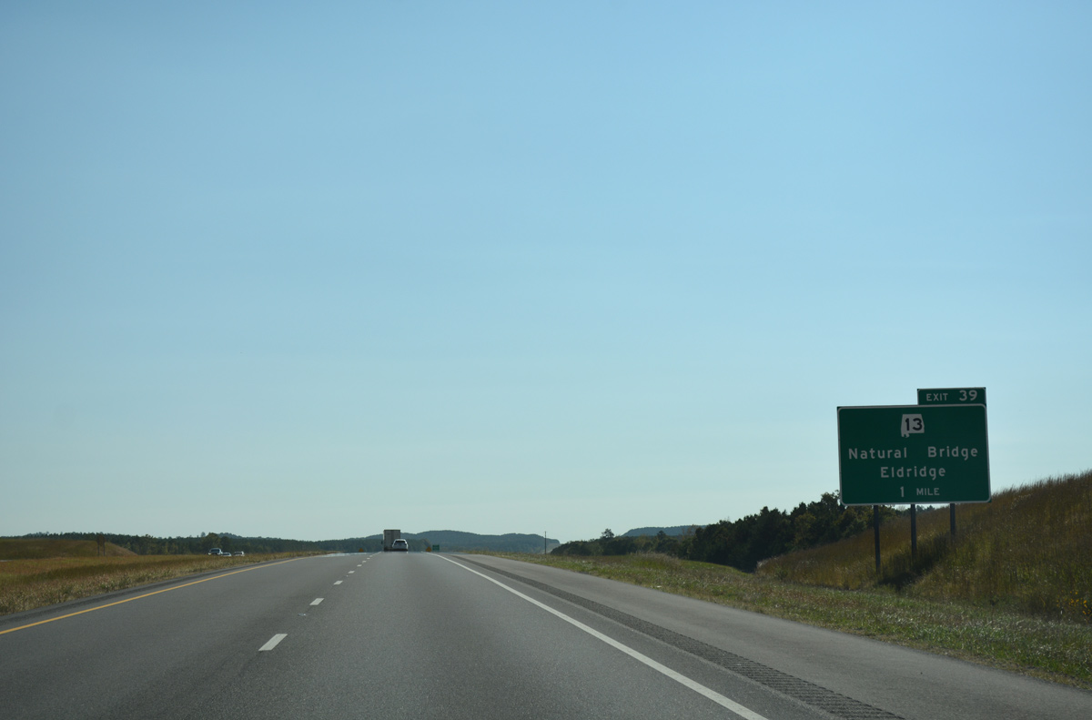
| SR 13 and Interstate 22 come together at a diamond interchange (Exit 39) in north Eldridge. 10/08/16 |
|
| Interstate 22 enters Walker County 38.47 miles east of the Mississippi state line. 10/08/16 |
Page Updated 05-13-2017.


 East
East