|
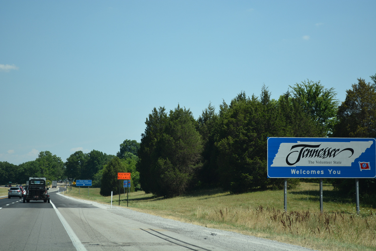
| The Tennessee welcome sign stands beside the state border with Kentucky. 06/25/22 |
|
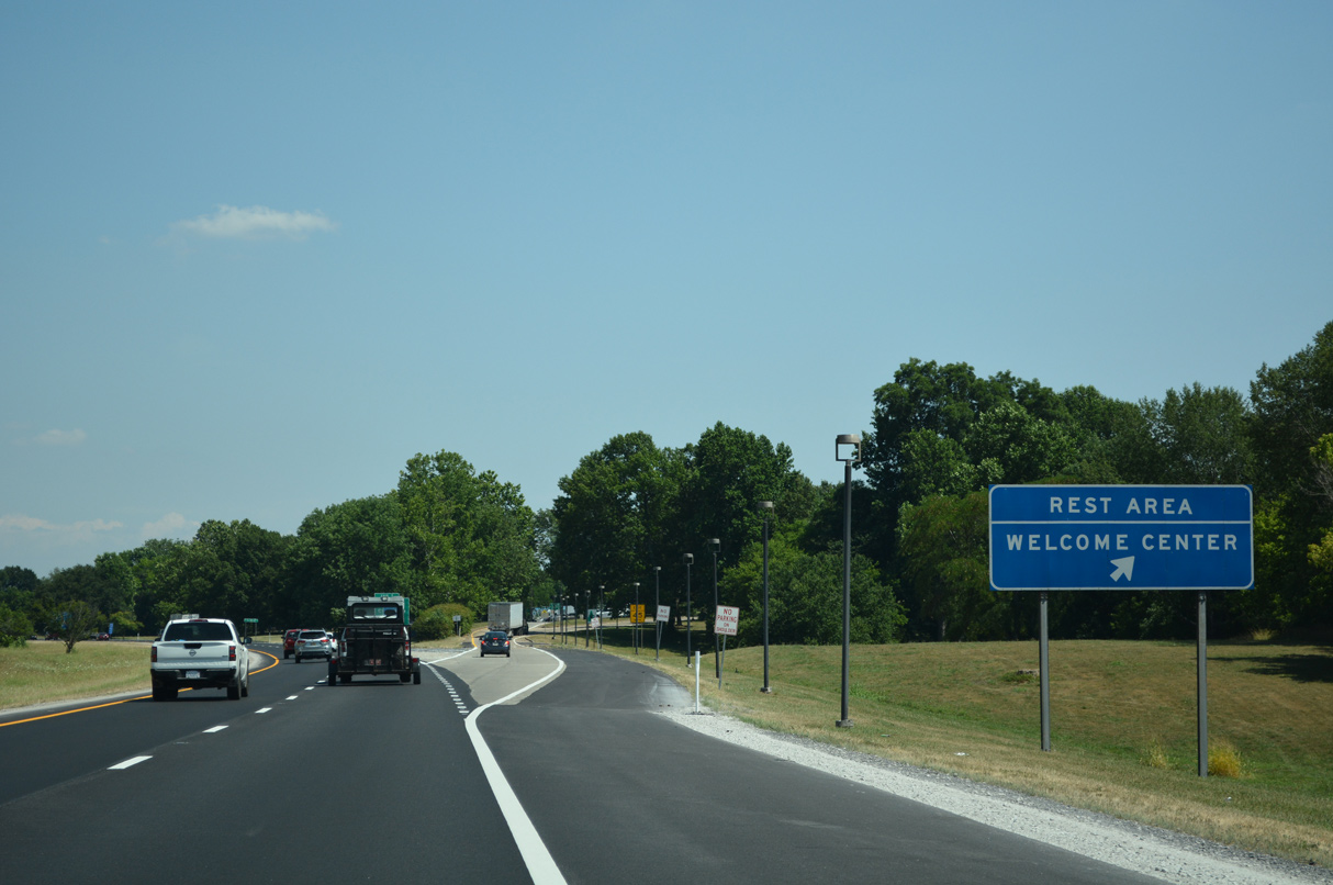
| Interstate 24 enters the city of Clarksville and Montgomery County, Tennessee just ahead of the Tennessee Welcome center and rest area. 06/25/22 |
|
| Forthcoming SR 48 (Trenton Road) travels 5.6 miles north from U.S. 79 (Wilma Rudolph Boulevard) to Kentucky Highway 104 at the state line. 06/11/17 |
|
| SR 48 (Trenton Road) south to SR 236 (Tiny Town Road) west leads to U.S. 41A (Fort Campbell Boulevard) at Fort Campbell. 06/25/22 |
|
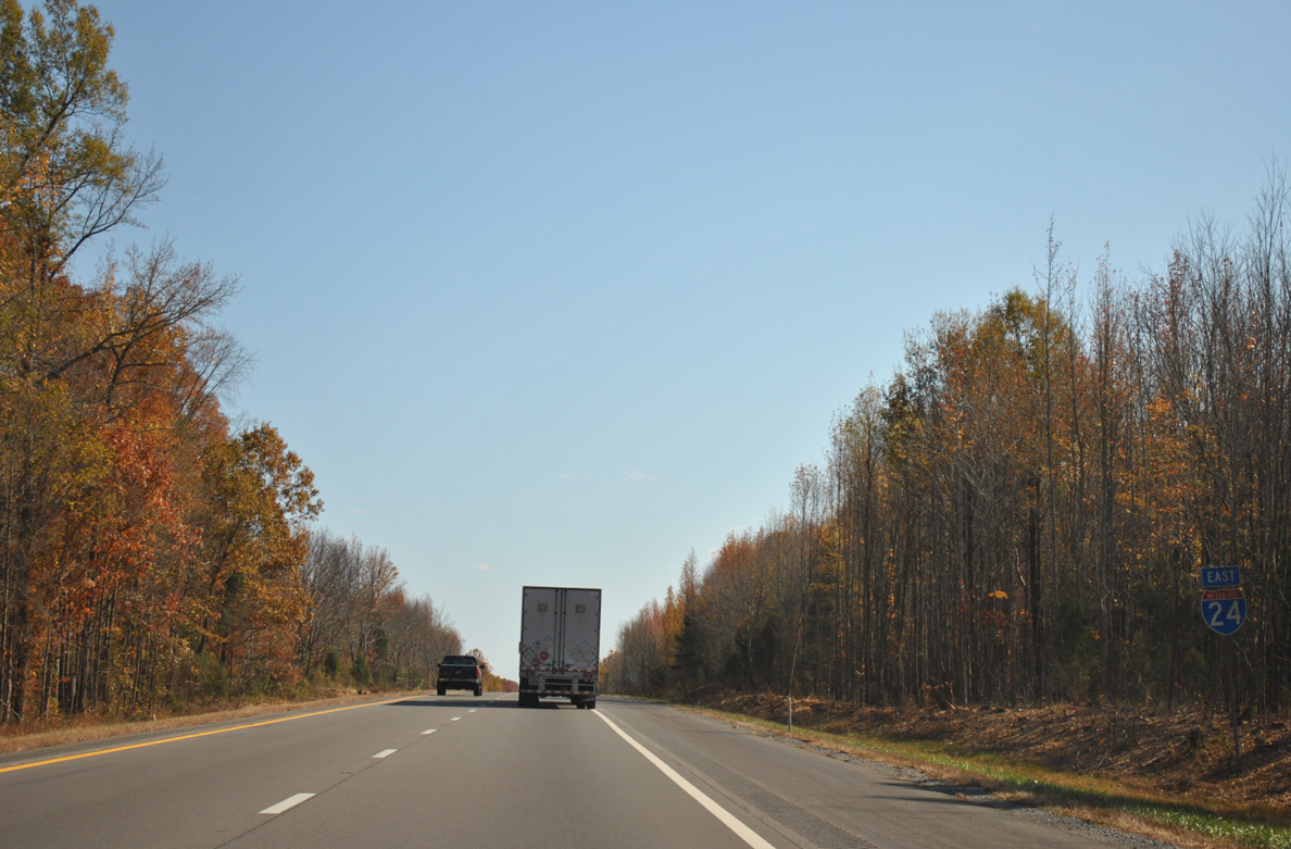
| I-24 enters the diamond interchange (Exit 1) with SR 48 (Trenton Road) just east of the rest area. 06/25/22 |
|
| KY 104 extends SR 48 northeast along a rural route 6.6 miles to Trenton and U.S. 41. The state route south through Clarksville is suburban, serving a bevy of subdivisions. 06/25/22 |
|
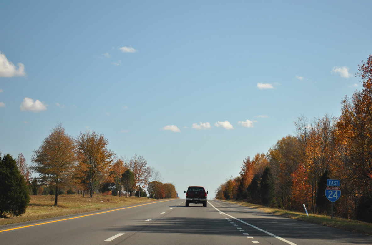
| Interstate 24 angles southeast between suburban tracts and crosses Spring Creek beyond this reassurance marker. 06/11/17 |
|
| Fort Campbell Military Reservation lies west of Clarksville along U.S. 79. An at-grade expressway bypass (SR 374 / 101st Airborne Division Parkway) provides another route to the Army Post via forthcoming Exit 4 and U.S. 79 south. U.S. 79 meets the parkway at a single point urban interchange completed in 2008. 06/11/17 |
|
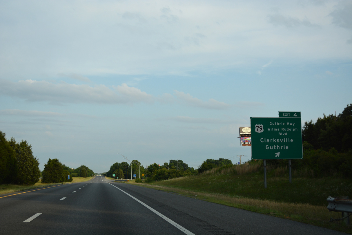
| U.S. 79 constitutes a busy commercial arterial (Wilma Rudolph Boulevard) heading southwest from Exit 4 to St. Bethlehem and Downtown Clarksville. U.S. 79 transitions into a rural highway continuing east to Guthrie, Kentucky. 06/11/17 |
|
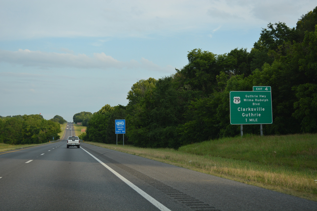
| I-24 east reaches the diamond interchange (Exit 4) with U.S. 79 (Guthrie Highway north / Wilma Rudolph Boulevard south). U.S. 79 angles across Tennessee from Memphis to Brownsville, Paris and Clarksville. Nationally the route travels 855 miles from Round Rock, Texas to Russellville, Kentucky. 06/11/17 |
|
| Interstate 24 passes between Gateway Medical Center and Clarksville-Montgomery County Corporate Business Park South after this shield assembly posted at milepost 5. The business park is home to the $800 million Hankook Tire manufacturing plant. The facility was built between late 2014 and 2016. 06/11/17 |
|
| A forested median appears south of the Dunlop Lane overpass. Interstate 24 progresses another 43 miles southeast to Nashville. 06/11/17 |
|
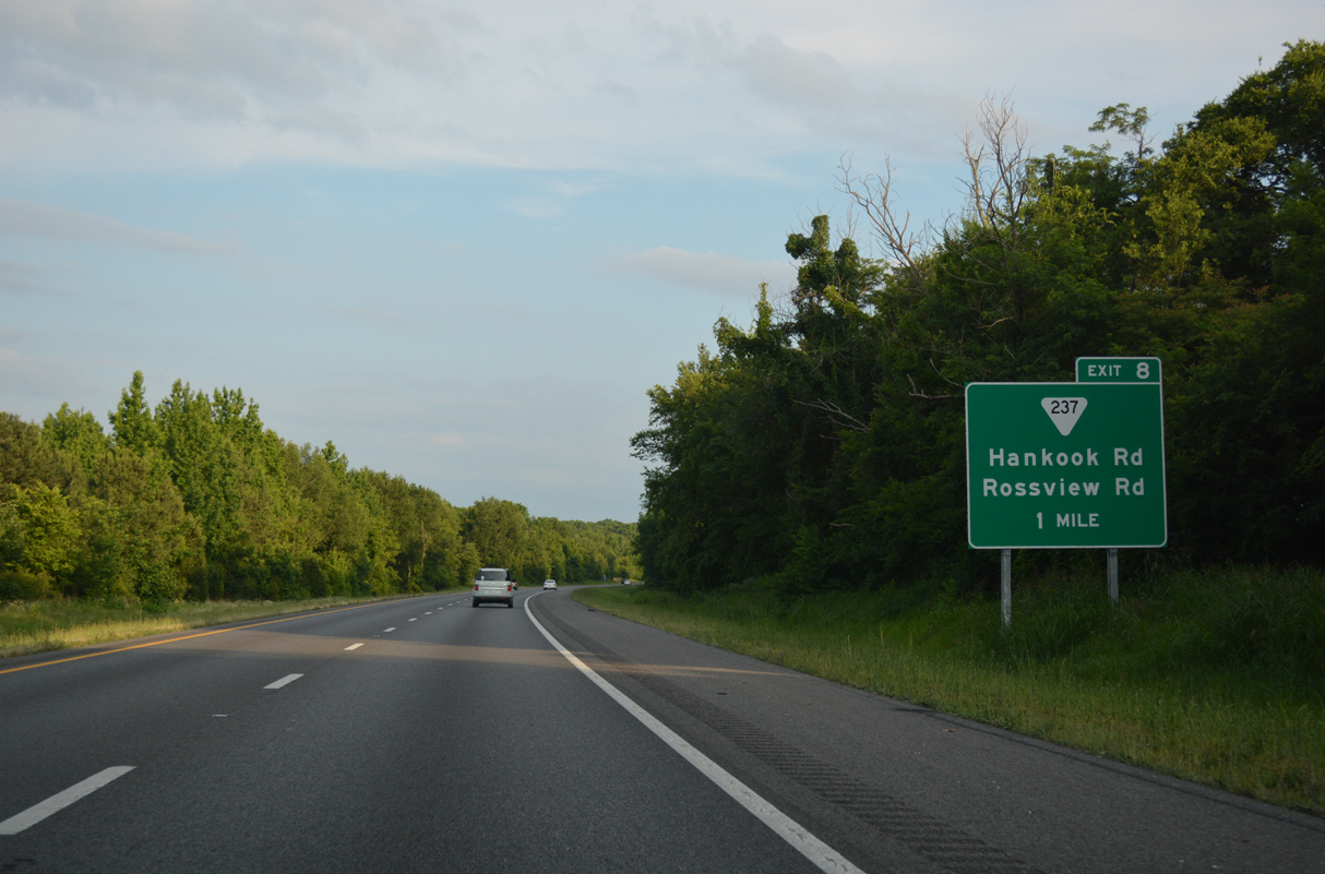
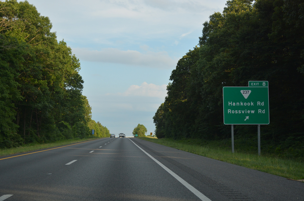
| SR 237 (Rossview Road) stems east from SR 374 (Wakefield Boulevard) to meet I-24 in one mile at a diamond interchange (Exit 8). $12.9 million in construction from December 2014 to May 2016 widened 0.8 miles of SR 237 at Exit 8 while replacing the overpasses across I-24. The expansion project provided capacity improvements for the adjacent Hankook Tire plant.1 06/11/17 |
|
| East from Exit 8, SR 237 (Rossview Road) serves adjacent Clarksville-Montgomery County Corporate Business Park South and growing suburbs at Rossview. SR 237 concludes a 7.9 mile long route at SR 238 (Port Royal Road). 06/11/17 |
|
| The footprint of Interstate 24 expands in width as the freeway ahead of the Red River. 06/11/17 |
|
| A tributary of the Cumberland River, the Red River flows 100 miles west from a hilly area of central Sumner County to Clarksville. 06/11/17 |
|
| SR 76 emerges from U.S. 41A Bypass along Dr. Martin Luther King, Jr. Parkway through east Clarksville. The parkway carries the route 3.2 miles east from U.S. 41A (Nashville Highway) to Interstate 24 at Exit 11. 06/11/17 |
|
| SR 76 transitions into a rural highway east from the diamond interchange (Exit 11) with I-24 to meet U.S. 41 at Adams in 11 miles. SR 76 travels mostly as the hidden counterpart of U.S. 79 from Brownsville east to Clarksville. The state route travels solo from Springfield to end at SR 109 in south Portland. 06/11/17 |
|
| Eastbound reassurance marker posted after the Trough Springs Road overpass. The freeway retains a forested median to Exit 24. 11/07/11 |
|
| 44,834 vehicles per day (vpd) were recorded in 2013 along the 7.9 mile exit less stretch through eastern Montgomery County. 11/07/11 |
|
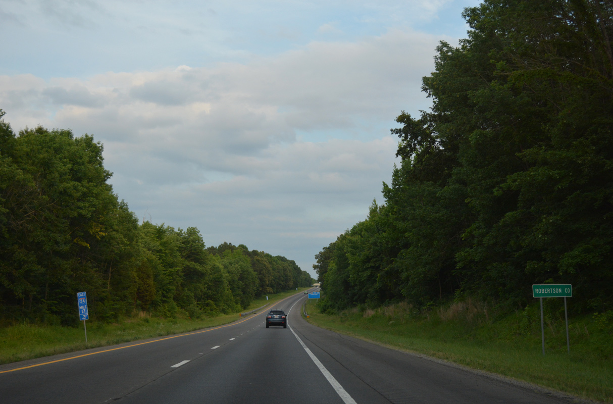
| Interstate 24 crosses into extreme southwestern Robertson County in a hilly area by Passenger Creek. 06/11/17 |
|
| The first of two exits in Robertson County joins Interstate 24 with SR 256 (Maxey Road) in one mile. 06/11/17 |
|
| SR 256 goes for 10.6 miles from U.S. 41A nearby in Cheatham County to SR 76 at Adams. 06/11/17 |
|
| Interstate 24 bee lines southeast parallel to U.S. 41 Alternate to Pleasant View. 11/07/11 |
|
| Meeting the freeway in one mile is SR 49 at Exit 24. SR 49 connects I-24 with the Cheatham County seat of Ashland City, ten miles to the south. 06/11/17 |
|
| North from the diamond interchange (Exit 24) with I-24, SR 49 continues to Coopertown and the city of Springfield. The state route runs 104.6 miles overall from U.S. 79 at Dover to Kentucky Highway 383 north of Orlinda. 06/11/17 |
|
| Travelers along I-24 east nip a corner of Cheatham County just east of Exit 24 11/07/11 |
|
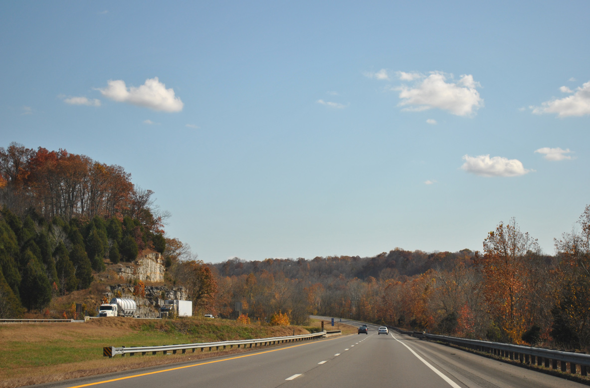
| Pronounced rock facades appear alongside Interstate 24 as the freeway kinks east into a valley fed by Sycamore Creek. 11/07/11 |
|
| Sycamore Creek marks the east-west boundary between Cheatham and Robertson County from U.S. 41 Alternate east to Long Creek near U.S. 431. 06/11/17 |
|
| Waters of Procks Branch flow between the roadways of Interstate 24 as the freeway advances to the diamond interchange (Exit 31) with SR 249 south and New Hope Road north. 06/11/17 |
|
| SR 249 begins at Exit 31 and meanders southwest 9.6 miles to overlap with SR 49 south into Ashland City. The state route ends at Exit 188 along Interstate 40 near Kingston Springs. 06/11/17 |
|
| Interstate 24 continues from Exit 31 and Pinnacle toward the Davidson County line. 06/11/17 |
|
| The Metropolitan Government of Nashville & Davidson County was formed in 1962 when the city and county merged. Six communities within the city-county consolidation retain some local authority include Goodlettsville, Belle Meade, Lakewood, Berry Hill, Forest Hills and Oak Hill.2 11/07/11 |
Page Updated 12-14-2023.

 East
East