|
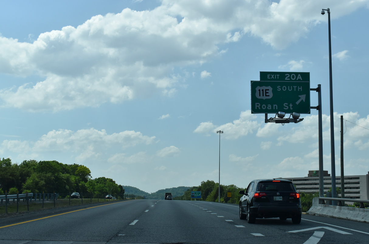
| Exit 20A loops onto U.S. 11E (Roan Street) south back toward Downtown Johnson City. Roan Street represents the pre-freeway alignment of U.S. 23. 05/26/21 |
|
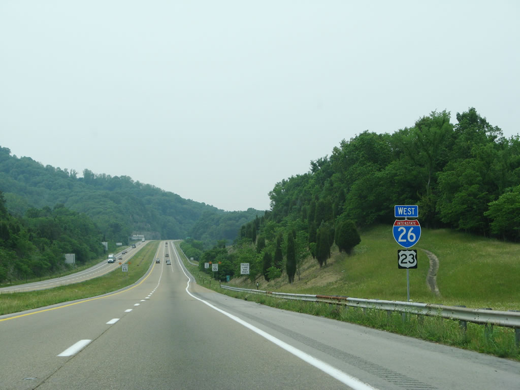
| I-26/U.S. 26 west span Browns Mill Road by these confirming markers. 05/26/21 |
|
| SR 381 (State of Franklin Road) meets I-26/U.S. 23 at a single point interchange (Exit 19). 05/26/21 |
|
| The north end of SR 381 ties into U.S. 11E/19W north toward Bristol Motor Speedway and the city of Bristol. 05/26/21 |
|
| The Rocky Mount State Historic Site lies northeast beyond Boone Lake along U.S. 11E/19W (Bristol Highway). 05/26/21 |
|
| State Route 381 (State of Franklin Road) is a 7.63 mile long controlled arterial bypassing Johnson City south from U.S. 11E/19W (Bristol Highway) to U.S. 321 at U.S. 11E (Market Street). 05/26/21 |
|
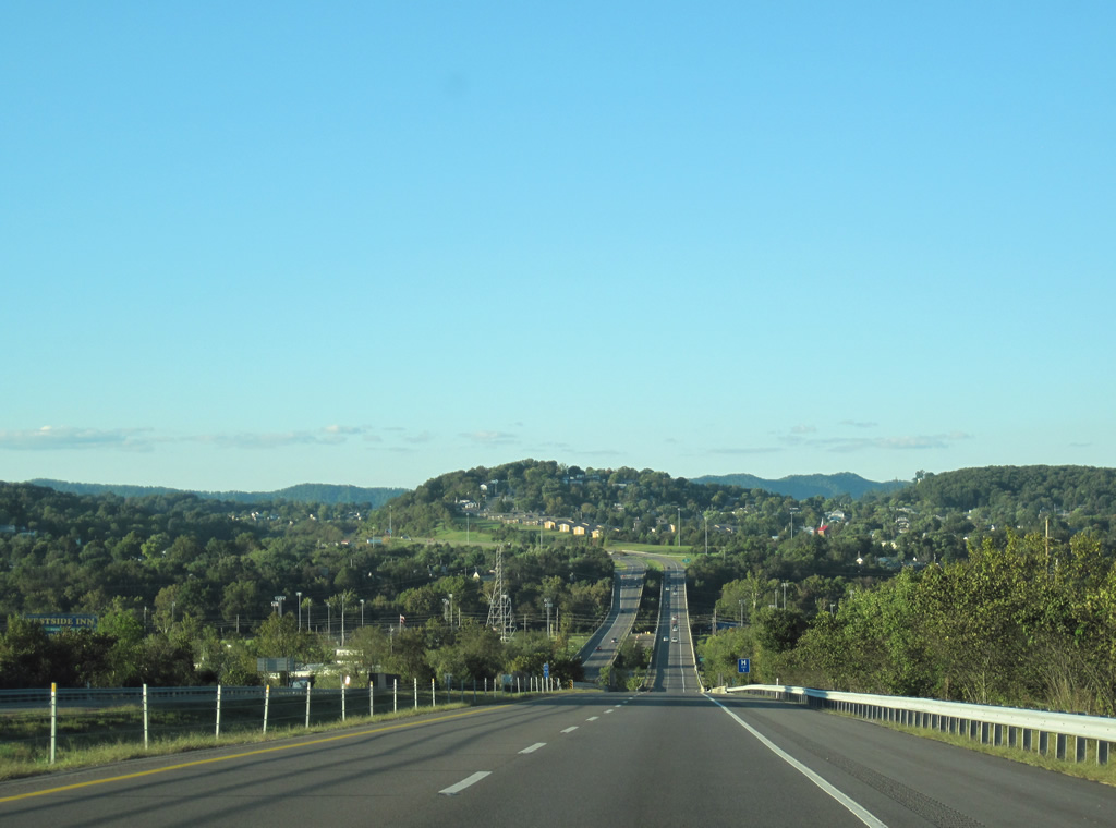
| I-26/U.S. 23 advance north across Indian Ridge. 05/26/21 |
|
| I-26/U.S. 23 converge with SR 354 (Boones Creek Road) in northern reaches of Johnson City. 05/26/21 |
|
| SR 354 (Boone Creek Road) angles southwest from SR 36 to I-26 at Exit 17 and U.S. 11E/321 at Jonesborough along a 7.45 mile course. Construction finished in September 2020 rebuilt the exchange with SR 354 into a DDI. 05/26/21 |
|
| Confirming markers posted westbound ahead of Reedy Creek. 05/26/21 |
|
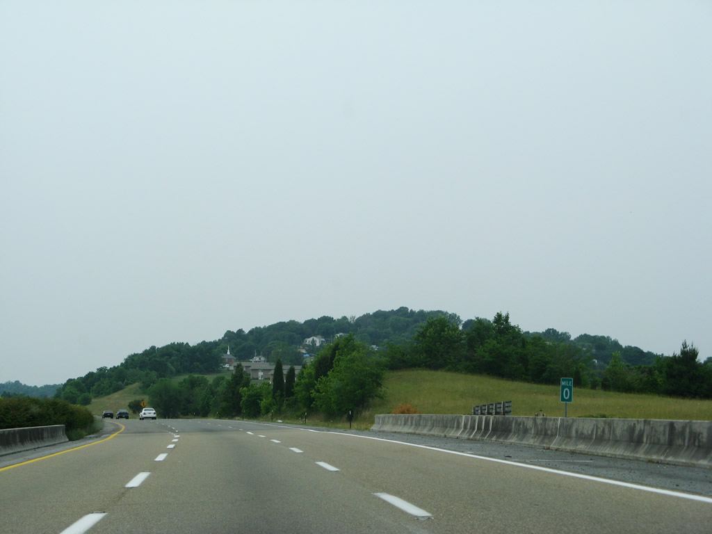
| Interstate 26 and U.S. 23 continues 16 miles north from the Old State Road underpass to Kingsport. 05/26/21 |
|
| The succeeding exit along I-26/U.S. 23 north is with SR 75 (Suncrest Drive south / Bobby Hicks Drive north) at the unincorporated community of Gray. 05/26/21 |
|
| SR 75 leads 6.51 miles northeast from Exit 13 to SR 357 at Tri-Cities Regional Airport (TRI) and Northeast State Community College. 05/26/21 |
|
| Entering the parclo interchange (Exit 13) with SR 75 (Bobby Hicks Highway north / Suncrest Drive south). SR 75 travels 27.20 miles overall from U.S. 11E/321 near Limestone to Blountville. 05/26/21 |
|
| I-26/U.S. 23 ascend northwest across Ford Creek and Gray Station Road. 05/26/21 |
|
| I-26/U.S. 23 traverse Douglas Shred Ridge ahead of Exit 10 for Eastern Star Road. 05/26/21 |
|
| Eastern Star Road stems north from Kinchloe Mill Road to Exit 10 and Fordtown Road beyond Miller Ridge. 05/26/21 |
|
| The diamond interchange (Exit 10) with Eastern Star Road straddles the Sullivan County line. 05/26/21 |
|
| The last I-26/U.S. 23 confirming markers posted northbound prior to the August 2, 2005 approval of the Interstate 26 extension. 05/26/21 |
|
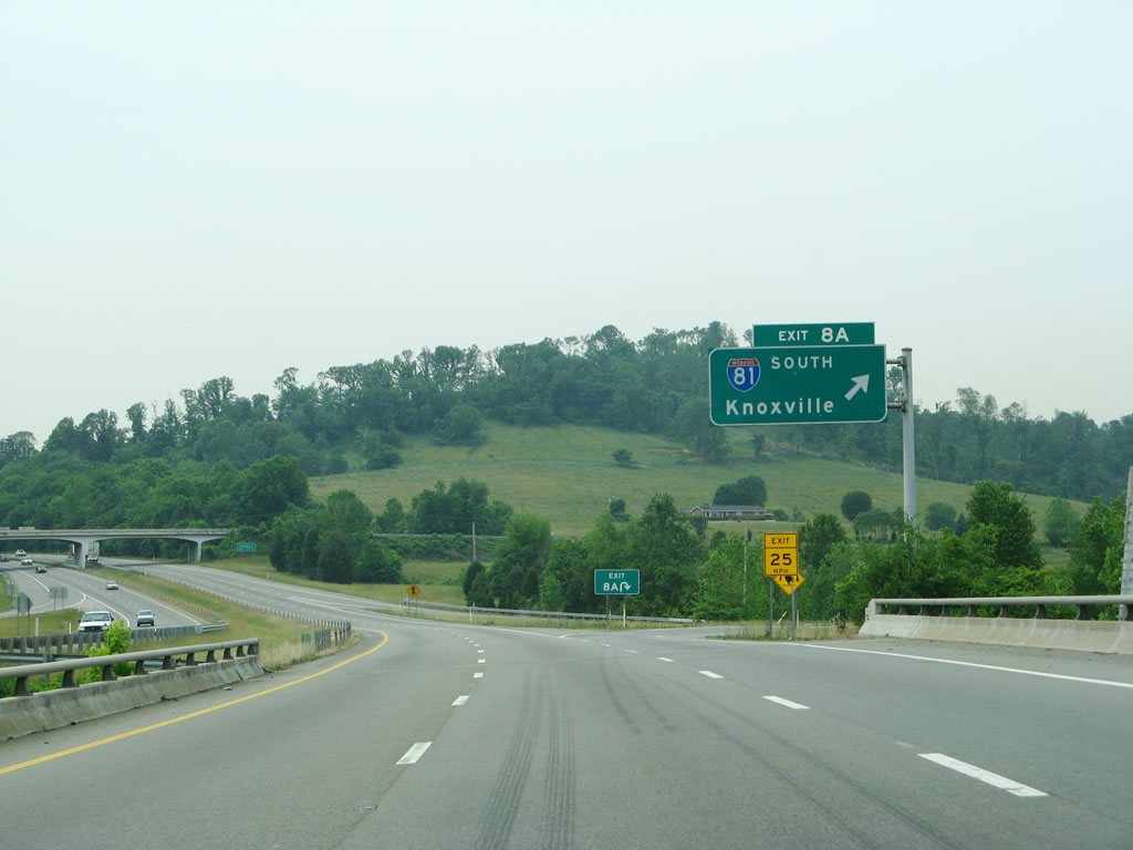
| Meeting I-26/U.S. 23 at a cloverleaf interchange (Exit 8), Interstate 81 passes between Johnston City and Kingsport northeast to Bristol. 05/26/21 |
|
| Interstate 81 runs 18 miles northeast from Exit 8A to Bristol along the Virginia state line. 05/26/21 |
|
| An important regional transportation corridor to the Northeastern U.S., Interstate 81 originates in Tennessee near Morristown. 05/26/21 |
|
| Knoxville lies 90 miles to the southwest via Interstate 81 and I-40. 05/31/07 |
|
| The next five exits from the freeway inclde the final exits of Interstate 26. They serve the vicinity of Kingsport, which is located mostly within Sullivan County and is part of the Tri-Cities with Johnson City and Bristol. 05/31/07 |
|
| Interstate 26 and U.S. 23 pass between Birdwell Ridge and Buckaloo Ridge along an S-curve just north of I-81. 05/31/07 |
|
| Forthcoming Exit 6 joins Interstate 26 with SR 347 west to Rock Springs and Rock Springs Road east to Colonial Heights. 05/31/07 |
|
| I-26/U.S. 23 lower into Rock Springs Valley and the diamond interchange (Exit 6) with SR 347 (Rock Springs Road). 05/31/07 |
|
| A diamond interchange was constructed for a Tennessee welcome center and rest area north of Exit 6 in 2012/13. 05/31/07 |
|
| The ensuing exit is with SR 93, an arterial and expressway bypass encircling the south and east side of Kingsport. 05/31/07 |
|
| Points of interest for Exit 4 include Meadow View Convention Center in Kingsport. 05/31/07 |
|
| Exit 4 departs I-26/U.S. 23 north for SR 93 (John B. Dennis Highway) and SR 126 (Wilcox Drive) north into Kingsport. 05/31/07 |
|
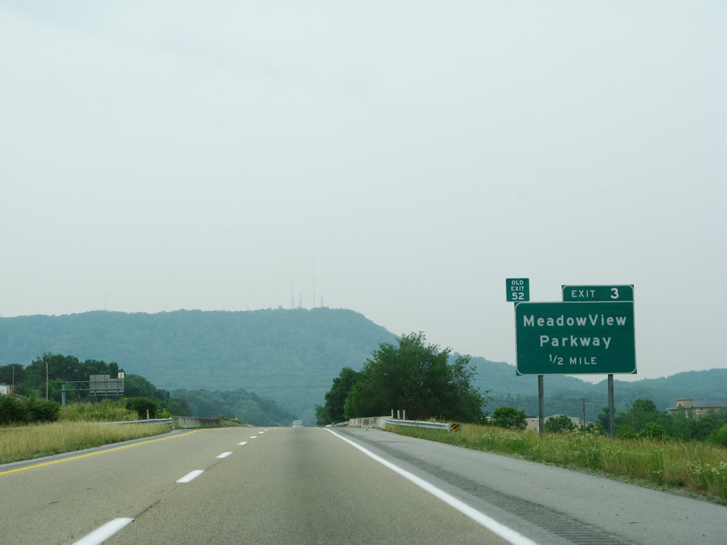
| A diamond interchange (Exit 3) joins I-26/U.S. 23 with MeadowView Parkway just north of SR 93. 05/31/07 |
|
| MeadowView Parkway stens west from SR 126 (Wilcox Drive) to Exit 3 and Reservoir Road toward Bays Mountain Park and Planetarium. 10/02/10 |
|
| The final confirming marker for Interstate 26 westbound. 05/31/07 |
|
| Interstate 26 cuts across the eastern side of Bays and Holston River Mountains. The speed limit reduces to 55 miles per hour on this stretch. 05/31/07 |
|
| I-26/U.S. 23 lowers from Holston River Mountain toward Long Island and U.S. 11W (W Stone Drive). The Midfields, West View Park, Howard Hill, Beartown, and Fort Robinson neighborhoods spread over the hillside beyond the South Fork of the Holston River. 10/02/10 |
|
| Interstate 26 crosses the South Fork of the Holston River and Long Island along a viaduct preceding Exit 1. 10/02/10, 05/31/07 |
|
| A six-ramp parclo interchange (Exit 1) joins the west end of Interstate 26 and U.S. 23 with U.S. 11W (W Stone Drive). U.S. 11W travels west to Church Hill and east across Kingsport. 10/02/10 |
|
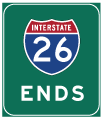
| An end I-26 shield stands beyond the on-ramp from U.S. 11W. U.S. 23 continues north from here to Gate City, Virginia. 05/31/07 |
|
| Mile zero for I-26 is the centerline of U.S. 11W (W Stone Drive). 05/31/07 |
|
| U.S. 23 extends north from I-26 along a freeway 3.03 miles to the Virginia state line. 10/02/10 |
|
| U.S. 23 converges with the north end of SR 36 (Lynn Garden Drive) and east end SR 346 (Carters Valley Road) at Morrison City in one mile. 05/31/07 |
|
| U.S. 23 runs though a series of S-curves from the Midfields neighborhood across Bell Ridge. 05/31/07 |
|
| Entering Carter Valley, U.S. 23 turns east to the half diamond interchange with SR 36 (Lynn Garden Drive) south back into Johnson City. 05/31/07 |
|
| Single lane ramps partition for U.S. 23 north into Weber City, Virginia and SR 36 (Lynn Garden Drive) to SR 346 (Carter Valley Road) west to Cloud Ford. 10/02/10 |
|
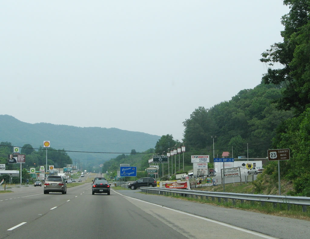
| U.S. 23 overtakes SR 36 (former U.S. 23) north between Cloud Ridge and Long Ridge. With various motorist services lining both sides of the following arterial, a small trailblazer promotes U.S. 23 as the Country Music Highway. 05/31/07 |
|
| U.S. 23 transitions into a four lane arterial north from the state line 2.9 miles to U.S. 58/321 in the town of Weber City. U.S. 23-58-321 overlap 17.7 miles from Gate City to Duffield. 10/02/10 |
Page Updated 08-09-2021.


 West
West  North
North