|
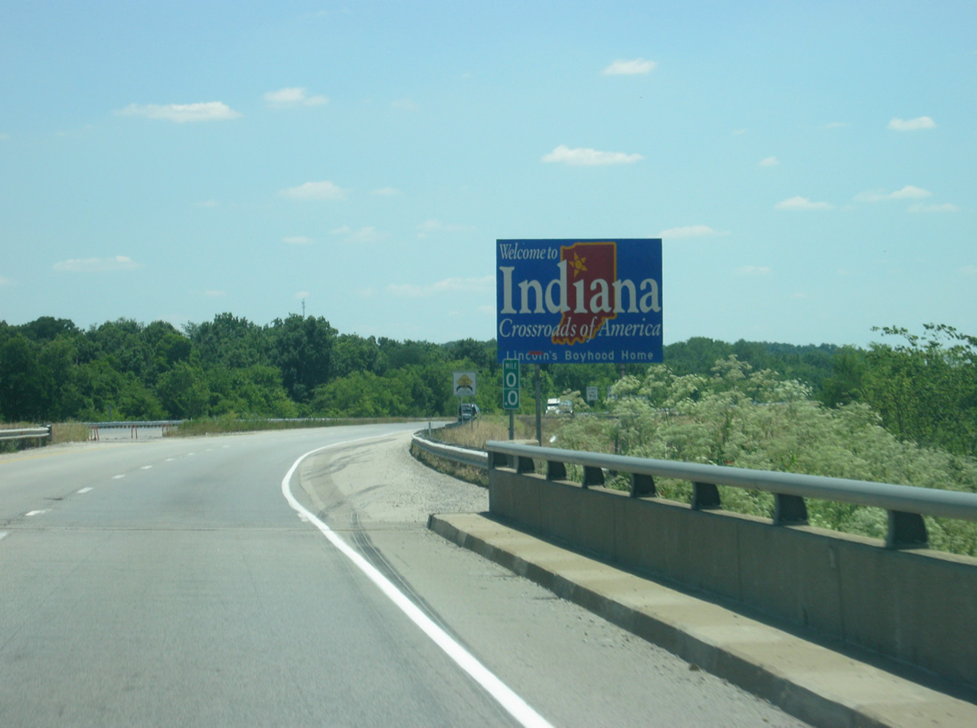
| Interstate 64 enters the Hoosier State of Indiana with a Welcome to Indiana sign posted at the end of the Wabash River Bridge. 06/07/12 |
|
| A view of the first Interstate 64 east shield in Indiana. 06/07/12 |
|
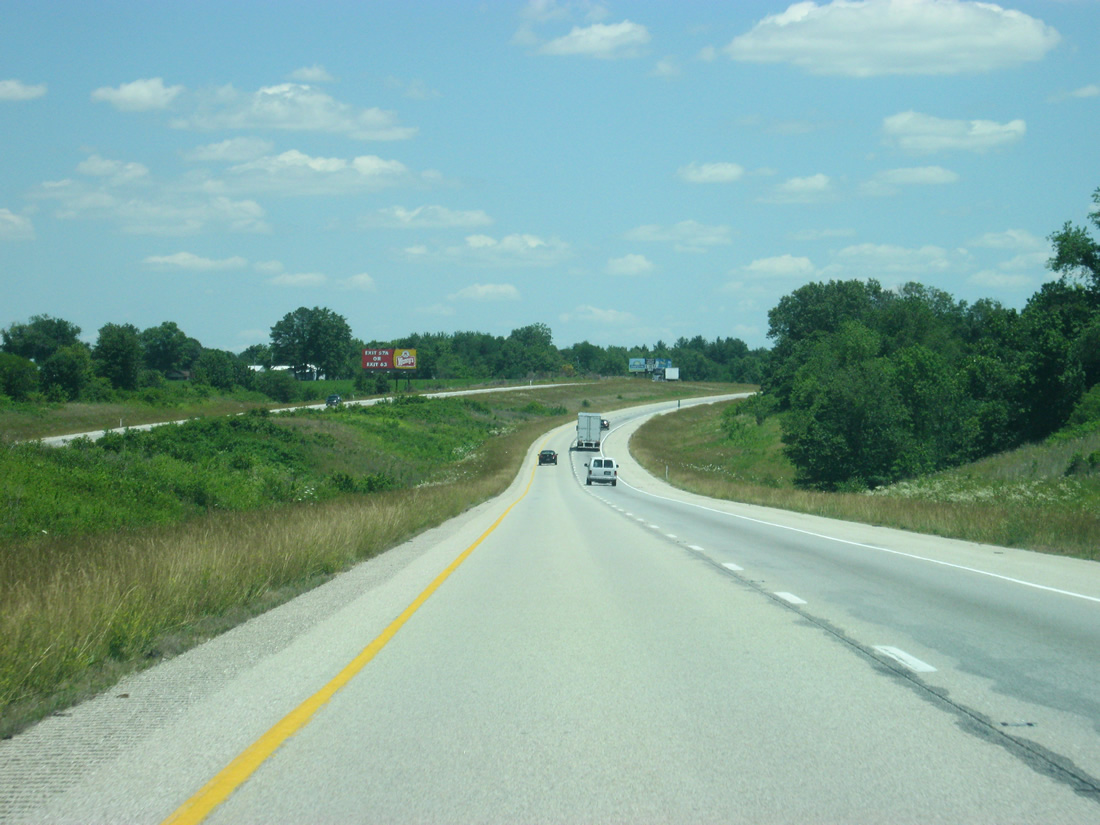
| Interstate 64 travels to the southeast for the first four miles between the Wabash River and the first interchange with SR 69, not to be confused with Interstate 69 which lies further east. 06/07/12 |
|
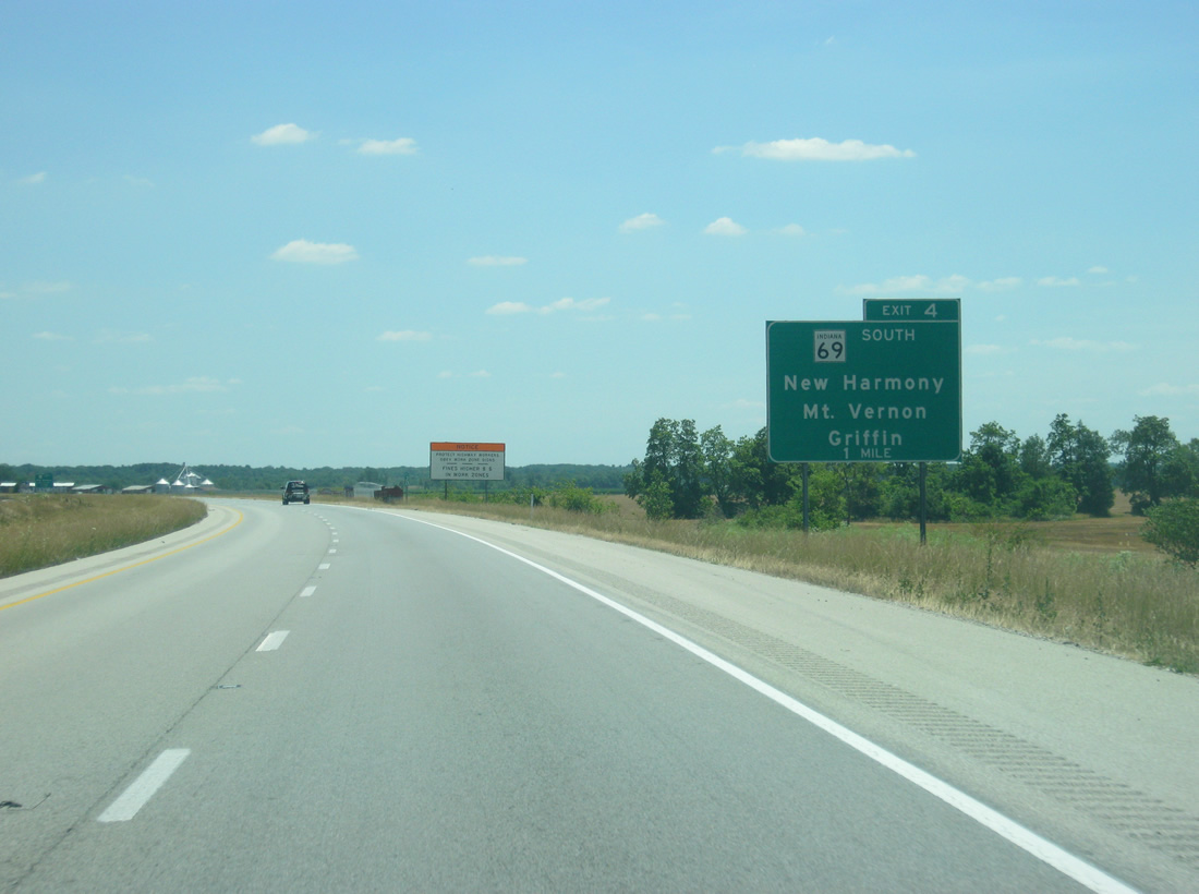
| Interstate 64 at the one mile advance sign for SR 69 (Wheeler Road) south and Main Street north to Griffin. 06/07/12 |
|
| SR 69 begins at the Exit 4 diamond interchange and meanders south 22.9 miles to New Harmony (SR 66) and Mt. Vernon (SR 62). The highway forms an important link between the Port of Indiana at Mt. Vernon and Interstate 64. 06/07/12 |
|
| Exit 4 connects motorists to New Harmony and the historic sites associated with the community. Harmonie State Park lays a couple of miles to the south of New Harmony via SR 69 and SR 269. 06/07/12 |
|
| A guide sign directs motorists to the Exit 4 off-ramp for SR 69 (Wheeler Road) south and Main Street north into Griffin. New Harmony lies about seven miles to the south via SR 69 and SR 66 and the Posey County seat of Mt. Vernon is 22 miles to the south along the Ohio River. 06/07/12 |
|
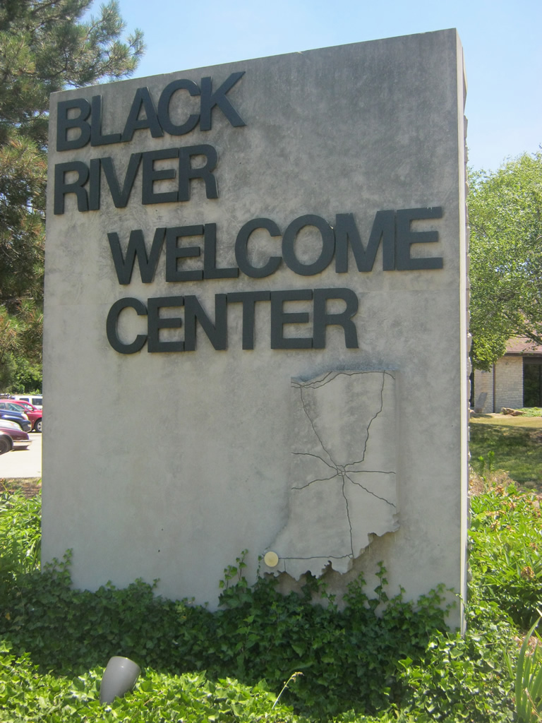
| East of Exit 4, the Black River Welcome Centers serves eastbound Interstate 64 travelers. The next rest area lies 50 miles away in Spencer County. Interstate 64 has two rest areas in each direction across Indiana. 06/07/12 |
|
| The off-ramp for the Black River Welcome Center turns off of Interstate 64 east. 06/07/12 |
|
| A gateway sign for the Black River Welcome Center indicates the center's location along Interstate 64 in Southwest Indiana. 06/07/12 |
|
| East of the welcome center, roadways of Interstate 64 travel through a hilly area near Stewartsville and Barrett ahead of Exit 12. 06/07/12 |
|
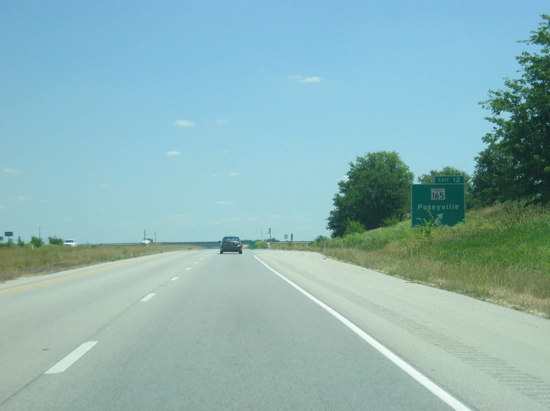
| SR 165 branches west from SR 65 at Owensville to meet Interstate 64 at a diamond interchange (Exit 12) in one mile. 06/07/12 |
|
| SR 165 enters Poseyville south of Interstate 64, following St. Francis Avenue to a merge with SR 68 along Main Street. 06/07/12 |
|
| Exit 12 departs Interstate 64 west to SR 165. SR 165 ends 3.9 miles south of Poseyville at SR 66 (former U.S. 460). 06/07/12 |
|
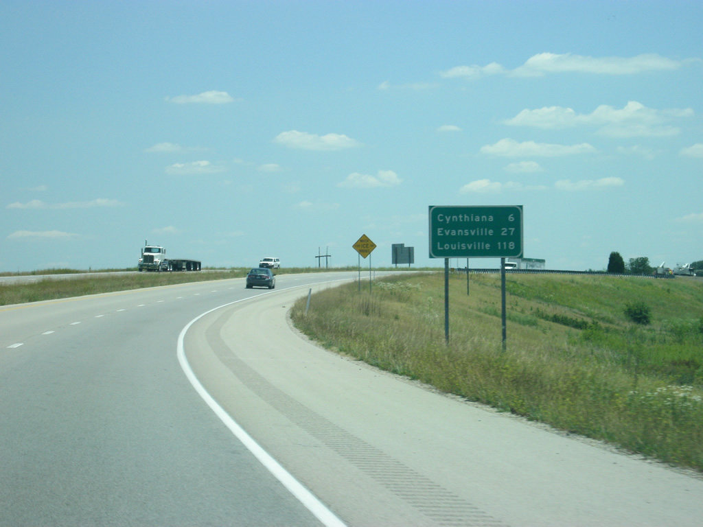
| The town of Cynthiana lies six miles away. Evansville and Louisville follow at 27 and 118 miles away respectively. 06/07/12 |
|
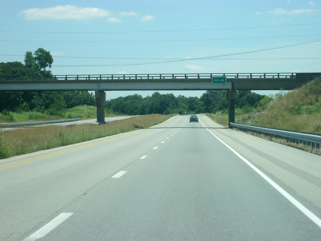
| Interstate 64 east passes underneath SR 68, which runs parallel to the interstate from this point eastward to the town of Dale at U.S. 231. 06/07/12 |
|
| Interstate 64 goes through a mix of fields and trees over slightly rolling hills en route to the Evansville area, but compared with further along the highway this stretch of the interstate is relatively flat. 06/07/12 |
|
| Evansville, the third largest city in Indiana, is served by the next three interchanges. Despite efforts to reroute Interstate 64 to the southern part of the state to better serve the city, Evansville is still 15 miles to the south of the highway, not being connected via interstate until the completion of Interstate 164 (future Interstate 69). 06/07/12 |
|
| Interstate 64 at the one mile approach to SR 65 (Big Cynthiana Road). Cynthiana lies nearby at the cross roads of SR 65 and 68. 06/07/12 |
|
| One half mile east of the Exit 18 diamond interchange with SR 65 (Big Cynthiana Road). The University Parkway, a four lane expressway that will connect the Lloyd Expressway (SR 62) with Diamond Avenue (SR 66), may one day be expanded up toward this interchange as a part of a west side bypass. 06/07/12 |
|
| SR 65 travels 47.7 miles northwest from Evansville to Cynthiana and Owensville and northeast to Princeton and Petersburg. 06/07/12 |
|
| Interstate 64 passes into the far northern edge of Vanderburgh County (home of Evansville) at the off-ramp onto SR 65. 06/07/12 |
|
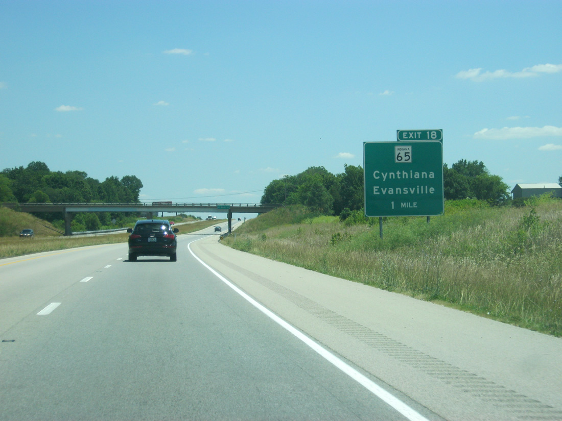
| A grouping of "-villes" greets motorists east of Exit 18. Evansville is now 20 miles away with the Warrick County seat of Boonville at 30 miles. Louisville is 111 miles away. 06/07/12 |
|
| Views of Interstate 64 east in far northern Vanderburgh County. This is where the highway gets its closest to Evansville. 06/07/12 |
|
| For those heading south of Evansville en route to Henderson, Kentucky and points south, Interstate 164 (future Interstate 69) serves as the bypass of the Evansville area via Exit 29A. 06/07/12 |
|
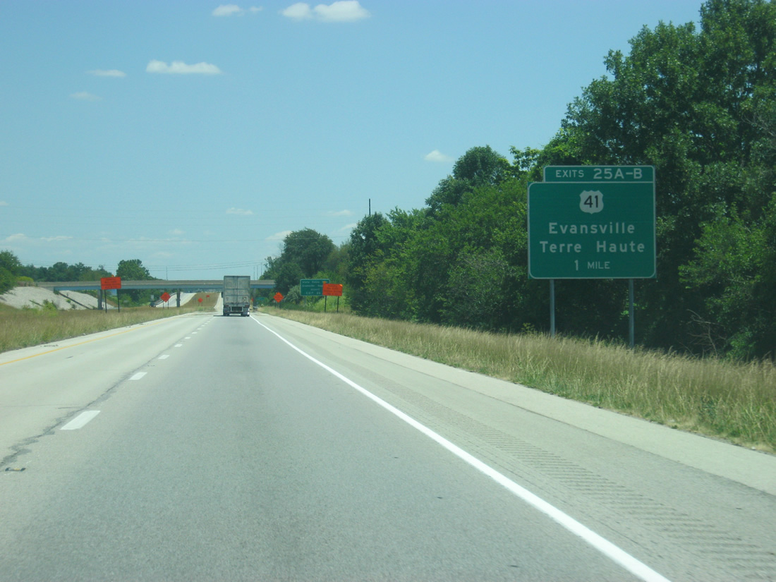
| U.S. 41 comprises a four lane divided highway north from Evansville and Inglefield to cross paths with Interstate 64 at a cloverleaf interchange (Exits 25B/A) in two miles. U.S. 41 represents a major corridor throughout western Indiana, linking Evansville with Henderson, Kentucky to the south and Princeton, Vincennes and Terre Haute to the north. 06/07/12 |
|
| The Indiana State Police Post and Evansville Regional Airport (EVV) are reached from Exit 25A. 06/07/12 |
|
| A guide sign alerts the approach to Exit 25A for U.S. 41 south to Evansville. Upgrades of U.S. 41 to expressway standards occurred to link Evansville with the Interstate 70 corridor at Terre Haute. This was done to provide a better link to Indianapolis, but the western component of that trek was still too much, and Interstate 69, thanks to the Major Moves initiative, is underway to provide a direct link between the capitol city. 06/07/12 |
|
| Now at Exit 25 A-B, a cloverleaf interchange between Interstate 64 and U.S. 41. Going for 280 miles, U.S. 41 maintains four lane expressway standards in conjunction with SR 63 to Northwest Indiana, including Rockville, Attica and Kentland. 06/07/12 |
|
| Exit 25B loops onto the northbound US Route ahead of Haubstadt and Fort Branch. U.S. 41 constitutes a four lane expressway type road from Evansville northward to Princeton, Vincennes and Terre Haute. 11/07/11 |
|
| An Interstate 164 trailblazer resides within Exit 25, perhaps for motorists emanating from U.S. 41 south destined for Henderson, Kentucky in lieu of U.S. 41 through Evansville. 11/07/11 |
|
| Eastbound Interstate 64 reassurance shield posted near the settlement of Warrenton. 11/07/11 |
|
| Three miles west of Interstate 164 along Interstate 64 east. The next town of significance outside the Evansville area is Santa Claus, 43 miles to the east and south via SR 162. Louisville, Kentucky is 100 miles away. 11/07/11 |
|
| Interstate 64 briefly dips back into Vanderburgh County southeast of Warrenton. 11/07/11 |
|
| Forthcoming Exit 29 comprises a cloverleaf interchange with I-69/SR 57 south to Evansville and Henderson, Kentucky and I-69/SR 57 north to Petersburg and Washington. 11/07/11 |
|
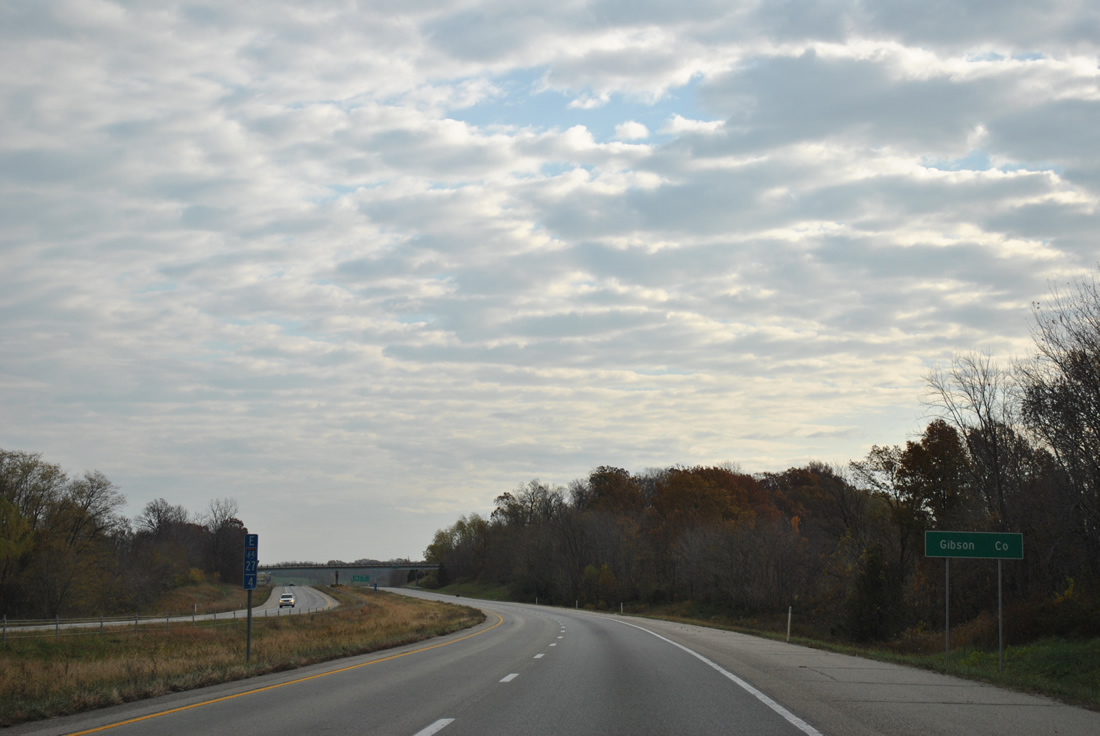
| I-64 east reenters Gibson County on the 1.5 miles leading to Interstate 69. 11/07/11 |
|
| SR 57 follows Interstate 164 south to Exit 19 for Daylight and Interstate 69 north to Wheatonville. Originally Exit 29 consisted of just a diamond interchange between Interstate 64 and the state road. 11/07/11 |
|
| Interstate 164 opened on August 2, 1990 to provide an Interstate connection to Evansville from Interstate 64. The 21.24 mile route directly connects with U.S. 41 south to the Ohio River Bridges.
Interstate 69 south will overlap with the spur to the area of Exit 3, where it will eventually utilize a new bridge into Kentucky. 11/07/11 |
|
| Exit 29B loops onto I-69/SR 57 north. A 1.7 mile freeway opened as I-69 on October 1, 2009. This is Section 1 of the future Interstate 69 corridor leading northeast to Washington, Bloomington and Indianapolis. Sections 2 and 3 are presently under construction to extend I-69 northeast to U.S. 231 near Crane Naval Surface Warfare Center. A December 2012 completion of this portion of freeway is anticipated. 11/07/11 |
|
| Still within the cloverleaf interchange at Exit 29 A-B, Interstate 64 enters Warrick County. 06/07/12 |
|
| East of the interchange with I-69/SR 57, Lynnville is the next community along Interstate 64 at a distance of ten miles with the town of Holland following at 29 miles. Louisville is 97 miles away as I-64 leaves the Evansville metro area. 06/07/12 |
|
| East of I-69/SR 57, the roadways of Interstate 64 split as the highway crosses over the Wabash and Erie Canal and passes through a forested area in northern Warrick County. 06/07/12 |
|
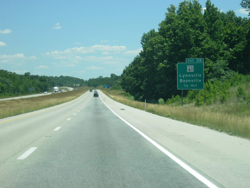
| The diamond interchange at Exit 39 joins Interstate 64 east with SR 61 and Lynnville in one mile. 06/07/12 |
|
| A 64.4 mile route, SR 61 links the Warren County seat of Boonville with Pike County's seat of Petersburg. The state road overall ends at Vincennes to the north and SR 66 near Dayville and the Ohio River to the south. 06/07/12 |
|
| SR 61 travels by a number of strip mines leading south from Lynnville to Boonville. A bypass of Boonville is planned for the west side of town to join the state road with SR 62 leading west to Chandler and Evansville. 06/07/12 |
|
| Holland and Dale follow at 19 and 20 miles away respectively. Louisville is 90 miles away. 06/07/12 |
|
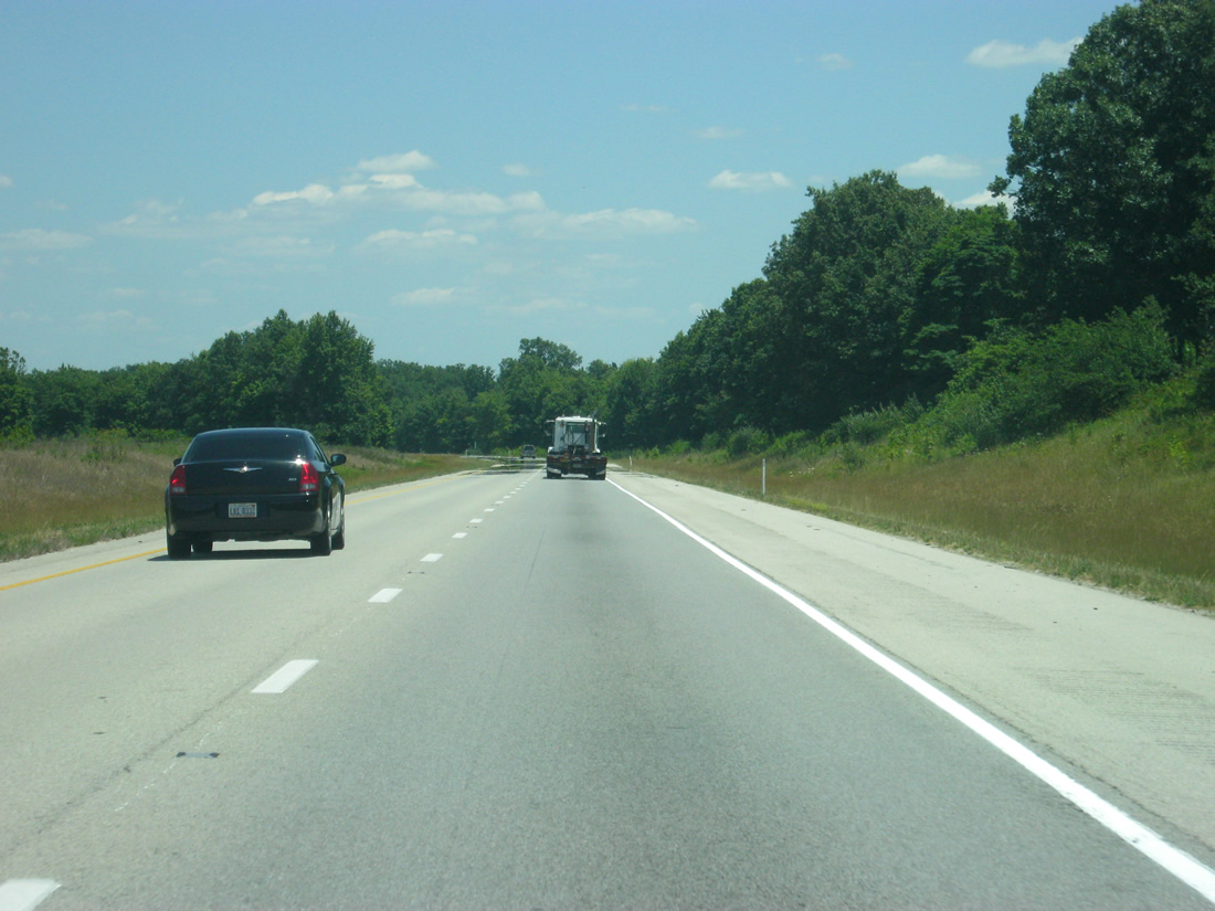
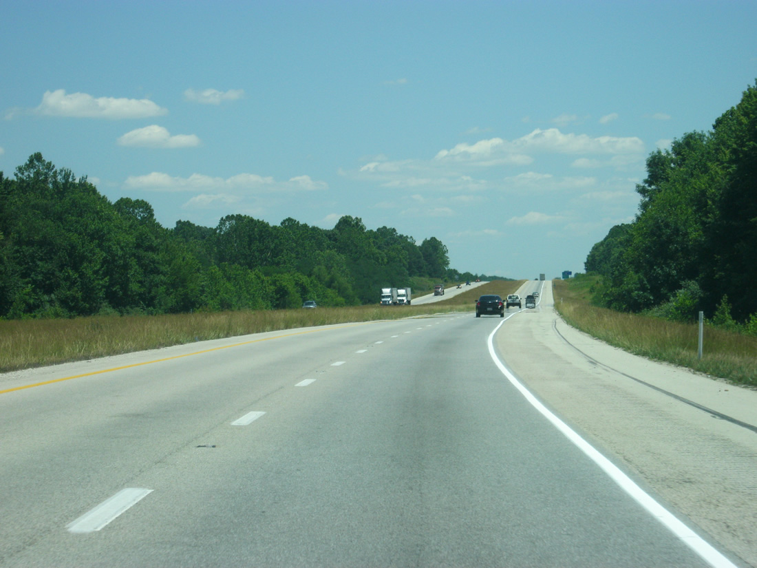
| Not much changes in scenery along the long 15 mile stretch between Exit 39 and 54 along Interstate 64 east, but the winding nature of the highway's roadways give a preview of what lies ahead for the freeway. 06/07/12 |
|
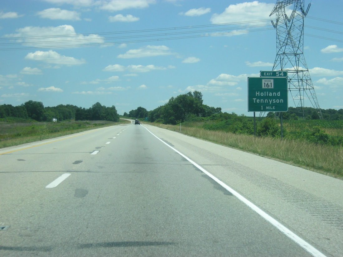
| SR 161 intersects Interstate 64 at Exit 54, but the north-south highway crosses Interstate 64 twice before the interchange. The first picture shows the first crossing, and the second picture shows SR 161 crossing the interstate while multiplexed with SR 68. 06/07/12 |
|
| A diamond interchange connects Interstate 64 with SR 161 at forthcoming Exit 54. 06/07/12 |
|
| SR 161 follows a stair-step orientated route 38.3 miles from the Ohio River at Owensboro, Kentucky to SR 64, west of Huntingburg. 06/07/12 |
|
| Exit 54 connects Interstate 64 with Holland to the north and Tennyson beyond the split with SR 68. SR 68 replaces SR 62 as the companion of I-64 west to Poseyville. 06/07/12 |
|
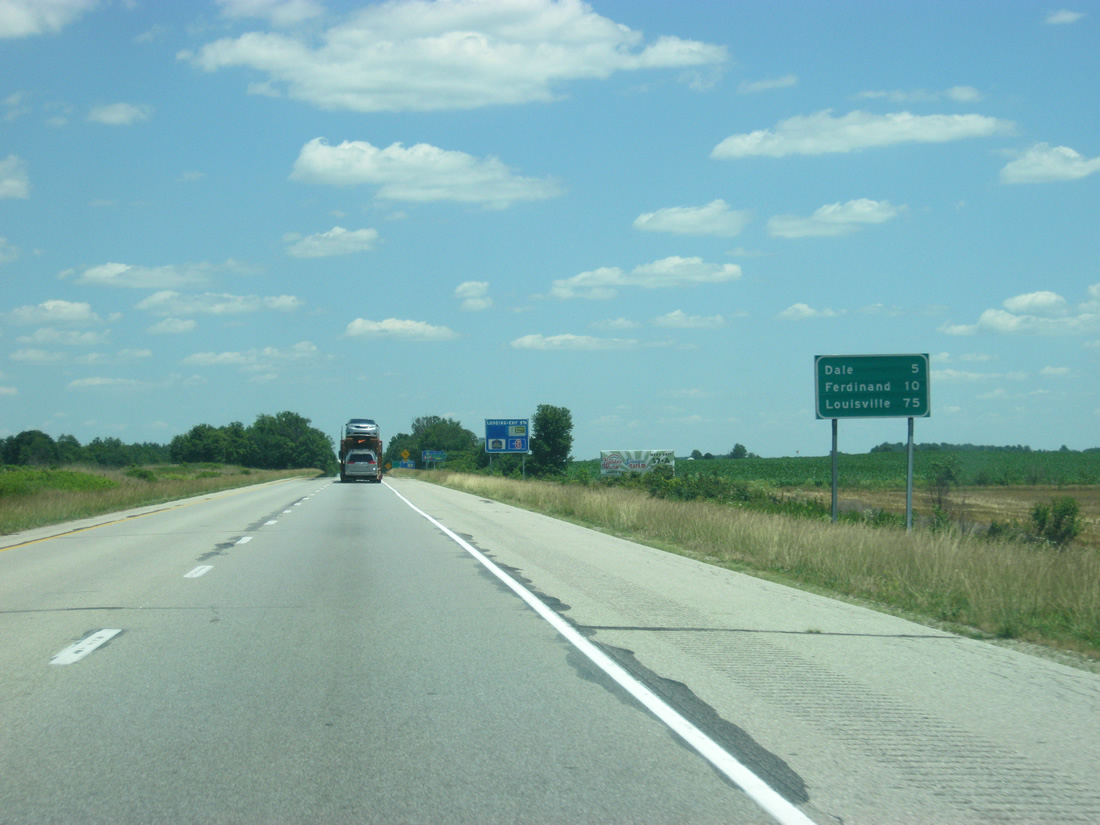
| Distances for the next two communities of Dale (five miles) and Ferdinand (ten miles). Louisville is 75 miles away. 06/07/12 |
|
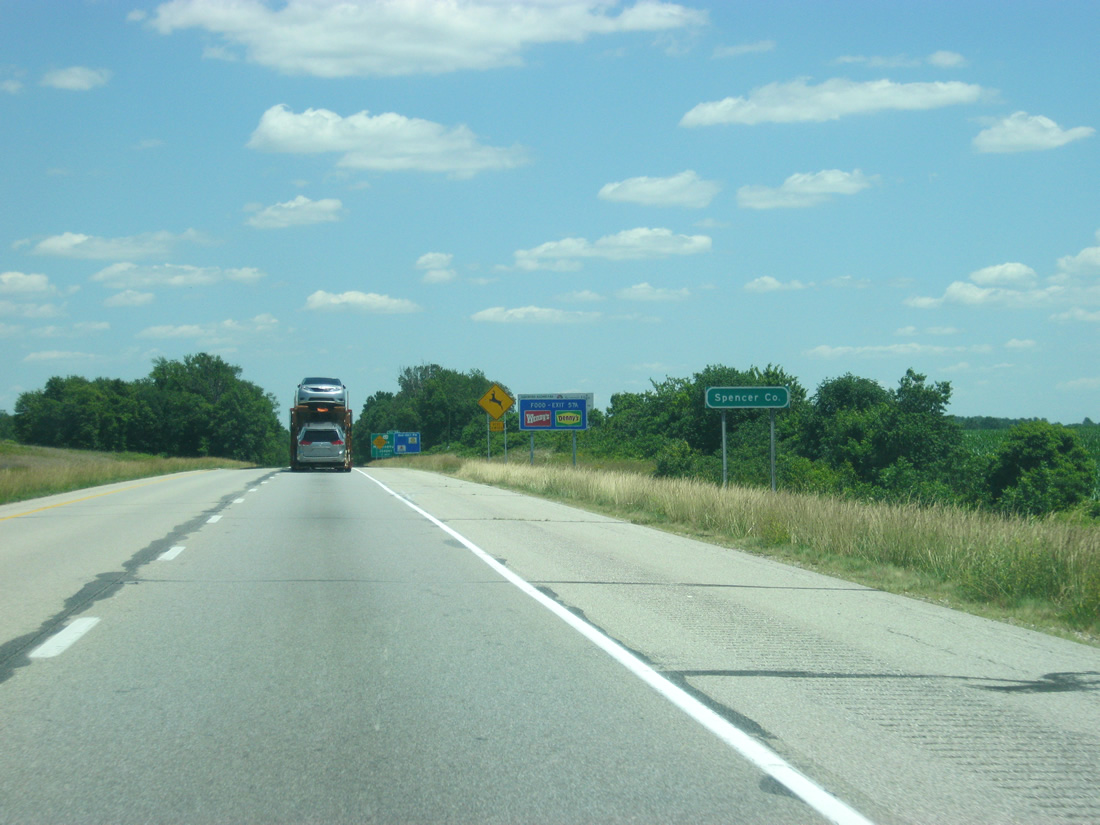
| Interstate 64 crosses into northern Spencer County to the east of Exit 54. 06/07/12 |
|
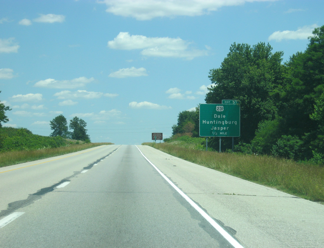
| U.S. 231, now a four lane divided highway in Spencer County, connects Interstate 64 with Dale to the south and Huntingburg at a six-ramp parclo interchange (Exits 57B/A). Construction of the US 231 expressway bypassing Gentryville and Chrisney was completed on March 15, 2011 as part of Governor Mitch Daniels' Major Moves initiative. 06/07/12 |
|
| Holiday World, a theme park including three wooden roller coasters and the Splashin' Safari water park, is located at the SR 162 overlap with SR 245. The theme park is reached via U.S. 231 south and SR 162 east. 35 miles to the south, the third-largest city in Kentucky, Owensboro, is connected to Interstate 64 via the four lane U.S. 231. 06/07/12 |
|
| U.S. 231 almost travels the height of Indiana, tallying 297 miles from the Ohio River near Rockport to St. John in Northwest Indiana. This is the longest signed route in Indiana at present. 06/07/12 |
|
| Travelers bound for Lincoln Boyhood National Memorial or Lincoln State Park are directed onto U.S. 231 south from Exit 57A to SR 162 near Lincoln City. 06/07/12 |
|
| Now two miles away from the Nancy Hanks Rest Area. The second eastbound rest area also doubles as a tourist information center along Interstate 64 eastbound near Johnsburg. 06/07/12 |
|
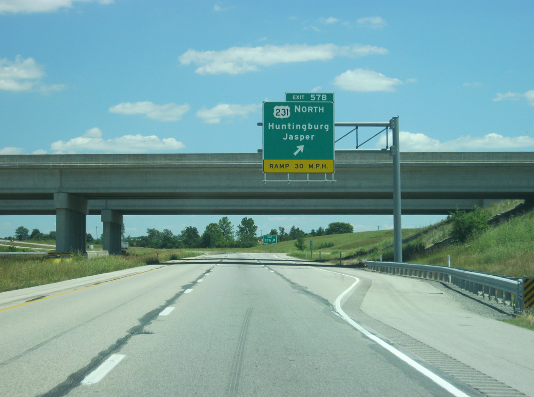
| Exit 57B follows onto U.S. 231 south to Dale and the William H. Natcher Bridge to Maceo, Kentucky. The parclo interchange at Exit 57 A-B replaced a diamond interchange that was located just east of the new interchange. 06/07/12 |
|
| Four-laning of U.S. 231 ends just north of the Spencer / Dubois County line. U.S. 231 continues 9.5 miles from Exit 57A to Huntingburg and 15.2 miles to Jasper. Dubois area leaders, including the 2011-formed Interstate 67 Development Corp. have worked on an idea to upgrade the U.S. 231 corridor through the county as part of a freeway connecting with new Interstate 69 at Washington. They have dubbed the corridor "Interstate 67", though Major Moves money was not allocated for further upgrading of the US Route. 06/07/12 |
|
| East of Exit 57 A-B, the Nancy Hanks Rest Area is now a half mile away. There is 94 mile gap between the Nancy Hanks Rest Area and the Kentucky Welcome Center east of Louisville. 06/07/12 |
|
| Ferdinand is now seven miles away from U.S. 231 and Birdseye is the next community at 23 miles. There are not too many communities along Interstate 64 on the now one-hour trek between U.S. 231 and Louisville, Kentucky. 06/07/12 |
|
| The Nancy Hanks Rest Area turns off of Interstate 64 east. The rest area is named for the mother of President Abraham Lincoln, who died in Spencer County in 1818 and is buried at the Lincoln Boyhood National Memorial. 06/07/12 |
|
| A view of Interstate 64 east of the Nancy Hanks Rest Area. 06/07/12 |
|
| Approaching the town of Ferdinand and Exit 63 diamond interchange with SR 162 along Interstate 64 east. 06/07/12 |
|
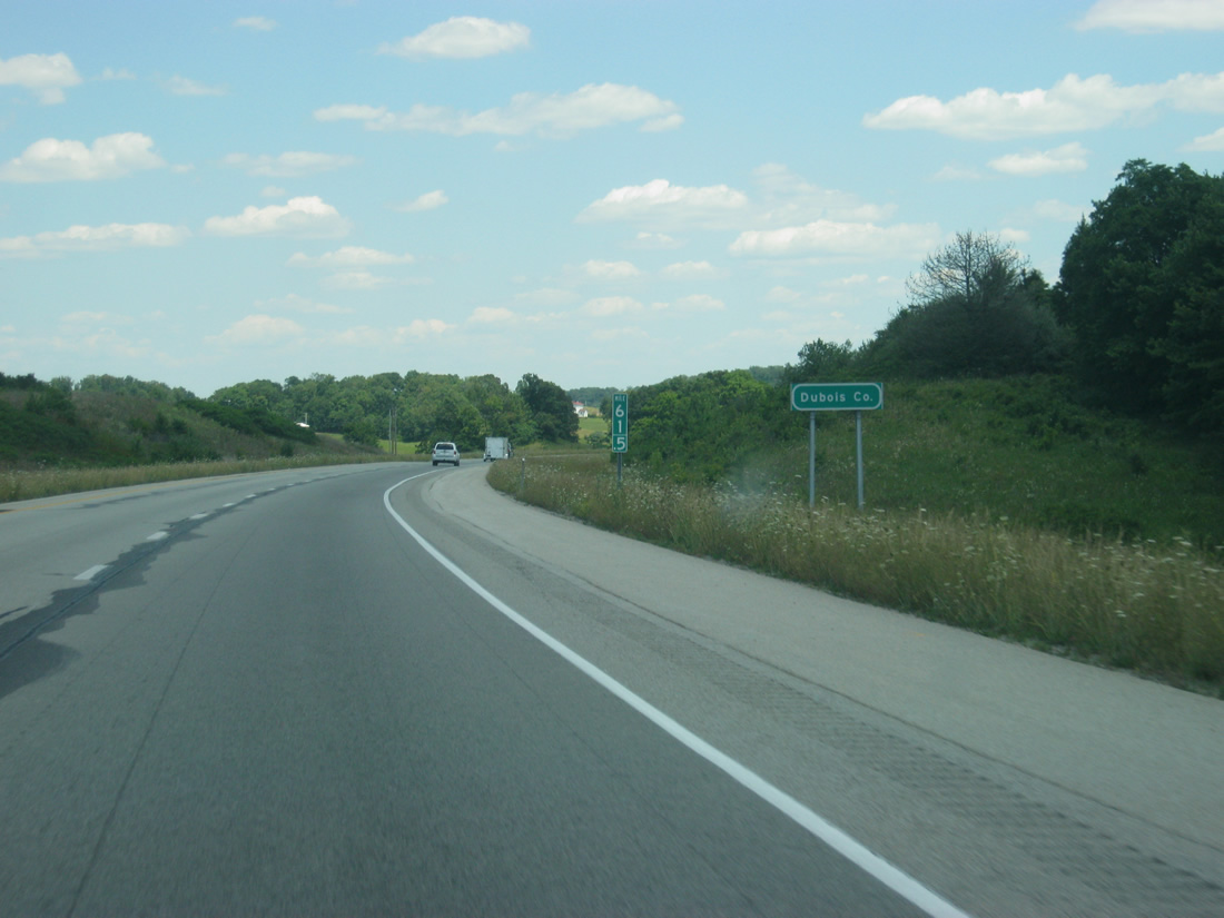
| Approaching Exit 63, Interstate 64 enters Dubois County, crossing over into the Eastern Time Zone for the first time in its journey. 06/07/12 |
|
| The St. Meinrad Archabbey and Seminary is located in the town of St. Meinrad, south along SR 162 and east on SR 62. SR 162 provides a closer approach to the Holiday World amusement park as well. 06/07/12 |
|
| Exit 63 parts ways with the Interstate 64 eastbound mainline for SR 162 south to Santa Claus and north to Ferdinand and Jasper. SR 162 joins the Dubois County seat of Jasper with Ferdinand along a 28 mile arc south to Gentryville. 06/07/12 |
|
| Birdseye is 17 miles away and the Crawford County seat of English is 33 miles off. Louisville is now 66 miles away. 06/07/12 |
|
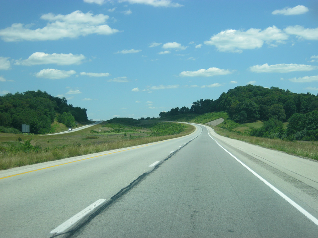
| Sweeping views and graceful curves set the tone of Interstate 64 travel as it heads east from Exit 63 into the heart of the Southern Indiana hill country. 06/07/12 |
|
| Between Exits 63 and 72 the interstate crosses into northern Perry County and reenters the Central Time Zone. Traffic counts were 13,439 vehicles per day (vpd) along this stretch in 2011, among the lower counts along Interstate 64 between Evansville and Leavenworth. 06/07/12 |
|
| Interstate 64 bypasses Uniontown ahead of the diamond interchange (Exit 72) with SR 145 by Kitterman Corners. 06/07/12 |
|
| SR 145 overlaps with SR 64 from the junction with SR 37 to the west to Birdseye, opting for a southerly course from there eight miles to Exit 72. 06/07/12 |
|
| SR 145 continues south 9.2 miles from I-64 to Bristow and 19.9 miles to SR 37 near Tell City. 06/07/12 |
Page Updated 02-24-2013.

 East
East