|
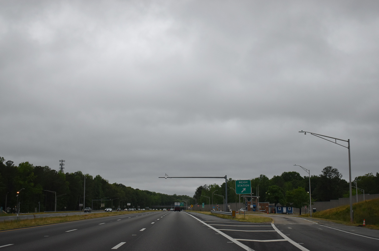
| Weigh stations operate in both directions of Interstate 64 at mile marker 203. 05/29/21 |
|
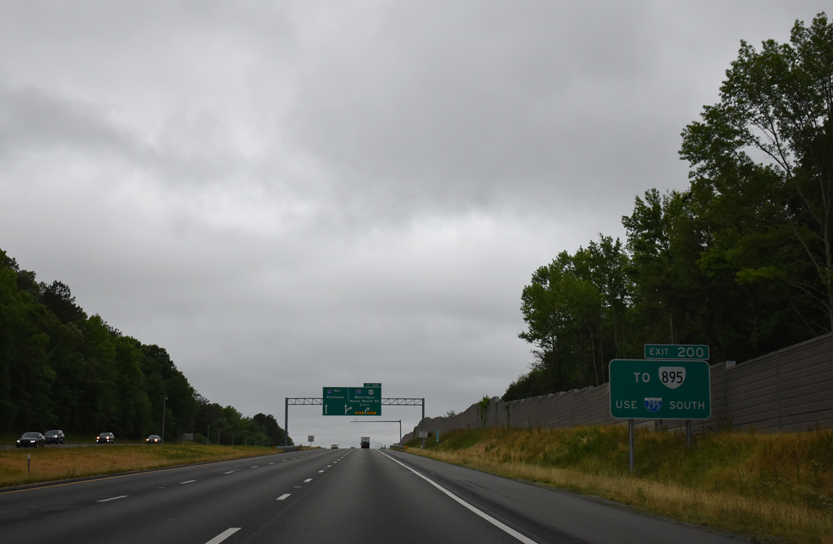
| The first in a series of signs for the cloverleaf interchange (Exit 200) with Interstate 295 references Pochahontas Parkway, the toll road along SR 895. 05/29/21 |
|
| A c/d roadway (Exit 200) separates from I-64 west in two miles to the ramps with I-295, U.S. 60, SR 33 and SR 156. SR 33 and SR 156 are not referenced on guide signs at Exit 200 in either direction of I-64. 05/29/21 |
|
| Sound walls separate the Sandston Weigh Station on I-64 with the adjacent Bradley Acres and Woodville Hills subdivisions. 05/29/21 |
|
| Exit 200 separates from I-64 west one mile beyond the Meadow Road overpass. I-295 serves as a bypass for I-95 around both Petersburg and Richmond. 05/29/21 |
|
| Providing a bypass of Richmond for I-64 west to Charlottesville and Staunton, I-295 converges with I-64 again 23 miles west in the Short Pump area. 05/29/21 |
|
| A lane drop occurs along I-64 west for the c/d roadway (Exit 200) to I-295, U.S. 60/SR 33-156. 05/29/21 |
|
| I-295 connects I-64 with SR 895 (Pocahontas Parkway) at Exit 25 to the south. 05/29/21 |
|
| Two lanes partition from I-64 west at Exit 200. Richmond International Airport (RIC) lies six miles to the southwest. I-64 combines with I-95 north near Downtown Richmond in 11 miles. 05/29/21 |
|
| Two lanes depart from the c/d roadway at Exit 200 for Interstate 295 north to Mechanicsville, I-95 south of Ashland and Glen Allen. 05/29/21 |
|
| Interstate 295 west to Short Pump is one mile longer than I-64 west through Richmond. 05/29/21 |
|
| The ramp for I-95 north to Washington, DC is 14.2 miles from the gore point along the I-64 c/d roadway. 05/29/21 |
|
| Interstate 295 heads south to I-95 around Petersburg. I-95 continues from there to Emporia and Rocky Mount, North Carolina. 05/29/21 |
|
| Interstate 295 leads one mile south from the cloverleaf interchange with I-64 to U.S. 60 (Williamsburg Road) near Seven Pines. 05/29/21 |
|
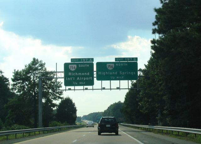
| I-64 advances west from I-295 to Exit 197 for SR 156 near RIC Airport. SR 156 (Airport Drive) meets the freeway between U.S. 60 (Williamsburg Road) and SR 33 (Nine Mile Road). 08/08/04 |
|
| SR 156 heads north from Exit 197B to the suburb of Highland Springs. Continuing east, SR 156 expands to four lanes through a cloverleaf interchange with I-295 at Exit 31 and loops northwest to Old Cold Harbor and Mechanicsville. 08/08/04 |
|
| SR 156 (Airport Drive) north links Interstate 64 with nearby SR 33 (Nine Mile Road). Nine Mile Road loops northward from U.S. 60 through Fair Oaks and Highland Springs to Laburnum Avenue. 08/08/04 |
|
| A $35 million project underway from February 2019 to late 2022 replaces the I-64 bridges over SR 156 (Airport Drive) and converted the full cloverleaf interchange into a six-ramp parclo.2 Airport Drive serves the terminal of Richmond International Airport. SR 156 turns eastward onto U.S. 60 through Sandston and Seven Pines. 06/01/03 |
|
| Oakleys Lane spans Interstate 64 one mile east of Exit 195 for Larburnum Road. Laburnum Road is an arterial running northward from SR 5 (New Market Road) to U.S. 360 (Mechanicville Turnpike) and the city of Richmond. 08/08/04 |
|
| I-64 west at the parclo interchange (Exit 195) with Laburnum Road. Laburnum Road becomes SR 197 within the city limits of Richmond. Like SR 73 (Parham Road) to the north, Laburnum Road represents one of several ring roads within the Richmond metropolitan area. 08/08/04 |
|
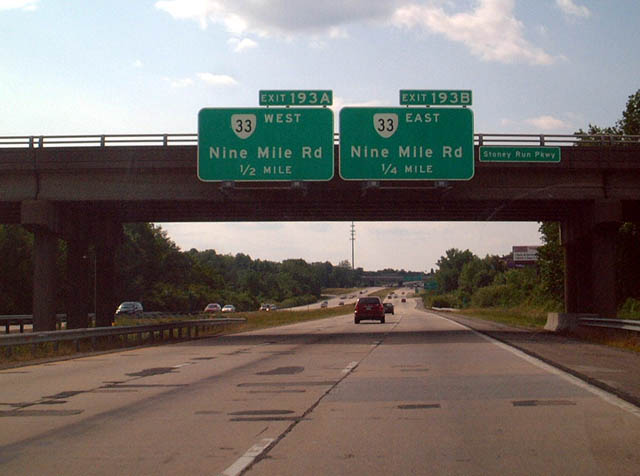
| A three quarter cloverleaf interchange joins I-64 with SR 33 (Nine Mile Road) at Exit 193. SR 33 continues from the southern terminus of U.S. 33 in the city of Richmond to Stingray Point on Chesapeake Bay. 06/01/03 |
|
| Exit 193B leaves I-64 west for SR 33 (Nine Mile Road) eastbound. SR 33 intersects Laburnum Avenue 1.3 miles to the east en route to Highland Springs. 08/08/04 |
|
| Exit 193A departs for SR 33 west (Nine Mile Road) into the city of Richmond. Nine Mile Road transitions into 25th Street through the Church Hill neighborhood of the city. The intersection of Broad and 25th Streets, where U.S. 60 meets U.S. 33, represents the west end of SR 33. 08/08/04 |
|
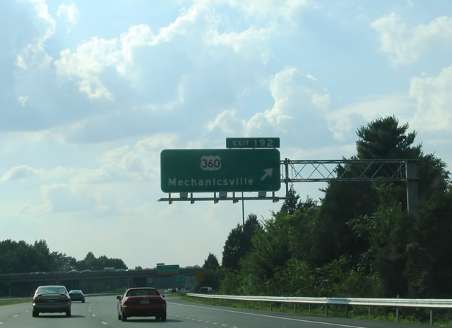
| Interstate 64 arcs northwest toward a parclo interchange (Exit 192) with U.S. 360 (Mechanicsville Turnpike) located just inside the Richmond city limits. U.S. 360 travels through Downtown via 17th and 14th Streets among other streets. 06/01/03 |
|
| Exit 192 ties into the intersection of U.S. 360 (Mechanicsville Turnpike) and Magnolia Street. Magnolia Street comprises a divided boulevard into the Hotchkiss Field area of the city. U.S. 360 reaches Mechanicsville four miles to the north. 08/08/04 |
|
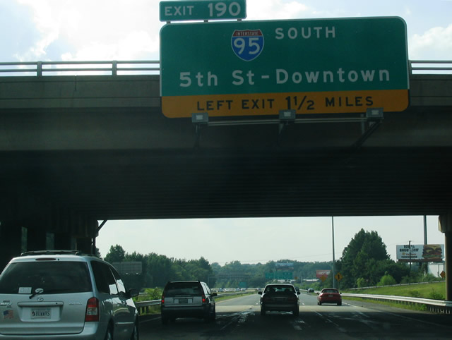
| Interstate 64 merges with I-95 (Richmond-Petersburg Turnpike) in 1.5 miles beyond Left Exit 190 for 5th Street and Downtown Richmond. 08/08/04 |
|
| Westbound I-64 separates with two lanes continuing onto I-95 north and two for Left Exit 190 to both I-95 south for Petersburg and 5th Street south to the Richmond Coliseum. 08/08/04 |
|
| Interstate 64 elevates over Valley Road, Hospital Street and CSX Railroad lines leading to the two wye interchange (Exit 190) with I-95 and 5th Street. 5th Street heads two blocks southward to SR 33 (Leigh Street) and the Richmond Coliseum. 06/01/03 |
|
| Left Exit 190 leads directly onto 5th Street south at the entrance ramp for I-95 south. The Richmond-Petersburg Turnpike reaches the city of Petersburg and north end of Interstate 85 in 24 miles. 06/01/03 |
|
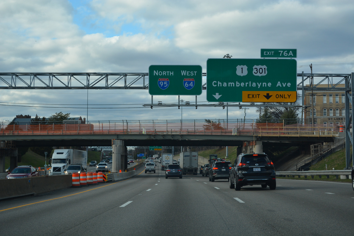
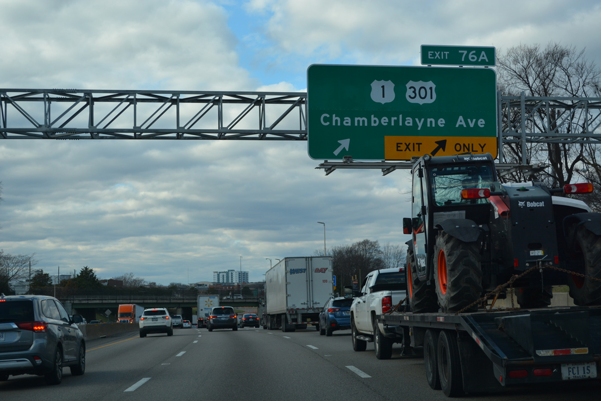
| U.S. 1/301 overlap north from Petersburg and Colonial Heights into Richmond along Belvidere Street. The two routes meet I-64/95 at Exit 76, just south of Chamberlayne Parkway. 12/16/22 |
|
| Exit 76 A joins I-64/95 (Richmond Petersburg Turnpike) west with Chamberlayne Parkway just south of Brook Road and U.S. 1/301 by the Gilpin Court neighborhood. 12/16/22 |
|
| These confirming markers precede the site where the Richmond Petersburg Turnpike main line toll plaza was located. 12/16/22 |
|
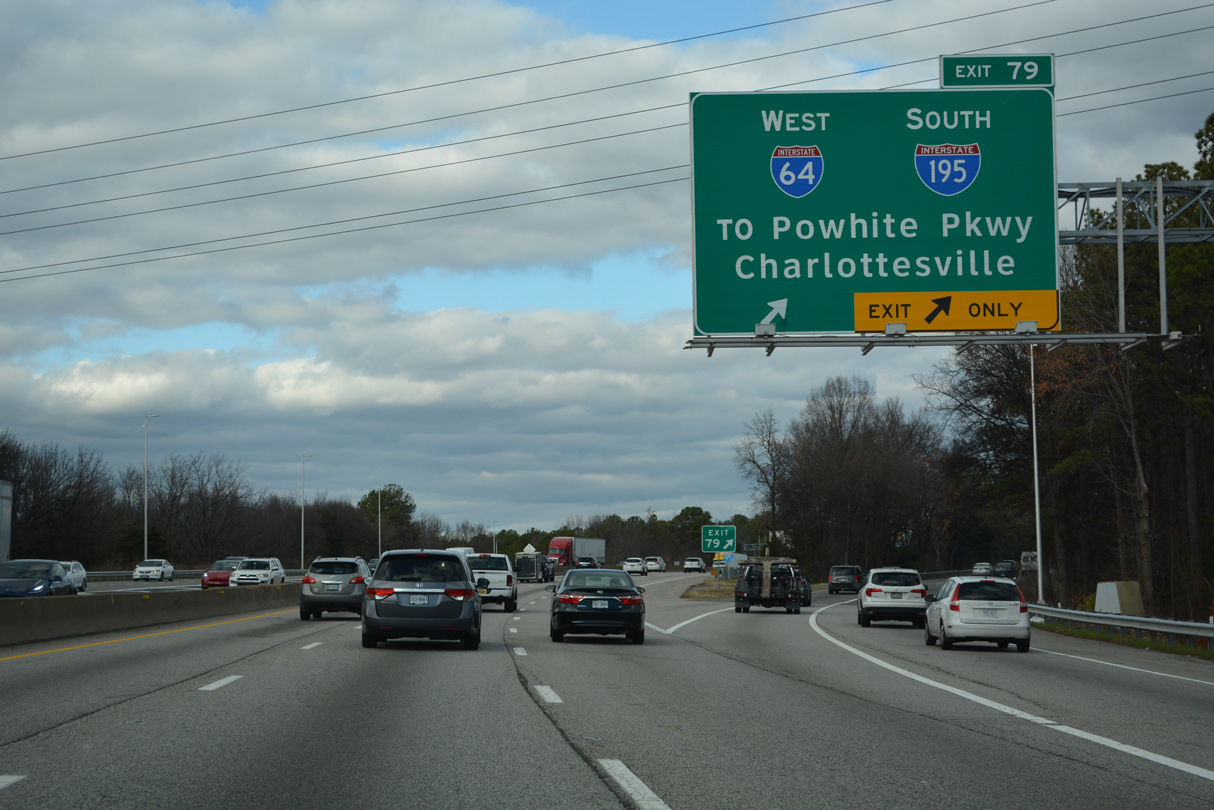
| Advancing north through an S-curve, I-64/95 meet Interstate 195 (Beltline Expressway) at overlapping directional T interchanges (Exit 79). 12/16/22 |
|
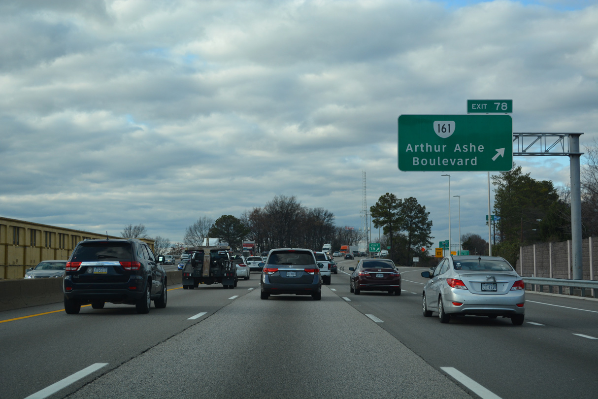
| SR 161 (Arthur Ashe Boulevard) angles northeast from the Museum District and Scott's Addition to I-64/95 at Exit 78. 12/16/22 |
|
| Exit 78 connects I-64/95 westbound with Hermitage Road 0.17 miles south of Brookland Parkway. SR 161 overtakes Hermitage Road north to Bryan Park and Lakeside. Hermitage Road south to Robin Hood Road links Exit 78 with SR 161. 12/16/22 |
|
| Interstate 195 (Beltline Expressway) spurs 3.50 miles southwest from I-95 by Bryan Park to SR 195 (Downtown Expressway) by the Stadium neighborhood. 12/16/22 |
|
| SR 161 travels 14.04 miles overall north to U.S. 1 (Brook Road) at Lakeside and south to I-95 at Exit 69 in south Richmond. 12/16/22 |
|
| SR 161 along Boulevard was dedicated to Tennis legend and Richmond native, Arthur Ashe, Jr. on June 22, 2019. 12/16/22 |
|
| Interstate 195 and SR 195 form a loop west from Downtown Richmond to SR 76 (Powhite Parkway) and I-64/95 (Richmond Petersburg Turnpike). Funds for I-195 were acquired in 1968 and the freeway was completed southwest to SR 76 (Powhite Parkway) in July 1975.1 12/16/22 |
|
| I-195 (Beltine Expressway) south to SR 147 (Cary Street Road) leads to the University of Richmond. 12/16/22 |
|
| Interstate 95 northbound reduces to two lanes at the Bellevue Avenue overpass just beyond the separation with I-64 west. 12/16/22 |
|
| Curving north by the Rosedale neighborhood, I-64 west partitions from I-95 north with two lanes at Exit 79. Interstate 95 continues from Richmond to Ashland, Fredericksburg and Washington, DC. 12/16/22 |
|
| I-64/95 overlap for 3.20 miles to the north end of the Richmond Petersburg Turnpike at Exit 79. 12/16/22 |
|
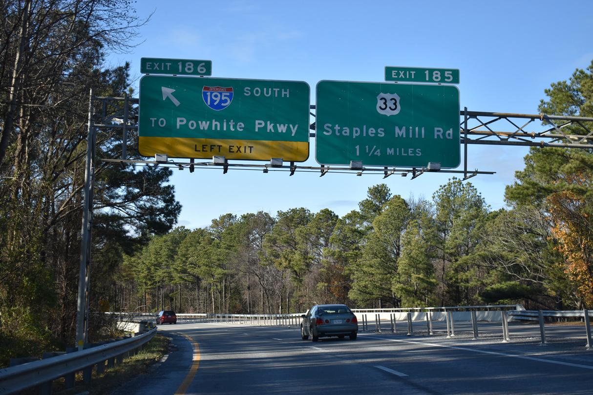
| Left Exit 186 departs I-64 west for I-195 south opposite of the entrance ramp from SR 197 (Laburnum Avenue). 12/17/20 |
|
| A 13.9 mile long toll road to SR 288, SR 76 (Powhite Parkway) branches south from I-195 at the Stadium neighborhood. 12/17/20 |
|
| Interstate 195 was designated in 1986 to provide ingress and egress to the Richmond central business district. 12/17/20 |
|
| Interstate 64 reenters Henrico County west of I-195 alongside Joseph Bryan Park. 12/16/16 |
|
| Westbound I-64 expands to four lanes with the addition of traffic from I-95/195. 12/16/16 |
|
| The succeeding exit is for U.S. 33 (Staples Mill Road). U.S. 33 separates from U.S. 250 (Broad Street) 1.25 miles to the south en route to Lakeside and Laurel. 12/16/16 |
|
| U.S. 33 parallels I-64 to the north between Glen Allen and Harrisonburg. Overall U.S. 33 constitutes a diagonal route northwest to Elkhart, Indiana. 12/16/16 |
|
| Exit 185 partitions into two ramps for U.S. 33 (Staples Mill Road). U.S. 33 overlaps with U.S. 250 (Broad Street) east through northern reaches of the Richmond central business district. 12/16/16 |
|
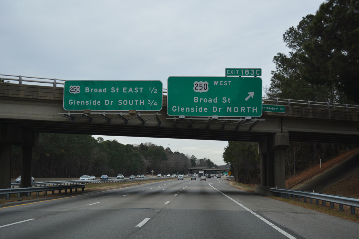
| Back to back parclo interchanges follow U.S. 33 (Staples Mill Road) along I-64 west with U.S. 250 (Broad Street) and Glenside Drive. 12/16/16 |
|
| U.S. 250 accompanies the Interstate 64 corridor from Exit 183C west to Staunton. 12/16/16 |
|
| Exit 183C links I-64 west with U.S. 250 (Broad Street) west ahead of Glenside Drive. 12/16/16 |
|
| Exit 183B loops onto U.S. 250 (Broad Street) east ahead of a commercialized stretch south to Sauer's Gardens in Richmond. 12/16/16 |
|
| Glenside Drive extends west from SR 356 at U.S. 33 (Staples Mill Road) to I-64 at Exit 183A, Crestview and Monument Avenue at Horsepen Road. 12/16/16 |
|
| Parham Road is a principal arterial weaving west from U.S. 301 at Chamberlayne to Laurel and Interstate 64 at Exit 181. 12/16/16 |
|
| Entering the six-ramp parclo interchange (Exit 181) with Parham Road on Interstate 64 west. 12/16/16 |
|
| Exit 181A loops onto Parham Road south. Parham Road meets SR 6 (Patterson Avenue) in 2.2 miles at Tuckahoe and SR 150 (Chippenham Parkway) at River Road in 4.2 miles. 12/16/16 |
|
| Interstate 64 proceeds west to pass under SR 157 (Pemberton Road) south of Innsbrook. 12/16/16 |
|
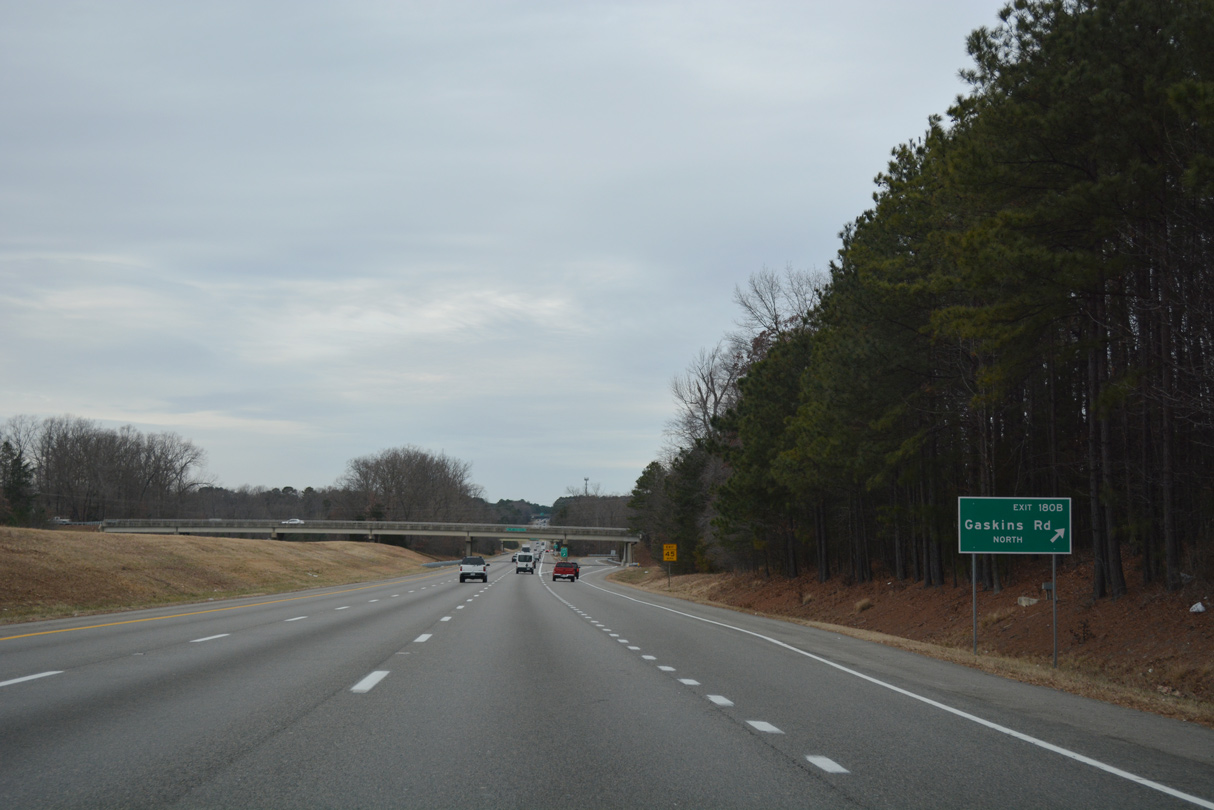
| A cloverleaf interchange connects Interstate 64 with Gaskins Road at Exit 180. 12/16/16 |
|
| Gaskins Road is a minor arterial extending southwest from SR 157 (Springfield Road) at Hungary Road to River Road in Tuckahoe. 12/16/16 |
|
| Interstate 64 advances west alongside a number of apartment complexes, Deep Run Office Park and Westere Commons. 12/16/16 |
|
| U.S. 250 (Broad Street) converges with Interstate 64 again at a three quarter cloverleaf interchange (Exit 178). 12/16/16 |
|
| Exit 178B links with U.S. 250 (Broad Street) east back to Henrico. Heading west, U.S. 250 continues through the community of Short Pump en route to Oilville and Gum Spring in Goochland County. 12/16/16 |
|
| U.S. 250 (Broad Streets) shifts to the south side of I-64 ahead of Interstate 295 at Short Pump. I-64 and U.S. 250 meet again directly at Charlottesville. 12/16/16 |
|
| An auxiliary lane opens along I-64 west to Exit 177 for Interstate 295 southbound to Glen Allen and I-95 to Washington. 12/16/16 |
|
| Interstate 295 loops northeast from Exit 177, 9.4 miles to I-95 and southeast 23.9 miles to I-64 again near Sandston. 12/16/16 |
|
| A flyover was constructed at the half cloverleaf interchange joining I-64/295 from 2006 to 2009. Had SR 288 been aligned further east, it would have tied into this exchange from the south. 12/16/16 |
|
| The southwestern bypass of Richmond, SR 288 stems south from Interstate 64 at the ensuing exit west of I-295. 12/16/16 |
|
| Interstate 64 passes just north of Short Pump Town Center and West Broad Marketplace, a mixed use development built in 2015-17. 12/16/16 |
|
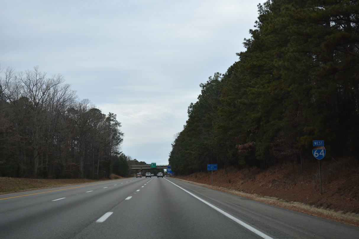
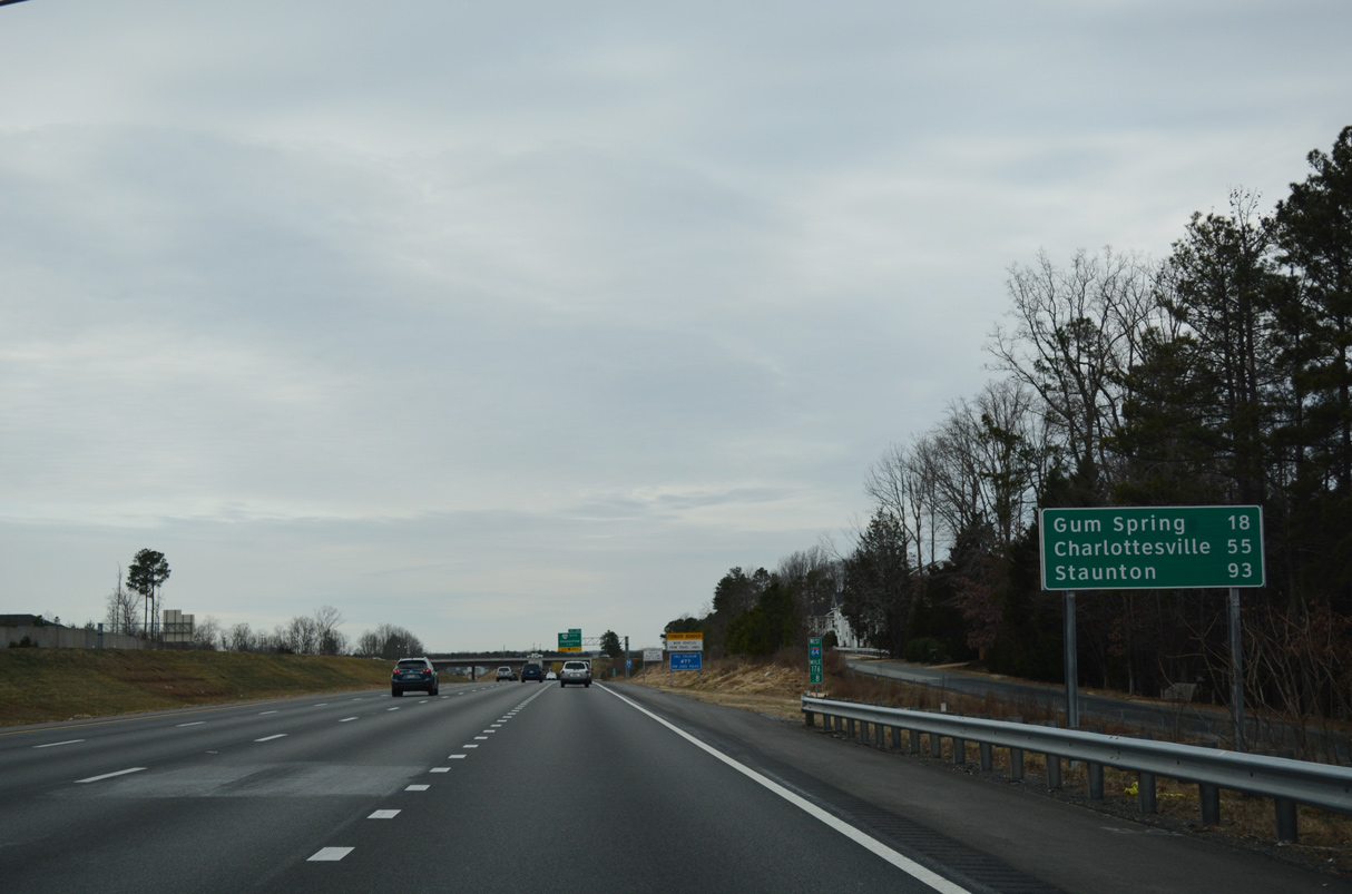
| Leading away from the Richmond area, Interstate 64 travels 18 miles to U.S. 522 at Gum Spring, 55 miles to Charlottesville and 93 miles to Staunton and I-81. 12/16/16 |
|
| SR 288 is a suburban freeway loop southeast to Midlothian, Chesterfield and Interstate 95 near Chester. 12/16/16 |
|
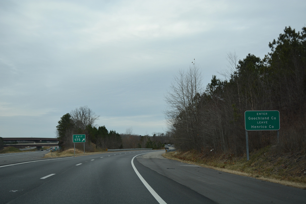
| The directional T interchange (Exit 175) with SR 288 (World War II Veterans Memorial Highway) south opened in late 2003. 12/16/16 |
|
| Constructed in stages from 1988 to 2004, State Route 288 opened up areas for development including Westchester Commons in 2008 at the exchange with U.S. 60 in Midlothian. 12/16/16 |
|
| Interstate 64 crosses into Goochland County at the gore point for Exit 175. 12/16/16 |
Page Updated 02-20-2023.

 West
West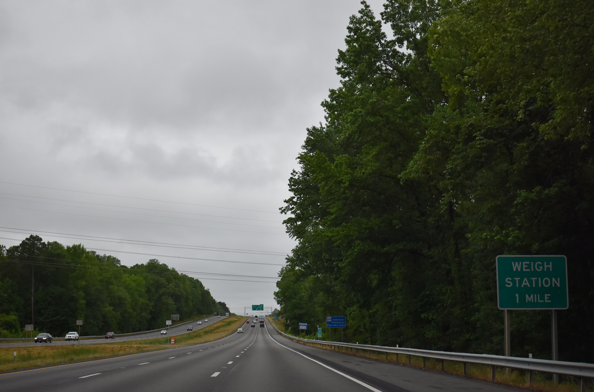


 North
North