|
| Turning northwestward, Interstate 64 meets U.S. 11 (Lee Highway) at a diamond interchange (Exit 55) on the outskirts of East Lexington. 06/17/05 |
|
| Exit 55 leaves Interstate 64 west for U.S. 11 (Lee Highway) south into Lexington and north to SR 39 (Maury River Road). SR 39 travels 58.86 miles from U.S. 11 to West Virginia west of Warm Springs. The Virginia Scenic Byway reaches Goshen in 20 miles. 06/17/05 |
|
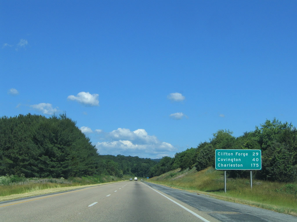
| The final Virginia control cities for Interstate 64 west include Clifton Forge (U.S. 220 south) and Covington (U.S. 220 north). 06/17/05 |
|
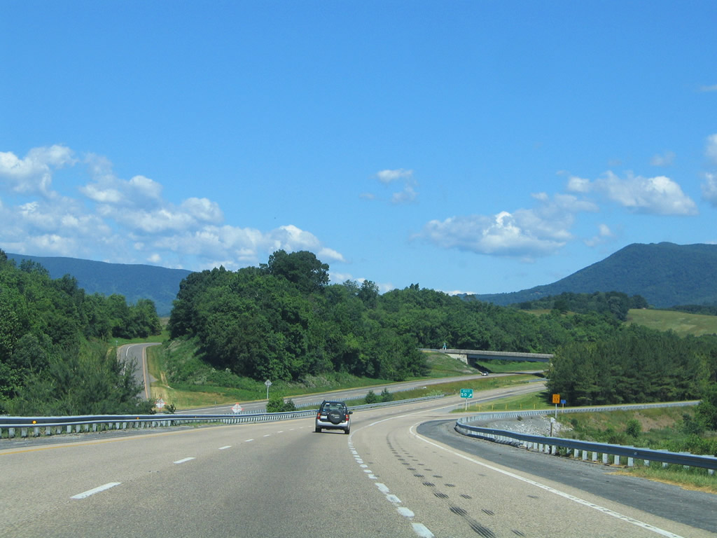
| Turning northward across the Maury River on Interstate 64 west outside Lexington. Forge and Bratton Mountains rise in the distance. 06/17/05 |
|
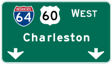
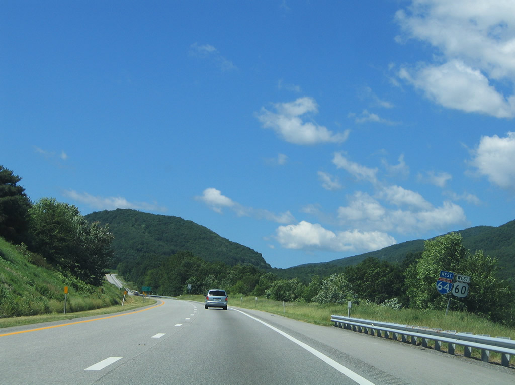
| U.S. 60 (Midland Trail) exits Lexington and winds westward by Rich and Brushy Hills to meet Interstate 64 near Kerrs Creek. U.S. 60 combines with the freeway west to Clifton Forge and Covington. SR 850 follows old U.S. 60 (Midland Trail) west to Denmark and North Mountain. 06/17/05 |
|
| SR 623 (Fredericksburg Road) continues north from a diamond interchange (Exit 50) with I-64/U.S. 60 to Fredericksburg and SR 39 near Rockbridge Baths. 06/17/05 |
|
| White Rock, Dale and Ragged Mountains rise to the north along with Coopers Knob and Forge Mountain. 06/17/05 |
|
| Clifton Forge lies 24 miles to the west, beyond North, Brushy and Mill Mountains. Charleston, the West Virginia capital, is 170 miles to the northwest via Interstate 77. 06/17/05 |
|
| I-64/U.S. 60 ascend onto North Mountain leading to the diamond interchange with SR 780 (Scenic Drive). SR 780 connects Exit 43 with parallel SR 850 (old U.S. 60) near California. 06/17/05 |
|
| Entering the diamond interchange (Exit 43) with SR 780 (Scenic Drive) on I-64/U.S. 60 west. SR 780 briefly overlaps with SR 850 before continuing north to California and SR 39 at Goshen. 06/17/05 |
|
| Reassurance shields posted along Interstate 64 west between Exit 43 and the Alleghany County line. 06/17/05 |
|
| Clifton Forge is 17 miles ahead, followed by Covington, the Alleghany County seat, in 28 miles. 06/17/05 |
|
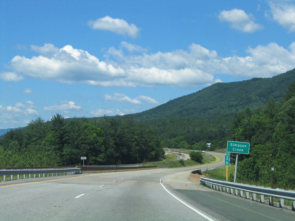
| I-64/U.S. 60 west parallel Simpson Creek in a valley between Brushy and North Mountains. 06/17/05 |
|
| Truckers are advised to check their brakes before using Exit 35 to SR 269 (Longdale Furnace Road) west and SR 850 (Mountain Road) east. SR 269 continues along the former U.S. 60 alignment from Exit 35 through Longdale Furnace. 06/17/05 |
|
| SR 269 follows Longdale Furnace Road (old U.S. 60) 6.60 miles between Exit 35 and 29. SR 269 was commissioned in 1984 when U.S. 60 shifted to the freeway.1 06/17/05 |
|
| I-64 spans Simpson Creek within the diamond interchange at Exit 35 and Longdale Furnace. 06/17/05 |
|
| I-64U.S. 60 west encircle Mill Mountain westward to the Cowpasture River and Clifton Forge. Bearwallow, Rich Patch and Horse Mountains rise to the west. 06/17/05 |
|
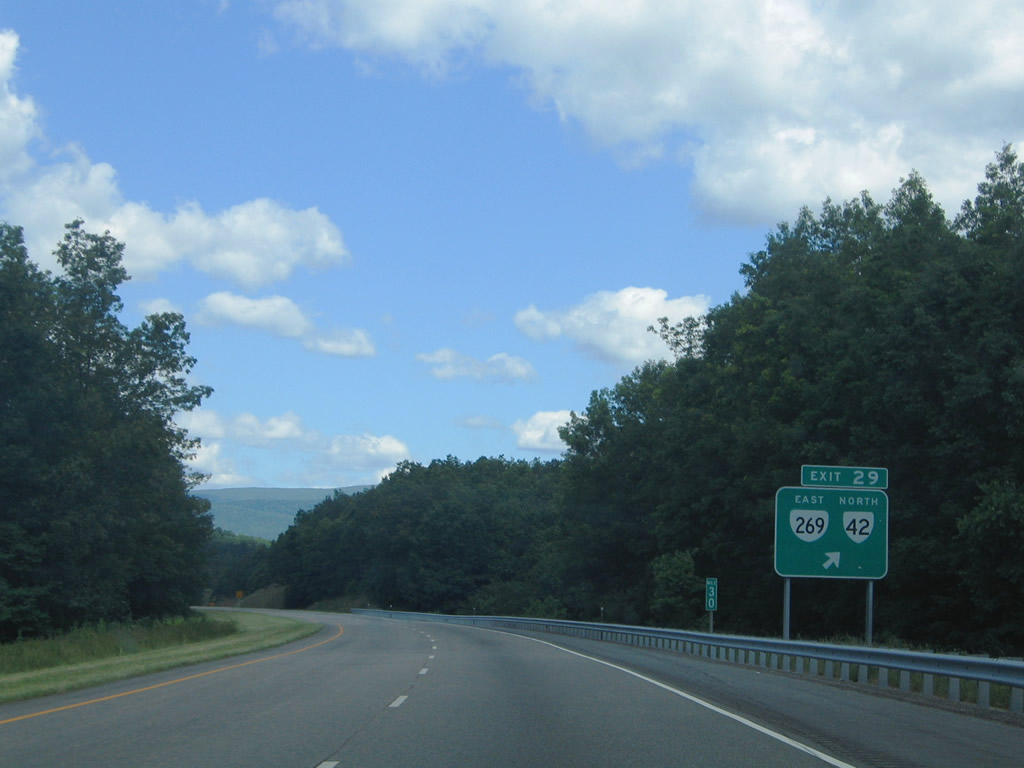
| SR 269 concludes across from the south end of the north segment of SR 42 at Exit 29 near Longdale. 06/17/05 |
|
| Exit 29 departs I-64/U.S. 60 west for SR 269 (Longdale Furnace Road) east, SR 42 (Forty Two Road) north and SR 632 (Old U.S. 60) west. SR 42 lines Rough Mountain northeastward on the 17 mile drive to Millboro Springs. 06/17/05 |
|
| U.S. 60 remains on I-64 to bypass Clifton Forge between Exit 27 and 24. U.S. 60 Business follows the old alignment along Grafton, Main and Ridgeway Streets. SR 632 (Longdale Furnace Road) ties in from the east; SR 629 (Douthat Road) enters the exchange from Douthat State Park to the north. 06/17/05 |
|
| U.S. 220 north combines with I-64/U.S. 60 west to Covington from Exit 27. U.S. 220 enters Clifton Forge from Roanoke, Fincastle, and Iron Gate to the south. 06/17/05 |
|
| U.S. 220 south and U.S. 60 Business west overlap briefly along Grafton Street between Exit 27 and a wye interchange. 06/17/05 |
|
| U.S. 220 north joins I-64/U.S. 60 west for 10.81 miles into Covington. Lewisburg, West Virginia follows along I-64. 06/17/05 |
|
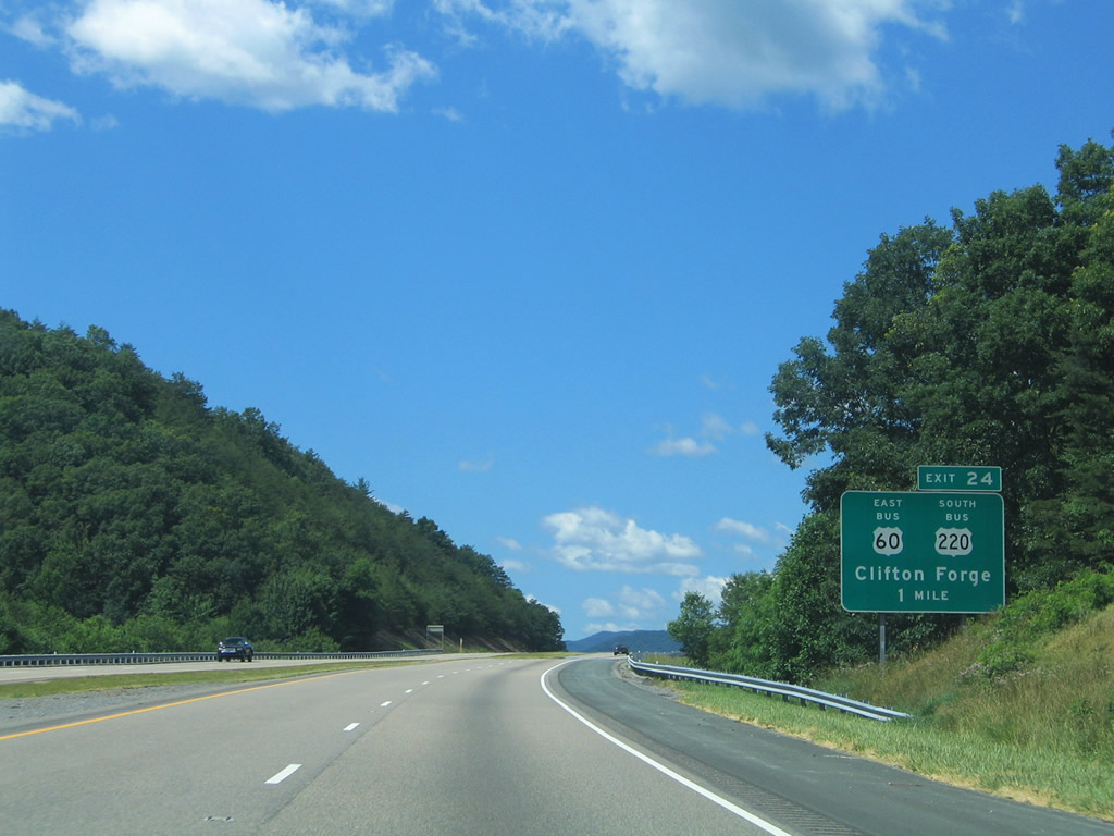
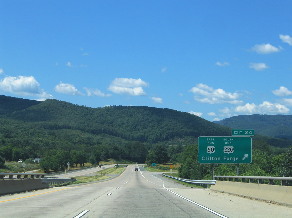
| U.S. 60 Business (Main Street) merges with U.S. 220 Business at A Street in Clifton Forge. The two combine along Main Street west to Ridgeway Street at Exit 24. 06/17/05 |
|
| Exit 24 departs I-64/U.S. 60 west and U.S. 220 north at the Jackson River. Ridgeway Street connects the freeway with Dabney S. Lancaster Community College to the west and the community of Selma and SR 696 (old U.S. 60/220) to the east. 06/17/05 |
Page Updated 04-28-2021.

 West
West


 West
West


 North
North