|
| Interstate 65 enters Boone County and the far western suburbs of Zionsville, just south of the junction with Interstate 865. 11/05/09 |
|
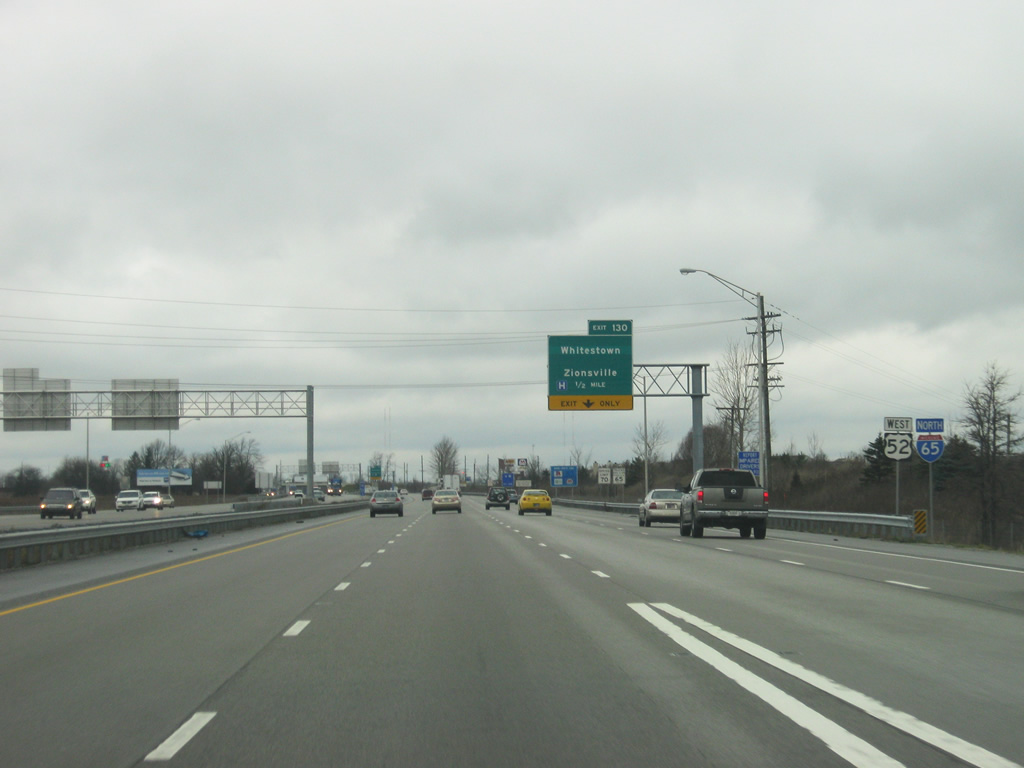
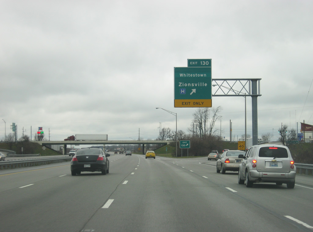
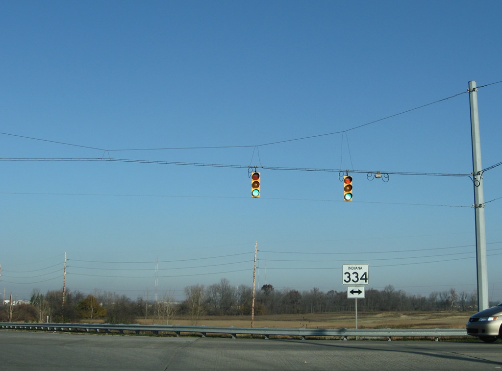
| Exit 130 for Oak Street, serving Zionsville and Whitestown is a mile away as travel lanes from Interstate 865 westbound merge with Interstate 65 northbound. Until the Summer of 2011, Oak Street was known as SR 334, which went from Indianapolis Road (Old U.S. 52) east for 6.3 miles through Zionsville to U.S. 421. The road has since been returned to both Zionsville and Whitestown. 11/05/09, 03/24/11 |
|
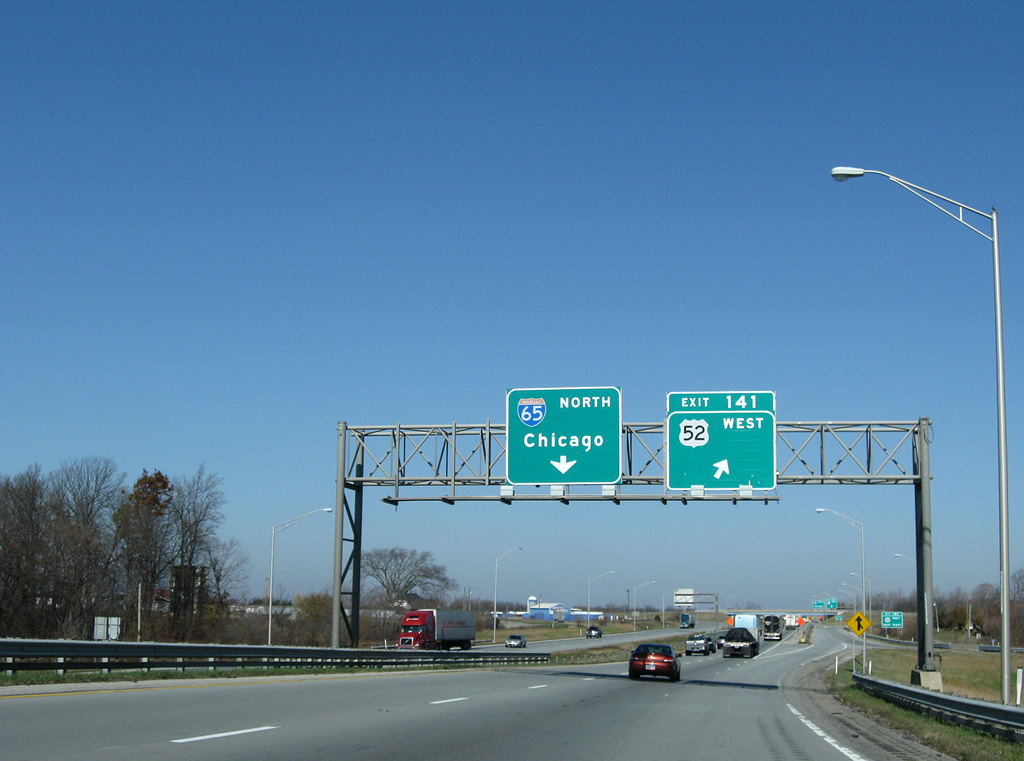
| Interstate 865 west merges with Interstate 65 north at Royalton just north of the Marion County line and the highway swells to eight lanes for the stretch from this junction to Exit 130 (Zionsville / Whitestown). U.S. 52 follows Interstate 65 north from Interstate 865 (Exit 129) to Exit 141 outside Lebanon. The highway was unsigned for the most part along its routing of the Indianapolis beltway.
The shield assembly for U.S. 52 west and Interstate 65 north pictured is the a second set of replacement shields posted since 2004. 03/24/11 |
|
| Oddly enough Whitestown was displayed originally, then removed from guide sign replacements, only to be reinstated with the decommissioning of State Road 334... 10/16/04, 11/05/09 |
|
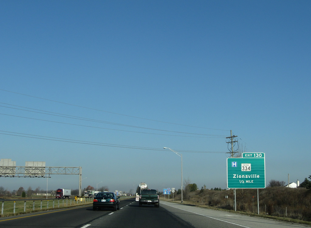
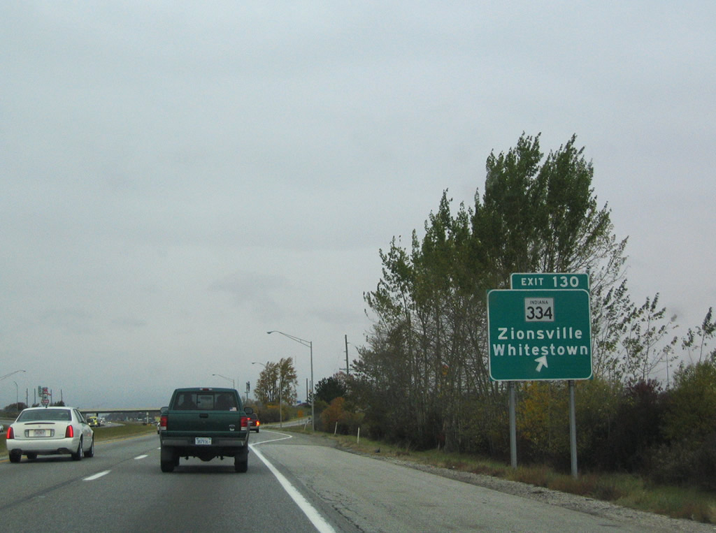
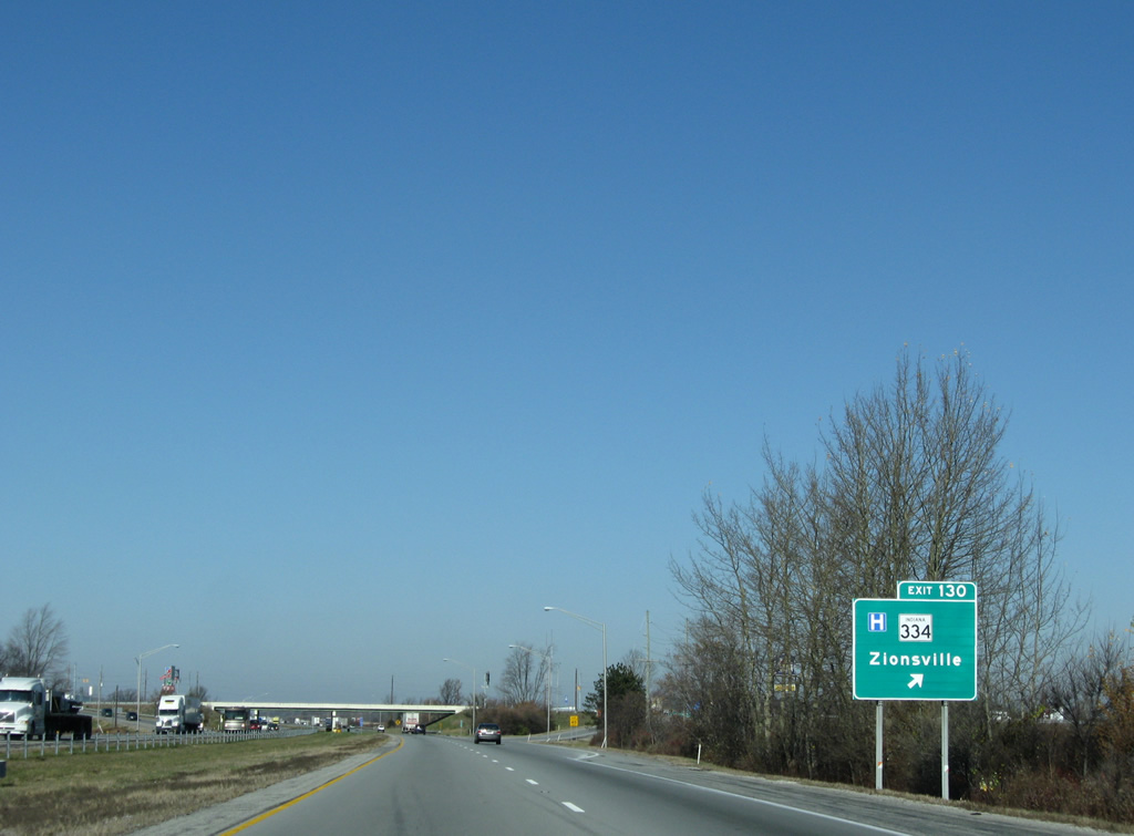
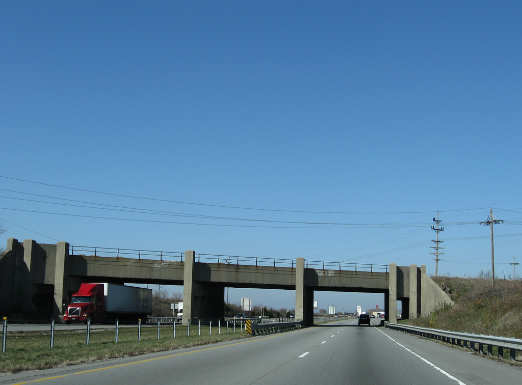
| Now at Exit 130 for Whitestown and Zionsville, which is a diamond interchange that was widened during the reconstruction of Interstate 65 in 2010. To the west, the road is known as County Road 650 South which ends at SR 267 in the small town of Fayette. To the east, it is known as Oak Street which heads straight for the heart of Downtown Zionsville. Whitestown can be reached from County Road 650 East from Oak Street to the east of the exit. 10/16/04, 11/05/09, 03/24/11 |
|
| Ascending the Exit 130 off-ramp to former SR 334 from Interstate 65 north. SR 334 ended across from County Road 650 South at Indianapolis Road (former U.S. 52) near Royalton. 11/05/09 |
|
| Reassurance shields posted for both Interstate 65 and U.S. 52 north of Exit 130 (Zionsville / Whitestown). The Anson development, which will be built up with residential homes, retail, and office parks, stretches along the east side of Interstate 65/U.S. 52 from Exit 130 to Exit 133. 11/05/09, 03/24/11 |
|
| Lebanon, the county seat of Boone County is eight miles away. Brownsburg, located in northeastern Hendricks County to the south of Boone County, and by all accounts out of the way for northbound traffic, is 12 miles, and Chicago, Illinois is 164 miles away. 03/24/11 |
|
| Interstate 65/U.S. 52 from Exit 129 (Interstate 865) to Exit 138 (Indianapolis Avenue) was widened to six lanes in 2010 to handle the traffic that flows between Lebanon and Indianapolis as well as the long-distance Chicago-bound traffic. Two roads, Perry-Worth and Indianapolis, follow the interstate on the east and west sides respectively, serving as frontage roads that were built when the original interstate was constructed along the path of U.S. 52. 03/24/11 |
|
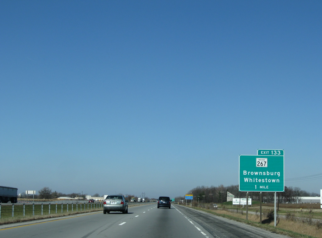
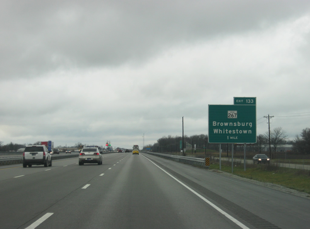
| Now one mile away from Exit 133 (SR 267 South) serving Whitestown and Brownsburg. SR 267 goes for 30 miles from Interstate 65 through Brownsburg, Avon, Plainfield and Mooresville, ending at SR 67. 11/05/09, 03/24/11 |
|
| Now at the rebuilt diamond interchange that is Exit 133 (SR 267 South). For northbound travelers, the exit primarily serves Whitestown, which can be reached by going north on County Road 400 East and east on County Road 300 South, and the Six Points Industrial Park, located to the east of the exit. 11/05/09, 03/24/11 |
|
| Lebanon is now five miles out but in fact the city limits have been extended along the interstate down to Exit 133. Thorntown, located in northern Boone County, is 17 miles and Chicago is 161 miles away. 03/24/11 |
|
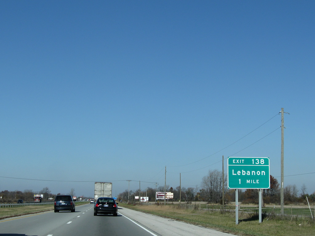
| One mile from Exit 138, serving Indianapolis Avenue (Old U.S. 52) which leads straight into Lebanon. Note the sign transition from a Washington or Illinois style internal exit margin, to a conventional INDOT exit tab. 11/05/09, 03/24/11 |
|
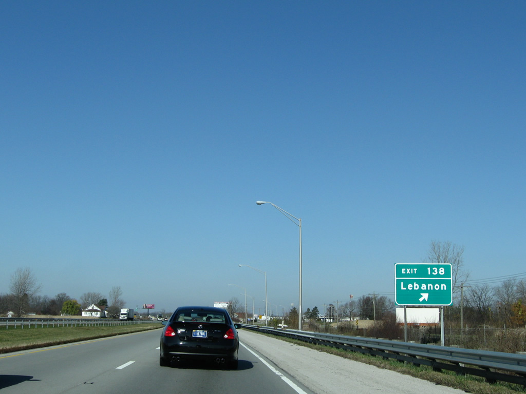
| Now a half mile from Exit 138. Indianapolis Avenue represents the original routing of U.S. 52 through the southeast side of Lebanon. The former highway then followed Main Street across the central part of Lebanon and then Lafayette Avenue north to its current end at Interstate 65. It was at this point where the four lane U.S. 52 continues to the northwest of Interstate 65. Today, U.S. 52 follows the interstate to that split at Exit 141. 11/05/09, 03/24/11 |
|
| Interstate 65 goes back to four lanes as it gets to Exit 138 (Indianapolis Avenue / Lebanon). The stretch from this exit around the south and west sides of Lebanon to Exit 141 (U.S. 52) will be widened in 2012 to six lanes. 11/05/09, 03/24/11 |
|
| A $32 million project widens Interstate 65 to six lanes between Exits 138 and 140 to the end of 2012. Work includes the rebuilding of the forthcoming diamond interchange (Exit 139) with SR 39.
Meeting Interstate 65 next is SR 39, whose northern section travels 179.2 miles from Martinsville to the Michigan state line at LaPorte County. 11/05/09 |
|
| Interstate 65 north & U.S. 52 west reach the Exit 139 off-ramp to SR 39. SR 39 follows Lebanon Street into downtown Lebanon nearby. Southward, the state road continues 3.7 miles to Milledgeville and 10.1 miles to Interstate 74 outside Lizton. 11/05/09 |
|
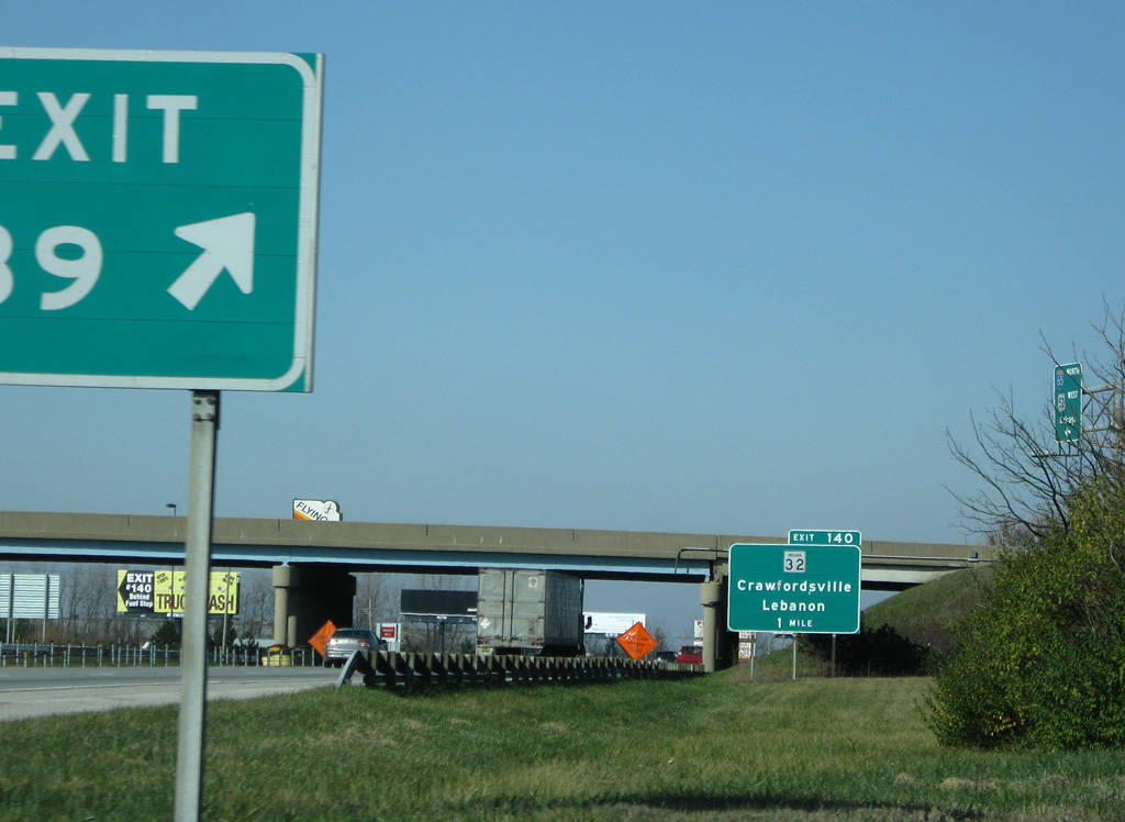
| The one mile guide sign for Exit 140 resides within Exit 139 of Interstate 65 north & U.S. 52 west. SR 32 (South Street) sees a diamond interchange with the freeway on the west side of Lebanon. 11/05/09 |
|
| Reassurance shields posted for Interstate 65 north & U.S. 52 west after the SR 39 on-ramp. The tandem shares 12.2 miles from Royalton to Lebanon. 11/05/09 |
|
| SR 32 travels the width of the state between Illinois state line outside Danville and Ohio at Union City. More locally, SR 32 joins Lebanon with Crawfordsville, 21 miles to the west. 11/05/09 |
|
| An original Pennsylvania Railroad Bridge makes way for the six-laning of the freeway through Lebanon. The bridge carried a Norfolk Southern Railroad line; a replacement is part of the expansion project of I-65. 11/05/09 |
|
| Exit 140 departs Interstate 65 north & U.S. 52 west for SR 32 (South Street). SR 32 totals 156.8 miles through Perrysville, Crawfordsville, Lebanon, Noblesville, Anderson, Muncie, Winchester and Union City. 11/05/09 |
|
| Northbound drivers span an abandoned Conrail Railroad line on the approach to the U.S. 52 westbound split from Interstate 65 north at Exit 141. 11/05/09 |
|
| Hugging the west side of Lebanon, U.S. 52 and Interstate 65 see their last cosigned assembly. 11/05/09 |
|
| Exit 141 consists of back to back wye interchanges. The southern connection brings traffic from Lafayette Avenue (former U.S. 52) onto a collector distributor roadway to the parting U.S. 52 west to Garden Park. 11/05/09 |
|
| U.S. 52 rejoins its original four lane alignment from Exit 141 northwest to Monroe and Lafayette. The US route parallels Interstate 65 along that stretch. 11/05/09 |
|
| Traveling the northbound c/d roadway from the Lafayette Road on-ramp of Lebanon to the Exit 141 ramp over Interstate 65. U.S. 52 joins U.S. 231 at West Lafayette briefly before heading west to Fowler and Benton County. The highway exits Indiana with U.S. 24 at Effner. 11/05/09 |
|
| Northbound at the c/d roadway partition to the freeway mainline and U.S. 52 west (Exit 141). Much of U.S. 52 is rural between Lebanon and Lafayette. Nearby towns of Thorntown, Colfax and Stockwell were orientated along the now abandoned Conrail Railroad to the west instead of the US Route. 11/05/09 |
|
| Continuing north along Interstate 65 beyond Prairie Creek and Lebanon. 11/05/09 |
|
| Thorntown is the next control point of Interstate 65 northbound distance sign, posted 11 miles to the southeast of the SR 42 and 75 town. Chicago is 154 miles to the northwest. 11/05/09 |
|
| State Road 47 arcs northeast from Crawfordsville through Darlington to Thorntown and SR 75. SR 57 continues east 4.7 miles to a diamond interchange (Exit 146) with Interstate 65. 11/05/09 |
|
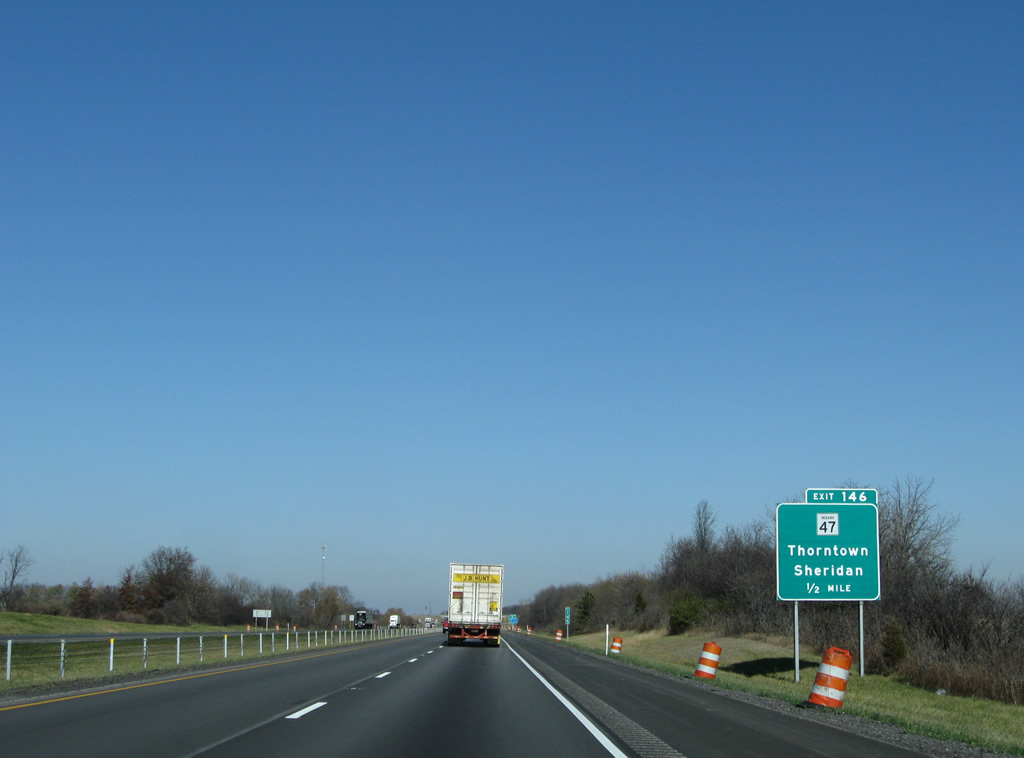
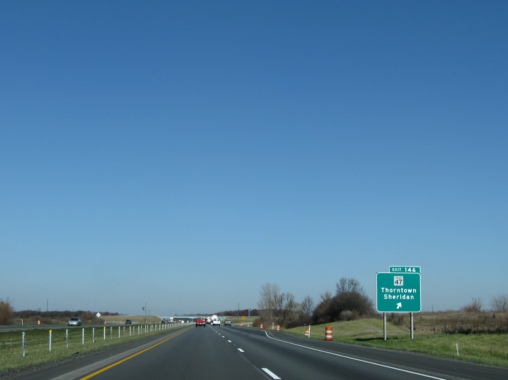
| East of Exit 146, SR 47 travels 2.1 miles to Pike (SR 39) and 14.8 miles to the Hamilton County community of Sheridan. 11/05/09 |
|
| Exit 146 leaves Interstate 65 north for SR 47. State Road 47 consists of a 64.2 mile route from U.S. 41 near Annapolis to SR 38 at Sheridan. 11/05/09 |
|
| Kinking northwest, Interstate 65 bends toward a crossing of Sugar Creek and the 29 mile approach to Lafayette. 11/05/09 |
|
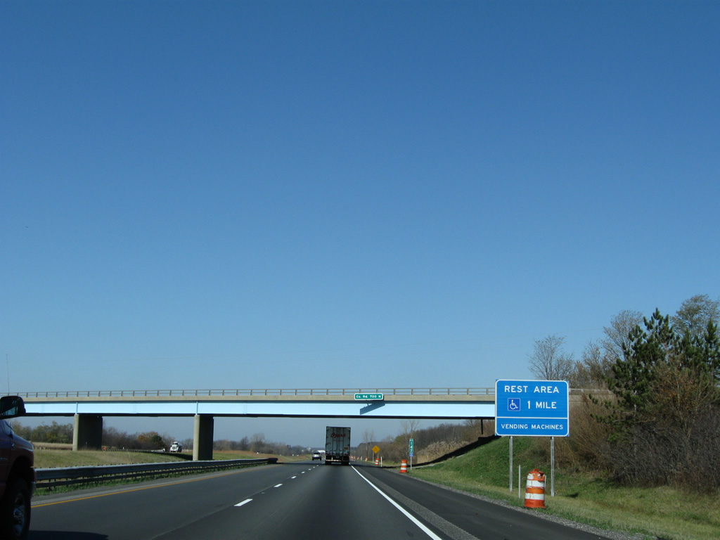
| County Road 700 North passes over Interstate 65 on the one mile approach to a set of rest areas. 11/05/09 |
|
| The northbound side rest area resides just beyond the 1969-built spans over Sugar Creek. A southbound facility follows near the county line. 11/05/09 |
|
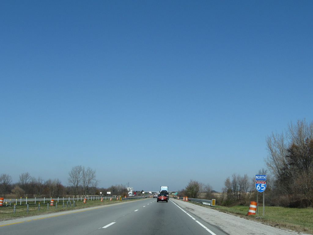
| Bluebaugh Avenue separates the rest area sides of Interstate 65. Northbound travelers see a second reassurance shield on the stretch between Exits 146 and 158. 11/05/09 |
|
| County Road 750 South straddles the Boone and Clinton County lines at Interstate 65. 11/05/09 |
Page Updated 01-10-2012.

 North
North


 west
west