|
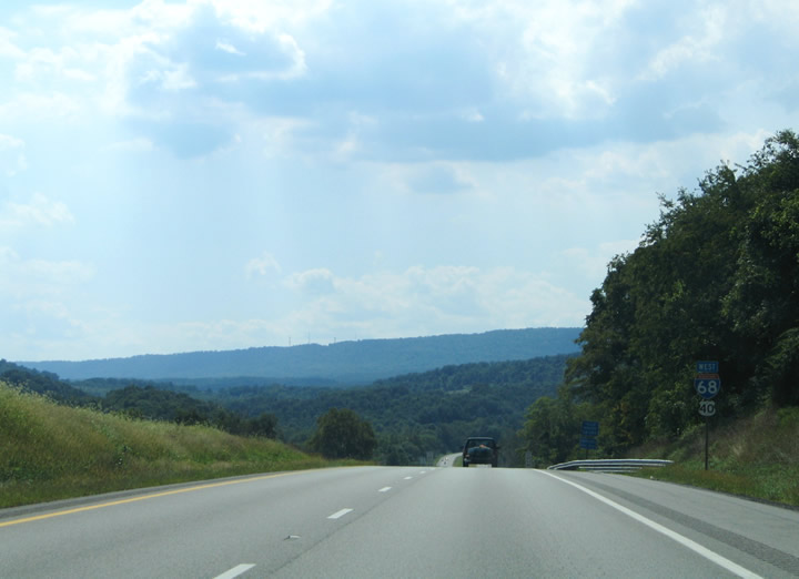
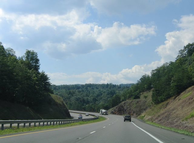
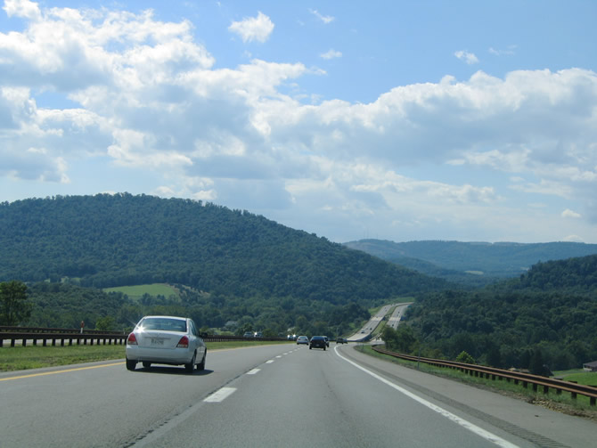
| The initial few miles of Interstate 68 westbound as it departs Interstate 70 & U.S. 522 with U.S. 40 in western Washington County. The first four miles of the freeway parallel MD 144 (former U.S. 40) west from Hancock to Harvey. 08/07/04 |
|
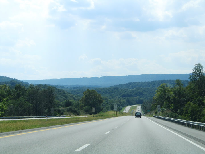
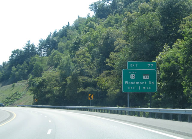
| MD 144 follows various portions of original U.S. 40 between Cumberland and Baltimore in northern Maryland. The state route exists in segments of the original route that are not signed as either U.S. 40 Alternate or U.S. 40 Scenic. A changeover between MD 144 (Western Pike) occurs at Exit 77 of I-68/U.S. 40 where the state route becomes U.S. 40 Scenic (National Pike) at Harvey. 08/07/04 |
|
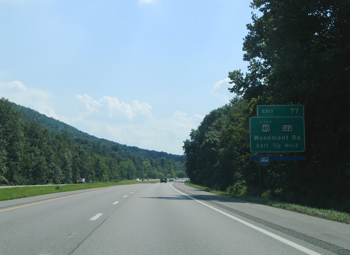
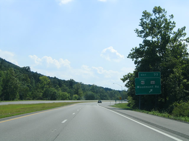
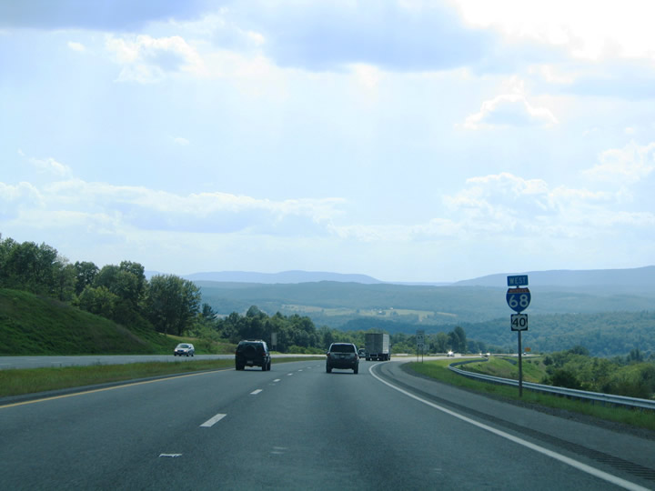
| A diamond interchange joins I-68/U.S. 40 with Woodmont Road at Exit 77 just north of MD 144 & U.S. 40 Scenic (Western Pike). Woodmont Road spurs south from the freeway to Exline and Woodmont via Long Ridge Road. MD 144 enters the scene three miles west of Hancock (pop. 1,725). 08/07/04 |
|
| I-68/U.S. 40 dip south from Sandy Mile Road to Rice Road at the interchange with Woodmont Road. U.S. 40 Scenic stems west from Woodmont Road and MD 144 along the National Pike west to Harvey and Sideling Hill. 08/07/04 |
|
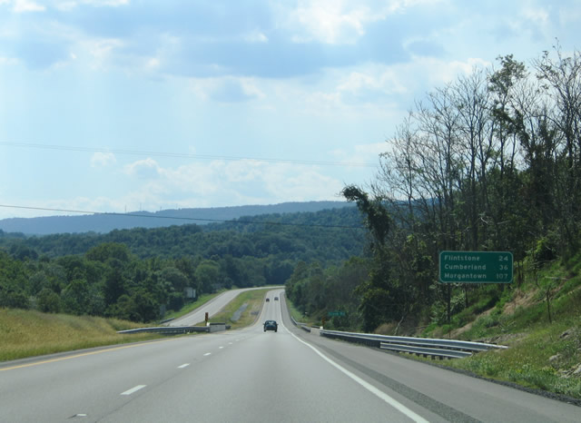
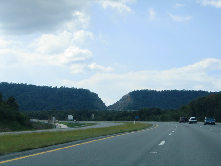
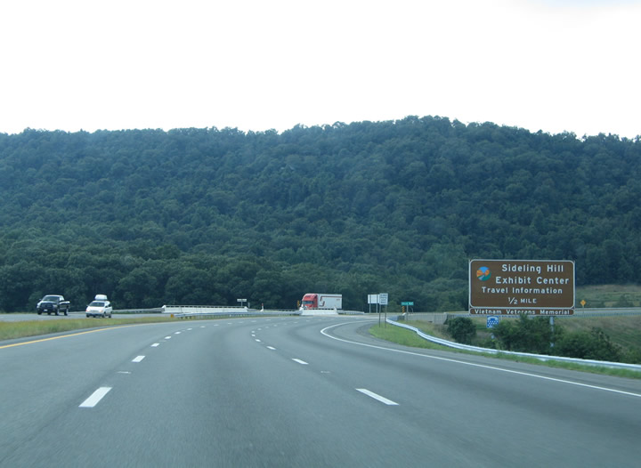
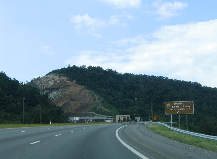
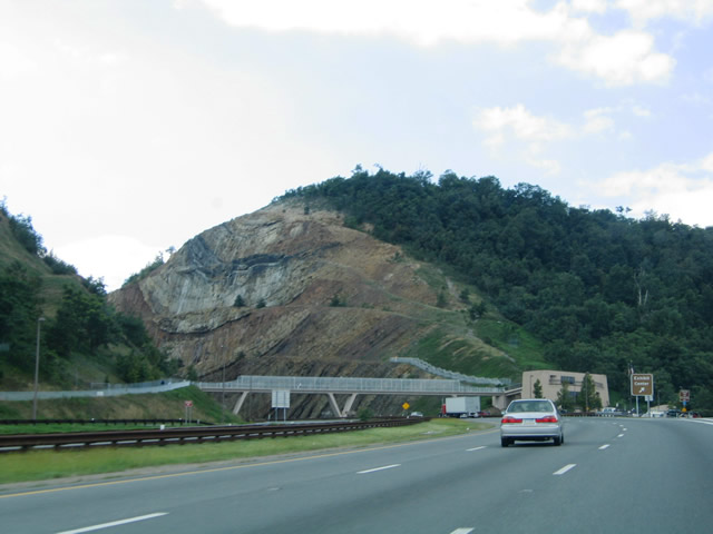
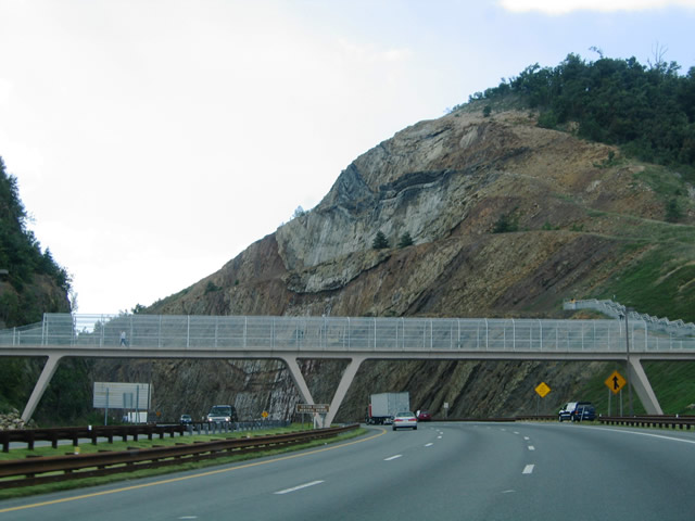
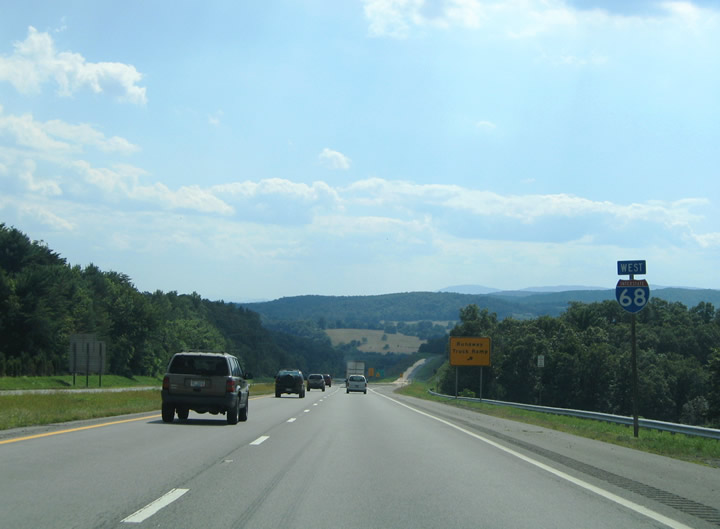
| I-68/U.S. 40 ascend from Exit 77 to Sideling Hill on the five mile drive to the Allegany County line and Exit 72. Sideling Hill represents a series of the Appalachian Mountains extending from the Potomac River northward into southern Pennsylvania. An 850-foot vertical cut carries the four lane freeway of I-68/U.S. 40 over the mountain just south of the Pennsylvania state line. Construction of the cut commenced in 1983 and represented the last portion of the Interstate 68 freeway to be completed by 1989. 08/07/04 |
|
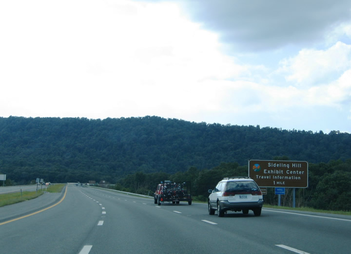
| The Sideling Hill Exhibit Center is located near the Sideling Hill pass within the Sideling Hill Wildlife Management Area. Visitors can learn about the construction of the Sideling Hill cut, the geology of the area, and the wildlife found within the surrounding WMA. A pedestrian bridge allows eastbound travelers access to the exhibit center. 08/07/04 |
|
| Descending toward Allegany County along I-68/U.S. 40 westbound. Green Ridge State Forest lies below in the wide open vista. A runaway truck ramp exists along the roadway near mile marker 74. 08/07/04 |
|
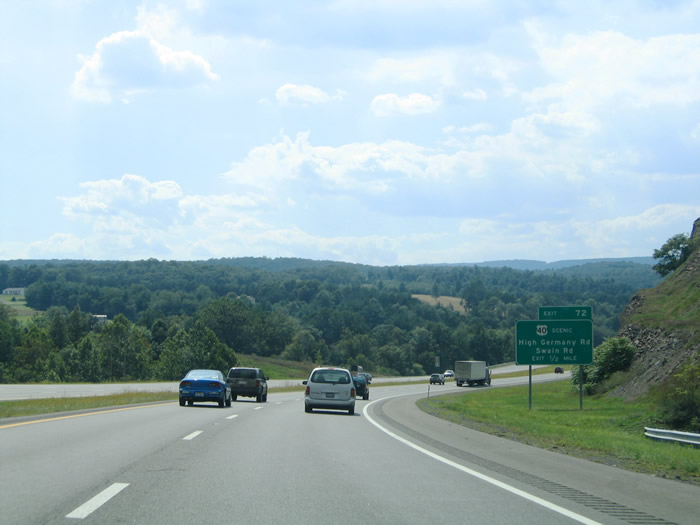
| U.S. 40 Scenic (National Pike) converges with I-68/U.S. 40 at a diamond interchange (Exit 72) at the Allegany County line. National Pike parallels the freeway from the south between Sideling Hill and Turkey Grove Road near Piney Grove. 08/07/04 |
|
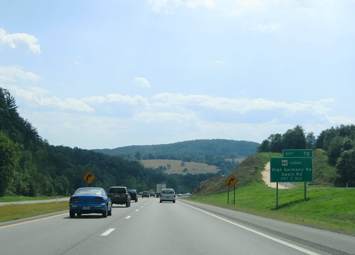
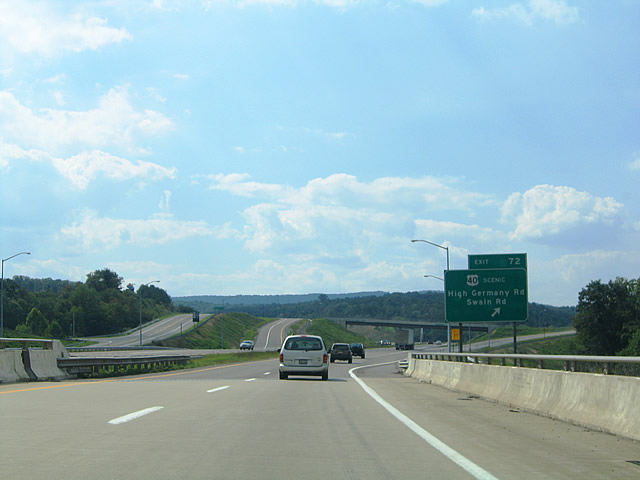
| One half mile east of Exit 72 for U.S. 40 Scenic (National Pike) and connections to Swain Road and High Germany Road. Swain Road stems south from the National Pike just west of Exit 72 into the Belle Grove Wildlife Management Area. 08/07/04 |
|
| I-68/U.S. 40 freeway cross the county line ahead of the Exit 72 off-ramp for U.S. 40 Scenic. The National Pike comes into view to the south of the interchange on its three mile drive west to Piney Grove. High Germany Road travels north from U.S. 40 Scenic across Interstate 68 to Harmon Road and PA 484 in Fulton County, Pennsylvania. 08/07/04 |
|
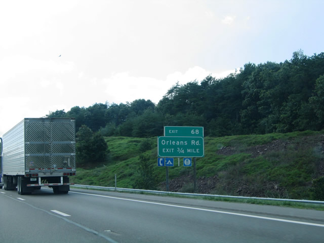
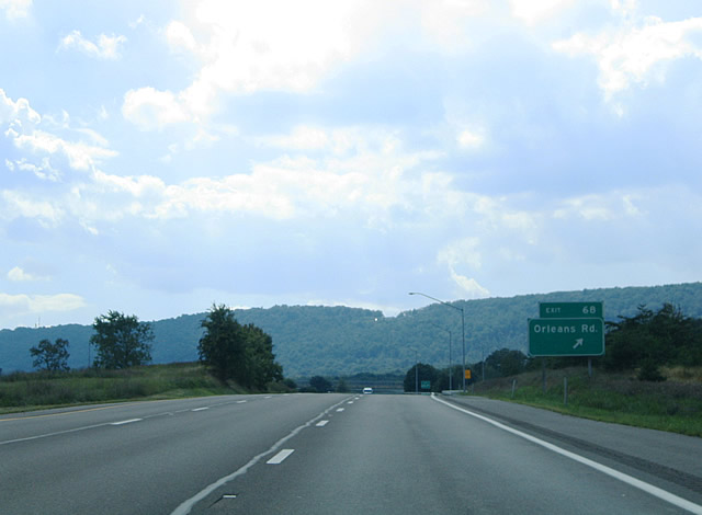
| The next westbound exit serves Orleans Road and the community of Piney Grove at Exit 68. A diamond interchange joins the freeway with the north-south roadway. 08/07/04 |
|
| Westbound at Exit 68 to Orleans Road. Orleans Road ventures north to U.S. 40 Scenic at Piney Grove nearby. The road continues three miles north from there to become PA 26 at the state line. Southward, Orleans Road reaches Little Orleans in five miles. PA 26 (Orleans Road) leads north for Inglesmith, Piney Creek and Millers Corner. 08/07/04 |
|
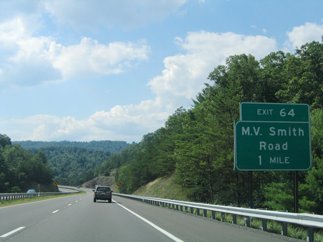
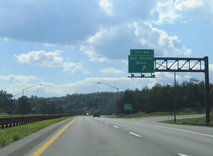
| Interstate 68/U.S. 40 enter Green Ridge State Forest just west of Orleans Road. From there the freeway curves southwest toward the M.V. Smith Road exit at the Bill Meyer WMA. 08/07/04 |
|
| Traffic to M.V. Smith Road leaves I-68/U.S. 40 westbound at Exit 64. M.V. Smith spurs south from U.S. 40 Scenic at Green Ridge Road to Fifteen Mile Creek and Dug Hill Roads within the Green Ridge State Forest. 08/07/04 |
|
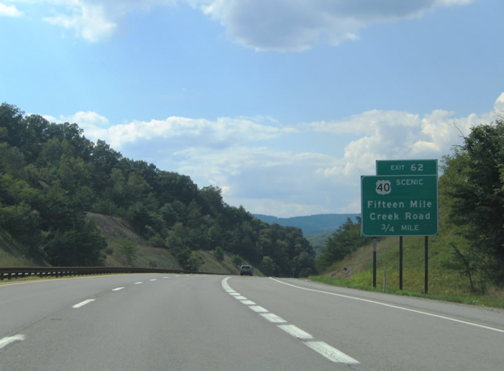
| Fifteen Mile Creek Road arcs northwest from M.V. Smith Road to meet I-68/U.S. 40 at Exit 62. There the freeway again meets U.S. 40 Scenic (National Pike). 08/07/04 |
|
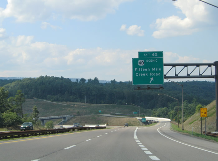
| Entering the parclo interchange (Exit 62) with U.S. 40 Scenic (National Pike) and Fifteen Mile Creek Road on I-68/U.S. 40. Fifteen Mile Creek Road continues with U.S. 40 Scenic east briefly before splitting to the north en route to Artemas, Pennsylvania. 08/07/04 |
|
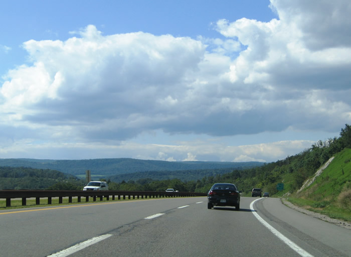
| Views of the scenery along I-68/U.S. 40 westbound within Green Ridge State Forest. The National Pike parallels the freeway to the south along the stretch through the settlement of Pratt. 08/07/04 |
|
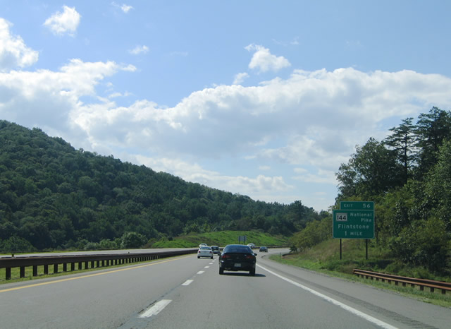
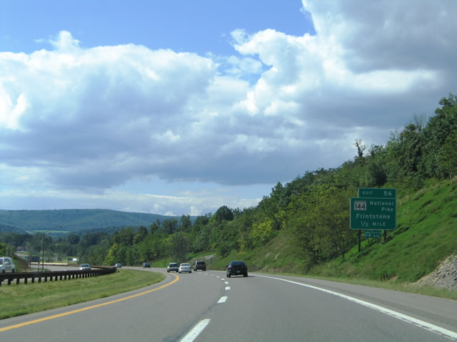
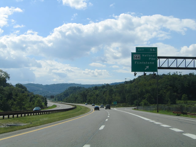
| MD 144 once again emerges from U.S. 40 at a diamond interchange (Exit 56) near the community of Flintstone. The state route overtakes National Pike from Flintstone west to U.S. 220 (Exit 46). 08/07/04 |
|
| A folded diamond interchange (Exit 56) joins I-68/U.S. 40 with Murleys Branch Road at Flintstone. Murleys Branch Road continues Black Valley Road (PA 326) south from Hewitt, Pennsylvania five miles to the north. Southwest from Flintstone, Murleys Branch Road heads five miles to Rush and eight miles to Twiggtown. 08/07/04 |
|
| Interstate 68/U.S. 40 west at Exit 56 to MD 144 (National Pike) and Murleys Branch Road. U.S. 40 Scenic east from Flintstone to Town Creek Road south connects with Pumkin Center and the Warrior Mountain Wildlife Management Area. 08/07/04 |
|
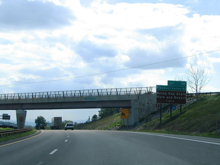
| One mile east of the Pleasant Valley Road diamond interchange (Exit 50) at the MD 144 (National Pike) over crossing near Exit 52. Pleasant Valley Road stems north from MD 144 into Rocky Gap State Park. 08/07/04 |
|
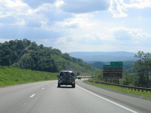
| One mile east of Exit 50 with Pleasant Valley Road at Rocky Gap State Park. Pleasant Valley Road travels through the heart of the state park en route to the Pennsylvania state line and Beans Cove. The state park is home to the Rocky Gap Veterans Cemetery. 08/07/04 |
|
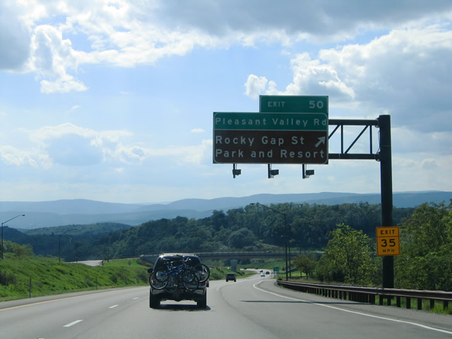
| I-68/U.S. 40 westbound at the off-ramp (Exit 50) to Pleasant Valley Road. MD 144 (National Pike) remains on a parallel alignment to the south of the freeway. 08/07/04 |
Page Updated 03-11-2005.


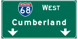
 West
West