|
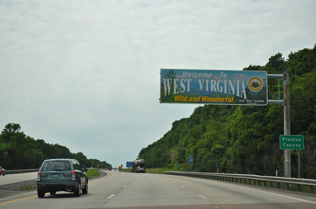
| Welcome to West Virginia overhead posted at state line with Maryland near Evans Hill. Interstate 68 enters Preston County, which was formed from a portion of Monogalia County in 1818 and named after James Preston, 13th governor of Virginia. 06/24/12 |
|
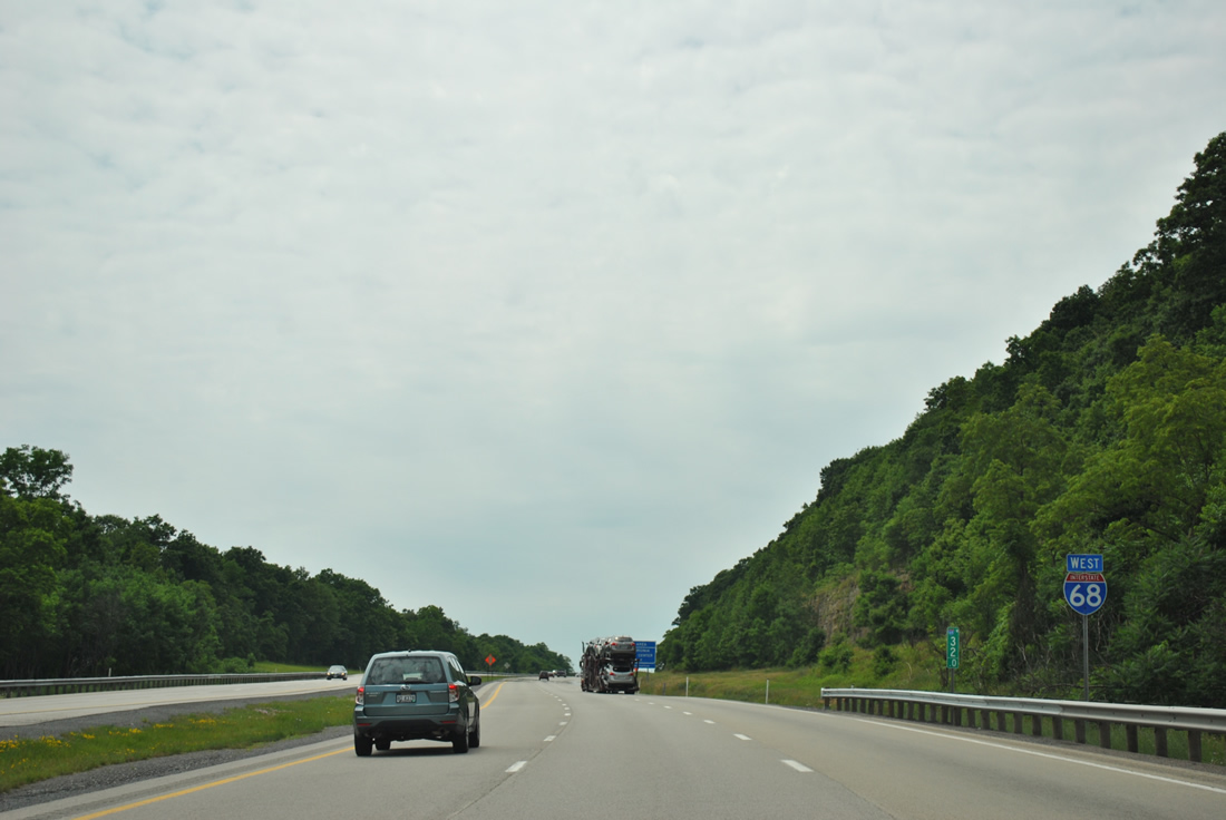
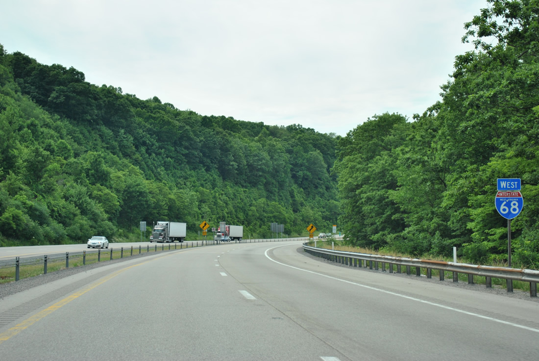
| An Interstate 68 reassurance marker follows the welcome sign by milepost 32. The westbound roadway carries three overall lanes with the addition of a truck climbing lane on this stretch. 06/24/12 |
|
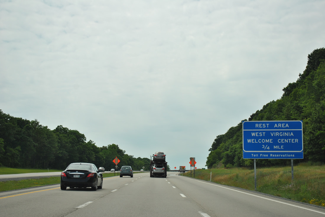
| A state welcome center and rest area lies along Interstate 68 west of the CR 12 overpass at Webb Chapel. 06/24/12 |
|
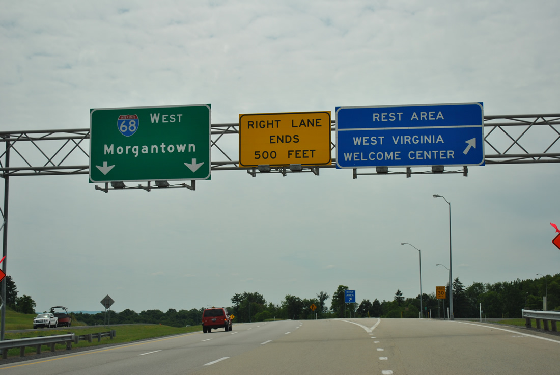
| Interstate 68 west at the welcome center / rest area off-ramp. The truck climbing lane concludes just west of the tourist information center. 06/24/12 |
|
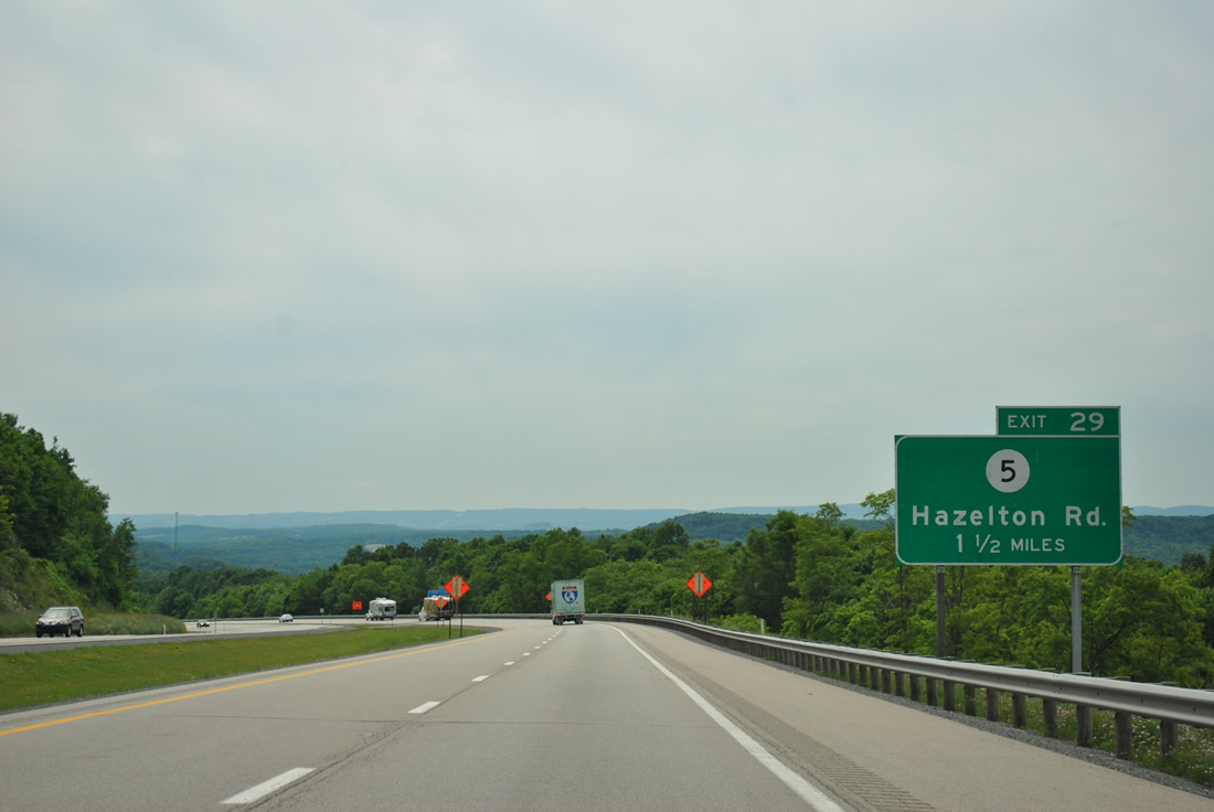
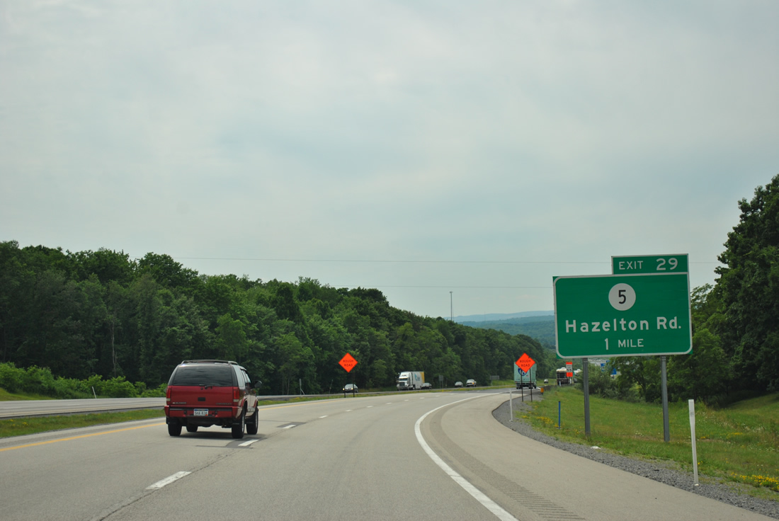
| Interstate 68 drops at a 5% grade on the 1.5 mile approach to the diamond interchange (Exit 29) with CR 5 (Hazelton Road). CR 5 joins Interstate 68 with the nearby settlement of Hazelton. 06/24/12 |
|
| Hazelton Road ventures 3.6 miles north from Exit 29 to WV 26 at Glade Farms. 06/24/12 |
|
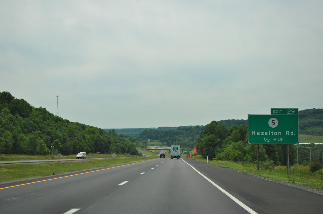
| One half mile east of Exit 29 to CR 5 (Hazelton Road). 06/24/12 |
|
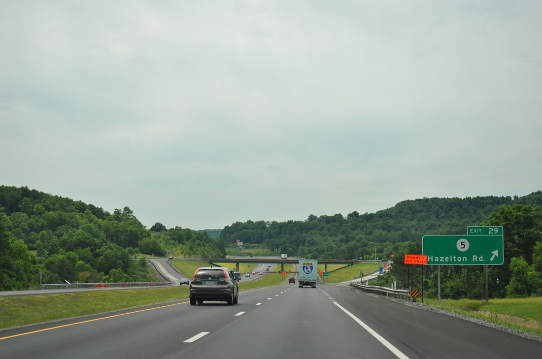
| Interstate 68 westbound reaches Exit 29 to CR 5 (Hazelton Road). CR 5 turns west from Hazelton Road onto Cuzzart Road at Hazelton for Cuzzart. CR 5/18 continues Hazelton Road south to Big Bear Lake. 06/24/12 |
|
| Interstate 68 leaves Hazelton and crosses Little Sandy Creek ahead of the next westbound shield. 06/24/12 |
|
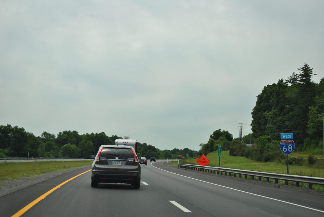
| Nearing the town of Brandonville along Interstate 68 west, 1.75 miles east of WV 26 (Exit 23). 06/24/12 |
|
| Brandonville Pike (CR 3) spans Interstate 68, one mile east of the Exit 23 diamond interchange with WV 26 (Preston Highway). 06/24/12 |
|
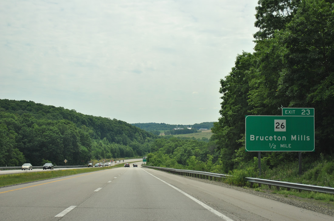
| WV 26 ventures eight miles west from PA 281 to Main Street through Brandonville. The state highway turns south at the town of Bruceton Mills to Interstate 68. 06/24/12 |
|
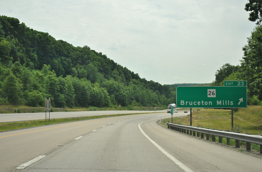
| Exit 23 leaves Interstate 68 westbound for WV 26. The state route continues south from Bruceton Mills six miles to Valley Point, nine miles to Albright, and 15.3 miles to WV 7 at Preston. 06/24/12 |
|
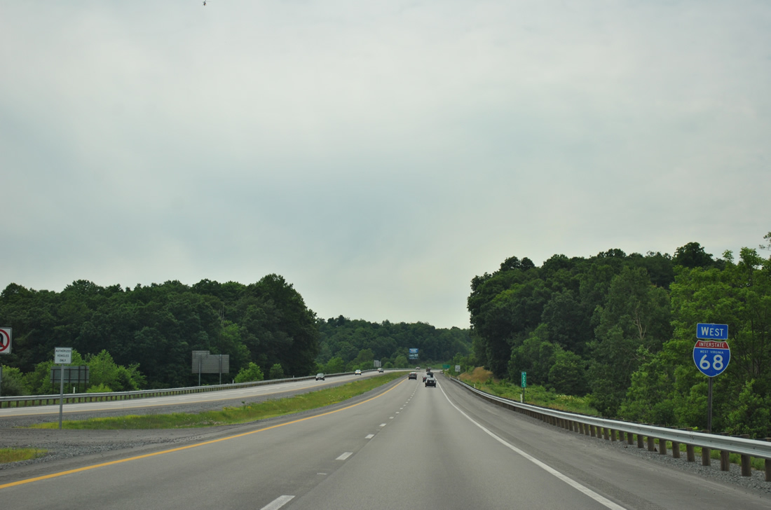
| Interstate 68 crosses Big Sandy Creek outside Bruceton Mills before climbing again on the seven mile drive to Coopers Rock. 06/24/12 |
|
| Several curves await westbound motorists through the hills north of Big Sandy Creek to Laurel Run on I-68. 06/24/12 |
|
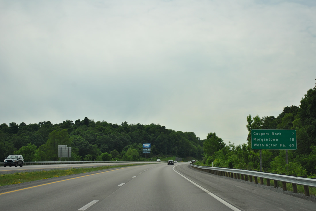
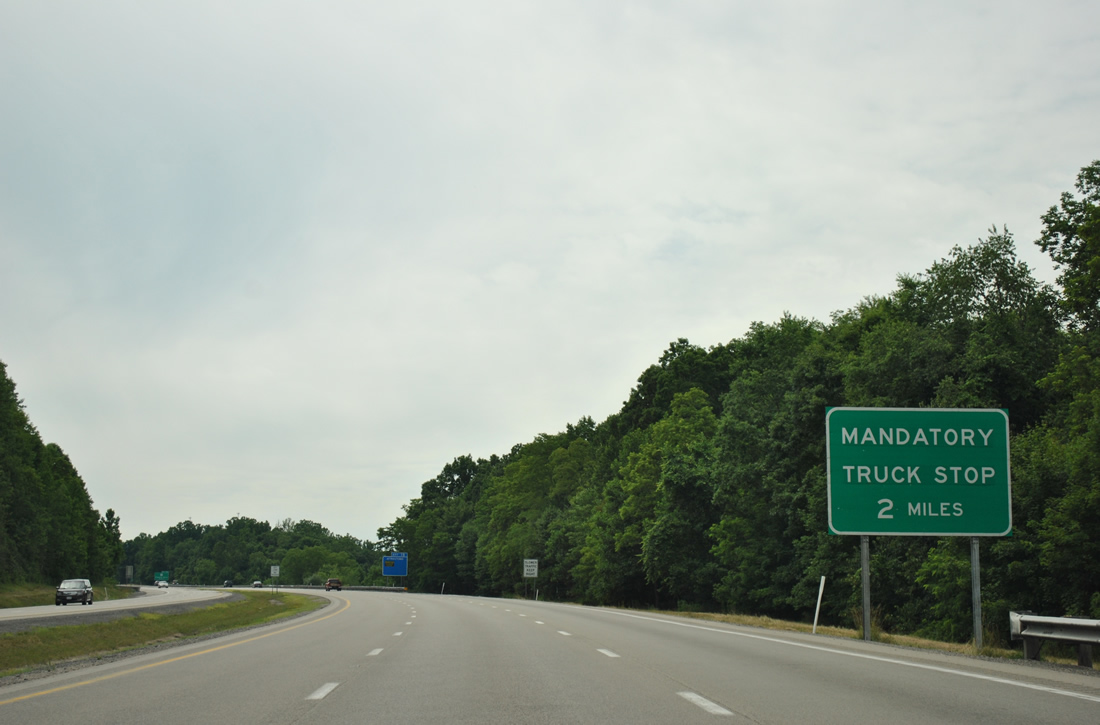
| Truckers are advised of the forthcoming 5% grade west of Coopers Rock. A brake check station resides just east of Exit 15. 06/24/12 |
|
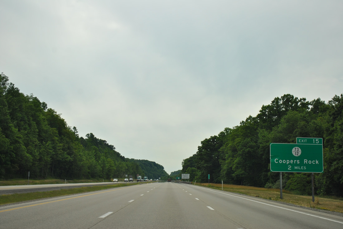
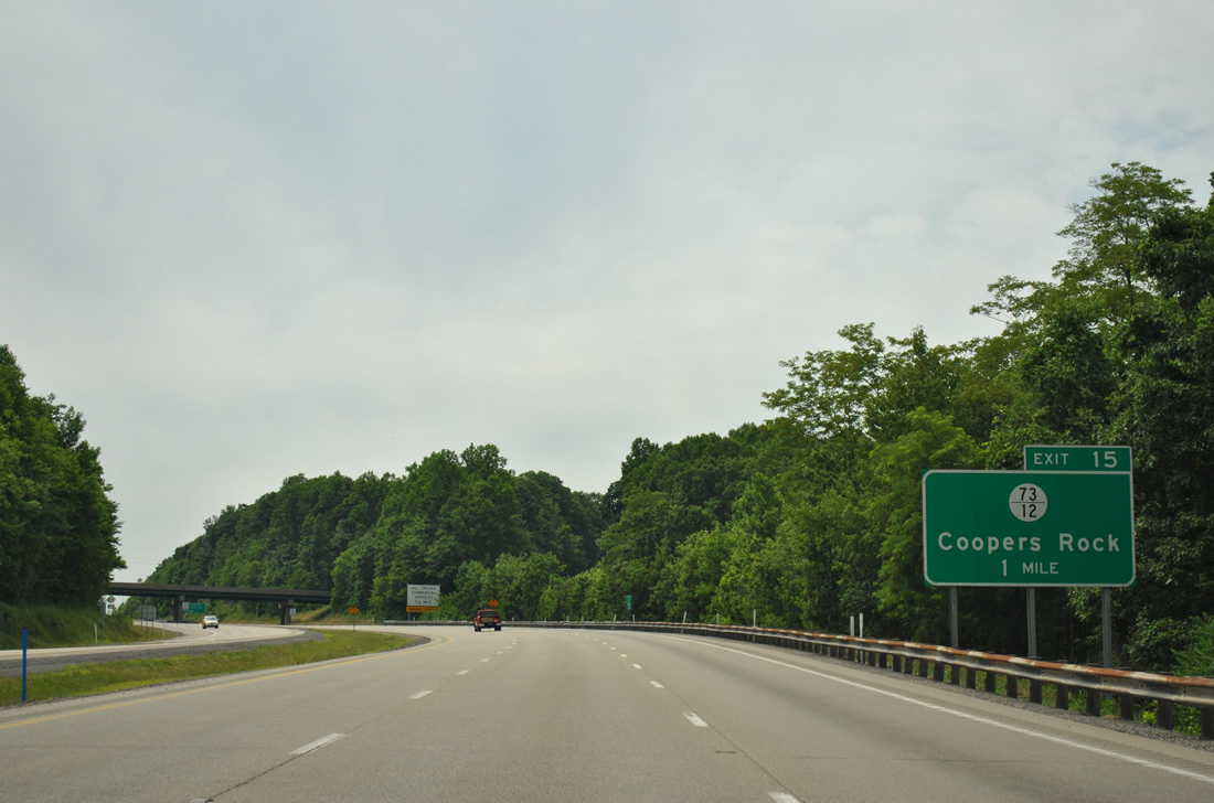
| Interstate 68 westbound expands briefly to three lanes with a truck climbing lane to the Exit 15 diamond interchange with CR 73/12. The freeway travels through Coopers Rock State Forest over the next several miles. 06/24/12 |
|
| Old Route 73 (CR 73/73) parallels Interstate 68 west from Bruceton Mills through Coopers Rock State Forest. CR 73/12 joins the two routes at Exit 15 in one mile. 06/24/12 |
|
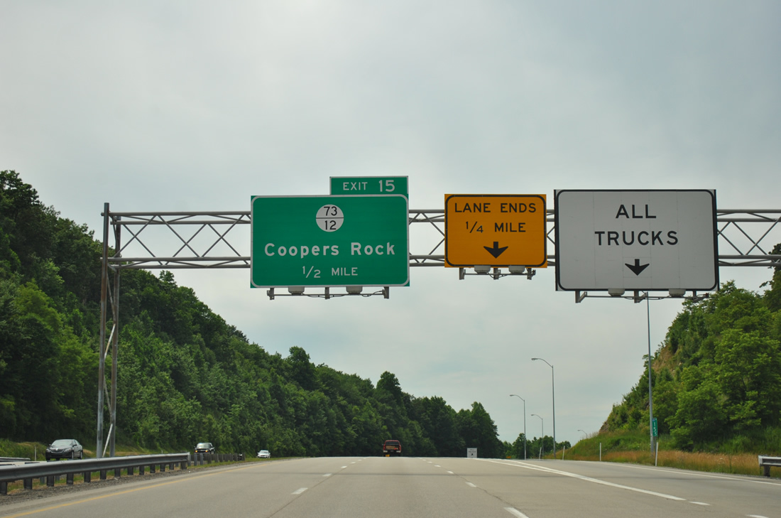
| Westbound at the brake check station off-ramp near Coopers Rock and Exit 15. CR 73/12 branches southwest from Old Route 73 to become CR 73/16 in Monongalia County to its end at Coopers Rock. 06/24/12 |
|
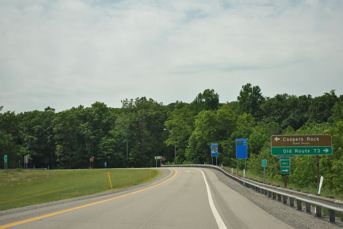
| Taking the Exit 15 off-ramp to CR 73/12. Another branch of secondary roadway (CR 73/1) spurs north to Harris Lake and Sand Spring within the state forest from nearby. Use Old Route 73 west for the West Virginia University Forest as well. 06/24/12 |
|
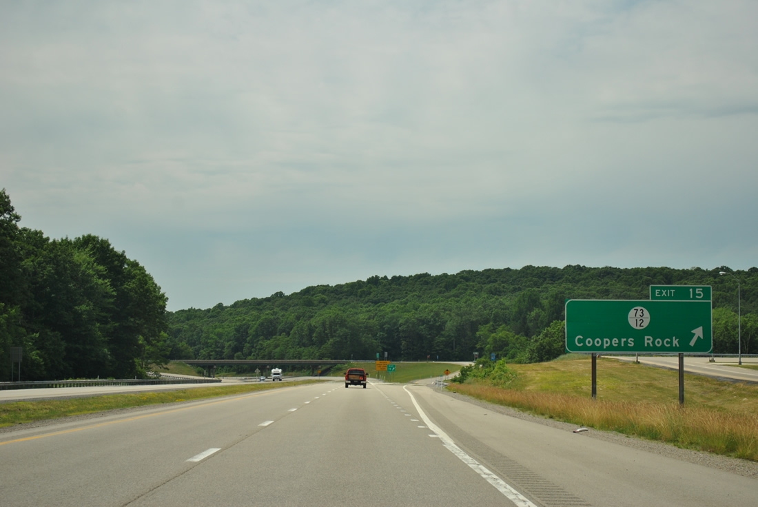
| Exit 15 departs Interstate 68 westbound for Coopers Rock. Old Route 73 remains parallel to the freeway west to Coopers Rock Lake and Quarry Run Road (CR 69/5). 06/24/12 |
|
| Drivers on Interstate 68 west immediately enter Monogalia County at the on-ramp merge from CR 73/12. 06/24/12 |
|
| The freeway travels through a valley parallel to Old Route 73 and Quarry Run through the remainder of Coopers Rock State Forest. 06/24/12 |
|
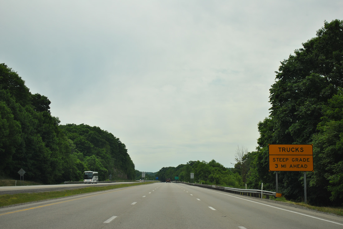
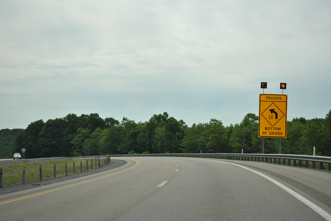
| The next four miles of Interstate 68 drop at a 5% grade. Trucks over 26,000 GVWR (gross vehicle weight rating) are relegated to a 50 mile per hour speed limit on the descent. 06/24/12 |
|
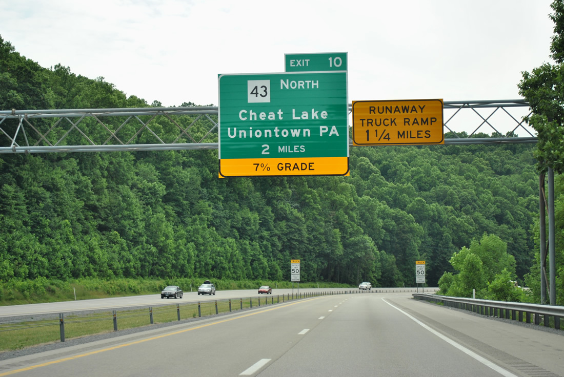
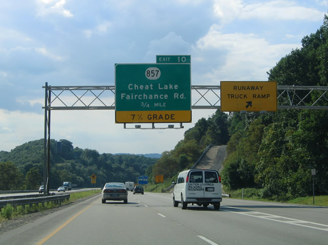
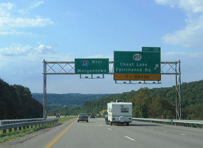
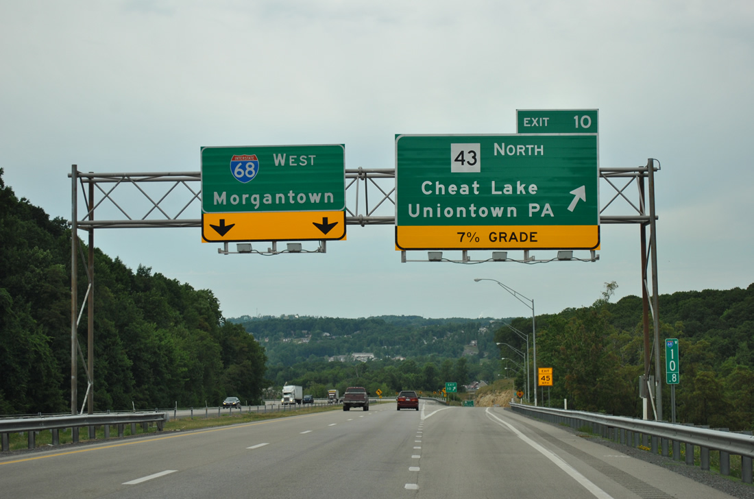
| Interstate 68 next meets WV 43 (Mon-Fayette Expressway) north and CR 69/15 to Ices Ferry at Exit 10. 06/24/12 |
|
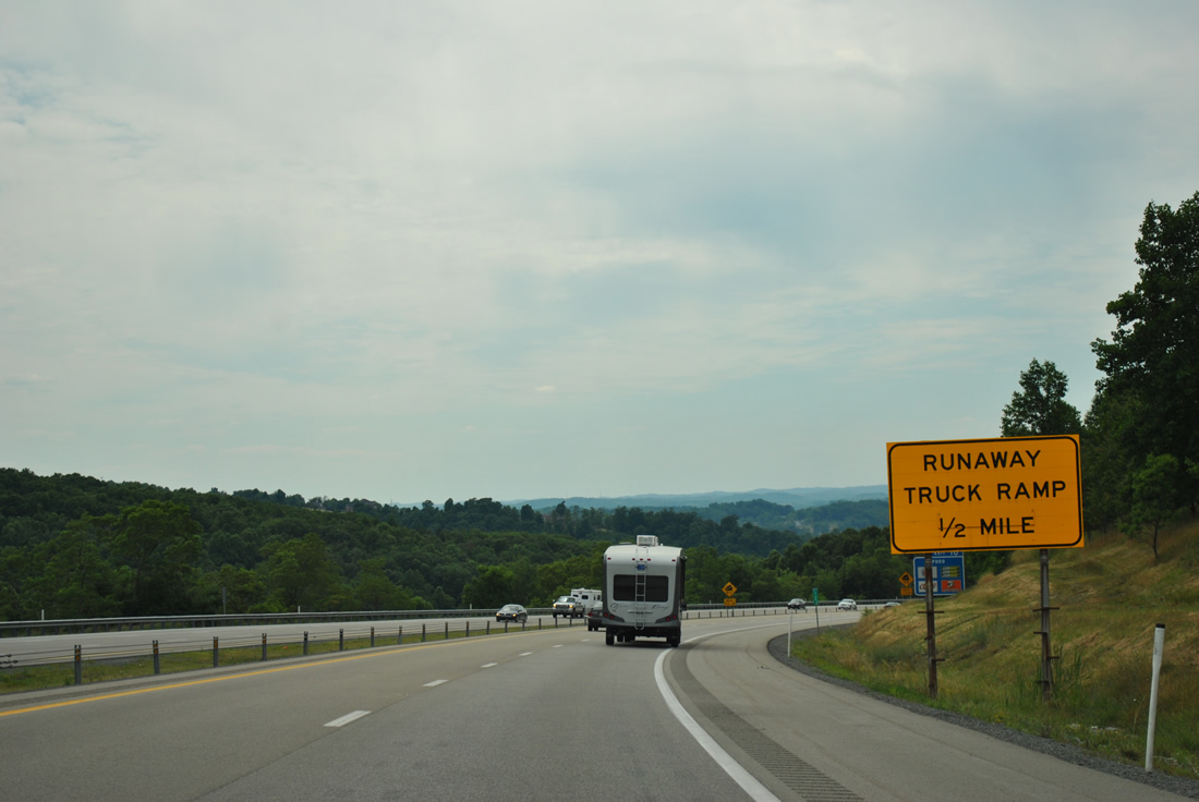
| A runaway truck ramp precedes the Exit 10 diamond interchange by one half mile. 06/24/12 |
|
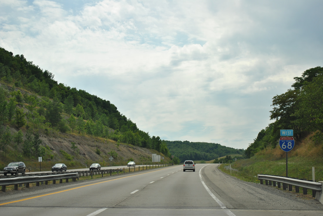
| Interstate 68 curves northwest toward Cheat Lake from the runaway truck ramp to the partition with Exit 10. Exit 10 originally connected the freeway with CR 857, but that changed with the July 11, 2011 opening of the Mon-Fayette Expressway north from Interstate 68 to the Pennsylvania state line. 08/07/04, 06/24/12 |
|
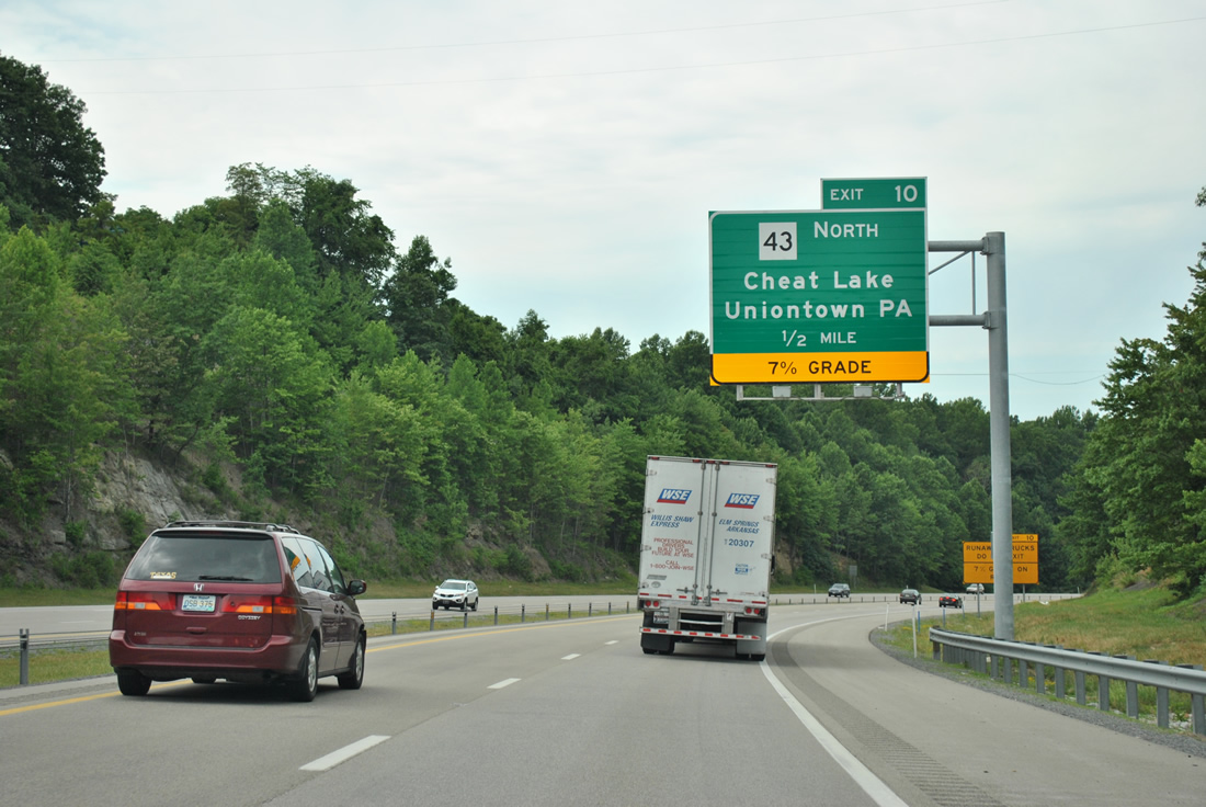
| One half mile out from Exit 10 on Interstate 68 west. WV 43 becomes Pennsylvaina 43 north to Uniontown and Brownsville, providing an alternate route between Morgantown and Pittsburgh. 06/24/12 |
|
| Interstate 68 continues to sink toward Cheat Lake. The Exit 10 off-ramp thus sees a 7% grade and is not recommended for most truck traffic.
WV 43 sees a folded diamond interchange nearby with CR 69/14 to provide access to CR 857 (Fairchance Road) north to Cheat Neck and Springhill, Pennsylvania and south across the Ices Ferry Bridge. CR 857 becomes PA 857 at the state line. 08/07/04, 06/24/12 |
|
| Exit 10 splits into a ramps for CR 69/19 to Ices Ferry and Lakeview Golf Resort and a higher speed ramp onto the Mon-Fayette Expressway. 06/24/12 |
|
| WV 43 and PA 43 total 70 miles in length from Interstate 68 by Cheat Lake to Jefferson Hills at PA 51. Tolls are charged on three portions of the Mon-Fayette Expressway in the Keystone State. 06/24/12 |
|
| The 50 mile per hour speed limit for trucks concludes as Interstate 68 levels out at Cheat Lake. 06/24/12 |
|
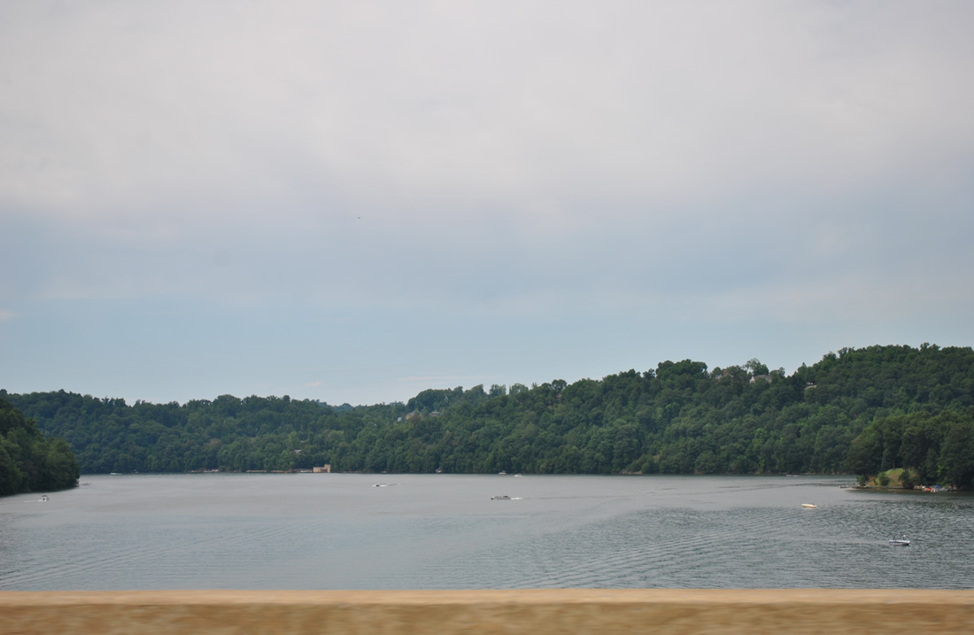
| Interstate 68 crosses Cheat Lake west from County Route 857 (Cheat Road) to enter the greater Morgantown metropolitan area. Cheat Lake was formed by the 1925-completed Cheat Lake Dam. 06/24/12 |
|
| Waters of the Cheat River flow northward into the Monongahela River at Port Marion, Pennsylvania. 06/24/12 |
|
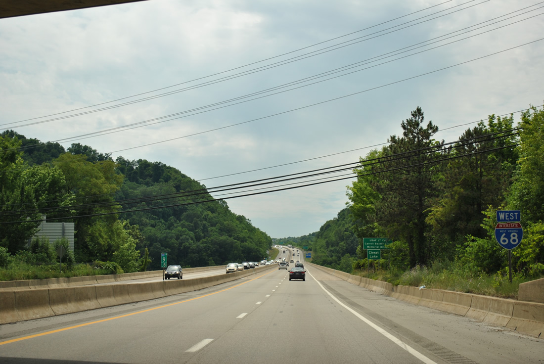
| The final three mainline interchanges of Interstate 68 serve the city of Morgantown. An interchange sequence sign listed the exits for CR 857 (Cheat Road) near Pierpont Road, WV 7 (Earl L. Core Road) and U.S. 119 (Grafton Road). 06/24/12 |
|
| Traffic bound for the West Virginia University campus and associated sports facilities should use CR 857 (Cheat Road) west to U.S. 119 (Mileground Road) south to WV 705 west. WV 705 arcs west from Mileground Road to WVU north of Mountaineer Field and U.S. 19 at WVU Coliseum. 08/07/04 |
|
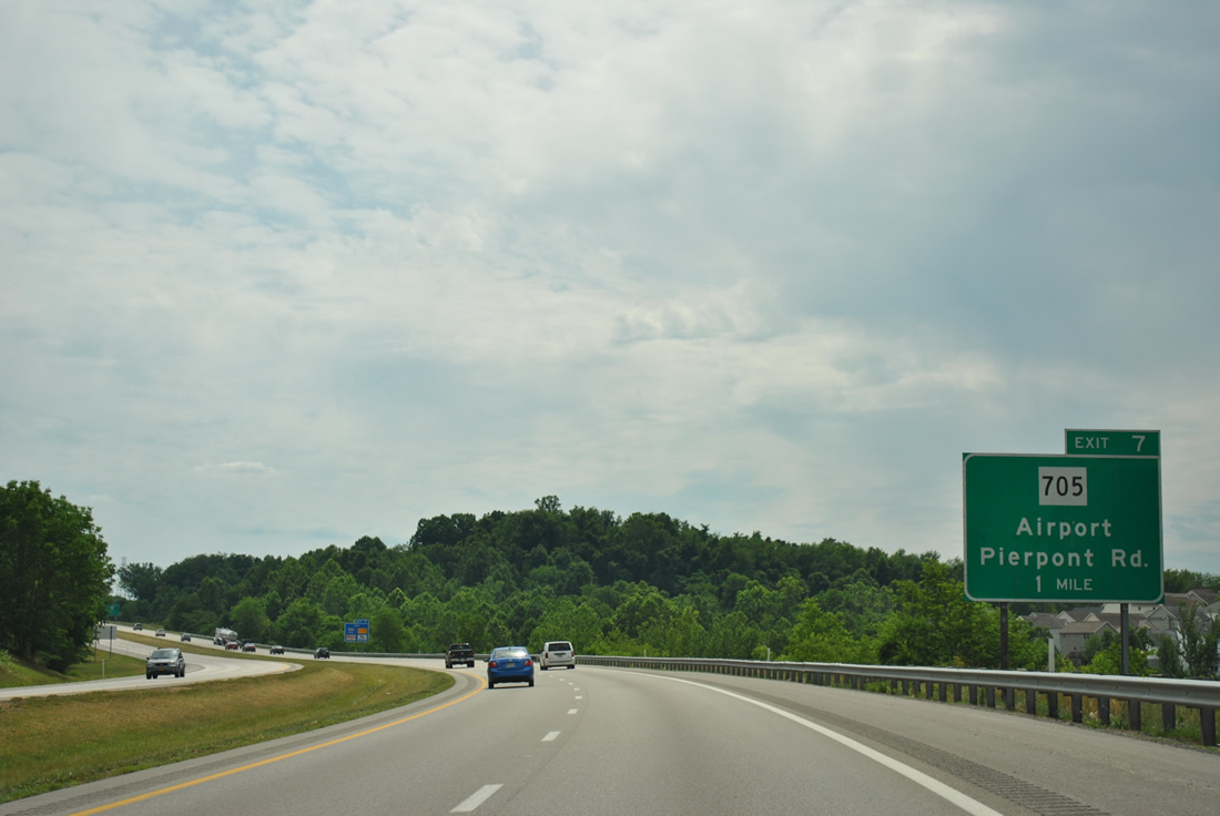
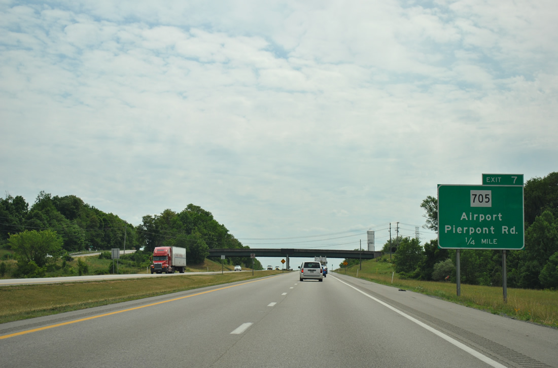
| One mile guide sign for the Exit 7 diamond interchange with County Route 857 (Cheat Road). Signs for Exit 7 refer to WV 705 exclusively, even though that route begins 2.4 miles to the west via CR 857 west to U.S. 119 south. 06/24/12 |
|
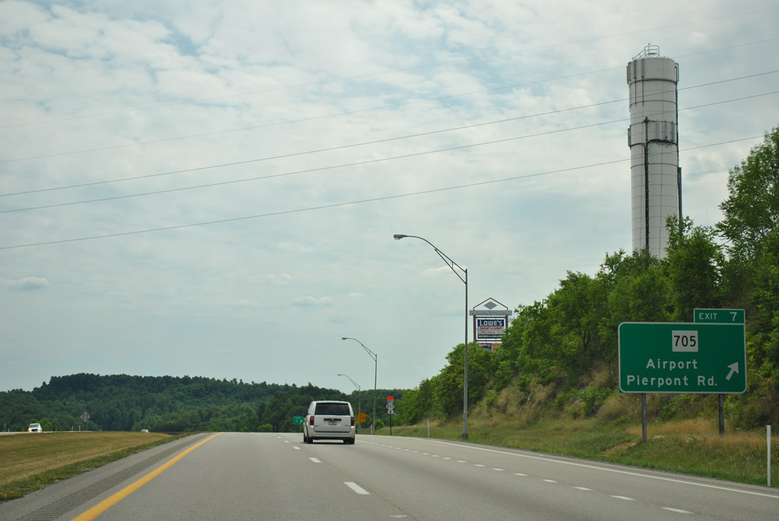
| One quarter mile out from the Exit 7 off-ramp to CR 857 (Cheat Road) near Pierpont on I-68 west. Pierpont Road (CR 67) spurs south from Cheat Road nearby to CR 75 (Tyrone Road), north of Brookhaven. 06/24/12 |
|
| Exit 7 leaves Interstate 68 westbound for County Route 857 (Cheat Road) to Easton and Pierpont. Cheat Road constitutes a four lane divided highway between the freeway and U.S. 119. CR 857 splits with U.S. 119 (Mileground Road) south for Hartman Run Road to provide the most direct link to Morgantown Municipal Airport (MGW) nearby. 06/24/12 |
|
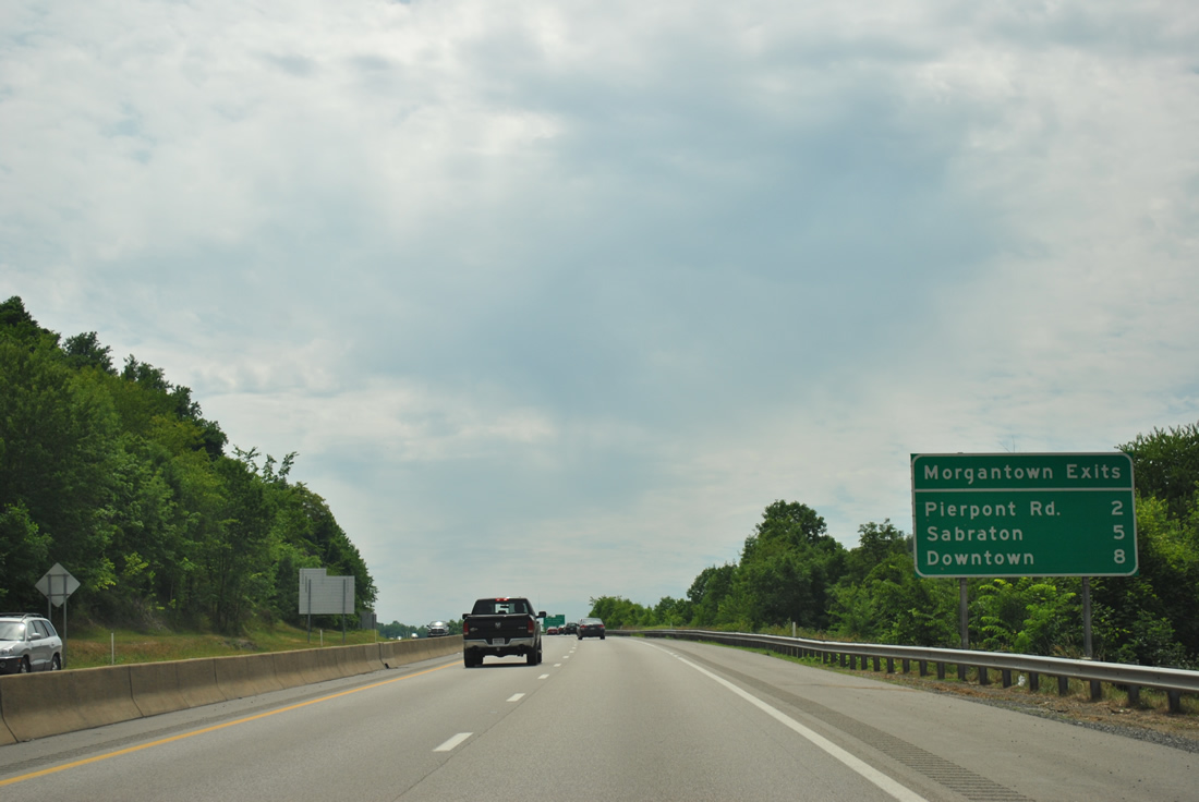
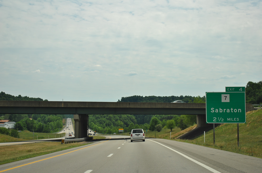
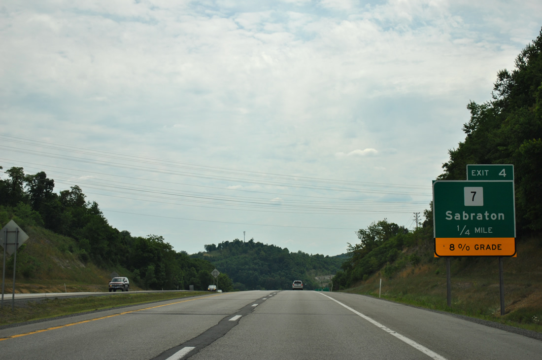
| The first sign of the next interchange (Exit 4) lies within Exit 7 on Interstate 68 west. WV 7 (Rogers Avenue) meets the freeway in 2.25 miles at Sabraton in southeast Morgantown. 06/24/12 |
|
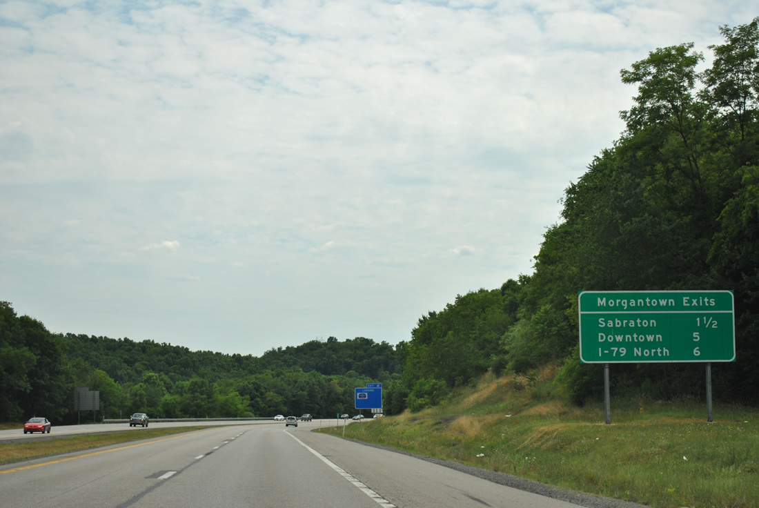
| Interchange sequence sign listing the final interchanges of Interstate 68 west. Interstate 68 ends in six miles at Interstate 79 south of the city. Interstate 79 passes by the western suburbs of Westover and Granville en route to Washington, Pennsylvania. 06/24/12 |
|
| One mile east of the Exit 4 off-ramp to WV 7 (Earl L. Core Road) on I-68 west. WV 7 leads north to Sabraton and east by Brookhaven. 06/24/12 |
|
| Interstate 68 descends abruptly into a valley ahead of Exit 4 and Deckers Creek. Truckers are advised of the 8% grade associated with the Exit 4 folded diamond interchange with WV 7 (Earl L. Core Road) at Sabraton. 06/24/12 |
|
| Motorists bound for WV 7 (Earl L. Core Road) depart Interstate 68 west at Exit 4. WV 7 travels three miles northwest of Brookhaven to downtown Morgantown. The state route continues from there with U.S. 19 north to Star City and Osage before splitting at Pursglove. WV 7 constitutes a lengthy route between New Martinsville at the Ohio River and Hopemont near the Maryland state line. 06/24/12 |
|
| Westbound reassurance shield posted as Interstate 68 ascends from Deckers Creek. Deckers Creek Trail, a rail to trail, also passes under the freeway. 06/24/12 |
|
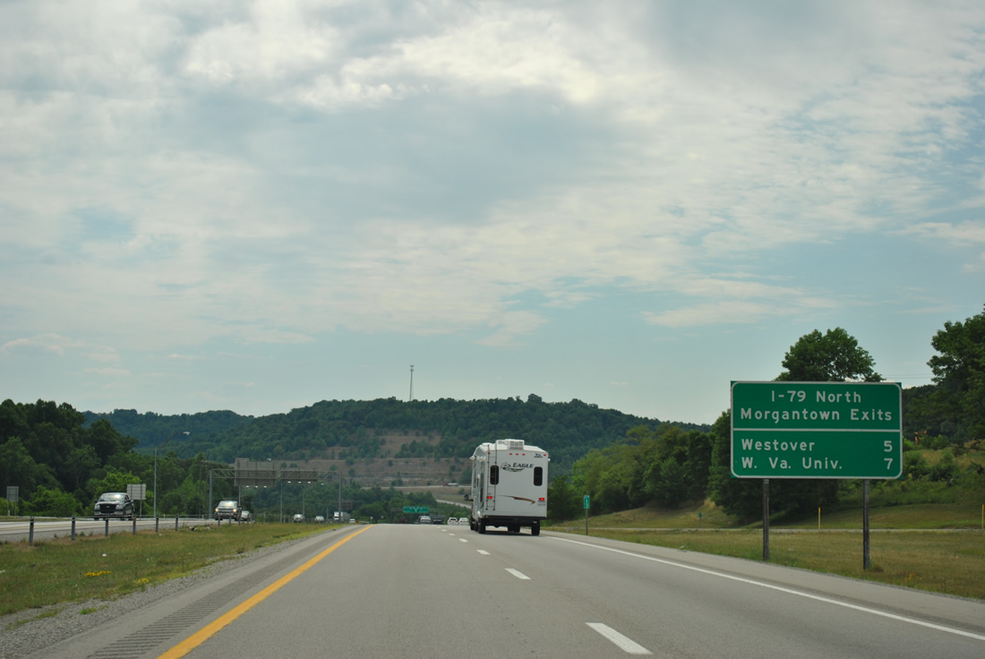
| A third Morgantown Exits sign posted along Interstate 68 westbound lists the distances to U.S. 119 (Exit 1), Interstate 79 (Exit 0), and Westover (Interstate 79 north - Exit 152). 06/24/12 |
|
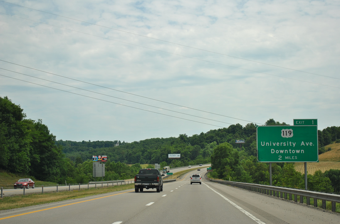
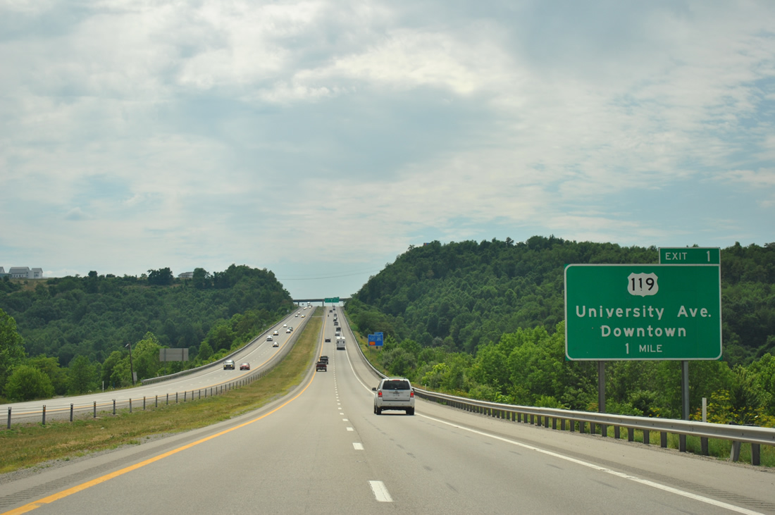
| U.S. 119 (Grafton Road) intersects Interstate 68 at its final mainline interchange south of Morgantown. The US route travels University Avenue south from U.S. 19 (Pleasant Avenue) and downtown 3.6 miles to meet Interstate 68 at a folded diamond interchange (Exit 1). 06/24/12 |
|
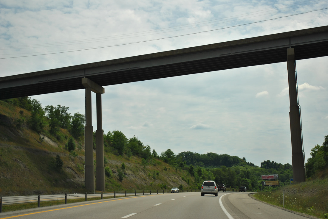
| A high-level bridge carries Kingwood Pike (CR 81) over Interstate 68 midway between Exits 4 and 1. Kingwood Pike ventures south from Dorsey Avenue & Greenbag Road (CR 857) to Mt. Vernon in Preston County. 06/24/12 |
|
| The first sign for the impending western terminus of Interstate 68 lies two miles east of Interstate 79 ahead of U.S. 119 (Exit 1). Interstate 79 provides the main route between Charleston and Pittsburgh, Pennsylvania. However WVDOT signs use Fairmont and Washington, Pennsylvania as the control cities for the freeway. 06/24/12 |
|
| The undulation of Interstate 68 continues on the mile approach to U.S. 119 (University Avenue). U.S. 119 enters the Mountain State by way of Port Marion, Pennsylvania northeast of Morgantown. From there the US highway enters Morgantown at Easton and travels southwest via Mileground Road and Wiley Street into the central business district. 06/24/12 |
|
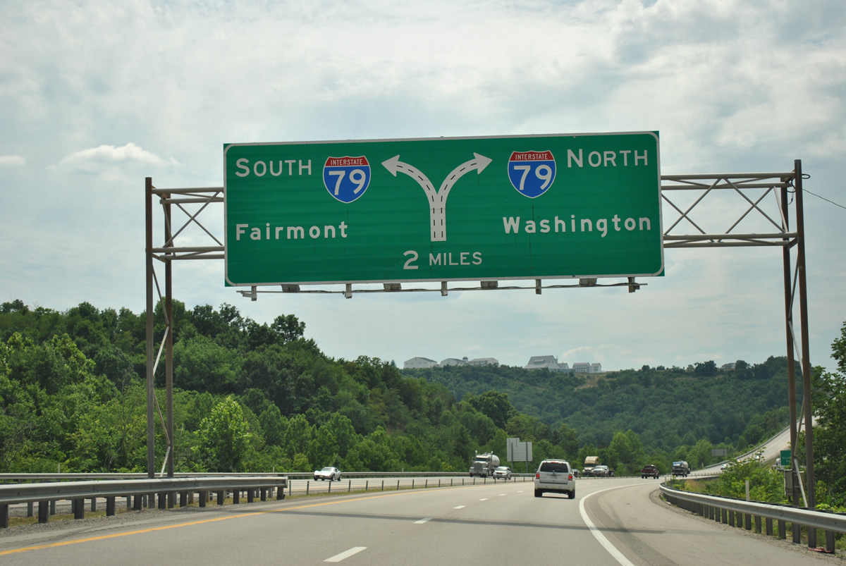
| One mile diagrammatic overhead for the tri-level stack interchange with Interstate 79 (Exit 0). Interstate 79 travels 11 miles southwest from Morgantown to Fairmont and 29 miles to Clarksburg. The freeway sees two interchanges north of Interstate 68 for west Morgantown. 06/24/12 |
|
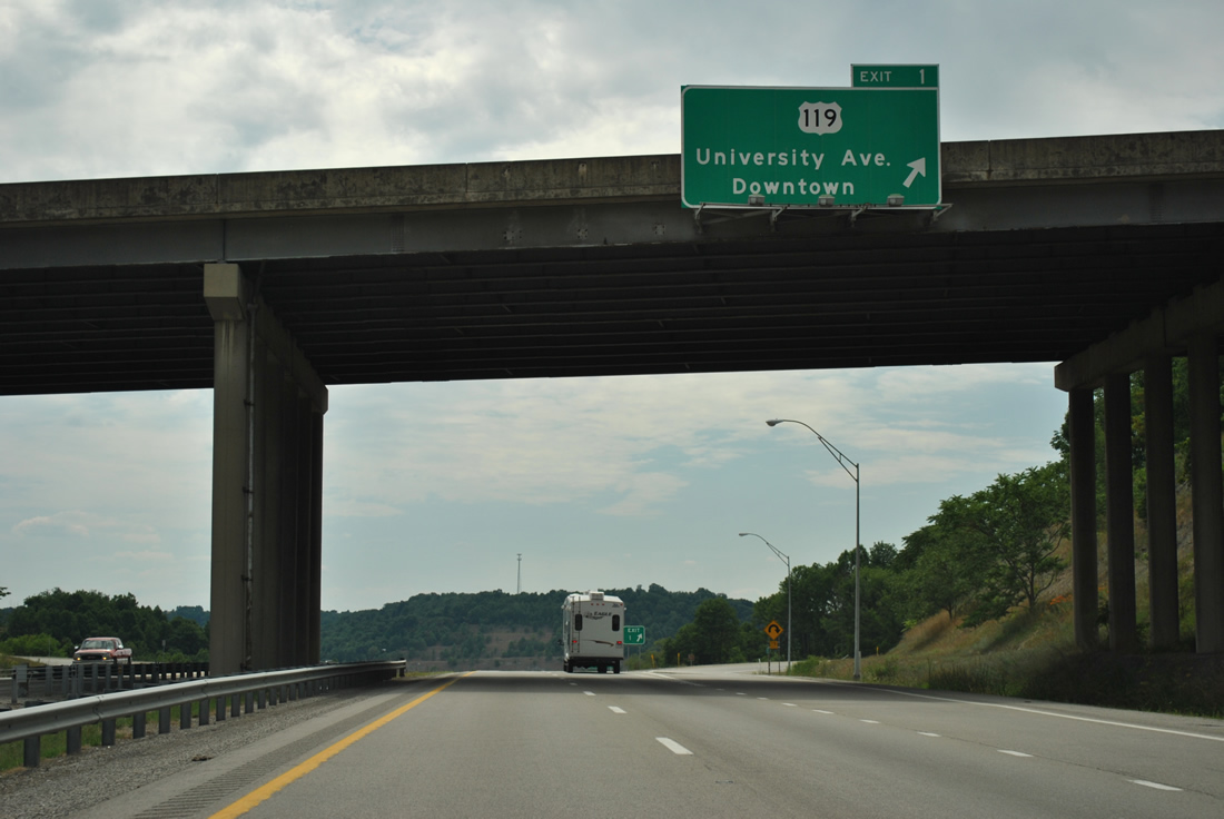
| Attached to the Grafton Road overpass high above is the Exit 1 overhead for the loop ramp onto U.S. 119. U.S. 119 follows University Avenue northward into Morgantown. South of Interstate 68, U.S. 119 is known as Grafton Road for its connection to Grafton, 20 miles to the south. 06/24/12 |
|
| Use Interstate 79 north for the Morgantown west suburbs of Westover, Granville, Star City, and Osage. Interstate 79 meets U.S. 19 (Fairmont Road) at Exit 152 and Chaplin Road near U.S. 19 & WV 7 at Exit 155. 06/24/12 |
|
| Interstate 68 westbound widens to three lanes in anticipation of the ramp split for Interstate 79 north and south. Interstate 79 southbound ends at Interstate 77 in 148 miles at Charleston. Northward the freeway crosses the Pennsylvania state line in 13 miles and overlaps with Interstate 70 in 46 miles at Washington, Pennsylvania. 06/24/12 |
|
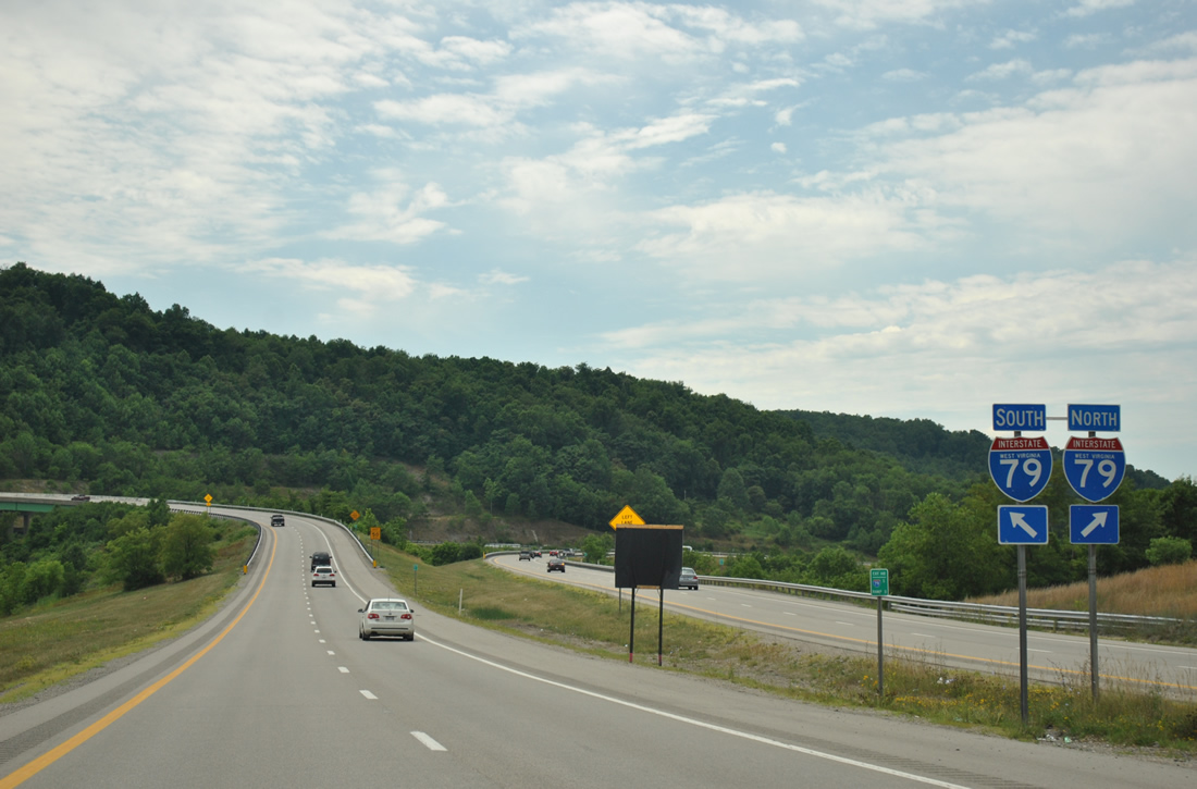
| Traffic partitions between high speed ramps to Interstate 79 south and north. Interstate 79 south next meets County Route 77 (Goshen Road) at Exit 146. Interstate 79 north meets U.S. 19 (Fairmont Road) in four miles. 73 miles separate Interstate 68 from the Steel City via Interstate 79. 06/24/12 |
|
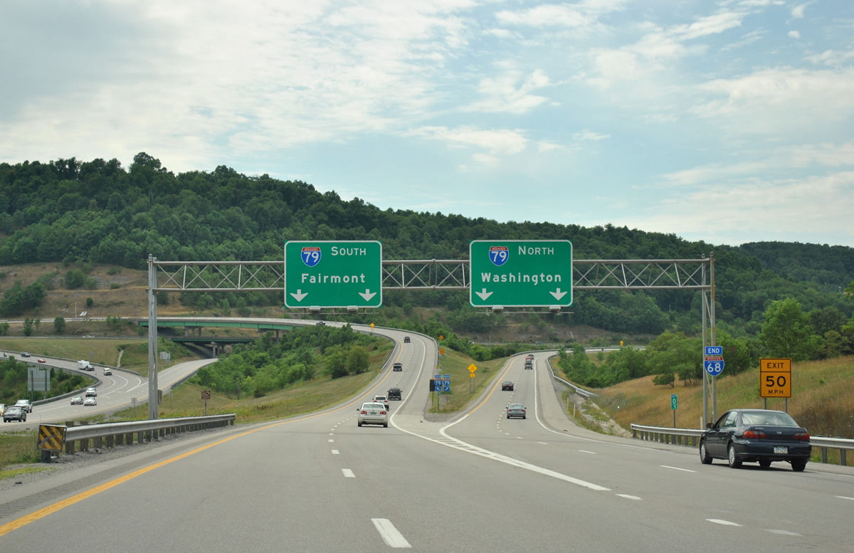
| Interstate 68 ends as traffic separates for I-79. A 73 mile proposed extension included in the National Highway System by the Federal Highway Administration as of September 9, 2003, outlined a route leading northwest from Morgantown to Moundsville and Wheeling. 06/24/12 |
Page Updated 02-05-2013.

 West
West