|
| I-68/U.S. 40 leave the Frostburg area and cross the Garrett County line on the three mile drive between Midlothian and MD 546 (Finzel Road). A button copy distance sign stands within the western reaches of Allegany County. 08/07/04 |
|
| I-68/U.S. 40 west expand to three lanes with the addition of a truck climbing lane ahead of Exit 29 and MD 546. MD 546 travels four miles between the National Freeway and the Pennsylvania state line. 08/07/04 |
|
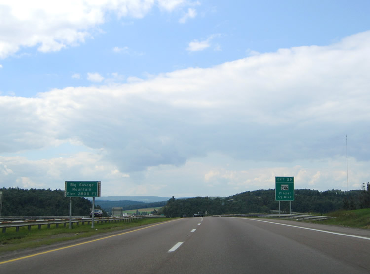
| The National Freeway crests at 2,800 feet over Big Savage Mountain one half mile ahead of the MD 546 (Exit 29) diamond interchange. The freeway skims the northern reaches of Savage River State Forest in eastern Garrett County. 08/07/04 |
|
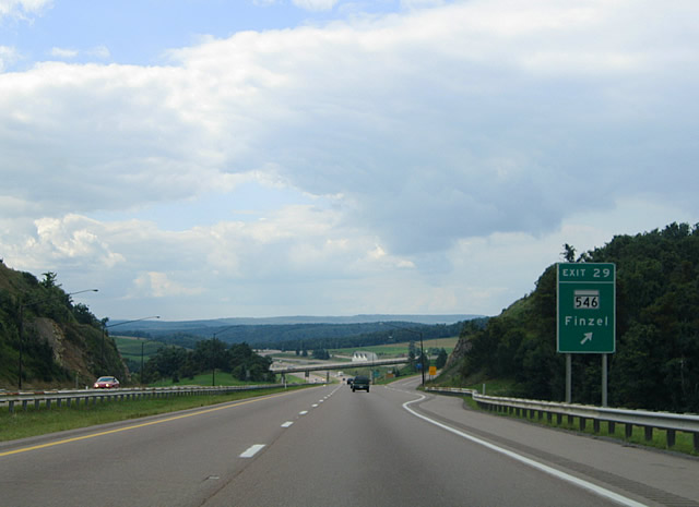
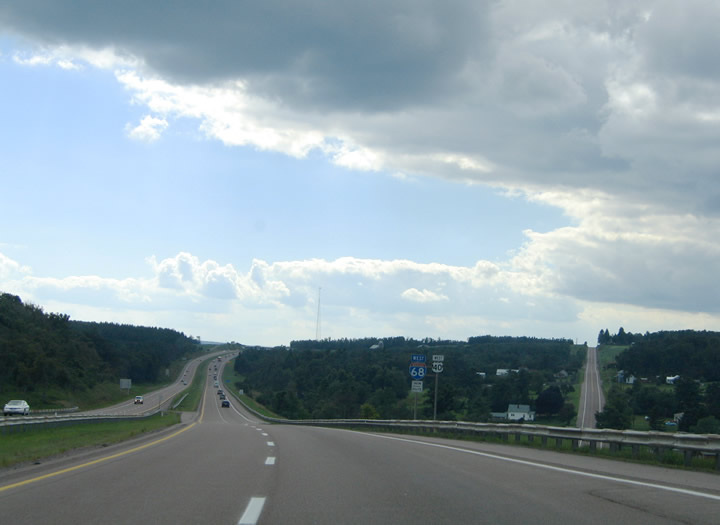
| Westbound at Exit 29 for MD 546 (Finzel Road) north to U.S. 40 Alternate (National Highway) and Finzel. Beall School Road continues south from Finzel Road and Interstate 68 to Old Frostburg Road. 08/07/04 |
|
| I-68/U.S. 40 (National Freeway) diverge with U.S. 40 Alternate (National Highway) from Exit 24 westward in this scene. The two routes however remain closely routed to Exit 19 (Grantsville). 08/07/04 |
|
| I-68/U.S. 40 cross the Eastern Continental Divide at the Green Lantern Road over crossing two miles east of Exit 24. The divide is 2,610 feet above sea level at this point. 08/07/04 |
|
| Lower New Germany Road intersects I-68/U.S. 40 at the Exit 24 diamond interchange. Meadow Mountain (2,790 feet) rises to the northwest beyond the adjacent U.S. 40 Alternate (National Highway). 08/07/04 |
|
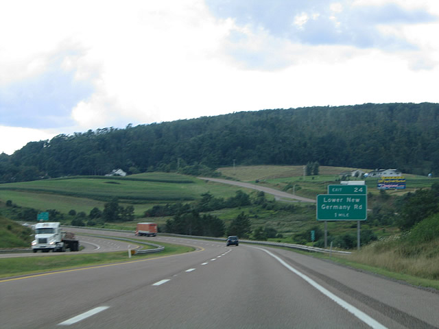
| I-68/U.S. 40 westbound again expand with the advent of a truck climbing lane 0.75 miles east of the Exit 24 ramp departure to Lower New Germany Road. Lower New Germany Road ventures four miles south from U.S. 40 Alternate and Meyersdale Road to Twin Churches and Westernport Roads. 08/07/04 |
|
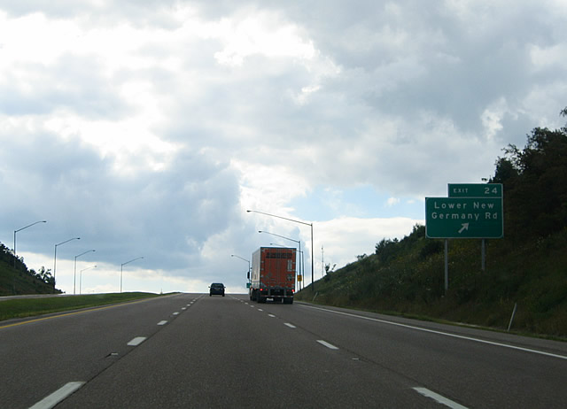
| Westbound at Exit 24 with Lower New Germany Road. Avilton Lonaconing Road stems east from Lower New Germany Road near I-68/U.S. 40. The rural highway travels three miles southeast to Avilton and 11 miles to the Allegany County line where MD 657 begins. 08/07/04 |
|
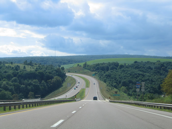
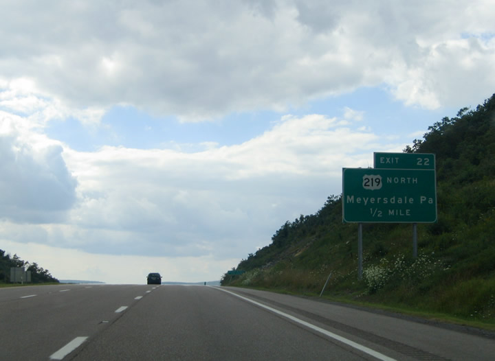
| The next westbound exit joins I-68/U.S. 40 with U.S. 219 south (Salisbury Road). U.S. 219 combines with the National Freeway west from 4.4 miles south of Salisbury, Pennsylvania. 08/07/04 |
|
| Cresting ahead of the diamond interchange (Exit 22) with Salisbury and Chestnut Ridge Roads. Chestnut Ridge Road continues Salisbury Road south two miles to New Germany Road. 08/07/04 |
|
| I-68/U.S. 40 westbound at the merge with U.S. 219 south. U.S. 219 northbound follows Salisbury Road north 2.3 miles to Pennsylvania and the Mason Dixon Highway. The US route splits into a Business and Bypass component 9.6 miles to the north at Meyersdale, Pennsylvania. 08/07/04 |
|
| The first shield assembly posted for I-68/U.S. 40 west and U.S. 219 south. New Germany Road passes over the National Freeway in the distance. 08/07/04 |
|
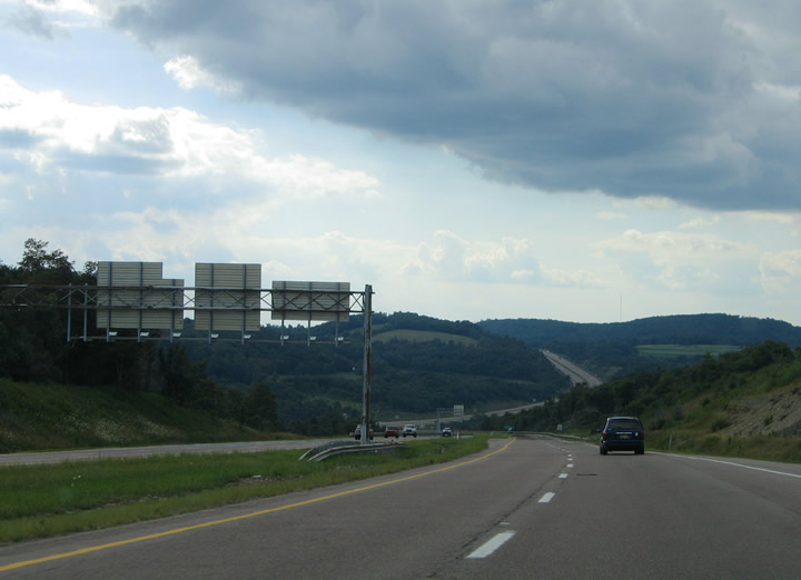
| Westbound distance sign posted at the New Germany Road over crossing. Three interchanges remain for the National Freeway within the state of Maryland. 08/07/04 |
|
| MD 495 (Bittinger Road) crosses paths with I-68/U.S. 40-219 at Grantsville in one mile. MD 495 flows south from U.S. 40 Alternate (Main Street) in town to Exit 19 and Bittinger eight miles to the south. 08/07/04 |
|
| I-68/U.S. 40 west and U.S. 219 south cross the Casselman River ahead of the Exit 19 diamond interchange with MD 495 (Bittinger Road). 08/07/04 |
|
| One half mile east of the Exit 19 off-ramp to MD 495 (Bittinger Road). MD 495 joins Grantsville with Swanton in 19 miles and MD 135 near Altamont in 22 miles. The state route ends at U.S. 40 Alternate (Main Street). 08/07/04 |
|
| MD 495 (Bittinger Road) north ties into U.S. 40 (Main Street) three blocks east of Springs Road (MD 669). MD 669 travels north from Grantsville two miles to Springs, Pennsylvania as PA 669. 08/07/04 |
|
| The National Freeway again descends toward the Shade Hollow Road under crossing west of Grantsville. 08/07/04 |
|
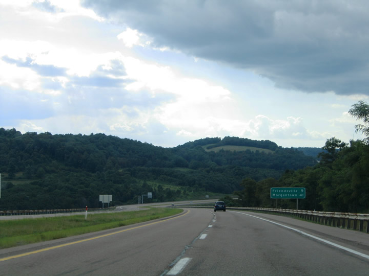
| I-68/U.S. 40 west and U.S. 219 south pass through the Savage River State Forest again on the drive to Keysers Ridge. Keysers Ridge lies four miles ahead at the partition of U.S. 40 west and U.S. 219 south with Interstate 68. Friendsville lies 14 miles to the west at MD 42. 08/07/04 |
|
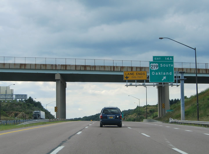
| A cloverleaf interchange connects Interstate 68 with the departing U.S. 40 west and U.S. 219 south. U.S. 40 overtakes the National Highway from U.S. 40 Alternate on the northwesterly turn toward Addison and Uniontown, Pennsylvania. U.S. 219 heads southwest to Accident and Oakland. 08/07/04 |
|
| Exit 14B carries U.S. 40 westbound motorists onto the National Highway in one half mile. U.S. 40 travels five miles from Keysers Ridge to Addison, Pennsylvania. Uniontown, Pennsylvania lies 30 miles to the northwest at the crossroads with U.S. 119. 08/07/04 |
|
| U.S. 40 westbound concludes a 68 mile overlap with I-68. The National Highway continues 65 miles northwest through Uniontown to Washington, Pennsylvania. U.S. 40 overlaps or parallels Interstate 70 west from there to Idaho Springs, Colorado. 08/07/04 |
|
| A loop ramp carries U.S. 219 southbound motorists from Interstate 68 west onto the Garrett Highway. U.S. 219 enters Accident in six miles and McHenry in 13 miles. The Garrett County seat of Oakland lies 25 miles to the south at MD 39. 08/07/04 |
|
| Continuing westbound on Interstate 68 toward Friendsville and Morgantown, West Virginia. For the first time the Interstate is devoid of any U.S. highway counterpart. 08/07/04, 0000 |
|
| The final Maryland interchange along I-68 west is with MD 42 (Friendsville Road) at Friendsville. MD 42 travels 15 miles overall between U.S. 219 near Hoyes and the Pennsylvania state line near Asher Glade. 08/07/04 |
|
| Interstate 68 curves south of Friendsville ahead of Exit 4 to Friendsville Hoyes Road. Friendsville Hoyes Road intersects MD 42 (Friendsville Road) just north of the National Freeway. 08/07/04 |
|
| Interstate 68 crosses over Water Street in Friendsville at Exit 4 for MD 42 (Friendsville Road). MD 42 ventures three miles south to Elder and six miles to Hoyes. Asher Grade lies six miles to the north. Friendsville Addison Road leads east for Selbysport and Youghiogheny River Lake. 08/07/04 |
Page Updated 03-14-2005.


 West
West


 South
South