|
| Truckers carrying hazardous cargo are advised to use Interstate 465 around the city of Indianapolis in lieu of Interstate 70 through downtown. Interstate 70 enters Marion County and the Indiana capital of Indianapolis ahead of the Cumberland Road overpass. 12/17/11 |
|
| Interstate 70 kinks southwestward into the Indianapolis eastern suburbs. Meeting the freeway next is Post Road at the Exit 91 parclo interchange. 12/17/11 |
|
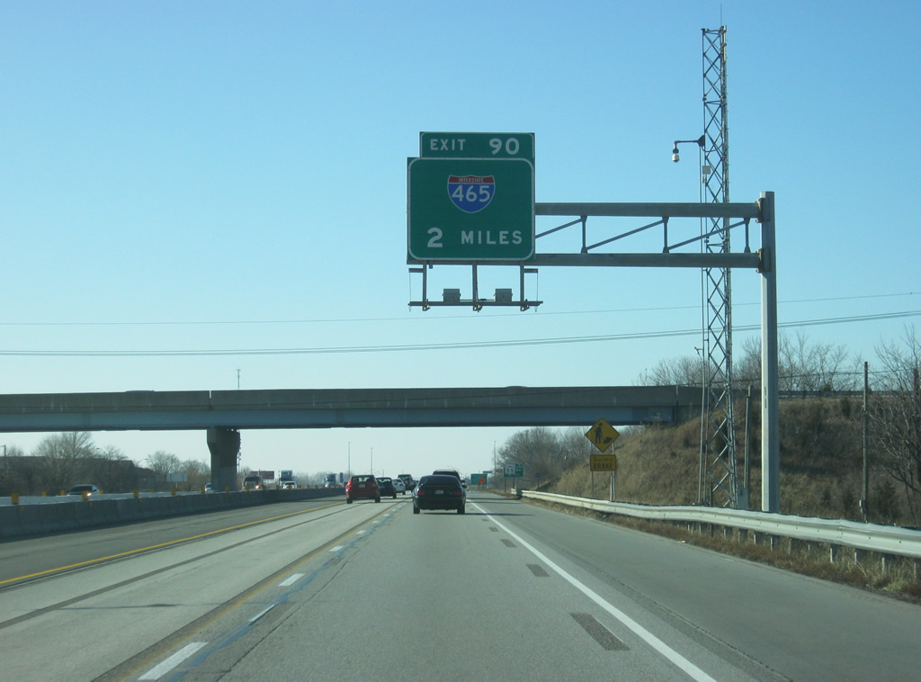
| Two miles east of Interstate 465 at the Mitthoefer Road overpass of Interstate 70 west. Interstate 465 constitutes a 53.51 mile beltway. 12/17/11 |
|
| Post Road consists of an arterial leading south to U.S. 40 (Washington Street) and the Wanamaker area near Interstate 74 and north to U.S. 36/SR 67 (Pendleton Pike) at Lawrence. 12/17/11 |
|
| The Indiana State Police Museum, Memorial and Eternal Flame are reached by taking Post Road south of Exit 91 to 21st Street. 12/17/11 |
|
| Now at Exit 91 (Post Road). The road was originally named for Fort Benjamin Harrison which was previously located in Lawrence at the spot where Post Road ended to the north. Today, it is Fort Harrison State Park. Post Road remains the most important north-south road across the Warren Township suburbs of Indianapolis. Exit 90 for Interstate 465 is one and half miles away. 12/17/11 |
|
| Still within the Exit 91 parclo interchange, Interstate 70 truckers are reminded again of the hazardous cargo prohibition within the beltway. 10/16/04 |
|
| West of Exit 91 (Post Road), Interstate 70 west expands to five lanes in anticipation of the Exit 90 directional cloverleaf interchange with Interstate 465. Although not signed, Interstate 465 carries a myriad of other routes along its encircling of the city. U.S. 31, 36, 52, and 421 follow the east side of the beltway along with SR 37 and 67, but none of those are acknowledged here. 12/17/11 |
|
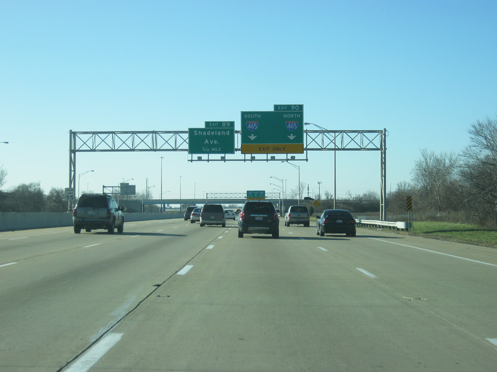
| Exit 90 carries motorists to Interstate 465 in unison from Interstate 70 west. Shadeland Avenue meets the freeway at the adjacent folded diamond interchange and represents the predecessor to the beltway (old SR 100). Interstate 465 was built between 1959 and 1970 and replaced SR 100 along the stretch between Exits 20 and 25.1 12/17/11 |
|
| Franklin Road passes over Interstate 70 west at the Exit 90 two lane ramp departure to Interstate 465. Interstate 465 north heads toward Lawrence with connections to U.S. 36/SR 67 (Pendleton Pike) east, I-69/SR 37 north to Fort Wayne, U.S. 31 north to Kokomo, and U.S. 421 north to Michigan City among others. 12/17/11 |
|
| A directional ramp scoots southward onto Interstate 465 to Beech Grove with connections to II-74/U.S. 421 south to Wanamaker, Acton, and Cincinnati, U.S. 31 south to Columbus, and SR 37 south to Martinsville. 10/16/04 |
|
| Exit 89 to Shadeland Avenue (former SR 100) leaves from within the Interstate 465 interchange. A loop ramp carries drivers from Interstate 465 north onto Interstate 70 with access to both Shadeland Avenue and the westbound freeway. 11/04/11 |
|
| Shadeland Avenue leads north through industrial areas west of Interstate 465 to former U.S. 36 (Pendleton Pike). Southward the arterial becomes commercial in nature to the cloverleaf interchange with former U.S. 40 (Washington Street); from Washington Street south former SR 100 constitutes a local freeway to Interstate 465 south near Five Points. 11/04/11 |
|
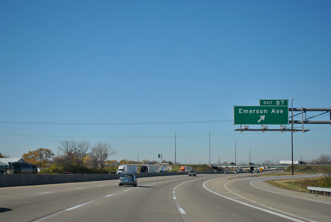
| Curving northwest, Interstate 70 approaches the Exit 87 six-ramp parclo interchange with Emerson Avenue (Exit 87). 11/04/11 |
|
| Emerson Avenue leads through residential areas south of Interstate 70 to Sunnyview, Irvington and Beech Grove. 11/04/11 |
|
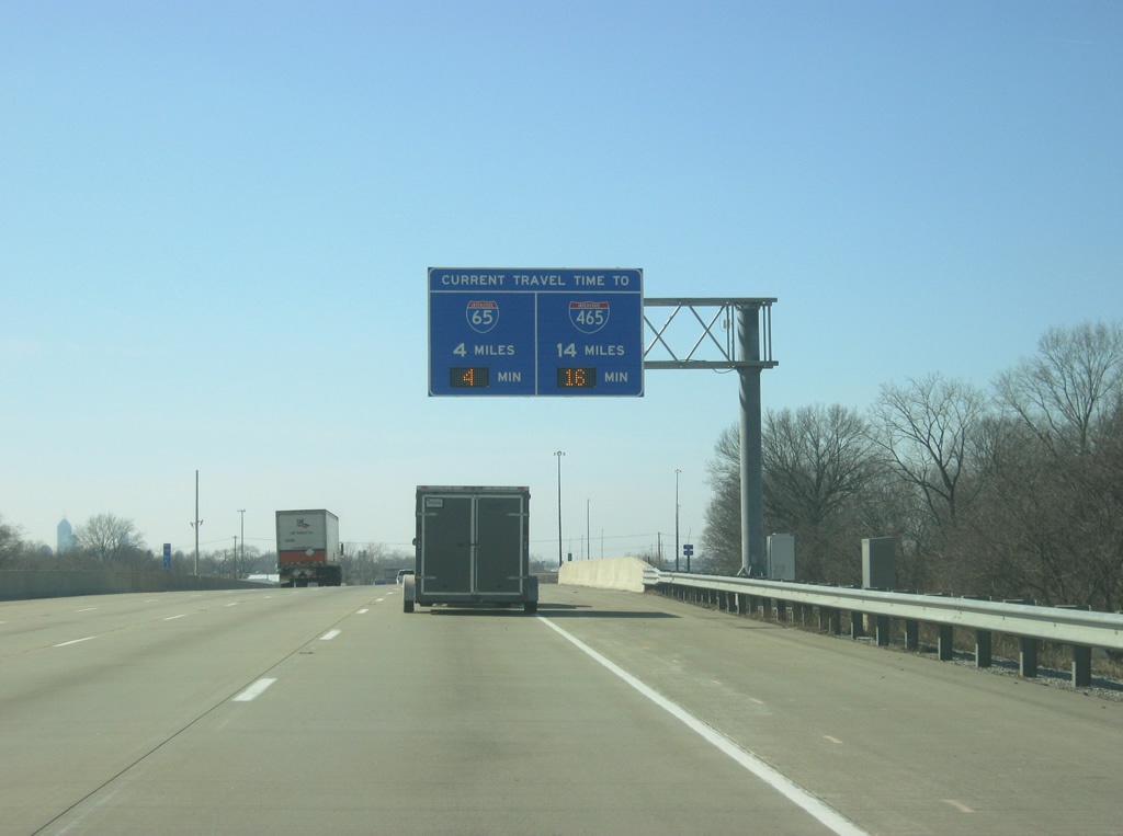
| Approaching Emerson Avenue (Exit 87), a new Travel Time Sign alerts motorists of the distance and estimated time to reach Interstates 65 (at Downtown) and 465 (on the west side). 02/18/12 |
|
| Exit 67 departs Interstate 70 west for Emerson Avenue. Emerson Avenue continues north through residential neighborhoods to Millersville and East 56th Street. 11/04/11 |
|
| Construction in 2007-08 rebuilt a six mile stretch of Interstate 70 between Interstate 465 and the merge with Interstate 65. The "Super 70" project widened the road in portions and added a bridge over the CSX Railroad and Sherman Drive in place of a lowered stretch of freeway to improve visibility and drainage.9 Low-mast lighting was also removed along the stretch. 11/04/11 |
|
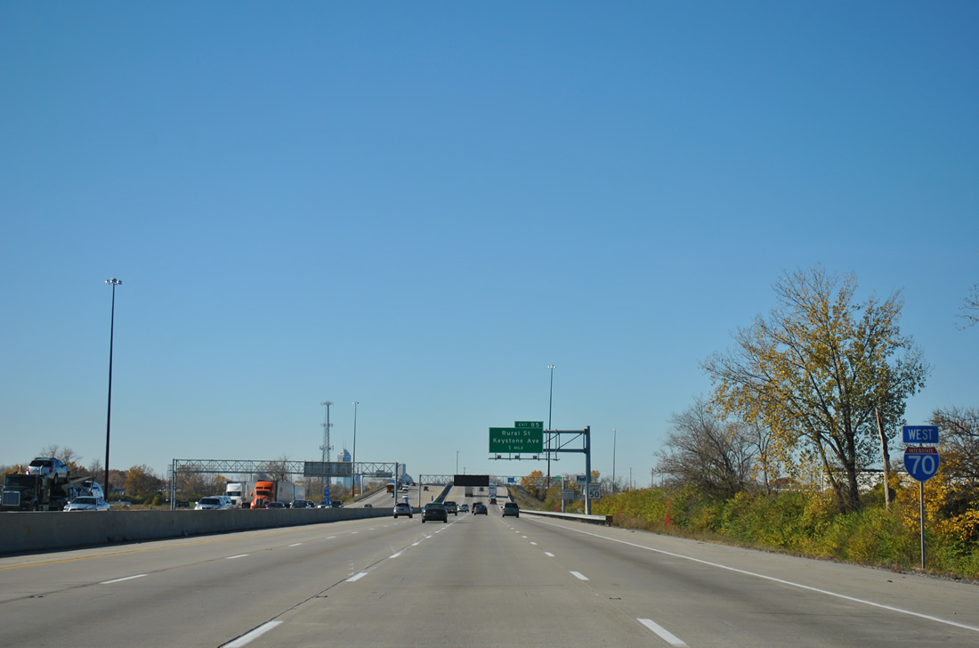
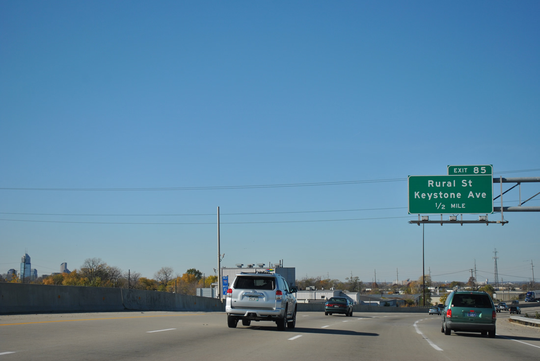
| Next in line for westbound drivers is the Exit 85 six-ramp parclo interchange with Keystone Way north and Rural Street south. 11/04/11 |
|
| A CSX Railroad line and Sherman Drive used to pass over Interstate 70 west on the half mile approach to Exit 85 and the divided Keystone Way. "Super 70" construction elevated the freeway above both the railroad line and adjacent street in 2007. 10/16/04 |
|
| A look at the new bridge for Interstate 70 over the CSX Railroad and Sherman Drive. Forthcoming Exit 85 provides access to Martin University via Massachusetts Avenue (former SR 367) east and the State Fairgrounds via 38th Street west. 11/04/11 |
|
| Keystone Avenue meanders north to Fall Creek Parkway / Binford Boulevard (former SR 37) where the street used to become SR 431 north. Rural Street continues the arterial south through Woodruff Place to the five-point intersection with English Avenue (former U.S. 52) and Southeastern Avenue (former U.S. 421). Interstate 65 south merges with Interstate 70 west in 1.5 miles. 11/04/11 |
|
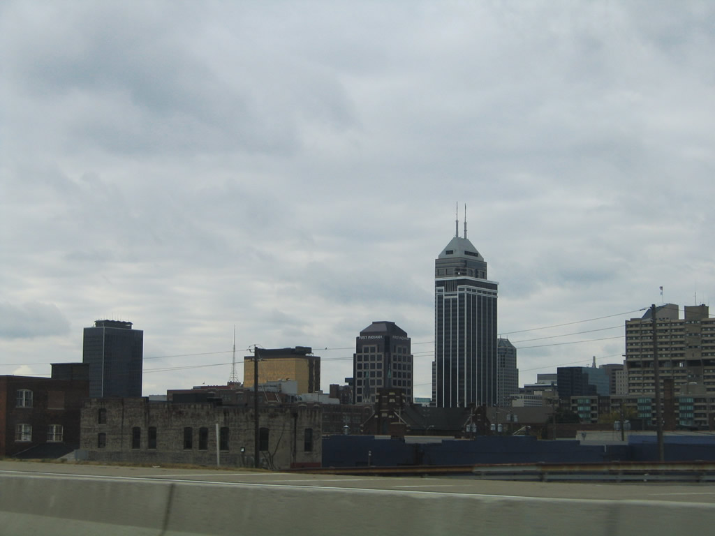
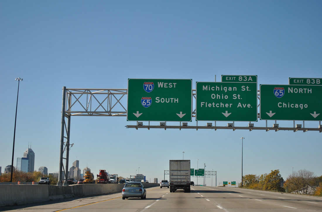
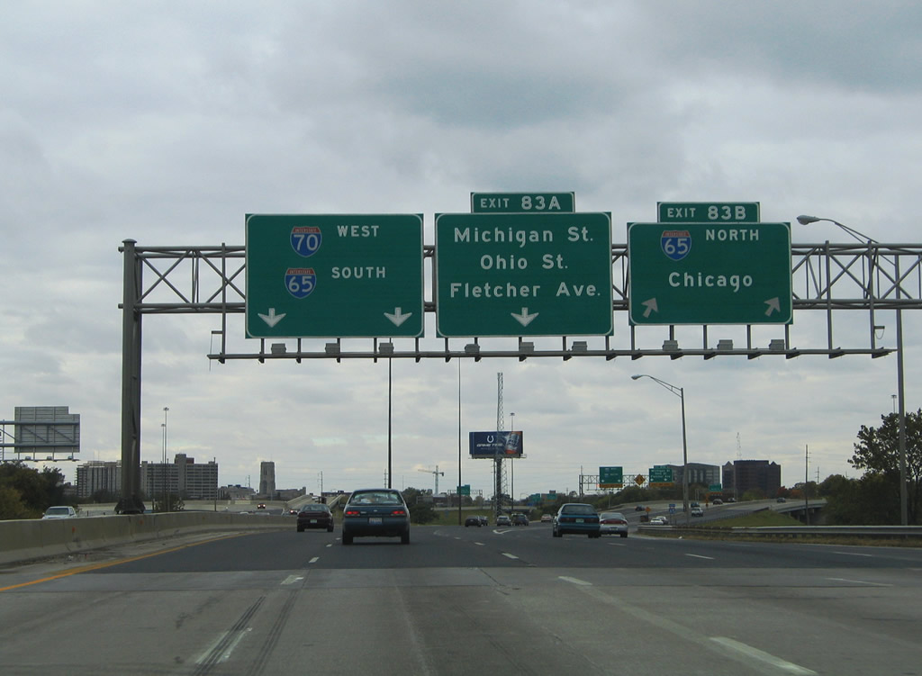
| The Indianapolis skyline comes into view as Interstate 70 nears the Exit 83 confluence with Interstate 65. 11/04/11 |
|
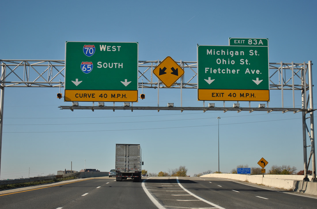
| Exit 83B connects with Interstate 65 along the north side of downtown; Exit 83A consists of a local roadway for I-65/70 providing connections into the central business district.
All button copy signs were changed for Exits 83B/A between 2004 and 2011. 10/16/04, 11/04/11 |
|
| Interstate 70 parallels Massachusetts Avenue (former SR 367) and CSX Railroad to the merge with Interstate 65. 11/04/11 |
|
| The interchange between Interstates 65 and 70 (Exit 83B) included provisions for the unconstructed section of Interstate 69 / NorthEast Freeway leading south from Binford Avenue and the beltway. Ramp stubs are visible in four locations along with a vacant grassy swath north abutting East 16th Street. 10/16/04, 11/04/11 |
|
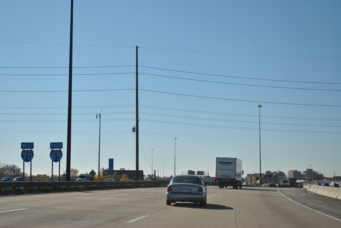
| Interstate 65 travels west briefly before turning northwest toward Wynnedale and an exit of the city. The freeway joins Indianapolis with Gary and the greater Chicago area at its northern terminus. 10/16/04, 11/04/11 |
|
| I-65/70 share 2.13 miles between Exits 83 and 80 along the east side of downtown Indianapolis. Use Interstate 65 north for Meridian Street (former U.S. 31) south into the CBD. The Exit 114 directional interchange with Martin Luther King, Jr. Street includes provisions for the unconstructed North Leg Extension Freeway leading west to the unconstructed Harding Freeway. 10/16/04, 11/04/11 |
|
| An Interstate 65 northbound shield lines the Exit 83B two lane ramp onto the North Leg Freeway at Lewis Street. 11/04/11 |
|
| Exit 83A immediately splits from Interstate 70 west as the freeway turns southward to merge with Interstate 65. Four overall lanes pass under the Interstate 65 ramps and over East 10th Street before accompanying the northbound roadway of I-65/70. 10/16/04, 11/04/11 |
|
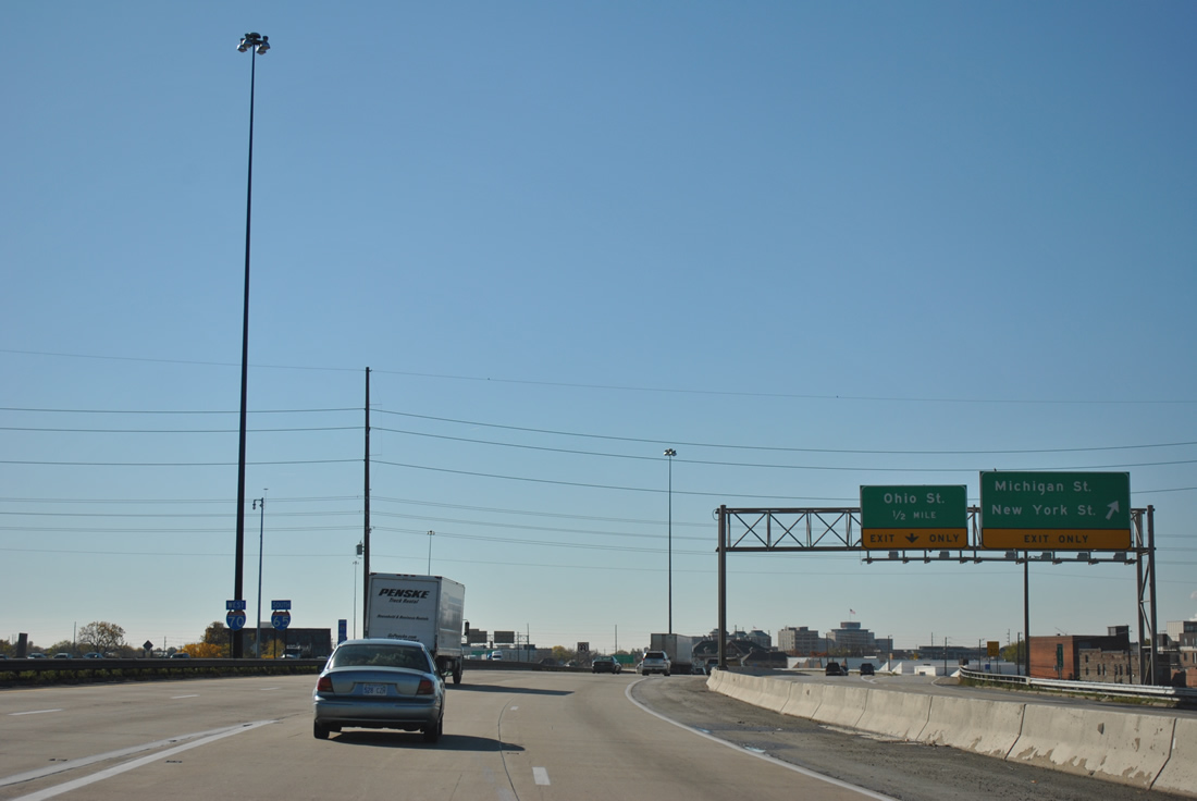
| Exit 83A comprises a local roadway with three separate ramps into downtown. Departing first is the Davison Street (southbound side frontage road) off-ramp to Michigan Street west and New York Street east. 11/04/11 |
|
| Shields posted for Interstates 65 south and 70 west at the merge of the two ramps by the Near Eastside neighborhood. These are the only reassurance markers posted along the 2.13 mile overlap of I-65/70. 11/04/11 |
|
| Looking west at the Indianapolis skyline from I-65/70. 10/16/04, 11/04/11 |
|
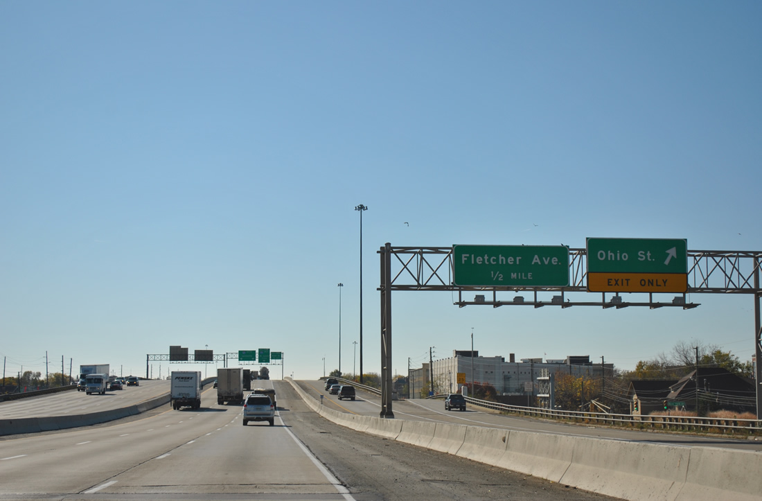
| Drivers bound for Ohio Street west into downtown leave the Exit 83A local roadway. Ohio Street provides access to the Indiana state capitol complex and the Soldiers and Sailors Monument. 11/04/11 |
|
| On-ramps join the local roadway from Market Street east and Ohio Street west ahead of the Fletcher Avenue off-ramp. Fletcher Avenue links Shelby Street east of I-65/70 with the six-way intersection of East Street, South Street, and Virginia Avenue. South Street west leads to the Bankers Life Fieldhouse (home of the Indiana Pacers NBA franchise) and Lucas Oil Stadium (home of the Indianapolis Colts NFL franchise).
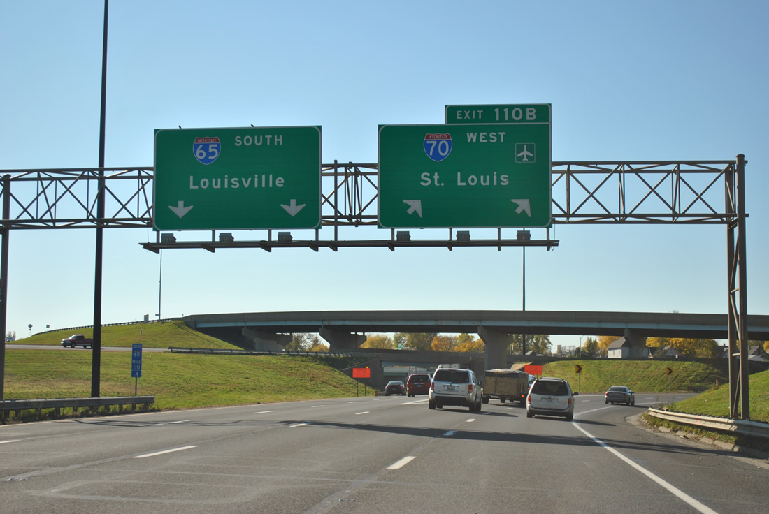
I-65/70 meanwhile prepare to split at a tri-level stack interchange (Exit 110B). 11/04/11 |
|
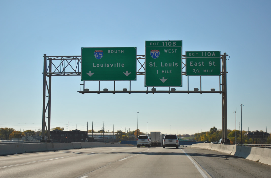
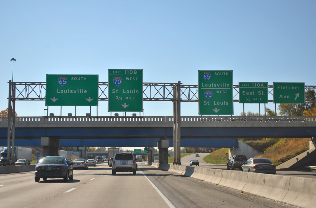
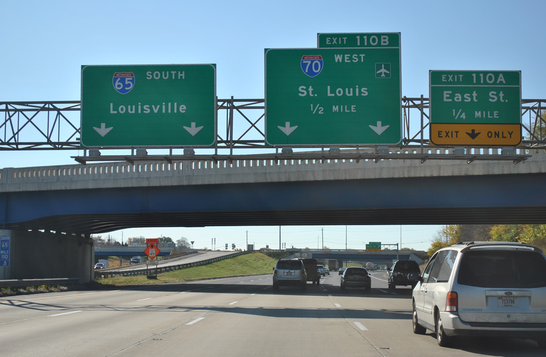
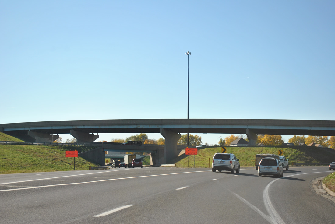
| Interstate 65 continues southeast toward Beech Grove and Louisville, Kentucky. Interstate 70 resumes its westward course to Indianapolis International Airport and Terre Haute. 11/04/11 |
|
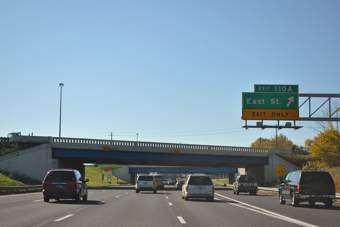
| Exit 110A leaves before the split, carrying motorists west to East Street at Bicking Street west. 11/04/11 |
|
| Southbound Interstate 65 at the Exit 110B departure of Interstate 70 west. Interstate 70 continues west from Indianapolis to St. Louis, Kansas City, and Denver on its 2,153.13 mile route across the country. The freeway was completed in Indiana by 1976.2 Interstate 65 travels 887.30 miles overall and 261.27 miles within the Hoosier State. Completion of the north-south freeway within the state occurred in 1976 as well.3 11/04/11 |
|
| Interstate 70 straddles southern reaches of downtown Indianapolis from Interstate 65 west to the White River. Exit 79B facilitates movements between the freeway and Meridian Street via a trumpet interchange and short access road. The Meridian (formerly McCarty) exit is the best route into the Wholesale District and Monument Circle. Older road signs referred to this exit as McCarty Street, but INDOT changed it recently to Meridian Street since it was a more familiar name and for the fact that the ramp itself lead to the street. 11/04/11 |
|
| Passing over Madison Avenue (former U.S. 31), Interstate 70 travels a short viaduct to the Exit 79B ramp departure to Meridian Street north to Monument Circle. The ramp meets with McCarty Street first after the exit. McCarty Street travels west to Meridian Street (former SR 135), Lucas Oil Stadium and Kentucky Avenue (former SR 67) and east to Madison Avenue south and Delaware Street north. West Street, a six lane arterial that forms the western leg of the Downtown "beltway" is one fourth of a mile away. 12/17/11 |
|
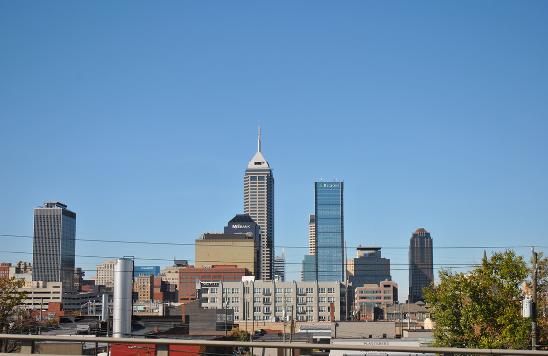
| Bankers Life Field (Conseco) House appears to the right in this skyline scene north of Interstate 70. 11/04/11 |
|
| Lucas Oil Stadium replaced the RCA Dome as the home of the Indianapolis Colts. The original Colts stadium opened in 1983 and was closed and demolished by December 2008 to make way for an expanded Indiana Convention Center. 10/16/04, 11/04/11 |
|
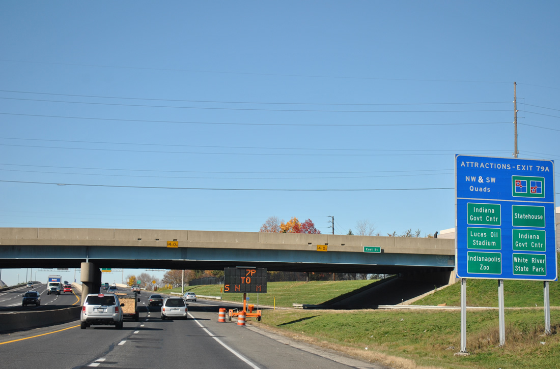
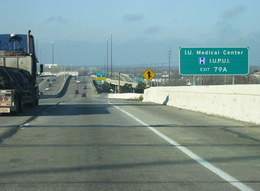
| Indiana University-Purdue University Indianapolis (IUPUI) and the IU Medical Center can be reached from West Street via Exit 79A. White River State Park and its attractions (Indianapolis Zoo, Indiana State Museum, etc.), the Indiana Government Center, the Indiana Convention Center and Lucas Oil Stadium can be best reached via West Street. 12/17/11 |
|
| A split diamond interchange (Exit 79 A) follows with the one way couplet of Missouri and West Streets. Together these roads represent a historic alignment of SR 37 to Washington and Maryland Streets (former U.S. 40). All signage along I-70 from Exit 80 / I-65 to Exit 75 / Sam Jones Expressway were replaced during the one-day closure of that highway as part of the Eli Lilly Company's Day of Service which provided for some landscaping to be done by some of the interchanges. 12/17/11 |
|
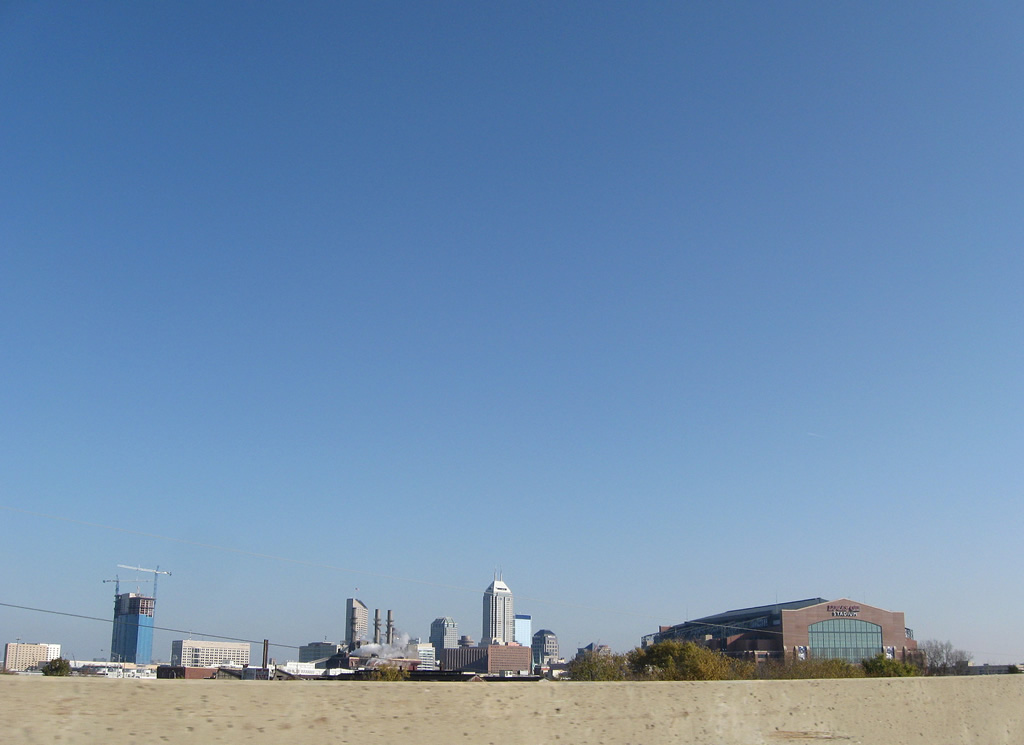
| One last look at the Indianapolis skyline before Interstate 70 leaves the central business district area. 10/16/04, 11/05/09 |
|
| West of Exit 79A (West Street). Interstate 70 leaves the downtown by crossing over the White River. 12/17/11 |
|
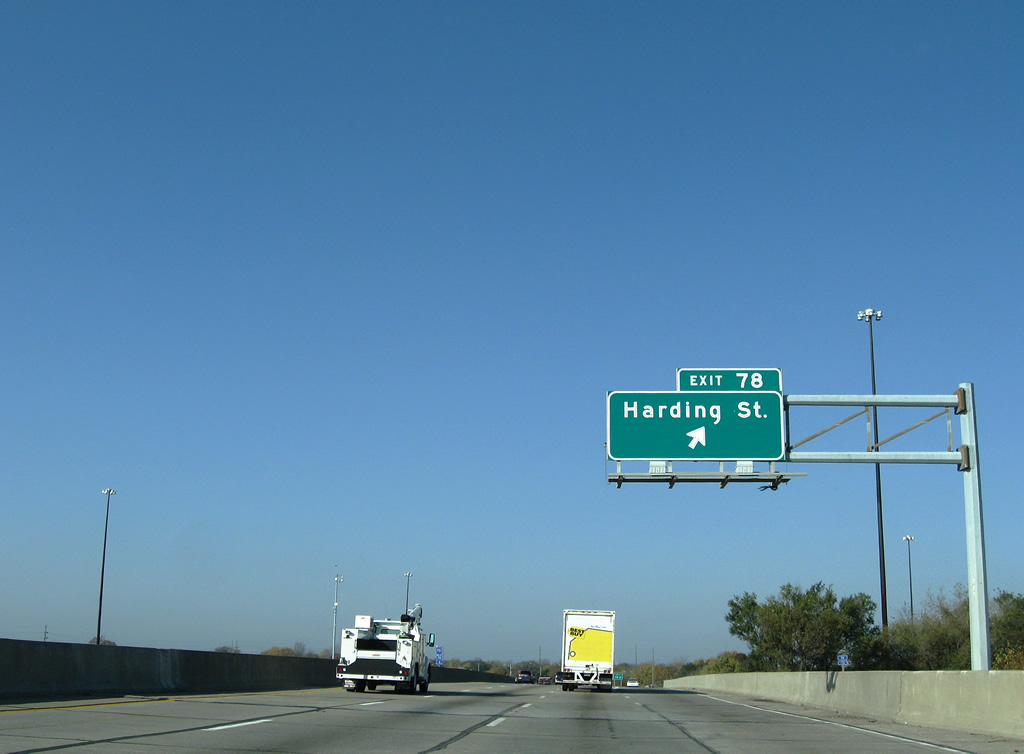
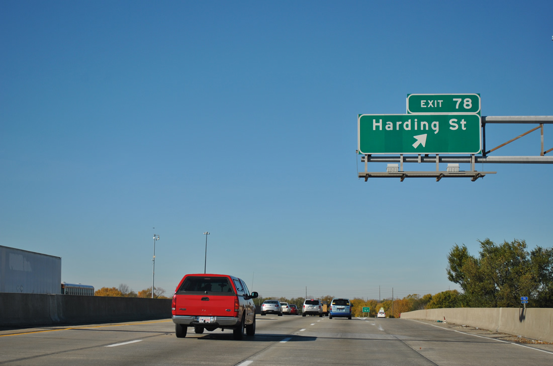
| West of the White River, the folded diamond interchange with Harding Street (Exit 78) is now a half mile away. Note the replacement of button copy based signage. 11/05/09, 11/04/11 |
|
| Harding Street begins at parallel Oliver Avenue nearby and travels southward to the Lilly Industrial Center and I-74/465 (Exit 4) at their split with SR 37 south. 11/05/09, 11/04/11 |
|
| Westbound reassurance marker posted after the Belmont Avenue under crossing along Interstate 70. McCarty Street parallels the westbound lanes of the freeway from Exit 78 to Warman Avenue. 11/05/09 |
|
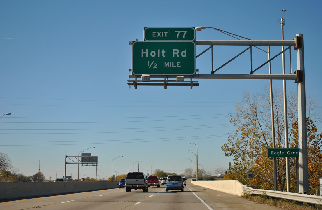
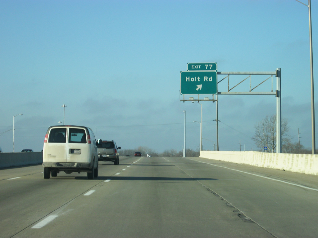
| Holt Road meets Interstate 70 by an industrial area centered on the former Stout Field at Exit 77.
All button copy signs for Exit 77 were replaced on October 7, 2010. 11/05/09, 11/04/11 |
|
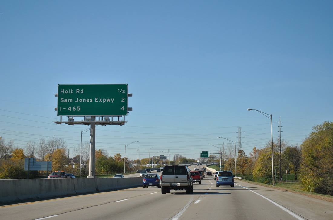
| Interstate 465 reappears on this interchange sequence sign as Interstate 70 travels over Tibbs Avenue. A Daimler Chrysler complex on the south side of the freeway was demolished between 2004 and 2009. 10/16/04, 11/04/11 |
|
| One half mile east of the Exit 77 diamond interchange with Holt Road at the crossing of Eagle Creek on Interstate 70 west. 11/05/09, 11/04/11 |
|
| Continuing north, Holt Road enters a residential area at Washington Street (former U.S. 40). The arterial stubs out at 11th Street within the town of Speedway.
Future plans call for the road to be extended to a new roundabout intersection with 16th Street, providing a new access route to the Indianapolis Motor Speedway from the south. 11/05/09, 12/17/11 |
|
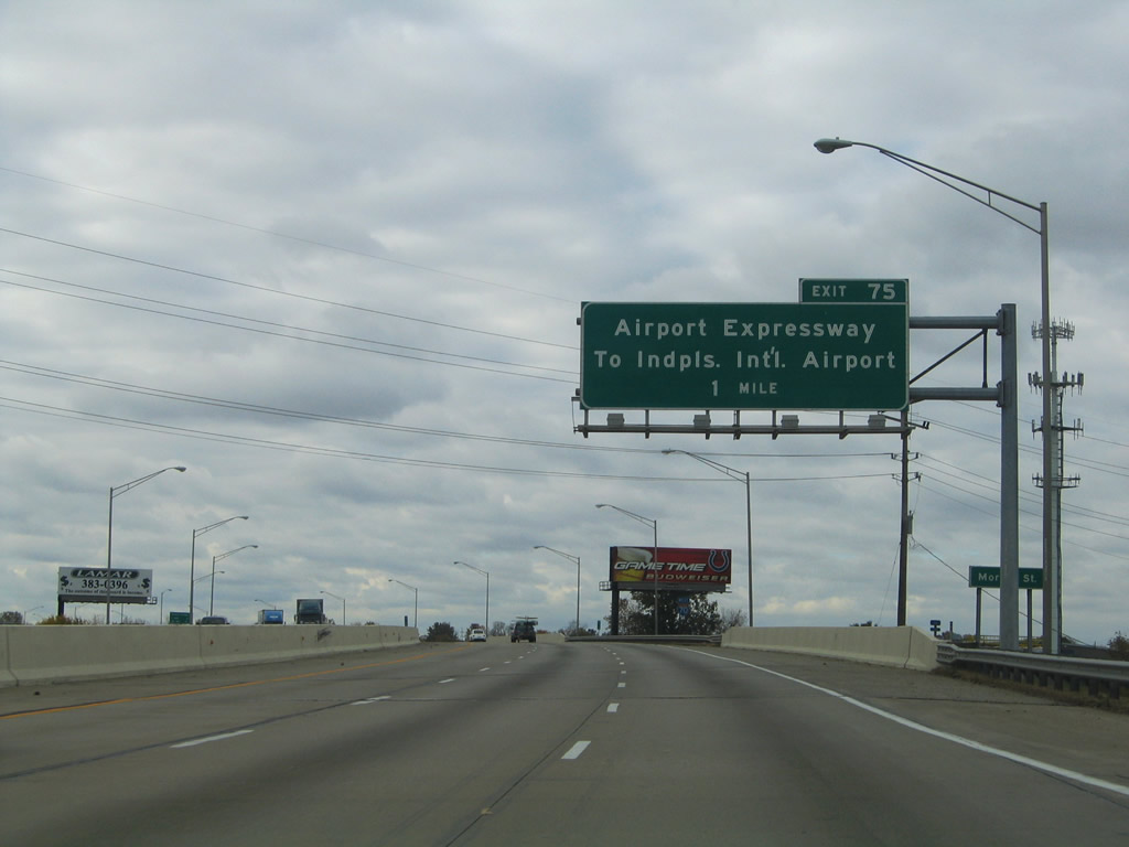
| Curving southward, Interstate 70 travels through the Drexel Gardens area on the one mile approach to Exit 75 (Sam Jones Expressway). Signed originally as the Airport Expressway, the freeway was renamed after Sam Jones, a local civic leader, in 2007. The change was made after a new terminal of Indianapolis International Airport opened north of Exit 68, rendering the Airport Expressway name irrelevant. 10/16/04, 11/05/09 |
|
| Interstate 70 westbound shield posted between the Morris and Minnesota Street underpasses. 11/04/11 |
|
| Interchange sequence sign highlighting the distances to Airport (Sam Jones) Expressway (Exit 75), Interstate 465 (Exit 73) and SR 267 (Exit 66). The original sign was replaced to reflect the Exit 68 stack interchange with the Airport access road. The new airport terminal opened on November 11, 2008, replacing the former terminal at Airport Expressway's west end.4 10/16/04, 11/04/11 |
|
| Minnesota Street passes under Interstate 70 west near the former Stout Field, one half mile north of the folded-cloverleaf interchange with Sam Jones Expressway. Sam Jones Expressway exists as a freeway west to High School Road on the airport grounds and east as surface arterial to Raymond Street at Tibbs Avenue. 10/16/04, 11/04/11 |
|
| This sign was added ahead of Exit 75 to redirect travelers bound for Indianapolis International Airport (IND) remain along Interstate 70 west to meet the facility directly at Exit 68. The Drexel Gardens community lies to the west of the assembly. 11/04/11 |
|
| Exit 75 connects Interstate 70 west with Sam Jones Expressway westbound only. The freeway facility opened in 1969 as a new route to Indianapolis International Airport.5 Both the expressway and Interstate 70 interchange with I-74/465 within two miles. 10/16/04, 11/04/11 |
|
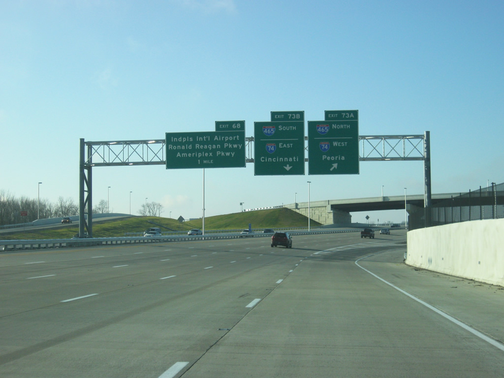
| A directional cloverleaf interchange joins Interstate 70 west with I-74/465 one mile southwest of Lyndhurst Drive. Exit 73 B serves I-74/465 north to Speedway while Exit 73 A connects with I-74/465 east to Beech Grove and Five Points. The two routes overlap for 20.60 miles.
Sign replacements add control cities for Interstate 74. 10/16/04, 12/17/11 |
|
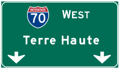
| St. Louis appeared on this interchange sequence sign westbound one half mile out from Exit 73. Ignored was Terre Haute, which lies 66 miles away.
This assembly was removed by 2011. 10/16/04 |
|
| Now a half mile away from the interchange with I-465/74. The interchange was rebuilt as part of the Accelerate 465 project along the western part of Interstate 465. The stretch of Interstate 70 through the interchange was also rebuilt with new ramps. The arrangement with the ramps remains the same however. New signage was erected that now mentions the control cities for Interstate 74 of Cincinnati, Ohio and Peoria, Illinois. 12/17/11 |
|
| Interstate 70 now expands to add two lanes for Exits 73A/B. Interstate 74 enters Indianapolis from Brownsburg parallel to U.S. 136 to the west, meeting Interstate 465 at Exit 16. Near Five Points, Interstate 74 departs the beltway for Shelbyville at a freeway spur (Exit 49) connecting with Southeastern Avenue (old U.S. 421). 10/16/04, 12/17/11 |
|
| Exit 73 B parts ways with I-70 west for I-74/465 north. I-465 north meets Interstate 65 in 11 miles; I-74 continues west to Crawfordville, Champaign-Urbana, Illinois, and the Quad Cities. Exit 68, for Indianapolis International Airport and the Ronald Reagan and AmeriPlex Parkways is accessed via a long collector distributor setup that runs from I-465 west along I-70 for several miles. 10/16/04, 12/17/11 |
|
| A loop ramp carries drivers onto I-74/465 east from a newly added fourth westbound lane of Interstate 70. Interstate 74 joins the Indianapolis area with Cincinnati, Ohio at its present eastern terminus. All of the freeway within Indiana was completed by 1967.6 10/16/04 |
|
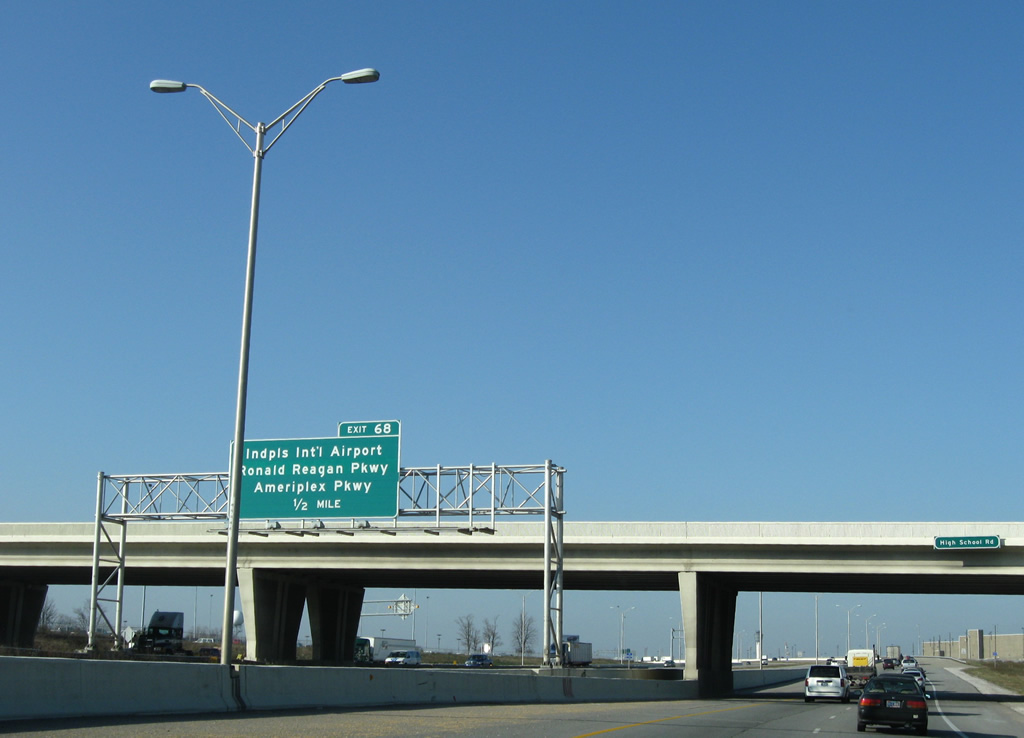
| Interstate 70 continues west from I-74/465 toward Indianapolis International Airport along a stretch of freeway reconstructed in the mid-2000s. Exit 68 consists of a two lane slip-ramp onto a new collector distributor roadway emanating from the ramps from the Indianapolis Beltway. 11/05/09 |
|
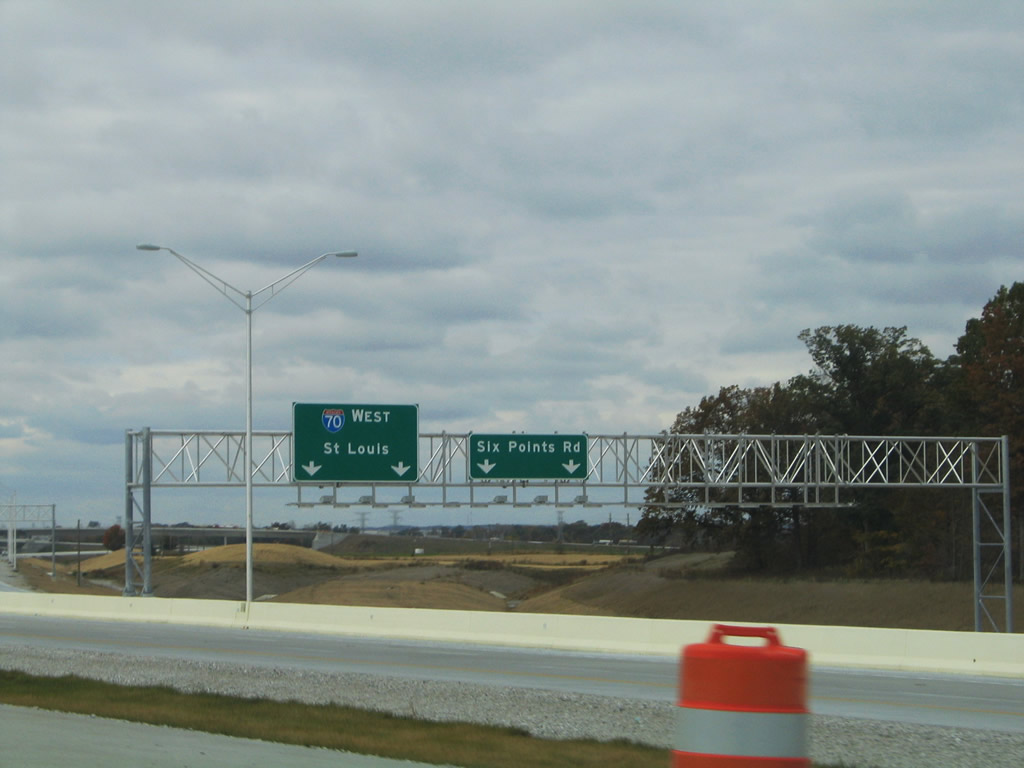
| Pictured here during construction, Exit 68 originally linked the freeway with Six Points Road. The new c/d roadway configuration acts as an express/local setup for Interstate 70 west through the directional interchange with Weir Cook Boulevard, the new access road to the airport. 10/16/04 |
|
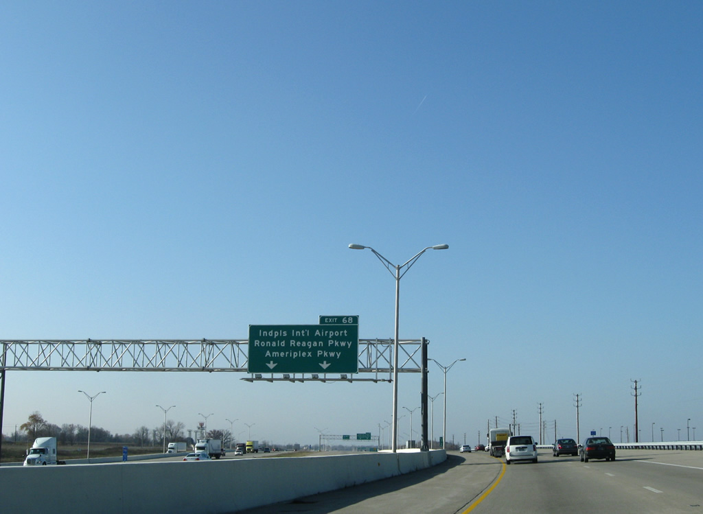
| All traffic bound for Indianapolis International Airport, Ronald Reagan Parkway and Ameriplex Parkway merge onto the Exit 68 c/d roadway in this scene. Ameriplex Parkway south and Ronald Reagan Parkway north replaced Six Points Road as a new multi-lane facility from SR 67 (Kentucky Avenue) north to U.S. 40 (Main Street) at Six Points. 11/05/09 |
|
| The c/d roadway partitions with a two lane off-ramp to Colonel H. Weir Cook Memorial Drive to a new terminal for Indianapolis International Airport opened on November 11, 2008,7 replacing the original terminal at the end of Airport Expressway. Realignment of Interstate 70 shifted the freeway south to accommodate the airport expansion between the beltway and Exit 68. 10/16/04, 11/05/09 |
|
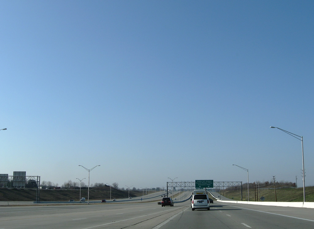
| Travelers from I-74/465 merge onto the Interstate 70 westbound mainline from the adjacent c/d roadway. The c/d roadway partitions ahead for the Colonel H. Weir Cook Memorial Drive north and the six-ramp parclo interchange with Ronald Reagan Parkway north and Ameriplex Parkway south (Exit 68). These roads were formerly known as Six Points Road for the community along U.S. 40 to the north. 10/16/04, 11/05/09 |
|
| Nearing the new off-ramp to the Colonel H. Weir Cook Memorial Drive north and return ramp to Interstate 70 west. 10/16/04, 11/05/09 |
|
| Colonel H. Weir Cook Memorial Drive arcs northeast from Interstate 70 (Exit 68) and sees a folded diamond interchange with West Perimeter Road ahead of its split to the passenger terminal. A high-speed directional interchange joins the airport access road with both Interstate 70 and adjacent Ameriplex Parkway at the Hendricks County line. 10/16/04, 11/05/09 |
|
| Approaching the flyover ramps from Colonel H. Weir Cook Memorial Drive onto the eastbound c/d roadway. A third flyover ramp shuttles drivers onto the westbound Interstate 70 c/d roadway after its split with the Airport off-ramp. 11/05/09 |
|
| The ramp to Ronald Reagan Parkway northbound departs the Exit 68 c/d roadway next. Ronald Reagan Parkway vastly replaced Six Points Road as a controlled-access expressway north to East County Road 200 (beyond U.S. 40). The north-south parkway is a part of a new corridor planned to run from SR 67 to Interstate 74 and Interstate 65 near Whitestown. The segment between U.S. 136 and Interstate 74 opened July 15, 2008 at cost of $17.5 million. This stretch includes a new diamond interchange.8 Two other segments of Ronald Reagan Parkway were joined when a new stretch of road opened between County Road 200 South and U.S. 36 at Avon on December 4, 2012.10 11/05/09 |
|
| Ameriplex Parkway continues the Ronald Reagan Parkway corridor south to SR 67 (Kentucky Avenue) near Maple Ridge. Previously rural areas between Interstate 70 and Kentucky Avenue are transitioning into a large industrial park due to the Ameriplex Parkway addition.
Interstate 70 westbound motorists formally enter Hendricks County in this scene. 11/05/09 |
Page Updated 02-29-2012.

 West
West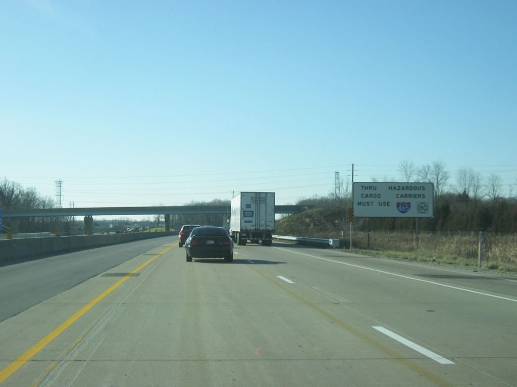


 South
South