|
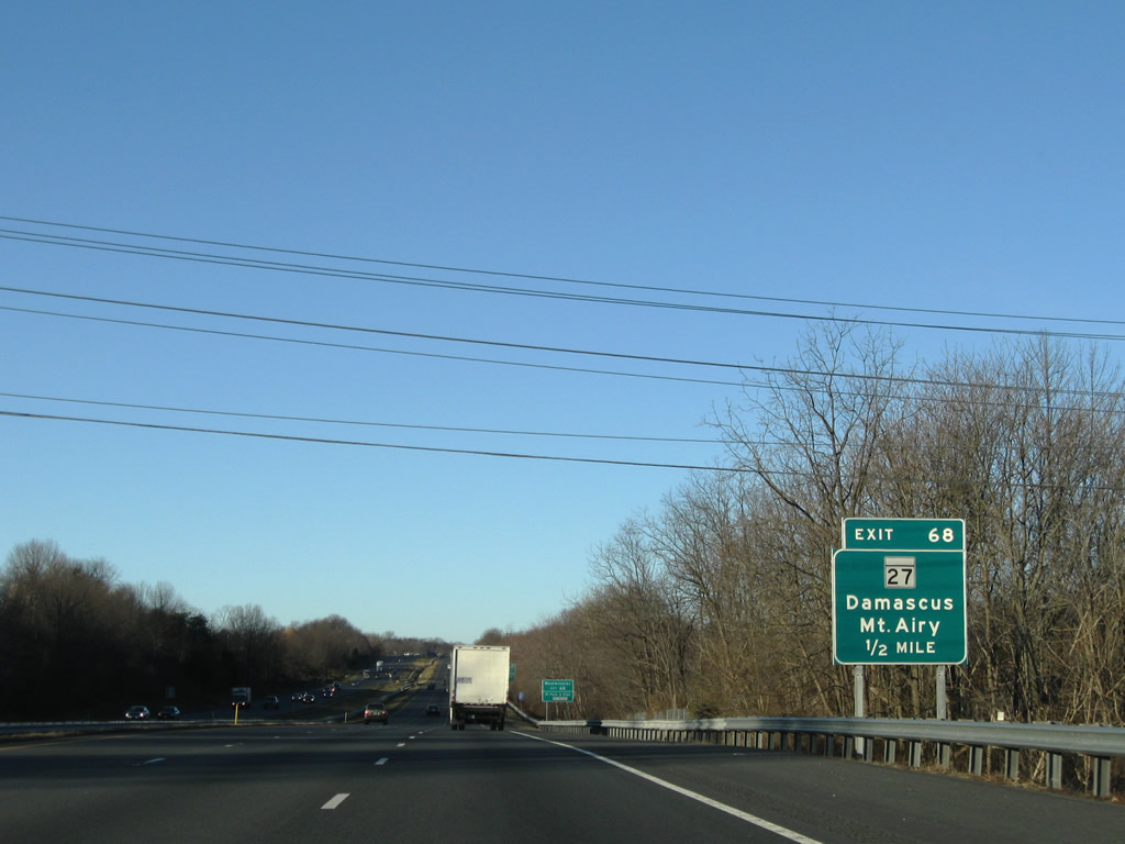
| MD 27, the next exit along westbound I-70/U.S. 40, heads north into the city of Mount Airy and south into Montgomery County to an interchange with Interstate 270 Exit 16. 12/30/08 |
|
| Exit 68 is the main exit north into Mount Airy via MD 808 (Main Street). MD 27 (Ridge Road) is a four lane route that bypasses Mount Airy to the east en route to Westminster and Manchester. 12/30/08 |
|
| Exit 68 departs the westbound freeway for MD 27 (Ridge Road). MD 27 enters northern Montgomery County west of Parrs Spring on the six mile drive to Damascus. The state route serves interests to Gaithersburg and Rockville via Interstate 270 east. 06/01/04 |
|
| Having traveled across the southwestern corner of Carroll County, between the South Branch of the Patapsco River and the center line of MD 27 (Ridge Road), I-70/U.S. 40 west enter Frederick County. A county line marker resides within the Exit 68 parclo interchange opposite a Korean War Veterans Memorial Highway monument within the freeway median. 12/30/08 |
|
| I-70/U.S. 40 parallel Bush Creek, a CSX Railroad line, and MD 144 (Old National Pike) between Mount Airy and New Market. 12/30/08 |
|
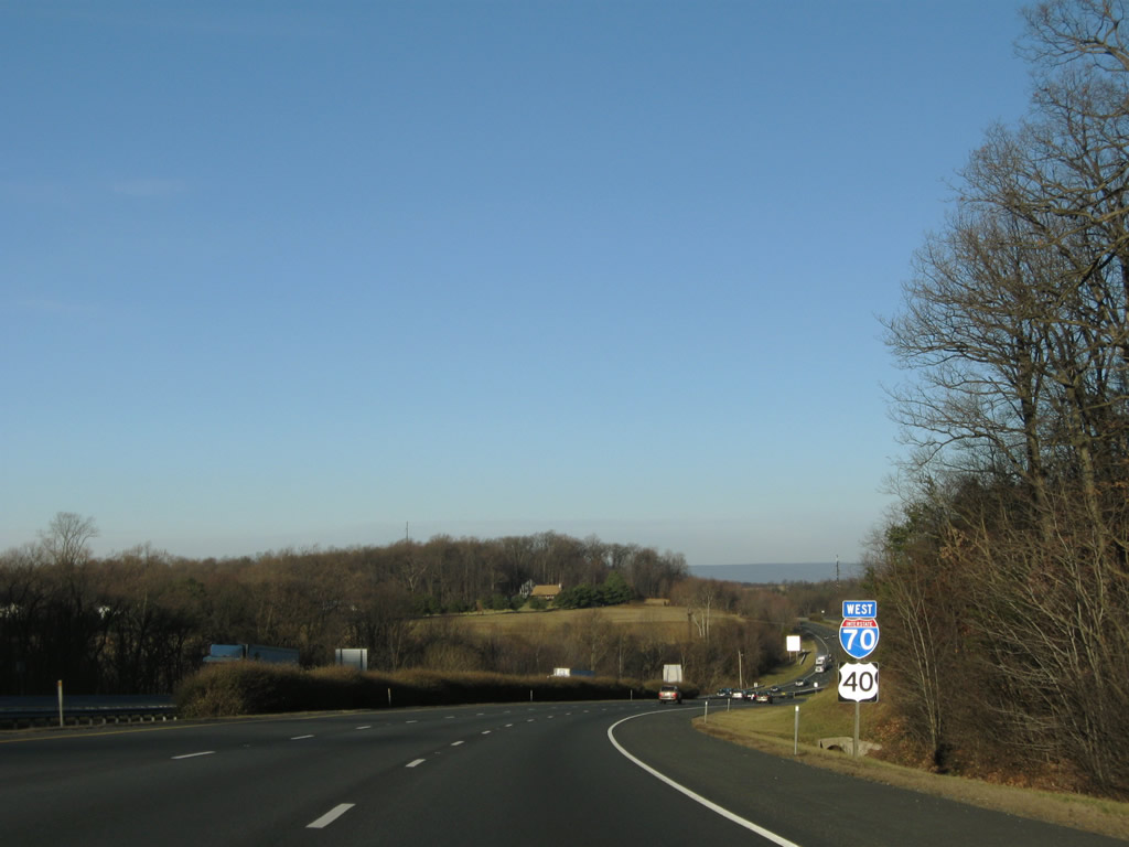
| MD 75 (Green Valley Road) crosses paths with I-70/U.S. 40 at the next interchange; Frederick follows in eight miles. 12/30/08 |
|
| Bartholows Road stems south from adjacent MD 144 by the Bartholows community on the south side of the freeway from this high overpass. 12/30/08 |
|
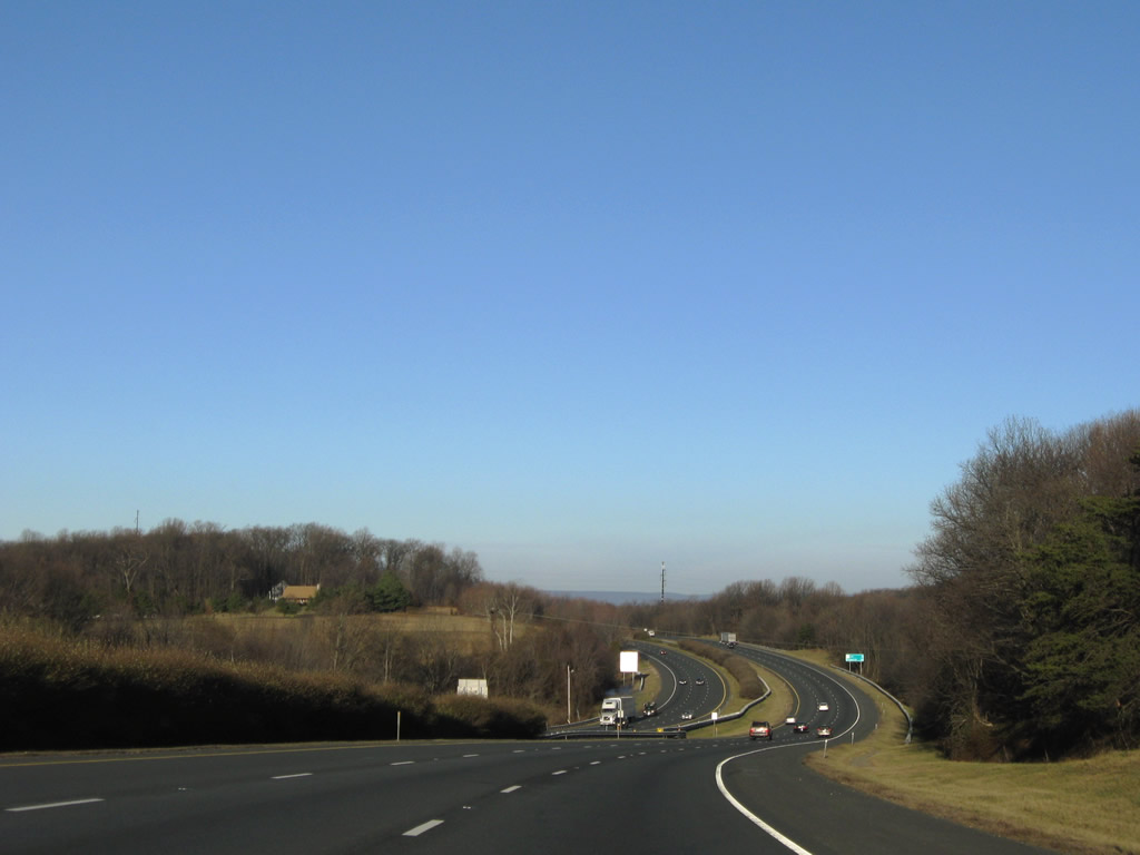
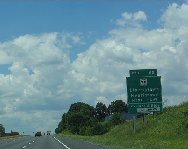
| One mile east of the diamond interchange (Exit 62) at New Market on I-70/U.S. 40 west. 06/01/04, 12/30/08 |
|
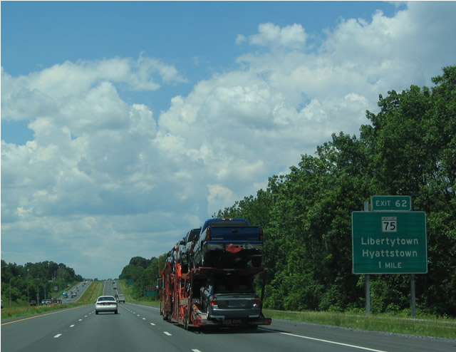
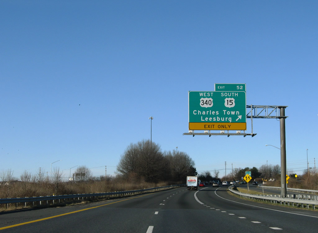
| MD 75 (Green Valley Road) ventures north from Exit 62 to Libertytown and Johnsville before crossing into Carroll County and ending at New Windsor. 06/01/04, 12/30/08 |
|
| A 28.53 mile route, MD 75 continues south from I-70/U.S. 40 through Monrovia to Green Valley and its conclusion at MD 355 in Hyattstown. 12/30/08 |
|
| Continuing west along I-70/U.S. 40 between Monrovia and New Market, eight miles east of Frederick. 12/30/08 |
|
| Catoctin Mountain rises to the west of Frederick from this scene along I-70/U.S. 40 west near Holly Hills Country Club. 12/30/08 |
|
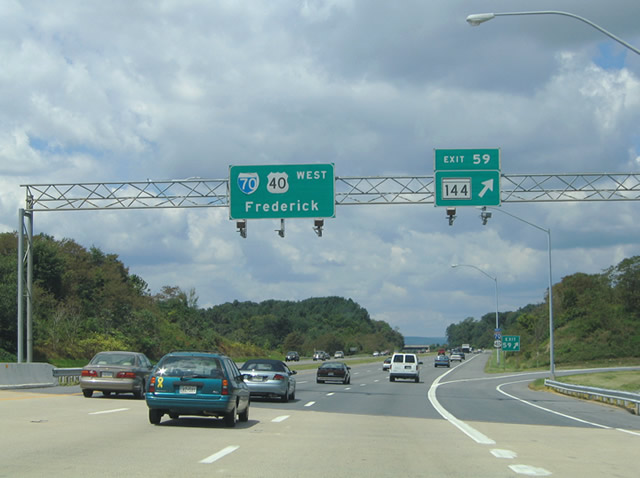
| As Interstate 70 approaches the outer limits of the Frederick metropolitan area, I-70/U.S. 40 approach Exit 59 with MD 144 (Old National Pike). MD 144 follows old sections of U.S. 40 parallel to the freeway. This interchange provides access to the third instance of MD 144 along westbound, that includes a divided highway/expressway segment west of Exit 59. 12/30/08 |
|
| One half mile east of the Exit 59 loop ramp for MD 144 (Old National Pike). Drivers using this ramp follow Meadow Road south to its intersection with Old National Pike adjacent to I-70/U.S. 40. Meadow Road north links with Hall Road west to suburban areas of east Frederick. 12/30/08 |
|
| Westbound I-70/U.S. 40 at Exit 59 to MD 144 (Old National Pike east / Baltimore National Pike west). Don't worry, U.S. 40 will encounter MD 144 again in at least three other segments: Washington Street in Hagerstown, Old U.S. 40 in Hancock, and a section between Interstate 68 Exits 62 and 47 east of Cumberland. 08/07/04 |
|
| The shields on the pull-through were replaced by 2008. It should be noted that I-70/U.S. 40 directly overlaid the original four lane Baltimore National Pike from Exit 82 westward to the northerly turn at Exit 59. This stretch of roadway was completed by 1970 and initially signed as Interstate 70N.1 12/30/08 |
|
| Veering northwest, Interstate 70 bisects subdivision areas near Bartonsville and sees this set of reassurance shields. There is no return ramp from Exit 59 onto the westbound freeway. 12/30/08 |
|
| This is the first sign advising motorists heading west to consider using Interstate 68 as an alternate to the tolled Pennsylvania Turnpike / Interstate 70. The only issue is that Interstate 68 currently ends at Interstate 79, thus making a return back to Interstate 70 a drive on some rural, non-freeway highways. If West Virginia is successful in constructing an extension of Interstate 68 northwest to rejoin Interstate 70 near Wheeling, then Interstate 68 will become even more appealing as an alternative to avoid the turnpike. 12/30/08 |
|
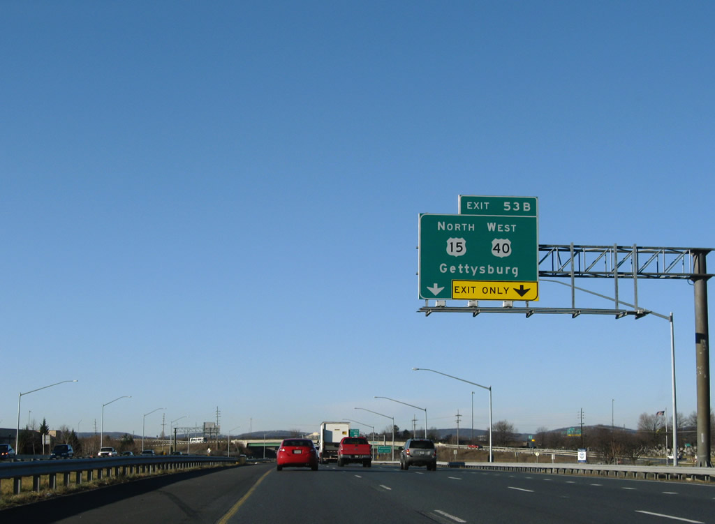
| The first in a series of interchange sequence signs profiles interchanges serving the city of Frederick from I-70/U.S. 40. U.S. 40 leaves Interstate 70 at Exit 53B. 12/30/08 |
|
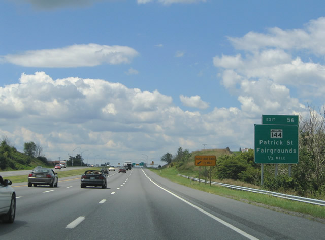
| A second interchange sequence sign follows at the Linganore Road over crossing. Note the replacement of the bridge-mounted sign for an independent sign bridge assembly. MD 144 (Baltimore National Pike) returns at Exit 56 to become East Patrick Street leading into the city. 08/07/04, 12/30/08 |
|
| I-70/U.S. 40 span the Monocacy River east of Frederick Municipal Airport (FDK). Connections from MD 144 (East Patrick Street) with MD 355 (Market Street) lead motorists south to Harry Grove Stadium. The rebuilt exchange with MD 85 east of MD 355 provides a more direct route from Interstate 70. 12/30/08 |
|
| Sign replacements eliminated Fairgrounds from the one half mile panel for Exit 56, MD 144 (East Patrick Street). The Fairgrounds reside along Patrick Street west MD 144 partitions into a set of one way street couplets. Eastbound utilizes South Street east and Franklin Street north. 08/07/04, 12/30/08 |
|
| Exit 56 leaves I-70/U.S. 40 to join Bowman Farm Road, a westbound side frontage road, ahead of its merge with East Patrick Street. Again the freeway overtakes the original Baltimore National Pike from this interchange west to Exit 53 (Interstate 270). 06/01/04, 12/30/08 |
|
| Taking the Exit 56 off-ramp, drivers follow Bowman Farm Road to its intersection with MD 144. MD 144 (East Patrick Street) west to Monocacy Boulevard provides return access to Interstate 70 east. MD 144 (Baltimore National Pike) east sees an eastbound ramp to I-70 opposite the intersection with Quinn Orchard Road. 12/30/08 |
|
| A folded diamond interchange with South Street follows at Exit 55. South Street splits with MD 144 at Franklin Street and continues to a large quarry and industrial area south of the freeway. 06/01/04 |
|
| A nearly 90 degree ramp joins I-70/U.S. 40 west with parallel Monocacy Boulevard midway between its intersections with MD 144 and South Street. South Street carries one way traffic from MD 144 to Exit 55 and two-way traffic southward to its transition into Reichs Ford Road. 06/01/04 |
|
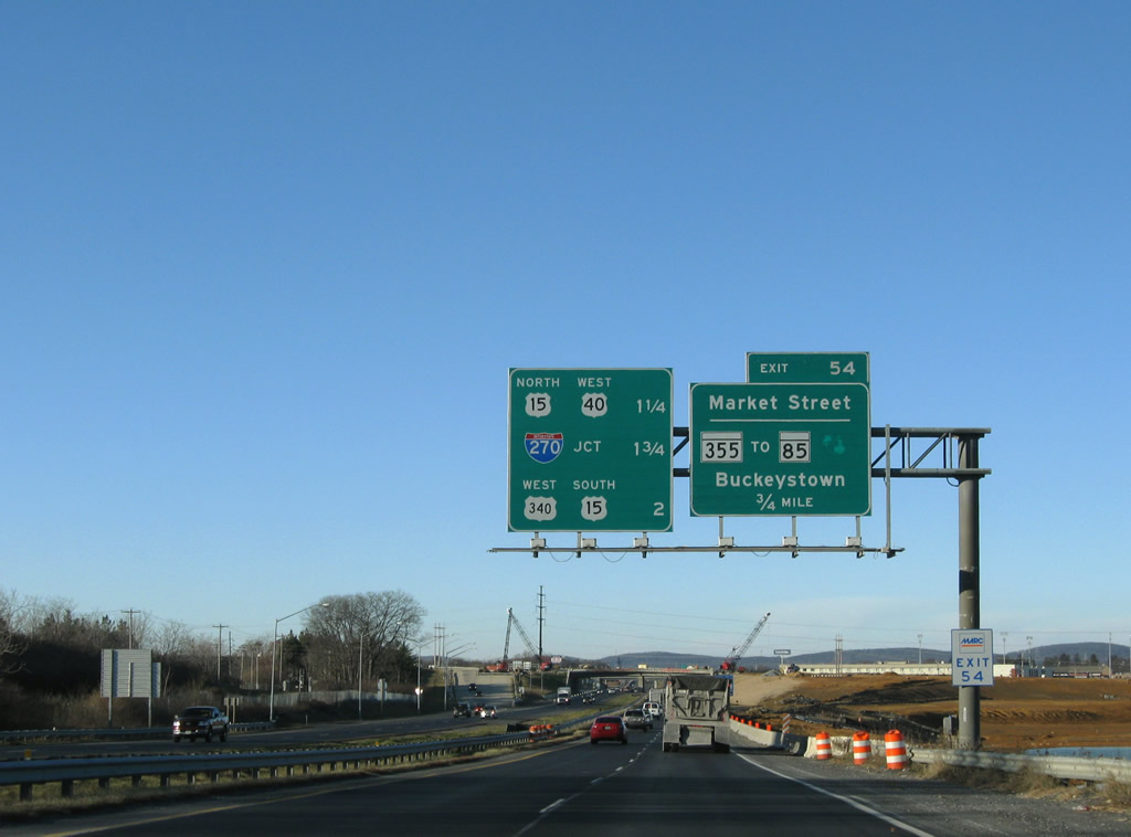
| Straddling the city limits of Frederick, I-70/U.S. 40 meets MD 85 (Buckeystown Pike) at a SPUI ahead of the exchanges with I-270 east, U.S. 40 west to U.S. 15 north, and U.S. 15 south / U.S. 340 west. 12/30/08 |
|
| Joining I-70/U.S. 40 with MD 85 at Exit 53, construction for the SPUI here was completed in 2009. This exchange replaced Exit 54 for Market Street. 12/30/08 |
|
| Accessible from I-70 via the SPUI with MD 85, Market Street north and Urbana Pike south are signed as MD 355. MD 355 represents the original route of U.S. 240 from Frederick to Washington, DC. 06/01/04 |
|
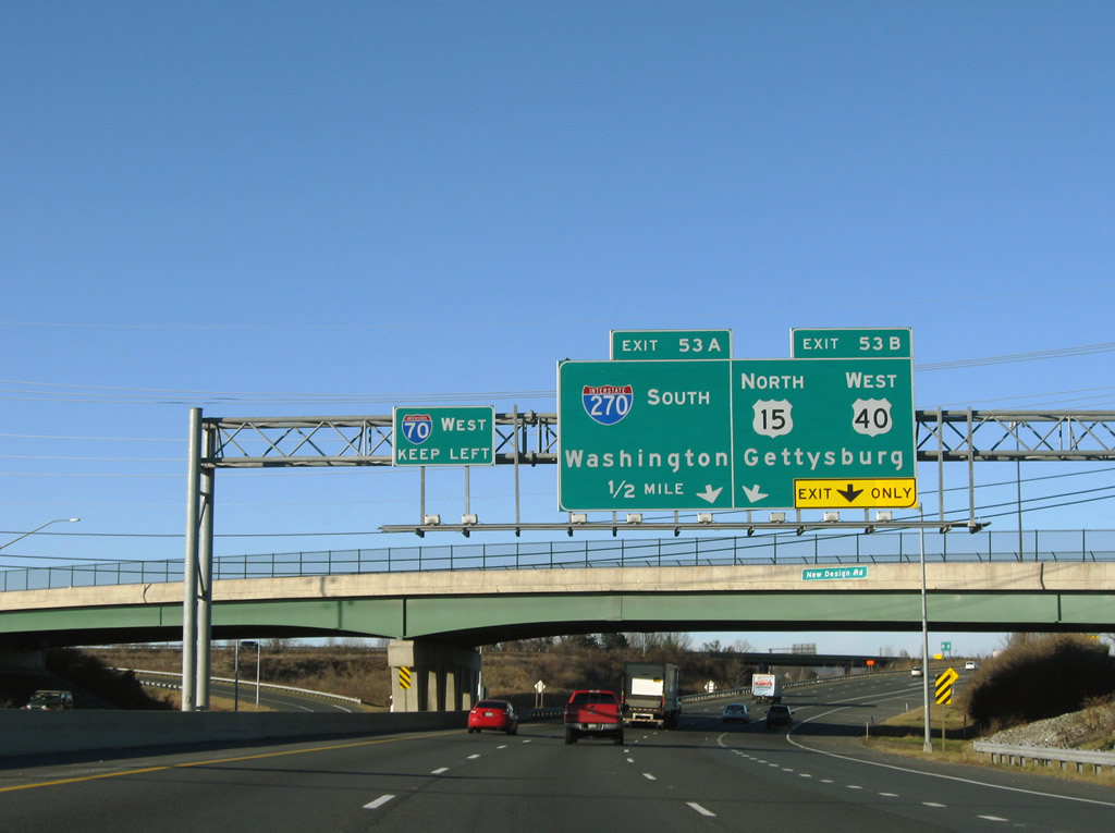
| U.S. 40 parts ways with Interstate 70 west at Exit 53B next. U.S. 40 utilizes the original Baltimore National Pike bypass of Frederick that now basically connects Interstate 270 with U.S. 15; Interstate 270 reaches its northern terminus at Interstate 70, so the remainder of the freeway is designated as U.S. 40. Use Exit 53B to reach the official northern terminus of U.S. 340 at its interchange with U.S. 40. 12/30/08 |
|
| Interstate 70 and U.S. 40 end a nearly 30 mile overlap at Exit 53B, as U.S. 40 turns north briefly to the U.S. 15 freeway, then exits the city of Frederick via West Patrick Street (which is designated as MD 144 east of U.S. 15). This begs the question of why U.S. 40 doesn't occupy all of Patrick Street if the whole route is state-maintained, and the answer is that the very brief freeway connector between Interstate 270 and U.S. 15 is designated as U.S. 40. 08/07/04 |
|
| Sign replacements at Exit 53B indicate that the number three lane serves both travelers continuing along U.S. 40 west to U.S. 15 north for Thurmont and Emitsburg but also the loop ramp onto the Interstate 270 eastbound beginning to Gaithersburg and Rockville. 12/30/08 |
|
| The right lane of Interstate 70 becomes exit only for southbound Interstate 270. Interstate 270 starts out as a rural road as it departs Frederick, but it quickly gains prominence upon entering Montgomery County. With a connection to the currently-under-construction Inter-County Connector (MD 200 via Interstate 370) and a light rail system, Interstate 270 becomes a dual freeway with local and express lanes as it approaches the Capital Beltway (Interstate 495). At one time Interstate 270 (former Interstate 70S) was planned for extension southeast into the District of Columbia to end at Interstate 66, but that never came to pass. 12/30/08 |
|
| Although some could argue that Interstate 270 travels east-west, it is mostly a northwest-southeast route and could be labeled north-south or east-west. Maryland opted to call it north-south, which makes sense considering how far south Washington is from here. Total mileage for Interstate 270 is 34.40 which includes the 1.8 mile Interstate 270 Spur at the south end. 12/30/08 |
|
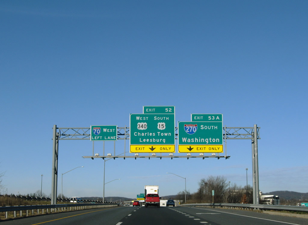
| The following exit along westbound is the U.S. 340 freeway, which heads southwest to Sandy Hook as a freeway, then converts into a divided highway (with cross traffic) upon crossing the Potomac River. U.S. 340 crosses the Potomac River and enters Virginia for one half mile, then enters West Virginia, passing by Harpers Ferry on its way to Charles Town. South of Charles Town, U.S. 340 re-enters Virginia and heads south to Front Royal and Luray before culminating at U.S. 11 south of Staunton. This exit also connects to southbound U.S. 15, which hitches a ride with U.S. 340 briefly then strikes south en route to Point of Rocks and Leesburg, Virginia, skipping West Virginia altogether. 12/30/08 |
|
| U.S. 340 is signed as westbound by Maryland but north-south in West Virginia and Virginia), and it reaches its northern terminus at U.S. 40 just a mile north of here. However, this exit only provides access to southbound U.S. 15-340; to reach northbound U.S. 15, use Exit 53B. 12/30/08 |
|
| Still hugging portions of the Frederick municipal line, Interstate 70 travels solo toward Braddock and Clifton outside the city. 12/30/08 |
|
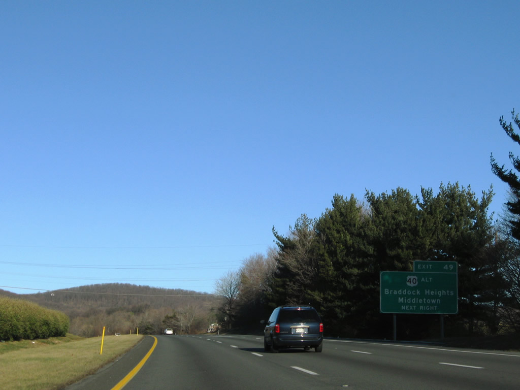
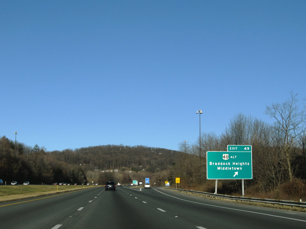
| The final Frederick area exit of Interstate 70 westbound is the half diamond interchange (Exit 49) with U.S. 40 Alternate (Old National Pike). Awye interchange links U.S. 40 (Baltimore National Pike) with Interstate 70 at Exit 48 for westbound return traffic. However as indicated by the yellow sign here, no direct access is provided to Interstate 70 west from U.S. 40 Alternate. 12/30/08 |
|
| Between Frederick and Hagerstown, U.S. 40 splits into regular U.S. 40 via Myersville and U.S. 40 Alternate via Boonsboro. Both routes are scenic, especially when U.S. 40 reaches Greenbrier State Park and the Appalachian Trail at the Frederick-Washington County line. Interests to Washington Monument State Park should follow U.S. 40 Alternate (Old National Pike) west and to Gathland State Park via MD 17 south from Middletown. 12/30/08 |
|
| Westbound Interstate 70 reaches the half diamond interchange with U.S. 40 Alternate (Exit 49). This is the only instance where both U.S. 40 and U.S. 40 Alternate both exist away from the freeway; MD 144 does not reemerge until downtown Hagerstown along West Washington Street. 12/30/08 |
|
| Interstate 70 turns northward to cross over Braddock Mountain east of Ridge Hill. 12/30/08 |
|
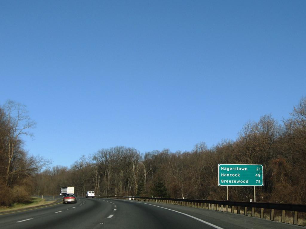
| This distance sign along westbound provides the distance to Hagerstown (21 miles), Hancock (Interstate 68) 49 miles, and Breezewood, where I-70 joins the Pennsylvania Turnpike, in 75 mile). 12/30/08 |
|
| An arch bridge (Ridge Road) graces the summit of Braddock Mountain at the height of 985 feet, as Interstate 70 witnesses its first gain in elevation of the Appalachian Mountains. Somewhat high in elevation for an eastern freeway, Braddock Mountain does not compare to the 11,013 feet elevation of Interstate 70 when it passes through the mile-long Eisenhower Tunnel in central Colorado. 12/30/08 |
|
| Interstate 70 lowers to meet MD 17 (Myersville Road) at a diamond interchange (Exit 42) next. 12/30/08 |
|
| Use MD 17 (Exit 42) to reach Gambrill, Gathland, and Greenbrier State Parks. 06/01/04 |
|
| MD 17 meanders from Brunswick at the Potomac River north via Burkittsville, Middletown, Myersville, and Wolfsville before terminating at the Appalachian Trail/Frederick-Washington County Line. 12/30/08 |
|
| Exit 42 leaves Interstate 70 west for MD 17 (Myersville Road). MD 17 is a 29.49 mile route that remains wholly within Frederick County. 12/30/08 |
|
| This distance sign provides the distance to Exit 35 with MD 66 (six miles), the city of Hagerstown, and the city of Hancock (which is located just south of the point along the Maryland-Pennsylvania state line where Interstate 70 crosses). 06/01/04 |
|
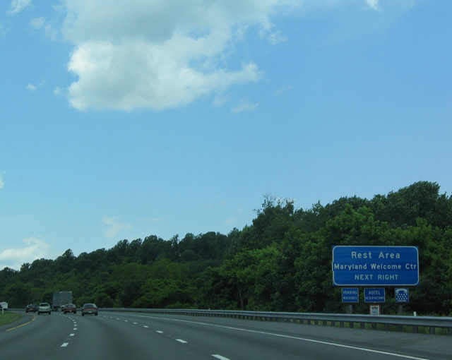
| Westbound Interstate 70 at a rest area / welcome center east of Bartman Hill. Use this exit to obtain a free Maryland state map and a guidebook listing the state's attractions. A companion welcome center is located on the opposite side of the freeway for eastbound traffic. 06/01/04 |
|
| A truck climbing lane joins Interstate 70 westbound on the ascent over South Mountain. The freeway climaxes at the Washington County line where the Appalachian Trail spans above. 12/30/08 |
Page Updated 08-24-2010.


 West
West