|
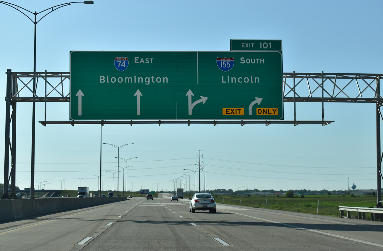
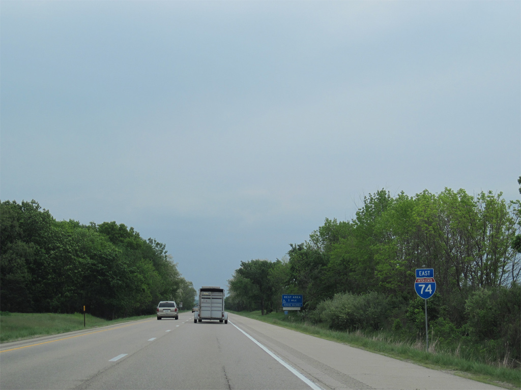
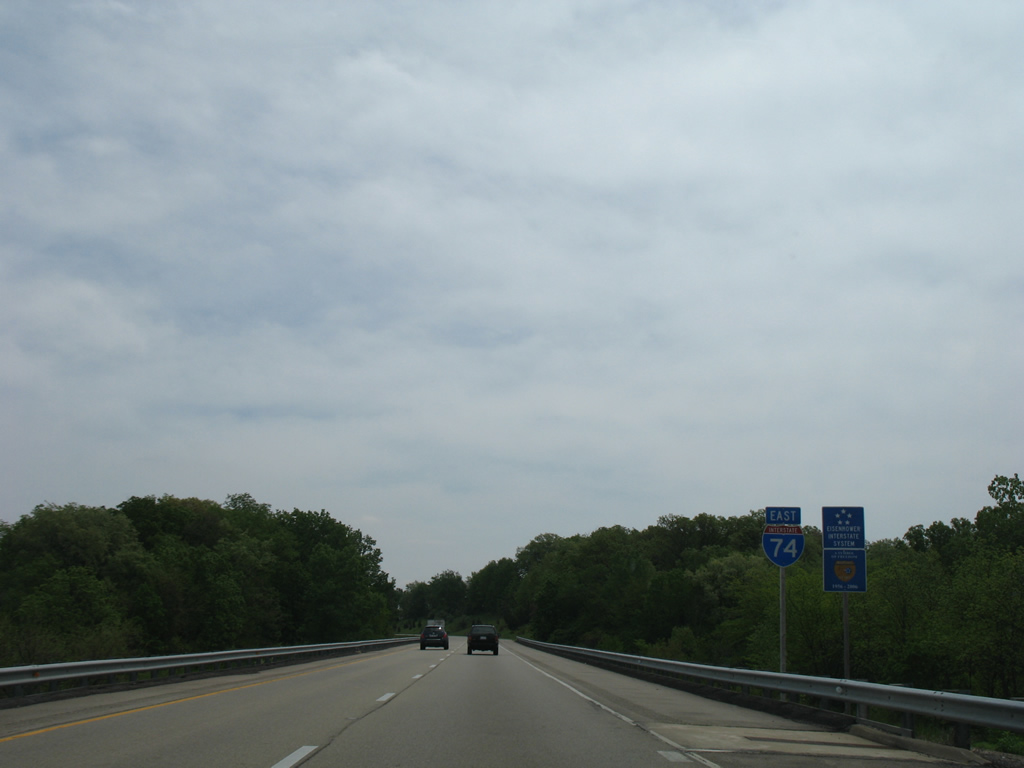
| Traffic from the east end of I-474, combines with I-74 ahead Exit 101 for Interstate 155 south. 05/24/18 |
|
| Two lanes depart at Exit 101 for Interstate 155 south from I-74 east. I-155 was completed in 1992 after over 20 years of construction to upgrade IL 121 between Morton and Lincoln. 05/24/18 |
|
| Interstate 155 initially runs along the west side of Morton while providing a direct route to I-55 south to Springfield and St. Louis. The I-74 and I-155 Improvement Project reconfigured the trumpet interchange at Exit 101 so that I-74 travels at-grade below new overpasses for I-155. 05/24/18 |
|
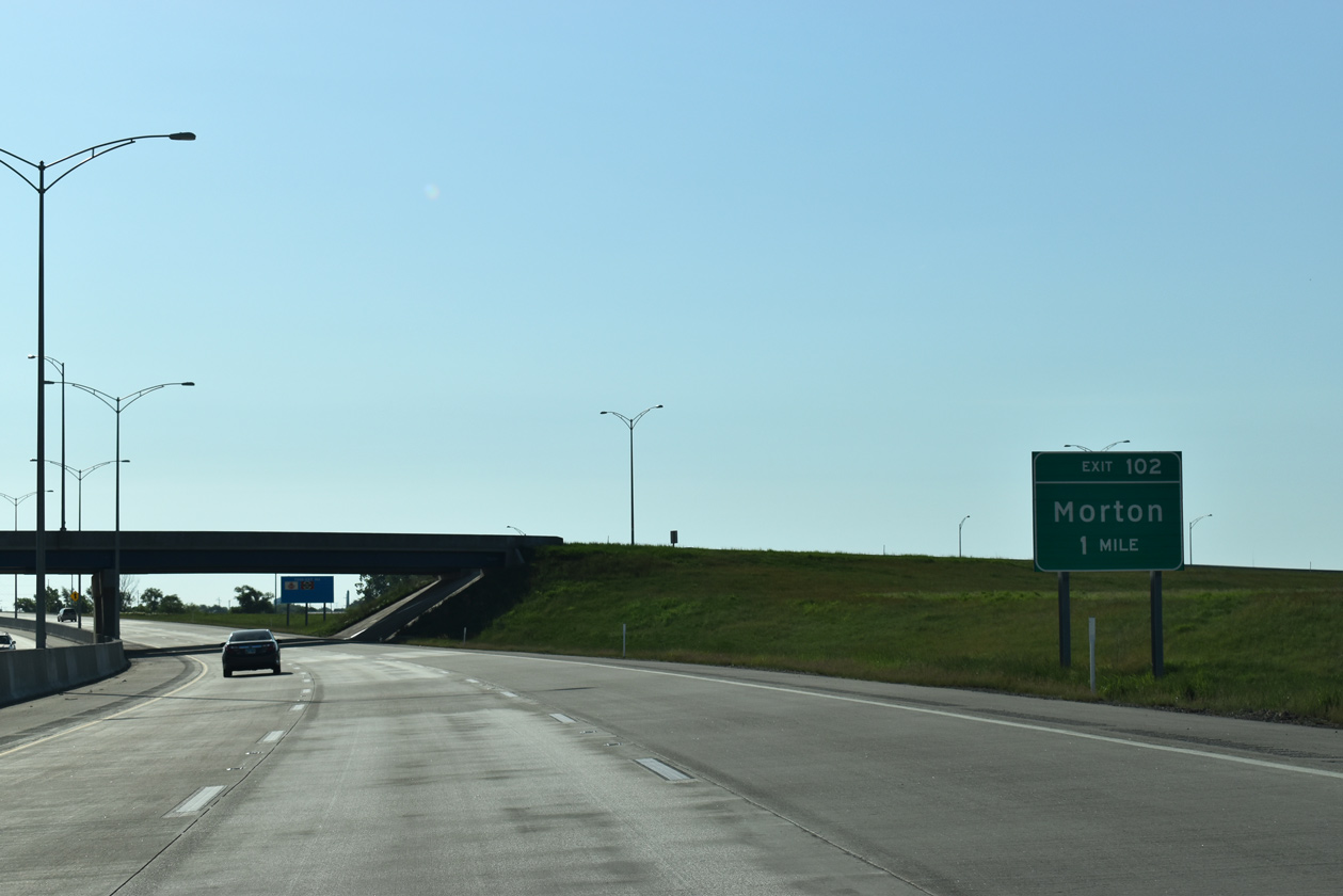
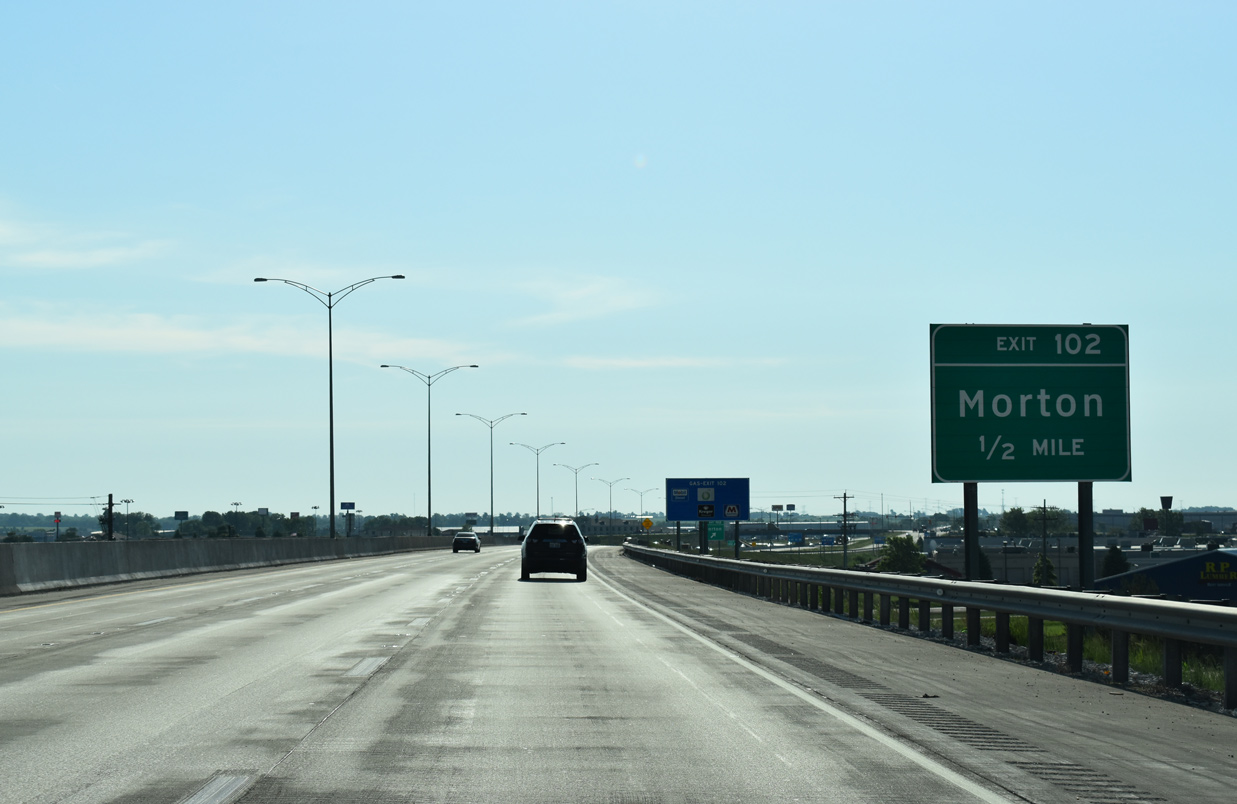
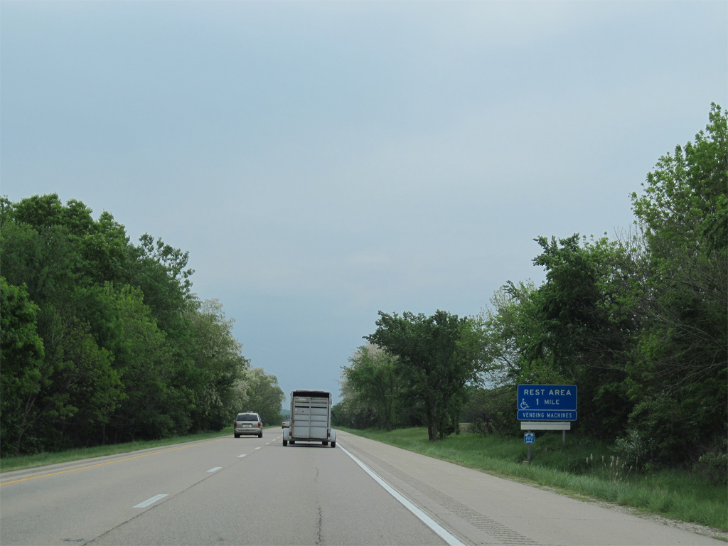
| I-74 advances east one mile from I-155 to Morton Avenue. I-74 and I-155 Improvement Project work underway between Spring 2013 and October 2016 expanded I-74 to six overall lanes to Exit 102. 05/24/18 |
|
| I-74 crosses over CR 22 (Jefferson Street) and U.S. 150 (Jackson Street) on the half mile preceding Exit 102 to Morton Avenue. The $85 million I-74/155 project removed an abandoned railroad underpass and replaced a pair of tunnels taking Jefferson Street below I-74 with new bridges on this stretch. 05/24/18 |
|
| The interchange between Interstate 74 and Morton Avenue was rebuilt in 1994 and was reconstructed again between 2013-16. Separate ramps for Morton Avenue were consolidated into a single ramp. Morton Avenue serves several travel amenities surrounding the freeway and comprises a commercial arterial south by an adjacent Caterpillar plant to U.S. 150 (Jackson Street). 05/24/18 |
|
| Interstate 74 passes by the Caterpillar plant along the industrial north side of Morton before exiting the village at the Toledo, Peoria & Western Railway underpass. 05/24/08 |
|
| A ten mile exit less stretch ensues as Interstate 74 leaves Morton for rural areas ahead of Deer Creek. Downtown Bloomington is 27 miles to the southeast. 05/07/10 |
|
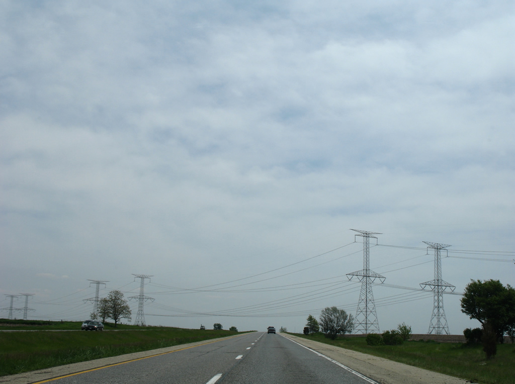
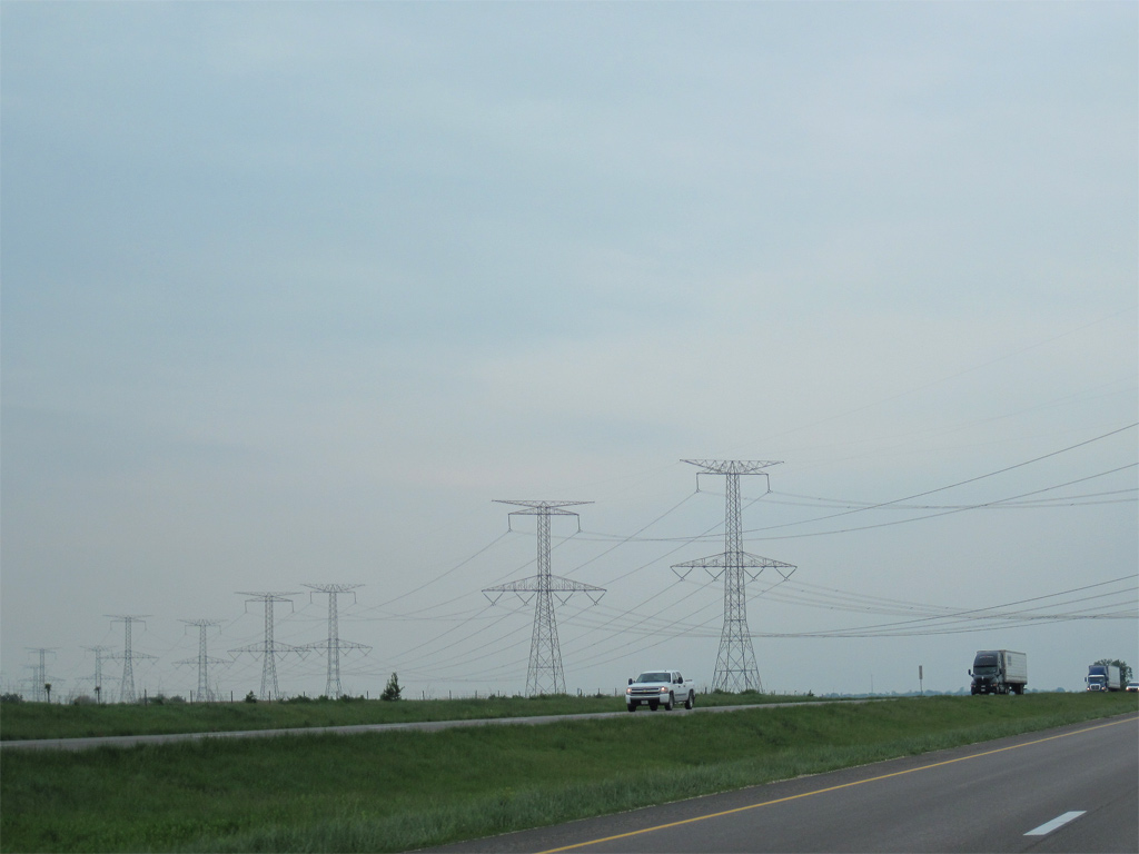
| A pair of transmission lines pass over Interstate 74 east of Tazewell County Route 3 (Washington Road). The lines originate at the Powerton Generation Station and lead northeast to Chicago. 05/24/08, 05/07/10 |
|
| Continuing east, Interstate 74 crosses Mud Creek to the west of County Road 6 (Dee-Mack Road) and the village of Deer Creek. 05/24/08 |
|
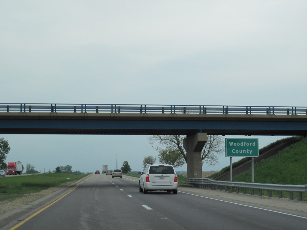
| U.S. 150 turns north along the Woodford County line and crosses Interstate 74 at Deer Creek. The US highway resumes an eastward course from Perry Street nearby to Goodfield. 05/07/10 |
|
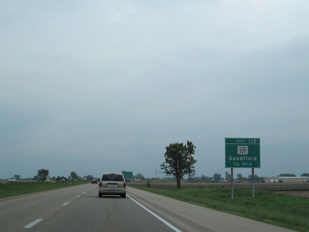
| IL 117 (Eureka Street) joins Interstate 74 with the village of Goodfield at Exit 112 in one mile. 05/07/10 |
|
| IL 117 begins a 31 mile route to IL 17 north of Toluca from Interstate 74 at Exit 112. 05/07/10 |
|
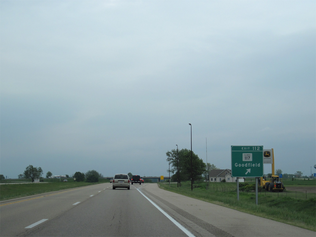
| Exit 112 departs Interstate 74 east for IL 117 (Eureka Street) north and Martin Drive to the south. IL 117 heads seven miles north from U.S. 150 (Peoria Street) in Goodfield to Eureka, the college home of President Ronald Reagan. 05/07/10 |
|
| The roadways of Interstate 74 diverge over the next several miles as the freeway traverses a forested valley fed by the Mackinaw River. 05/07/10 |
|
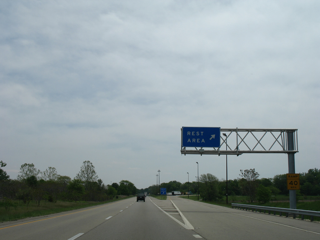
| Rest areas line both sides of Interstate 74 to the east of the Mackinaw River. 05/07/10 |
|
| Flowing 130 miles from headwaters near Sibley, the Mackinaw River weaves west to Tazewell County before hooking northward into the Illinois River at Pekin. 05/24/08 |
|
| This is the third overall rest area facility of I-74 east. 05/24/08 |
|
| Interstate 74 leads east from the rest area through the village of Congerville. 05/24/08 |
|
| Interstate 74 turns southeasterly alongside a Norfolk Southern Railroad from Congerville to the McLean County line. 05/07/10 |
|
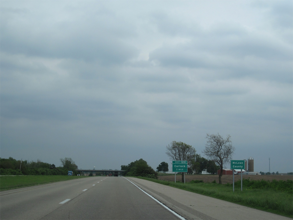
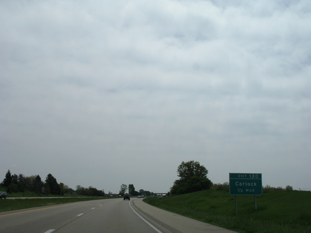
| McLean County Road 53 crosses paths with Interstate 74 at a diamond interchange (Exit 120) in one mile. 05/24/08 |
|
| CR 53 follows Washington Street into the village of Carlock from Exit 120. U.S. 150 overtakes Washington Street from Bradbury Street on the five miles east to I-74 at Exit 125. 05/24/08 |
|
| Exit 120 leaves Interstate 74 from just south of Rock Creek for Washington Street in Carlock. County Route 53 runs west and south to the village of Danvers. 05/07/10 |
|
| Center Street leads south from Carlock to pass over Interstate 74 beyond this eastbound reassurance marker. 05/24/08 |
|
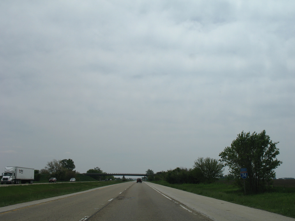
| I-74 converges with Interstate 55 south in six miles and reaches Indianapolis, Indiana in 176 miles. 05/07/10 |
|
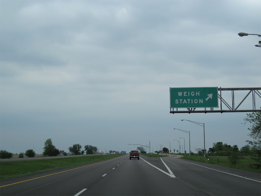
| Weigh stations operate along both directions of Interstate 74 between the N 800 East Road and E 1800 North Road overpasses. 05/07/10 |
|
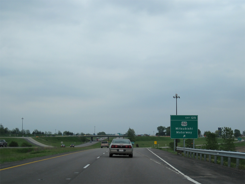
| Exit 125 for U.S. 150 (Mitsubishi Motorway) is the first of five interchanges serving the Bloomington-Normal area along Interstate 74 east. 05/07/10 |
|
| U.S. 150 travels south from a diamond interchange (Exit 125) with Interstate 74 to the Mitsubishi Motors car assembly plant on the west side of Normal. Named Mitsubishi Motorway, the four lane divided highway takes U.S. 150 south from Exit 125 to IL 9 (Market Street) east. 05/07/10 |
|
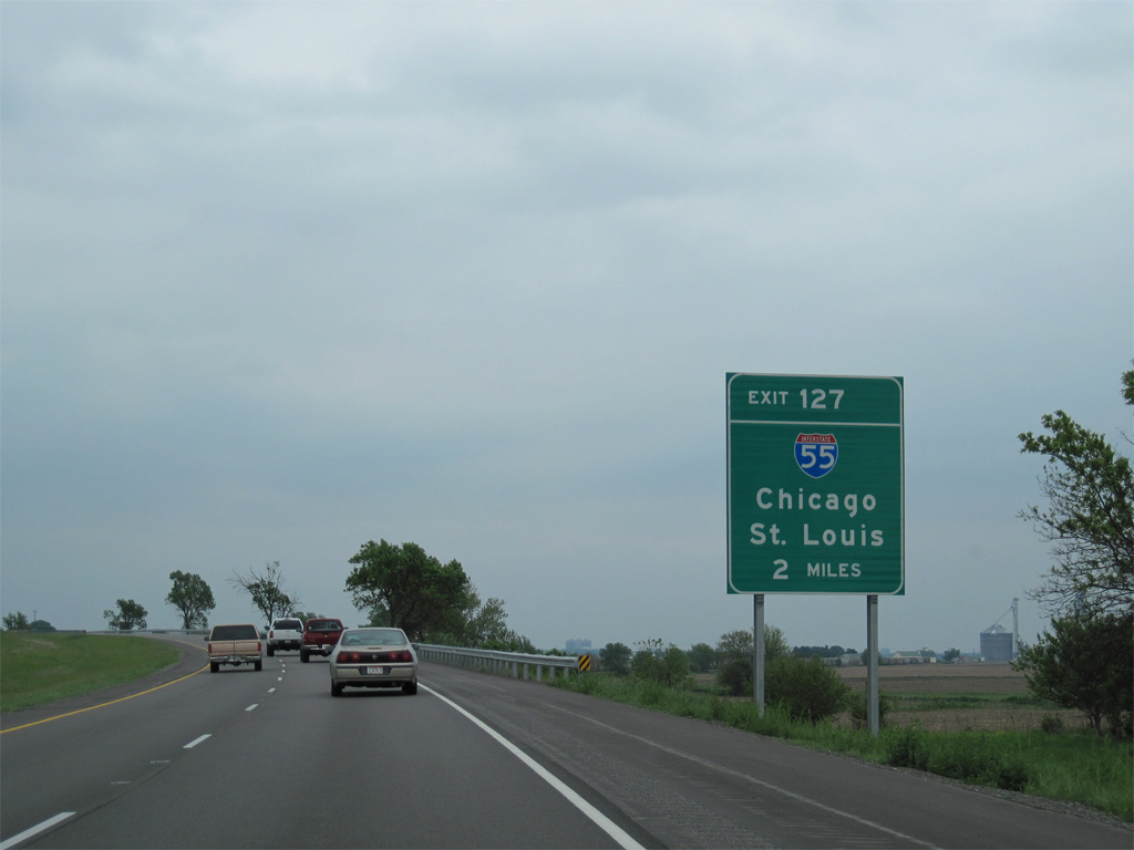
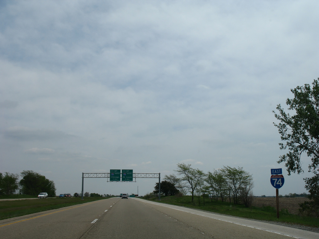
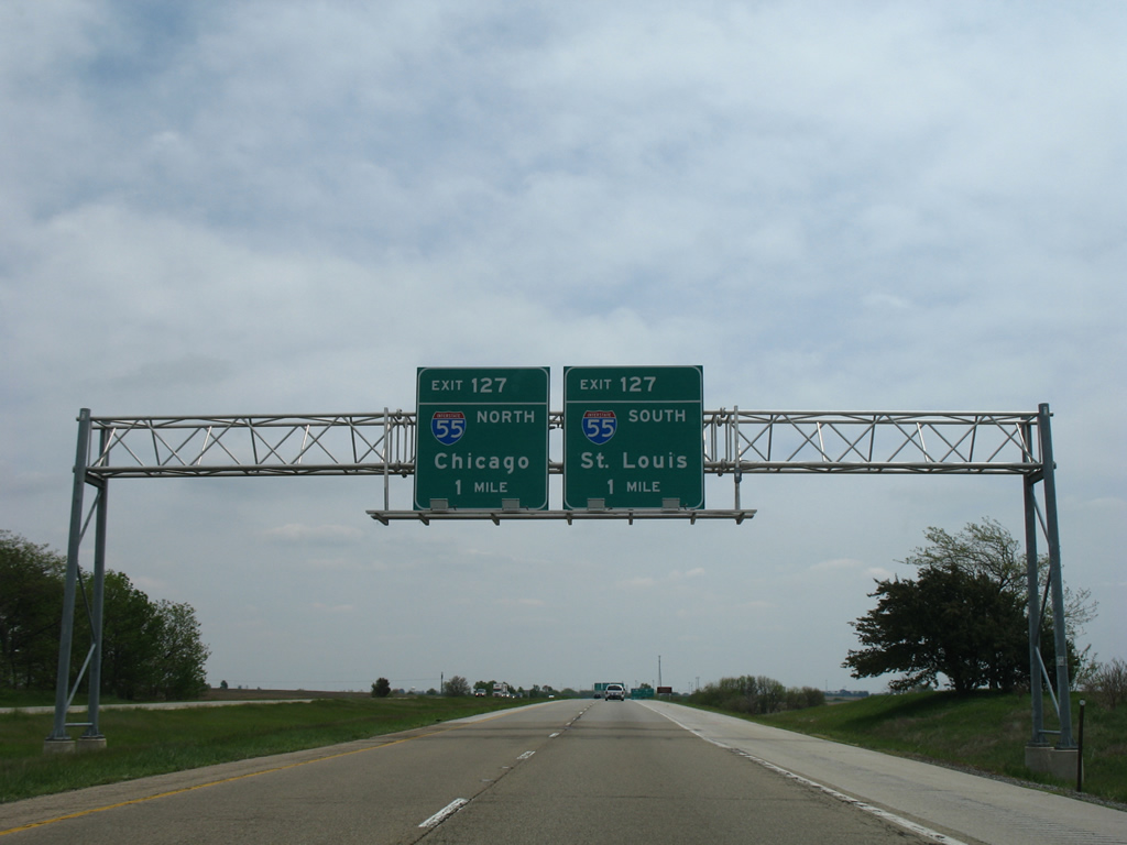
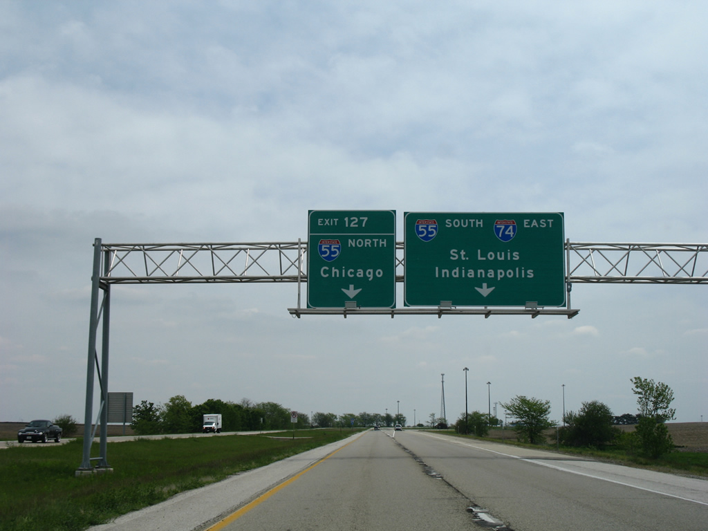
| A trumpet interchange (Exit 127) connects I-74 with Interstate 55 two miles beyond U.S. 150 (Mitsubishi Motorway). 05/07/10 |
|
| Exit 125 leaves Interstate 74 east for U.S. 150 (Mitsubishi Motorway) at Yuton. CR 70 follows Old Route 150 southeast from Yuton to White Oak Road in Bloomington. 05/07/10 |
|
| The final reassurance marker posted before the 5.89 mile overlap with Interstate 55 south. 05/24/08 |
|
| Interstate 55 travels 293 miles overall in Illinois from the Poplar Street Bridge across the Mississippi River at St. Louis, Missouri to Lakeshore Drive (U.S. 41) in Chicago. 05/24/08 |
|
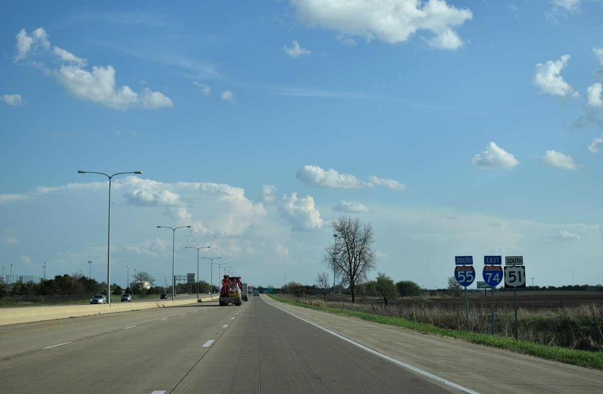
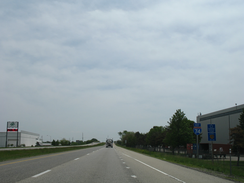
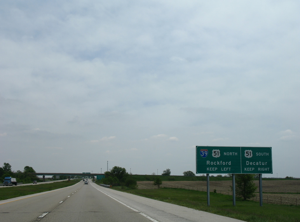
| I-55 turns east from I-74 to meet the south end of Interstate 39 a half mile from Exit 127. Iz39 combines with U.S. 51 from Normal north to La Salle and Rockford. 05/07/10 |
|
| I-55/74 generally bypass both Normal and Bloomington to the west before separating at Veterans Parkway (Business Loop I-55). Interests to Central Illinois Regional Airport at Bloomington-Normal (BMI) are directed along I-55 north to Business Loop I-55 south from Exit 167. 05/07/10 |
|
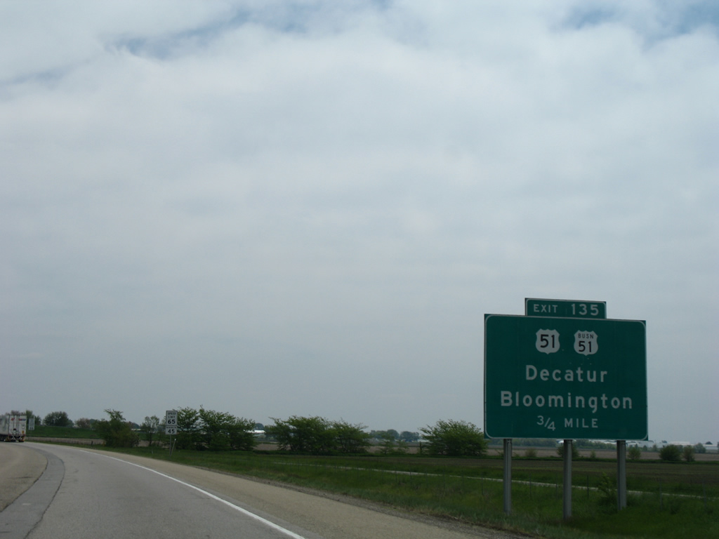
| Utilizing Interstate 55 from I-39 south to I-74 east of from the south split with I-55, U.S. 51 bypasses Normal and Bloomington. U.S. 51 leads 58 miles south from I-74 at Exit 135 to Decatur. 05/24/08 |
|
| Traffic partitions into single lane ramps for Interstate 55 north to Illinois State University and Chicago and I-55/74 south to Springfield and Champaign-Urbana. 05/24/08 |
|
| A trailblazer for Interstate 39 stands next to the ramp to I-55 north. Interstate 39 travels 157 miles north from Normal to Wisconsin at South Beloit. 05/24/08 |
|
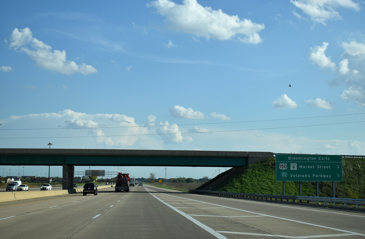
| U.S. 150/IL 9 (Market Street) meet I-55/74 in three miles at the first of two exits for Bloomington on I-55 south. 05/06/18 |
|
| Travelers destined for Decatur via U.S. 51 south are advised to remain along Interstate 74 east beyond the split with I-55 south. 05/06/18 |
|
| I-55/74 and U.S. 51 travel through west Normal and Bloomington with six overall lanes. 05/06/18 |
|
| A six-ramp parclo interchange joins I-55-74/U.S. 51 with U.S. 150/IL 9 (Market Street). Loop ramps to Market Street were removed from the originally full cloverleaf interchange. 05/06/18 |
|
| I-55/74-U.S. 51 cross over CR 70 (White Oak Road) and a Norfolk Southern Railroad one mile ahead of Exit 160. White Oak Road is the historic alignment of U.S. 150 southeast to Locust Street in Bloomington. 05/06/18 |
|
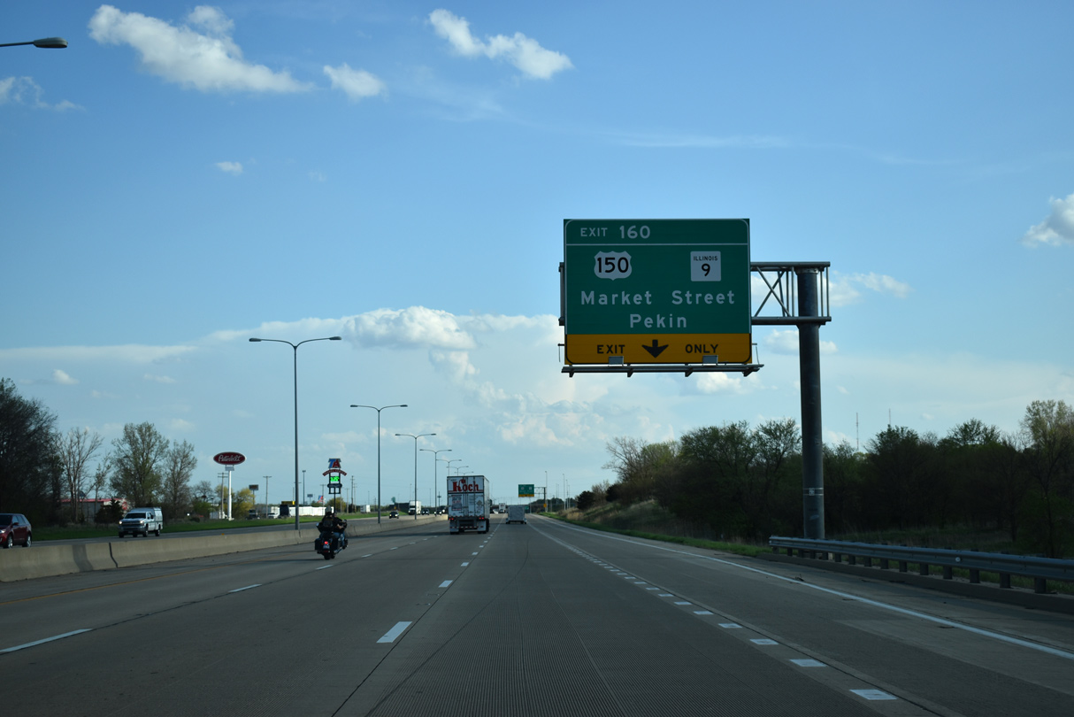
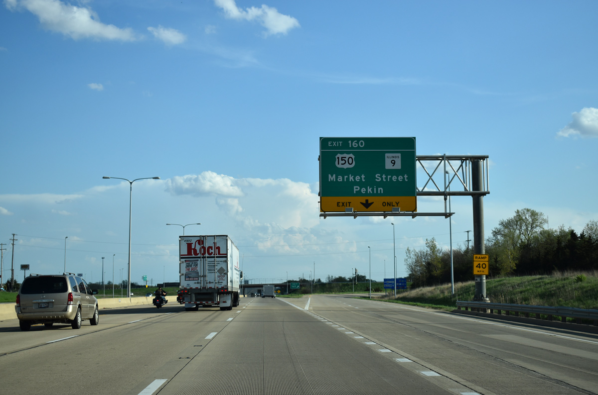
| U.S. 150 and IL 9 combine for 4.1 miles between Mitsubishi Parkway to the west and Clinton Street east of Downtown Bloomington. 05/06/18 |
|
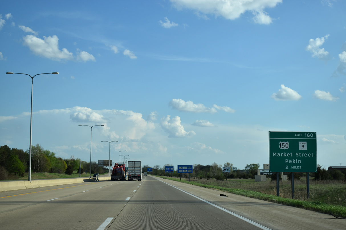
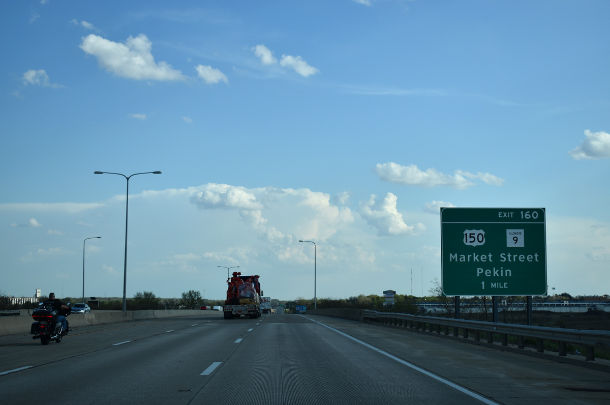
| Exit 160 expands to two lanes as it leaves I-55/74 south for Market Street. Measuring 216 miles in length across the width of the state, IL 9 links Bloomington with Pekin, 36 miles to the west. 05/06/18 |
|
| I-55/74-U.S. 51 confirmimg markers posted ahead of the Washington Street underpass. 05/06/18 |
|
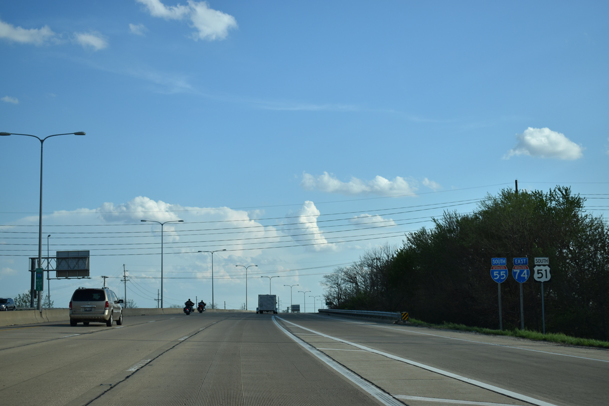
| I-55/74-U.S. 51 part ways in two miles ahead of a three quarter cloverleaf interchange with Veterans Parkway (Business Loop I-55) north into Bloomington. 05/06/18 |
|
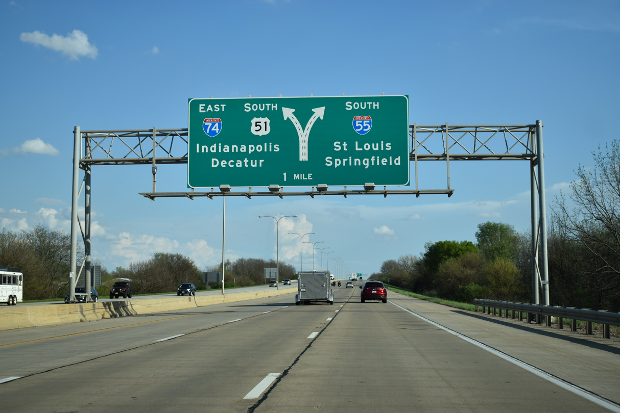
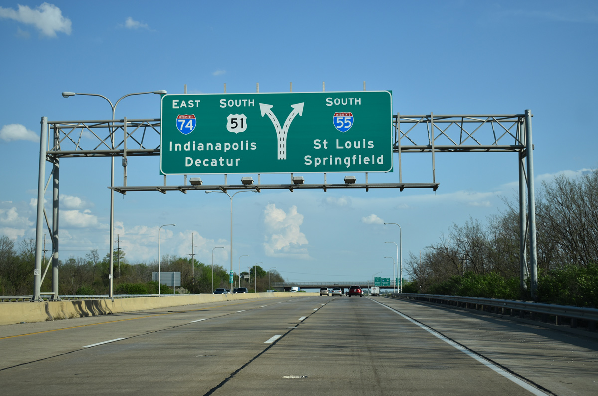
| Two lanes are allocated for both Interstate 55 south to Springfield and St. Louis and the continuation of I-74 east to Indianapolis and U.S. 51 south to Decatur. 05/06/18 |
|
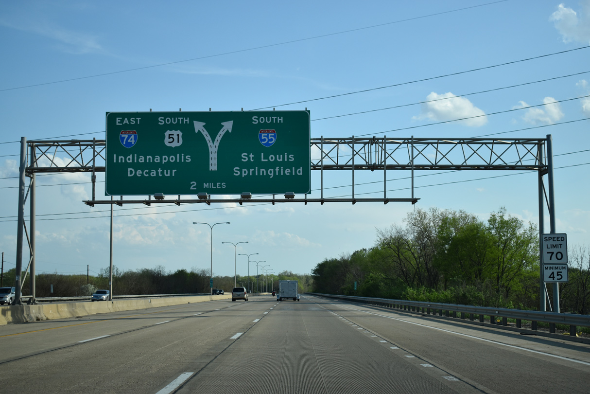
| I-55 remains southwest along the original course of U.S. 66 to Lincoln and Springfield while Interstate 74 parallels the U.S. 150 corridor southeast to Farmer City, Champaign-Urbana and Danville. U.S. 51 leaves Bloomington along a four lane highway leading south to Clinton and Decatur, where the route merges with I-72. 05/06/18 |
|
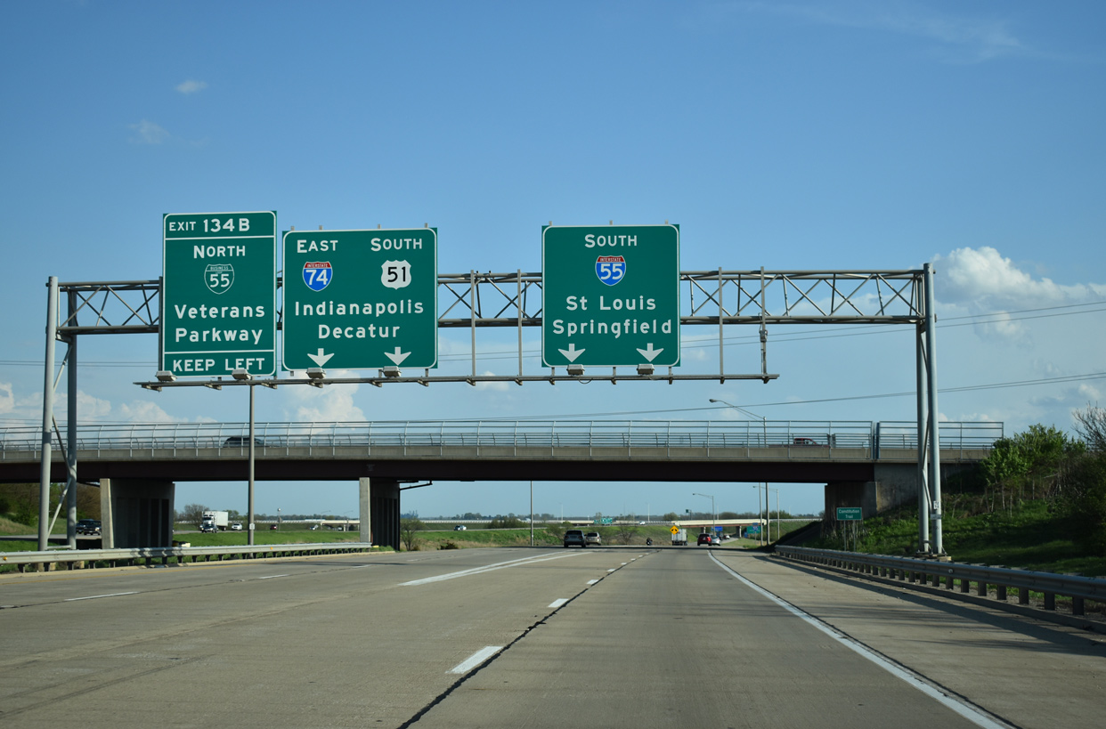
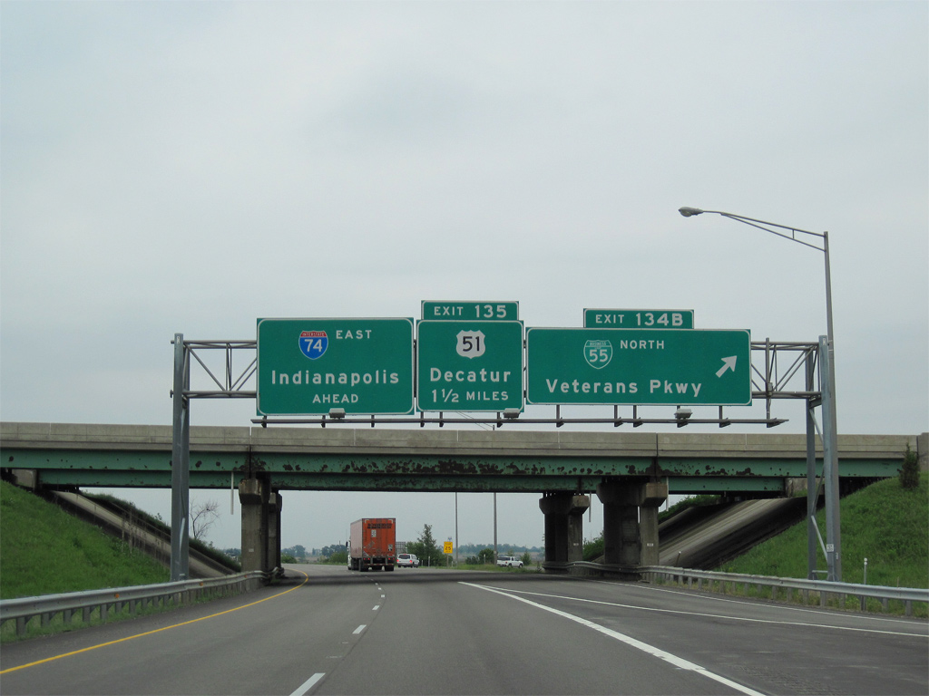
| Fox Creek Road passes over I-55-74 and U.S. 51 at their separation. Exit 134 B appears here for I-74 east to Business Loop I-55 / Historic U.S. 66 (Veterans Parkway) north back into Bloomington. BL I-55 south converges with I-55 south from the left after the partition with I-74 east. 05/06/18 |
|
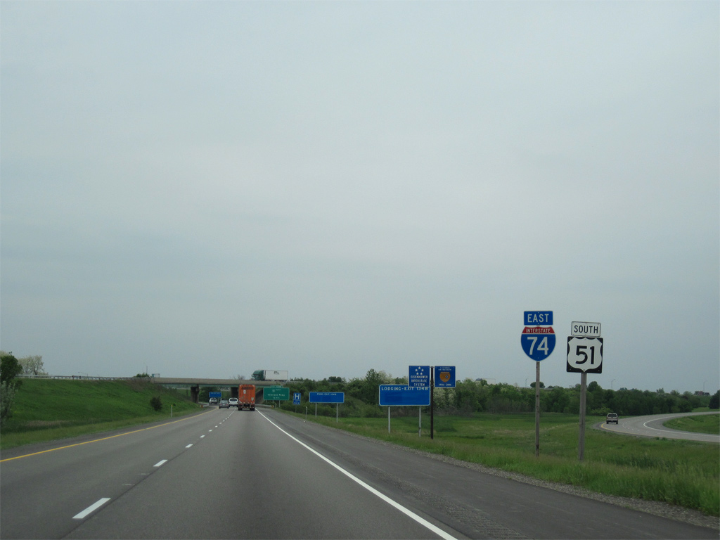
| Shields for Interstate 74 east and U.S. 51 south appear just after the gore point with I-55 south. 05/07/10 |
|
| The northbound mainline of I-55 spans I-74/U.S. 51 ahead of the loop ramp onto Veterans Parkway north. All of Veterans Parkway through both Bloomington and Normal doubles as Business Loop I-55. The business route follows the final alignment of Historic U.S. 66 for 9.7 miles. 05/07/10 |
|
| Exit 134 B leaves Interstate 74 east for Business Loop I-55 north. There is no Exit 134 A.
U.S. 51 departs next in 1.5 miles to rejoin its original alignment south from Main Street in Bloomington to Heyworth and Clinton. 05/07/10 |
|
| Traffic from I-55 north joins Interstate 74 east and U.S. 51 south ahead of these shields. 12/27/09 |
|
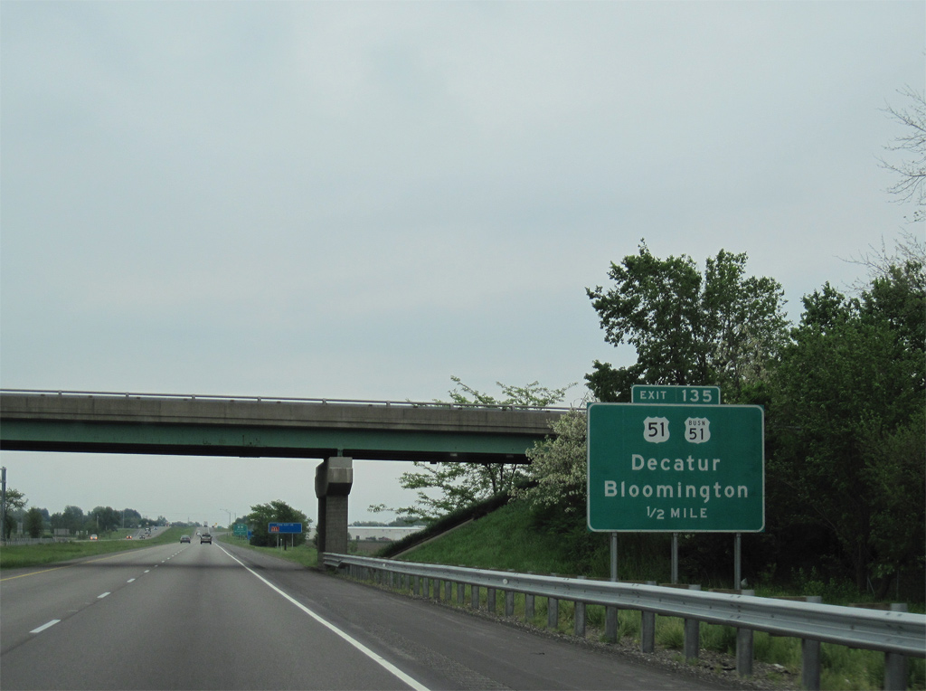
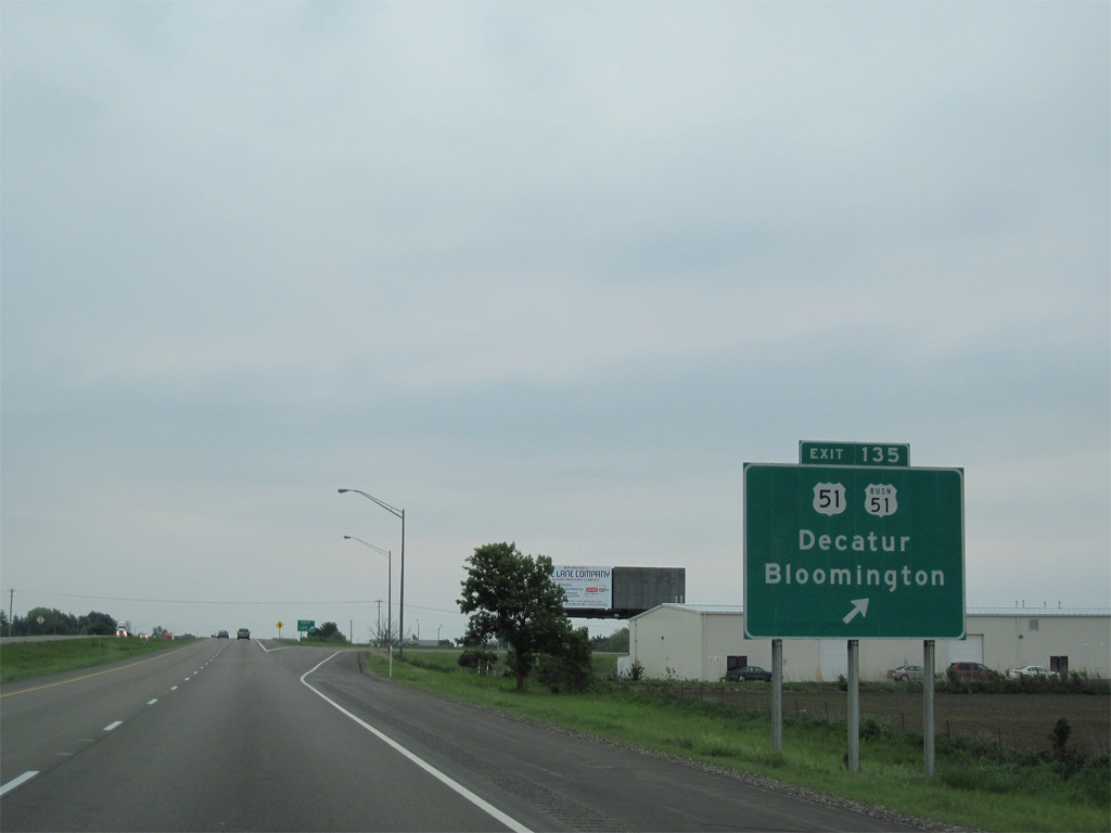
| Exit 135 departs in three quarters of a mile for U.S. 51 south to Decatur and U.S. 51 Business (Main Street) north to Bloomington. 05/24/08 |
|
| Following the former route of U.S. 51, U.S. 51 Business travels 8.8 miles north through both Downtown Bloomington and Normal to rejoin U.S. 51 at Interstate 39 / Exit 2. 05/07/10 |
|
| Entering the six-ramp parclo interchange with U.S. 51 south and U.S. 51 Business north on Interstate 74 east. Clinton is 21 miles to the south. 05/07/10 |
|
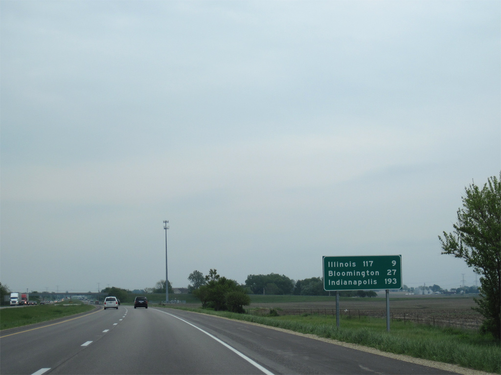
| Interstate 74 leaves Bloomington along a rural course east 46 miles to Champaign. Indianapolis is a two and half hour drive away. 12/27/09 |
|
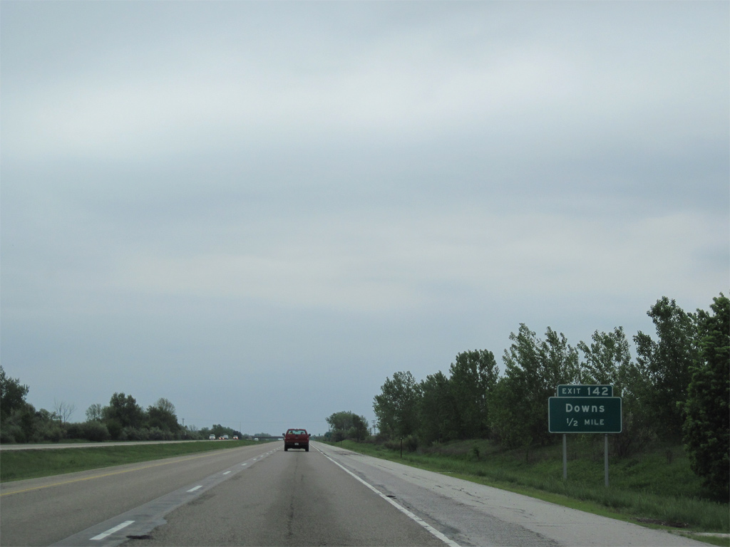
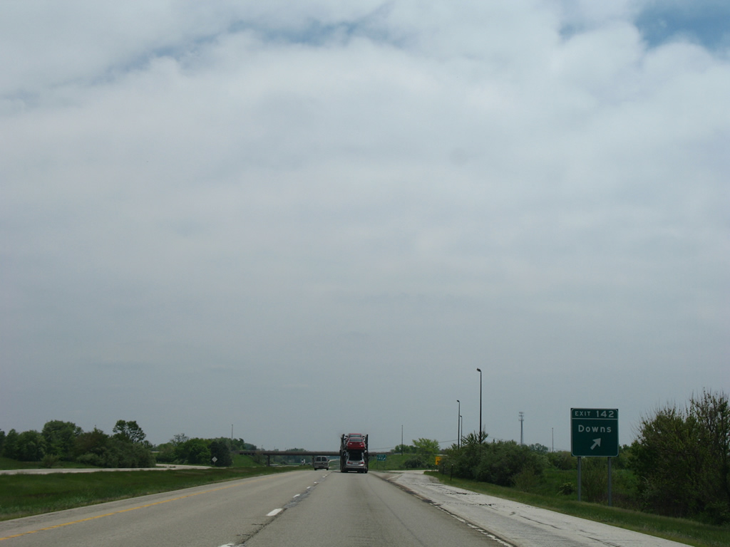
| Downs, a village of around 1,000, lies between Interstate 74 and U.S. 150 at Exit 142 in one mile. 05/07/10 |
|
| Meeting Interstate 74 at Exit 142 is McLean County Route 36. CR 36 follows Seminary Street north to Washington Street, where the route turns east to U.S. 150 (Highway Avenue). 05/07/10 |
|
| West from the diamond interchange (Exit 142) at Downs, CR 36 continues 1.4 miles to CR 29 south of Gillum, and six miles to U.S. 51 near Randolph. 05/24/08 |
|
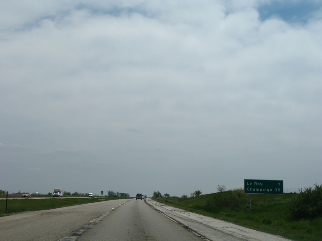
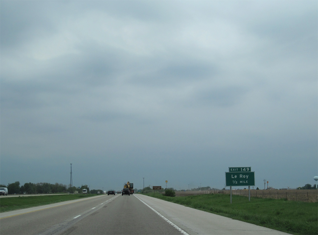
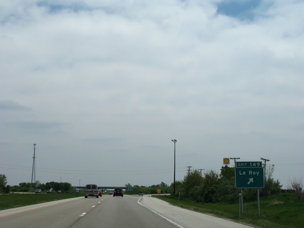
| Interstate 74 bee lines seven miles southeast to the city of Le Roy. Champaign is 39 miles away. 05/24/08 |
|
| One mile out from the diamond interchange (Exit 149) with McLean County Road 21 (Chestnut Street) on I-74 east. 05/24/08 |
|
| CR 21 winds southward along Bicentennial Drive from 2600 East Road to eventually become De Witt County Rpute 8 (Leroy Road) en route to Fullerton and Clinton Lake. 05/07/10 |
|
| Exit 149 parts ways with Interstate 74 east for Chestnut Street north to U.S. 150 (Cedar Street) in Le Roy. CR 21 (West Street) north from U.S. 150 (Washington Street) leads to Moraine View State Park. 05/24/08 |
|
| Turning more southward from Le Roy, Interstate 74 crosses the North Fork of Salt Creek. 05/24/08 |
|
| The diamond interchange at Exit 152 joins I-74 with U.S. 136 in one mile. 05/07/10 |
|
| U.S. 136 runs along a linear route 14 miles west from Exit 152 to Heyworth and 28 miles east to Rantoul. 05/07/10 |
|
| U.S. 136 travels 213 miles across the state from Keokuk, Iowa through Maccomb to Rantoul and Danville. 05/07/10 |
|
| Interstate 74 continues across open farm land to the west of U.S. 150 and Empire. 12/27/09 |
|
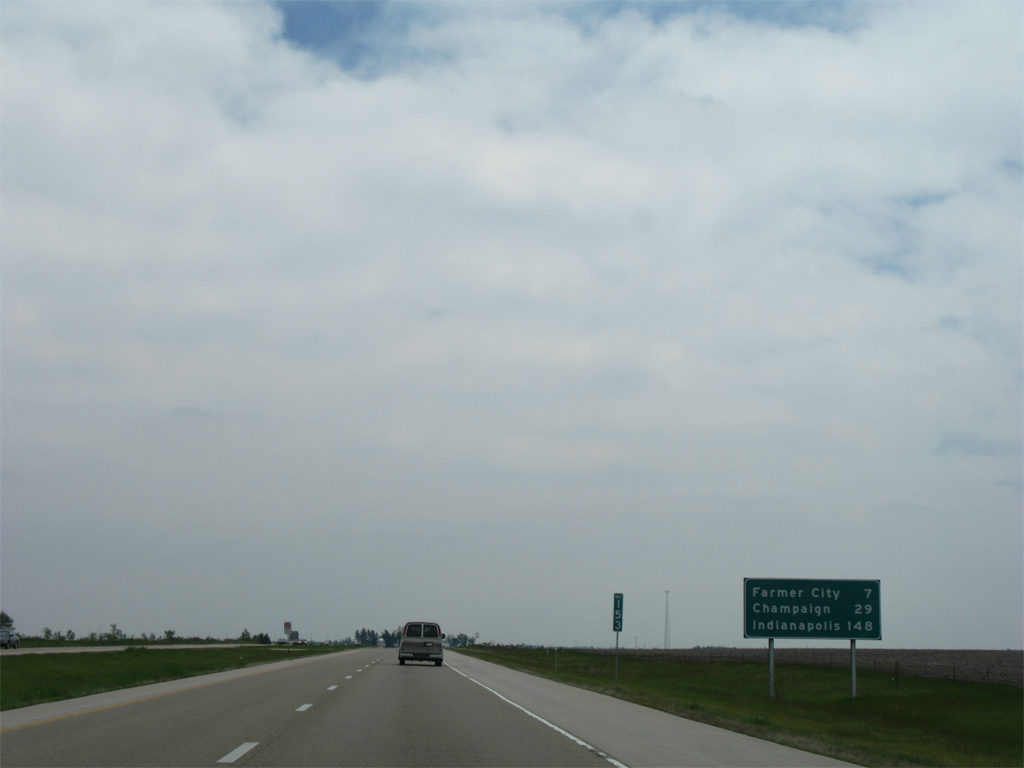
| Farmer City is the succeeding exit from Interstate 74 east in seven miles. Champaign follows in 29 miles and Indianapolis, Indiana is 148 miles away. 05/24/08 |
|
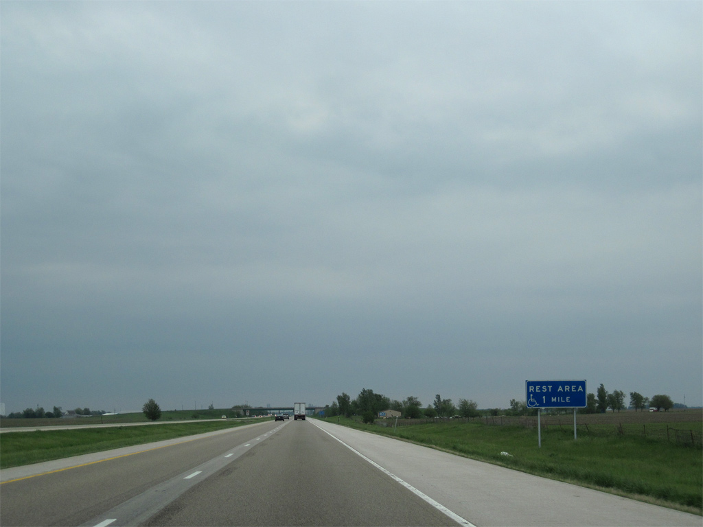
| The fourth rest area on Interstate 74 east in Illinois lies just south of the De Witt County line. 05/07/10 |
|
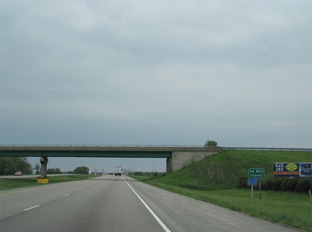
| County Road 00 North / Old Principal Road spans Interstate 74 by Watkins at the northeastern corner of De Witt County. 05/07/10 |
Page Updated 03-19-2013.

 East
East


 South
South