|
| Exit 200 departs I-74 just east of the Champaign County line for IL 49. IL 49 constitutes a 137 mile route from Willow Hill in Jasper County to U.S. 45/52 in northern Iroquois County. Within Vermilion County, IL 47 travels five miles north from Exit 200 to Hope. The village of Rankin lies 23 miles to the north at the crossroads with IL 9. Fithian lies just east of the IL 49 split with U.S. 150. 08/19/10 |
|
| Exit 206 departs Interstate 74 east for Oakwood Street south into Oakwood and Newtown Road north to Glenburn and Newtown. Heading north from Exit 206, Newtown Road becomes Vermilion County Route 10 en route to Collison and U.S. 136 at Potomac. 08/19/10 |
|
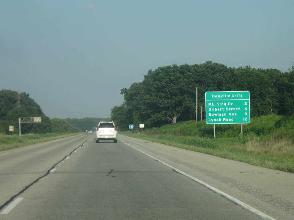
| An interchange sequence sign outlines the succeeding four exits, all serving the city of Danville. U.S. 150 (Martin Luther King Drive) converges with Interstate 74 between Hillery and Bucktown in two miles. 08/19/10 |
|
| Interstate 74 lowers to span the Middle Fork of the Vermilion River while traveling across a portion of Kickapoo State Recreation Area. The parclo interchange (Exit 210) with U.S. 150 (Martin Luther King Drive) follows. 08/19/10 |
|
| Interstate 74 east passes underneath the CSX railroad ahead of Exit 210 to U.S. 150 (Martin Luther King Drive). 08/19/10 |
|
| U.S. 150 leads east from Exit 210 four miles into the city of Danville. Oakwood is a four mile return drive to the west along the US highway. 08/19/10 |
|
| Tilton lies to the immediate south of Danville at Exits 214 and 215 along Interstate 74. The community of around 3,000 was named after a friend of Abraham Lincoln who worked in the railroad industry. 08/19/10 |
|
| A diamond interchange (Exit 214) links I-74 with G Street in a half mile. A cloverleaf interchange follows at Exits 215 A/B for U.S. 150/IL 1 in one mile. 08/19/10 |
|
| G Street leads south from an industrial plant on the north side of I-74 to W 5th Street and the Tilton residential street grid. 5th Street becomes Catlin Tilton Road southwest to the village of Catlin.
U.S. 150/IL 1 run 1.25 miles north from Exit 215 A to U.S. 136 (Main Street), where U.S. 150 turns west and U.S. 136 turns north. IL 1 coincides with U.S. 136 to Moores Corner and a split east of Henning. 08/19/10 |
|
| Exit 215 departs I-74 east as a collector distributor roadway to U.S. 150/IL 1 (Georgetown Road south / Gilbert Street north). U.S. 150/IL 1 continue 32.5 miles south from Tilton through Westville, Chrisman and Paris. IL 1 travels nearly the length of the state for 309 miles from the Cave-In-Rock Ferry across the Ohio River to I-57 in Chicago. 08/19/10 |
|
| A parclo interchange (Exit 216) links I-74 east with Bowman Avenue between the Vermilion River and Stony Creek. The exchange originally consisted of a trumpet onto Bowman Avenue north only, but was modified when Bowman Avenue was extended south to Perrysville Road. 08/19/10 |
|
| Bowman Avenue leads north from adjacent Perrysville Road to U.S. 136 (E Main Street) and the east side of Danville to Vermilion Airport and Bismark. Perrysville Road becomes CR 6 outside Danville en route to the west end of SR 32 at the Indiana state line. 08/19/10 |
|
| The last exit in Illinois is for Lynch Road in three miles. 39 miles away, Crawfordsville is the largest city between Danville and Indianapolis. 08/19/10 |
|
| Joining I-74 with U.S. 136 (E Main Street) nearby, Lynch Road serves the east side of Danville. Lynch Road forms an industrial bypass of Danville along with Voorhees Street / County 1900 North east from Bowman Avenue.
Exit 220 originally consisted of a trumpet interchange with Lynch Road north. Changes to a parclo interchange were made when Lynch Road was extended to Southgate Drive to accommodate a new industrial park. 08/19/10 |
Page Updated 03-05-2013.

 East
East