|
| Veterans Boulevard lines the west side of I-75 from an array of apartment complexes to the Sarasota County line. 10/01/17 |
|
| Interstate 75 briefly enters the southwest corner of DeSoto County. Arcadia, the seat and lone incorporated city within the county, lies 21.1 miles to the east. 02/03/19 |
|
| The succeeding exit along I-75 lies eight miles ahead with Toledo Blade Boulevard (CR 779). Downtown Sarasota is 44 miles to the northwest. 02/03/19 |
|
| Interstate 75 enters both Sarasota County and the city of North Port west of the Lake Pembroke development. 05/19/19 |
|
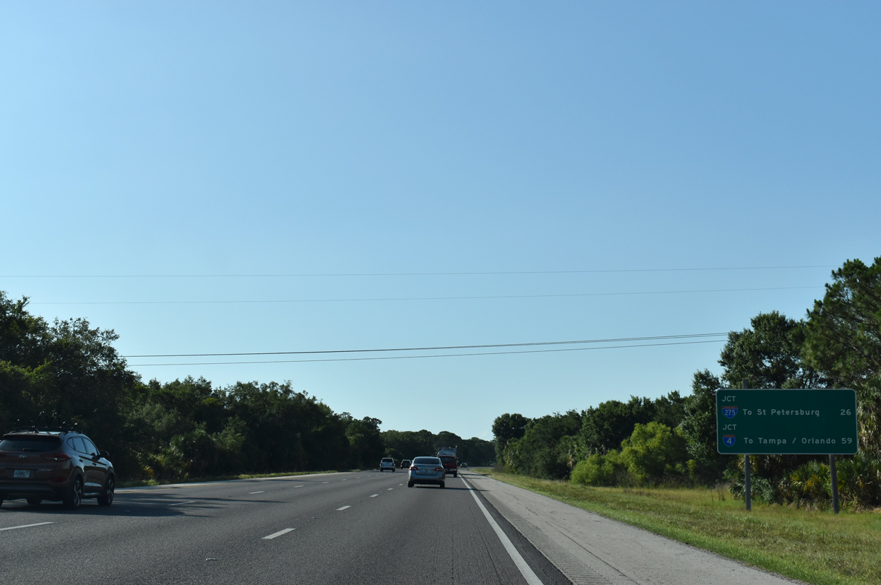
| Distance signs referencing the next major freeway connections appear regularly along Florida interstate highways. I-75 converges with I-275 north of Ellenton while the cross state I-4 meets I-75 beyond the Brandon area. 10/01/17 |
|
| I-75 north meets Toledo Blade Boulevard at a diamond interchange (Exit 179) 1.25 miles ahead. 10/01/17 |
|
| Toledo Blade Boulevard connects Interstate 75 with U.S. 41 northwest of Murdock in Charlotte County. 10/01/17 |
|
| The second exit for North Port links Interstate 75 with Sumter Boulevard (CR 771) in 1.25 miles. 10/01/17 |
|
| A wide median separates traffic along Interstate 75 as the freeway shifts northward through Deer Prairie Creek Preserve at milepost 186.5. 07/09/17 |
|
| Toledo Blade Boulevard continues one mile north from Interstate 75 to Tropicaire Boulevard. 10/01/17 |
|
| $73 million expansion of I-75 to six overall lanes from Harborview Road to Sumter Boulevard started on January 4, 2016. The 15.6 mile long project added a 12 foot wide travel lane and a 10 foot wide shoulder to the inside of both roadways.1 10/01/17 |
|
| Until the late 1990s and early 2000s, Sumter Boulevard was sparsely populated between U.S. 41 and I-75. Growth during the economic boom of the mid 2000s added several residential subdivisions and commercial centers along the arterial. 10/01/17 |
|
| Sumter Boulevard extends 1.8 miles south from the diamond interchange at Exit 182 to North Port City Hall and 4.6 miles to U.S. 41. 10/01/17, 10/04/20 |
|
| A $35.6 million project widened an 8.5 mile section of I-75 north from Sumter Boulevard to N River Road. Work commenced in October 2013 and was completed by Fall 2016.2 07/09/17 |
|
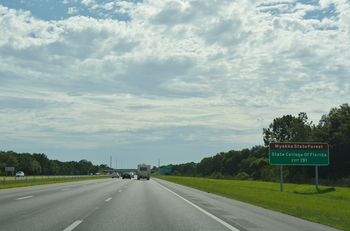
| Interstate 75 continues west across Schewe Ranch and Deer Prairie Creek Preserve eight miles to Exit 191 for SR 777 (River Road). 10/01/17 |
|
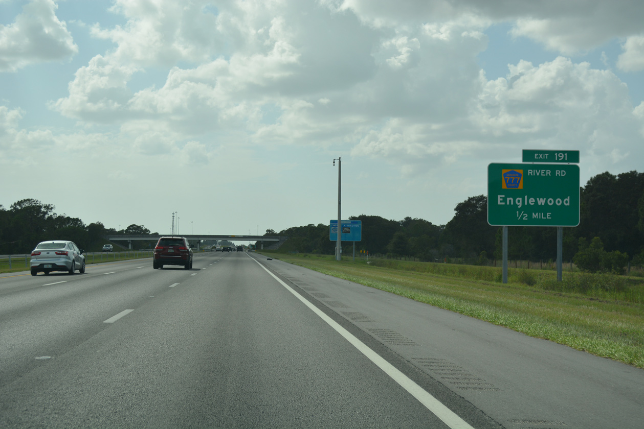
| SR 777 (River Road) angles 5.82 miles southeast from Exit 191 to U.S. 41 in western North Port. CR 777 extends River Road another 7.67 miles south to SR 776 in the coastal community of Englewood. 10/01/17 |
|
| River Road parallels the Myakka River southeast from I-75 to U.S. 41 and Myakka State Forest. The Myakka River meanders from Lower Myakka Lake, within Myakka River State Park, southeastward and empties into Charlotte Harbor east of El Jobean. 07/09/17 |
|
| SR 777 (River Road) ends just north of the diamond interchange (Exit 191) with Interstate 75 adjacent to an a shuttered off freeway rest area. 10/01/17 |
|
| A mileage swap between Sarasota County and FDOT in May 2018 added River Road (CR 777) south from I-75 to U.S. 41 as a state road in exchange for portions of SR 72 and SR 758 west of U.S. 41 to Siesta Key.3 $47.5 million in construction widening River Road to four lanes runs from early 2022 to early 2025. 10/01/17 |
|
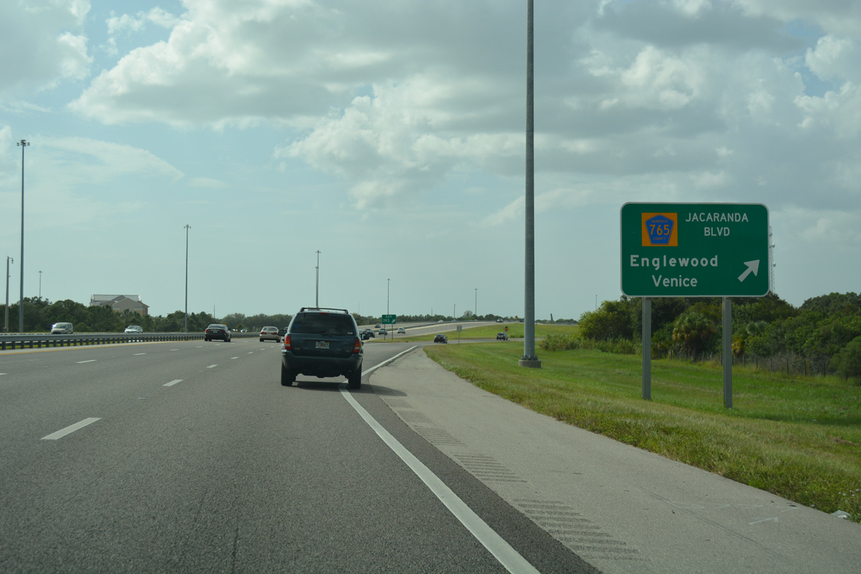
| Jacaranda Boulevard (unsigned CR 765) connects Interstate 75 with the city of Venice at Exit 193. Jacaranda Boulevard weaves southward through an array of development 5.2 miles to U.S. 41 (Tamiami Trail) and SR 776 (Englewood Road) near South Venice. 07/09/17 |
|
| Interstate 75 was expanded from four to six lanes between SR 777 (River Road) and SR 681 by 2012. 07/09/17 |
|
| Jacaranda Boulevard extends beyond Exit 193 into suburban areas of northeastern Venice. Venice Avenue stems west from a roundabout with the arterial 4.8 miles to Downtown Venice. 10/01/17 |
|
| Entering the parclo interchange (Exit 193) with Jacaranda Boulevard on I-75 north. Installed after June 2015, the sign at the off-ramp for Jacaranda Boulevard replaced a previous assembly that included the missing exit tab. 10/01/17 |
|
| Exit 193 serves as the turning point for Interstate 75 as the freeway resumes a northerly heading toward Sarasota and Tampa. 07/09/17 |
|
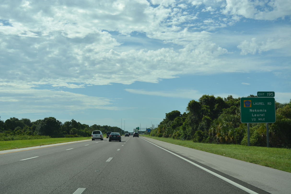
| Interstate 75 enters the Venice city limits at the Border Road overpass. The ensuing exit is with Laurel Road. Laurel Road connects with Albee Farm Road south to the community of Nokomis and U.S. 41 north to Oscar Scherar State Park. 07/09/17 |
|
| Laurel Road (CR 762) is a four lane arterial leading west to U.S. 41 at the community of Laurel and east to the Venetian Golf & River Club development and Venice Myakka River Park. 07/09/17 |
|
| Originally, Laurel Road (CR 762) had no direct access to I-75. Construction of the exchange at Exit 195 occurred well over a decade after the opening of I-75. The exchange was Exit 35 A in the old sequential numbering system. 07/09/17 |
|
| The roadways for Interstate 75 through the diamond interchange at Exit 195 separate by nearly 1,000 feet. 07/09/17 |
|
| I-75 crosses Salt Creek nine miles south of Exit 205 for SR 72. Land along the east side of I-75 north to Cow Pen Slough and Fox Creek was approved by Venice City Council for development of 696 homes on two plats totaling 298.54 acres on October 21, 2021.4 05/19/19 |
|
| SR 681 constitutes a 4.14 mile long connection between U.S. 41 and a wye interchange (Exit 200) with I-75 north near Laurel. SR 681 was originally built as a limited access spur with a 70 mph speed limit. However, the opening of the Honore Avenue extension south to SR 681 in March 2011 ended the freeway status and reduced the speed limit to 60 mph along its entire stretch. Two additional at-grade intersections were eventually added. 05/19/19 |
|
| The previous six lane stretch of I-75 commenced north from SR 681 to Exit 265 / SR 582 near Tampa. That changed when widening was completed southward to North Port and again in 2016 with six-laning in north Hillsborough. Commercial truck restrictions for the left lane are in place for all six lane sections of the freeway. 05/19/19 |
|
| Suburban development lines almost the entire west side of I-75 north over the three miles leading to Exit 205 / SR 72. With construction underway in 2020, the Grand Park development replaces agricultural areas just east. 05/19/19 |
|
| Interstate 275, the urban loop west from I-75 through both St. Petersburg and Tampa, begins in 26 miles while Interstate 4 crosses paths with I-75 in 59 miles. 05/19/19 |
|
| A community interchanges identification references access points to the Gulf area beaches. SR 72 (Clark Road) takes beach goers west to south Siesta Key while SR 758 (Bee Ridge Road) leads to north Siesta Key. SR 780 (Fruitville Road) provides access to St. Armands via SR 789 (Ringling Causeway). 05/19/19 |
|
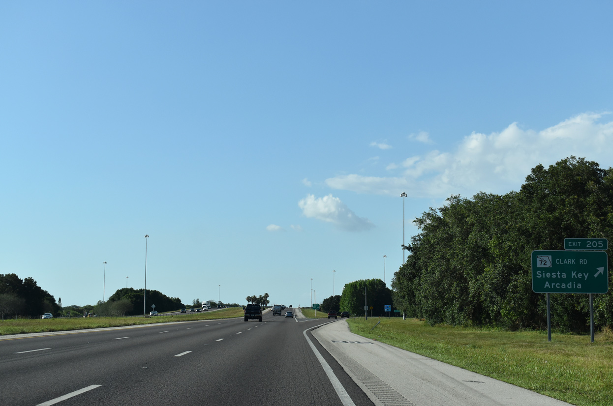
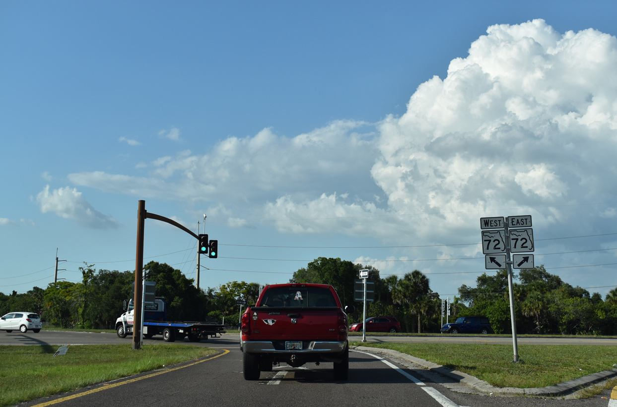
| SR 72 (Clark Road) meets Interstate 75 well southeast of the Sarasota city limits at Exit 205. SR 72 begins to the west at U.S. 41 near Siesta Key and extends east through Myakka River State Park to SR 70 just outside of Arcadia. 05/19/19 |
|
| SR 72 (Clark Road) is six lane arterial west from Exit 205. Eastward, SR 72 transitions into a rural two lane highway as shifts southeast toward Myakka River State Park. A FDOT PD&E Study underway from early 2022 to mid 2024 evaluates expanding 3.39 miles of SR 72 east into a four lane boulevard. 05/19/19 |
|
| Downtown Sarasota is ten miles to the northwest from Exit 205 via SR 72 (Clark Road) west and U.S. 41 (Tamiami Trail) north. Aracadia, seat of Desoto County, is 39 miles to the east along SR 70 at U.S. 17. 05/19/19 |
|
| $62.4 million in construction converts the diamond interchange at Exit 205 into a DDI. Work from late 2021 to late 2023 also expands SR 72 (Clark Road) to eight lanes through the exchange.5 05/19/19 |
|
| A parclo interchange joins Interstate 75 north with SR 758 (Bee Ridge Road) at Exit 207. Bee Ridge Road is a heavily developed arterial leading west between Sarasota Springs and Bee Ridge to U.S. 41 in southern reaches of the Sarasota city limits. 05/19/19 |
|
| Construction starting beyond 2025 reconfigures the exchange at Exit 207 into a hybrid DDI. SR 758 concludes just east of I-75 and west at U.S. 41. Since turned over to local maintenance, SR 758 formerly extended across Roberts Bay to Siesta Key. 05/19/19 |
|
| Confirming marker posted beyond the entrance ramp from SR 758 (Bee Ridge Road). Auxiliary lanes will be added to 3.8 miles of I-75 as part of the reconstruction at Exit 207. 05/19/19 |
|
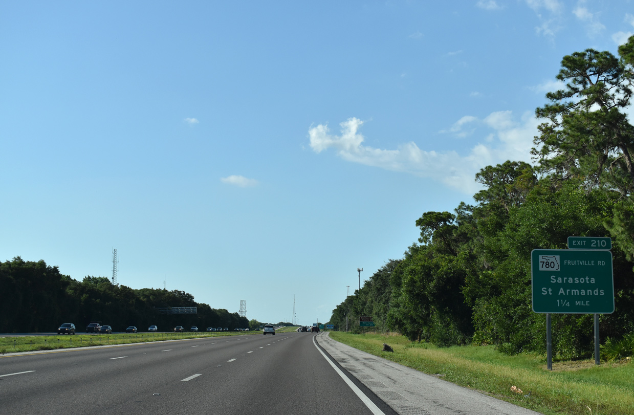
| Interstate 75 north meets SR 780 (Fruitville Road) next in 1.25 miles. Exit 210 joins I-75 with downtown Sarasota. 05/19/19 |
|
| SR 780 (Fruitville Road) maintains six lanes leading west from I-75 to U.S. 301 (Washington Boulevard) near Downtown. Future work at Fruitville Road converts the six-ramp parclo interchange into a DDI. 05/19/19 |
|
| SR 780 ends ahead of Lakewood Ranch Boulevard east of I-75 with Fruitville Road (CR 780) advancing into more rural parts of Sarasota County. 05/19/19 |
|
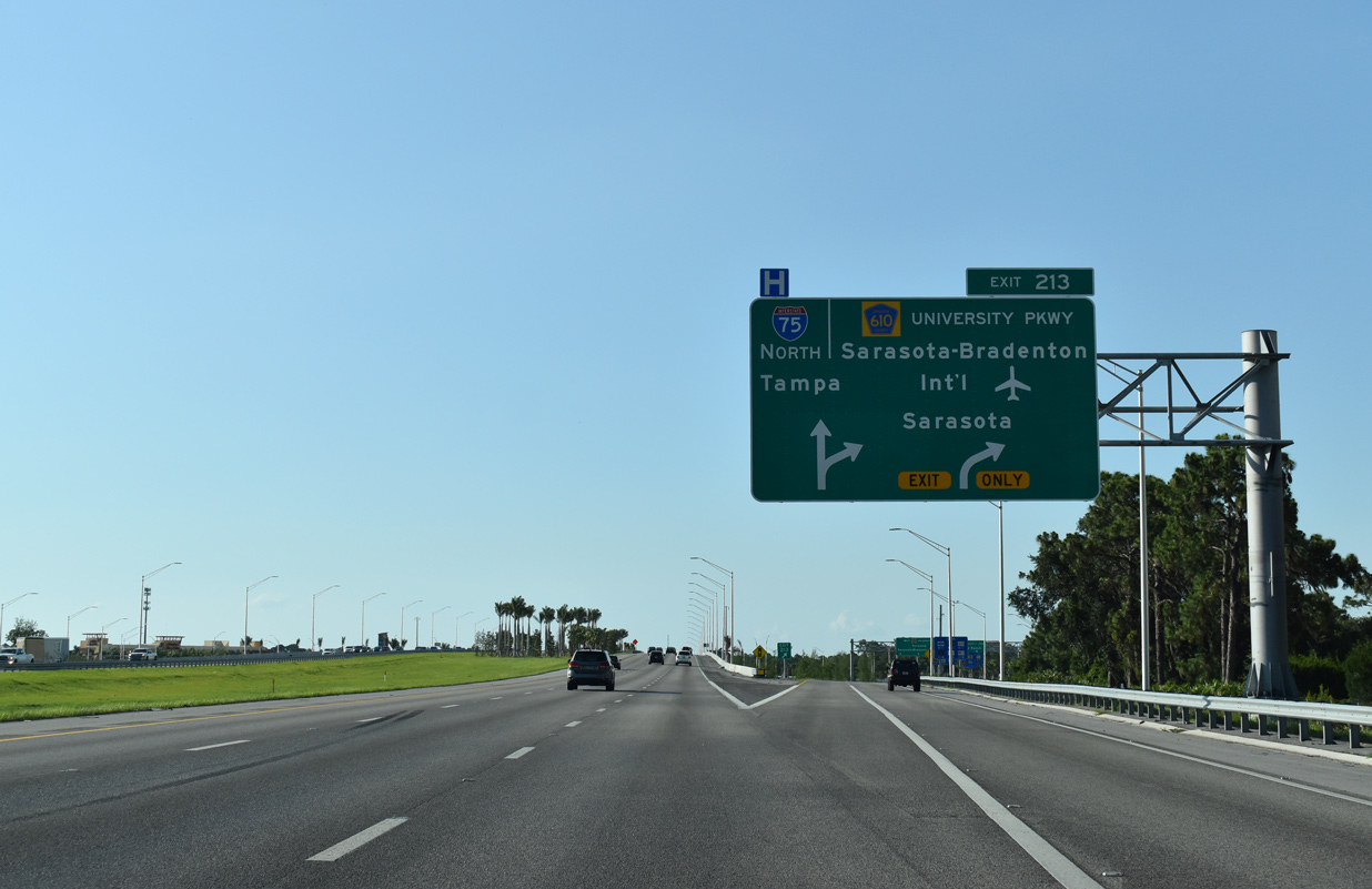
| Commuter traffic between Sarasota and Bradenton adds to seasonal traffic, totaling 123,500 vehicles per day (vpd) on the stretch of I-75 between Exits 210 and 213 as recorded in 2013. FDOT counts along this segment rose to 142,000 vpd in 2018 but lowered slightly to 141,500 by 2021. 05/19/19 |
|
| University Parkway joins Interstate 75 with Lakewood Ranch 2.5 miles ahead, followed by the city of Bradenton (23 miles).
The previous version of this sign listed Bradenton at 16 miles out. 05/19/19 |
|
| 22 months of construction both reconfigured Exit 213 with University Parkway into a diverging diamond interchange (DDI) and added auxiliary lanes along I-75. With 12 lanes on University Parkway, the largest DDI in the United States opened to traffic on May 20, 2017.6 05/19/19 |
|
| A portion of upcoming University Parkway was former U.S. 301 prior to its realignment and extension in the 1980s. U.S. 301 originally headed south from Bradenton and Oneco along Washington Boulevard to University Parkway west around the periphery of Sarasota-Bradenton International Airport (SRQ).
The airport was formerly referred to as Sarasota-Bradenton Regional Airport, but promoted to international status in November 1992 when it became a Port of Entry. 05/19/19 |
|
| Development around the Exit 213 was absent for years until the mid 1990s, when land to the east was opened up for residential subdivisions. Lakewood Ranch grew out of cow pastures and horse farms to become one of the premiere unincorporated communities in adjacent Manatee County. 05/19/19 |
|
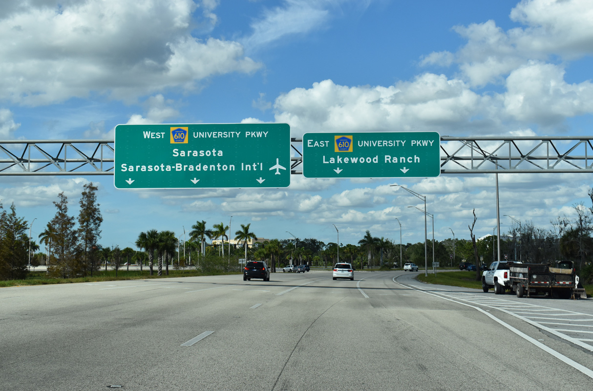
| Anchored by the Mall at University Town Center completed in October 2014, University Parkway is heavily traveled residential and commercial corridor west from I-75 west to U.S. 41. Points of interest for Exit 213 include the famous Ringling Museum, SRQ Airport, and the New College of Florida and USF Sarasota-Manatee campuses via U.S. 41 north. 10/23/22 |
|
| Passing over University Parkway, Interstate 75 enters Manatee County. Founded in 1855, the county is named after the state's official marine mammal, the manatee (sea cow as it is commonly called). 04/17/22 |
Page Updated 10-16-2023.

 North
North