|
| Signs were installed throughout the Florida Interstate system in 2018 indicating the number of spaces available for both rest areas and weigh stations. This assembly precedes the weigh station located eight miles north of the SR 44 entrance ramp. 07/28/18 |
|
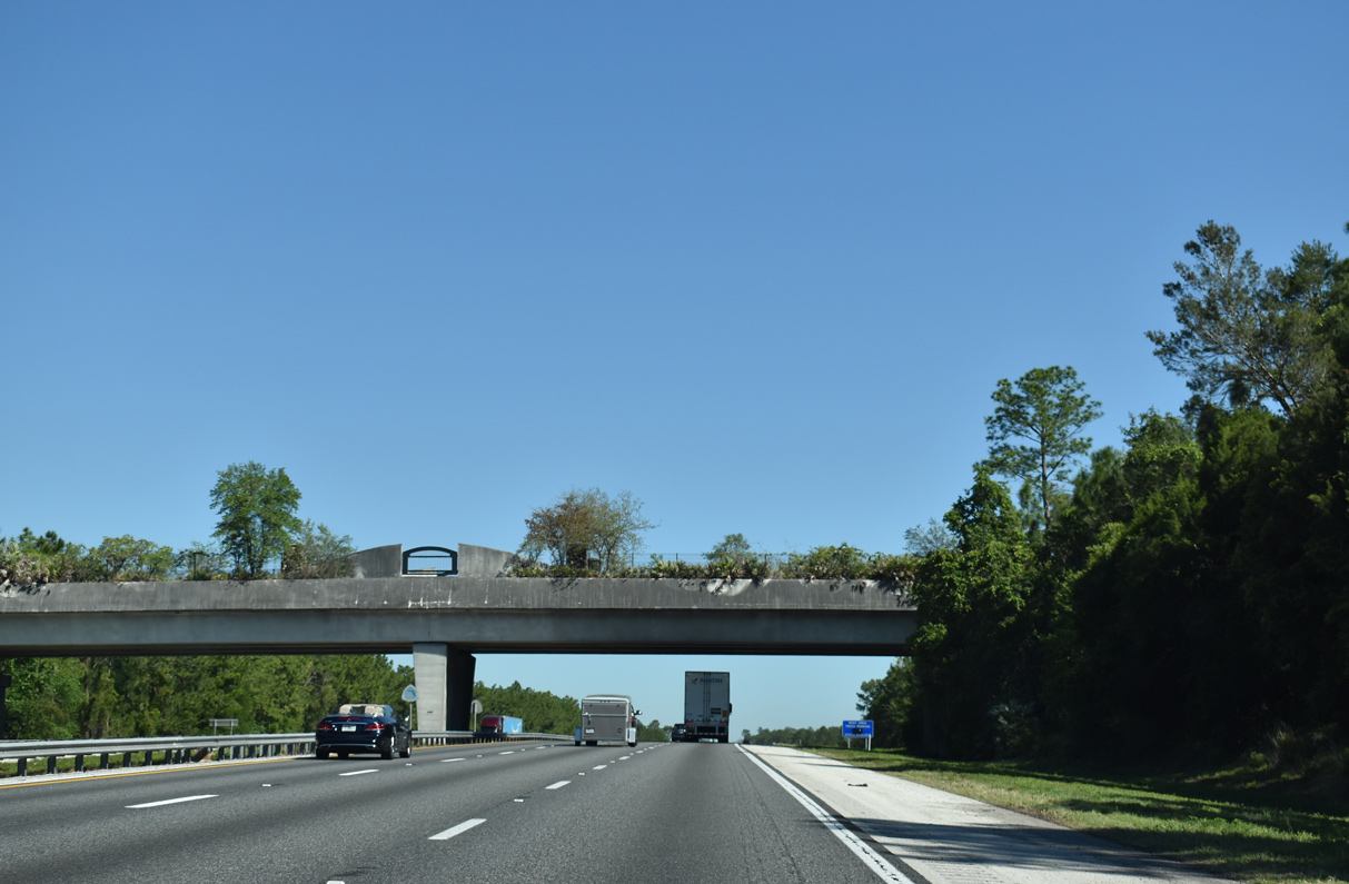
| The Marion County weigh station is the second of three weigh stations along Interstate 75 in Florida. 05/05/16 |
|
| Northbound I-75 reaches the weigh station as it passes to the east of the Summer Glen golf course community. 08/16/18 |
|
| Interstate 75 next approaches a diamond interchange (Exit 341) with Marion County Road 484. CR 484 connects Dunnellon to the west with Belleview to the east along a 28 mile course. 04/17/19 |
|
| Heading east from Exit 341, CR 484 comprises a four lane arterial to the Belleview Bypass along SE 132nd Street Road. West of I-75, CR 484 travels through Marion Oaks en route to SR 200 and Dunnellon. 08/16/18 |
|
| Curving northwest from CR 484 (Exit 341) I-75 advances to within 14 miles of Downtown Ocala. Downtown Gainesville lies 52 miles ahead in central Alachua County. 08/16/18 |
|
| I-75 passes under the Marjorie Harris Carr Cross Florida Greenway through a wooded area 1.75 miles beyond the CR 484 entrance ramp. Utilizing lands once set for the Cross-Florida Barge Canal, the Cross Florida Greenway is a nature trail stretching 110 miles from the Gulf of Mexico to the St. Johns River, 05/02/20 |
|
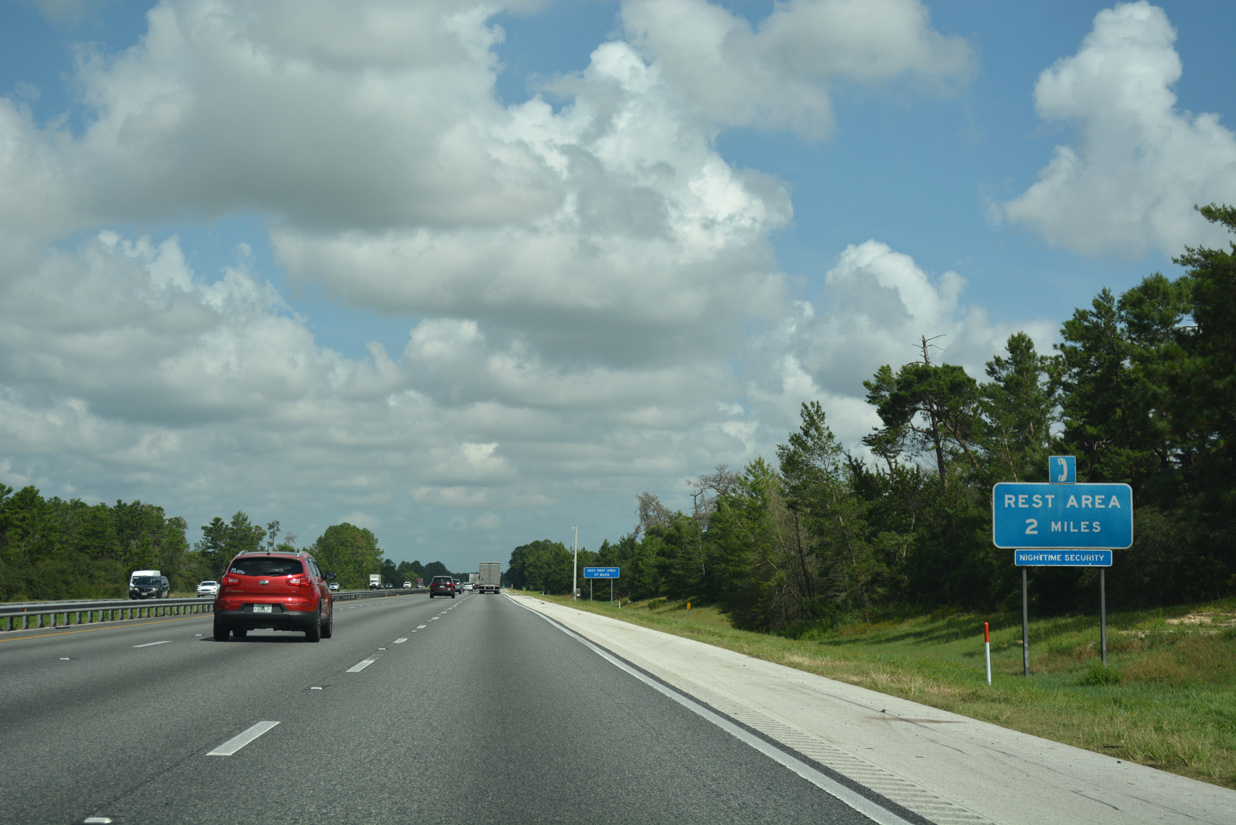
| The westward shift of Interstate 75 extends to a point one mile ahead of the Marion County rest area west of CR 475A (SW 27th Avenue). 08/16/18, 05/02/20 |
|
| A ramp leaves for the rest area as Interstate 75 travels due north toward the Ocala city limits. Travelers see another rest area in 37 miles, located just south of SR 121 (Exit 384) in Alachua County. 08/16/18 |
|
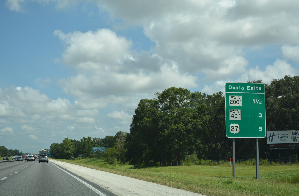
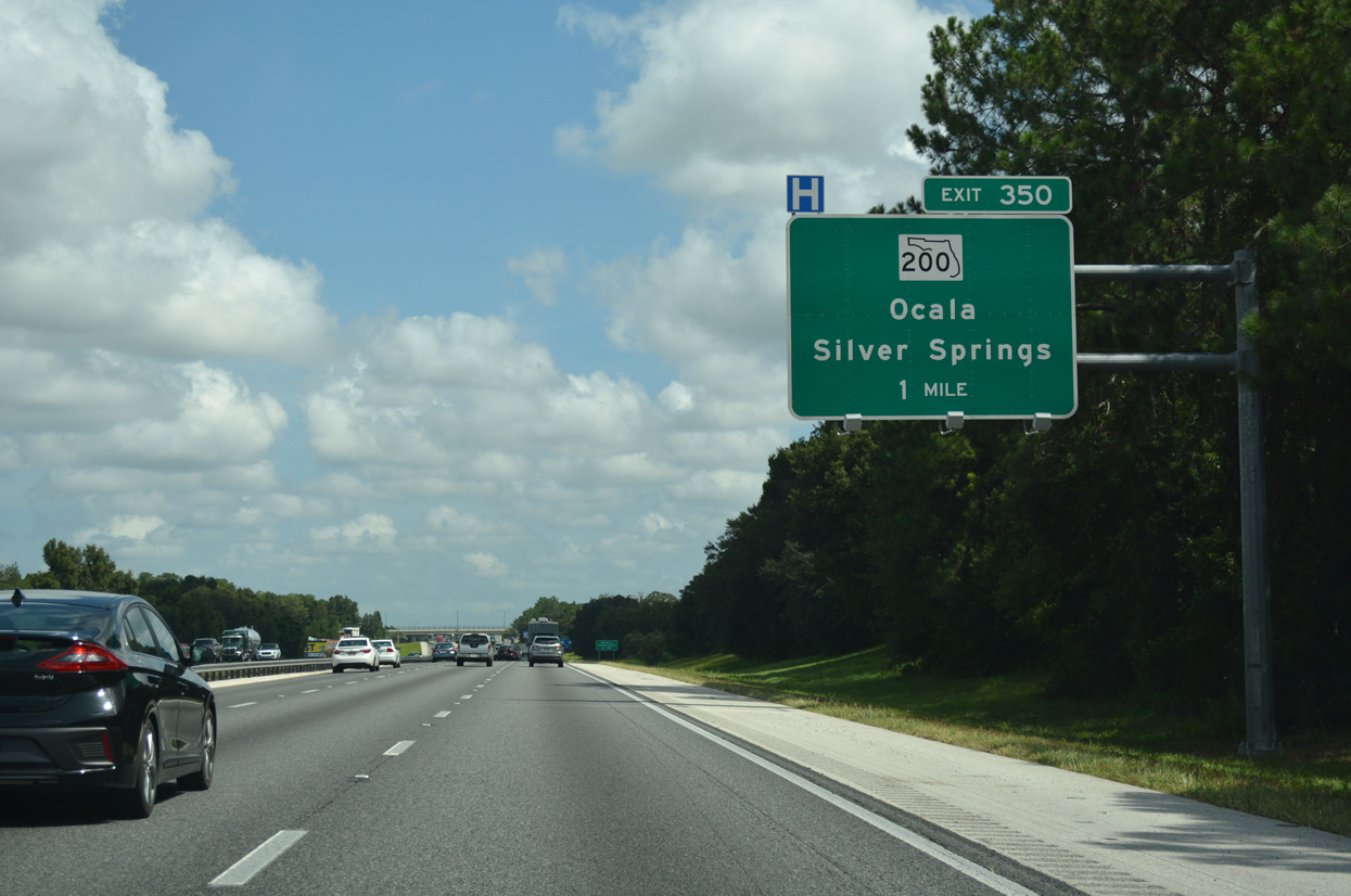
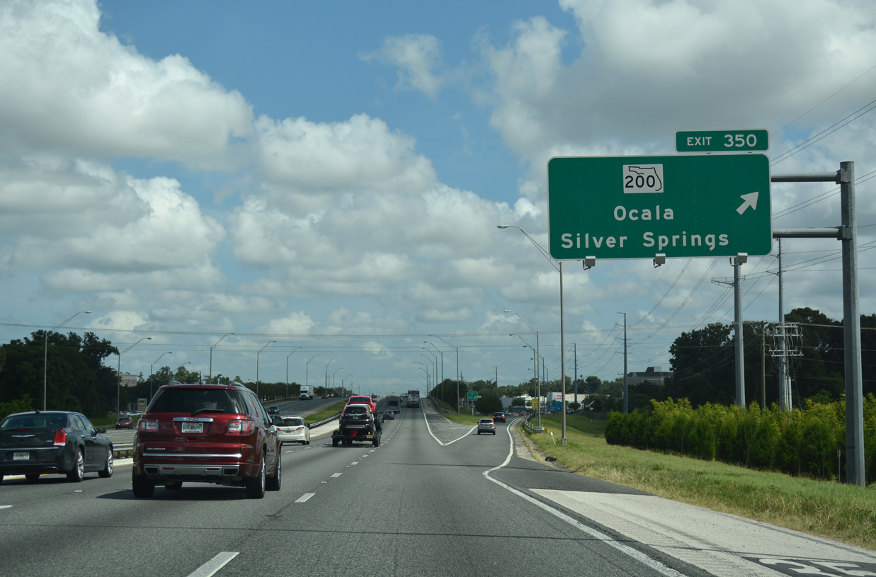
| The first of three Ocala interchanges is with SR 200 (Exit 350) in 1.5 miles. Succeeding ramps join I-75 with SR 40 at Exit 352 in three miles and U.S. 27 (Exit 354) in five miles. 08/16/18 |
|
| Crossing paths with I-75 in one mile, State Road 200 (SW College Road) enters the Ocala area from the southwest. Overall, the state road travels 155.8 miles, originating from U.S. 41 in Hernando (Citrus County) and ending in Fernandina Beach (Nassau County) at SR A1A. From Ocala to Callahan, SR 200 runs in tandem with U.S. 301 as an unmarked route. 08/16/18 |
|
| Exit 350 leaves the freeway for SR 200 (SW College Road). Accessible from both Exits 350 and 352, Silver Springs lies east of Ocala along SR 40 (Silver Springs Boulevard). 08/16/18 |
|
| Commercial retail centers and restaurant establishments saturate SW College Road between SW 60th Avenue and SR 464 (SW 17th Street), often resulting in significant traffic congestion within the vicinity of I-75. 12/04/20 |
|
| Completed in Fall 2020, an $8 million project added additional turn lanes to Exit 350 and along SR 200 at Interstate 75. 12/04/20 |
|
| FDOT recorded 78,500 vehicles per day (vpd) along Interstate 75 between SR 200 and forthcoming SR 40 in 2017. 08/16/18 |
|
| Passing over SW 20th Street, the freeway advances one mile to SR 40 (Silver Springs Boulevard). SR 40 constitutes the main east-west corridor across the city of Ocala. Spanning 91.8 miles, the state road stretches across the Florida peninsula from U.S. 41 north of Dunnellon to Silver Springs and Ormond Beach along the Atlantic coast. 08/16/18 |
|
| Exit 352 departs I-75 north for SR 40 east to Downtown Ocala and Silver Springs. Silver Springs is an unincorporated area situated around a group of natural springs whose headspring forms the Silver River. 08/16/18 |
|
| The Ocala central business district lies three miles east from the diamond interchange (Exit 350) with I-75 along SR 40 (Silver Springs Boulevard). Silver Springs is six miles further. 08/16/18 |
|
| SR 40 shields at the ramp end from Exit 352. The state road east traverses Ocala National Forest en route to Ormond Beach. The western eight miles constitutes a four lane, divided highway to CR 328. 08/16/18 |
|
| This reassurance shield stands beyond the entrance ramp from SR 40 (Exit 352). 05/02/20 |
|
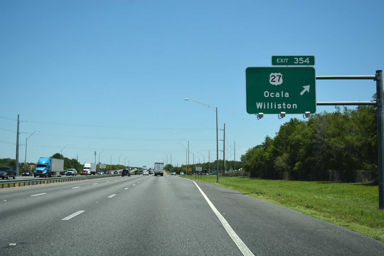
| U.S. 27 spokes northwest from Ocala toward Williston and Perry, meeting Interstate 75 along Blitchton Road in a half mile. 05/27/17 |
|
| Exit 354 parts ways with I-75 north for U.S. 27 (NW Blitchton Road). U.S. 27 heads 2.7 miles southeast and runs along NW 10th Street to U.S. 301/441 (Pine Avenue) north of Downtown Ocala. NW Blitchton Road leads U.S. 27 northwest to Blitchton (CR 326) and Williston in Alachua County. 05/27/17 |
|
| Motorists leaving for U.S. 27 north are also directed to use the highway to reach Tallahassee (168 miles) as an alternative to the freeway system. 05/02/20 |
|
| Bonnie Heath Boulevard is an alternative name used for U.S. 27 along this stretch and is done so in honor of a pioneer who helped establish the thoroughbred horse farm industry in the Ocala area. 05/02/20 |
|
| A number of distribution centers were constructed along the east side of Interstate 75 starting in 2014. The freeway leaves the Ocala city limits here. 05/02/20 |
|
| Shifting a quarter mile westward through an S-curve, I-75 transitions into a rural freeway three miles ahead of Exit 358 with SR 326. Gainesville is a 40 mile drive from this point. 05/02/20 |
|
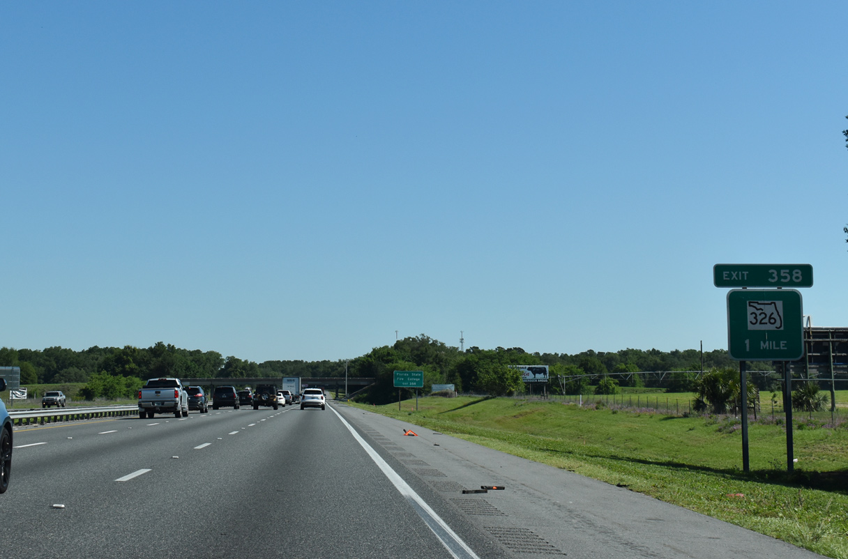
| An 11.57 mile route, upcoming SR 326 provides a northern bypass of Ocala, connecting I-75 with SR 40 east of Silver Springs. Exit 358 also serves interests to the Florida State Fire College and Indian Lake State Forest. 05/02/20 |
|
| Exit 358 departs northbound I-75 to State Road 326. SR 326 comprises a well traveled link between I-75 and U.S. 30 northeast toward Jacksonville. Heading west, SR 326 transitions into Marion County Road 326 en route to U.S. 27 and Morristown. 07/24/22 |
|
| Progressing north from SR 326 near Zuber toward Gainesville, Interstate 75 trends westward again. 05/02/20 |
|
| Traversing a series of rolling hills across northern Marion County, I-75 next meets County Road 318 in nine miles. The freeway passes west of the town of Reddick on the ensuing stretch. 05/02/20 |
|
| One mile ahead of Exit 368 for Marion County Road 318. Irvine is a small unincorporated area situated around the diamond interchange with I-75 while the community of Orange Lake lies 3.8 miles to the northeast along U.S. 441. 05/02/20 |
|
| Northbound I-75 reaches Exit 368 to County Road 318 at Irvine. CR 318 nearly travels across the width of Marion County, leading west to U.S. 27 at Williston and east to CR 315 at Orange Springs. 05/02/20 |
|
| CR 318 east from Exit 368 to U.S. 441 north leads motorists five miles to the town of McIntosh, which is located on the west side of Orange Lake. 05/27/17 |
|
| Rising to an elevation of 200 feet above sea level, Interstate 75 plies across timber land west of Orange Lake and McIntosh between CR 318 and the Alachua County line. 05/05/16 |
|
| Edging closer to Gainesville (25 miles), travelers along I-75 north reach the town of Micanopy in 5 miles via Alachua County Road 234. 05/05/16 |
|
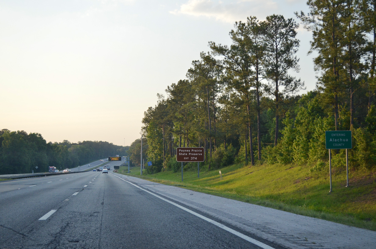
| One mile ahead of Exit 374 with CR 234 on Interstate 75 north. A ten mile exit less stretch through Paynes Prairie Preserve State Park unfolds beyond the forthcoming diamond interchange. 06/16/16 |
|
| Interstate 75 enters Alachua County just west of Tuscawilla Lake and Preserve. Paynes Prairie Preserve State Park lies north of Micanopy along parallel U.S. 441. 05/05/16 |
Page Updated 08-26-2022.

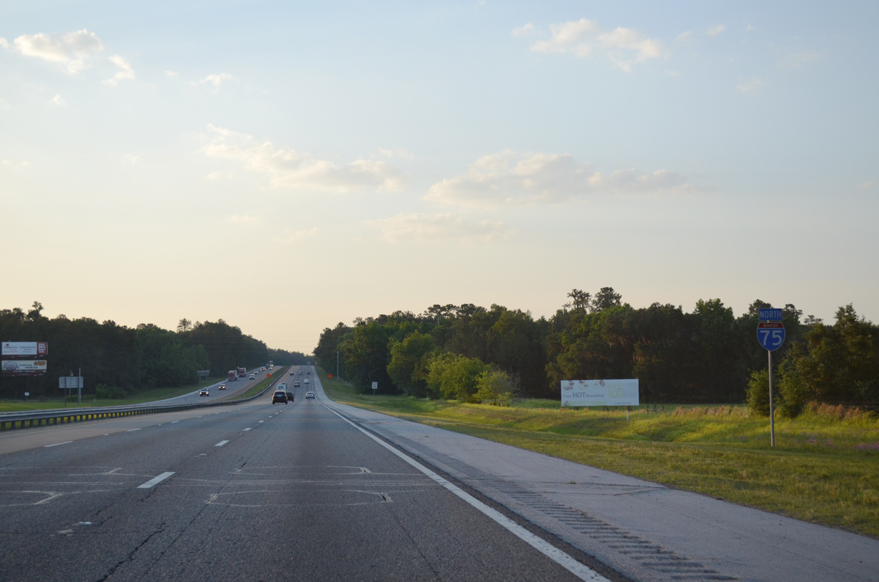
 North
North