|
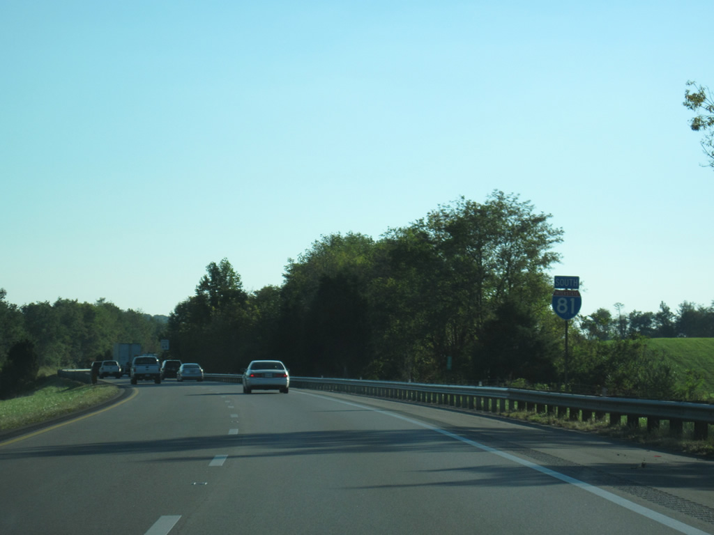
| U.S. 11 (Lee Highway) and Interstate 81 again switch sides at a modified diamond interchange (Exit 32) by Hutton Creek. 10/02/10 |
|
| Exit 32 also serves SR 751 (Fleet Road), which provides a cutoff 2.40 miles northwest to SR 91 (Crescent Road0 via Fleet and Plum Creek. SR 751 also spurs south along Kilmachronan Drive by the former Greenway Creek golf course. 10/02/10 |
|
| U.S. 11 lines the south side of I-81 west from Exit 32 to Old Glade Spring. Glove Drive (SR F033) comprises the north side service road along the same stretch. 10/02/10 |
|
| SR 91 is another multi state highway, traveling 55.15 miles in Virginia from Tazewell south to Tennessee State Route 91 en route to Hunter. 10/02/10 |
|
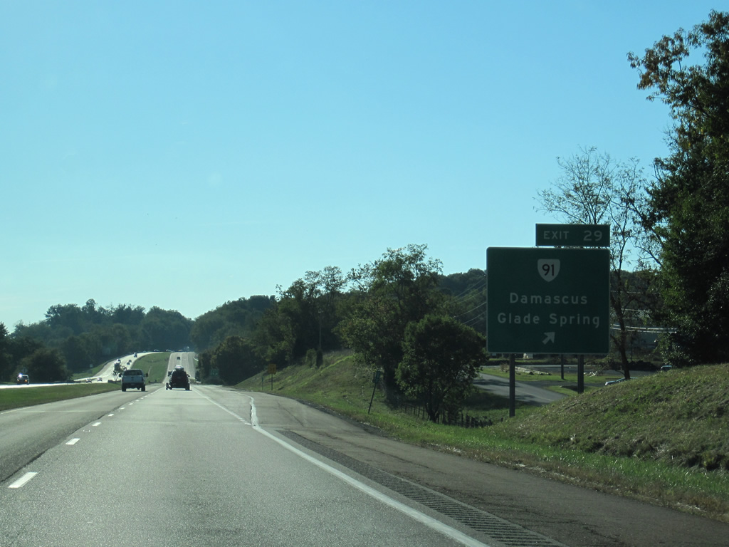
| Entering the diamond interchange (Exit 29) with SR 91 (Maple Street) outside Glade Spring. SR 91 encircles the town bypasses town to the east along Monte Vista Drive en route to Saltville. Southward SR 91 continues 13 miles to Damascus near the state border. 10/02/10 |
|
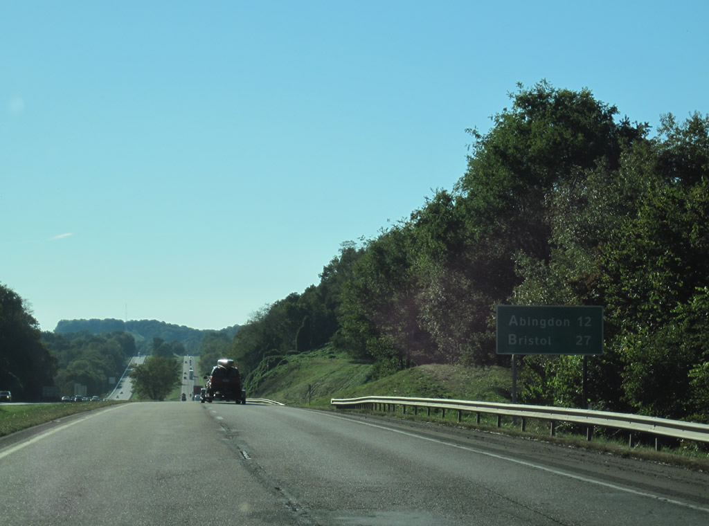
| Interstate 81 runs through a wide agricultural valley on the 12 mile drive west to Abingdon. 10/02/10 |
|
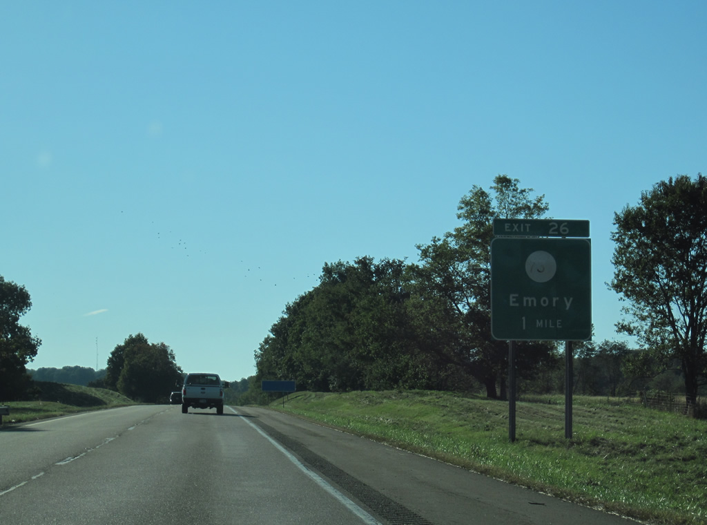
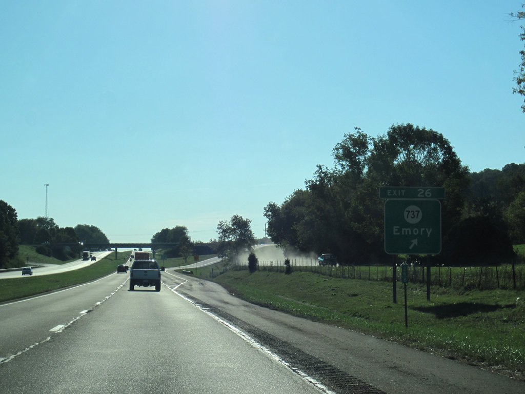
| The succeeding exit joins I-81 with SR 737 (College Drive) by the community of Emory. College Drive leads north 0.57 miles to SR 609 (Hillman Highway) and Garnand Drive east into the campus of Emory & Henry College. 10/02/10 |
|
| South from the diamond interchange at Exit 26, SR 737 (College Drive) connects with U.S. 11 (Lee Highway) in 0.58 miles. 10/02/10 |
|
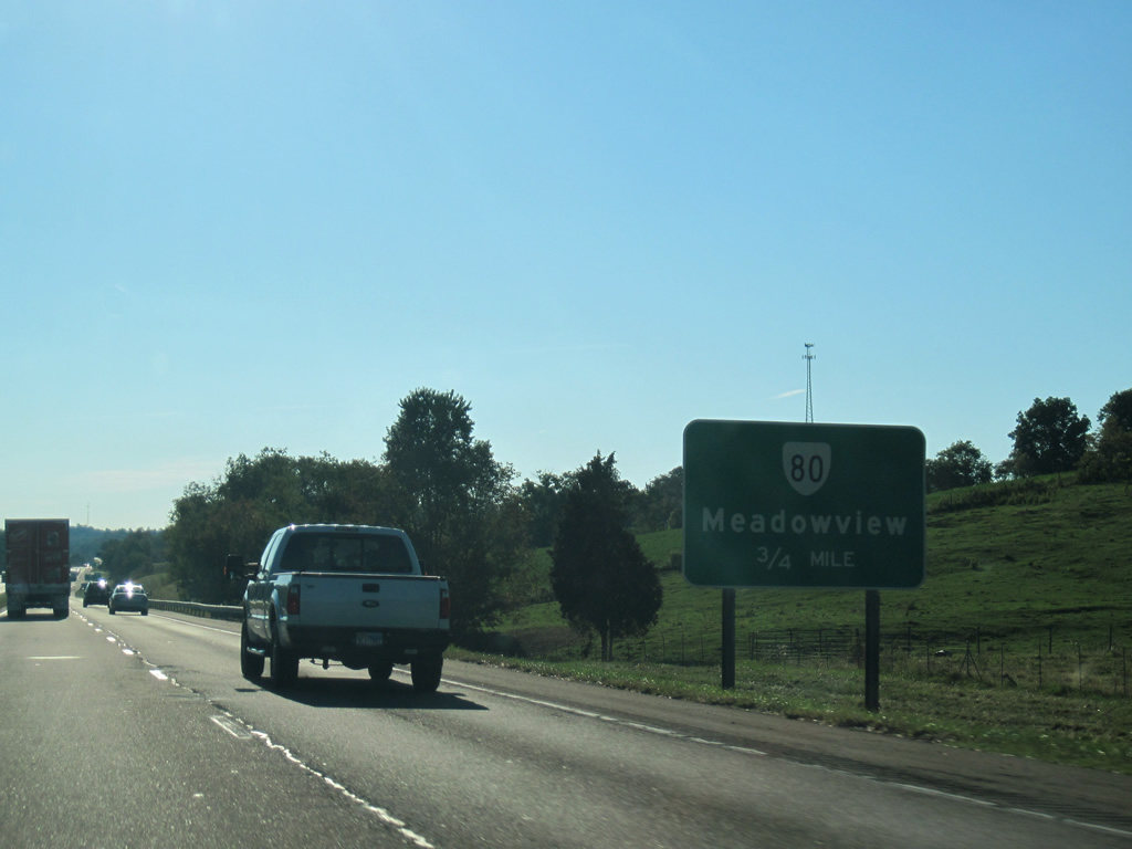
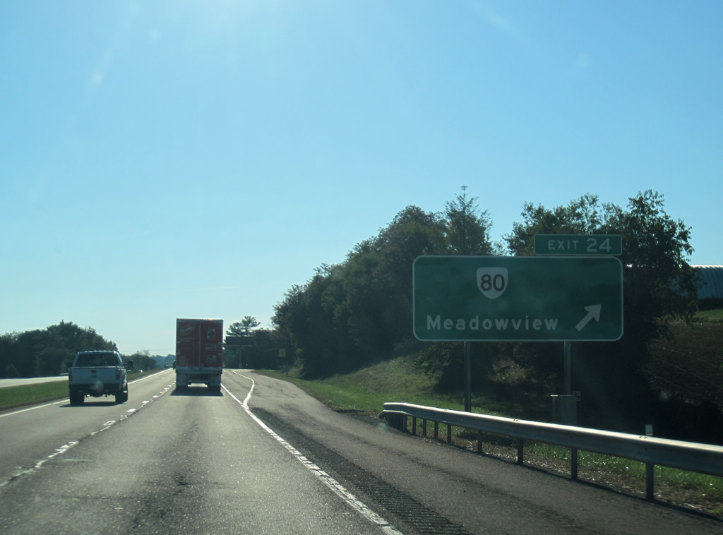
| SR 80 (Glenbrook Avenue) converges with I-81 at a diamond interchange (Exit 24) between Cedarville and Meadow View in one mile. 10/02/10 |
|
| SR 80 (Glenbrook Avenue) originates 0.78 miles south of Exit 24 at U.S. 11 and SR 803 (Cedar Creek Road). SR 80 is part of a multi state highway stretching 581 miles along the southern tier of Kentucky and via a ferry across the Mississippi River to southeastern Missouri. 10/02/10 |
|
| 1.10 miles long, SR 704 (Enterprise Road) links I-81 at Exit 22 with parallel SR 609 (Hillman Highway) at an industrial park and U.S. 11 (Lee Highway) to the south. 10/02/10 |
|
| Interstate 81 curves southwest alongside Harrison Road ahead of this shield assembly. 10/02/10 |
|
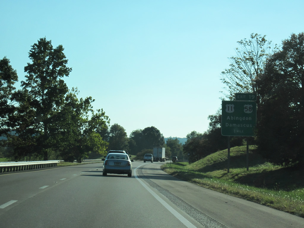
| U.S. 58 west combines with U.S. 11 south from Damascus ahead of a six-ramp parclo interchange (Exit 19) with Interstate 81. 10/02/10 |
|
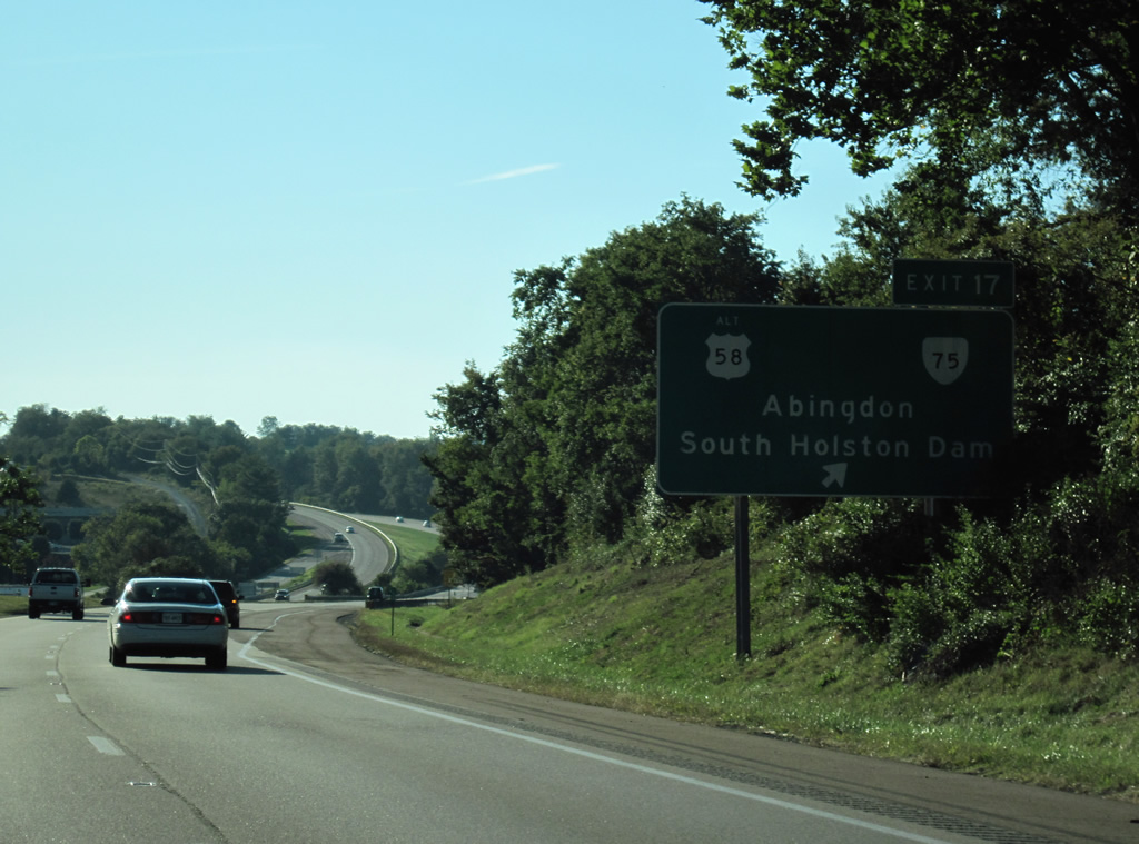
| Exit 19 leaves Interstate 81 for U.S. 11 (Lee Highway) south into the town of Abingdon. U.S. 58 west joins the freeway to bypass the community of around 8,000. 10/02/10 |
|
| U.S. 58 Alternate (Cummings Street) constitutes an 86.74 mile loop from Abingdon to Holston, Norton, Big Stone Gap and Jonesville. SR 75, a 10.51 mile long route, heads south from Abingdon to Green Spring and as Tennessee State Route 75 to U.S. 421 at Holston Valley, near South Holston Dam. 10/02/10 |
|
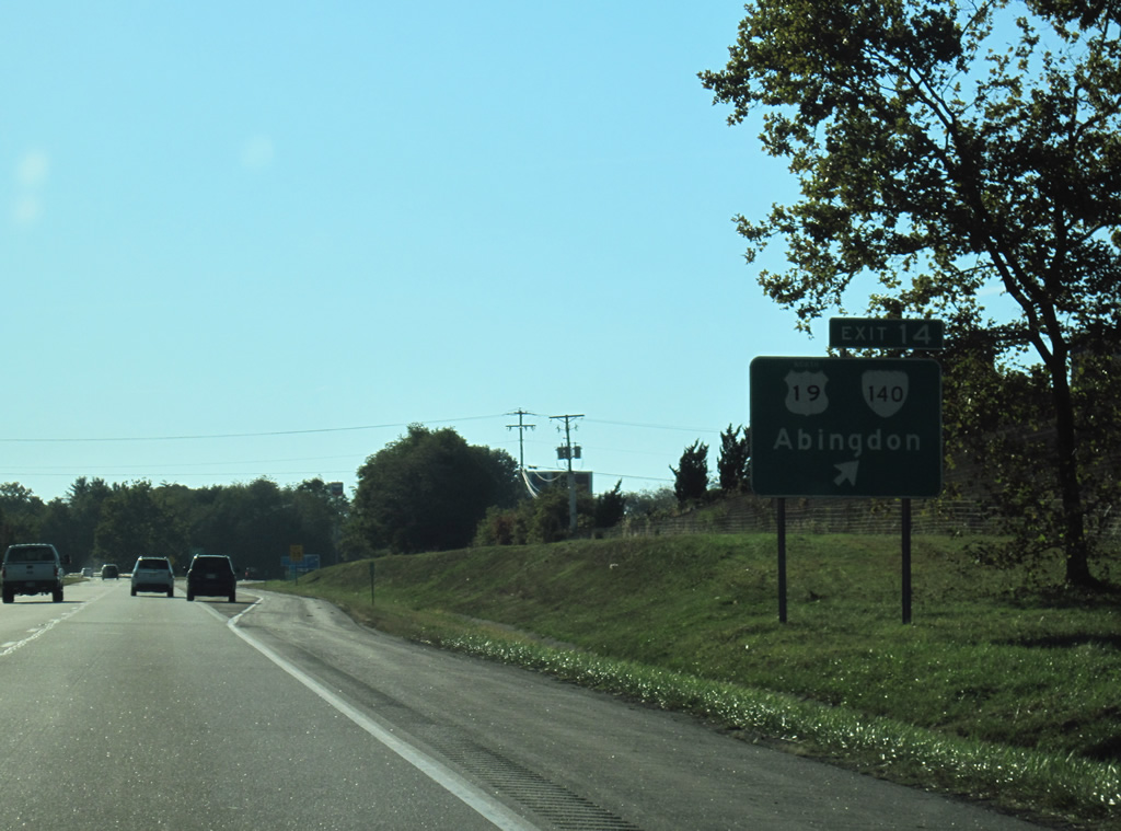
| U.S. 19 enters Abingdon with U.S. 58 Alternate from Hansonville and Holston to the northeast. U.S. 19 turns westerly alongside U.S. 11 (Main Street) to Bristol. SR 140 connects I-81 with the adjacent routes from Exit 14. 10/02/10 |
|
| SR 140 (Jonesboro Road) comprises just 0.38 miles from the diamond interchange at Exit 14 to U.S. 11/19. SR 647 (Old Jonesboro Road) extends 10.25 miles southwest to nearby residential subdivisions, Hall Bottom and the Bristol city line. 10/02/10 |
|
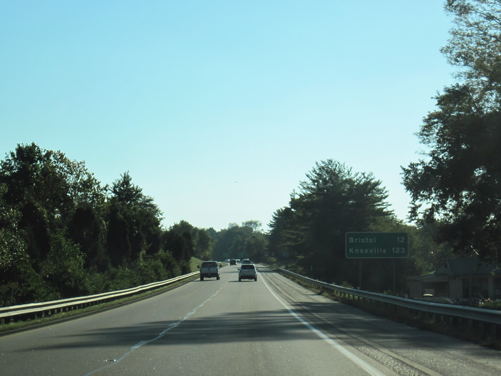
| Knoxville, Tennessee debuts on distance signs 12 miles east of Bristol. 10/02/10 |
|
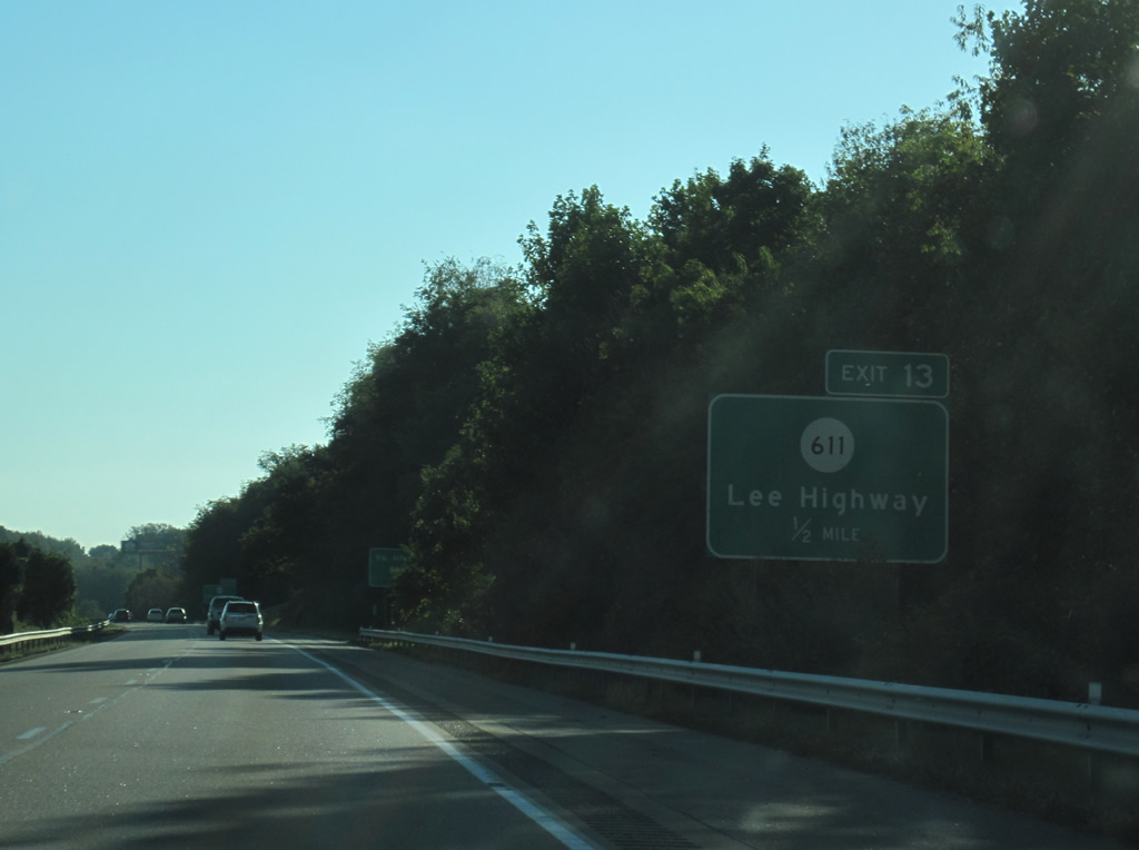
| SR 611 follows Spring Creek Road 0.48 miles south from Exit 13 to SR 647 (Old Jonesboro Road) and north 0.14 miles to adjacent U.S. 11/19 (Lee Highway). 10/02/10 |
|
| SR 611 continues 1.70 miles along Providence Road north from U.S. 11/19 to SR 645 (Wyndale Road). Virginia Highlands Airport (VJI) lies to the east along Lee Highway. 10/02/10 |
|
| The diamond interchange at Exit 10 with SR F-310 links I-81 with U.S. 11/19 (Lee Highway), east of Preston Hills, and Majestic Drive near Evergreen Hills. 10/02/10 |
|
| I-81/U.S. 58 west enter the independent city of Bristol ahead of Exit 7 to Old Airport Road. Old Airport Road arcs 0.99 miles southwest from U.S. 11/19 (Lee Highway) and Clear Creek Road to Bonham Road near Shakesville in Bristol. 10/02/10 |
|
| U.S. 11/19 (Lee Highway) navigate westward from Bonham Road to meet I-81/U.S. 58 directly at Exit 5. U.S. 11/19 wind southwest through Virginia Heights to Euclid Avenue and the Bristol city street grid. 10/02/10 |
|
| U.S. 19 travels south from Bristol with U.S. 11E to Bluff City, Tennessee, where the route splits. U.S. 11 splits into U.S. 11E to Johnson City and U.S. 11W west to Kingsport where U.S. 19/421 and SR 381 converge along Commonwealth Avenue in Bristol. 10/02/10 |
|
| Interstate 381 constitutes a 1.67 mile long spur linking I-81/U.S. 58 with U.S. 11/11E/11W, U.S. 19 and U.S. 421 at Commonwealth and Euclid Avenues in Bristol. 05/26/21 |
|
| U.S. 58 was realigned onto Interstate 81 from an overlap with U.S. 11 along Lee Highway between Abingdon and Bristol in 1966. 05/26/21 |
|
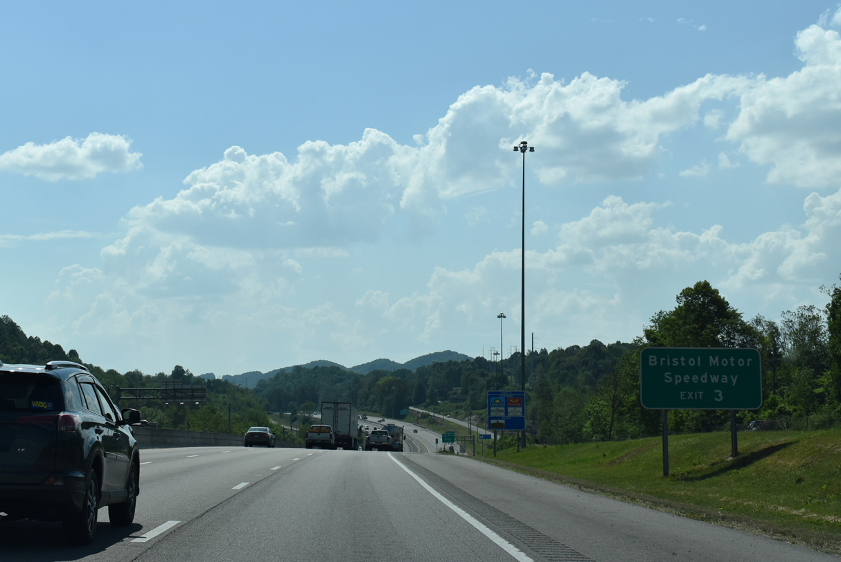
| Bristol Motor Speedway lies southwest of Bristol along U.S. 11E/19. SR 381 south from I-381 leads directly onto U.S. 11E/19/421 (Commonwealth Avenue) into Bristol, Tennessee. 05/26/21 |
|
| Interstate 381 has no exits between I-81/U.S. 58 and the intersection of Commonwealth Avenue (unsigned SR 381 south) and Keys Street. 05/26/21 |
|
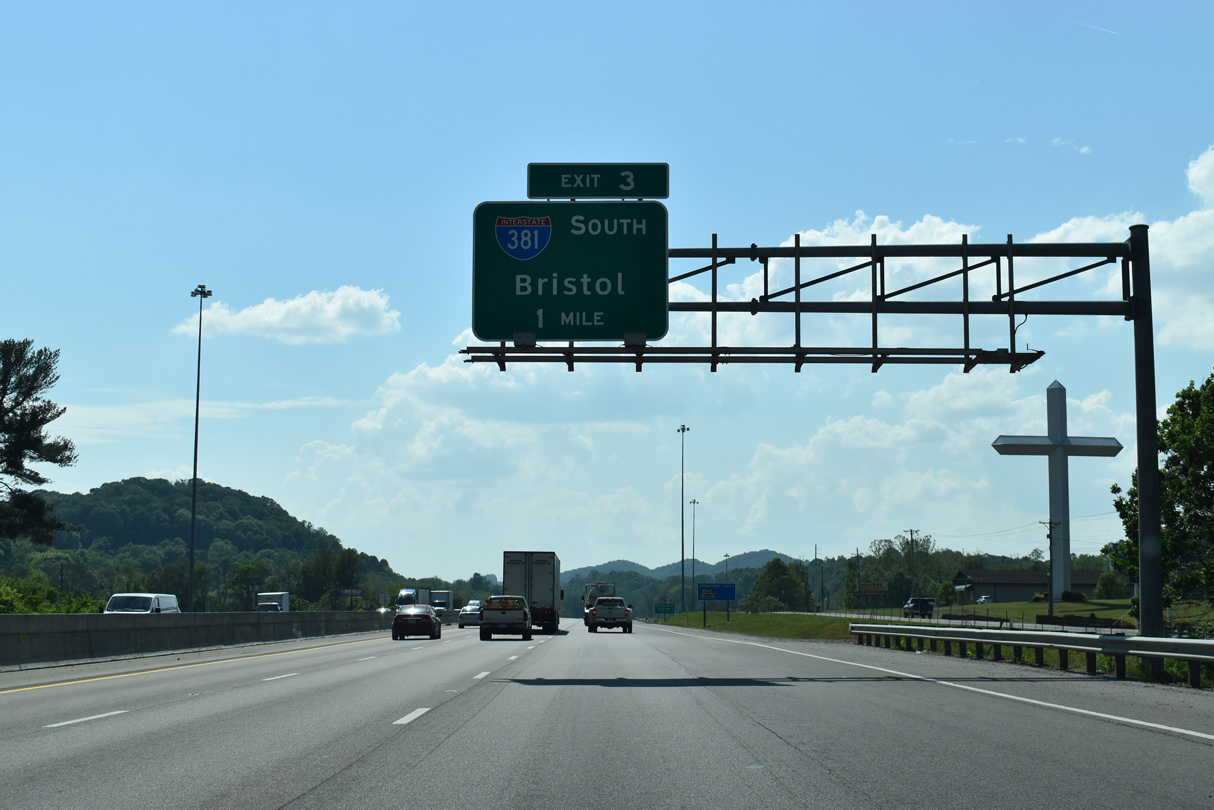
| Exit 3 departs I-81/U.S. 58 south for Interstate 381 south to Downtown Bristol. 05/26/21 |
|
| A directional T interchange connects I-81/U.S. 58 with Interstate 381 south at Exit 3. 05/31/07 |
|
| U.S. 58 west concludes an 18.28 mile long overlap with I-81 south at forthcoming Exit 1 with U.S. 421 (Gate City Highway). 05/31/07 |
|
| U.S. 58 joins U.S. 421 (Gate City Highway) north along a 42 mile overlap to Duffield. Weber City, where U.S. 58/421 combine with U.S. 23, lies 24.48 miles to the west. 05/31/07 |
|
| Entering the parclo interchange (Exit 1) with U.S. 58 west / U.S. 421 (Gate City Highway) north. U.S. 58/421 head 19 miles west to Hiltons along a rural two lane highway. 05/31/07 |
|
| Exit 1A loops onto U.S. 421 south (Gate City Highway) into Bristol. U.S. 421 combines with U.S. 11W along Euclid Avenue east to Commonwealth Avenue at State Street in 1.01 miles, 05/31/07 |
|
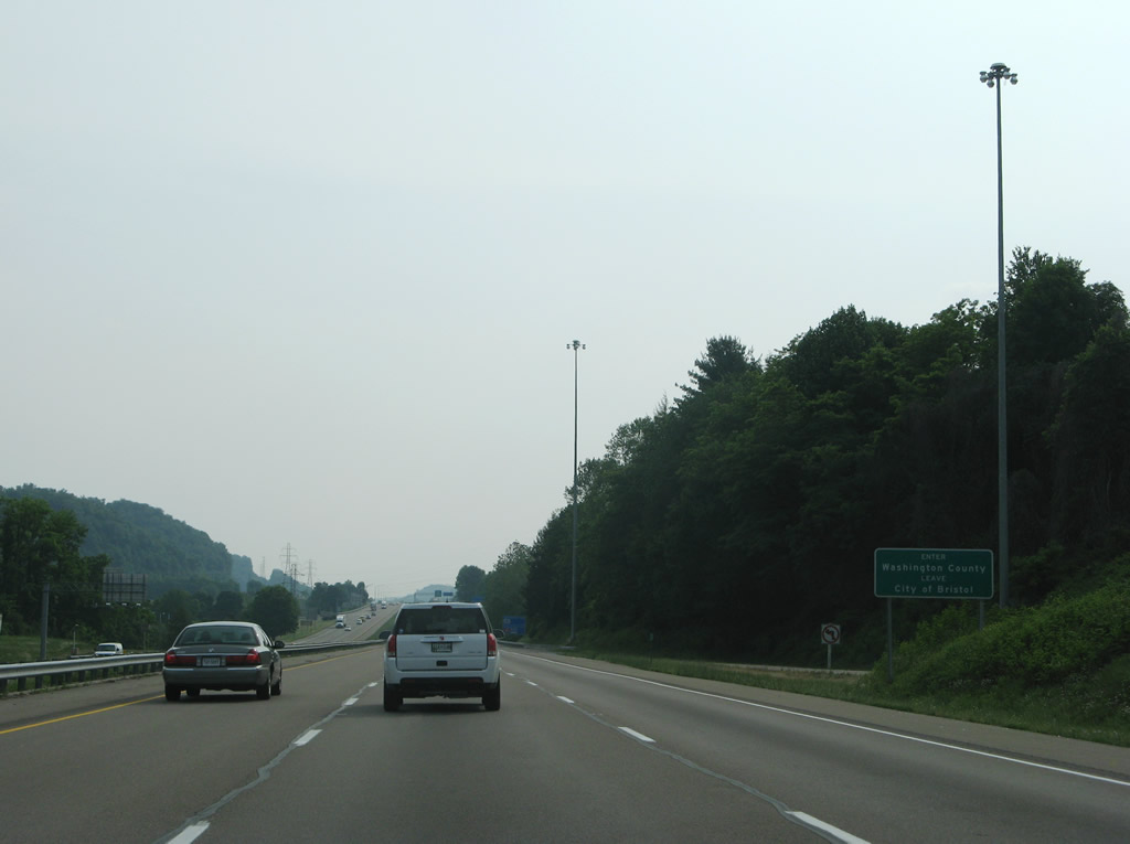
| Interstate 81 straddles the Bristol city and Washington County line to the state border. 05/31/07 |
|
| Interstate 81 advances southwest from U.S. 58/421 to the Tennessee state welcome center. 05/31/07 |
|
| The cloverleaf interchange (Exit 74) with U.S. 11W (W State Street) lies just beyond the Tennessee state line. U.S. 11W is the main highway between Bristol and Kingsport. 05/31/07 |
Page Updated 08-09-2021.

 South
South


 West
West