|
| President Street originates in the Fells Point neighborhood of Baltimore and heads north by Pratt, Lombard, and Baltimore Streets directly to the southern terminus of Interstate 83 at Fayette Street. 08/27/05 |
|
| Beyond the Fayette Street intersection, Interstate 83 begins along the Jones Falls Expressway. This view shows Fayette Street west at President Street. 06/20/12 |
|
| This overhead assembly appears beyond the Fallsway off-ramp from Fayette Street. The Fallsway parallels the freeway viaduct northward to Biddle Street at Guilford Avenue. 12/28/07 |
|
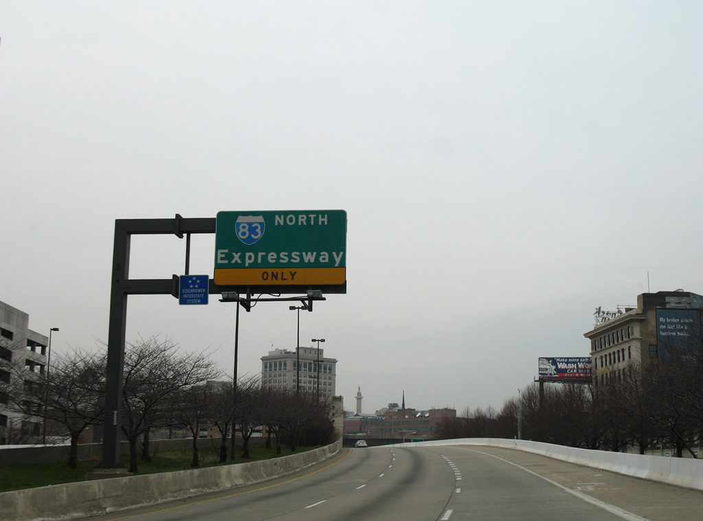
| This view of the eastern Baltimore skyline is afforded on Interstate 83 as it angles slightly northwest toward Gay and Orleans Streets. Originally, Interstate 83 was to be a longer freeway. It was to have continued due south from Fayette Street along the President Street corridor, then turn east along Fleet Street and Boston Street until meeting Interstate 95 near the point where Interstate 95 and Interstate 895 pass by each other northeast of the tunnels. Plans to construct Interstate 83 to the southeast were dropped by the mid-1980s. To handle the traffic flow, both President Street and Boston Street were widened. 08/27/05 |
|
| An Interstate 83 shield without a directional banner was positioned along northbound as Interstate 83 ahead of the Gay Street on-ramp. This was the first reassurance shield along northbound. 06/02/03 |
|
| Merging onto Interstate 83 northbound from the North Gay Street on-ramp near downtown. Visible in the background is the U.S. 40 (Orleans Street) viaduct. 10/10/04 |
|
| The first exit along northbound Interstate 83 (Jones Falls Expressway) is Exit 3, Chase Street. Even though this is Exit 3, we are still only a mile or so from the southern terminus at Fayette Street. It is probable that the exit numbers reflect the unbuilt interchanges slated for the unconstructed connection to Interstate 95. 06/20/12 |
|
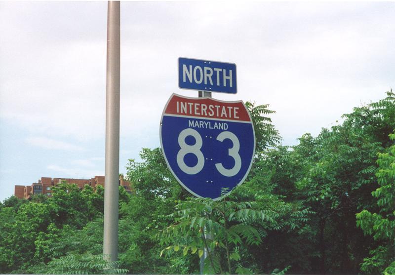
| Interstate 83 northbound reassurance shield posted on the viaduct above Centre Street. There are very few state name Interstate shields remaining within the state of Maryland. This particular assembly was replaced by 2007.
Interstate 83 within the city of Baltimore is maintained by the city rather than the state, given the nature of several signs about a continuing reconstruction of the route from the southern terminus north to the city limits just south of Exit 11. This is a distance of approximately seven miles, and one of the performance measures of the City's Transportation Department is to maintain seven miles of Interstate Highway. 08/27/05, 06/20/12 |
|
| Exit 3 departs the northbound viaduct and joins Fallsway north to East Chase Street. Chase Street flows west to form the southbound beginning of Martin Luther King, Jr. Boulevard. Eastward, the street intersects Greenmount Avenue nearby. 06/20/12 |
|
| Approaching the Chase Street over crossing on Interstate 83 (Jones Falls Expressway) northbound. A major reconstruction project saw completion in 2004 involving repaving and bridge repairs for the Jones Falls Expressway through downtown Baltimore. Known as the JFX Phase II Project, it was started by the City of Baltimore in November 2002. 10/10/04 |
|
| Interstate 83 (Jones Falls Expressway) curves northwest under Preston Street and the Guilford Avenue arch bridge. The freeway lowers under a series of bridges to the viaduct over North Avenue. 06/20/12 |
|
| North Avenue carries U.S. 1 east from Fulton Avenue/Monroe Street to Bel Air Road. The multi-lane street doubles as U.S. 40 Truck west to Hilton Parkway. Exit 6 joins Interstate 83 with North Avenue via a parclo interchange. 06/20/12 |
|
| Passing under Charles Street and Maryland Avenue. A half diamond interchange adds traffic from Penn Station. 08/27/05, 10/10/04 |
|
| The colorful Howard Street viaduct crosses over Interstate 83 as the freeway elevates again onto a viaduct. Howard Street intersects North Avenue nearby. Falls Road (MD 25) passes under both surface roads adjacent to Interstate 83. 12/28/07, 06/20/12 |
|
| All traffic to both North Avenue (U.S. 1/40 Truck) and Druid Hill Park leave Interstate 83 northbound in unison. A loop ramp descends from viaduct southward to meet U.S. 1/40 Truck underneath the Interstate 83 viaduct, while Exit 7 travels alongside the Jones Falls Expressway to 28th Street east and Druid Park Lake Drive west. 06/20/12 |
|
| Exits 6 and 7A/B partition for U.S. 1/40 Truck (North Avenue) and the Druid Hill Park stack interchange. An on-ramp joins Exit 7 from North Avenue ahead of the ramp split to Druid Park Lake Drive west and 28th Street east. 12/28/07 |
|
| The Exit 6 northbound off-ramp ties into the North Avenue Light Rail Station (MARC) before meeting U.S. 1 & U.S. 40 Truck. An Interstate 83 trailblazer is posted along the ramp where it meets the access road to the MARC station. 12/28/07 |
|
| Traffic meets North Avenue at the JFX viaduct. U.S. 1/40 Truck overlap between the one way street couplet of Fulton & Monroe Streets eastward to MD 151 (Erdman Avenue). North Avenue otherwise carries four overall lanes between the Walbrook and Clifton Park areas of the city. 12/28/07 |
|
| Exits 7A/B splits into elevated ramps for Druid Park Lake Drive west to Druid Lake and MD 129 (McCulloh Street) and 28th Street east to Johns Hopkins University (via Charles Street north). 06/20/12 |
|
| The next exit along northbound connects with MD 25 (Falls Road) north. The stack interchange at Druid Hill Park precedes the Exit 8 wye interchange and connector road to Falls Road. 06/20/12 |
|
| A reassurance shield for Interstate 83 follows the loop ramp from West 29th Street onto the northbound JFX. 06/20/12 |
|
| MD 25 begins at MD 2 (Calvert and St. Paul Streets) via a one way couplet of Lafayette and Linville Streets just east of Exit 6. The state route joins Falls Road three blocks west of MD-2 north for a parallel course to Interstate 83 to the Baltimore Beltway. 06/20/12 |
|
| Exit 8 departs Interstate 83 (Jones Falls Expressway) north to MD 25 (Falls Road) northbound at the Hampden neighborhood of the city. MD 25 follows all of Falls Road northward to Beckleysville Road in rural north Baltimore County.
The next JFX exits are Exit 9, Cold Spring Lane and Exit 10, Northern Parkway. 06/20/12 |
|
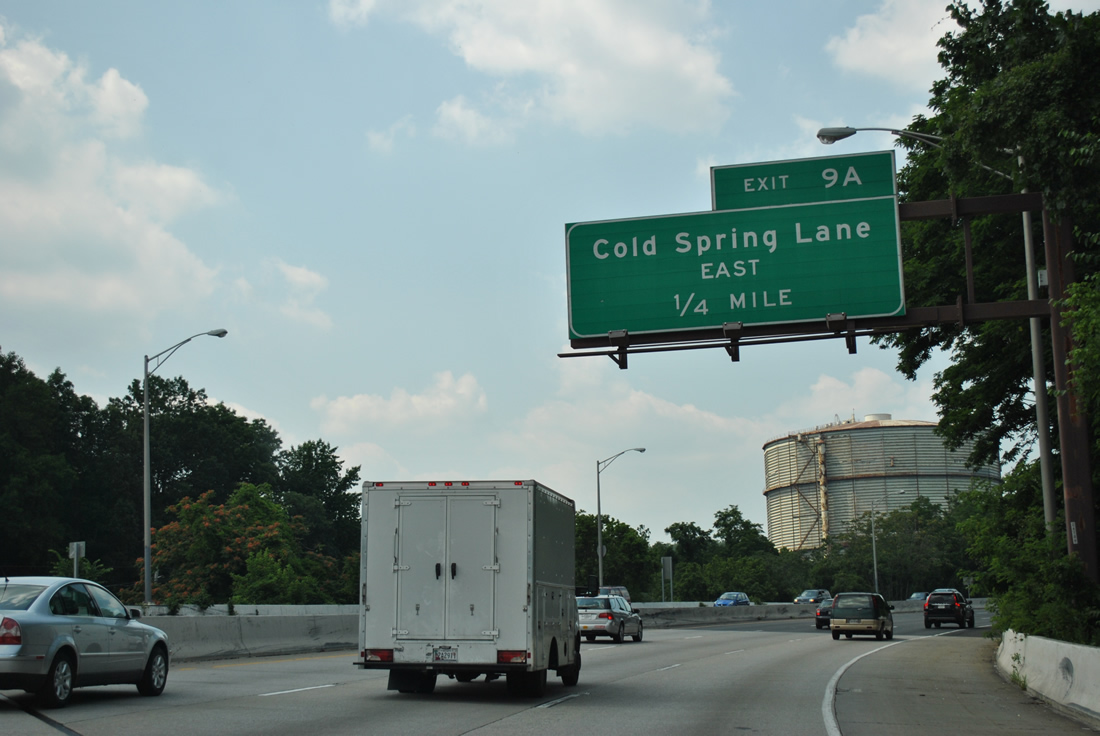
| Interstate 83 again elevates onto a viaduct, crossing Jones Falls on the one mile drive to Cold Spring Lane (Exit 9). The next two interchanges are the last two within the city of Baltimore. 06/20/12 |
|
| The six-ramp parclo interchange (Exit 9) with Cold Spring Lane follows the 41st Street viaduct on I-83 north. A sign replacement made by 2012 directs motorists bound for Loyola University. Cold Spring Lane east heads to the Loyola University campus in addition to the campuses of Notre Dame of Maryland and Morgan State Universities. 06/20/12 |
|
| Exit 9A connects with Cold Spring Lane east to MD 25 (Falls Road) and the Evergreen, Guilford, and Roland Park neighborhoods. 06/20/12 |
|
| Exit 9A parts ways with Interstate 83 (Jones Falls Expressway) north for Cold Spring Lane east. Beyond MD 147 (Harford Road), Cold Spring Lane changes into Moravia Road.
Exit 9B follows onto Cold Spring Lane west to Melvale and Denmore Park. 06/20/12 |
|
| Northbound Interstate 83 (Jones Falls Expressway) at Exit 9B. Cold Spring Lane heads west to meet MD 140 (Reisterstown Road) and MD 129 (Park Heights Avenue). 06/20/12 |
|
| Continuing north one mile to Northern Parkway (Exit 10) and four miles to Ruxton Road (Exit 12). There is no Exit 11. 06/20/12 |
|
| Northern Parkway (Exits 10A/B) arcs south of the northern boundary of Baltimore, starting at MD 26 (Liberty Heights Avenue) to the west and ending at U.S. 1 (Bel Air Road) to the east. 06/20/12 |
|
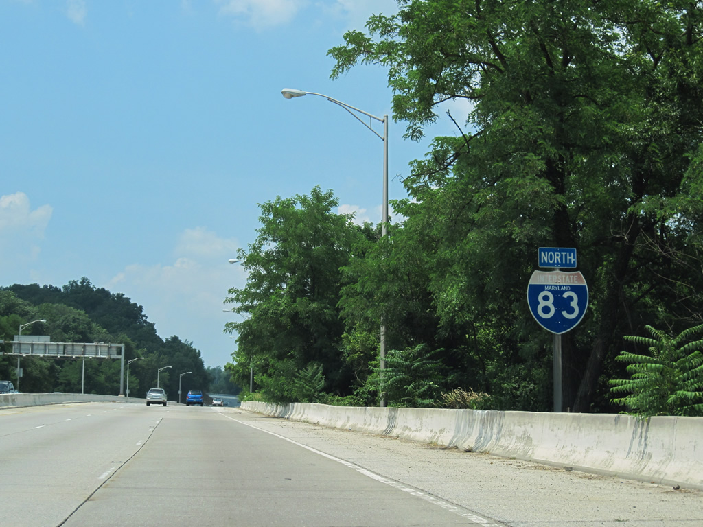
| What was a state-named shield posted (replaced by 2009) for Interstate 83 between Cold Spring Lane and Northern Parkway. Beyond the trees is Jones Falls paralleling the northbound side of the freeway. 06/17/00, 06/20/12 |
|
| Nearing the Exit 10 directional cloverleaf interchange with Northern Parkway on Interstate 83 (Jones Falls Expressway) north. The interchange includes bridges over the adjacent Jones Falls, the name sake of Interstate 83. 06/20/12 |
|
| Jones Falls comes into view alongside the Exit 10A ramp departure to Northern Parkway east. Northern Parkway ventures east to Homeland, Govanstown, Cedarcroft and U.S. 1 near Overlea. 06/20/12 |
|
| A loop ramp carries motorists over Jones Falls to Northern Parkway westbound to Mount Washington, Glenmore Park and Howard Park. The east-west arterial replaced parts of Belvedere Avenue when it was completed in 1974. 06/20/12 |
|
| The final state-named shield for Interstate 83 northbound. Northbound travelers cross another viaduct over Jones Falls and a MARC Light Rail line and exit the city. 06/27/10 |
|
| Interstate 83 leaves the city of Baltimore and enters Baltimore County near Lake Roland. The Maryland State Highway Administration assumes maintenance of the freeway from here north to the Pennsylvania State Line. 06/20/12 |
|
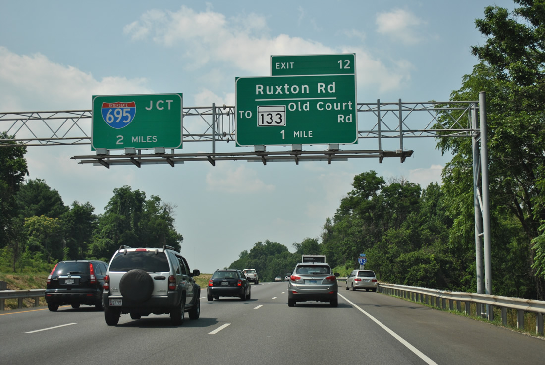
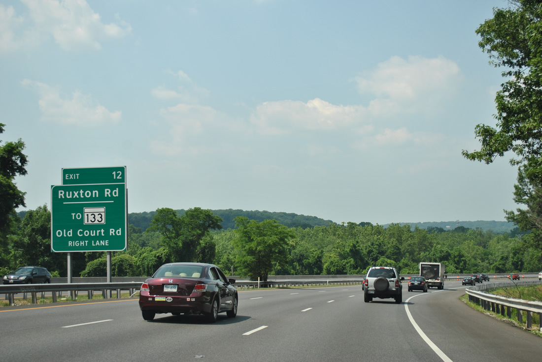
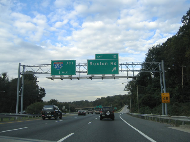
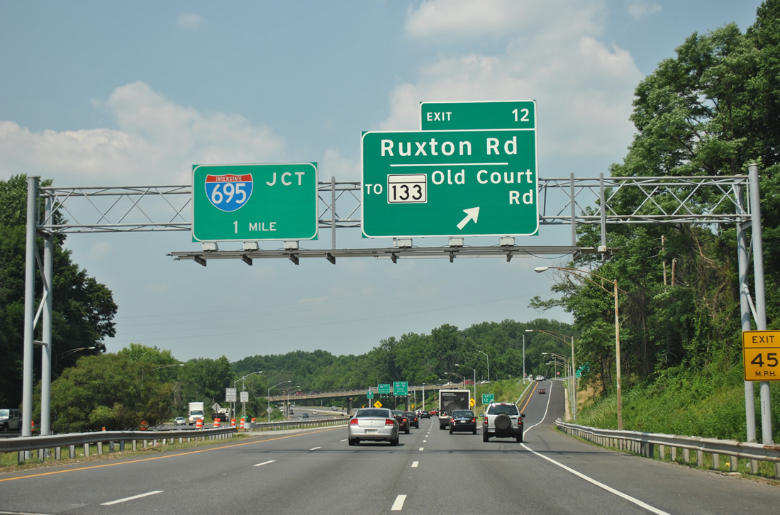
| A half diamond interchange joins Ruxton Road at Exit 12 next. Sign changes now reflect the connection of Ruxton Road west to the beginning of MD 133 (Old Court Road). The 3.31 mile route links MD 25 (Falls Road) with MD 129 (Park Heights Avenue) at Pikesville. 05/31/04, 06/20/12 |
|
| A standard Maryland State Highway Administration-based shield assembly posted for Interstate 83 north near Rockland. 06/27/10 |
|
| Ruxton Road heads east to meet MD 134 (Belloma Avenue) at Ruxton and west to MD 25 and 133 at Rockland. 06/20/12 |
|
| Exit 12 leaves Interstate 83 north for Ruxton Road, one mile south of the directional cloverleaf interchange with Interstate 695 (Baltimore Beltway). 05/31/04, 06/20/12 |
|
| Interstate 83 combines with I-695 east for a mile until resuming its northward course toward York, Pennsylvania.
The left lane of the Jones Falls Expressway continues to MD 25 (Falls Road) at Brooklandville. The center lane exits to I-695 west/outer loop to I-795 (Northwest Expressway) north and I-70 west. 06/20/12 |
|
| Interstate 83 splits with the Jones Falls Expressway for Interstate 695 east (inner loop). The Jones Falls Expressway continues directly to MD 25 south of its intersection with MD 130 (Greenspring Valley Road). The JFX was originally planned to loop northeast from Brooklandville to Interstate 83 at Exit 18 (Warren Road). Had this been constructed, Interstate 83 would not utilize a portion of Interstate 695. 06/20/12, 06/27/10 |
|
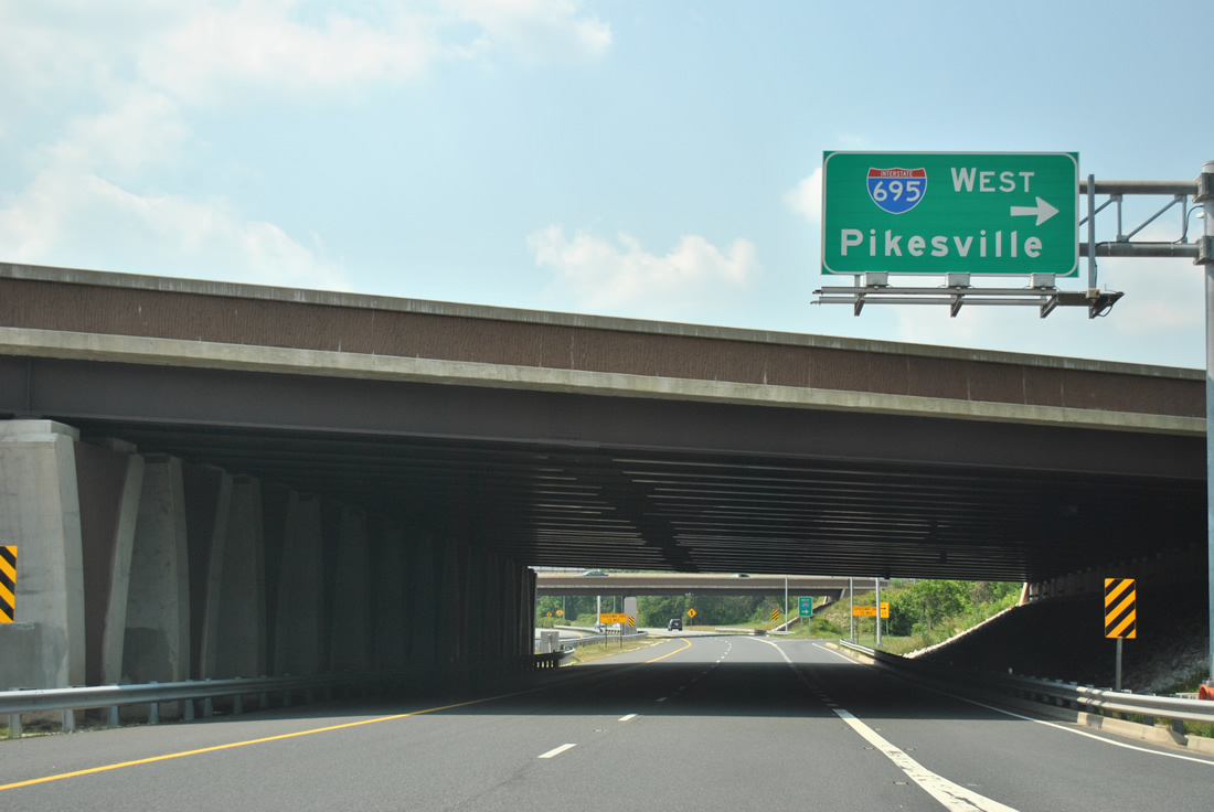
| Traffic to Interstate 695 west / outer for Pikesville and Owings Mills departs the Jones Falls Expressway via a cloverleaf ramp beyond the split with Interstate 83. Interstate 695 winds west from here to Randallstown and Interstate 795 (Northwest Expressway) for Owings Mills, Reisterstown, and Westminster. 06/20/12 |
|
| A look at the Interstate 695 (Baltimore Beltway) westbound ramp departure from the Jones Falls Expressway northbound. A three quarter cloverleaf interchange with a directional ramp from Interstate 83 south & 695 west to the Jones Falls Expressway south facilitates the movements between the two freeways. 06/20/12 |
|
| The Jones Falls Expressway continues another half mile before ending at MD 25 (Falls Road) at Joppa Road. MD 25 enters the scene from Falls Road alongside the southbound lanes of the Jones Falls Expressway (JFX). MD 25 and Falls Road overtake the JFX from Joppa Road northbound through Brooklandville. 10/10/04 |
|
| The JFX ties into MD 25 (Falls Road) and Joppa Road at a signalized intersection. Falls Road continues to the east end of MD 130 (Greenspring Valley Road) and the west end of MD 131 (Seminary Road). 10/10/04 |
06/17/00, 06/02/03, 05/31/04, 10/10/04, 08/27/05, 12/28/07, 06/27/10, 06/20/12 by AARoads
Page Updated 05-30-2013.

 North
North