|
| The former route of U.S. 6 followed Glen Road across the Housatonic River to River Road in Southbury. River Road parallels the waterway northwest to Purchase Brook Road near George C. Waldo State Park. 08/19/21 |
|
| Curving northeast between Horse Hill and Ichabod Hill, a third lane opens along I-84/U.S. 6 eastbound to Exit 14. 08/19/21 |
|
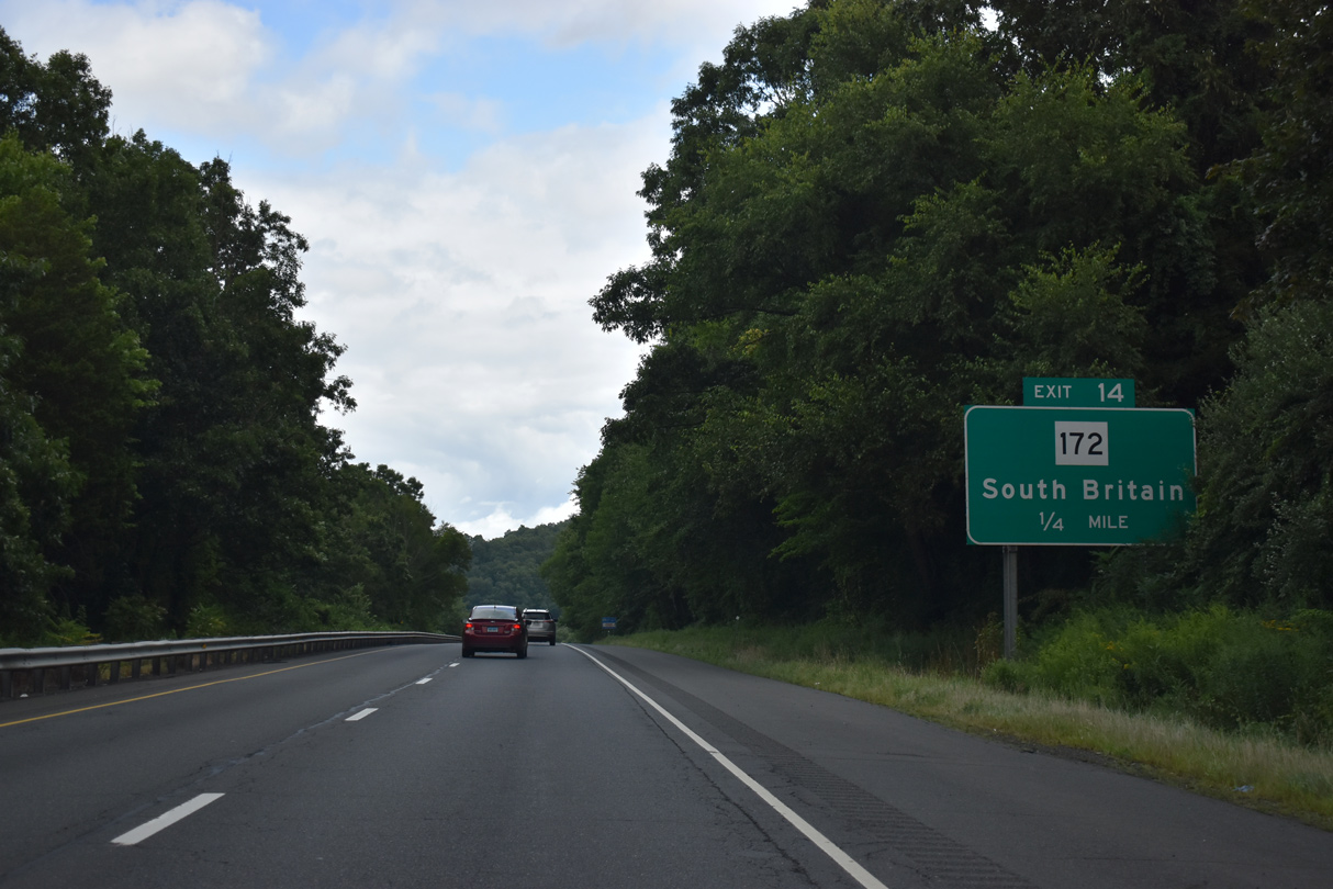
| Route 172 (S Britain Road) runs 4.45 miles north from I-84/U.S. 6 at Exit 14 through the town of South Britain. 08/19/21 |
|
| Georges Hill Road branches southeast from the end of Route 172 and Lakeside Road 2.71 miles to Kettletown State Park. Lakeside Road spurs 1.65 miles south past Ichabod Hill to Lee Farm Drive and Lakemere Drive at Lakeside. 08/19/21 |
|
| Route 172 (S Britain Road) south, Lakeside Road north and Georges Hill Road north converge with I-84/U.S. 6 at a parclo interchange (Exit 14). 08/19/21 |
|
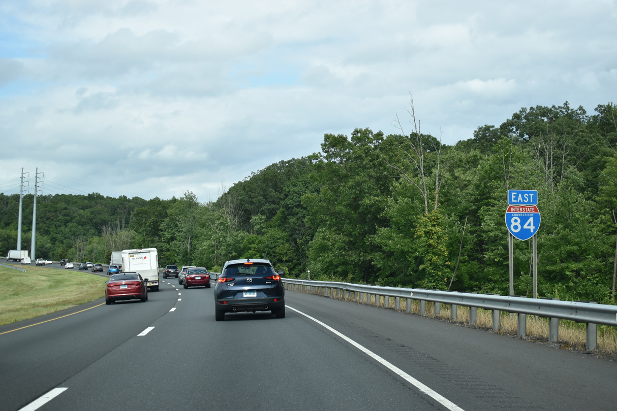
| U.S. 6 parts ways with Interstate 84 again at forthcoming Exit 15. The two routes recombine at Exit 38 in Farmington. 08/19/21 |
|
| U.S. 6 circumvents Waterbury to the north through Woodbury, Watertown and Thomaston. Route 67 overlaps with U.S. 6 north in Southbury 1.57 miles to Roxbury Road. 08/19/21 |
|
| Measuring 31.00 miles in length overall, Connecticut Route 67 runs northwest from Exit 15 to U.S. 7/202 in New Milford and southeast to Route 63 in Woodbridge. 08/19/21 |
|
| Kettletown Road stems south from Route 67 at Exit 15 as part of unsigned Route 487 leading 4.24 miles to Kettletown State Park. Route 67 (Southford Road) enters the town of Oxford 2.97 miles to the east. 08/19/21 |
|
| The diamond interchange at Exit 15 includes a direct ramp from I-84/U.S. 6 east to Kettletown Road south. Multiple golf courses and country clubs are located in Southbury nearby. Seymour is 9.8 miles away to the southeast. 08/19/21 |
|
| Interstate 84 proceeds east from U.S. 6/Route 67 between Bullet Hill Brook and Bullet Hill. 08/19/21 |
|
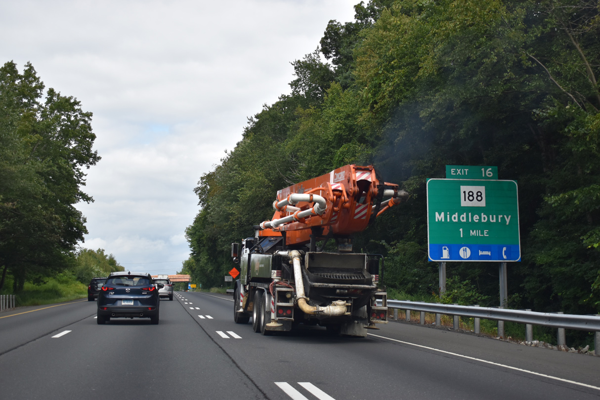
| Meeting I-84 at the succeeding exit, Route 188 (Strongtown Road) travels 15.92 miles from Route 34 in Seymour to Route 63 in Middlebury. 08/19/21 |
|
| Interstate 84 crosses Bucks Hill and Bucks Hill Road a half mile from the parclo interchange (Exit 16) with Route 188 (Strongtown Road). 08/19/21 |
|
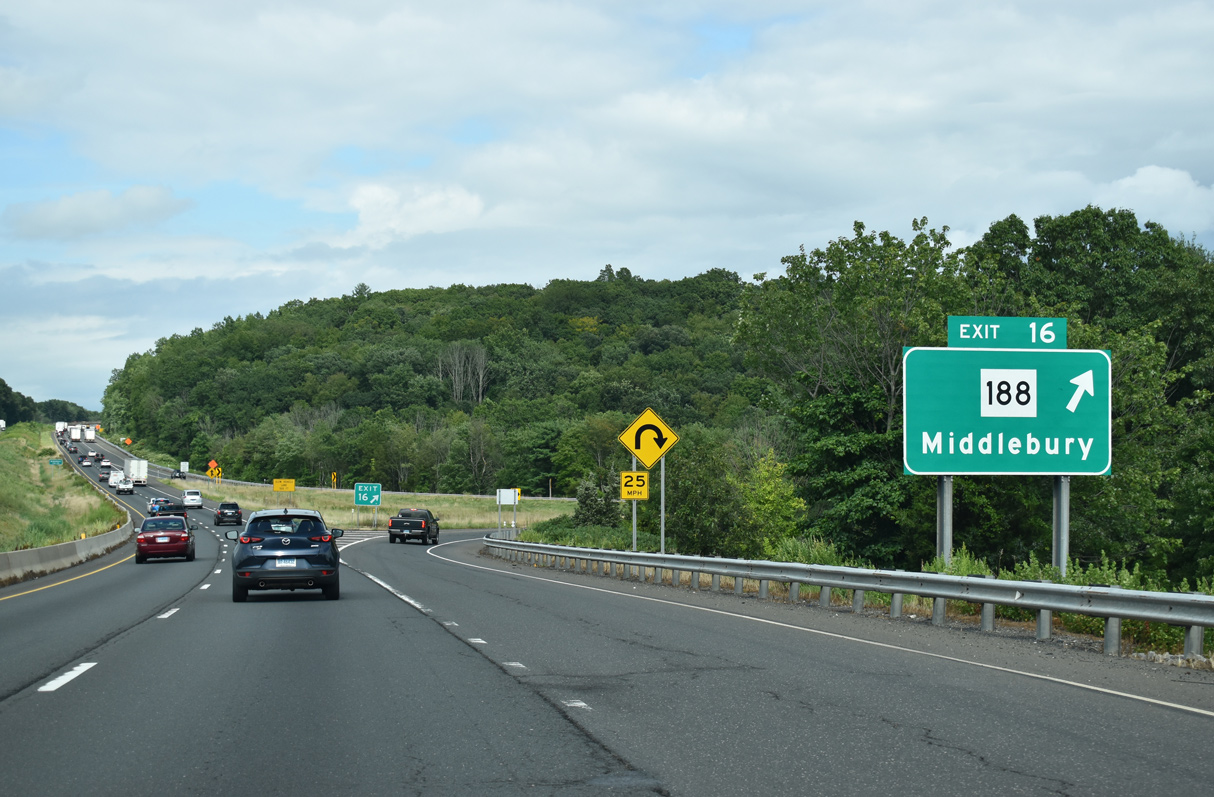
| Route 188 south connects with Airport Road (Route 486) east to Waterbury-Oxford Airport (OXC) and north with Route 64 (Middlebury Road) west to Quassy Amusement Park along Lake Quassapaug. 08/19/21 |
|
| Route 188 diverges from Interstate 84 north to Middlebury and crosses the freeway again ahead of Exit 17 to Bradleyville. 08/19/21 |
|
| Rising east onto Bedlam Hill, Interstate 84 crosses Long Meadow Road and Long Meadow Brook north of Long Meadow Pond. 08/19/21 |
|
| South Street spans Interstate 84 across an arch bridge at Bedlam Hill. 08/19/21 |
|
| Interstate 84 continues east through Middlebury by Tuttle Woods Preserve. 08/19/21 |
|
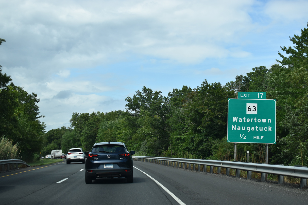
| Paralleling the Middlebury / Waterbury city line just to the west, forthcoming Route 63 (Straits Turnpike) leads north to Watertown and south to Naugatuck. 08/19/21 |
|
| Making a gradual northward turn, Interstate 84 passes over Hop Brook and Route 188 (Whittlemore Road) west of Bradleyville. 08/19/21 |
|
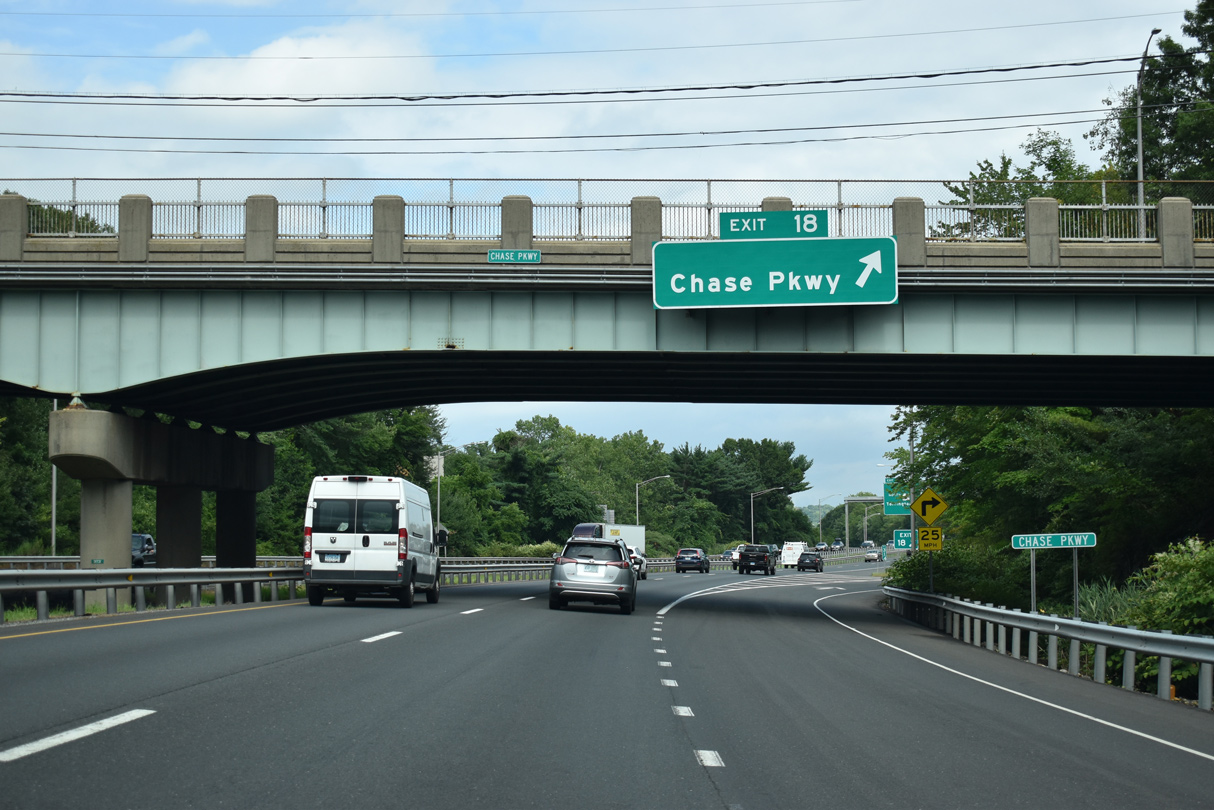
| A half diamond interchange (Exit 17) joins I-84 east with Route 63 south of Route 64 (Chase Parkway). A wye interchange (Exit 17) links westbound I-84 with Route 63 via Chase Parkway. 08/19/21 |
|
| A 52.57 mile long highway, Route 63 north concludes at U.S. 7 in Litchfield southeast at Route 10 in New Haven. The large Country Club of Waterbury and Whittemore Glen State Park are located south of I-84 off Route 63 (Straits Turnpike). 08/19/21 |
|
| The 8.14 mile long course of Route 64 ends at I-84 one mile from Exit 18 and urbanized areas of west Waterbury. 08/19/21 |
|
| Chase Parkway stems east from Route 64 to Naugatuck Valley Community College (NVCC) and W Main Street before shifting to the south side of I-84 at Country Club Road and Exit 17. 08/19/21 |
|
| Chase Parkway is unsigned Route 845 east 1.64 miles from Route 64 to Highland Avenue and Sunnyside Avenue at Chase Park in Waterbury. 08/19/21 |
|
| The ramps at the Mixmaster Interchange, a multi level exchange with the freeway along Route 8, are separated numbered Exits 19 and 20 in both directions of Interstate 84. 08/19/21 |
|
| I-84 descends towards the Central Naugatuck Valley ahead of Route 8. The freeway along Route 8 extends north from Waterbury to a 0.99 mile long overlap with U.S. 6 at Thomaston. 08/19/21 |
|
| Located south of Waterbury, Naugatuck is the birthplace of Naugahyde. The area was once prosperous in the early days of industrialization, but was severely affected by a loss of a major portion of its manufacturing base. More recently the Naugatuck Valley serves as a bedroom community of New York City and Fairfield County. 08/19/21 |
|
| Part of a 134 mile long multi state highway north to Searsburg, Vermont, the 67.36 mile long course of Connecticut Route 8 originates in Bridgeport. MSR 8 is one of the original New England Interstates that predated the U.S. Highway system. 08/19/21 |
|
| The westbound roadway runs below I-84 eastbound along a double decked freeway through the Mixmaster Interchange. 08/19/21 |
|
| Exit 21 loops south from I-84 onto Meadow Street west of Bank Street. Meadow Street leads to the Waterbury Train Station which serves both Amtrak passengers as well as the Waterbury Branch of the Metro-North Railroad. 08/19/21 |
|
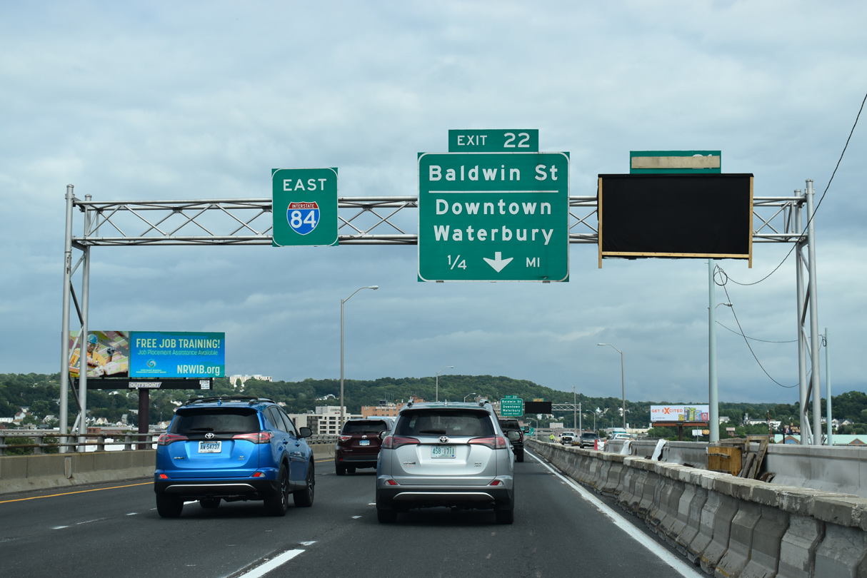
| Bank Street leads north into Downtown Waterbury and south across the Naugatuck River. Baldwin Street parallels to the east by St. Mary's Hospital. 08/19/21 |
|
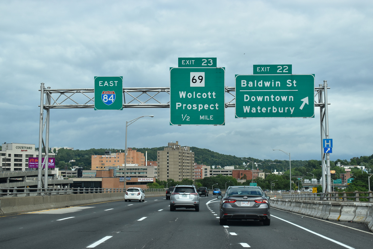
| Exit 22 leaves I-84 east onto Market Square head of Main Street and Elm Street to Downtown Waterbury and the UConn-Waterbury Campus. The double decked section of I-84 concludes above Bank Street. 08/19/21 |
|
| The entrance ramp from Meadow Street expands I-84 eastbound to four lanes ahead of Exit 23 for Washington Street and Route 69 (Hamilton Avenue). 08/19/21 |
|
| A collector distributor roadway separates at Exit 23 and the Baldwin Street overpass for Washington Street to Route 69 (Silver Street Express) at Brass Mill Center mall. 08/19/21 |
|
| Route 69 travels 35.16 miles overall north to Route 4 in Burlington and south to Route 63 in New Haven. 08/19/21 |
|
| A loop ramp departs for Washington Street west of Route 69 (Silver Street Express) at Union Street while a separate ramp links with Route 69 directly along Hamilton Avenue. Route 69 heads south from Waterbury to Prospect and northeast to Wolcott. 08/19/21 |
|
| Exit 25 constitutes a 0.79 mile long ramp from ahead of Route 69 (Hamilton Avenue) to Harpers Ferry Road. 08/19/21 |
|
| Harpers Ferry Road stems south from E Main Street to meet Interstate 84 at Reidville Drive, a south side frontage road. 08/19/21 |
|
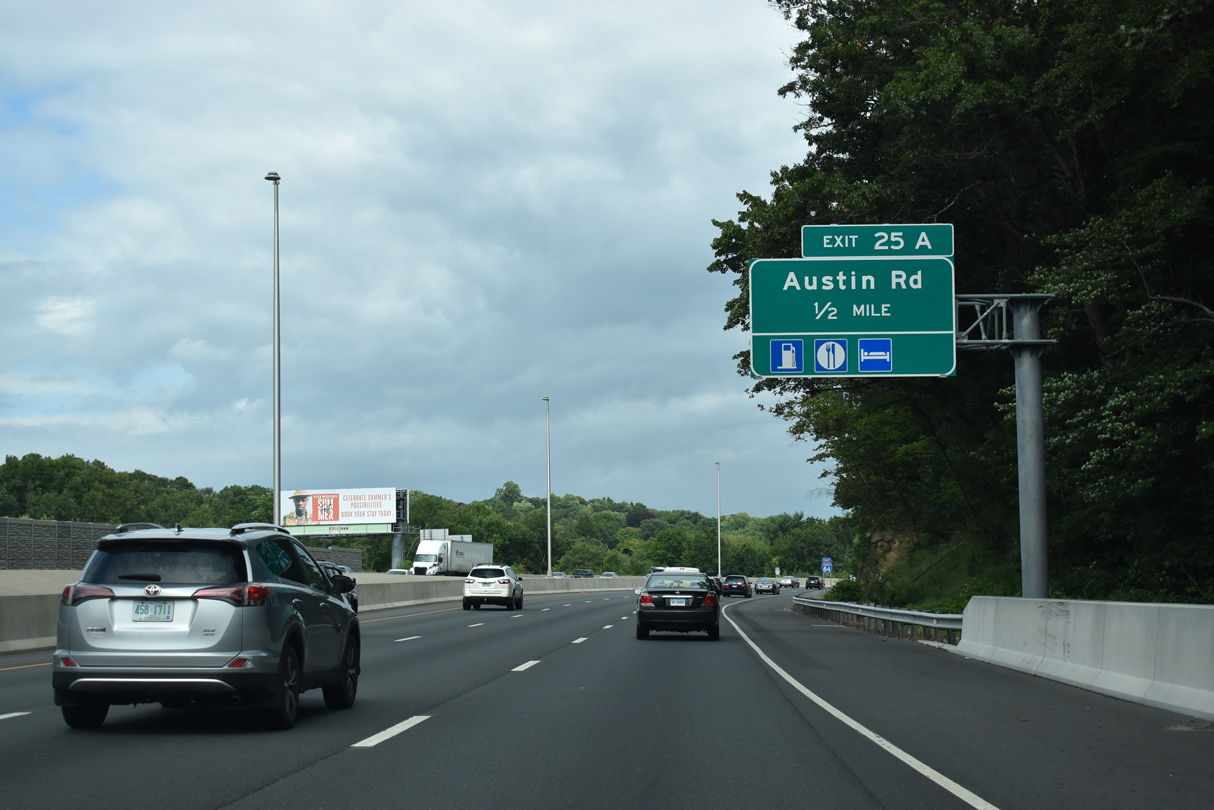
| Reidville Drive parallels Interstate 84 east along a commercialized stretch to a half diamond interchange (Exit 25 on westbound) with Scott Road. The ensuing exit is for Austin Road. 08/19/21 |
|
| Interstate 85 advances a half mile east to the diamond interchange (Exit 25 A) with Austin Road. 08/19/21 |
|
| I-84 passes over Pierpont Road beyond this confirming marker. Pierpont Road becomes Captain Neville Drive, a south side frontage road leading east to Plank Road. 08/19/21 |
|
| North of Exit 25 A, Austin Road ties into East Main Street (Route 801) nearby. South of I-84, Austin Road passes by a business park to Scott Road. 08/19/21 |
|
| Continuing east into the town of Cheshire, the succeeding exit along Interstate 84 east is for Route 70 east and Waterbury Road (Route 801) west. 08/19/21 |
|
| Connecticut Route 70 (Waterbury Road) stretches 10.92 miles across Cheshire to Route 71 (Old Colony Road) in Meriden. 08/19/21 |
|
| The original parclo at Exit 26 was reconstructed into a modified diamond interchange. Unsigned Route 801 lines Waterbury Road and East Main Street west 2.22 miles to Fair Lawn in Waterbury. 08/19/21 |
|
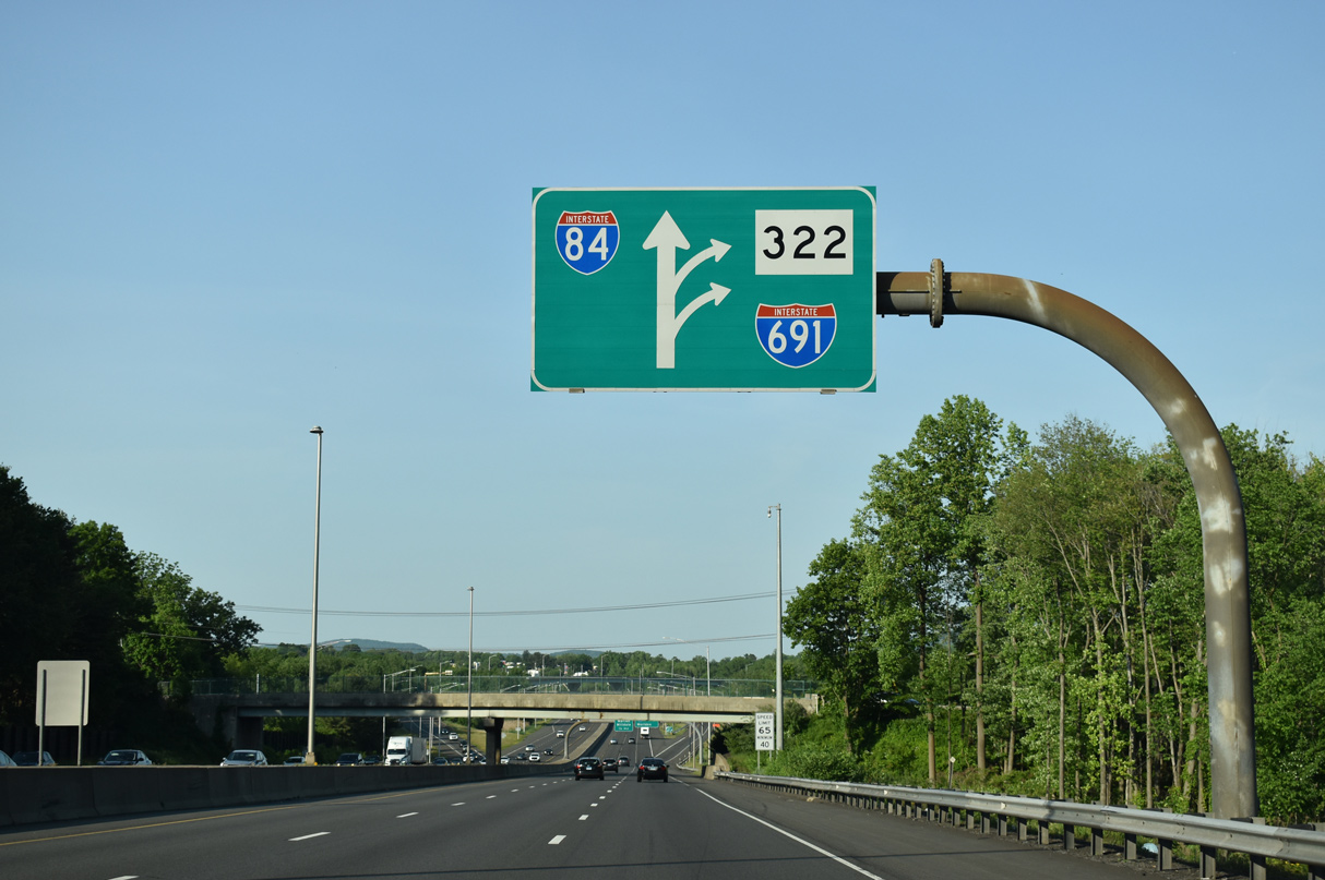
| Interstate 691 branches east from I-84 at a directional T interchange (Exit 27) straddling the Cheshire and Southington town line in one mile. 05/30/22 |
|
| The first exit along Interstate 691 east of I-84 connects with Route 10 (Highland Avenue) in the town of Cheshire. 05/30/22 |
|
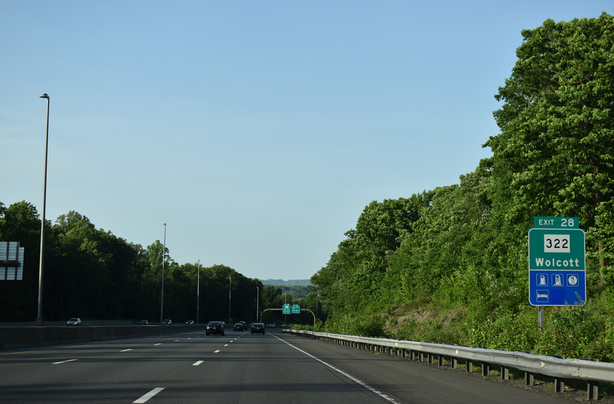
| The foot print of the exchange at Exit 27 overlays the folded diamond interchange (Exit 28) linking I-84 with Route 322 (Meriden-Waterbury Turnpike) east of Wolcott. 05/30/22 |
|
| Interstate 691 travels 8.21 miles from Exit 27 near Marion to Route 66 (Meriden Road) at East Meriden. 05/30/22 |
|
| Previously Route 66, I-691 opened in stages between 1966 and 1987. Route 66 was truncated west of I-91. Parallel Route 322 follows the pre freeway alignment of Route 66 west across Southington.1 05/30/22 |
|
| Interstate 691 provides a cut off from I-84 east to I-91 south for New Haven. 05/30/22 |
|
| Interstate 691 east to Route 66 leads to Middlefield and Middletown. The community of Marion lies just west of Exit 28 along Route 322. 08/19/21 |
|
| Route 322 (Meriden Waterbury Turnpike) follows an L-shaped route 9.80 miles between Route 69 at the Wolcott town center and I-691 at Exit 4 near Pratts Corner in Southington. 08/19/21 |
|
| Interstate 84 angles northeast from I-691 into Southington. 08/19/21 |
Page Updated 03-08-2023.


 East
East