|
| The Day Street Connector ties into the exchange joining I-65/U.S. 82 with Interstate 85 north east from Hill Street. 06/26/22 |
|
| The exchange joining Day Street with I-65/85 was constructed in 1972/73. 06/26/22 |
|
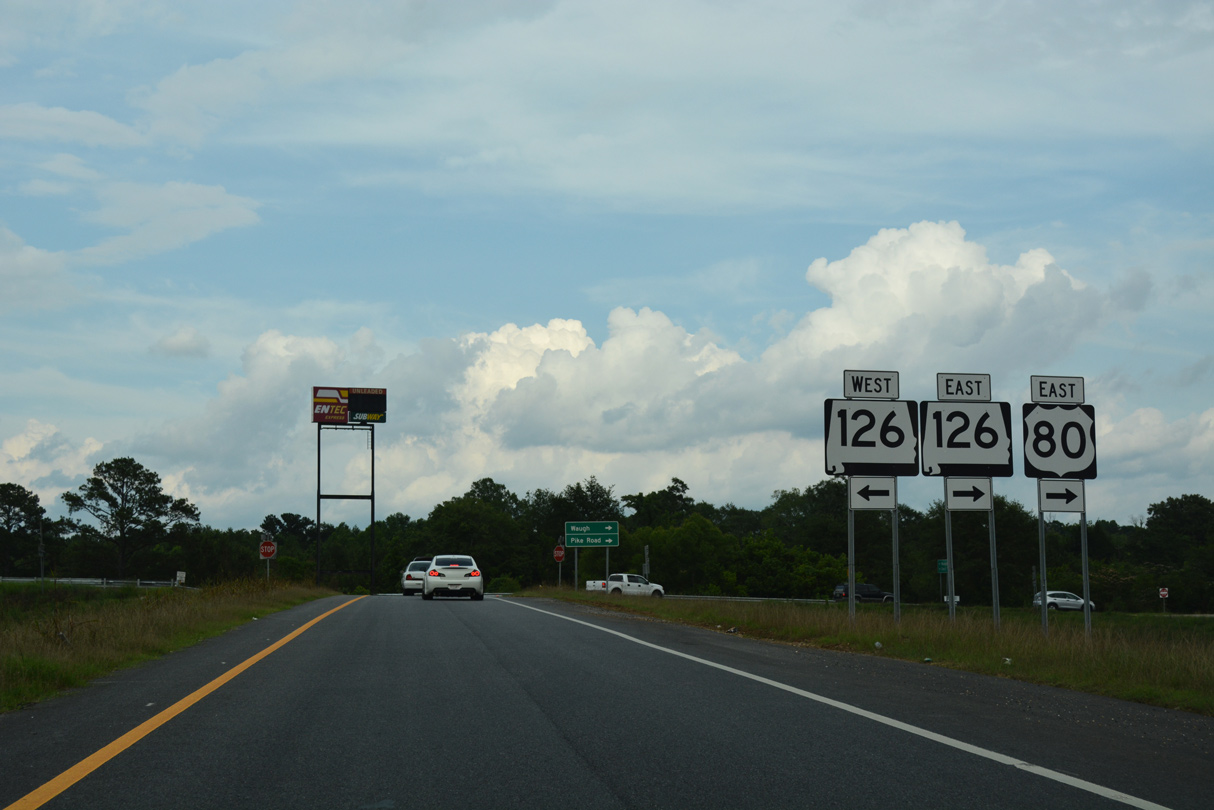
| A loop ramp joins the Day Street Connector east with I-65/U.S. 82 north to Prattville and Birmingham ahead of the transitions onto Interstate 85. 06/26/22 |
|
| A three level interchange joins I-65/U.S. 82, I-85 and the Day Street Connector outside Downtown Montgomery. 06/26/22 |
|
| Two lanes from I-65 south and a single lane from Day Street form the northbound beginning of Interstate 85. 06/26/22 |
|
| Leading away from I-65/U.S. 82, Interstate 85 runs between Downtown Montgomery and the campus of Alabama State University (ASU). 06/26/22 |
|
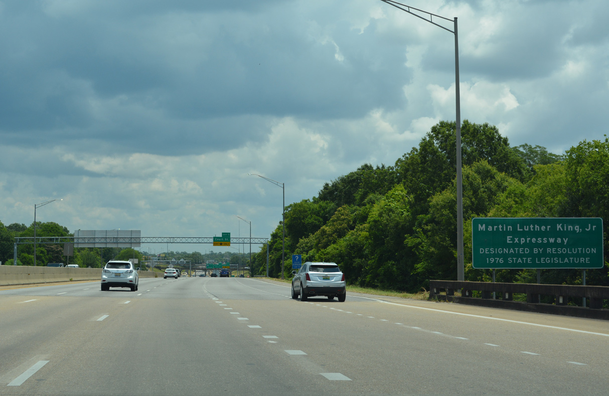
| Ramps converge ahead of the Rosa L. Parks Avenue underpass along Interstate 85 (Dr. Martin Luther King, Jr. Expressway). The concrete pictured here was paved over with asphalt by 2008. 06/26/22 |
|
| With four lanes, northbound Interstate 85 lowers toward the split diamond interchange (Exit 1) with Court Street. The ramp at Exit 1 forms Arba Street, a service road east to Union Street, near Alabama State University (ASU). 06/26/22 |
|
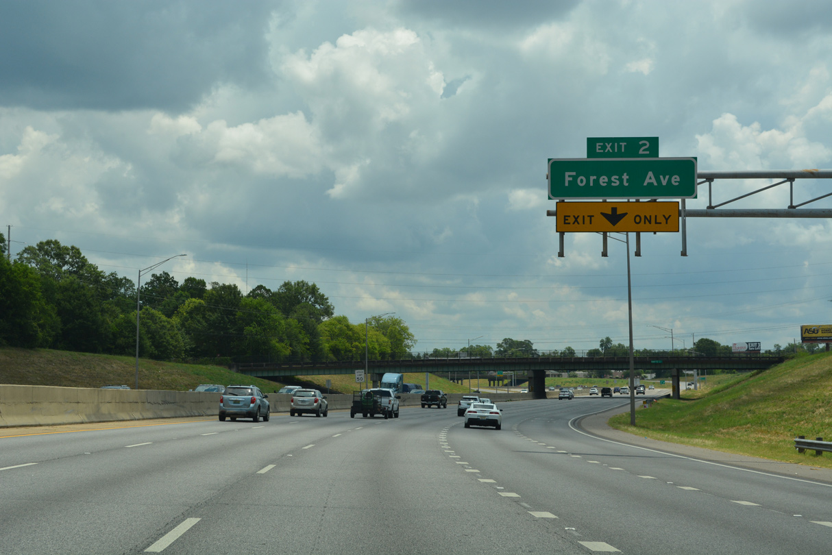
| Exit 1 leaves I-85 north at the Holcombe Street underpass for the Montgomery central business district, Old Alabama Town and the Alabama State Capitol. A second split diamond interchange (Exit 2) follows in 1.25 miles with Forest Avenue. 06/26/22 |
|
| Forming a couplet with Hull Street, Perry Street north passes over Interstate 85 along the historic alignment of U.S. 331 between Downtown Montgomery and Fairview Avenue. Union Street was a part of U.S. 331 until the route was truncated north of South Boulevard in 1990. 04/13/12 |
|
| The first confirming marker for Interstate 85 north stands beyond the entrance ramp from Union Street, Arba Street and ASU. 06/26/22 |
|
| Forest Avenue leads south from Highland Avenue outside Downtown Montgomery to meet Interstate 85 by Oak Park and Jackson Hospital at Exit 2. 06/26/22 |
|
| Exit 2 departs northbound Interstate 85 for Forest Avenue and W 2nd Street east to Mulberry Street. Mulberry Street south ties into Carter Hill Road (former SR 110) near Cloverdale. Narrow Lane Road stems south from there to Huntingdon College. 06/26/22 |
|
| Interstate 85 next meets Ann Street at a diamond interchange (Exit 3) by Oak Park in one mile. 06/26/22 |
|
| Ann Street leads north from Exit 3 to Madison Avenue (old U.S. 80/231-SR 21) just west of Atlanta Highway (old U.S. 80) east and Federal Drive (old U.S. 231/SR 21) north. 06/26/22 |
|
| South from Exit 3, Ann Street becomes Robison Hill Road at E 5th Street en route to Carter Hill Road (old SR 110) at the McGehee Estates community. 06/26/22 |
|
| Interstate 85 shifts southeast from Ann Street. 06/26/22 |
|
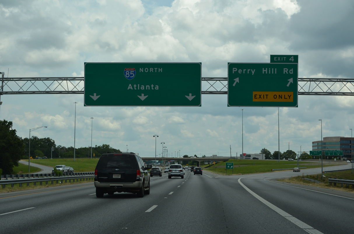
| Interstate 85 northbound continues with four lanes to the six-ramp parclo interchange (Exit 4) with Perry Hill Road. 06/26/22 |
|
| Perry Hill Road constitutes a multi lane boulevard between I-85 and Vaughn Road (former SR 110) to the south. Leafy residential streets spread along both sides of the freeway preceding Exit 4. 06/26/22 |
|
| Exit 4 departs with two lanes from I-85 north for Perry Hill Road. Perry Hill Road runs north to Atlanta Highway (old U.S. 80) at the Dalraida community. 06/26/22 |
|
| Perry Hill Road intersects Carmichael Road, a commercial boulevard paralleling I-85 to East Boulevard, just south of Exit 4. 06/21/05 |
|
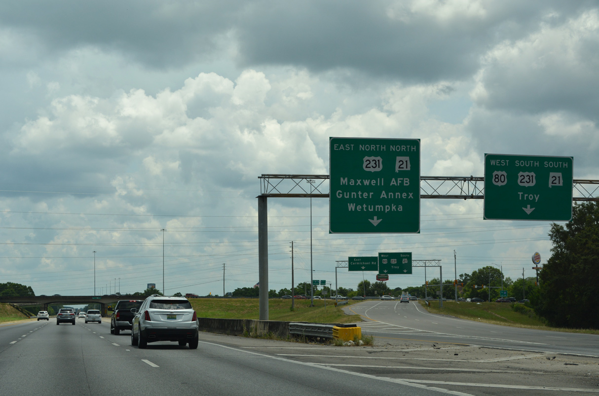
| The succeeding exit is the directional cloverleaf interchange with U.S. 80 west, U.S. 231 and SR 21. Collectively known as East Boulevard, the roadway is part of a system of arterials built in the 1960s that encircle the core of Montgomery. 06/26/22 |
|
| U.S. 80 east joins I-85 north from Exit 6 to Exit 16 at Waugh. Relocated onto I-85 in 2010, U.S. 80 previously followed East Boulevard north to Atlanta Highway at Eastdale Mall. 06/26/22 |
|
| U.S. 231/SR 21 (East Boulevard) north link I-85 with Maxwell A.F.B. Gunter Annex via their former alignment along Cong. W.L. Dickinson Drive south. East Boulevard south leads toward the Alabama Shakespeare Festival, located off Vaughn Road (former SR 110). 06/26/22 |
|
| The roadways of Interstate 85 diverge just ahead of the exchange with East Boulevard. 06/26/22 |
|
| A two lane distributor roadway leaves I-85 north at Exit 6 for East Boulevard. The busy commercial route includes a number of travel amenities and assorted retail in either direction. 06/26/22 |
|
| U.S. 80/231 south part ways in 3.12 miles at Troy Highway, where U.S. 82 west enters South Boulevard and U.S. 231 leaves East Boulevard. SR 21 remains along the arterial belt system west to U.S. 31. 06/26/22 |
|
| U.S. 80 combines with Interstate 85 north for 9.51 miles. Paralleling to the north, Atlanta Highway (former U.S. 80) leads east from U.S. 231/SR 21 to Mitylene and Exit 11. 06/26/22 |
|
| Belt Road spans I-85/U.S. 80 one mile ahead of Exit 9 for SR 271 (Taylor Road). SR 271 comprises a divided arterial north to Auburn University at Montgomery and south to U.S. 231 at Barachias. 06/26/22 |
|
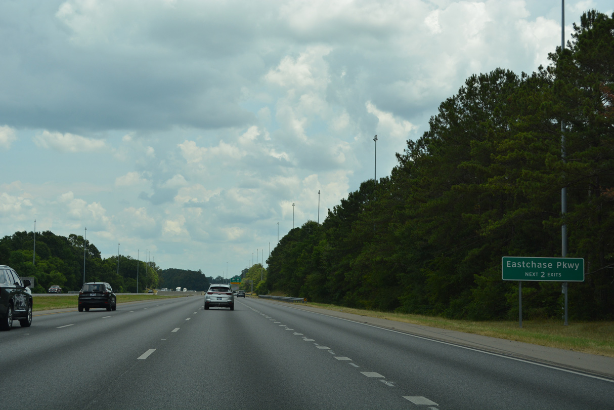
| Exit 9 is the first of two from I-85/U.S. 80 northbound for Eastchase Parkway, a commercial boulevard constructed in 2003 between Taylor Road and SR 110 (Chantilly Parkway). 06/26/22 |
|
| Exit 9 was reconstructed in the early 2000s with the addition of a loop ramp from SR 271 (Taylor Road) north onto I-85/U.S. 80 west. 06/26/22 |
|
| SR 271 (Taylor Road) connects U.S. 82/231 (Troy Highway), Vaughn Road (former SR 110), and Atlanta Highway (old U.S. 80) along a 5.44 mile long course. 06/26/22 |
|
| Exit 9 separates with I-85/U.S. 80 east of Oliver Creek. SR 271 is signed as an alternate to U.S. 231 for points south such as Troy and Dothan. 06/26/22 |
|
| Passing by The Shoppes of Eastchase retail area, I-85/U.S. 80 narrow from six to four lanes. 06/26/22 |
|
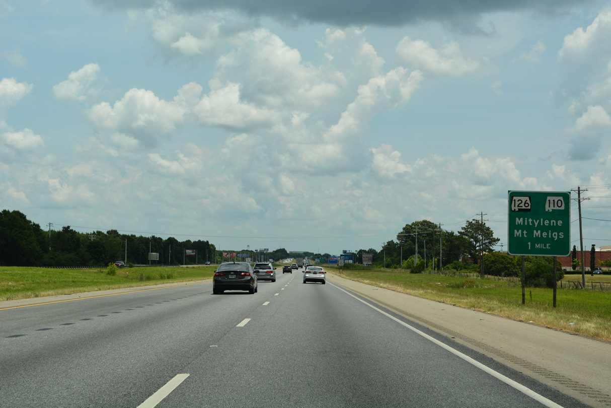
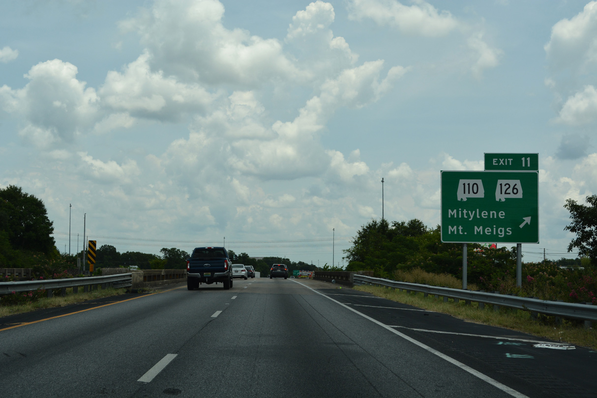
| I-85/U.S. 80 converge with Atlanta Highway (old U.S. 80), SR 110 (Chantilly Parkway) east and SR 126 at Exit 11. SR 126 overtook old U.S. 80 east from SR 110 in Fall 2011 when the route was relocated onto I-85 between Exit 6 and 16. 06/26/22 |
|
| SR 126 constitutes an 11.05 mile long loop utilizing the north and south frontage roads between Exits 11 and Exit 16 through the unincorporated community of Mt. Meigs. 06/26/22 |
|
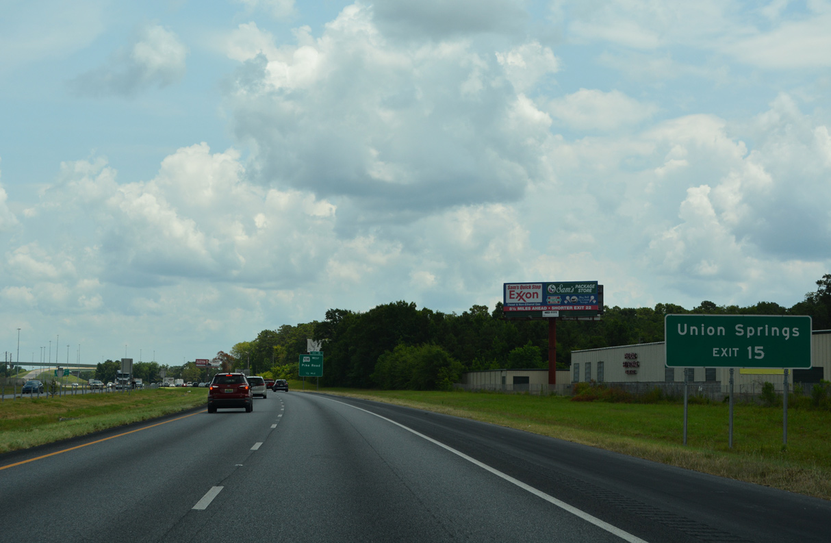
| SR 110 follows Chantilly Parkway southeast to Vaughn Road as part of a 32.26 mile course long to Cecil and U.S. 82 near the Bullock County seat of Union Springs. 06/26/22 |
|
| Atlanta Highway (old U.S. 80) angles northwest from SR 110/126 and the diamond interchange at Exit 11 to Mitylene. 06/26/22 |
|
| The U.S. 80 reassurance marker preceding Jenkins Creek was knocked down by February 2022. SR 126 closely parallels both sides of I-85 along Atlanta Highway and Old U.S. 80. 06/26/22 |
|
| The unincorporated community of Waugh lies four miles east of Mt. Meigs along U.S. 80. Atlanta, Georgia is over two hours away to the northeast. 06/26/22 |
|
| Work on a $65.8 million project broke ground on September 28, 2011 to construct the first 3.5 miles of the Montgomery Outer Loop (SR 108). 06/26/22 |
|
| Replacing SR 293, the freeway along SR 108 links with SR 110 (Vaughn Road) south to U.S. 82 near Union Springs. 06/26/22 |
|
| SR 108 was intended to be the first segment of a realignment taking Interstate 85 south around Montgomery. The remainder of the Montgomery Outer Loop may never be built due to lack of funding. 06/26/22 |
|
| SR 108 (Montgomery Outer Loop) opened to traffic on January 26, 2016. The route spurs south to a partially built interchange with SR 110. 06/26/22 |
|
| High flyovers link I-85/U.S. 80 and SR 108 (Montgomery Outer Loop) at a directional T interchange (Exit 15). 06/26/22, 06/07/17 |
|
| U.S. 80 parts ways with Interstate 85 at a diamond interchange (Exit 16) with SR 126 (Atlanta Highway) one mile beyond the Montgomery Outer Loop. 06/07/17 |
|
| ALDOT recorded 43,649 vehicles per day along I-85/U.S. 80 between Exits 15 and 16. 06/07/17 |
|
| The town limits of Pike Road extends northeast from U.S. 82/331 to I-85 and U.S. 80 at Exit 16. 06/07/17 |
|
| CR 107 (Marler Road) branches 4.5 miles south from U.S. 80 nearby to SR 110 (Vaughn Road) at the unincorporated community of Cecil. 06/07/17 |
|
| U.S. 80 continues east from SR 126 and Exit 16 at Waugh to the town of Shorter. 06/07/17 |
|
| SR 126 loops west along both Atlanta Highway to the north and Old U.S. 80 to the south from Exit 16 to Mount Meigs. 06/07/17 |
|
| Confirming marker posted east of U.S. 80 near Waugh. 04/13/12 |
|
| The ensuing exit along Interstate 85 northbound is for the town of Shorter. Atlanta, Georgia is 152 miles away. 04/13/12 |
|
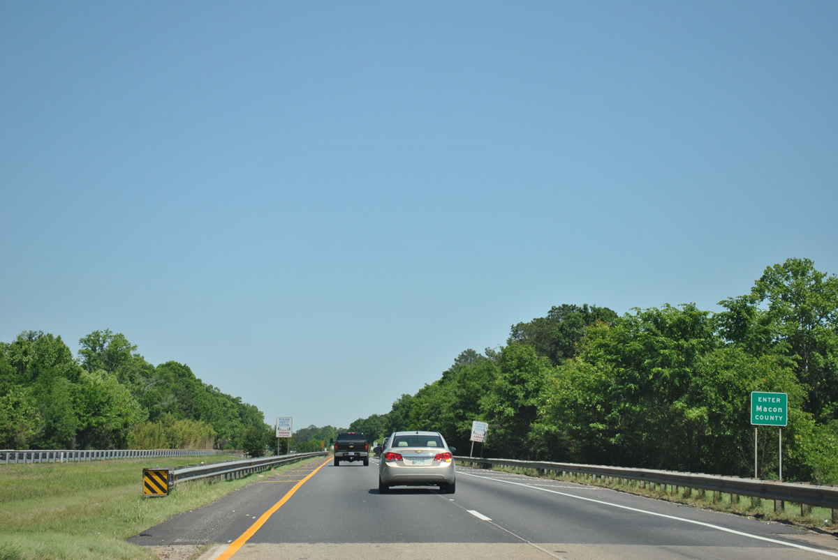
| Crossing Line Creek, Interstate 85 north enters Macon County. 04/13/12 |
|
| One mile west of the diamond interchange (Exit 22) with SR 138, a 0.785 mile route connecting I-85 with parallel U.S. 80 at Shorter. There are no signs acknowledging SR 138 at this exchange. 04/13/12 |
|
| Exit 22 provides the penultimate direct route to U.S. 80 before the highway separates from the Interstate 85 corridor to Phenix City and Columbus, Georgia. 04/13/12 |
|
| Exit 22 departs I-85 north for SR 138 east to Shorter and rural Main Street north. Located east off SR 138, Victoryland Casino replaced the Macon County Greyhound Park, where races ended on May 10, 2011. The venue provides simulcast betting on dog and horse racing. 04/13/12 |
|
| Macon County Route 40 spans Interstate 85 beyond this confirming marker. A distance sign posted here until 2011 referenced Tuskegee at 16 miles and Atlanta at 144 miles. 04/13/12 |
|
| Interstate 85 advances east across Calebee Creek and next meets the south end of SR 229 at Exit 26. 04/13/12 |
|
| Measuring 21.02 miles in length, SR 229 runs north from I-85 near the E V Smith Research Center to Tallassee, Burlington, Kent, Red Hill and SR 63 near Lake Martin. 04/13/12 |
|
| Macon County Route 30 arcs eastward from SR 229 at Exit 26 to the town of Franklin. 04/13/12 |
|
| Interstate 85 traverses areas of timberland over the course of 6.3 miles east to Franklin. 04/13/12 |
|
| The diamond interchange at Exit 32 represents the third in a series of state route end points along I-85. SR 49 travels 30 miles north from Franklin to the Tallapoosa County seat of Dadeville. 04/13/12 |
|
| CR 51 (Pleasant Springs Drive) extends southeast from SR 49 and Exit 32 to Franklin Road and U.S. 80 east into Tuskegee. Franklin Road (CR 30) leads to Tuskegee University and the Tuskegee Institute National Historic Site. 04/13/12 |
|
| An 82.68 mile long highway, SR 49 heads northward to Lineville and SR 281 (Talladega Scenic Drive) near Cheaha Mountain, the tallest point in the state. 04/13/12 |
|
| Trending northward, Interstate 85 continues from the rural town of Franklin toward Tuskegee on the ensuing stretch. 04/13/12 |
|
| The succeeding exit from Interstate 85 north is 3.1 miles north of Downtown Tuskegee. Atlanta is 136 miles to the northeast. 04/13/12 |
|
| SR 81 follows Notasulga Road north from Crawford Street in the Tuskegee street grid to meet Interstate 85 at a diamond interchange (Exit 38) in one mile. 04/13/12 |
|
| Notasulga lies 6.5 miles north of Exit 38 where SR 81 ends at SR 14. SR 14 parallels I-85 east from Wetumpka to Auburn. 04/13/12 |
|
| SR 81 originates where U.S. 29/80 converge at the Tuskegee city center. U.S. 29 enters the Macon County seat from Troy and Union Springs to the south. U.S. 29 north joins U.S. 80 east to Pleasant Hill and accompanies the I-85 corridor northeast to Greensboro, North Carolina. 04/13/12 |
Page Updated 08-01-2022.

 North
North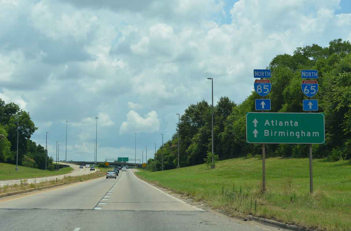


 East
East