|
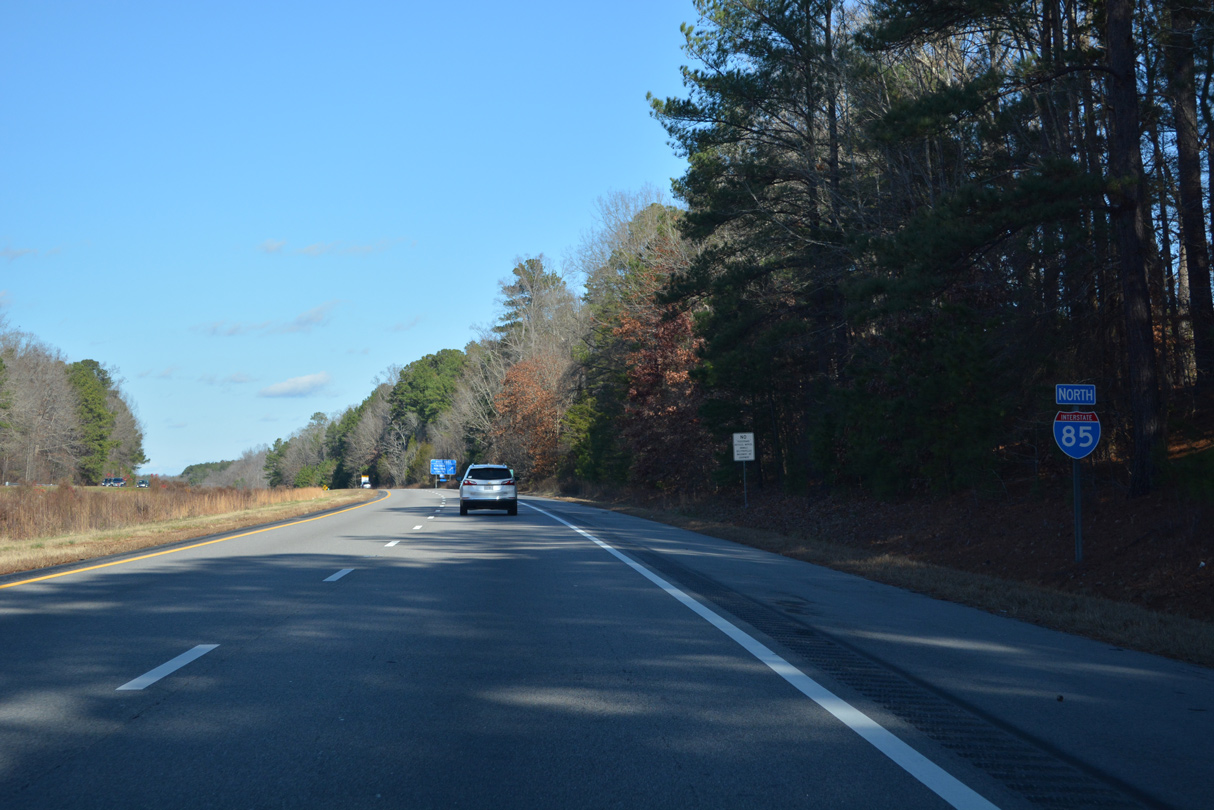
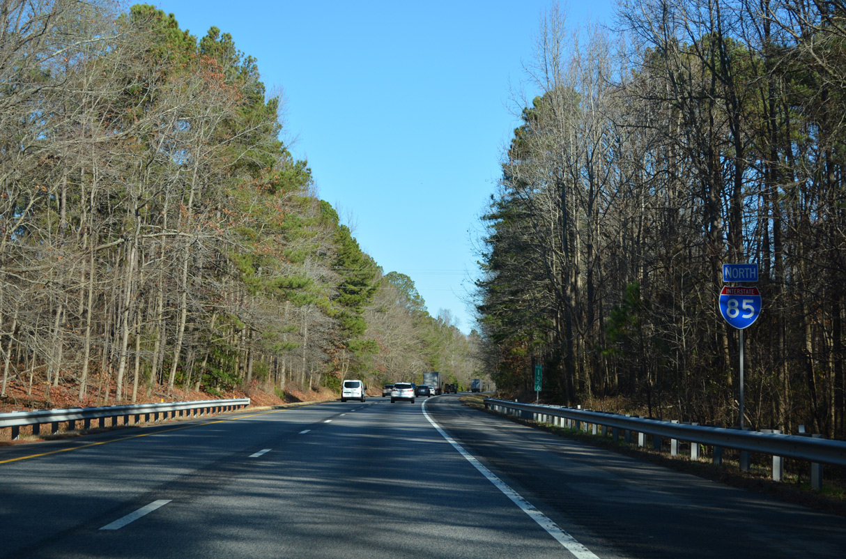
| Interstate 85 north enters the Commonwealth of Virginia in a rural area between Smith Creek and Reedy Branch. 12/16/22 |
|
| The first northbound Interstate 85 reassurance marker posted within Virginia. 12/16/22 |
|
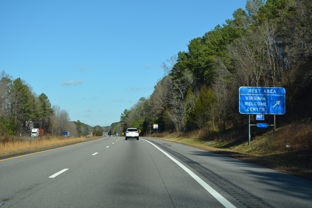
| The Virginia welcome center and a rest area lie adjacent to Smith Creek and southwest of Lake Gaston. 12/16/22 |
|
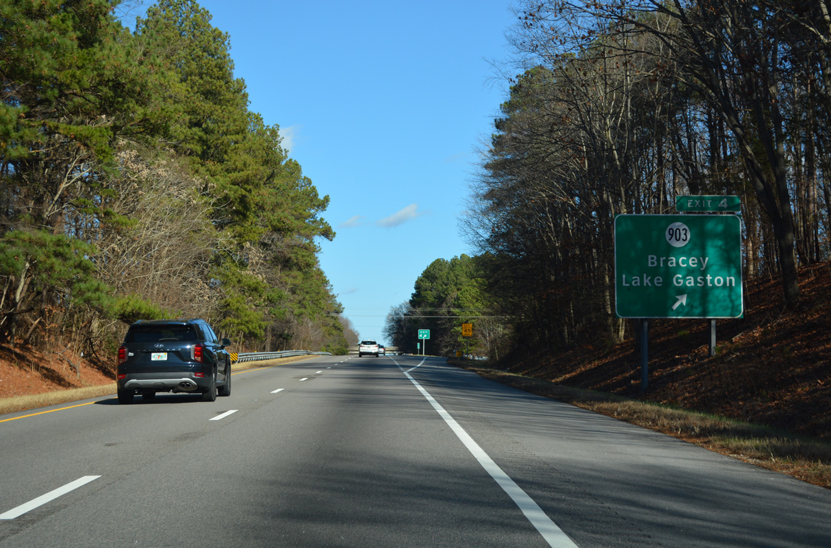
| SR 903 meets Interstate 85 at a diamond interchange (Exit 4) near Bracey. The secondary route loops southwest from South Hill then east to Ebony along northern fringes of Lake Gaston. 12/16/22 |
|
| Interstate 85 turns northeast across Lake Gaston ahead of Exit 4 and Bracey in in southeastern Mecklenburg County. 12/16/22 |
|
| SR 903 travels 5.5 miles north to Smiths Crossroads and 10.5 miles east to Ebony Road near Ebony. SR 903 concludes in South Hill ten miles to the north at U.S. 1 (Danville Street). 12/16/22 |
|
| Continuing north from Bracey, Interstate 85 crosses Hewey Creek beyond this confirming marker. 12/16/22 |
|
| The South Hill town center lies nine miles to the north via I-85, U.S. 58 and U.S. 58 Business at U.S. 1. 12/16/22 |
|
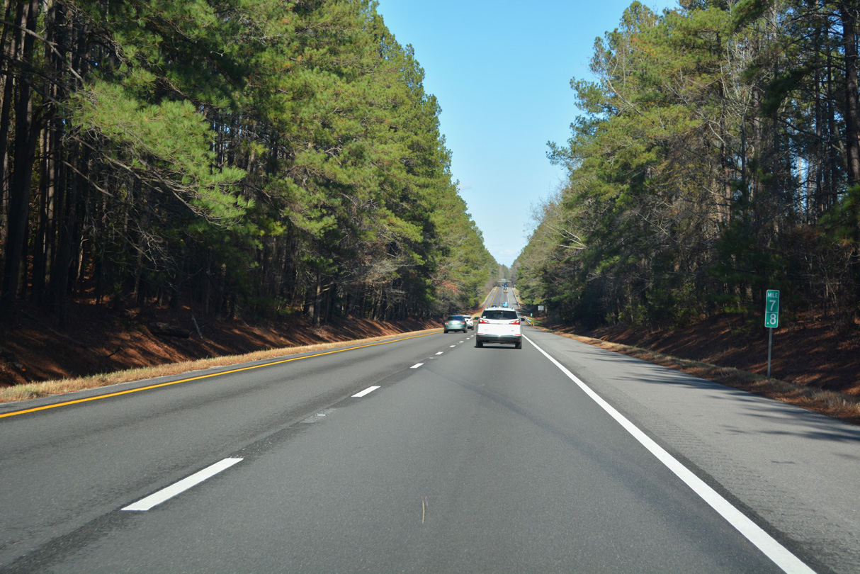
| Most of Interstate 85 in Virginia has a wide forested median. I-85 crosses Parham Creek and CR 630 (Bellfield Road) along this stretch. 12/16/22 |
|
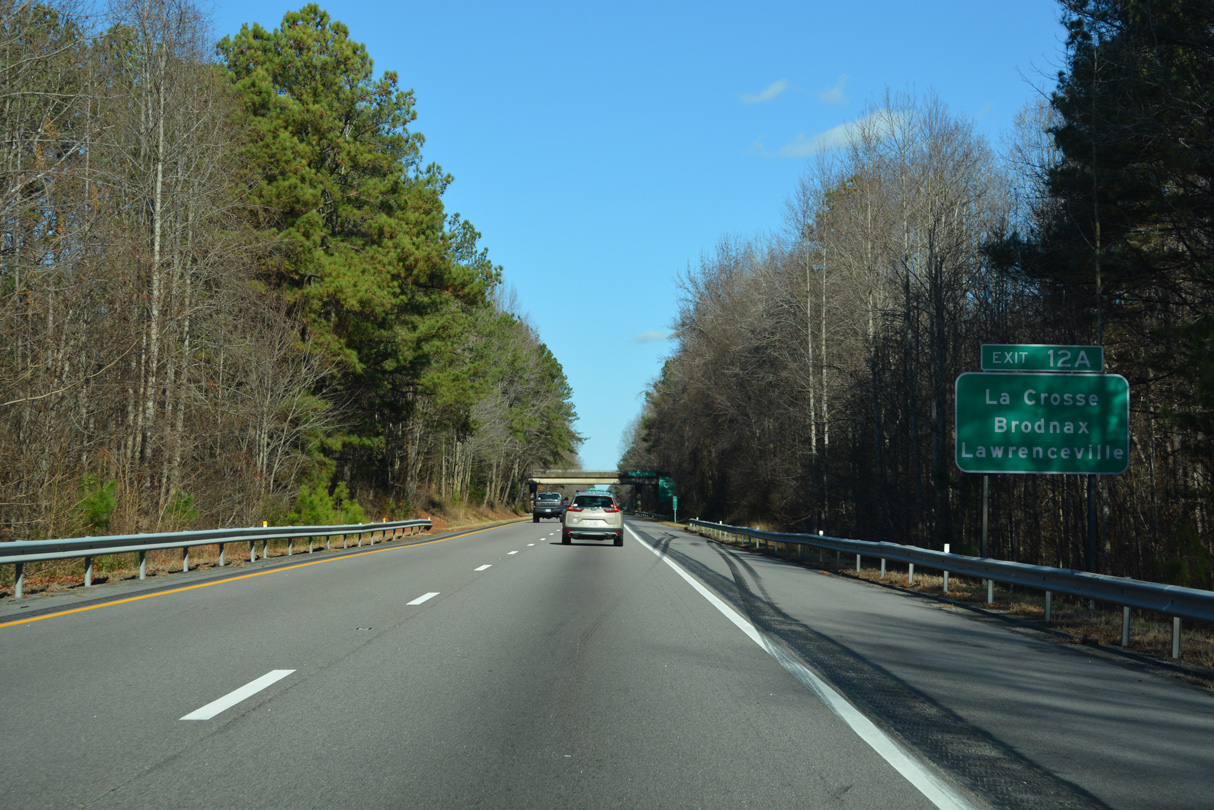
| Forthcoming Exit 12 A links with U.S. 58 east to South Hill. LaCrosse, Brodnax and Lawrenceville follow South Hill over the 34 mile long course to Emporia. 12/16/22 |
|
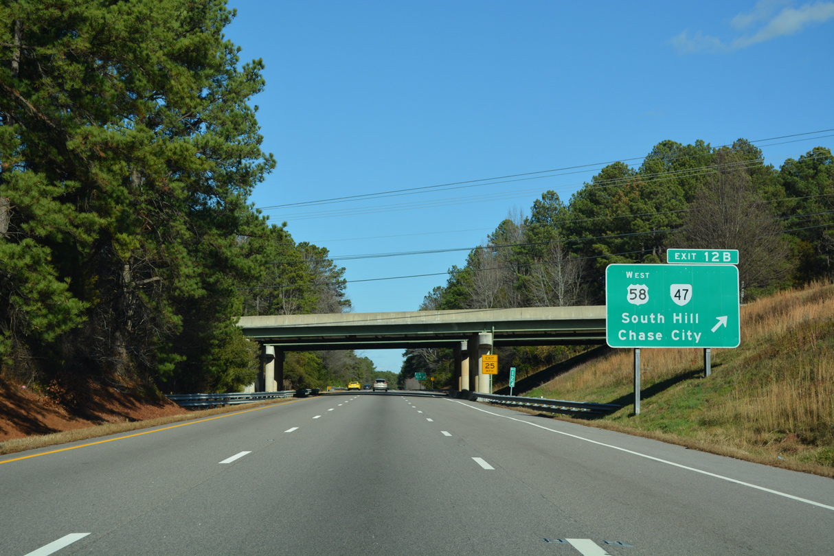
| U.S. 58 comprises an expressway from Exit 12 west to U.S. 1 along the south side of South Hill. U.S. 58 overlaps with U.S. 1 for 3.43 miles from a point 3.3 miles west of Exit 12 B. 12/16/22 |
|
| West from South Hill, U.S. 58 heads to Boydton and Clarksville and 20 miles from there to South Boston. 12/16/22 |
|
| A cloverleaf interchange joins I-85 with U.S. 58 at Exit 12. U.S. 58 was relocated from Atlantic Street, Mecklenburg Avenue and Danville Street onto an expressway bypass of South Hill by November 4, 1999. The $35.1 million bypass is 5.2 miles in length.1 12/16/22 |
|
| The folded diamond interchange at Exit 12 was upgraded to a full cloverleaf in conjunction with the U.S. 58 Bypass project by 2000.1 U.S. 58 enters LaCrosse directly east of I-85. U.S. 58 extends east from Emporia to Hampton Roads and Virginia Beach. 12/16/22 |
|
| The overpasses for U.S. 58 at I-85 were also rebuilt during the 1998-2000 South Hill Bypass project.1 Exit 12 B loops onto Atlantic Street westbound ahead of the split for U.S. 58 (South Hill Bypass) west and SR 47 north. SR 47 follows Atlantic Street through Downtown South Hill en route to Chase City in 22 miles. 12/16/22 |
|
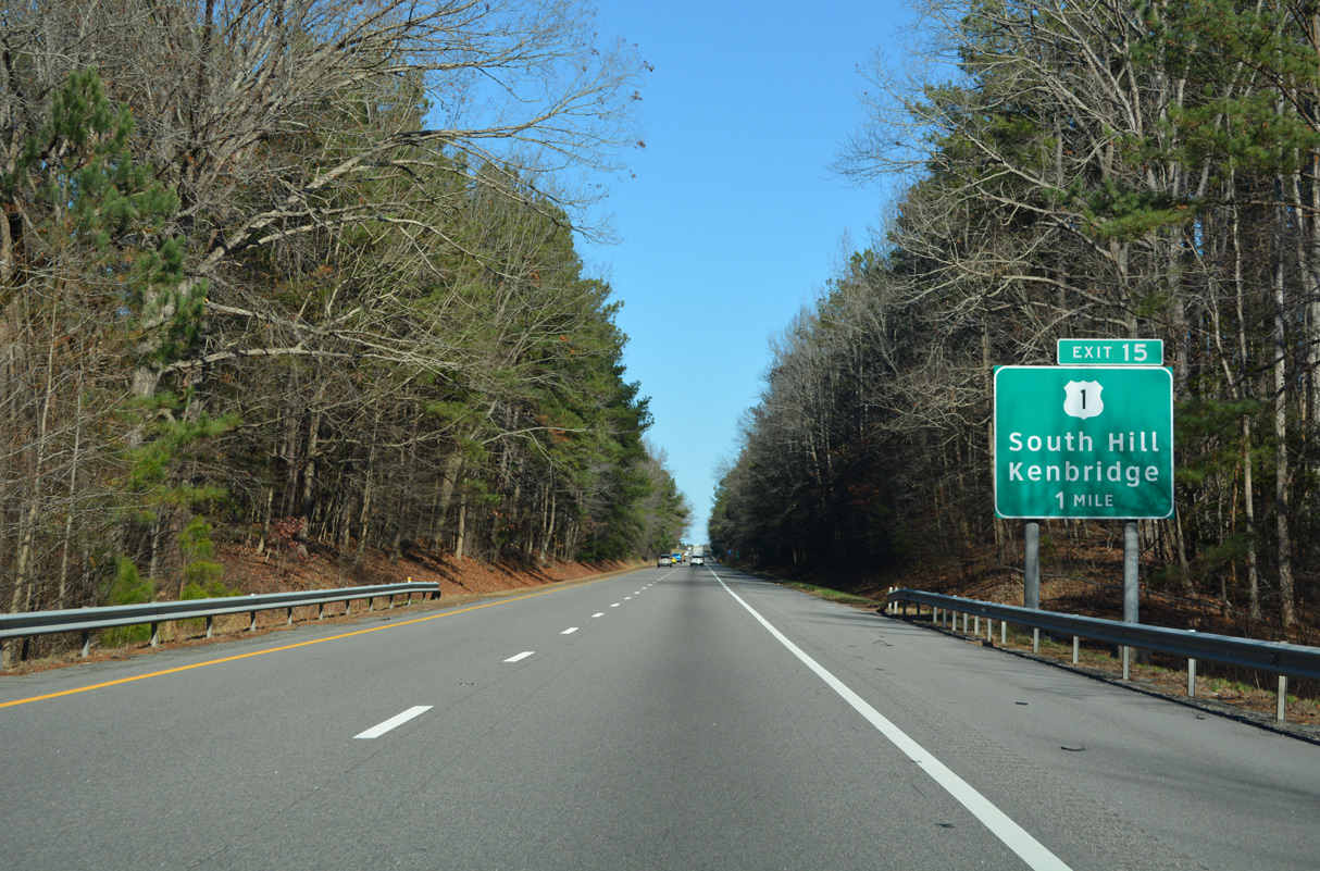
| Interstate 85 remains within the town of South Hill north to Exit 15. 12/16/22 |
|
| Richmond joins Petersburg on this northbound distance sign, 79 miles south of the capital city. 12/16/22 |
|
| U.S. 1 runs through Downtown South Hill on Mecklenburg Avenue from Danville Street northward. U.S. 1 continues northeast to a parclo interchange (Exit 15) with Interstate 85. 12/16/22 |
|
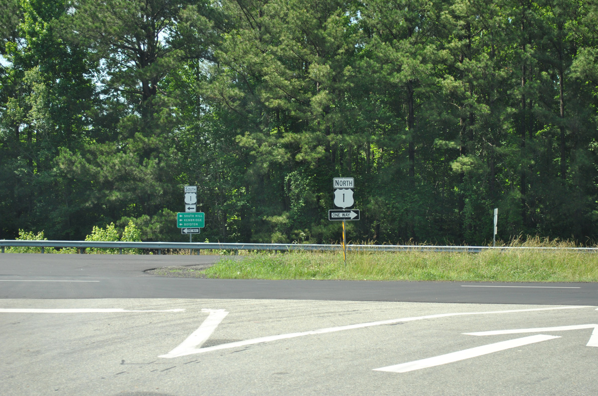
| Exit 15 departs Interstate 85 northbound for U.S. 1 (Mecklenburg Avenue). U.S. 1 ventures 17 miles north to Kenbridge and SR 40. 12/16/22 |
|
| U.S. 1 meets the south end of SR 138 (Union Mill Road) just west of I-85. U.S. 1 northbound enters the community of Cochran 14 miles to the east. 06/01/12 |
|
| Interstate 85 turns northeast from South Hill to Alberta and Petersburg. 12/16/22 |
|
| A forested median separates the roadways along Interstate 85 for the bulk of the route between the North Carolina state line and Petersburg. The 8.55 mile long stretch between Exits 15 and 24 is the longest exit less segment for I-85 in Virginia. 12/16/22 |
|
| Interstate 85 enters Brunswick County 19.52 miles northeast into Virginia. 12/16/22 |
|
| I-85 spans the Meherrin River a short distance east of the Brunswick County line. The Meherrin separates Luneburg and Mecklenburg Counties west of the Brunswick line. Interstate 85 however just misses the southeast corner of Luneburg County. 12/16/22 |
|
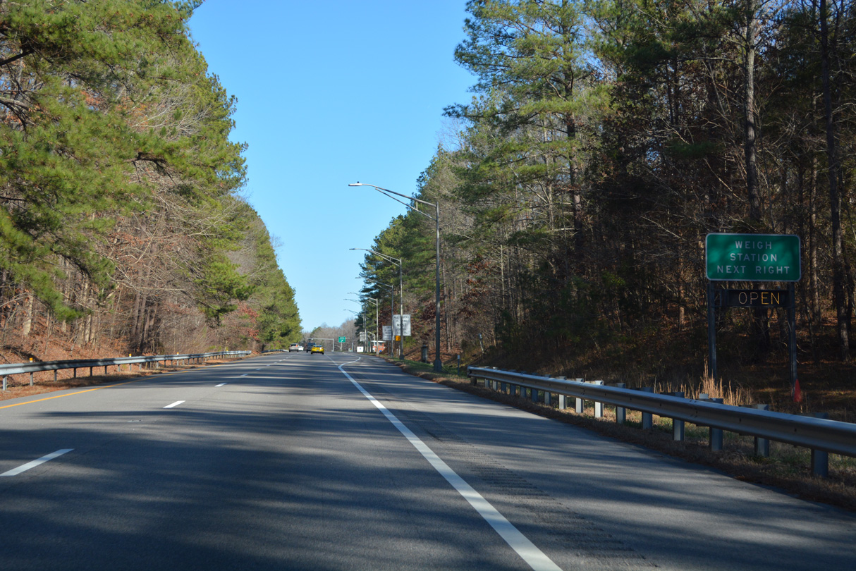
| Following the SR 637 (Old Indian Road) overpass are truck weigh stations along both sides of Interstate 85. 12/16/22 |
|
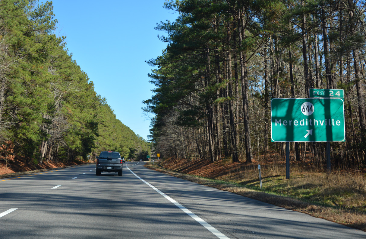
| The diamond interchange at Exit 24 connects I-85 with SR 644 (Brunswick Drive) 0.94 miles north of U.S. 1 (Boydton Plank Road at Meredithville. 12/16/22 |
|
| SR 644 heads 6.53 miles south from Meredithville to U.S. 58 and 13 miles to White Plains. Northward, Brunswick Drive continues 5.5 miles to SR 46 (Christanna Highway) east of Danieltown. 12/16/22 |
|
| Interstate 85 continues four miles across Great Creek to Alberta and 44 miles to Petersburg. 12/16/22 |
|
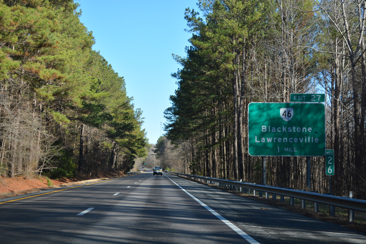
| SR 46 (Christanna Highway) crosses paths with Interstate 85 at Exit 27 near Cochran. 12/16/22 |
|
| SR 46 serves the campus of St. Paul's College at Lawrenceville and the Christanna campus of Southside Virginia Community College. The Brunswick Byways Visitor Center lies south of Lawrenceville and east of the Fort Christanna Historical Site. 12/16/22 |
|
| SR 46 extends 16.43 miles north from NC 46 near Lake Gaston to U.S. 58 at Lawrenceville. North from the diamond interchange at Exit 27, SR 46 continues 17.75 miles to SR 40 at Blackstone. 12/16/22 |
|
| U.S. 1 (Boydton Plank Road) shifts from south of I-85 to the north between Cochran and Alberta. U.S. 1 is a four lane divided highway between SR 46 (Christanna Highway) and SR 136 (Second Avenue). 12/16/22 |
|
| U.S. 1 (Boydton Plank Road) meets Interstate 85 at a diamond interchange (Exit 28) by the town of Alberta. Boydton Plank Road leads U.S. 1 northeast 4.6 miles to Warfield and Sturgeonville. 12/16/22 |
|
| Interstate 85 curves southward across Gum Branch on the ensuing stretch past Alberta. 12/16/22 |
|
| Prestwood Road (SR 646) spans Interstate 85 five miles from the succeeding exit to Warfield. 12/16/22 |
|
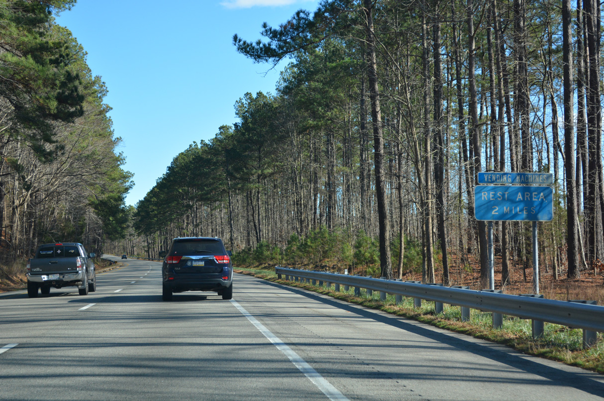
| The Alberta Safety Rest Areas line both roadways of Interstate 85 east of Alberta. The last rest area along northbound follows in 23 miles. 12/16/22 |
|
| The Alberta Safety Rest Areas closed due to VDOT budget cuts in 2008 but reopened, along with the Dinwiddie Safety Rest Areas, in April 2010. 12/16/22 |
|
| SR 630 (Sturgeon Road) stems 0.53 miles southeast from U.S. 1 (Boydton Plank Road) to the diamond interchange with Interstate 85 at Exit 34. 12/16/22 |
|
| SR 630 (Sturgeon Road) heads 7.02 miles miles southward to SR 712 (Old Stage Road, two miles north of U.S. 58 (Governor Harrison Parkway) at Edgerton. 12/16/22 |
|
| Leaving Sturgeonville, Interstate 85 angles northeast three miles to the Rawlings exit and 33 miles to the city of Petersburg. 12/16/22 |
|
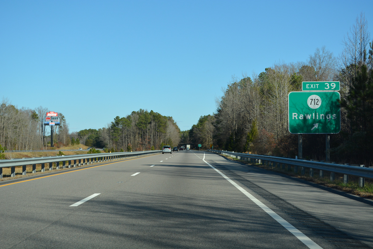
| Exit 39 joins Old Stage Road (SR 712) with Interstate 85, 0.23 miles south of U.S. 1 (Boydton Plank Road) near the Nottoway River. 12/16/22 |
|
| Interstate 85 northbound at the diamond interchange (Exit 39) with SR 712. The community of Rawlings lies 3.3 miles west via U.S. 1 (Boydton Plank Road) and SR 629 (Rawlings Road). 12/16/22 |
|
| The Virginia Department of Transportation (VDOT) recorded 25,000 vehicles per day (vpd) along Interstate 85 at the Nottoway River in 2021. 12/16/22 |
|
| Nottoway River separates Brunswick and Dinwiddie Counties across Interstate 85. 12/16/22 |
Page Updated 02-20-2023.

 North
North