|
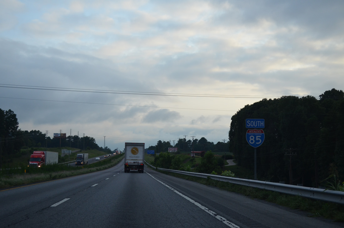
| Interstate 85 south enters Cherokee County in the Palmetto State from Grover, North Carolina. 08/06/13 |
|
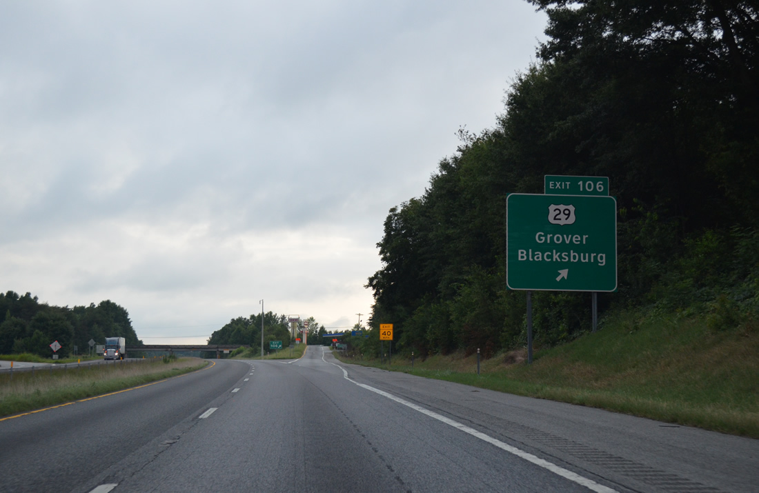
| Paralleling I-85 south from Exit 4 through Grover, U.S. 29 converges with I-85 at a parclo interchange (Exit 106) just beyond state line. South from Exit 106, U.S. 29 continues to the town of Blacksburg and the Cherokee County seat of Gaffney. 08/06/13 |
|
| The first reassurance marker posted for Interstate 85 south in the Palmetto State. 08/06/13 |
|
| Interstate 85 winds westward and spans a Norfolk Southern Railroad line ahead of Exit 104 with Tribal Road (Road 99). 08/06/13 |
|
| Sign changes made by 2013 replaced Road 99 with Tribal Road for Exit 104. Tribal Road leads 0.71 miles north to Hollyridge Road, which runs 1.90 miles west to S.C. 198, and 1.45 miles south to U.S. 29. 08/06/13 |
|
| A South Carolina welcome center and rest area are located southbound between Exit 104 and 102. 08/06/13 |
|
| I-85 west from the North Carolina line to S.C. 129 in Spartanburg County was originally built as a new alignment of U.S. 29. U.S. 29 was relocated back through Gaffney, Cowpens and Spartanburg with the establishment of I-85 in 1959. 08/06/13 |
|
| Interstate 85 lines the north side of Whitaker Mountain by the rest area and tourist information center. 08/06/13 |
|
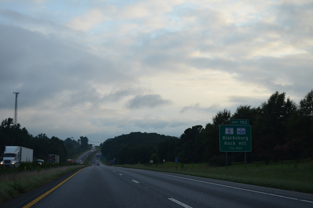
| S.C. 5 north and S.C. 198 south conclude at forthcoming Exit 102. S.C. 198 continues NC 198, 2.66 miles south from Earl, while S.C. 5 follows Mountain Street on the outskirts of Blacksburg. 08/06/13 |
|
| S.C. 5 leads 19 miles east from Exit 102 to the York County seat of York. Overall the state highway travels 51.61 miles to U.S. 521 southeast of Rock Hill. MSR 198 runs 6.8 miles from I-85 north to NC 180 just outside Patterson Springs. 08/06/13 |
|
| A diamond interchange (Exit 102) joins I-85 with S.C. 5 (Mountain Street) south and S.C. 198 north. Frontage roads (Rocky Springs / Henson Roads) stem west from the exchange, providing part of the connection with the freeway. 08/06/13 |
|
| Interstate 85 bypasses Blacksburg to the north to Exit 100. 08/06/13 |
|
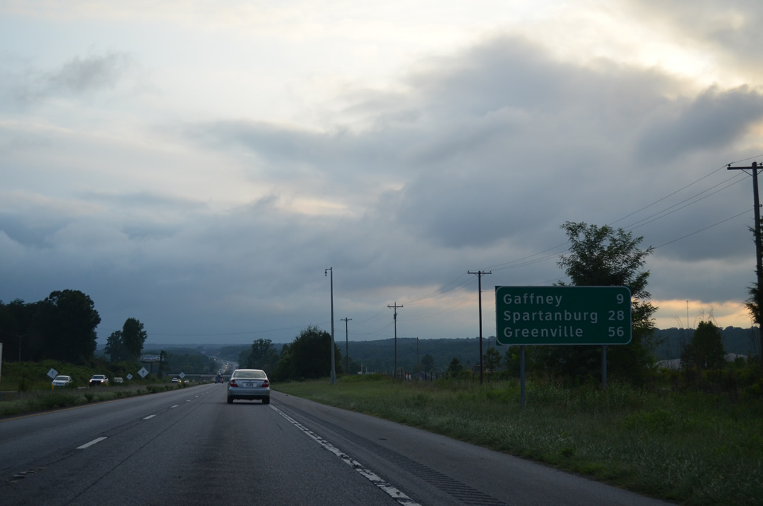
| The city of Gaffney is next along I-85 south in nine miles. Spartanburg follows in less than 30 minutes. 08/06/13 |
|
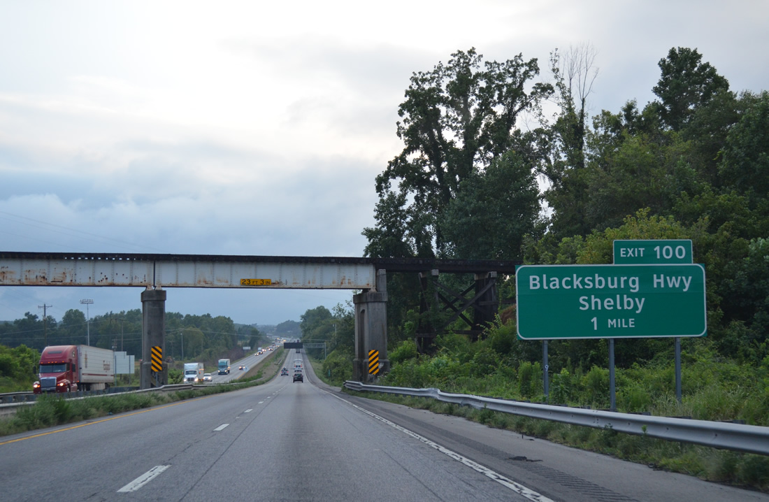
| A diamond interchange (Exit 100) joins Interstate 85 with Blacksburg Highway (old S.C. 5) one mile beyond this Norfolk Southern Railroad overpass. 08/06/13 |
|
| Exit 100 departs from I-85 at Buffalo Creek for Blacksburg Highway. Blacksburg Highway winds southeast to become Carolina Street in Blacksburg. Northward the former route of S.C. 5 concludes at NC 18 (Shelby Highway), nine miles south of Shelby. 08/06/13 |
|
| Interstate 85 south advances toward a crossing of the Broad River on the six miles leading to Gaffney. Greenville is 53 miles to the west via I-385 north from Exit 51C. 08/06/13 |
|
| S.C. 18 (Shelby Highway) branches 3.37 miles southwest from Blacksburg Highway to span the Broad River ahead of a diamond interchange (Exit 96) with Interstate 85. 08/06/13 |
|
| Exit 96 departs Interstate 85 south for S.C. 18 (Shelby Highway). S.C. 18 turns west from the end of S.C. 329 nearby to join Limestone Street into Gaffney. A S.C. 329 provides an easterly bypass of Gaffney 6.35 miles south to S.C. 105. 08/06/13 |
|
| S.C. 18 (Limestone Street) lines the south side of I-85 while Wilcox Avenue parallels the north side to Exit 95. 08/06/13 |
|
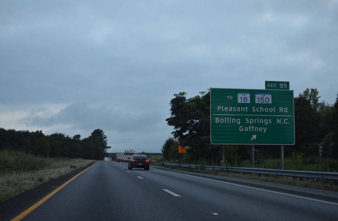
| Pleasant School Road (Road 82) connects I-85 with adjacent S.C. 18 as it turns southwest into Gaffney while frontage roads (Wilcox Avenue and Hampshire Drive) lead west from Road 82 to NC 150 (Boiling Springs Highway). 08/06/13 |
|
| Pleasant School Road (Road 82) encircles Lake Whelchel to the north 5.00 miles en route to Ellis Ferry Road, east of Grassy Pond and NC 150. There is no direct access between I-85 and S.C. 150, which comprises a 218 mile long multi state route with NC 150 between U.S. 158 near Locust Hill and S.C. 56 near Glenn Springs. 08/06/13 |
|
| Interstate 85 skims northern reaches of the Gaffney city limits to forthcoming Exit 92. 08/06/13 |
|
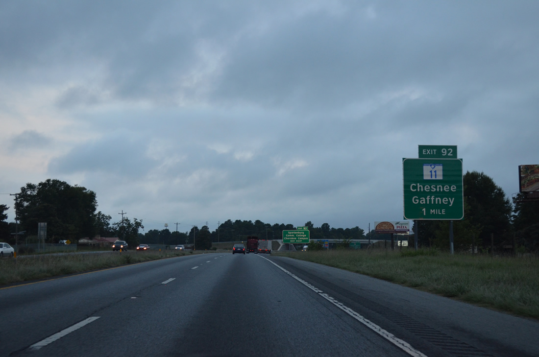
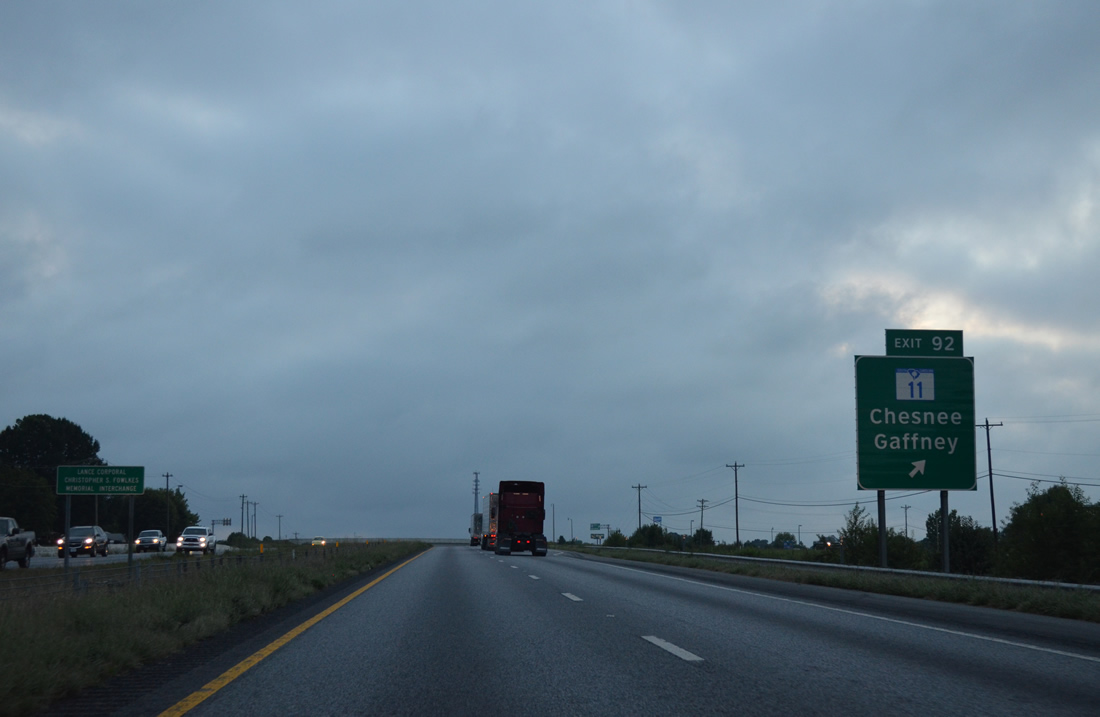
| S.C. 11 commences a 119.85 mile long route at the intersection of S.C. 150 (Limestone Street) and Frederick Street (S.C. 18) in Uptown Gaffney. S.C. 11 heads northwest from Frederick Street onto Floyd Baker Boulevard to meet I-85 in one mile. 08/06/13 |
|
| S.C. 11 doubles as the Cherokee Foothills Scenic Highway west from Exit 92 to Cowpens National Battlefield, Chesnee, New Prospect, Campobello and Gowensville. 08/06/13 |
|
| A six-ramp parclo interchange (Exit 95) joins Interstate 85 with S.C. 11 north (Chesnee Highway) to Chesnee and Floyd Baker Boulevard south into Gaffney. 08/06/13 |
|
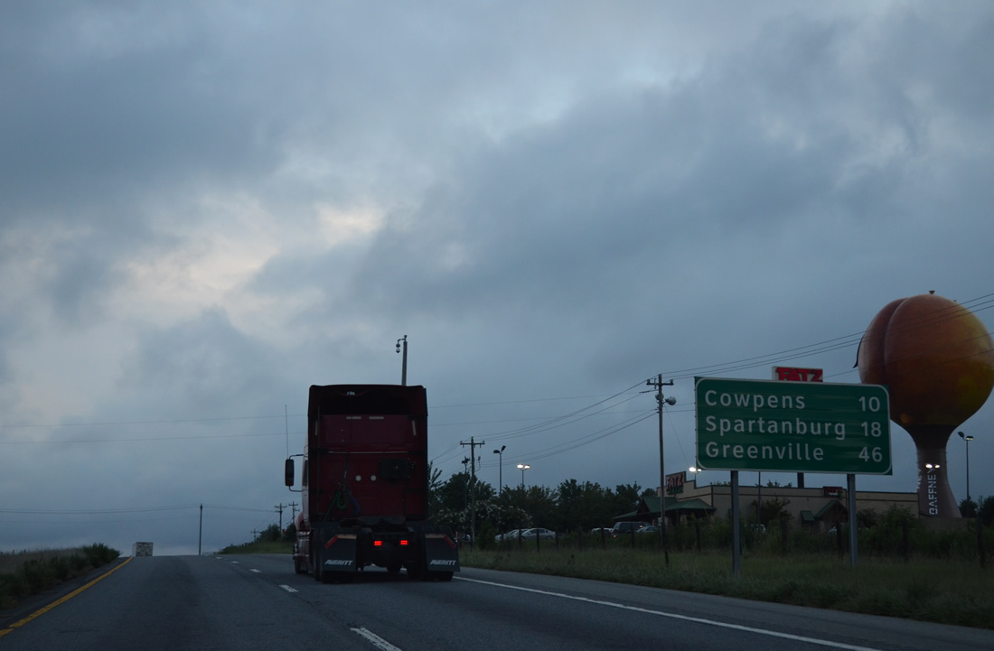
| The town of Cowpens is ten miles away via I-85 south. Spartanburg lies west of there along U.S. 29. 08/06/13 |
|
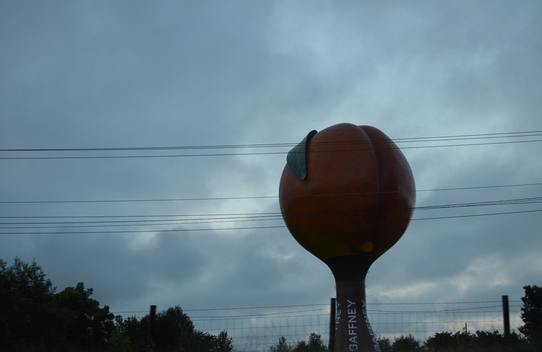
| A 135 foot tall water tower appears just west of Exit 92 along the north side of I-85. The "Peachoid" was built in 1981 and designed to represent the then peach orchards that were prevalent in the Gaffney area.1 08/06/13 |
|
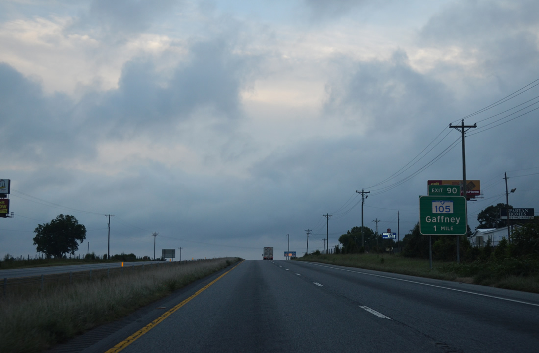
| S.C. 105 (Hyatt Street) commences southeast from Interstate 85 at Exit 90. The 33.22 mile long highway follows a rural course from Gaffney south to Draytonville, Wilkinsville and S.C. 49, west of Lockhart. 08/06/13 |
|
| Exit 90 leaves I-85 south for Hyatt Street (Road 81) 1.29 miles north to Old Post Road (Road 61) and S.C. 11 (Chesnee Highway) and S.C. 105 (Hyatt Street) southeast 3.15 miles to S.C. 150 (Limestone Street) in Gaffney. 08/06/13 |
|
| Interstate 85 south sinks toward a crossing over Thicketty Creek. The upcoming bridge was replaced in 2002 and can accommodate six overall lanes. 08/06/13 |
|
| The Gaffney area rest areas along I-85 permanently closed. The southbound facility was shuttered in 2010; the northbound area followed on June 3, 2011. SCDOT cited their proximity to commercial businesses for the closures.2 08/06/13 |
|
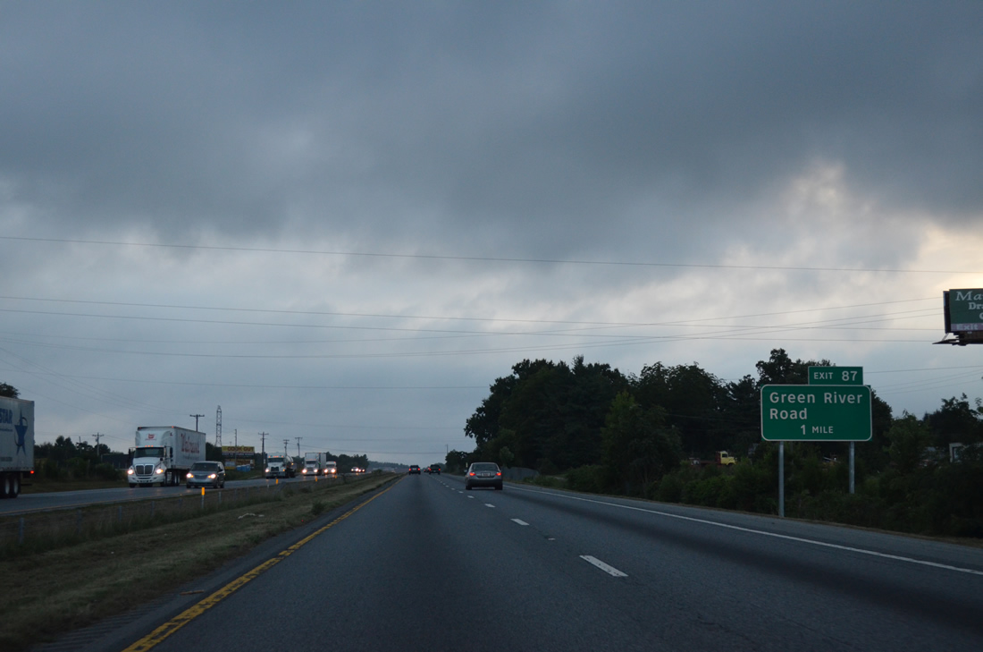
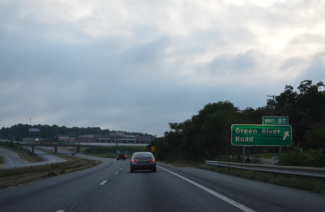
| A diamond interchange (Exit 87) joins Interstate 85 with Green River Road (Road 39) at Macedonia one mile to the west. 08/06/13 |
|
| Green River Road (Road 39) leads 4.42 miles southward from Exit 87 to U.S. 29 (Old Georgia Highway) at Thicketty. Northward Road 39 splits with Macedonia Road (Road 59) for the Thicketty Mountain area while Road 59 branches northwest 3.61 miles to S.C. 110, south of Cowpens National Battlefield. 08/06/13 |
|
| S.C. 110 travels 7.55 miles south from U.S. 221 Alternate and S.C. 11 at Cowpens National Battlefield to cross paths with Interstate 85 near Exit 83. 08/06/13 |
|
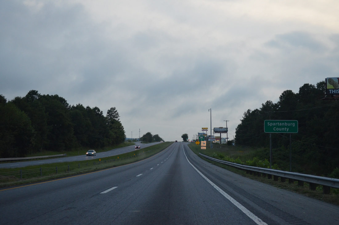
| Interstate 85 south enters Spartanburg County ahead of Exit 83 near Cowpens. 08/06/13 |
Page Updated 06-18-2021.

 South
South