|
| Entrance ramps from U.S. 460 Business/SR 36 (Washington / Wythe Streets) connect with both I-95 south / US. 460 east and the southbound beginning of I-85 with U.S. 460 west. 05/29/21 |
|
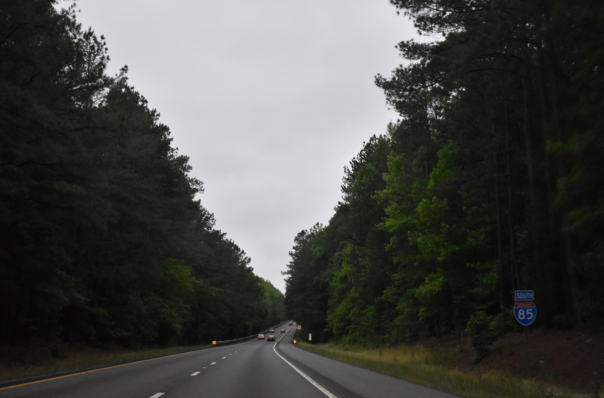
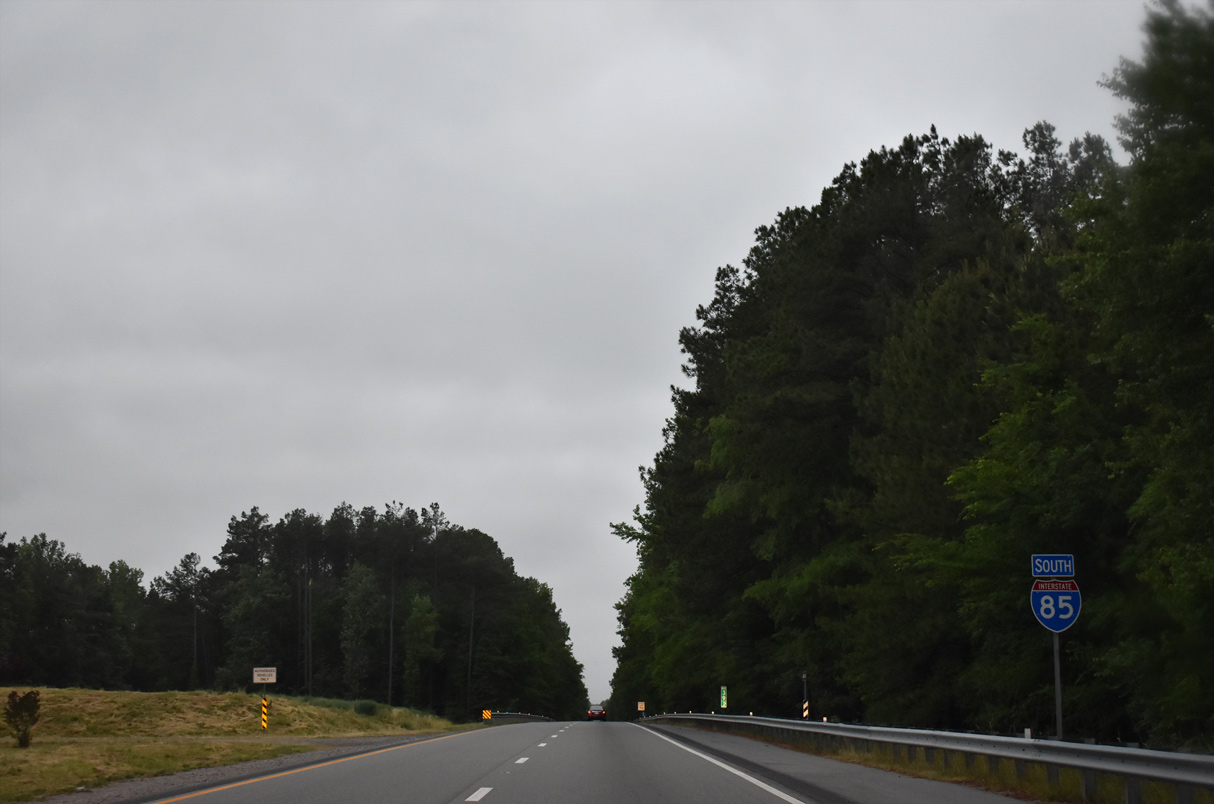
| The first confirming marker for Interstate 85 south stands within the trumpet interchange (Exit 51) joining I-95 and U.S. 460. 05/29/21 |
|
| I-85/U.S. 460 combine 6.4 miles west from Interstate 95 in Petersburg. 05/29/21 |
|
| I-85/U.S. 460 passes over U.S. 301 ALT (Sycamore Street) one mile ahead of a diamond interchange (Exit 65) with Squirrel Level Road (SR 1070). 05/29/21 |
|
| Squirrel Level Road heads south from Youngs Road and SR 142 (Boydton Plank Road) to I-85 at Exit 65 and a unit of Petersburg National Battlefield. Wells Road extends south from nearby to Halifax Road (SR 970). 05/29/21 |
|
| Posted in 2019 beyond the entrance ramp from Squirrel Level Road (SR 1070), this shield assembly replaced a cutout for U.S. 460. 05/29/21 |
|
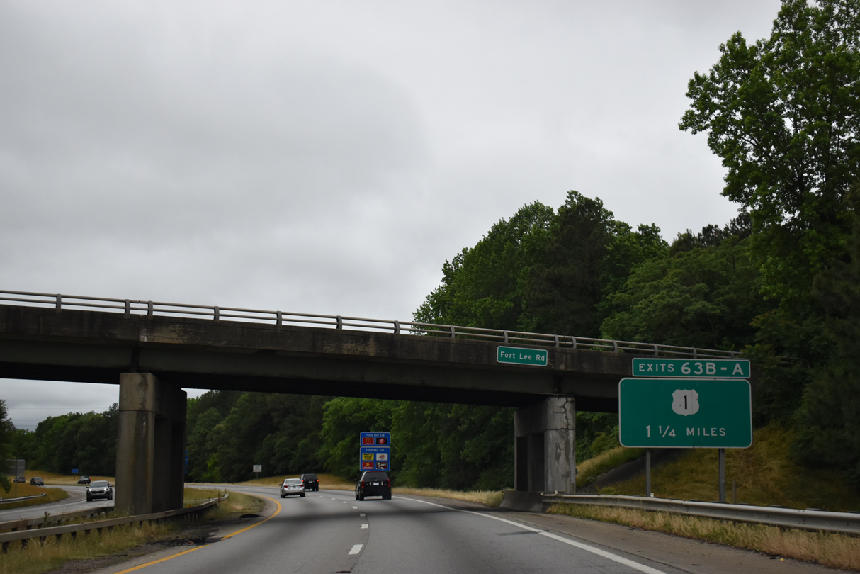
| U.S. 1/460 Business combine west from Downtown Petersburg along Washington Street to the Kennelworth section of the city. The arterial route converges with I-85/U.S. 460 at a six-ramp parclo interchange (Exit 63) 1.25 miles beyond the Fort Lee Road overpass. 05/29/21 |
|
| Interstate 85 south / U.S. 460 west leave the independent city of Petersburg and enter Dinwiddie County just west of the Dupuy Road under crossing. 05/29/21 |
|
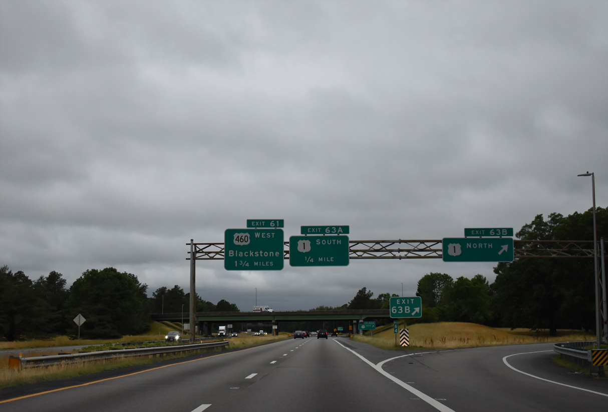
| Exit 63 B departs I-85 south for U.S. 1/460 Business (Boydton Plank Road) east to West Petersburg. Points of interest for Exit 63 A to U.S. 1 south include Virginia Motorsports Park, Pamplin Historical Park and the National Museum of the Civil War Soldier. 05/29/21 |
|
| U.S. 1/460 Business (Boydton Plank Road) parallel I-85/U.S. 460 to the south between Exit 63 A and Airport Street. U.S. 1 continues alongside Interstate 85 to South Hill and Henderson, North Carolina. 05/29/21 |
|
| Spanning Sterling Road (SR 603) and a Norfolk Southern Railroad line, I-85/U.S. 460 advance 1.8 miles west to their separation. 05/29/21 |
|
| U.S. 460 splits with I-85 south at a parclo interchange (Exit 61) for Blackstone, Farmville and Lynchburg. 05/29/21 |
|
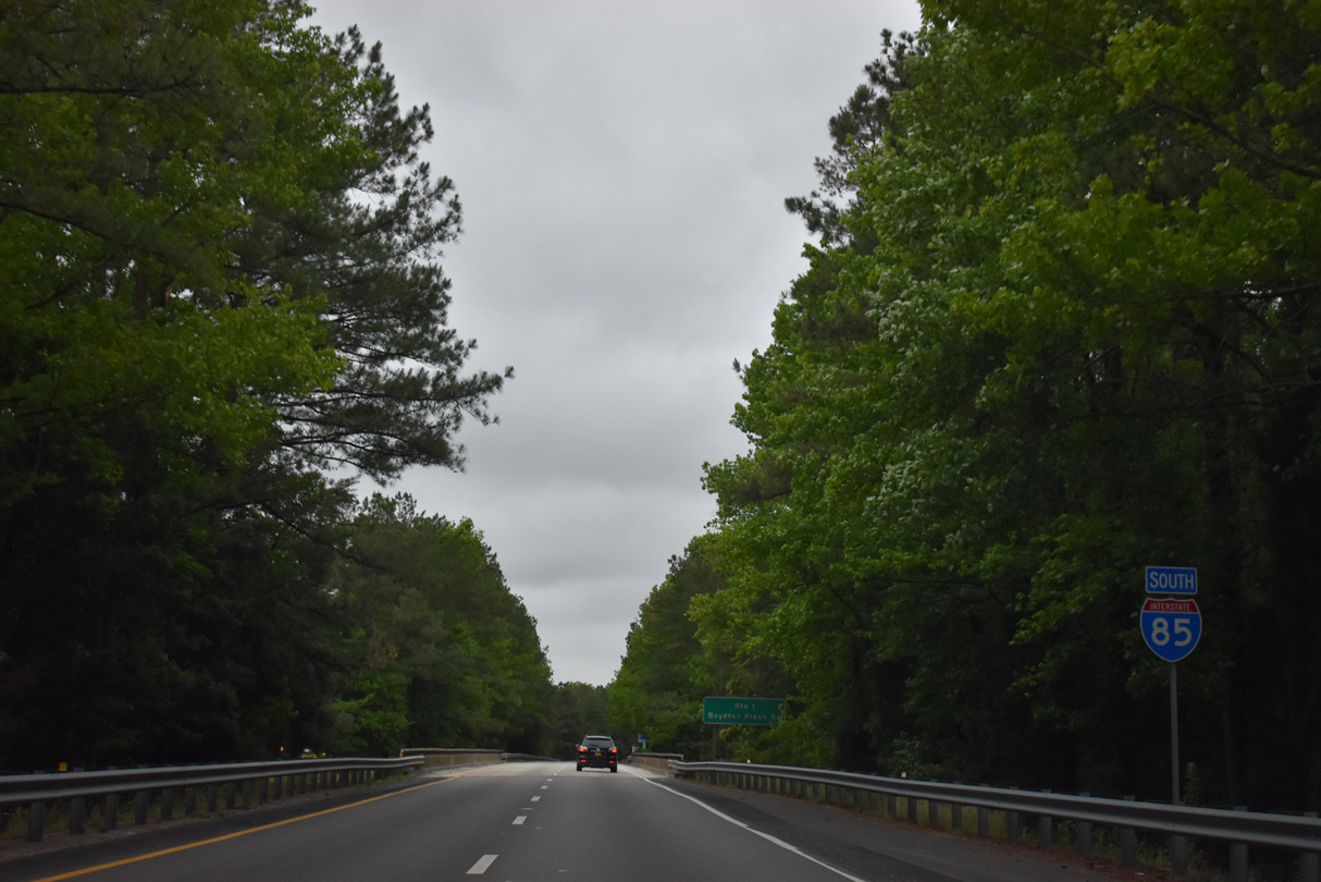
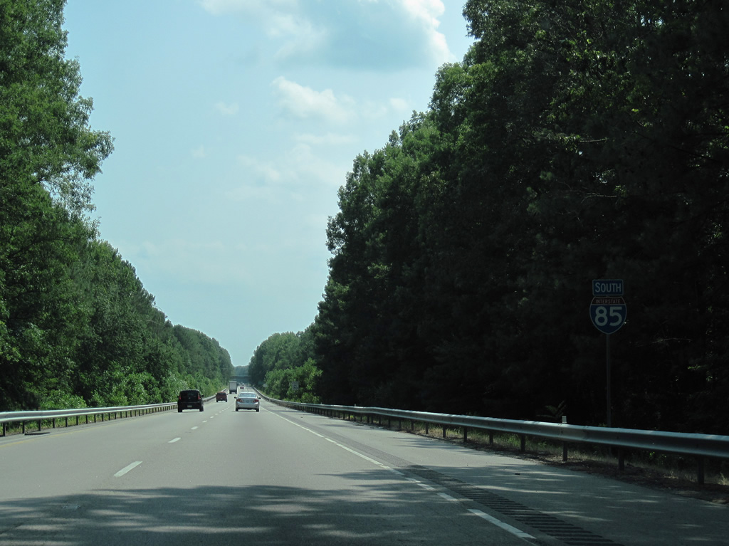
| Interstate 85 travels southwest from U.S. 460, 50 miles to U.S. 58 at South Hill and 119 miles U.S. 15-501 Business south to Downtown Durham, North Carolina. 05/29/21 |
|
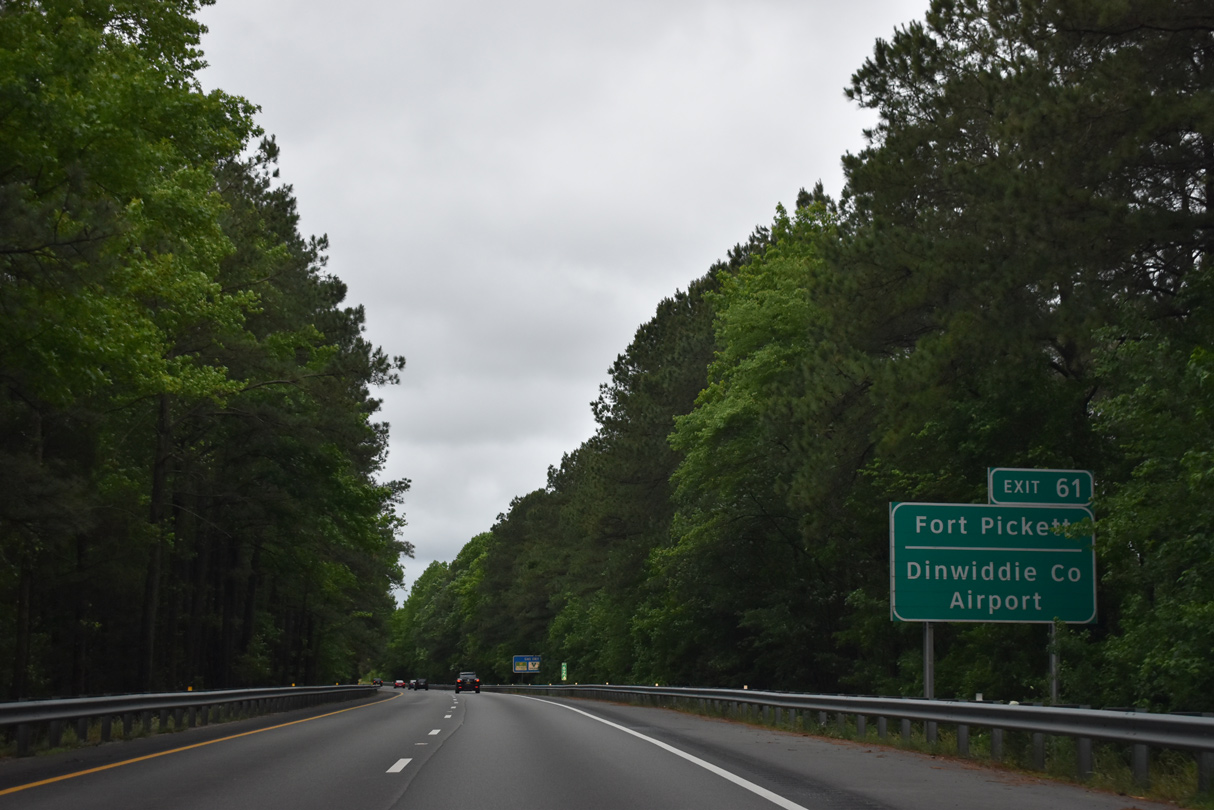
| U.S. 460 joins Airport Street west from Exit 61 and U.S. 460 Business to Dinwiddie County Airport (PTB). 05/29/21 |
|
| Located 30 miles away along U.S. 460 Business, Blackstone lies northwest of Fort Pickett. 05/29/21 |
|
| U.S. 1 (Boydton Plank Road) travels underneath Interstate 85 beyond this confirming marker. 05/29/21 |
|
| Downtown South Hill lies 49.6 miles to the southwest. The next major city along the corridor is Durham in 119 miles. 05/29/21 |
|
| Rest areas line both roadways of Interstate 85 between the SR 660 (Quaker Road) and SR 605 (Hunnicut Road) overpasses. 05/29/21 |
|
| The Dinwiddie Safety Rest Area South and North closed in 2008 due to budget cuts by the Virginia Department of Transportation (VDOT) budget cuts. However both facilities reopened in April 2010. 05/29/21 |
|
| The parclo interchange (Exit 53) with SR 703 (Carson Road) east of Dinwiddie serves interests to the Five Forks Unit of Petersburg National Battlefield via SR 627 (Courthouse Road) north from U.S. 1 in Dinwiddie. 05/29/21 |
|
| SR 703 (Carson Road) connects with U.S. 1 (Boydton Plank Road) at the Dinwiddie County seat 1.30 miles west of the exchange at Exit 53. Eastward, SR 703 meanders 11.24 miles to SR 604 (Halifax Road) at the unincorporated community Carson near Interstate 95. 05/29/21 |
|
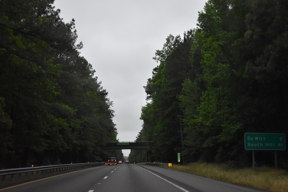
| Continuing by Dinwiddie, Interstate 85 advances five miles southwest to DeWitt. 05/29/21 |
|
| SR 619 (Courthouse Road) spans Interstate 85 beyond this distance southward from U.S. 1 to Wharfs Store. 05/29/21 |
|
| SR 650 (Hamilton Arms Road) meets Interstate 85 at a diamond interchange (Exit 48) just east of DeWitt. 05/29/21 |
|
| SR 650 extends west from U.S. 1 (Boydton Plank Road) and DeWitt along Lew Jones Road to Gunns Hill and SR 610 (Old White Oak Road) north of SR 40 (McKenney Highway). East of Exit 48, SR 650 follows Hawkins Church Road to Hamilton and SR 619 (Courthouse Road). 05/29/21 |
|
| Southbound confirming marker posted ahead of the SR 709 (Shippings Road) overpass. 05/29/21 |
|
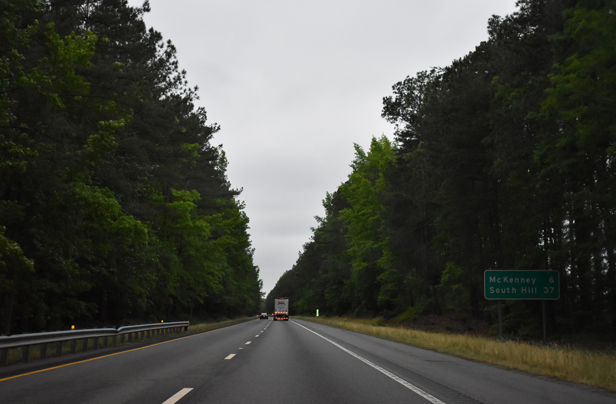
| The succeeding exit along Interstate 85 south is for the town of McKenney in five miles. South Hill follows at Exit 12 B in 35 miles. 05/29/21 |
|
| SR 40 (Doyle Boulevard) west joins Interstate 85 with McKenney at forthcoming Exit 42. SR 40 follows McKenney Highway outward from the town northwest to Darvills and east toward Stony Creek and Sussex. 05/29/21 |
|
| Exit 42 leaves I-85 south for SR 40 (Doyle Boulevard west / McKenney Highway east). SR 40 overall travels 233 miles across southern reaches of the state from SR 8 at Woolwine to SR 10 at Spring Grove. 05/29/21 |
|
| Confirming marker for Interstate 85 south posted at mile marker 42.2. 05/29/21 |
|
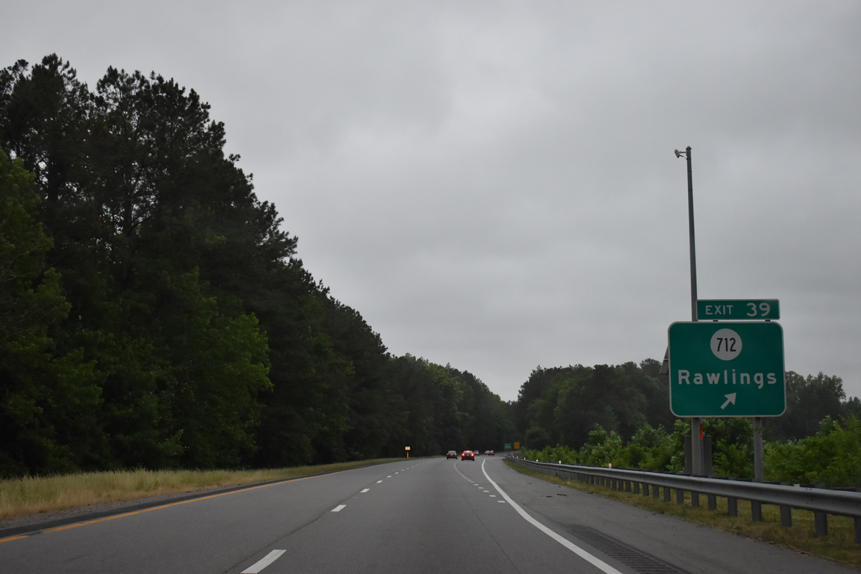
| The ensuing exit is two miles ahead for the unincorporated community of Rawlings. 05/29/21 |
|
| SR 712 (Old Stage Road) stems 0.23 miles south from U.S. 1 (Boydton Plank Road) to the diamond interchange at Exit 39. 05/29/21 |
|
| Crossing the Nottoway River just ahead of Exit 39, Interstate 85 south enters Brunswick County. 05/29/21 |
|
| Rawlings lies west of U.S. 1 along SR 629 (Rawlings Road). SR 712 (Old Stage Road) extends 12.18 miles south from Interstate 85 to Poarch Store and U.S. 58 at Edgerton. 05/29/21 |
|
| Continuing southwest, Interstate 85 crosses Waqua Creek on the four mile stretch leading to Exit 39 for Warfield. 05/29/21 |
|
| The diamond interchange at Exit 34 joins Interstate 85 with SR 630 (Sturgeon Road) east of Warfield and Sturgeonville. 05/29/21 |
|
| SR 630 (Sturgeon Road) west connects with U.S. 1 (Boydton Plank Road) at Sturgeonville in 0.53 miles. The rural community of Warfield is located west of U.S. 1 along SR 643 (Flat Rock Road). SR 630 south runs 7.02 miles to SR 712 northeast of Edgerton. 05/29/21 |
|
| This reassurance marker along Interstate 85 southbound precedes Sturgeon Creek. 05/29/21 |
|
| A second set of rest areas along Interstate 85 in Virginia are located west of Poor House Road (SR 642). 05/29/21 |
|
| Alberta, the most populated community along the Interstate 85 corridor in Brunswick County, follows in six miles. 05/29/21 |
|
| The succeeding rest area along Interstate 85 south is the North Carolina Welcome Center 34 miles southwest of the Alberta Safety Rest Area South. 05/29/21 |
|
| Located at mile marker 32, parking spaces at the Alberta Safety Rest Area South accommodate 78 cars and 13 trucks. 05/29/21 |
|
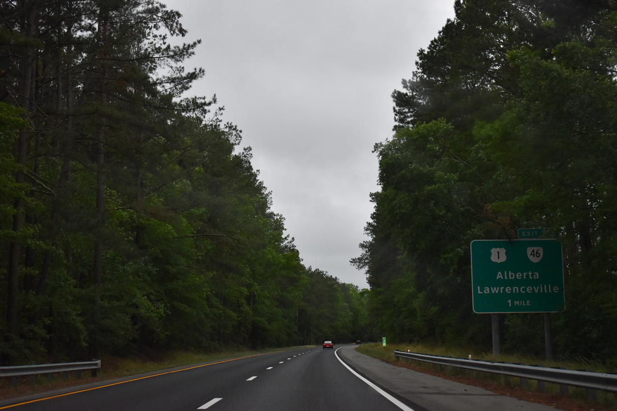
| U.S. 1 (Boydton Plank Road) shifts south of I-85 at a diamond interchange (Exit 28) outside Alberta. A multi state highway with NC 46 south to Garysburg, SR 46 (Christanna Highway) meets U.S. 1 just west Cochran. 05/29/21 |
|
| SR 46 (Christanna Highway) travels south from U.S. 1 (Boydton Plank Road) eight miles to Lawrenceville and St. Paul's College. SR 46 north heads to Danieltown, Blackstone and SR 40. 05/29/21 |
|
| Curving west from Alberta, Interstate 85 next passes through a half diamond interchange (Exit 27 on I-85 north) with SR 46 (Christanna Highway). 01/02/08 |
|
| Interstate 85 south ahead of Great Creek. 05/29/21 |
|
| Meredithville lies three miles to the south at the crossroads of U.S. 1 (Boydton Plank Road) and SR 644 (Brunswick Drive). South Hill is 13 miles to the southwest. 05/29/21 |
|
| SR 644 (Brunswick Drive) leads 1.23 miles south from forthcoming Exit 24 to U.S. 1 (Boydton Plank Road) at Meredithville. 05/29/21 |
|
| A diamond interchange links Interstate 85 with SR 644 (Brunswick Drive) at Exit 24. SR 644 (Grandy Road) continues 6.53 miles south from U.S. 1 to Grandy and U.S. 58. 05/29/21 |
|
| An 8.55 mile long exit less stretch commences along Interstate 85 south of Exit 24. 05/29/21 |
|
| Truck weigh stations line both sides of Interstate 85 at mile marker 22.4. 05/29/21 |
|
| 81 miles away, Durham, North Carolina reappears on Interstate 85 southbound distance sign 11 miles north of South Hill. 05/29/21 |
|
| Interstate 85 southbound arrives at the weigh station ahead of Shining Creek. 01/02/08 |
|
| Interstate 85 spans the Meherrin River just east of the Mecklenburg County line. 05/29/21, 07/09/10 |
|
| Interstate 85 enters the town of South Hill at the parclo interchange (Exit 15) with U.S. 1 (Mecklenburg Avenue) near Burnt Store. 01/02/08 |
|
| U.S. 1 (Mecklenburg Avenue) angles 2.53 miles southwest from Exit 15 to U.S. 58 Business and SR 47 along Atlantic Street in Downtown South Hill. 07/11/05 |
|
| Interstate 85 straddles the South Hill town line south of Exit 15. 07/09/10 |
|
| The ensuing exit connects Interstate 85 with Downtown South Hill via U.S. 58 Business (Alantic Street) west. 07/09/10 |
|
| A cloverleaf interchange (Exits 12 B/A) joins Interstate 85 with U.S. 58 (Atlantic Street) and SR 47 west in South Hill. U.S. 58 partitions with U.S. 58 Business/SR 47 (Atlantic Street) just west of Exit 12 B for an expressway bypass of South Hill. 07/09/10 |
|
| 62 miles in length, SR 47 travels northwest from South Hill to Chase City and Pamplin City. U.S. 58 constitutes the longest signed route in Virginia at 509.4 miles between Cumberland Gap and Virginia Beach. 07/09/10 |
|
| Exit 12 B provides separate ramps for U.S. 58 west to Boydton and Clarksville and U.S. 58 Business west / SR 47 north along Atlantic Street into South Hill. 07/09/10 |
|
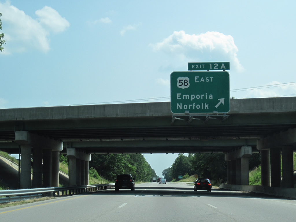
| Ramps along the south side of U.S. 58 were added by 2000 during construction of the expressway bypass across southern South Hill. Exit 12 A loops onto U.S. 58 east to La Cross, Brodnax, Lawrenceville and Emporia. U.S. 58 comprises a four lane corridor eastward into Hampton Roads. 07/09/10 |
|
| Interstate 85 leaves the South Hill town limits south ahead of the SR 642 (Rocky Branch Road) over crossing. 07/09/10 |
|
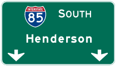
| The next major population center along Interstate 85 is Henderson, North Carolina, 32 miles to the southwest. 07/09/10 |
|
| The diamond interchange at Exit 4 connects Interstate 85 with SR 903. SR 903 traverses area north of Lake Gaston east to Bracey, Joyceville and Ebony. The route derives its number from NC 903 south to U.S. 158 at Littleton. 07/11/05 |
|
| SR 637 was renumbered as SR 903 northwest from Bracey to Smiths Crossroads and South Hill. SR 615 (Redlawn Road) links SR 903 with U.S. 1 at Beechwood in 1.60 miles. 07/09/10 |
|
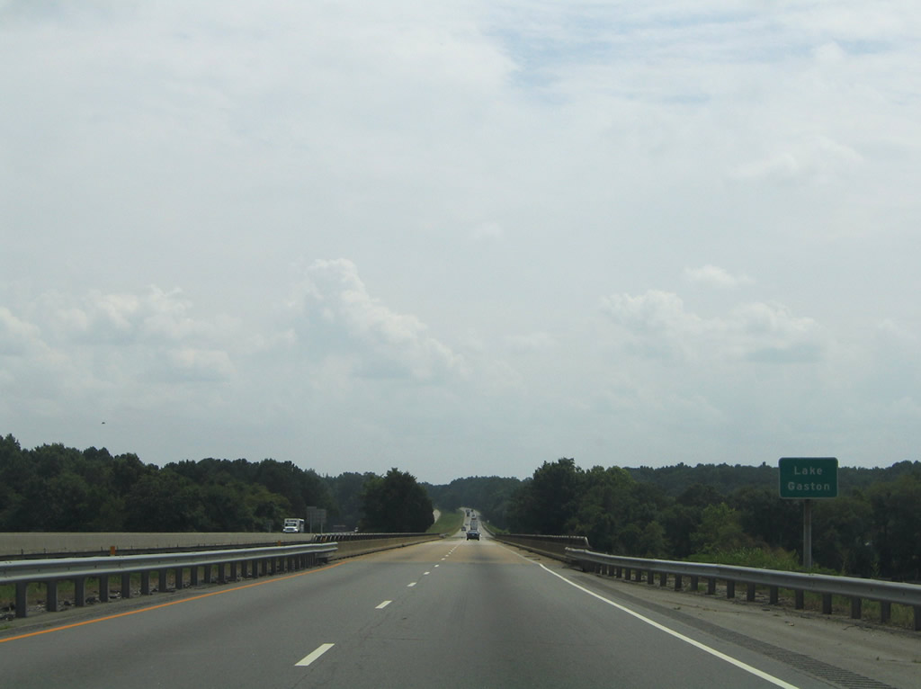
| Southbound distance sign posted ahead of Lake Gaston (Roanoke River). 07/09/10 |
|
| Interstate 85 first crosses the Roanoke River and then travels a causeway over shallow areas of Lake Gaston. This stretch of freeway opened in 1964. 07/11/05 |
|
| Looking east from the causeway over Lake Gaston at an abandoned Seaboard Coast Railroad bridge. 07/11/05 |
|
| A diamond interchange (Exit 233) joins I-85 with U.S. 1 and U.S. 401 south just across the state line. Extended north alongside U.S. 1 from Norlina in 2001, U.S. 401 originates at Exit 233, 3.5 miles north of Wise. 07/09/10 |
|
| The 68.84 mile long course for Interstate 85 through the Old Dominion concludes at the Warren County, North Carolina line. 07/09/10 |
Page Updated 12-12-2022.

 South
South  West
West