|
| A half diamond interchange (Exit 84) joins I-90 west with Oakes Avenue, one mile from SR 970 north to SR 903 on the east side of Cle Elum. 06/28/15 |
|
| Paralleling the Yakima River, Interstate 90 runs alongside Hanson Ponds Park. 06/28/15 |
|
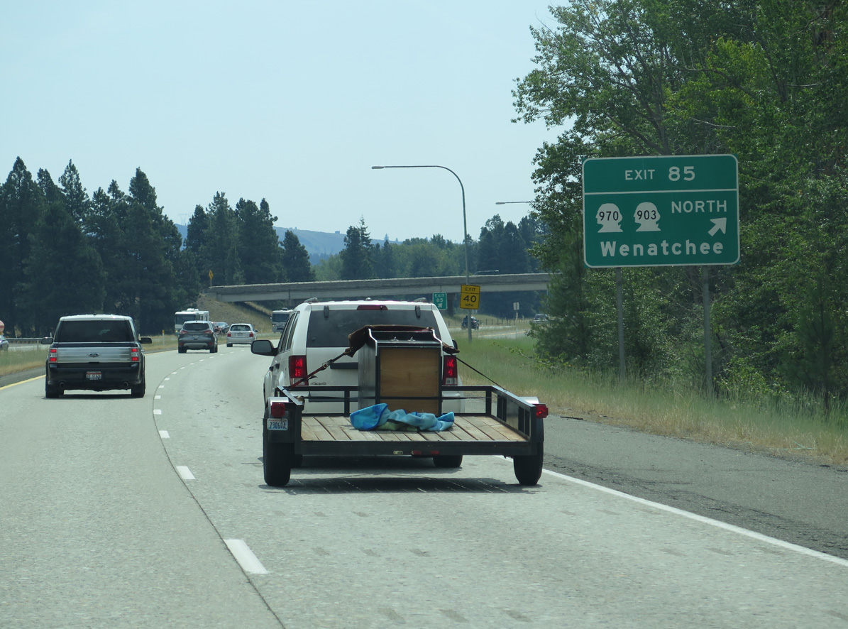
| SR 970 stems north from the diamond interchange at Exit 85 to the east end of SR 903 just outside the Clem Elum city limits. 06/28/15 |
|
| SR 970 travels 10.31 miles east from Interstate 90 to U.S. 97. U.S. 97 heads north from SR 970 to U.S. 2, four miles southeast of Leavenworth. 06/28/15 |
|
| SR 903 follows old U.S. 10 along 1st Street to the Cle Elum city center before turning north to Roslyn, Ronald, Lakedale and Cle Elum Lake along a 10.06 mile long course. 06/28/15 |
|
| Interstate 90 spans the Yakima River for the third time as it leaves Cle Elum. 08/31/06 |
|
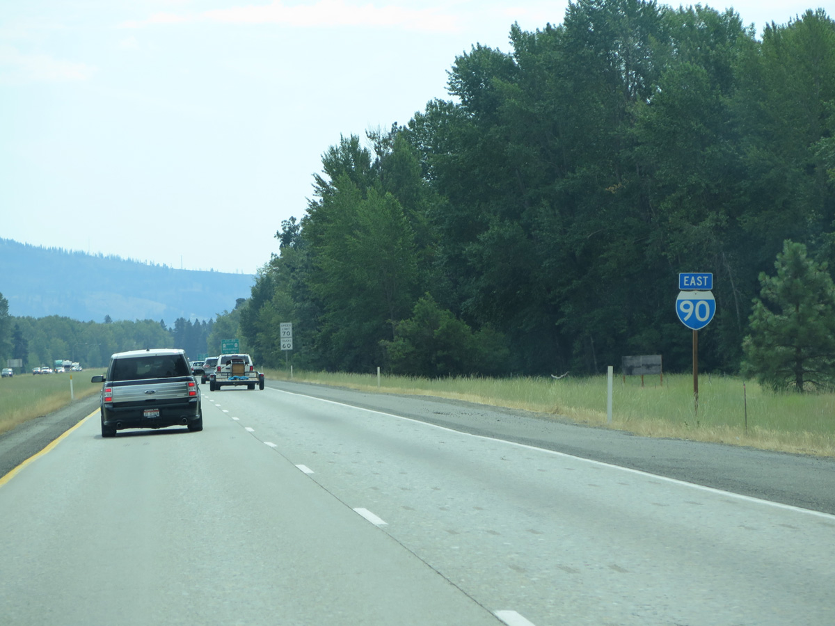
| Spokane is 194 miles east of Cle Elum. 06/28/15 |
|
| Shifting south across Palouse to Cascades State Park Trail, the right of way along Interstate 90 widens with a forested median. 06/28/15 |
|
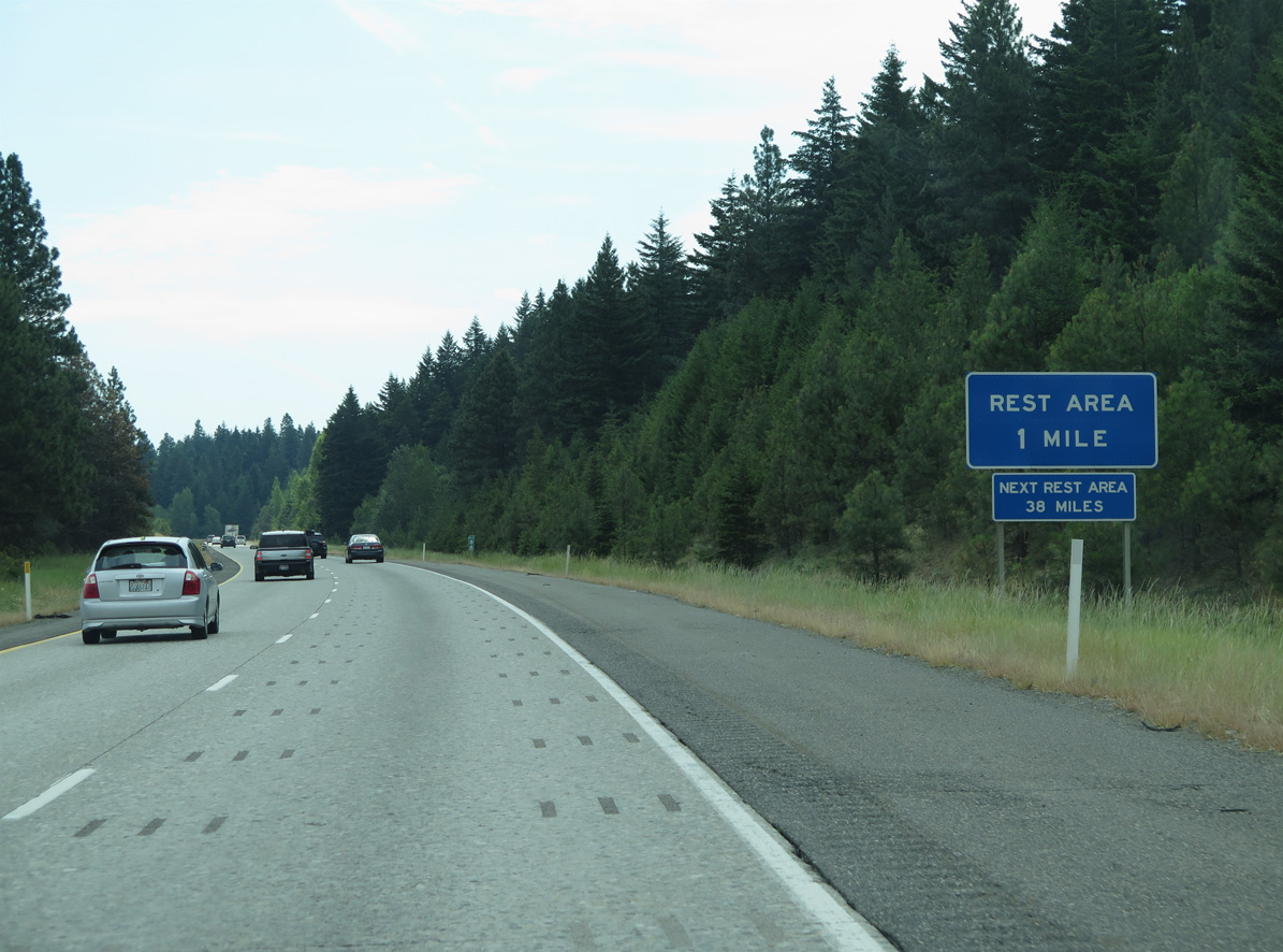
| The first rest area along Interstate 90 is one mile east of Thornton Creek at Indian John Hill. 06/28/15 |
|
| Indian John Hill (elevation 2,141 feet) lies just beyond mile marker 89. 06/28/15 |
|
| Turning southward ahead of Horseshoe Canyon, Interstate 90 crosses Main Canal, which feeds the Columbia Basin Federal Reclamation Project. A truck climbing lane opens east to Elk Heights. 06/28/15 |
|
| Thorp Prairie Road appears alongside Interstate 90 north of Morrison Canyon. The parallel road continues Upper Peoh Point Road from South Cle Elum to Thorp Prairie by Exit 93. 06/28/15 |
|
| Exit 93 joins Interstate 90 with Elk Heights Road in one mile at Morrison Canyon. 06/28/15 |
|
| Interstate 90 crosses Elk Heights at an elevation of 2,359 feet above sea level. 06/28/15 |
|
| Thorp Prairie Road leads south from Elk Heights Road across Thorp Prairie to Taneum Creek. Taneum Creek flows east into the Yakima River from Taneum Ridge in Wenatchee National Forest. 06/28/15 |
|
| Interstate 90 east at the diamond interchange (Exit 93) with Elk Heights Road. 06/28/15 |
|
| Interstate 90 traverses Thorp Prairie east from Elk Heights. 06/28/15 |
|
| Ellensburg is 16 miles to the east in Kittitas Valley while Spokane is under 200 miles away. 06/28/15 |
|
| Also part of the Columbia Basin Federal Reclamation Project, South Branch Canal flows alongside Interstate 90 ahead of Taneum Canyon. 06/28/15 |
|
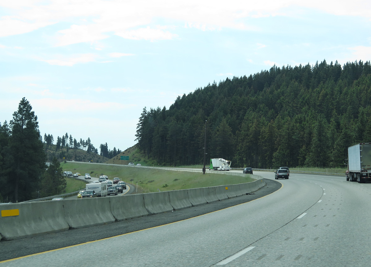
| Interstate 90 lowers from 2,000 feet above sea level near Exit 93 to 1,623 feet at Exit 101. Trucks are advised to use lower gear on the descent to Taneum Canyon. 06/28/15 |
|
| Taneum Road spans Interstate 90 between Thorp Cemetery Road and Thorp Prairie Road at Taneum Canyon. 06/28/15 |
|
| Crossing Taneum Creek along Interstate 90 east. Thorp Cemetery Road parallels to the south. 08/31/06 |
|
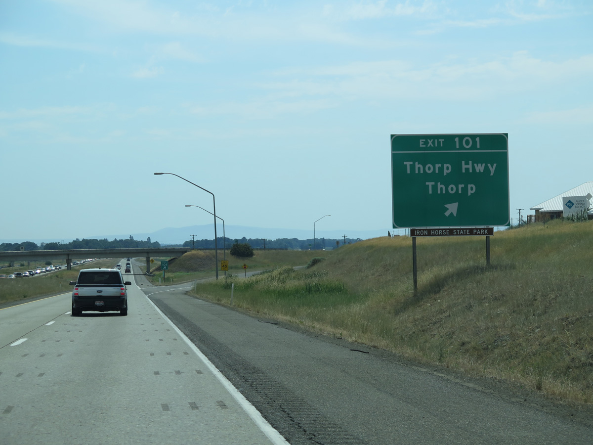
| Thorp Highway meanders five miles south from SR 10 (former U.S. 10) through the unincorporated community of Thorp to meet Interstate 90 at Exit 101. 06/28/15 |
|
| Beyond the diamond interchange at Exit 101, Thorp Highway continues 5.4 miles southeast across farm land to U.S. 97 at I-90. 06/28/15 |
|
| Agricultural areas spread south from Interstate 90 in the Kittitas Valley. 06/28/15 |
|
| Interstate 90 and the Yakima River come together twice more on the nine miles to Ellensburg. Spokane is 179 miles to the east. 06/28/15 |
|
| Interstate 90 east crosses the Yakima River ahead of milepost 103. 06/28/15 |
|
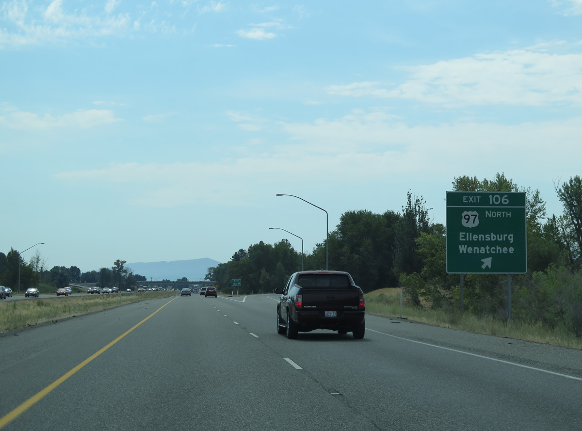
| U.S. 97 runs west then south from Wenatchee by way of the Wenatchee Mountains to combine with Interstate 90 at a trumpet interchange (Exit 106) west of Ellensburg. 06/28/15 |
|
| Exits 106 and 109 serve Ellensburg and its National Historic District via portions of old U.S. 10 (University Way, Main Street and Canyon Road). University Way east from U.S. 97 also represents a former Business Loop for Interstate 90. 06/28/15 |
|
| Exit 106 departs Interstate 90 east for both U.S. 97 north to Wenatchee and University Way east to Ellensburg and the campus of Central Washington University. 06/28/15 |
|
| Bypassing Ellensburg to the west, U.S. 97 south joins Interstate 90 east for 3.9 miles. 06/28/15 |
|
| The Yakima River appears by I-90/U.S. 97 just east of Exit 106. The 214 mile long river flows southward from Ellensburg to its namesake city, and eastward to Prosser and Richland, where it empties intot the Columbia River. 06/28/15 |
|
| Canyon Road heads south from Main Street in Ellensburg along former U.S. 10-97 and Business Loop I-90 to Interstate 90 at Exit 109. 06/28/15 |
|
| The folded diamond interchange at Exit 109 joins Canyon Road where it parallels a Washington Central Railroad line. Canyon Road leads south on old U.S. 97 and SR 821 to Thrall.
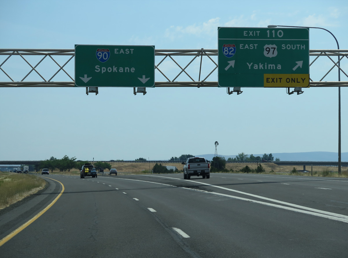
Exit 110 follows in one mile for I-82 and the separation with U.S. 97 south. 06/28/15 |
|
| I-90 east expands to three lanes leading into the trumpet interchange (Exit 110) with Interstate 82. Completed in 1988 to Hermiston, Oregon, I-82 leads south across Umtanum Ridge into the Yakima Valley. U.S. 97 splits with I-82 for Toppenish while freeway turns east with U.S. 12 to Sunnyside and the Tri-Cities. 06/28/15 |
|
| Providing part of a route between Seattle to Boise, Idaho and Salt Lake City, Utah, Interstate 82 travels 143 miles to I-84 in Oregon. U.S. 97 follows the freeway for 37 miles to Union Gap, where the route branches southward to Wapato, Goldendale and Bend, Oregon. 06/28/15 |
|
| The census designated place of Vantage is 25 miles east of I-82/U.S. 97 along Interstate 90 at Wanapum Lake along the Columbia River. 06/28/15 |
|
| Interstate 90 continues east across Kittitas Valley toward Johnson Canyon. 06/28/15 |
|
| Interstate 90 east next meets Main Street north and Cleman Road south at the city of Kittitas. 06/28/15 |
|
| Olmstead Place State Park lies midway between I-82 and Kittitas to the north of I-90 along Coleman Creek and Kittitas Highway. 06/28/15 |
|
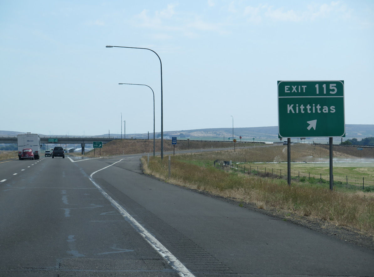
| Main Street leads 0.9 miles north from the diamond interchange at Exit 115 to the Kittitas city center. 06/28/15 |
|
| Interstate 90 advances 20.6 miles from the Main Street overpass at Kittitas to the succeeding exit at Vantage. 06/28/15 |
|
| The northern reaches of the Boylston Mountains rise east beyond agricultural areas in Kittitas Valley. 06/28/15 |
|
| Interstate 90 gains elevation east into Johnson Canyon. 06/28/15 |
|
| Boylston Road runs just south of I-90 east to Stevens Road in Johnson Canyon. 06/28/15 |
|
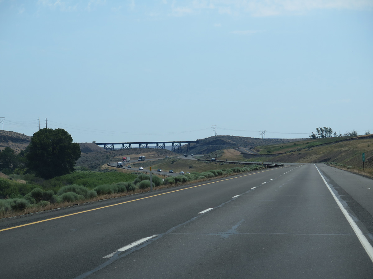
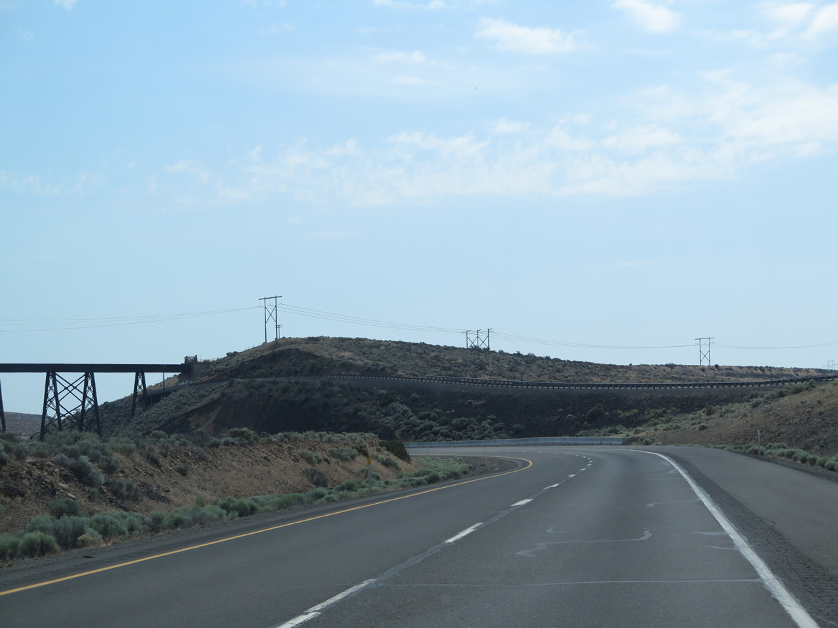
| The trestle along the former Chicago, Milwaukee, St. Paul & Pacific Railroad spans Interstate 90 from the old siding of Renslow. 06/28/15 |
|
| The former Chicago, Milwaukee, St. Paul & Pacific Railroad was converted into Palouse to Cascades State Park Trail. 06/28/15 |
|
| The Palouse to Cascades State Park Trail bridge across Interstate 90 in Johnson Canyon dates back to 1915. 06/28/15 |
|
| Ascending from Johnson Canyon, the roadways for Interstate 90 diverge. 06/28/15 |
|
| The Ryegrass Safety Rest Area is the second facility along eastbound Interstate 90. 06/28/15 |
|
| Interstate 90 crests at 2,535 feet above sea level at Ryegrass. 06/28/15 |
|
| With a 4% grade, the ensuing stretch of Interstate 90 lowers toward Vantage and Wanapum Lake. 06/28/15 |
|
| Old U.S. 10 travels over a mile north of Interstate 90 along Vantage Highway through Schnebly Coulee. 06/28/15 |
|
| Interstate 90 reaches the Moses Lake, the largest city in Grant County, in 49 miles. 06/28/15 |
|
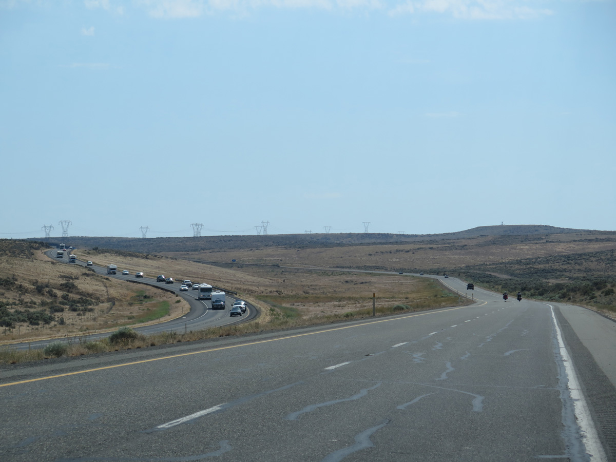
| The roadways for I-90 remain separate east into Ryegrass Coulee. 06/28/15 |
|
| The distance Saddle Mountains stretch across the southern horizon. 06/28/15 |
|
| The roadway separation through Ryegrass Coulee runs to the north of Ryegrass Mountain. 06/28/15 |
|
| Interstate 90 drops 1,300 feet in elevation through Ryegrass Coulee to 600 feet above sea level at Vantage. 06/28/15 |
|
| Interstate 90 drops 1,200 feet in elevation through Ryegrass Coulee to 600 feet above sea level at Vantage. 06/28/15 |
|
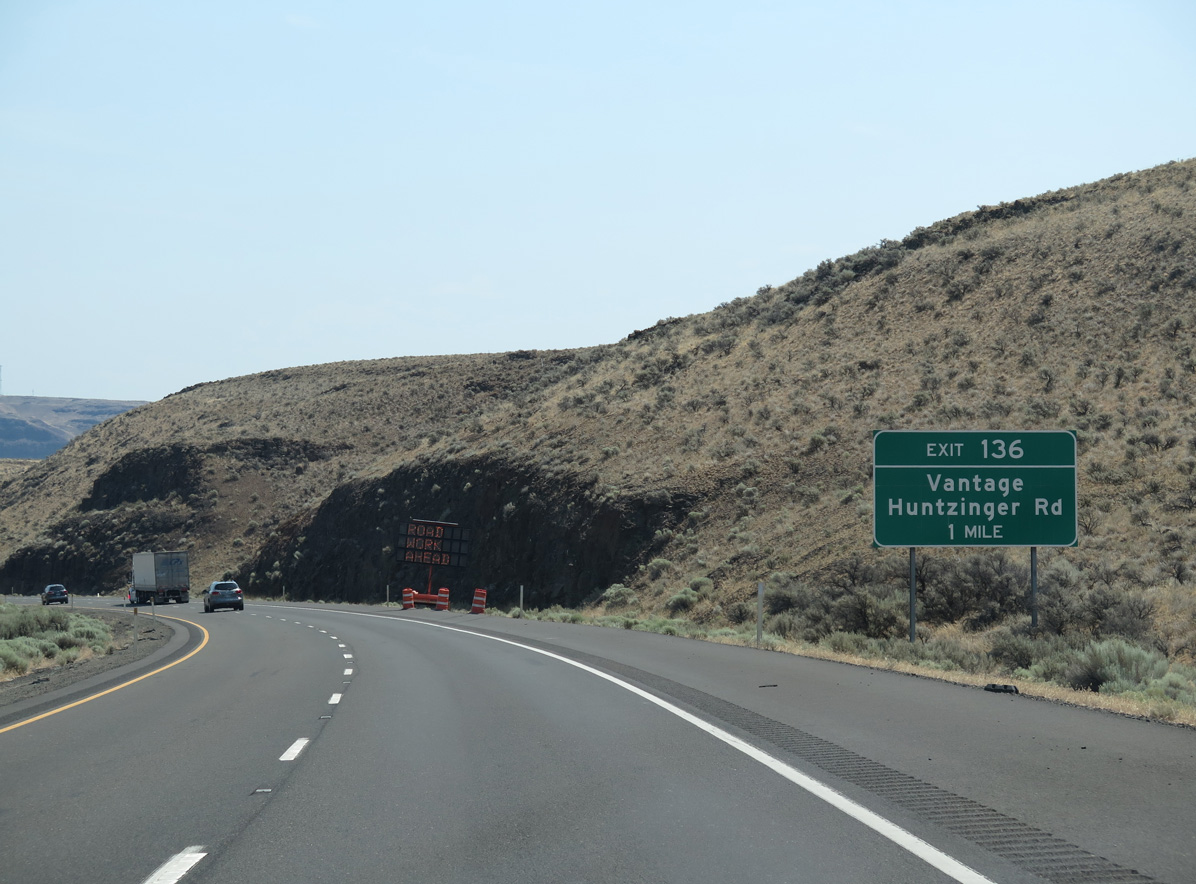
| Huntzinger Road parallels the Columbia River north from Sentinel Gap to a folded diamond interchange (Exit 136) with Interstate 90 at Vantage. 06/28/15 |
|
| Ginko Petrified Forest State Park spreads north from Vantage along Rocky Coulee and the Columbia River. 06/28/15 |
|
| Huntzinger Road becomes Main Street north from Exit 136 through Vantage. Main Street curves west to become Vantage Highway, the former route of U.S. 10 from Recreation Way to Ellensburg. 06/28/15 |
|
| The Vantage Bridge taking Interstate 90 across Wanapum Lake along the Columbia River comes into view at Exit 136. 06/28/15 |
Page Updated 07-12-2023.

 East
East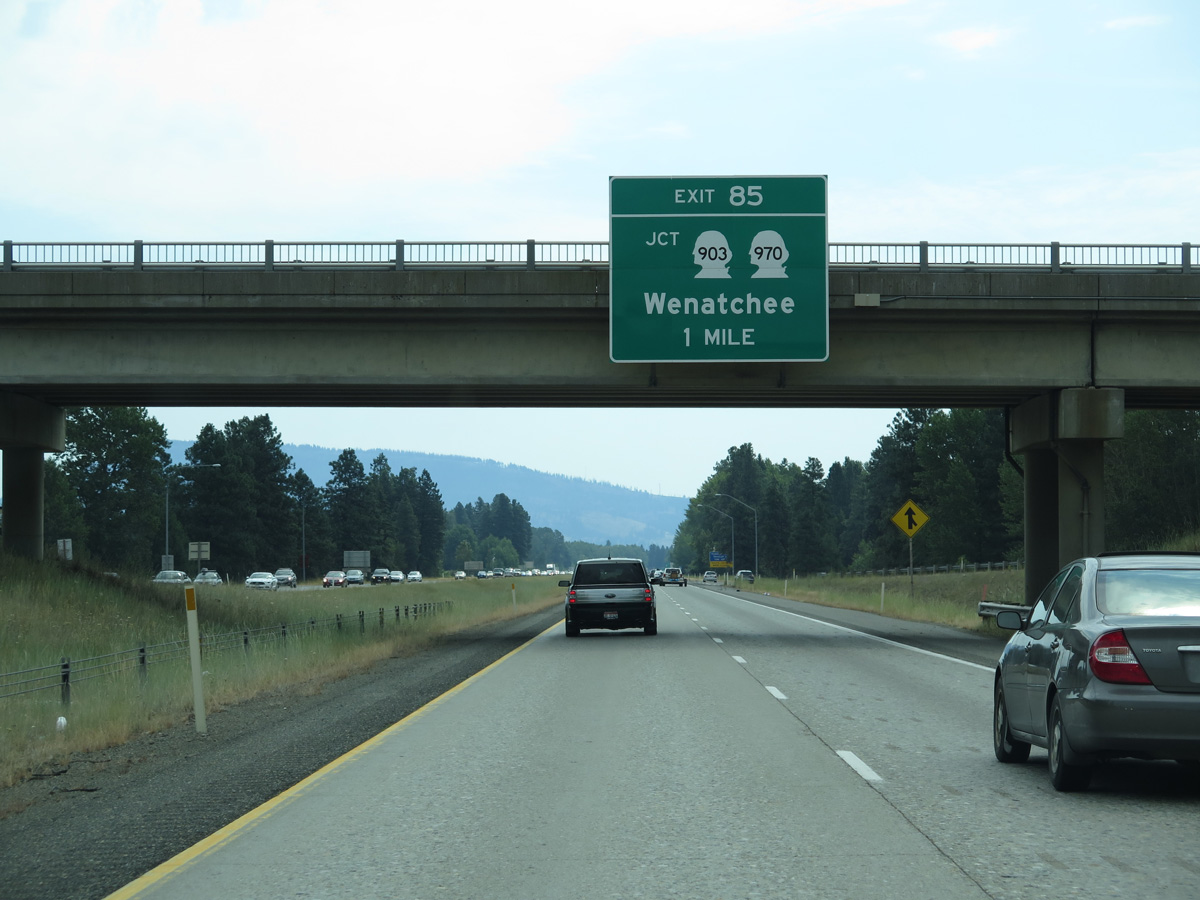


 South
South