

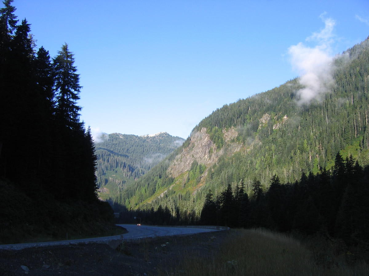
Interstate 90 east climbs onto Snoqualmie Summit in this scene near Franklin Falls. I-90 west straddles the hillside (out of view) of Denny and Granite Mountains. 08/13/06
27 miles of Interstate 90 opened between Ellensburg and Vantage on November 20, 1968 at a cost of $16 million. A dedication ceremony was held at the interchange with yet-to-be-opened Interstate 82. A 23.4 mile stretch of I-90 opened two days later between Fishtrap and Tokio.1
The Lacey V. Murrow Floating Bridge was the last major piece of Interstate 90 opened to traffic in Washington. The bridge was built as part of a $1.56 billion project for I-90 that included a tunnel, retaining walls, landscaped lids (tunnels) and bike/pedestrian trails that ran through 1996. The span across Lake Washington stretches 6,500 feet. The south bridge opened on September 12, 1993 with three overall eastbound lanes to compliment the 1989-completed north bridge (Homer M. Hadley Memorial Bridge) that does double duty with four westbound lanes and two eastbound carpool/bus lanes. The 1993 bridge consists of 25, 350-foot long floating concrete pontoons that replaced a 1940 bridge. The 1940 bridge was replaced because it partially sunk during stormy weather in November 1990 during a $35.6 million renovation project.2
Interstate 90 Washington Guides
East
Interstate 90 - Snoqualmie Pass East
$551 million in funding for the Snoqualmie Pass East Project to upgrade 15 miles of Interstate 90 between Hyak and Eaton was secured in 2005. The work expands the freeway by an additional lane in each direction, replaces aging concrete, adds or replaces existing bridges and culverts, and reduces winter avalanche closures by constructing new bridges to supplant the existing snowshed along I-90 west by Keechelus Lake. Interstate 90 along this stretch overtook U.S. 10, which was four-laned during the 1950s and 1960s.
Broken into three stages, Phase 1 improved I-90 between Hyak and Keechelus Dam, covering the stretch along Keechelus Lake. This work included straightening sharp curves and stabilizing rock cuts in addition to the aforementioned project elements. Construction commenced in Spring 2009 and extended through Fall 2017.
$108 million in cost savings made with the first phase allowed WSDOT to focus on the next two miles (Phase 2A) from Keechelus Dam to Stampede Pass. Work here included the construction of a new wildlife overpass at the Price Creek Snopark. Phase 2B continued work another 2.5 miles eastward to the Cabin Creek Interchange. The 2013 schedule outlined construction between Spring 2015 and Fall 2020.
Phase 3, between Milepost 64.4 and Easton, includes additional wildlife crossings, extending truck climbing lanes and replacing low-clearance bridges. The project web site indicates that Phase 3 is underway as of 2023.

Business Loop Interstate 90 - Moses Lake
The best signed business loop for Interstate 90 in Washington is the six mile loop along old U.S. 10 through Moses Lake. The route follows Broadway northeast from Exit 176 along SR 171 to downtown and Pioneer Way southward, part of which doubles as SR 17, to Exit 179. Signage varies between the standard green and white shields and tri-color Interstate shields.
| Business Loop I-90 east & SR 171 north |
 | A reassurance guide sign for Business Loop I-90 & SR 171 appears at Broadway and Driggs Drive. Small guide signs are used throughout the business loop in place of stand alone shields. 09/01/06 |
 | Business Loop I-90 west ends with SR 171 at a diamond interchange (Exit 176) with Interstate 90. Originally a wye served the westbound on-ramp and a half diamond interchange connected with I-90 east at Wapato / Driggs Drive. 09/01/06 |
 scenes scenes |
 | Asahel Curtis Road south at the diamond interchange with Interstate 90 within Mt. Baker-Snoqualmie National Forest. Exit 47 includes a chain-up area. 08/28/06 |
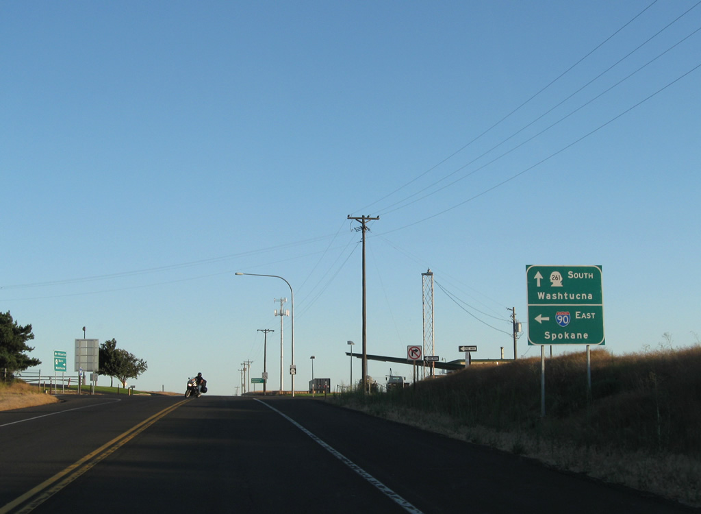
 | SR 261 ends at a diamond interchange (Exit 221) with Interstate 90. The westbound ramp to the freeway departs from Weber Avenue rather than SR 261 directly. 08/03/11 |
 | Division Street (former Business Loop I-90) in Ritzville southbound meets Interstate 90 & U.S. 395 at Weber Avenue. The westbound ramp joins the freeway ahead of the I-90 and U.S. 395 split for Moses Lake and Pasco. 08/03/11 |
 | Continuing from underneath Interstate 90 & U.S. 395, SR 261 approaches the eastbound ramp to Spokane. U.S. 395 is omitted from signage here despite the overlap to Exit 281. 08/03/11 |
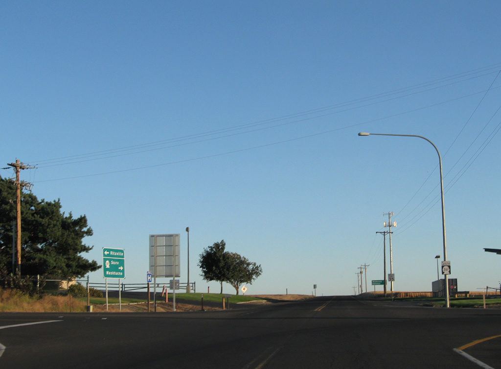 | SR 261 leaves Ritzville and the interchange with Interstate 90 & U.S. 395 for a 27 mile drive to Washtucna. Kahlotus is referenced on the following distance sign for the connection with SR 260 west. 08/03/11 |
- "Interstate Opens Near Ellensburg." The Spokesman-Review, November 21, 1968.
- "New bridge is the last link in I-90." Lewiston Morning Tribune, September 10, 1993.
Photo Credits:
08/28/06, 09/01/06, 08/03/11 by AARoads
Connect with:
Interstate 5
Interstate 82
Interstate 405
U.S. 395
State Route 290
Page Updated 07-13-2023.