|
| Exit 299 joins Interstate 90 with Appleway Avenue (old U.S. 10) west into the city of Liberty Lake. The exit included a mid-1970s constructed weigh station along the on-ramp from Spokane Bridge Road. That facility was replaced with a new Port of Entry-Weigh Station along the freeway mainline just to the west by September 2011.1 09/01/06 |
|
| Spanning the Spokane River, Interstate 90 enters Washington 297.51 miles from the west end in Seattle. 09/01/06 |
|
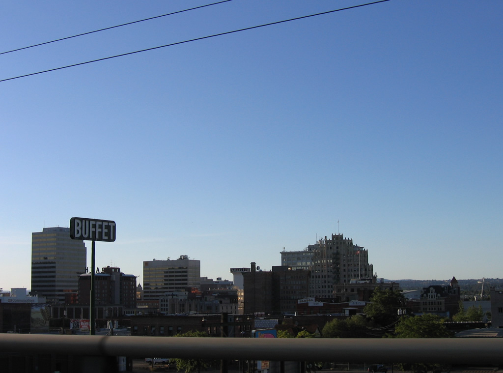
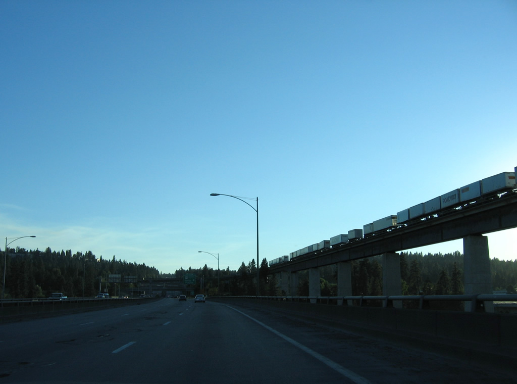
| Spokane County is the first of six Interstate 90 travels through in the Evergreen State. 09/01/06 |
|
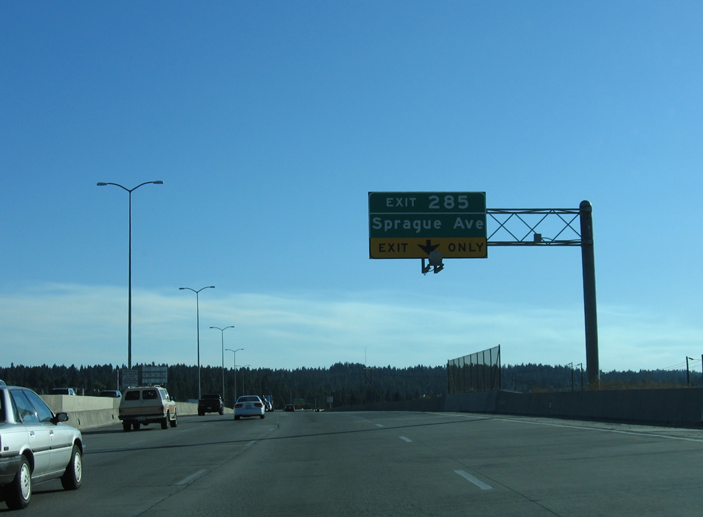
| Westbound distance sign posted where a weigh station opened in 2011. The freeway travels through Liberty Lake and Spokane Valley to Exit 285 before entering the city of Spokane. 09/01/06 |
|
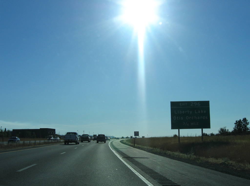
| Harvard Road south and Liberty Lake Road north come together at a parclo interchange (Exit 296) at Liberty Lake in 0.75 miles. 09/01/06 |
|
| Liberty Lake Road leads south from Interstate 90 and adjacent Appleway Avenue (old U.S. 10) to Liberty Lake. Harvard Road connects the freeway with Wellesley Avenue at the community of Otis Orchards. 09/01/06 |
|
| Construction of Interstate 90 directly overlaid old U.S. 10 from Exit 296 to the wye interchange (Exit 294) with Appleway Avenue (Business Loop I-90) west into Spokane Valley. Appleway Avenue was designated as an extension of Business Loop I-90 through Spokane Valley as approved by AASHTO on May 5, 2013. 09/01/06 |
|
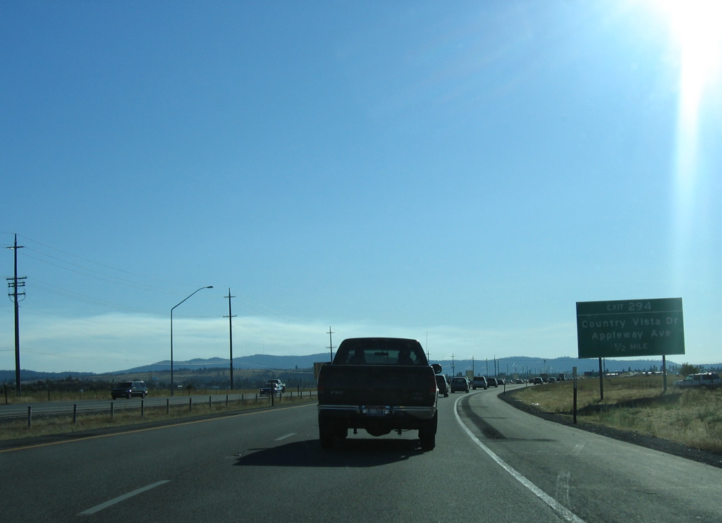
| Exit 294 leaves Interstate 90 west for Appleway Avenue west and Country Vista Drive east into Liberty Lake. Appleway Avenue is the old U.S. 10 southwest to Sprague Avenue through Spokane Valley. 09/01/06 |
|
| Midway between Exit 294 and Exit 293 to Barker Road, Interstate 90 enters the city of Spokane Valley. Incorporated on March 31, 2003, the city of Spokane Valley grew from a population of 89,755 per the 2010 census to 103,778 in 2020. 09/01/06 |
|
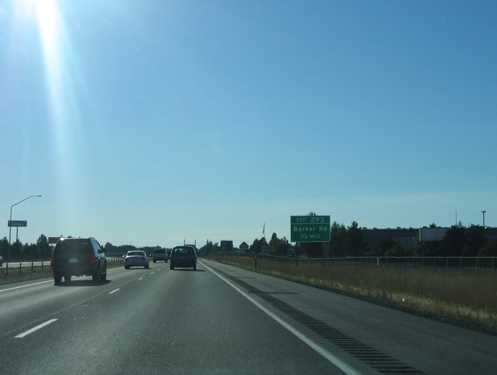
| Barker Road serves the east side of Spokane Valley from SR 290 (Trent Avenue) northward to 32nd Avenue outside the city. A parclo interchange joins Interstate 90 with the road at Cataldo Avenue, a north side frontage road. 09/01/06 |
|
| Interstate 90 bends northward from the Greenacres area in Spokane Valley to area around Spokane Valley Mall at Exit 291 B for Sullivan Road and Exit 291 A for Evergreen Road. This stretch of freeway was expanded to six overall lanes in 2011. 09/01/06 |
|
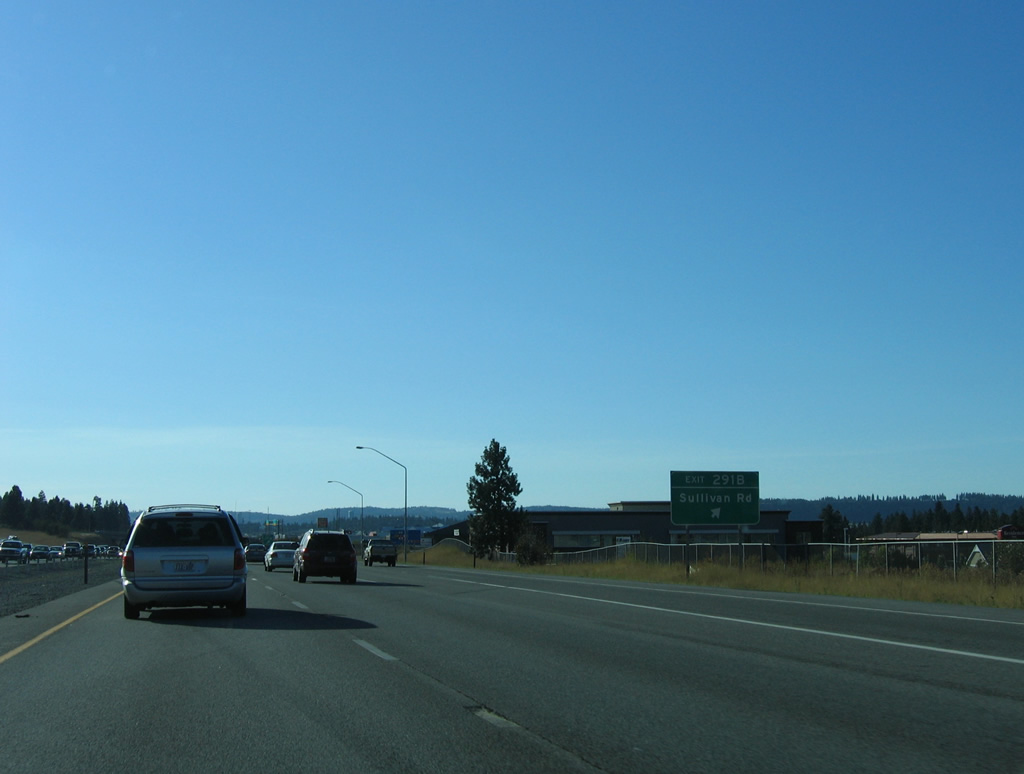
| Exit 291B connects Interstate 90 west with both Sullivan Road and Indiana Avenue. Sullivan Road heads south through the industrial north side of Spokane Valley to Veradale, where the arterial meets Sprague Avenue (old U.S. 10) at a commercialized intersection. Indiana Avenue parallels the freeway westward to Spokane Valley Mall. 09/01/06 |
|
| I-90 passes by Spokane Valley Mall ahead of the diamond interchange (Exit 291 A) with Evergreen Road. Evergreen Road was expanded to five lanes and connected with I-90 via a new exchange after the mall opened in 1997. Exit 291 A was completed on May 4, 2001. 09/01/06 |
|
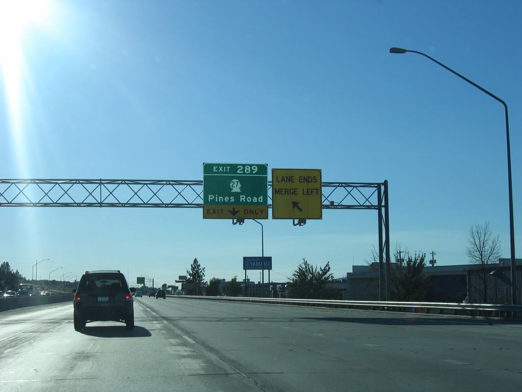
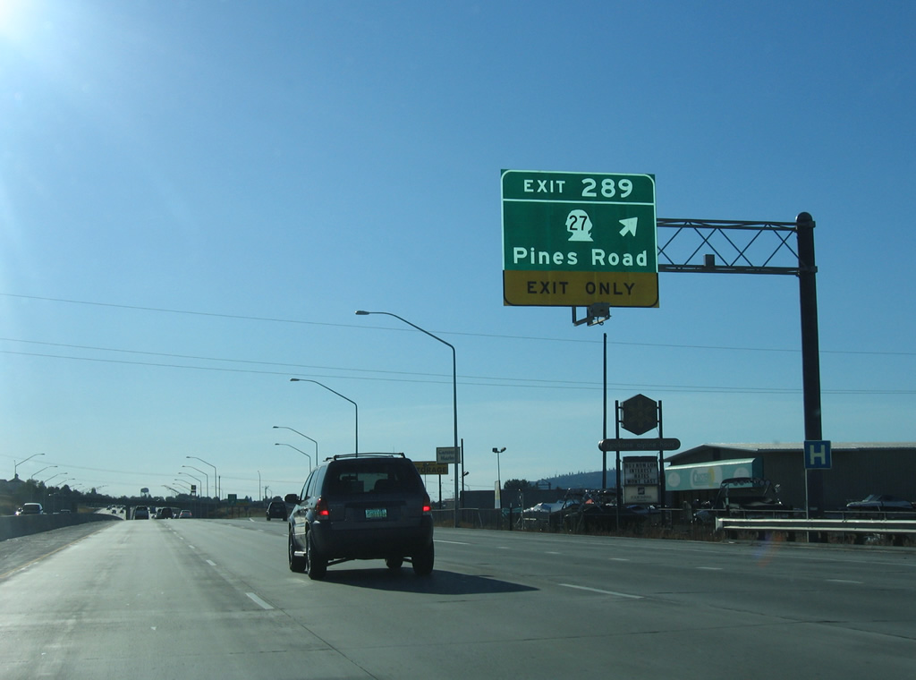
| The succeeding exit along I-90 west is the modified diamond interchange with Indiana Avenue, Montgomery Drive and SR 27 (Pines Road). 09/01/06 |
|
| SR 27 comprises a 89.7 mile route from SR 290 (Trent Avenue) in Spokane Valley to U.S. 195 south of Pullman. Through Spokane Valley, SR 27 follows Pines Road, a commercial arterial leading south to 16th Avenue and a semi controlled access route southeast from there. 09/01/06 |
|
| Exit 289 was redesigned between 2007 and 2009 to realign the ramps from Interstate 90 west onto parallel Indiana Avenue / Montgomery Drive. The two side roads come together at SR 27 (Pines Road) just north of the freeway overpass. 09/01/06 |
|
| Widening of Interstate 90 between Sullivan and Argonne Roads took place between August 2003 and November 15, 2005. 09/01/06 |
|
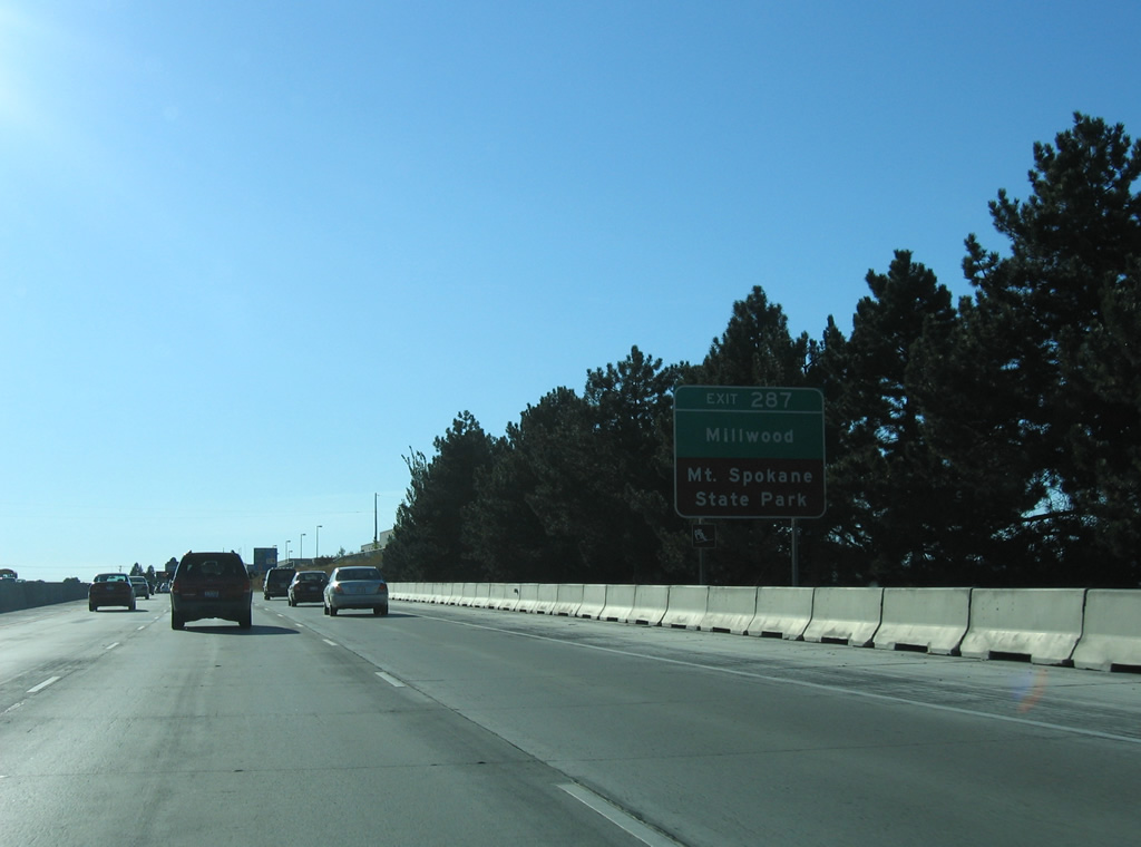
| Argonne Road leads north from Interstate 90 into the city of Millwood. North from there, the road crosses the Spokane River into Pasadena Park, eventually becoming Bruce Road en route to SR 206 (Mt. Spokane Park Drive). SR 206 spurs northeast from U.S. 2 near Mead to Mt. Spokane State Park. 09/01/06 |
|
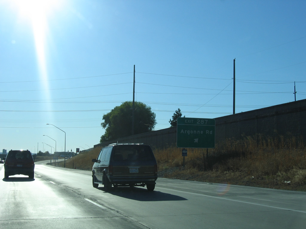
| A diamond interchange joins Interstate 90 with Argonne Road at Exit 287. Argonne Road forms a commercialized couplet with Mullan Road from Interstate 90 southward to Dishman and the Valley Couplet (Business Loop I-90) of Sprague Avenue west and Appleway Boulevard east. 09/01/06 |
|
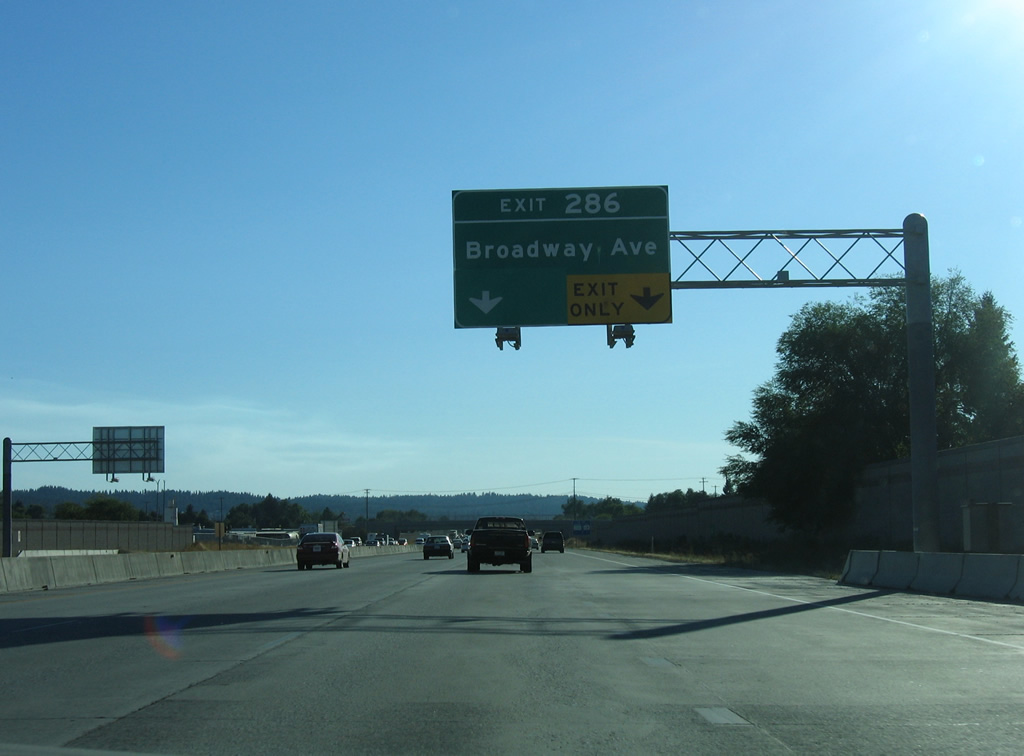
| Turning back toward the south, Interstate 90 continues to the parclo interchange (Exit 286) with Broadway Avenue. 09/01/06 |
|
| West from Exit 286, Broadway Avenue continues through an industrial area to Interstate Fairgrounds at Havana Street. Interstate Fairgrounds is home to Avista Stadium, a minor league ball park. Eastward the road becomes more residential beyond Park Road. 09/01/06 |
|
| The final Spokane Valley exit joins Interstate 90 west with Sprague Avenue (Business Loop I-90 and old U.S. 10) via Fancher Road north. A four-stage project included widening of I-90 between Broadway Avenue and Exit 285 and redesign of the interchange at Sprague Avenue between 1997 and October 15, 2001. 09/01/06 |
|
| Sprague Avenue continues Business Loop I-90 west as an unsigned route into Spokane. Completed October 11, 2000, the Sprague Avenue to the east was converted to one way traffic during construction of the Valley Couplet, which added Appleway Boulevard, a four lane eastbound arterial between I-90 and University Road. 09/01/06 |
|
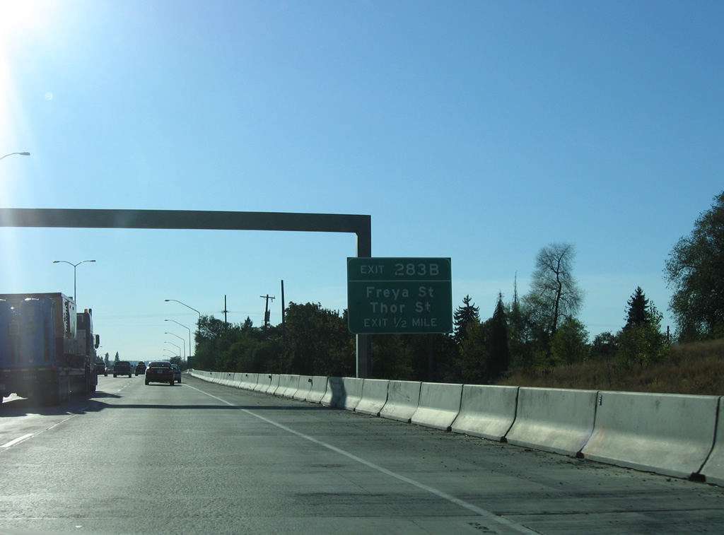
| I-90 crosses the Spokane city line at the Havana Street underpass. An off-ramp originally joined westbound with Havana Street via parallel 3rd Avenue. It was removed during the 1997-2001 reconstruction of the freeway at Sprague Avenue, leaving Exit 283 B as the next westbound off-ramp at Freya Street and 2nd Avenue. 09/01/06 |
|
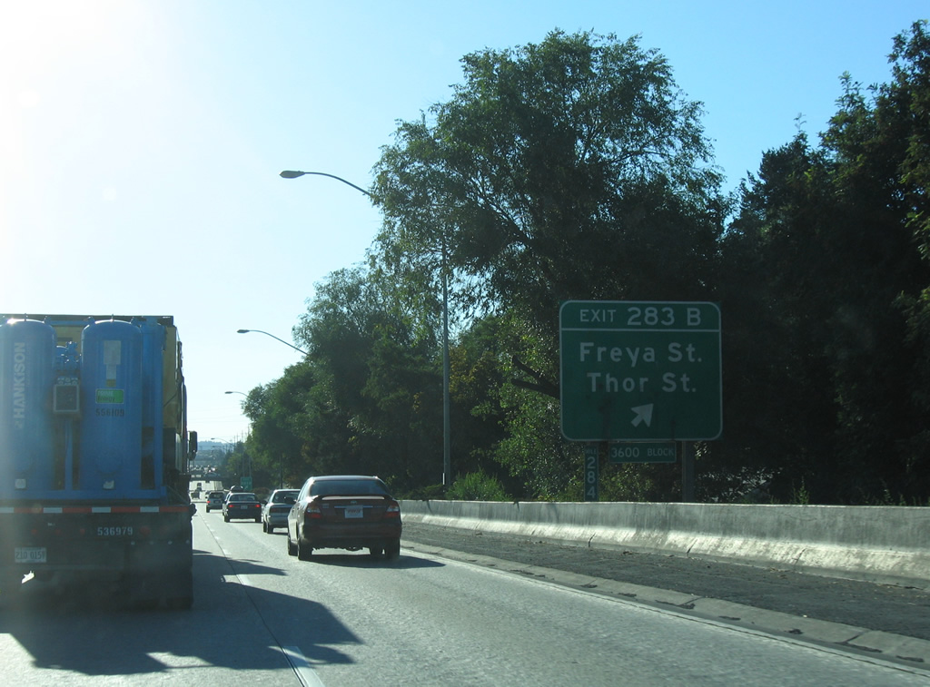
| Exit 283 B is a split diamond interchange with Freya Street north to Spokane Community College and the Garry Park and Hillyard neighborhoods, and Thor Street south to East central and Lincoln Park. 09/01/06 |
|
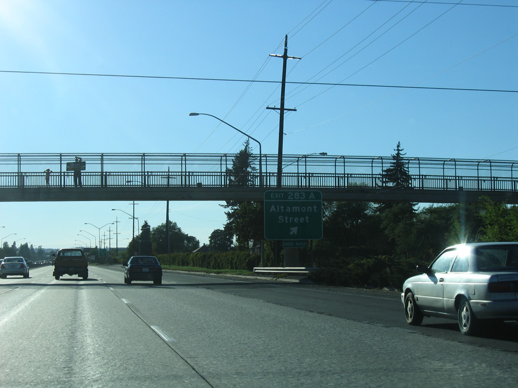
| The split diamond interchange (Exit 283 A) for Altamont Street utilizes ramps with parallel 2nd and 3rd Avenues between Smith and Crestline Streets for the East Sprague and East Central neighborhoods. 09/01/06 |
|
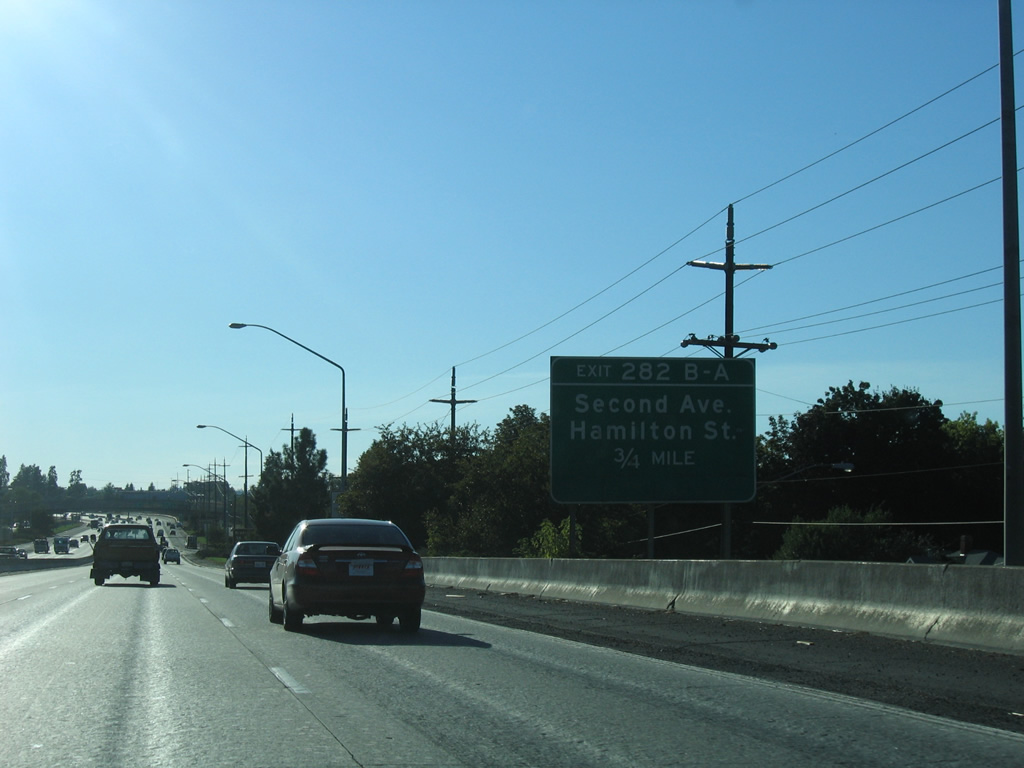
| 2nd Avenue and Interstate 90 diverge at Exit 282 B in three quarters of a mile. The westbound street becomes a part of unsigned Business Loop I-90 west from Sprague Way into Downtown Spokane. 09/01/06 |
|
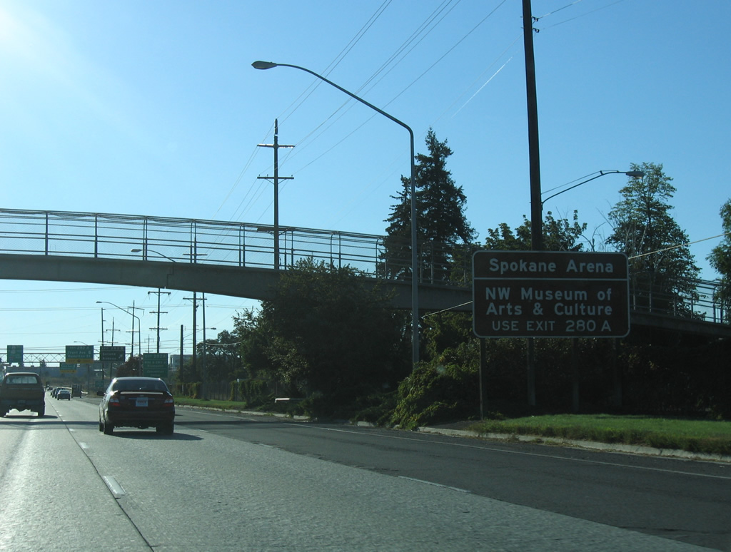
| Motorists are advised to remain along I-90 west beyond the directional T interchange (Exit 282 A) with SR 290 east for Exit 280 A for Spokane Arena and the Northwest Museum of Arts & Culture. 09/01/06 |
|
| Beginning at Exit 282 A, SR 290 spurs north along a short expressway spanning the Spokane River to Hamilton Street at Spokane Falls Boulevard. Spokane Falls Boulevard leads west to the convention center and Washington State University at Spokane while Hamilton Street continues north to the Gonzaga and Logan neighborhoods. 09/01/06 |
|
| SR 290 travels 18.38 miles overall from I-90 in Spokane to Spokane Valley, Millwood and the Idaho state line east of Moab. The expressway link to Trent Avenue was constructed in anticipation of the original North Spokane Freeway. 09/01/06 |
|
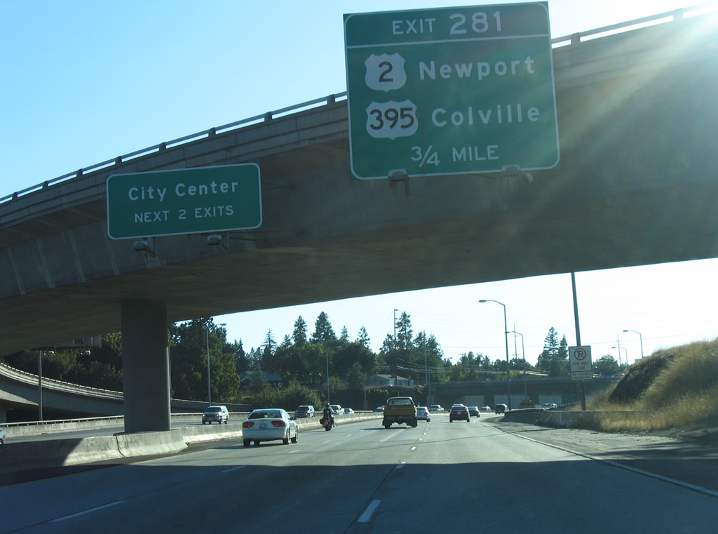
| Advancing west, I-90 passes south of Downtown Spokane and meets U.S. 2/395 at Exit 281. U.S. 2/395 presently follow Division Street, and a combination of Division with Brown and Ruby Streets north to Emerson Garfield, North Hill and Shiloh Hills in north Spokane. Upon completion of the North Spokane Corridor freeway, both routes will shift to the east. 09/01/06 |
|
| Points of interest served by Exit 281 include Riverfront Park and Spokane River Falls, Riverside State Park, Gonzaga University and Whitworth College. 09/01/06 |
|
| U.S. 2/395 overlap 6.1 miles north from Interstate 90 to the Country Homes community in north Spokane. U.S. 2 branches northeast from there to Colbert and Newport while U.S. 395 turns more westerly to Deer Park, Loon Lake and Colville. 09/01/06 |
|
| U.S. 2/395 combine with Interstate 90 west from Browne Street south to bypass Downtown Spokane along an elevated roadway.. 09/01/06 |
|
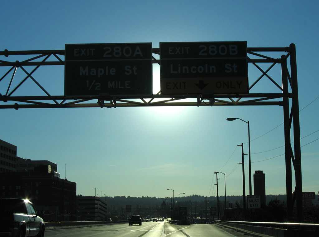
| Exit 280 B lowers from the westbound viaduct onto Lincoln Street north at 3rd Avenue (Business Loop I-90 east). Lincoln Street heads north through the city center to River Park Square.
Exit 280 A follows for 4th Avenue west at Walnut Street north to the Maple Street Bridge and Maple Street south to Cannon Hill. 09/01/06 |
|
| Leaving the split diamond interchange (Exit 280 A) with Walnut and Maple Streets, I-90/U.S. 2-395 proceed a half mile west to the north end of U.S. 195 at Exit 279. 09/01/06 |
|
| A BNSF Railroad curves southward over I-90/U.S. 2-395 ahead of the Inland Empire Way under crossing. Inland Empire Way is the former alignment of U.S. 195 bypassed an expressway to the west. 09/01/06 |
|
| I-90/U.S. 2-395 span Hangman Creek adjacent to a high level BNSF Railroad bridge. 09/01/06 |
|
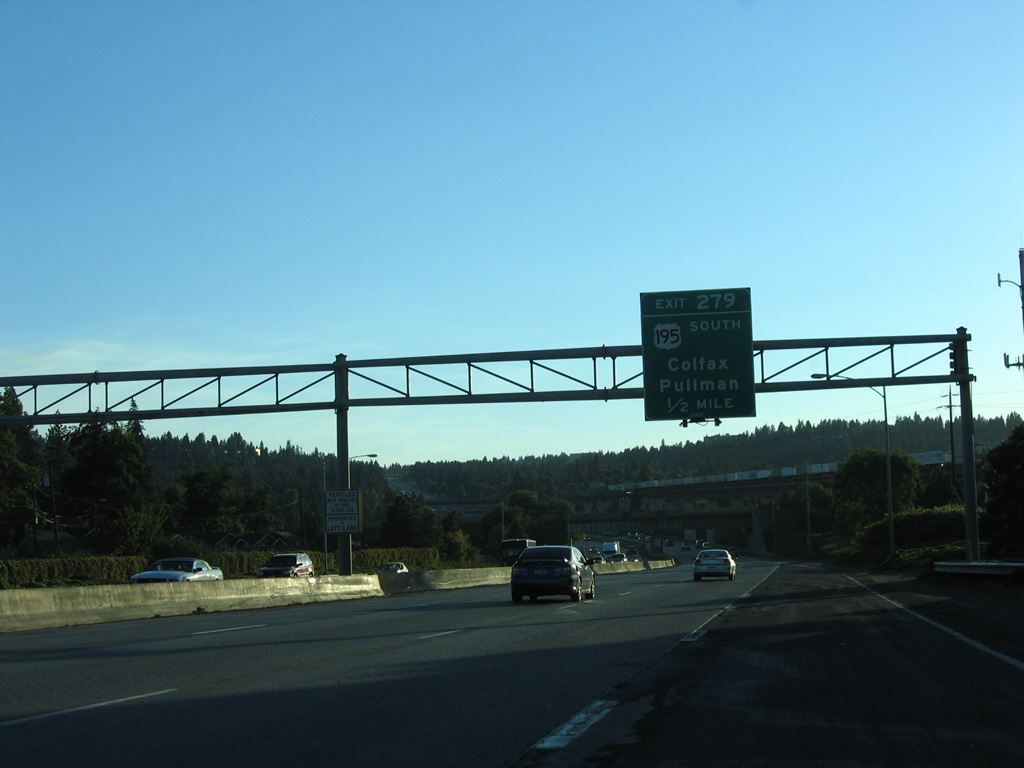
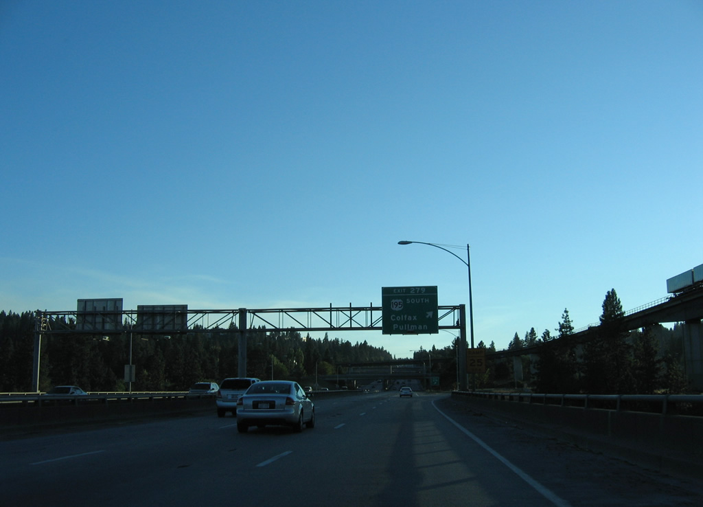
| A trumpet interchange joins I-90 with U.S. 195 south to Colfax and Pullman at Exit 279. U.S. 195 travels 95 miles overall between Spokane and U.S. 95 outside Lewiston, Idaho. The route originally continued north with U.S. 2 to Newport and U.S. 95 in Idaho. 09/01/06 |
|
| U.S. 2 part ways with I-90/U.S. 395 west at forthcoming Exit 277. The trumpet interchange includes a loop ramp to Garden Springs Road for parallel Sunset Boulevard (Business Loop I-90 / old U.S. 2-10-395) at the community of Garden Springs. 09/01/06 |
|
| U.S. 2 follows a short expressway leading northwest from I-90/U.S. 395 to Sunset Highway and Airport Drive, the access road to Spokane International Airport (GEG). 09/01/06 |
|
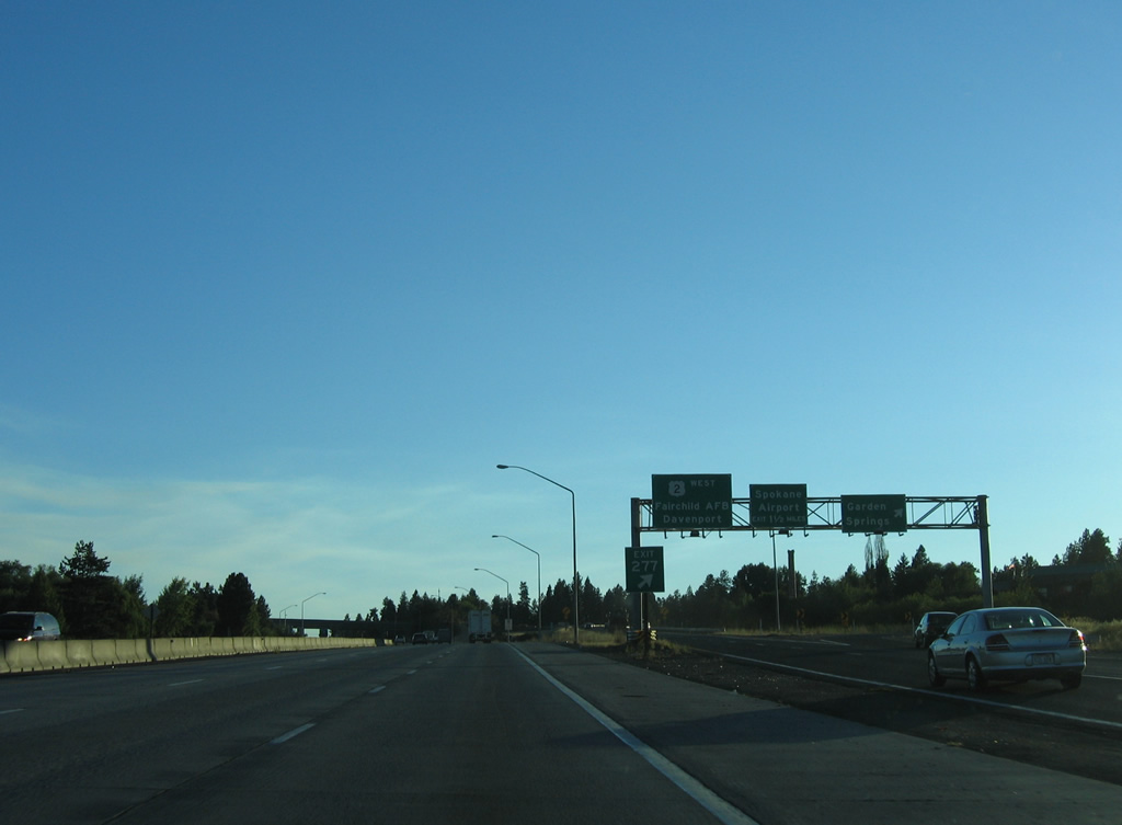
| U.S. 2 joins Sunset Highway west to Airway Heights and Fairchild Air Force Base. Grand Coulee Dam is located to the northwest via U.S. 2 west 62 miles to Wilbur and SR 174 north from there. 09/01/06 |
|
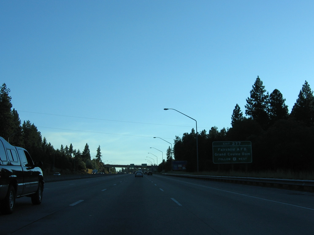
| Exit 277 departs I-90/U.S. 395 south at the Garden Springs Road overpass. U.S. 2 travels 326 miles across the Evergreen State, leading west from Spokane to Davenport, Waterville, Monroe and I-5 at Everett. 09/01/06 |
|
| A loop ramp to Garden Springs Road departs beyond Exit 277 as U.S. 2 overtakes Sunset Highway (old U.S. 2 to the east) to the northwest. A wye interchange links U.S. 2 with Airport Drive in 1.5 miles. 09/01/06 |
|
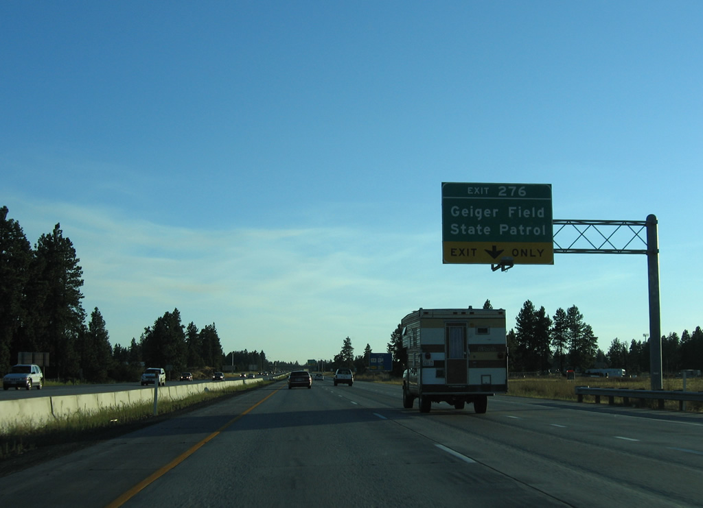
| Business Loop I-90 from Spokane returns to I-90 at Exit 276 via Grove Road south from parallel Geiger Boulevard. Geiger Boulevard (old U.S. 10/395) comprises a freeway frontage road from south of Geiger Field to SR 902 and Exit 272. 09/01/06 |
|
| The parclo interchange (Exit 276) with Grove Road utilizes roundabouts at both ramp ends. Grove Road becomes Flightline Boulevard west into the back side of Geiger Field, the original name of Spokane International Airport (GEG). Grove Road south heads to Geiger Heights and Marshall. 09/01/06 |
|
| The first distance sign posted since Spokane references Ritzville, where U.S. 395 splits for the Tri-Cities in 56 miles, and the west end of I-90 at Seattle in 275 miles. 09/01/06 |
|
| SR 902 branches west from the diamond interchange at Exit 272 in one mile. The state route forms a 12.40 mile long loop west from I-90 to the city of Medical Lake. 09/01/06 |
|
| Exit 272 leaves I-90/U.S. 395 south for SR 902 west and Aero Road east to a handful of traveler services and subdivisions. 09/01/06 |
|
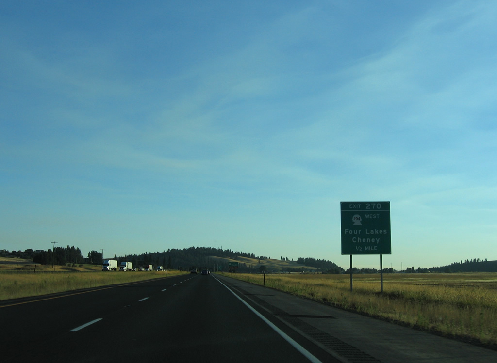
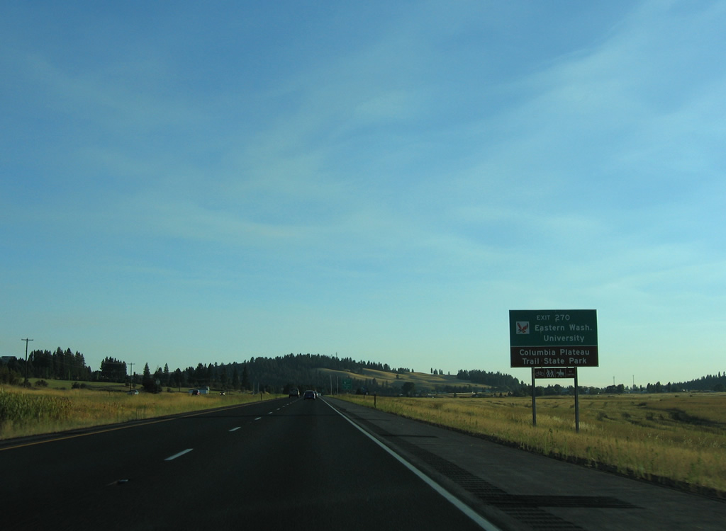
| Wrights Hill appears along I-90/U.S. 395 ahead of the trumpet interchange (Exit 270) with SR 904 at the community of Four Lakes. 09/01/06 |
|
| SR 904 heads south six miles to the city of Cheney, which is home to Eastern Washington University and the trail head of Columbia Plateau Trail State Park, a 130 mile linear park along the former Spokane, Portland and Seattle Railway. 09/01/06 |
|
| SR 904 loops 16.96 miles south of I-90/U.S. 395 through Four Lakes, Cheney and Tyler along the former alignment of U.S. 10/395. 09/01/06 |
Page Updated 06-26-2013.

 West
West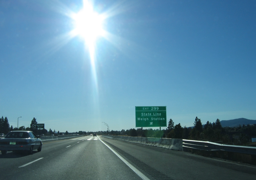


 West
West  South
South