|
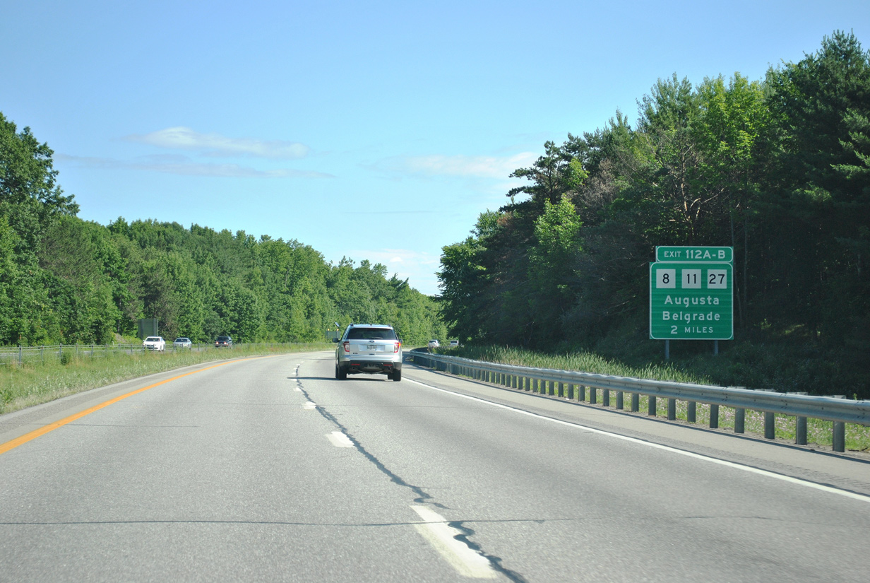
| The Maine Turnpike extends north along Interstate 95 to Exit 113 as an untolled route. Exits 112A/B join the freeway next with Maine 8-11-27 (Civic Center Drive) near the University of Maine at Augusta. 07/01/12 |
|
| One southwest of the parclo interchange (Exit 112) with Maine 8-11-27 on I-95 north at the crossing over Bond Brook. The state route trio travel Civic Center Drive north from Downtown Augusta to North Augusta and West Sidney. The three routes share pavement from West Sidney to Belgrade near Messalonskee Lake. 07/01/12 |
|
| Exit 112A departs Interstate 95 north for Civic Center Drive south toward central Augusta. Maine 8-11-27 split at Downtown; Maine 11 joins U.S. 202 & Maine 17 (Western Avenue) south to Augusta State Airport (AUG) and I-95 at Exit 109. Maine 27 joins U.S. 201 south to Hallowell. Maine 8 meanwhile ends at Memorial Circle in Downtown at the intersection of Maine 11 and 27 with U.S. 201 & 202 and Maine 17. 07/01/12 |
|
| Northbound at the loop ramp (Exit 112B) onto Maine 8-11-27 (Civic Center Drive) north to Belgrade. Beyond Belgrade, Maine 27 continues northwest to U.S. 2 at New Sharon; Maine 8 & 11 veer northeast along Messalonskee Lake together before parting ways to Norridgewock and Oakland respectively. 06/27/05 |
|
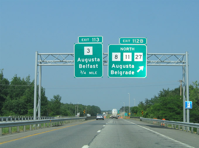
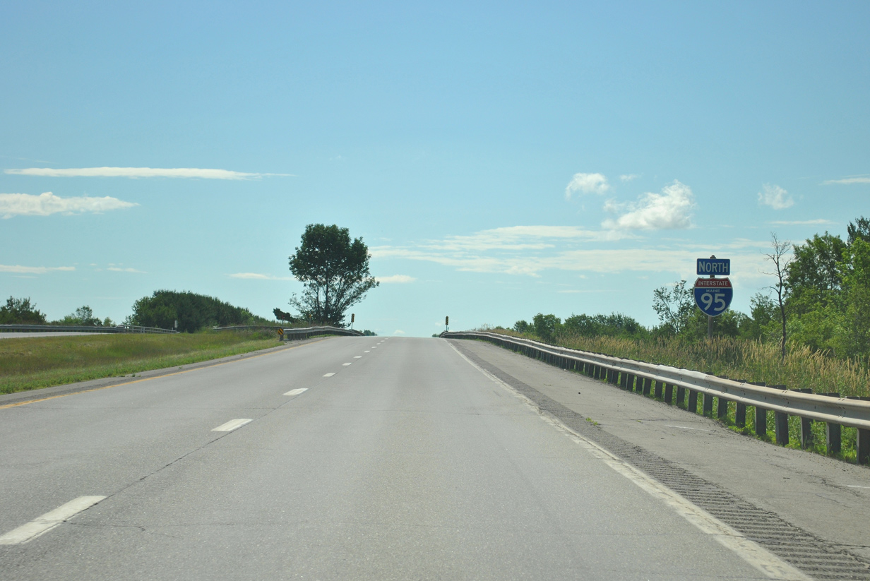
| Interstate 95 continues north to the 2004-constructed Maine 3 expressway bypass of Augusta. Maine 3 provides a major route between I-95 and the coast at Belfast. The north Augusta bypass of SR 3 doubles as a truck route since 2004 legislation extended the Maine Turnpike designation northward on I-95 from Exits 109 to 113. The extension, in conjunction with SR 3, allows vehicles exceeding 100,000 pounds to use the two roads to bypass Downtown Augusta. Previously commercial trucks were required to depart Interstate 95 at Exit 109.1 07/01/12 |
|
| Originally a trumpet interchange joined the western terminus of Maine 3 with Interstate 95 at Exit 113. A $13 million project in 2013 redesigned Exit 113 into a parclo interchange with roundabouts at the ramp ends. The new traffic pattern ties the interchange in with Old Belgrade Road to the west.2 07/01/12 |
|
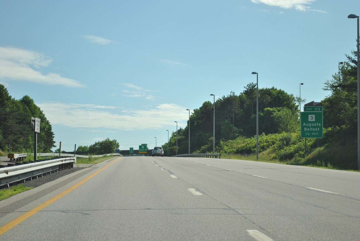
| Maine 3 spans the Kennebec River and meets U.S. 201 to the east in north Augusta. U.S. 202 and SR 3 join paths from Augusta east to South China. Long distance interests to Ellsworth, Bar Harbor, and Acadia National Park should use SR 3 east to its merge with U.S. 1 north. 07/01/12 |
|
| Interstate 95 enters a moose crossing zone from Augusta area through Sidney. Signs such as this advise motorists of the potential late night incursions. 07/01/12 |
|
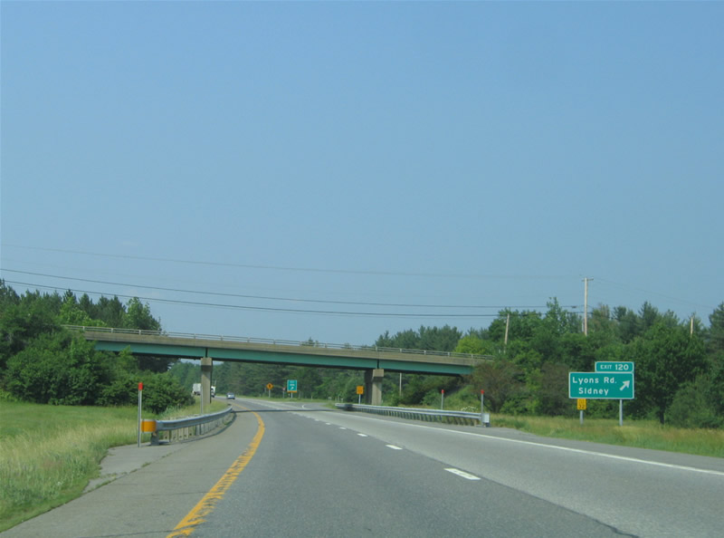
| Lyons Road meets Interstate 95 at a parclo interchange (Exit 120) near Sidney Center. Sidney lies between Messalonskee Lake and the Kennebec River. 06/27/05 |
|
| Exit 120 departs Interstate 95 northbound for Lyons Road. Lyons Road travels east-west between Maine 104 (River Road) and Middle Road in north Sidney. 06/27/05 |
|
| Northbound reassurance marker posted along Interstate 95 north of Lyons Road. 06/27/05 |
|
| Interstate 95 next encounters the city of Waterville along its northbound trek toward Bangor. Waterville is home to both Colby College and Thomas College. 06/27/05 |
|
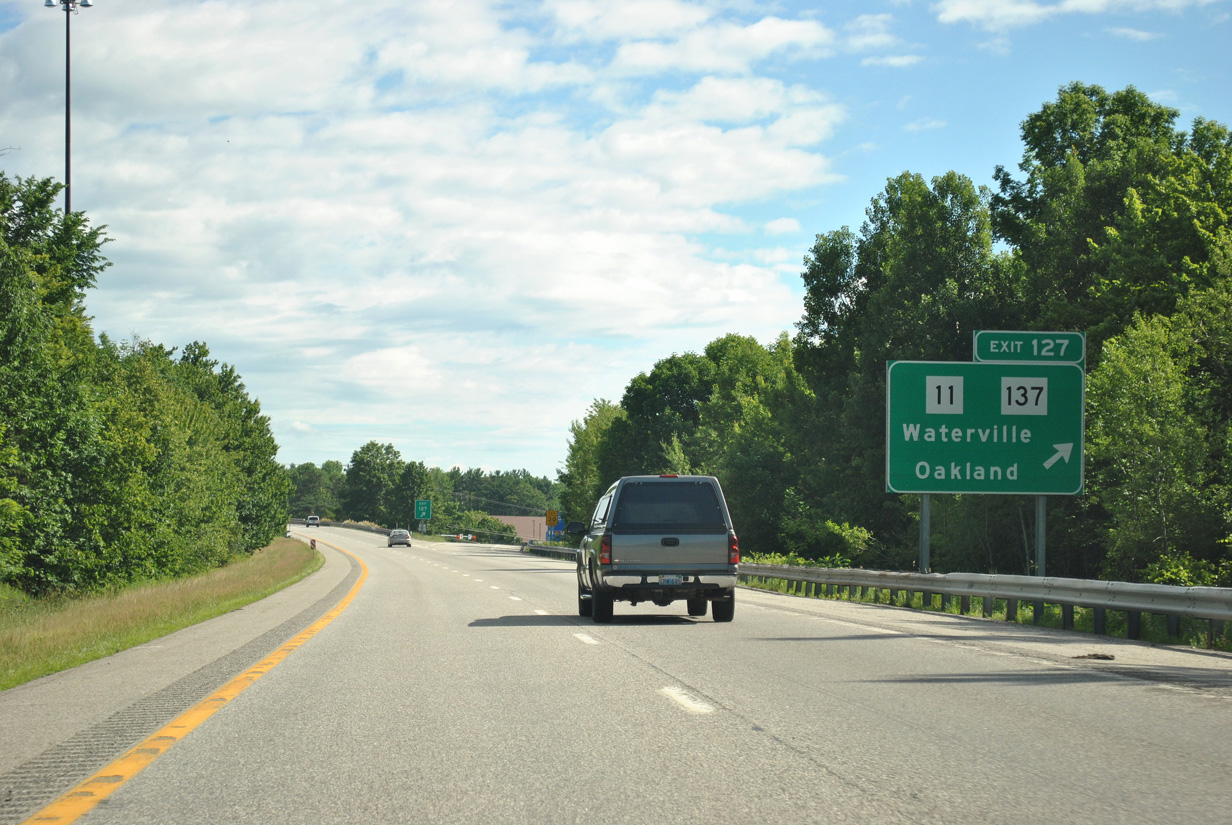
| The first of two Waterville area interchanges joins Interstate 95 with Maine 11 & 137 (Kennedy Memorial Drive) near Waterville Robert Lafleur Airport (WVL). Maine 11 & 137 combine between the town of Oakland to the west and south Waterville (Maine 104) to the east. Maine 137 joins Waterville and Oakland with Smithfield and U.S. 2 near Mercer. 07/01/12 |
|
| Exit 127 consists of a parclo interchange between Interstate 95 and Maine 11 & 137 (Kennedy Memorial Drive) in south Waterville. Maine 11 follows Maine 104 north along Silver Street into Downtown from its split with Maine 137. 07/01/12 |
|
| I-95 north reaches Exit 137 to SR 11 & 137 (Kennedy Memorial Drive). SR 137 east follows a bypass route of Waterville to Hayden Corner as it heads toward China and U.S. 202. The state route continues all the way to U.S. 1 & SR 3 at Belfast. 07/01/12 |
|
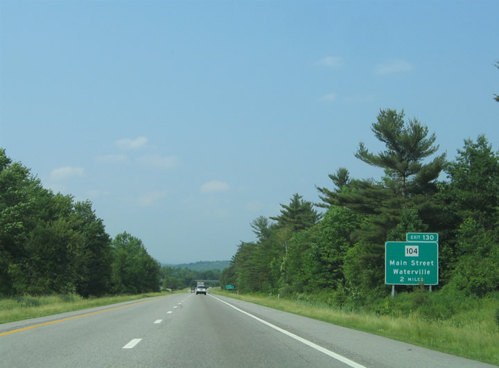
| The second Waterville exit serves Downtown via Maine 104 (Main Street) south. Maine 104 travels north from the tangle with U.S. 201 and Maine 11 in Downtown to Fairfield Center and Skowhegan. 06/27/05 |
|
| Interests to Madison or Norridgewock should use SR 104 north through its merge with SR 139 near Fairfield Center. SR 139 branches northwest from SR 104 after 2.75 miles for Norridgewock and U.S. 2 and 201A. U.S. 201A links Norridgewock with Madison, Solon and Anson to the north. SR 104 meanwhile ends at U.S. 201 just south of Skowhegan. 06/27/05 |
|
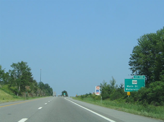
| One mile southwest of the diamond interchange (Exit 130) with Maine 104 (Main Street) in Waterville. SR 104 joins SR 11 along Elm Street at the five-way intersection with U.S. 201 & Maine 100 (College Avenue) south at Center Street west. SR 104 otherwise straddles the Kennebec River valley southward to North Sidney, Sidney and ultimately Augusta. 06/27/05 |
|
| Interstate 95 northbound as it spans Messalonskee Steam in Waterville. The stream flows south from the Belgrade Lakes region into the Kennebec River.3 06/27/05 |
|
| Exit 130 departs Interstate 95 north just east of Messalonskee Stream. Maine 104 meets U.S. 201 south in 1.4 miles and Maine 139 in two miles. 06/27/05 |
|
| Interstate 95 enters Somerset County one mile south of the diamond interchange (Exit 132) with Maine 139 (Western Avenue). Western Avenue carries Maine 139 one mile east to U.S. 201 (Main Street) in Downtown Fairfield. 06/27/05 |
|
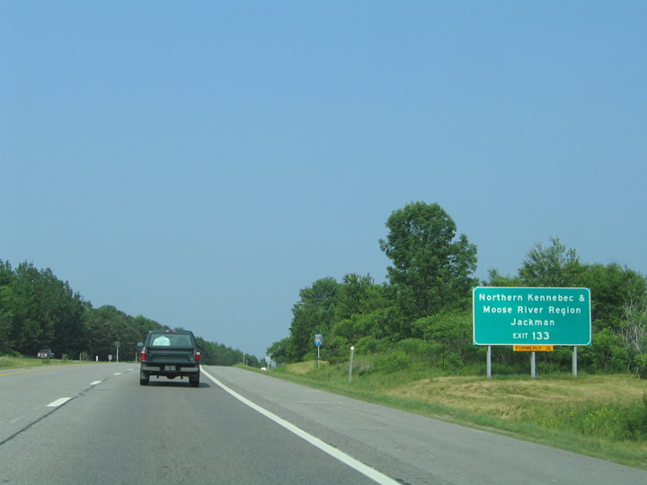
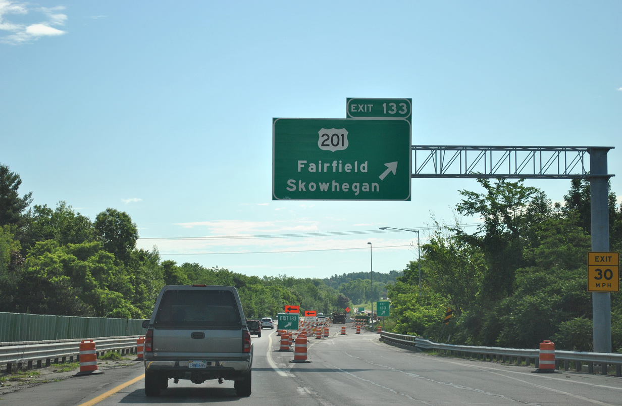
| Long distance interests to Quebec City, Quebec should use Exit 133 onto U.S. 201 north, though U.S. 201 may be accessed via a routing of Maine 139 north to U.S. 201A at Norridgewock and Solon. U.S. 201 ventures to the Canadian border by way of Lake Parlin and Jackman. Quebec City lies 190 miles to the northwest via U.S. 201, Quebec 173, and Autoroute 73. 07/01/12 |
|
| Northbound at the ramp departure of Exit 132 onto SR 139 (Western Avenue). SR 139 ventures west 2.1 miles to its merge with SR 104 at Fairfield Center. The state route travels overall between U.S. 2 at Norridgewock and U.S. 1A at Winterport. Fairfield is home to Kennebec Valley Community College; SR 139 also serves Unity College at Unity (U.S. 202 & SR 9). 07/01/12 |
|
| Attached to the Maine 139 over crossing is the one mile guide sign for U.S. 201. A three-quarter cloverleaf interchange joins the US highway with Interstate 95 at Exit 133 near the Kennebec River. U.S. 201, an intrastate route, travels 157 miles between the Canadian border and U.S. 1 at Brunswick. 07/01/12 |
|
| U.S. 201 travels through the northern hinterlands of the Kennebec and Moosehead Rivers en route to Jackman and the Province of Quebec. Jackman is an 87 mile drive north along the route. 06/27/05 |
|
| Interstate 95 northbound curves east ahead of its crossing of the Kennebec River as drivers bound for U.S. 201 (Main Street) depart at Exit 133. U.S. 201 south meets SR 139 in Downtown, briefly sharing pavement with the state route before joining SR 11 & 100 from Benton Station. A 14.5 mile drive awaits northbound motorists en route to Skowhegan and U.S. 2. 07/01/12 |
|
| Looking west at the end of the Exit 133 loop ramp to U.S. 201. U.S. 201 follows Main Street south 0.75 miles to Downtown. Shawmut lies two miles to the north, followed by Hinckley in 6.6 miles. 06/27/05 |
|
| The Kennebec River separates Kennebec and Somerset Counties. Pictured here is Interstate 95 as it crosses the river into the town of Benton. The Benton town center lies east along Maine 11-100-139 from Fairfield. 06/27/05 |
|
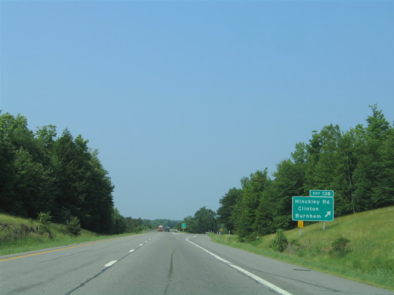
| The final Kennebec County interchange (Exit 138) of Interstate 95 joins the freeway with Hinckley Road within the town of Clinton. Hinckley Road becomes Baker Street en route to SR 11 & 100 (Main Street) as it enters the town center. 06/27/05 |
|
| Northbound at the diamond interchange (Exit 138) with Hinckley Road on Interstate 95 north. Maine 10 & 100 travel north from Baker Street in Clinton to Burhnam and Pittsfield on a parallel alignment to Interstate 95. Meanwhile to the west, Hinckley Road ventures six miles to Maine 23 midway between its trek from Hinckley to Canaan. 06/27/05 |
|
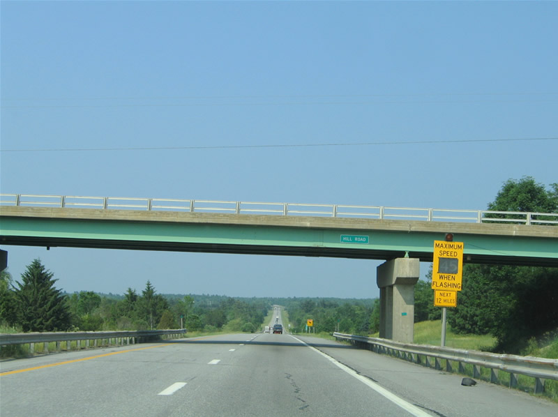
| Moose crossing detectors and warning signs lie along Interstate 95 between Clinton and Pittsfield, a 12 mile exit less stretch. When a moose is detected, travelers are directed to reduce speed to 45 MPH. Animal detectors along Interstate highways is not unique to Maine, as such features exist along the Indiana Toll Road as well. 06/27/05 |
|
| A rest area facility lies along Interstate 95 in both directions in southwest Pittsfield. 06/27/05 |
|
| Interstate 95 travels through the town of Pittsfield to Exit 150 at Somerset Avenue. Pittsfield centers around the Sebasticook River at the junction of Maine 11 & 100 with 152. 06/27/05 |
|
| One mile southwest of the diamond interchange (Exit 15) to Somerset Avenue on I-95 north. Somerset Avenue travels one mile west from Downtown and SR 11 & 100 to I-95. Once west of Exit 150, Somerset Avenue becomes Higgins Road to U.S. 2. 06/27/05 |
|
| Connections with Maine 152 nearby lead travelers north to Hartland and U.S. 2 east to Palmyra. Maine 11 & 100 continue east from Downtown Pittsfield to Houston Corner and Detroit. Maine 152 ends in Pittsfield otherwise. 06/27/05 |
|
| Drivers bound for Pittsfield leave Interstate 95 northbound at Exit 150. Somerset Avenue merges with Maine 152 (Hartland Avenue) close by at Park Street. Hartland lies 8.8 miles to the north. 06/27/05 |
|
| Interstate 95 curves eastward around Pittsfield to cross Sebasticook River south of Douglas Pond. 07/01/12 |
|
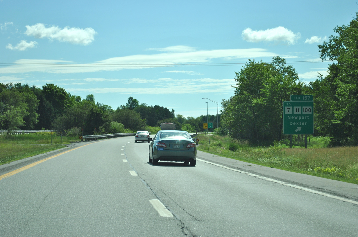
| Maine 11 & 100 cross paths with Interstate 95 again at Exit 157 near the Somerset and Penobscot County lines. The tandem travel north from the Detroit area into Newport where they split. 07/01/12 |
|
| Maine 11 & 100 (Moosehead Trail) intersect U.S. 202 & Maine 7 (Main Street) just north of Interstate 95. There Maine 100 joins U.S. 2 & Maine 7 along Main and Elm Streets through the town of Newport.
Maine 11 continues north with Maine 7 together for six miles to Corina. Maine 7 continues from there to Dexter and Dover-Foxcroft with connections there to the Moosehead Lake and Moose Mountain areas. 07/01/12 |
|
| Interstate 95 turns southeastward at the diamond interchange (Exit 157) with Maine 11 & 100 (Moosehead Trail). Maine 100 follows the path of U.S. 2 east to Bangor; Maine 11 meanwhile leaves Maine 7 north on a northeastern path to Millinocket, coming close to Interstate 95 again at Exits 244 and 264. 07/01/12 |
|
| Interstate 95 enters the large Penobscot County and town of Newport as it leaves Exit 157. 06/27/05 |
|
| A reassurance marker stands at the Maine Central Railroad underpass at Newport. 07/01/12 |
|
| Carmel and Bangor are the next population centers along Interstate 95 east of Newport. 06/27/05 |
|
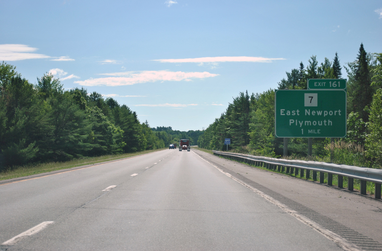
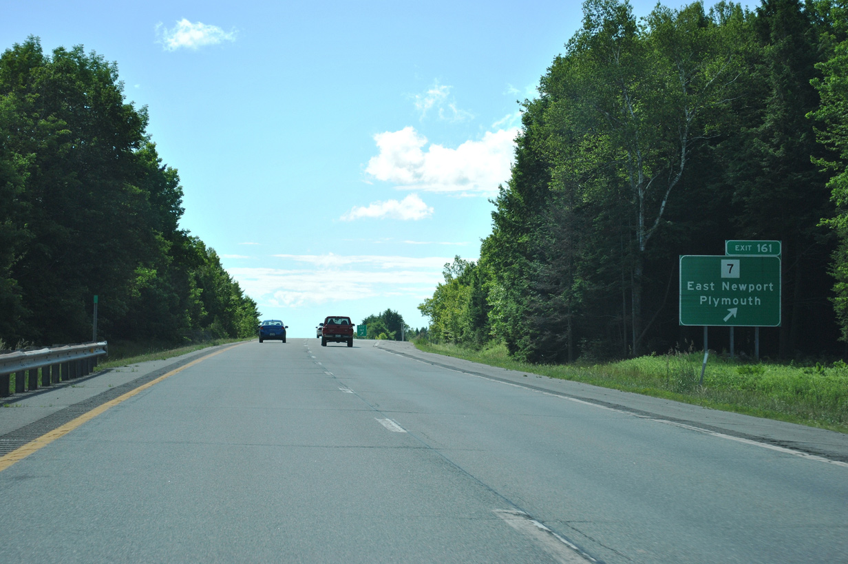
| Maine 7 departs its overlap with U.S. 202 & Maine 100 via Rousin Road / Moosehead Trail at East Newport. South from there the state route journeys to Plymouth, Brooks and Belfast. Interstate 95 crosses paths with SR 7 at Exit 161. 07/01/12 |
|
| Interstate 95 northbound at the parclo interchange (Exit 161) with Maine 7 (Moosehead Trail). Maine 7 heads 2.4 miles south to Plymouth (Maine 69) and 30 miles to its end at U.S. 1 & Maine 3 outside Belfast. 07/01/12 |
|
| Interstate 95 roadway separation near its parallel alignment with Maine 69 (Plymouth Road) midway between Plymouth and Carmel. 06/27/05 |
|
| Maine 69 (Plymouth Road) joins Maine 143 (Dixmont Road) briefly through a parclo interchange (Exit 167) with I-95 at Etna Center. SR 143 travels 15 miles overall between U.S. 202 & SR 9 at Dixmont Center and SR 222 at Stetson. 07/01/12 |
|
| Rocky formations and forest land abuts Interstate 95 ahead of Exit 167 with Maine 69 & 143 (Dixmont Road). Maine 69 continues along Plymouth Road in either direction from Dixmont Road and Maine 143. 06/27/05 |
|
| Exit 167 leaves Interstate 95 north for Maine 69 & 143 (Dixmont Road). Maine 69 continues east three miles to Carmel. Maine 143 heads 2.4 miles north to Etna and U.S. 2 & Maine 100. 07/01/12 |
|
| The forested landscape of Interstate 95 east of Etna Center and west of Hinkley Hill. Carmel lies north of the freeway at this point along U.S. 2 & Maine 100 at Maine 69. 06/27/05 |
|
| Maine 69 and U.S. 202 & Maine 100 bump at Carmel with U.S. 202 & Maine 100 following Main Road east to Hermon and Maine 69 veering southward along Hampden Road five miles to Interstate 95 at Exit 174. 07/01/12 |
|
| Interstate 95 takes a gradual northward curve through the diamond interchange (Exit 174) with Maine 69 (Hampden Road) at North Newburgh. The SR 69 continues south from the freeway 1.75 miles to U.S. 202 & SR 9 near Newburgh Center and 11.3 miles to its end at U.S. 1A in Winterport. 07/01/12 |
|
| Drivers bound for Maine 69 (Hampden Road) depart Interstate 95 north at Exit 174. SR 69 to U.S. 202 & SR 9 (Western Avenue) carries drivers to West Hampden and Hampden Center. Winterport lies along U.S. 1A midway between Stockton Springs and Bangor along the Penobscot River. 07/01/12 |
|
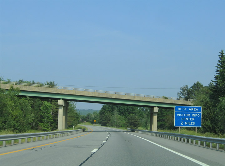
| Interstate 95 swings northward across wetlands associated with Patten Pond and Stream on the two mile approach to a rest area and tourist information center. 06/27/05 |
|
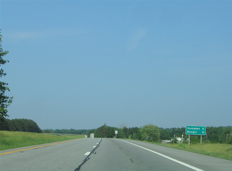
| The town of Hampden is five miles ahead on Interstate 95 at Exit 180. Bangor follows in another three miles. 06/27/05 |
|
| The northbound side rest area and tourist information center lies south of Hermon Pond along a hill side. 06/27/05 |
|
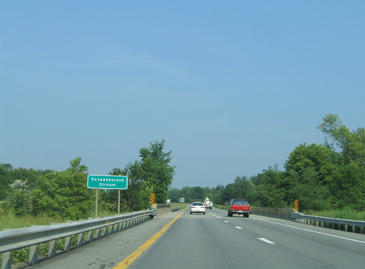
| Interstate 95 lowers again through wetland areas surrounding Hammond Pond and Souadabscook Stream. 06/27/05 |
|
| Cold Brook Road crosses paths with Interstate 95 on the outskirts of Bangor at Exit 180. The north-south roadway travels between U.S. 1A & Maine 9 in and U.S. 202 to the south in Hampden and U.S. 2 & Maine 100 to the north at Hermon Center. 06/27/05 |
|
| Cold Spring Road links Interstate 95 with the town of Hermon to the northwest and Hampden town center to the south. Situated along the Penobscot River, Hampden is bypassed by an expressway alignment of U.S. 202 and served by SR 9 (Western Avenue) and U.S. 1A (Main Road). 06/27/05 |
|
| Eastbound at at the diamond interchange (Exit 180) with Cold Spring Road on Interstate 95 north. Hermon is a four mile drive northwest via Cold Spring Road to U.S. 2 & SR 100 west. Odlin Road stems east from Cold Spring Road nearby to parallel to I-95 east through industrial areas and Speedway 95 to U.S. 2 & SR 100 by Exit 182. 06/27/05 |
|
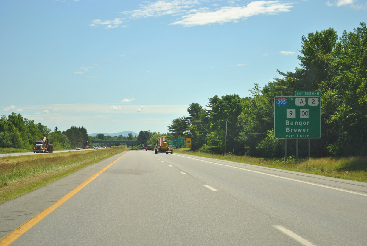
| Interstate 95 turns more inland from the coastal areas of Maine from Bangor north to Houlton. Interstate 395 east (Exit 182A) represents the last departure point for interests to the coast including Bar Harbor and Acadia National Park. 04/15/16 |
|
| Motorists heading to Mansfield Stadium or Sawyer Arena, both located along 13th Street between U.S. 2 & SR 100 and SR 222 (Union Street), should remain along I-95 north to Exit 183. 04/15/16 |
|
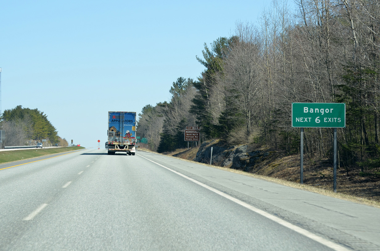
| Forthcoming Exit 395 is the first of six interchanges for Bangor along I-95 north. Interests to Downtown Bangor, the Bangor war memorials, Cross Insurance Center, Hollywood Casino or the Maine Discovery Museum should use Interstate 395 east & Maine 15 south to Exit 3B (U.S. 1A & 202 north / Main Street). 04/15/16 |
|
| Centered around Bangor Mall, the main shopping / retail area of Bangor lies on the north side of the city by Exits 186 and 187. 04/15/16 |
|
| Interstate 95 enters the City of Bangor and approaches Interstate 395 & Maine 15 (Exits 182A/B). I-395 constitutes an east-west freeway between I-95 near West Bangor and the city of Brewer. The freeway acts as a connector to area through routes including U.S. 2, U.S. 1A, U.S. 202, SR 9 and SR 100 among others. 07/01/12 |
|
| U.S. 1A extends south from the freeway end of I-395 at Brewer to U.S. 1 at Ellsworth. Calais is reached by connections with Maine 9 east of Bangor. 07/01/12 |
|
| Maine 15 shares pavement with Interstate 395 east between Exits 1 and 4 on its cross city routing. The state route combines with I-95 north from Exits 182B to 185 (Broadway). 04/15/16 |
|
| Flashing LED's accompany the speed limit signs referencing the reduction to 60 MPH along I-95 north through Bangor. 04/15/16 |
|
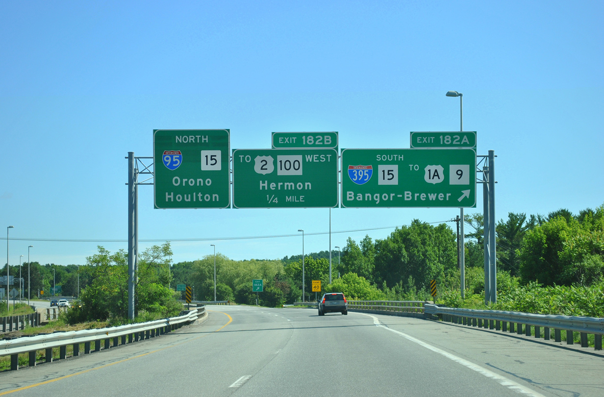
| Exit 182 consists of a cloverleaf interchange between Interstate 95 and Interstate 395 & SR 15. Exit 182A departs the northbound freeway here for I-395 east & SR 15 south toward Downtown Bangor and U.S. 1A south for Holden Center and the southeast coast.
SR 15 south departs I-395 on the east banks of the Penobscot River for South Brewer and Bucksport (U.S. 1). Brewer meanwhile lies to the north along SR 9 (Main Street). 07/01/12 |
|
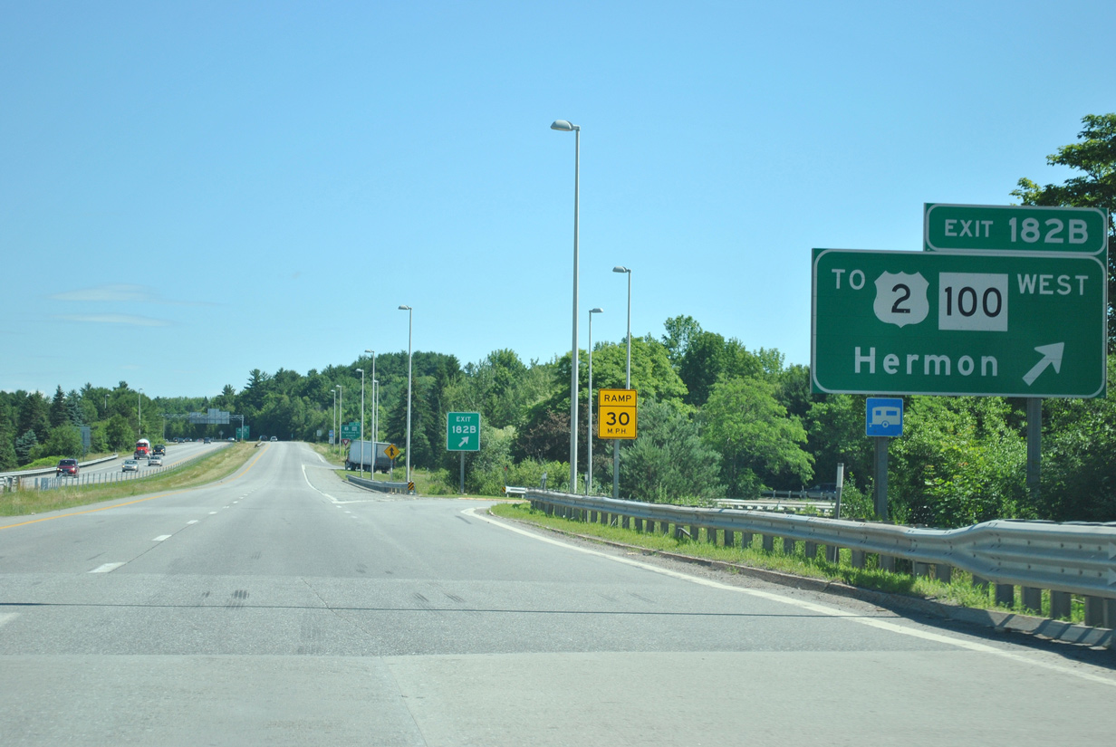
| Interstate 395 ends just west of Interstate 95 (Exit 182B) at the signalized intersection of U.S. 2 & Maine 100 (Hammond Street) with Odlin Road. U.S. 2 & SR 100 follow Odlin Road around Bangor International Airport (BGR) to Hammond Street and West Bangor. I-95 meets them directly at Exit 183 on the continuation of Hammond Street into central Bangor. 07/01/12 |
Page Updated 04-16-2016.

 North
North