|
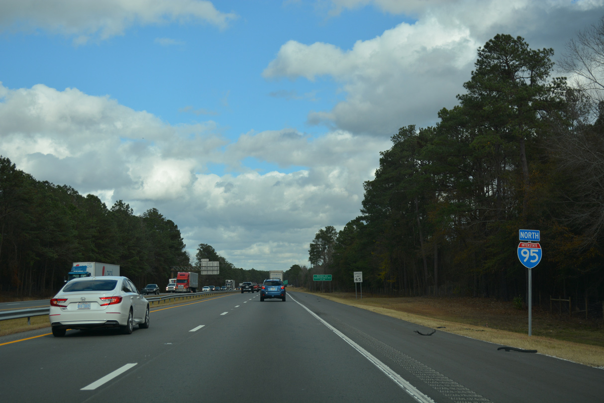
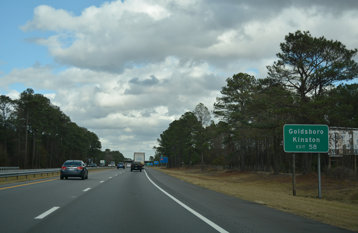
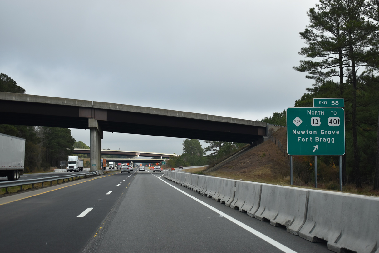
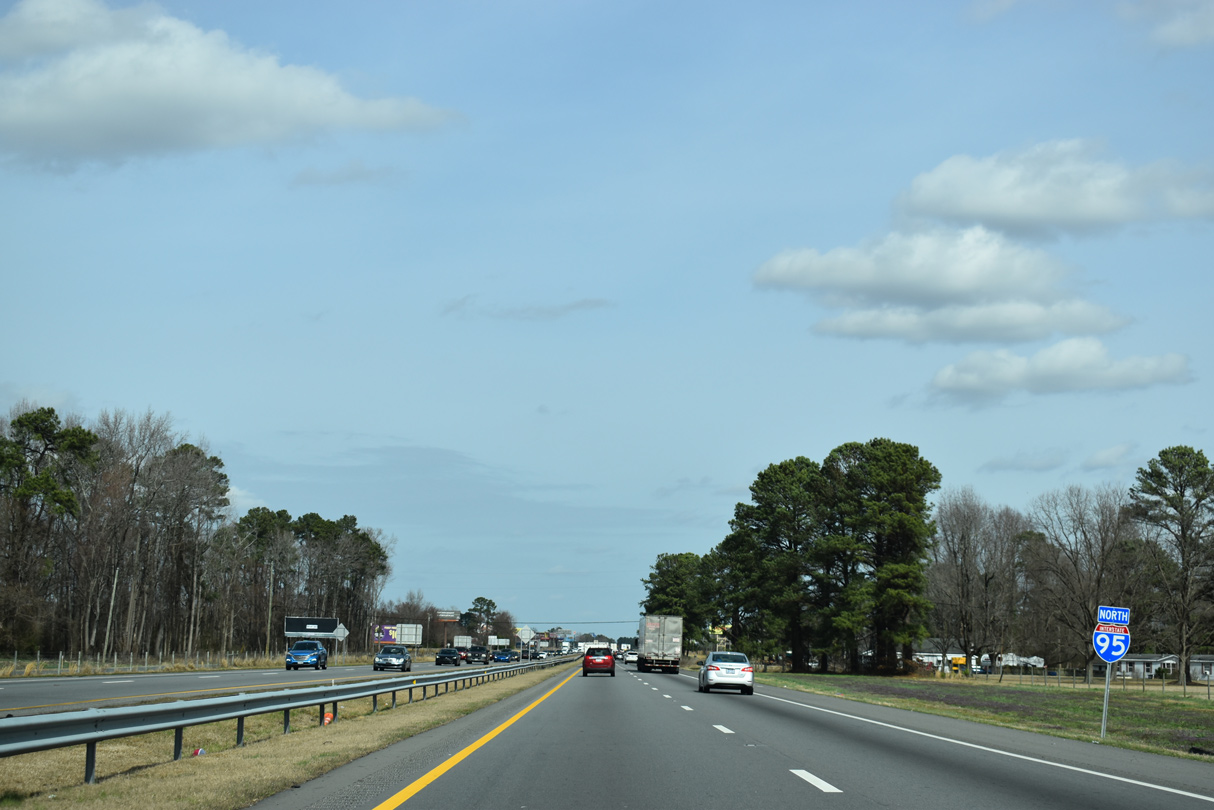
| The final Fayetteville area interchange joins Interstate 295 and U.S. 13 with I-95 at Exit 58. Prior to 2014, NC 295 west to U.S. 401 was signed as Future I-295. 12/17/20 |
|
| Interstate 95 straddles the Eastover town line north from Business Loop I-95 to Exit 58. 12/21/18 |
|
| Expected to be completed in 2024, the Fayetteville Outer Loop (I-295) is a 39 mile long freeway encircling Fayetteville. The initial section opened from I-95 west to U.S. 401 in July 2005. 12/17/20 |
|
| U.S. 13 begins at the exchange joining I-95 with I-295. U.S. 13 travels 16 miles east from Exit 58 to Spivey's Corner at U.S. 421 and 24 miles to Newton Grove at U.S. 701 en route to Goldsboro. 12/21/18 |
|
| Money allocated from the 2009 American Recovery and Reinvestment Act (ARRA) funded the westward extension of Interstate 295 from U.S. 401 to the All American Freeway at Fort Bragg. 12/21/18 |
|
| I-295 construction commenced toward Fort Bragg in June 2009,1 with a 1.7 mile long section of freeway opened in August 2014 locally between NC 24/87 and NC 210 (Murchison Road). The link with U.S. 401 was completed in August 2016. 12/17/20 |
|
| The original diamond interchange (Exit 58) with U.S. 13 was upgraded after 2000 with higher speed ramps including a flyover from I-295 east to I-95 north. 12/17/20 |
|
| 2019-24 widening of I-95 adds a loop ramp to Interstate 295 west, replacing the at-grade turn at U.S. 13. 12/21/18 |
|
| U.S. 13 originally ended nearby at U.S. 301, a connection now made by adjacent Pembroke Lane (SR 1933). 12/21/18 |
|
| U.S. 301 parallels I-95 just to the west as the freeway advances through rural northeast Cumberland County. 02/15/19 |
|
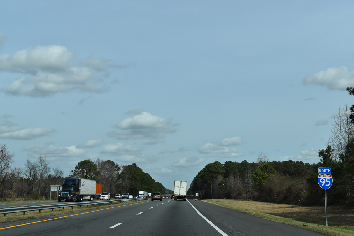
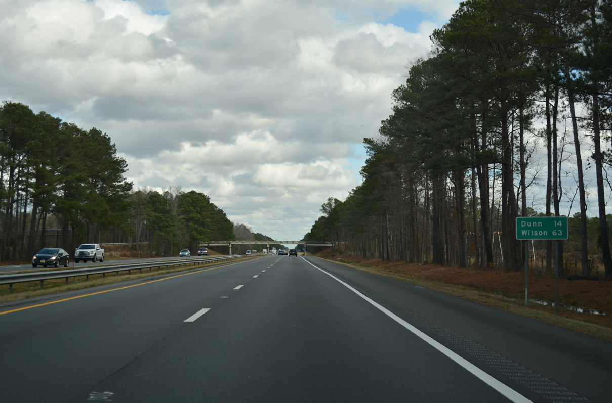
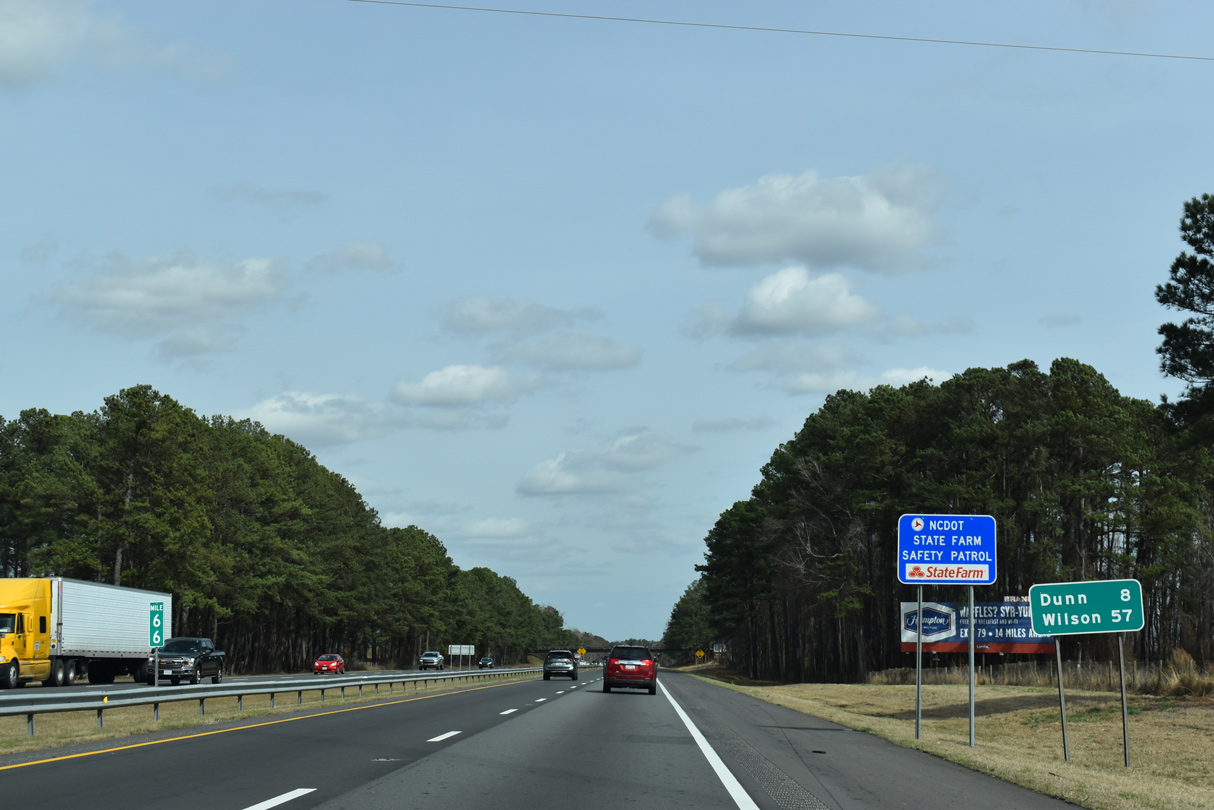
| Wilson replaces Benson as the second control city on this distance sign north of I-295 and U.S. 13. Located 63 miles ahead, Wilson lies east of the I-95 along U.S. 264 Alternate and I-587/795. 12/21/18 |
|
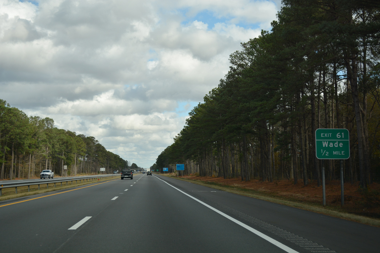
| Wade-Stedman Road (SR 1815) arcs 3.38 miles northwest from U.S. 13 (Goldsboro Road) to I-95 and U.S. 301 in the town of Wade. 2019-24 widening of I-95 redesigns the diamond interchange at Exit 61 into a parclo B2. 12/21/18 |
|
| Exit 61 leaves I-95 north for Wade-Stedman Road (SR 1815). A pair of frontage roads (Eva Wallace / J.T. Mathews Roads) fan outwards from Wade-Stedman Road to SR 1813 (Percy Strickland Road) and U.S. 301 respectively. SR 1815 connects with U.S. 301 at Church Street (SR 1714). 12/21/18 |
|
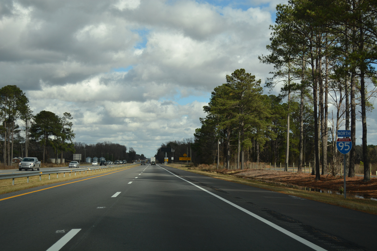
| Interstate 95 leaves the Wade area and plies across a mixture of forest stands and farm land over the next four miles. 12/21/18 |
|
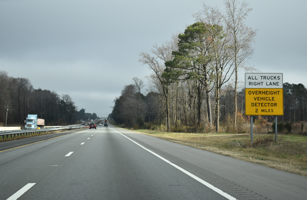
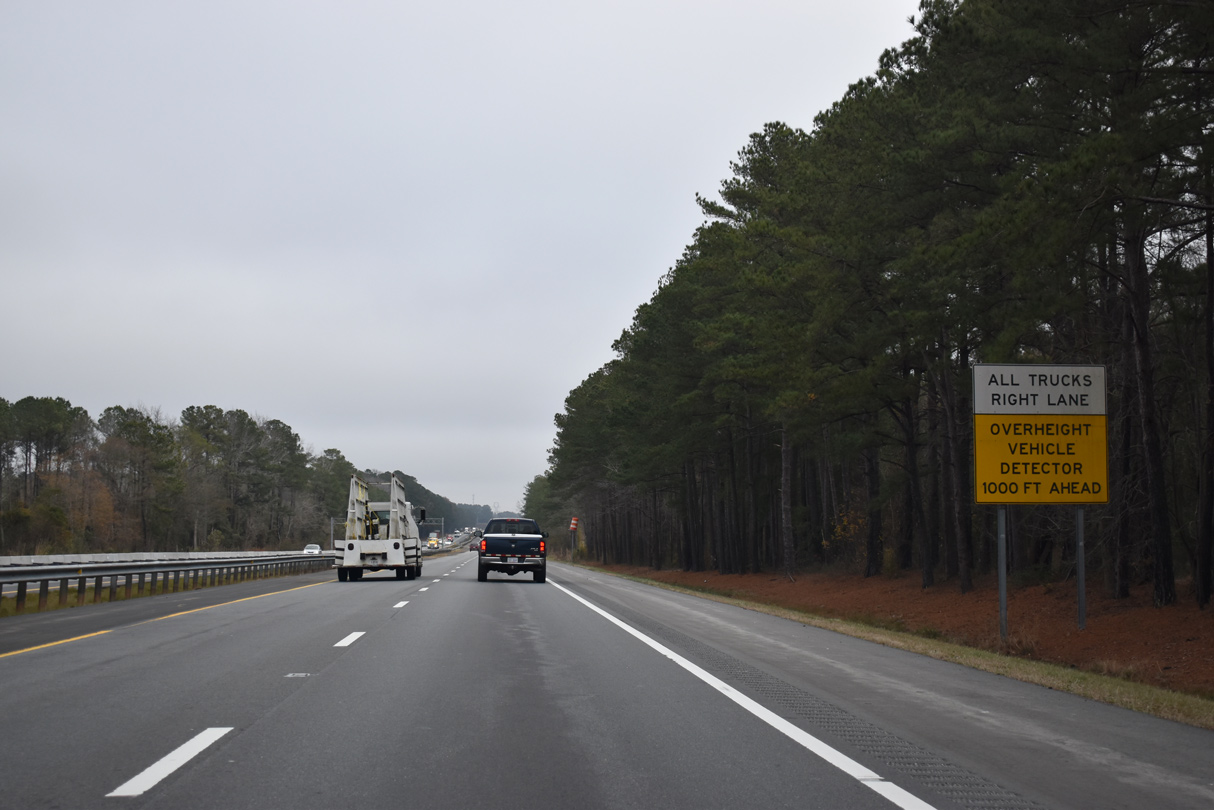
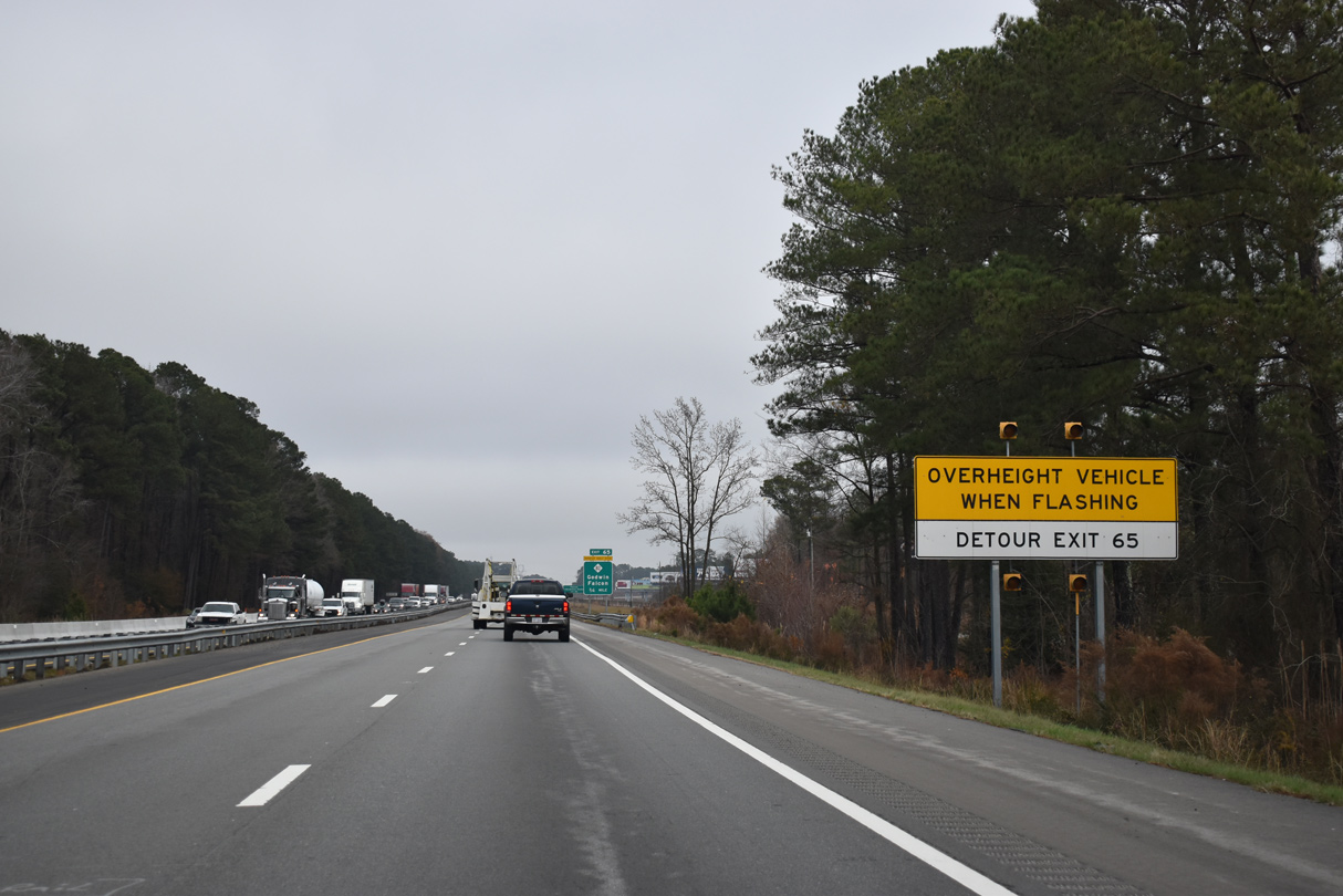
| I-95 north from Eastover to Kenly was completed by 1960. Several of the overpasses along a 12 mile stretch leading north from Wade to Dunn never met modern Interstate clearances. Started in Spring 2019, eight lane expansion of I-95 north from Exit 56 to 71 replaces all substandard bridges.2 12/17/20 |
|
| An overheight vehicle detector directs truckers exceeding the minimum clearance at the NC 82 overpass to use the ramps at Exit 56 to circumvent the 1956-built bridge. 12/17/20 |
|
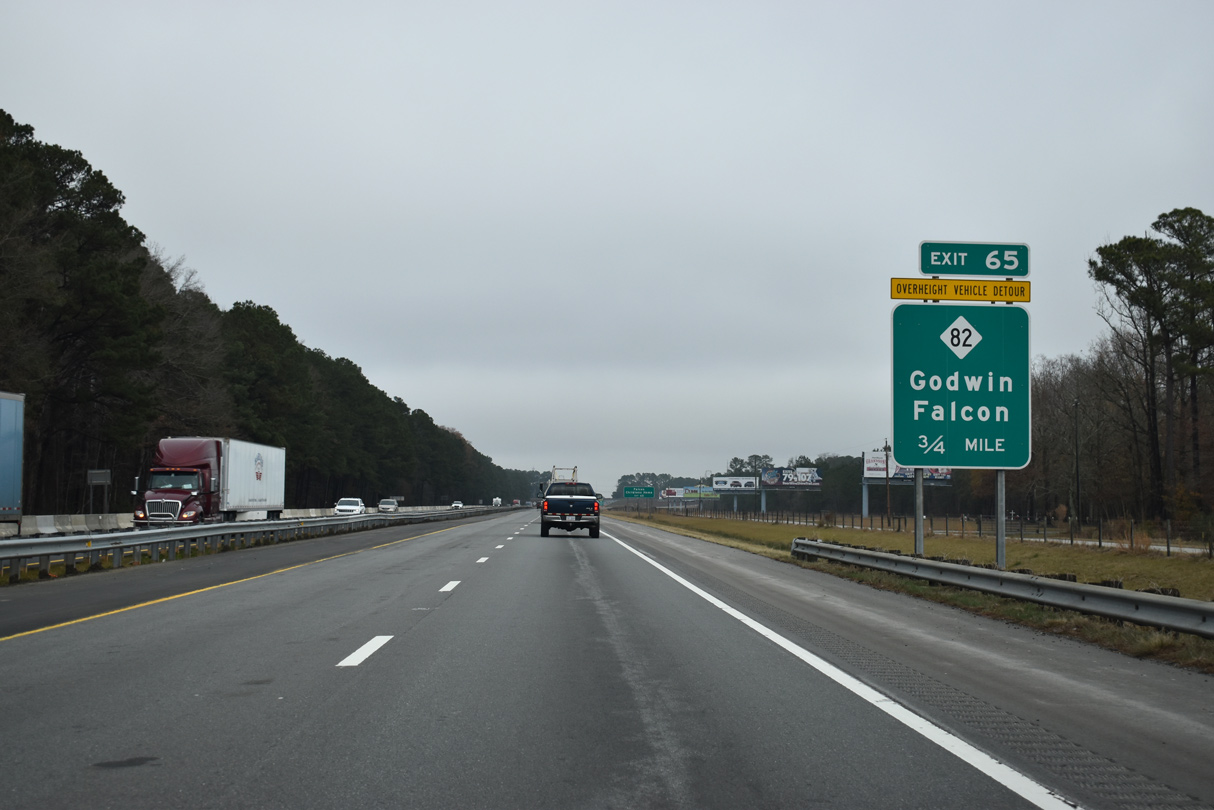
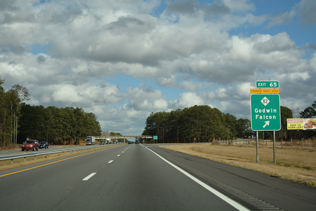
| A diamond interchange (Exit 65) joins I-95 with NC 82 between the rural towns of Godwin and Falcon. I-95 widening rebuilds Exit 56 and realigns the east side frontage road (SR 1860) to accommodate the wider footprint of the exchange. 12/17/20 |
|
| NC 82 travels 15.4 miles overall south to U.S. 13 near the South River and Cooper and north to U.S. 421 at Erwin. The state route follows West Street east through Falcon and Main Street through Godwin, intersecting U.S. 301 (Dunn Road) 1.1 miles to the northeast. 12/21/18 |
|
| Interstate 95 advances northward from NC 82 across wetlands associated with the Black River. 02/15/19 |
|
| Eight miles south of Dunn near the Sherrill Baggett Road (SR 1806) overpass along Interstate 95 north. 02/15/19 |
|
| Interstate 95 crosses into Harnett County over the succeeding mile and meets Bud Hawkins Road (SR 1811) at Exit 70. 12/21/18 |
|
| Named for Cornelius Harnett, a member of the Continental Congress, Harnett County was carved out of Cumberland County in 1855.3 12/21/18 |
|
| Widening of the SR 1811 navigates along a series of S-curves on a 3.96 mile course from parallel U.S. 301 north to SR 1793 (Pope Road) at Dunn. The $708.9 million expansion and modernization of I-95 north from Cumberland County to I-404 will upgrade the parclo B2 interchange (Exit 70) with SR 1811 to improve ramp geometry. 12/17/20 |
|
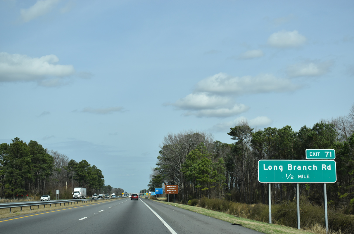
| Forthcoming Exit 71 serves interests to Averasboro Civil War Battleground and Edgerton Industrial Park to the northwest of Interstate 95. 02/15/19 |
|
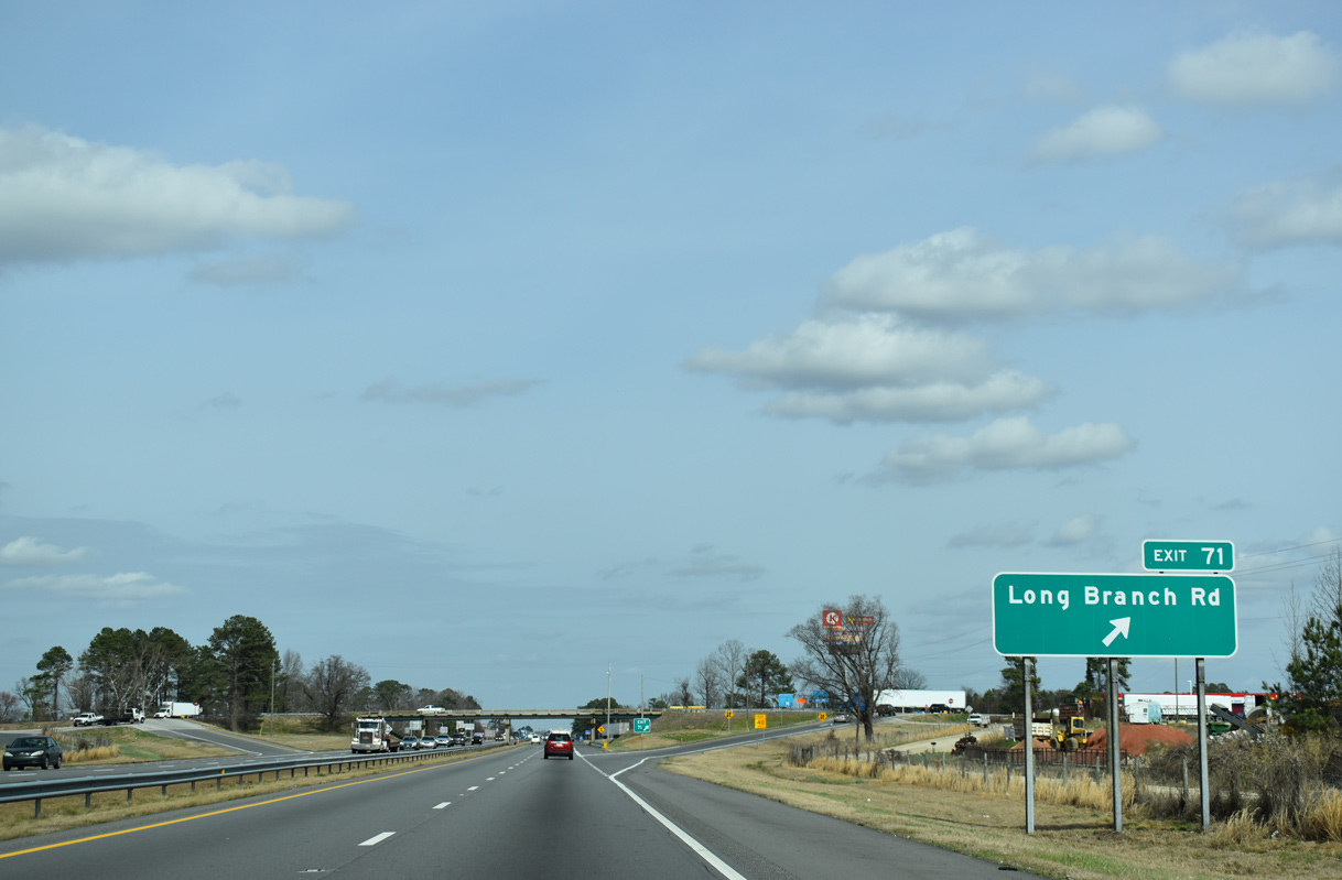
| Long Branch Road (SR 1002) meets I-95 at a diamond interchange (Exit 71) in one mile. SR 1002 continues south of Harnett County as Spring Branch Road into rural areas. Work starting in 2019 realigns and extends the ramps at Exit 71. 02/15/19 |
|
| Long Branch Road (SR 1002) intersects U.S. 301 and Arrowhead Road (SR 1780) 0.74 miles to the west of Exit 71 west of I-95. U.S. 301 north travels north from there into the city of Dunn along Clinton Avenue. 02/15/19 |
|
| Bud Hawkins Road (SR 1811) returns to Interstate 95 as the east side frontage road. Interstate Drive (SR 1837) and Elm Street Extension (SR 1785) run along the west side. 02/15/19 |
|
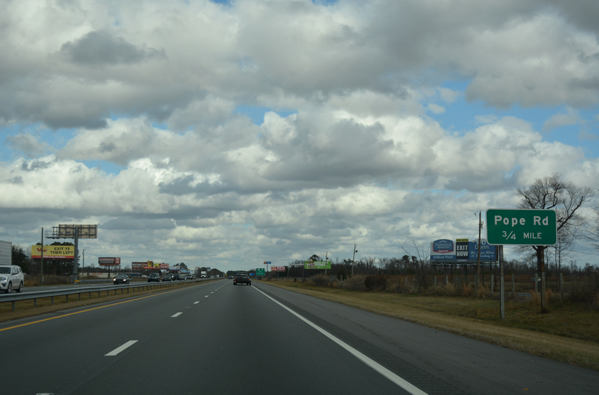
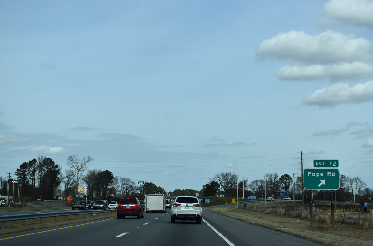
| Spring Branch Road (SR 1793) heads south from Pope Street and Wilmington Avenue in the Dunn street grid to become Pope Road at Interstate 95 (Exit 72). 12/21/18 |
|
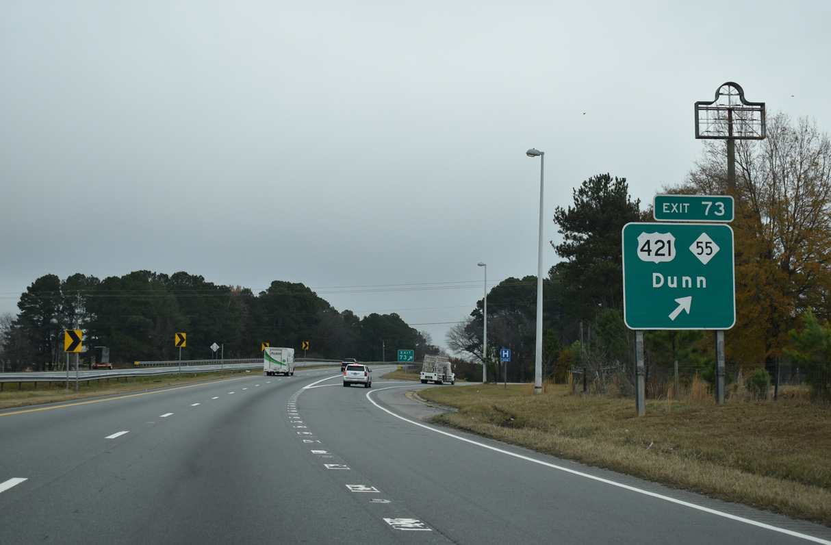
| U.S. 421/NC 55 (East Cumberland Street) meets I-95 at the succeeding interchange southeast of Downtown Dunn. The two routes overlap 5.1 miles west to the town of Erwin. 02/15/19 |
|
| Exit 72 departs Interstate 95 northbound for Spring Branch Road (SR 1793) north to Dunn and Pope Road south to Long Branch Road (SR 1002). 02/15/19 |
|
| Auxiliary lanes accompany I-95 between the Pope Road entrance ramp and the U.S. 421/NC 55 off-ramp (Exit 73). Starting in 2020, eight lane expansion of Interstate 95 north to I-40 will consolidate Exits 72 and 73 into a split diamond interchange. 02/15/19 |
|
| Exit 73 leaves I-95 north for U.S. 421/NC 55 (Cumberland Street) north to Dunn and Campbell University. U.S. 421/NC 55 south part ways in 0.25 miles. NC 55 extends east 13 miles to Interstate 40, 15 miles to Newton Grove and ultimately to Oriental on Pamlico Sound. U.S. 421 south travels ten miles to Spivey's Corner (U.S. 13) and 24 miles to Clinton (U.S. 701). 12/17/20 |
|
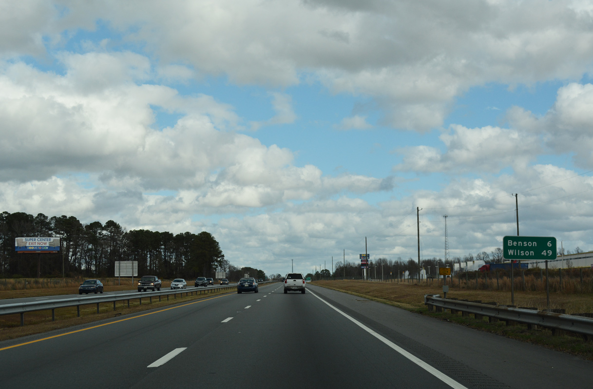
| Interstate 95 continues six miles north to Benson and 49 miles to Wilson. 12/21/18 |
|
| Jonesboro Road (SR 1808) heads east from Carolina Drive and crosses paths with I-95 at Exit 75. SR 1801 measures 4.74 miles in length from U.S. 301 (Granville Street) in Dunn to the Johnston County line at Mingo Swamp. 02/15/19 |
|
| 2020-25 expansion of I-95 at Exit 75 widens the foot print of the diamond interchange (Exit 75) with Jonesboro Road and realignd Jerry Carr Road (SR 1836), the west side frontage road. 12/21/18 |
|
| The new northbound entrance ramp displaces a portion of George Perry Lee Road (SR 1841), which ties into the on-ramp ahead of this confirming marker. The west side frontage road (Sadler Road / SR 1835) will be eliminated beyond Weeks Road to accommodate the realigned southbound off-ramp at Exit 77. 12/21/18 |
|
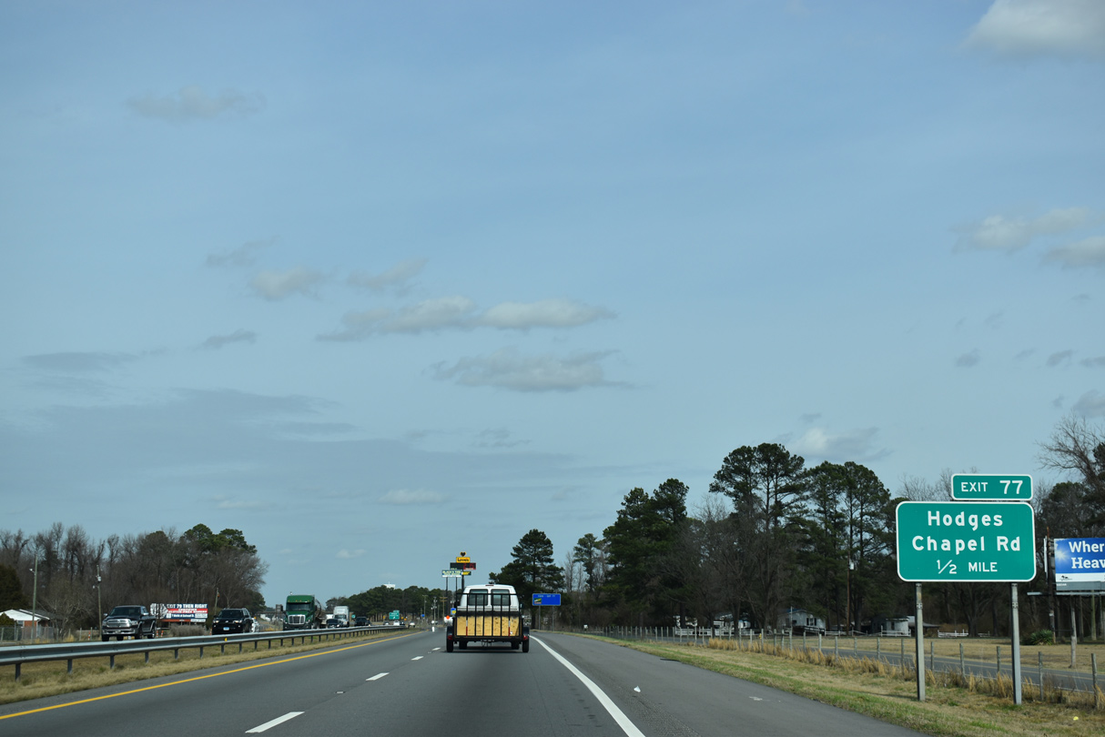
| A diamond interchange joins I-95 with Hodges Chapel Road (SR 1709) in one mile. Hodges Chapel Road travels 2.3 miles north from Jonesboro Road to U.S. 301 near the Johnston County line. 02/15/19 |
|
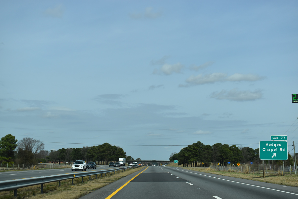
| Hodges Chapel Road (SR 1709) parallels Mingo Swamp northward from Exit 77 to U.S. 301 (Martin Luther King, Jr. Memorial Highway) and NC 27 outside Benson along a 4.59 mile long course. 02/15/19 |
|
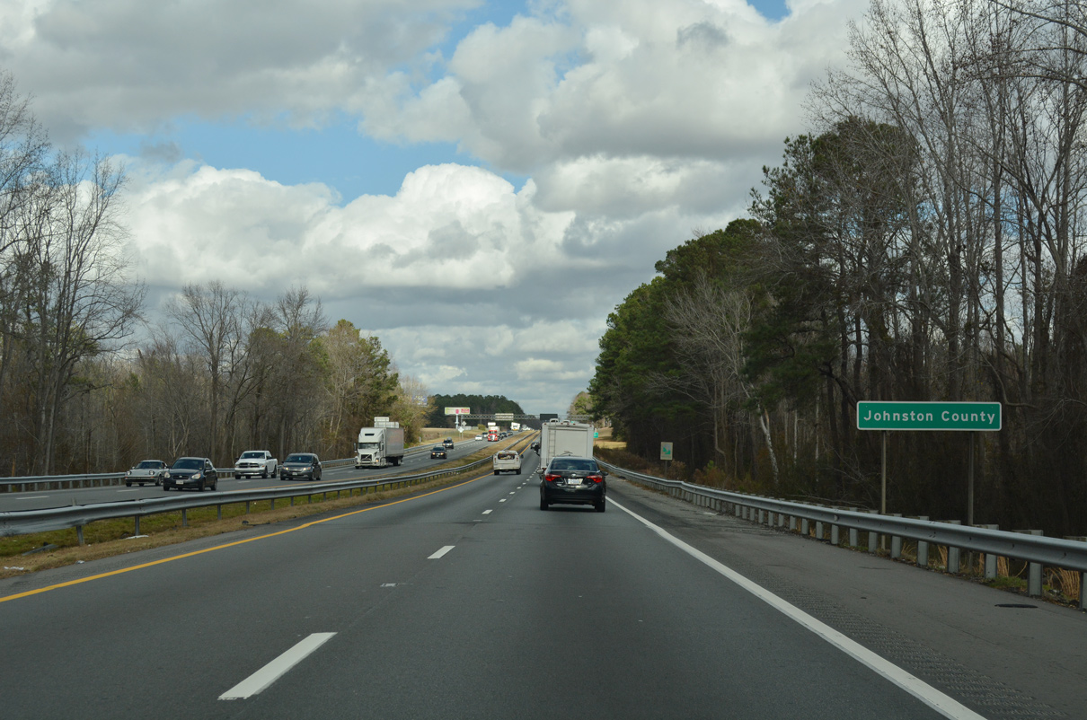
| Interstate 95 crosses Mingo Swamp and enters Johnston County. 07/28/13, 12/21/18 |
Page Updated 02-08-2021.

 North
North