|
| Confirming formerly marker posted after the wye interchange with Interstate 895 south. 07/11/05 |
|
| Distance sign posted ahead of the Montgomery Road overpass, 12 miles from Laurel. 12/30/12 |
|
| Interstate 95 passes through eastern reaches of Howard County from the Patapso River southward to the Patuxent River near Laurel. The succeeding three exits serve Columbia. 12/30/12 |
|
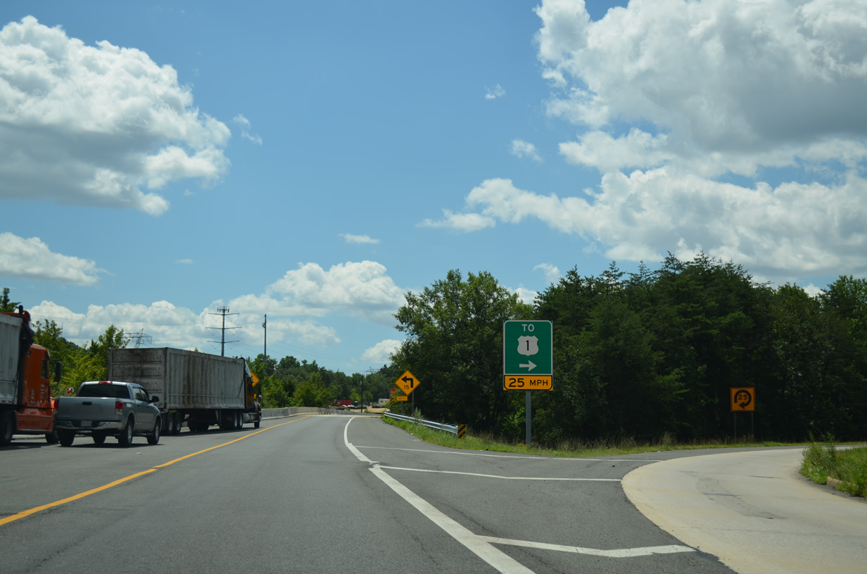
| A directional cloverleaf interchange (Exit 43B/A) joins I-95 with MD 100 to Ellicott City and Glen Burnie in a half mile. 12/30/12 |
|
| MD 100 is a suburban freeway traveling 15.7 miles southeast to MD 607 (Magothy Bridge Road) at Pasadena and 5.5 miles northwest to U.S. 29 in Ellicott City. 10/12/14 |
|
| Exit 43A loops onto MD 100 southeast to Severn, Glen Burnie, Southgate, Lake Shore, and Gibson Island. 10/12/14 |
|
| Continuing south, I-95 meets MD 175 (Little Patuxent Parkway) at Exit 41 in one mile. MD 175 constitutes an expressway north from parallel U.S. 1 (Washington Boulevard) to U.S. 29 in Columbia. 12/30/12 |
|
| Interstate 95 converges with MD 175 by the Columbia Gateway area, a large office park area bound by I-95, Little Patuxent Parkway and Snowden River Parkway. 12/30/12 |
|
| MD 175 continues south from U.S. 1 at Jessup into Anne Arundel County en route to Fort George G. Meade and Odenton. 06/20/12 |
|
| Entering the directional cloverleaf interchange (Exit 41) with MD 175 (Little Patuxent Parkway) on I-95 south. MD 175 travels overall between MD 3 at Millersville and the U.S. 29 freeway near The Mall in Columbia. 06/20/12 |
|
| Interstate 95 passes between Gateway Commerce Center and a quarry along the ensuing stretch. 06/20/12 |
|
| A forested median separates the roadways of Interstate 95 between Exit 41 and 38. 06/20/12 |
|
| Forthcoming MD 32 is the Patuxent Freeway encircling Fort George G. Meade and Odenton east from Exit 38 and heading northwest through Columbia. 06/20/12 |
|
| MD 32 travels three miles west from Exit 38B to the U.S. 29 in Columbia. The Patuxent Freeway continues another 6.5 miles from U.S. 29 north to Linden Church Road at Dayton. 10/12/14 |
|
| Guilford Road passes over southbound I-95 at Exit 38B for MD 32 west. A loop ramp (Exit 38A) follows for MD 32 east to Savage and Laurel Park via U.S. 1 south. 10/12/14 |
|
| MD 32 (Patuxent Freeway) converges with MD 3 (Crain Highway) at Millersville and Interstate 97 south to Annapolis in 14.6 miles. 06/20/12 |
|
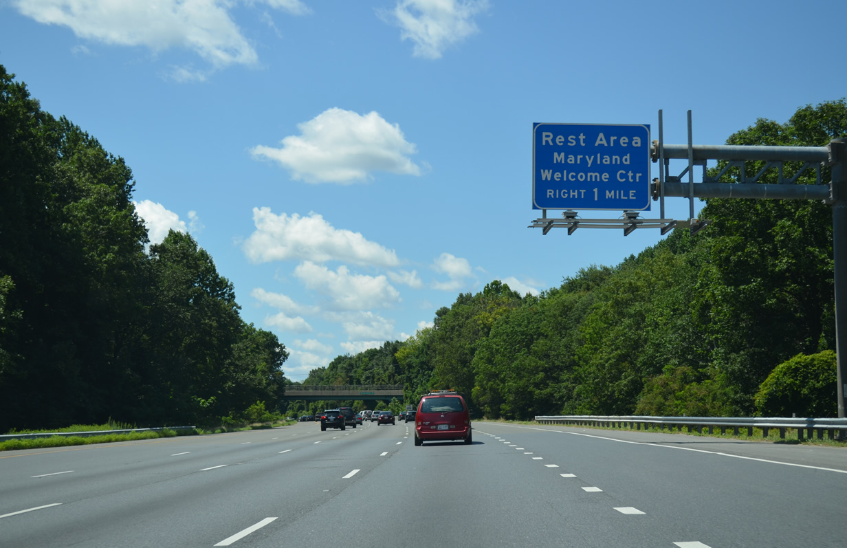
| Interstate 95 advances one mile south to the Maryland Welcome Center and rest area in Howard County. 08/04/13 |
|
| Interstate 95 passes by Savage Park and across the Middle Patuxent River just ahead of the Maryland Welcome Center and rest area. 08/03/13 |
|
| The rest area lies 1.25 miles north of the cloverleaf interchange (Exits 35B/A) with MD 212 (Scaggsville Road). 08/03/13 |
|
| MD 216 arcs northwest along a controlled access arterial from the Patuxent River and city of Laurel to U.S. 29 (Columbia Pike) at Scaggsville. 10/12/14 |
|
| Exit 35B departs for MD 216 (Scaggsville Road) west to Scaggsville, Fulton, and Mooresfield. The 8.73 mile long route concludes 4.04 miles west of U.S. 29 at MD 108 (Clarksville Pike) in Highland. 10/12/14 |
|
| MD 216 (Scaggsville Road) leads south 2.5 miles from Exit 35A to MD 198 (Gorman Avenue / Talbott Avenue) outside Downtown Laurel. 10/12/14 |
|
| Confirming marker posted south of the Stansfield Road underpass at North Laurel. 06/20/12 |
|
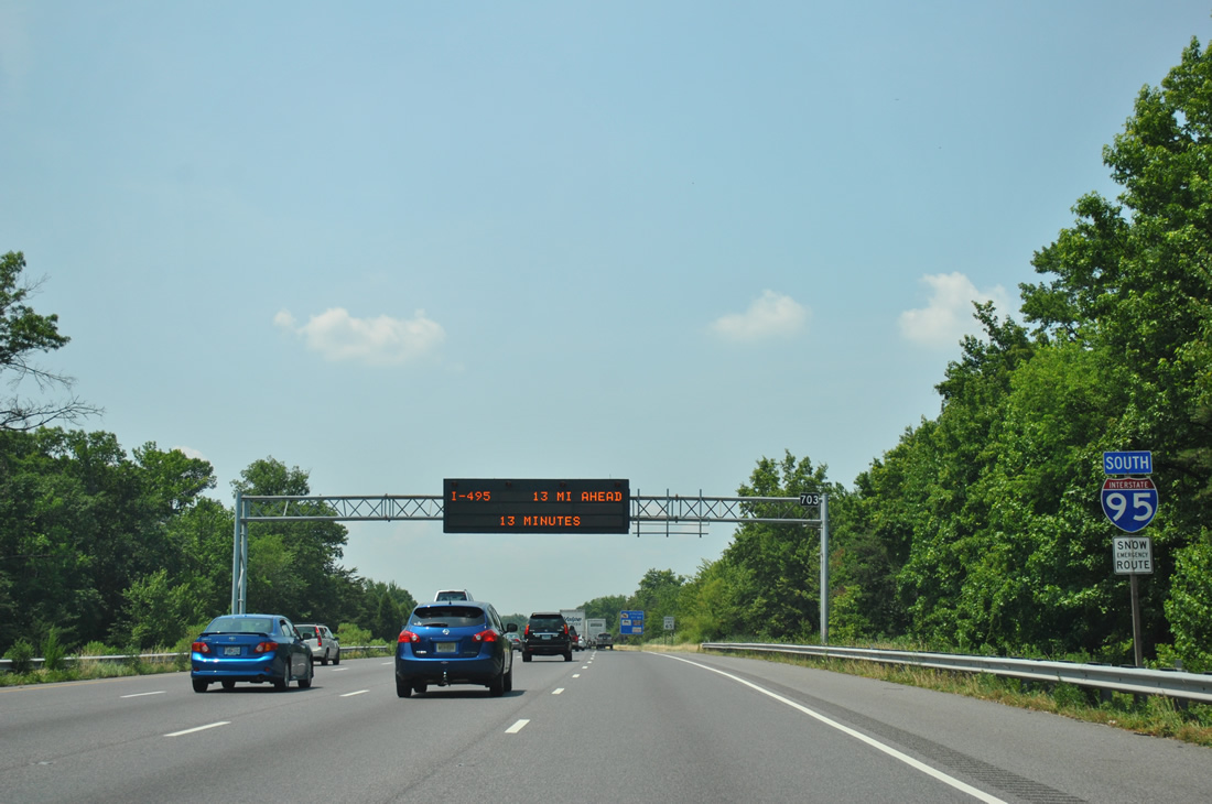
| Interstate 95 crosses the Patuxent River into Prince Georges County, seven miles ahead of the Capital Beltway (I-495). 10/12/14, 12/20/12 |
|
| The succeeding exit is a distributor roadway (Exit 33) for MD 198 (Sandy Spring Road). 10/12/14 |
|
| Exit 32 separates from within the directional cloverleaf interchange (Exit 31) with MD 198 for Kontera Drive. Kontera Drive is a 3.17 mile long major collector west to Old Gunpowder Road and south to MD 212 at Ammendale. 10/12/14 |
|
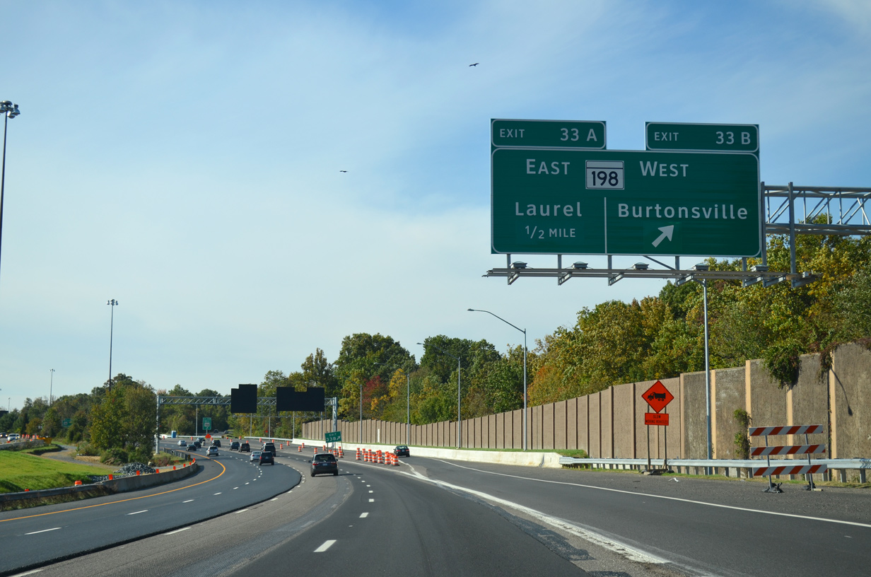
| Sandy Spring Road leads MD 198 east to Gorman Avenue in the city of Laurel. West from Exit 33B, MD 198 continues to Burtonsville and MD 650 (New Hampshire Avenue) at Spencerville in Montgomery County. 10/12/14 |
|
| MD 198 (Gorman Avenue) extends 0.75 miles east from Exit 33A to MD 216 (7th Street) in Laurel and 7.7 miles to MD 32 at Fort George G. Meade. 10/12/14 |
|
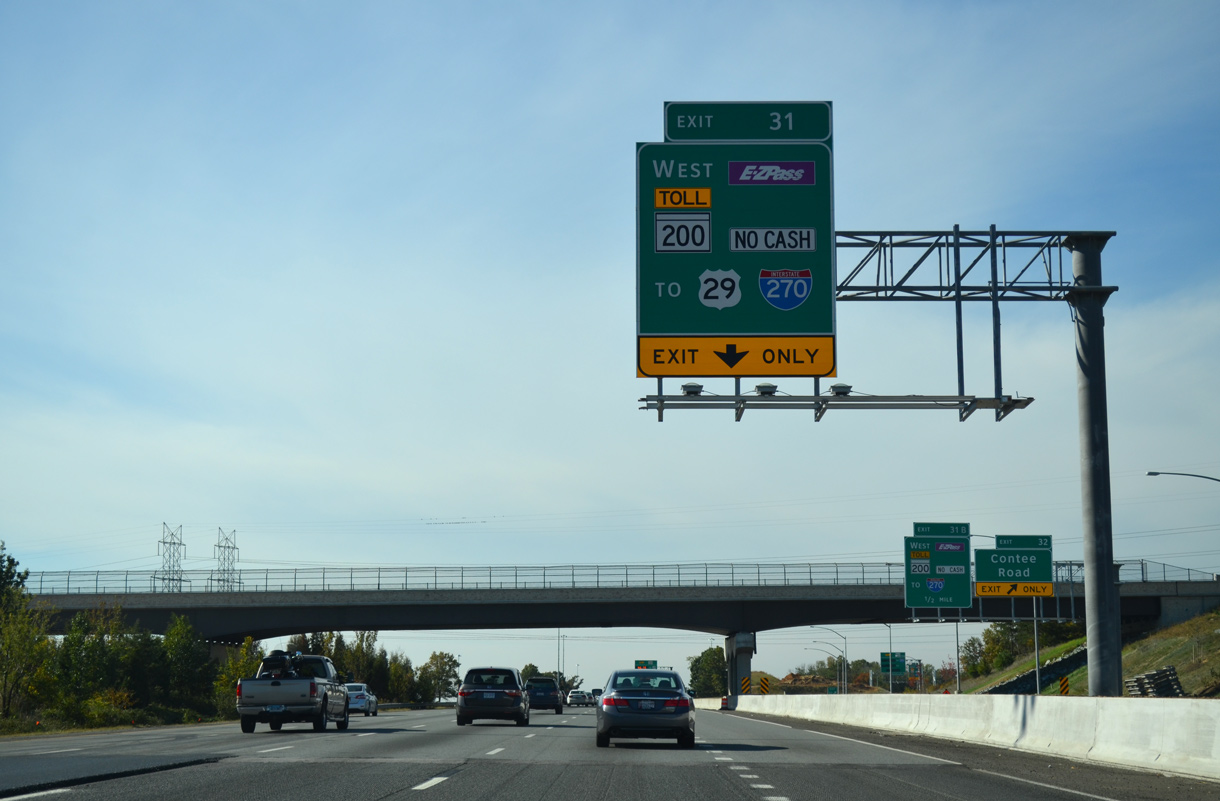
| Exit 32 forms a c/d roadway south from MD 198 to Kontera Drive and the Intercounty Connector (ICC) / MD 200. Opened on November 22, 2011 west to I-370, the ICC connects I-95 with Rockville, Gaithersburg and Interstate 270 in Montgomery County. 10/12/14 |
|
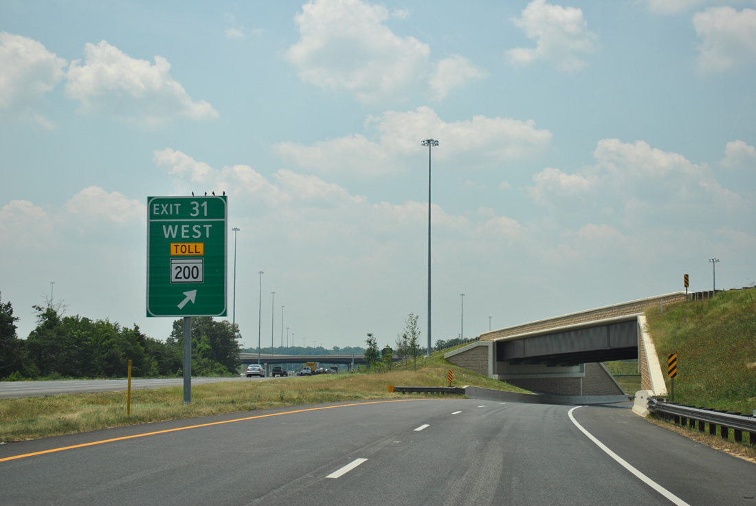
| Exit 31 departs in one mile for the ICC (MD 200) west to U.S. 29 at Fairland and Interstate 270. The ICC uses all electronic toll collection. 10/12/14 |
|
| Advancing south through the folded diamond interchange (Exit 32) with Konterra Drive on I-95. MD 200 runs 17.63 miles west from U.S. 1 (Baltimore Avenue) to the interchange joining I-370 with Metro Access Road to Shady Grove Metro Station. 10/12/14 |
|
| Kontera Drive was formerly named Contee Road. Konterra is an unincorporated area to the west of Laurel. 10/12/14 |
|
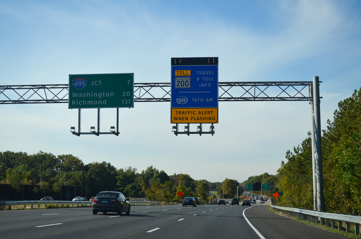
| Tolls along the ICC vary depending upon time of day. Dynamic toll schedule signs such as this one posted ahead of Exit 31 advise motorists of current rates. 06/20/12 |
|
| The ICC travels through a bevy of suburban communities such as Fairland, Colesville, Cloverly, Olney and Redland. Signs for MD 200 omit control cities and instead indicate the connections with I-95, I-270 and U.S. 29. 10/12/14 |
|
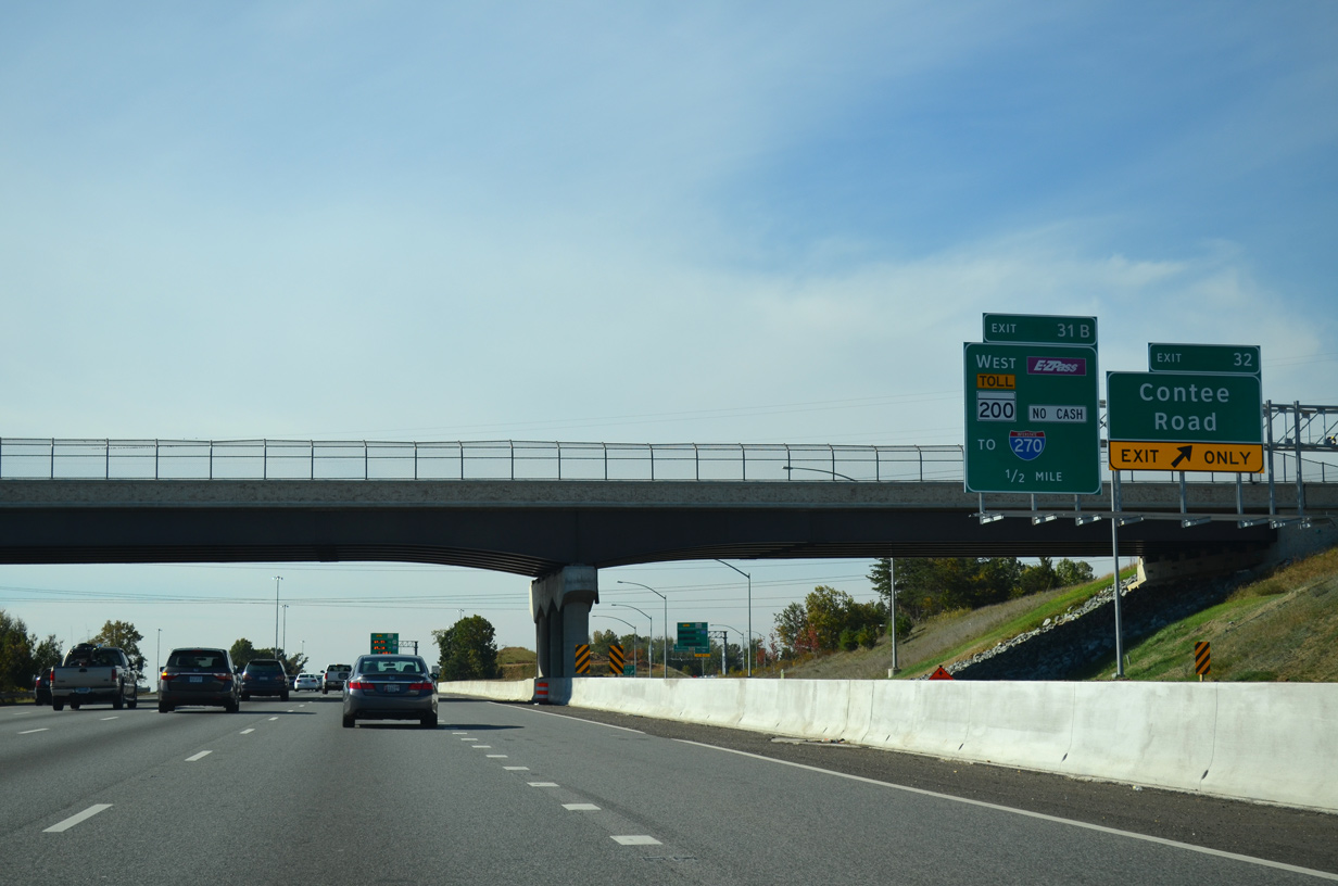
| Exit 31 parts ways from I-95 southbound with two lanes for MD 200 / ICC. 06/20/12 |
|
| Exit 32 loops onto MD 200 east from the c/d roadway. The 1.52 mile extension of the ICC east to U.S. 1 opened to traffic on November 9, 2014. 10/12/14 |
|
| A cloverleaf interchange joins I-95 with MD 212 (Powder Mill Road) one mile southwest at Calverton. MD 212 arcs westward from U.S. 1 (Baltimore Avenue) at Beltsville to Knollwood, Adelphi, Lewisdale and north Washington, DC. 10/12/14 |
|
| Old Gunpowder Road crosses over Interstate 95 south at this reassurance marker. 10/12/14 |
|
| Travelers headed for I-66 west in Northern Virginia are advised to take I-495 west from I-95 south beyond MD 212. A lane drop occurs at Exit 29B for MD 212 (Powder Mill Road) west at Calverton. 10/12/14 |
|
| MD 212 measures 10.43 miles in length from the District of Columbia line near Chillum and Takoma Park north to Exit 29 and east to MD 201 at Beltsville. 10/12/14 |
|
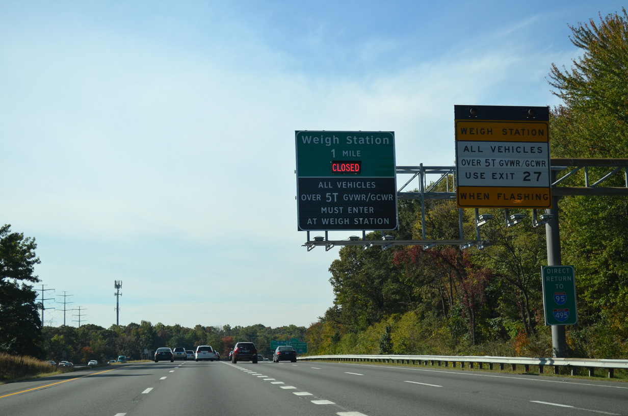
| A weigh station lies at the south end of the exchange joining I-95/495, two miles beyond the MD 212 (Powder Mill Road) overpass at Exit 29. 10/12/14 |
|
| MD 212 continues east from Powder Mill Road to U.S. 1 (Baltimore Avenue) at Ammendale. Powder Mill Road (unsigned MD 212-A) turns south through Beltsville 1.95 miles to MD 201 (Edmonston Avenue). 10/12/14 |
|
| Interstate 95 runs between Centerpark office park and Little Paint Branch Stream Valley Park south of MD 212. 10/12/14 |
|
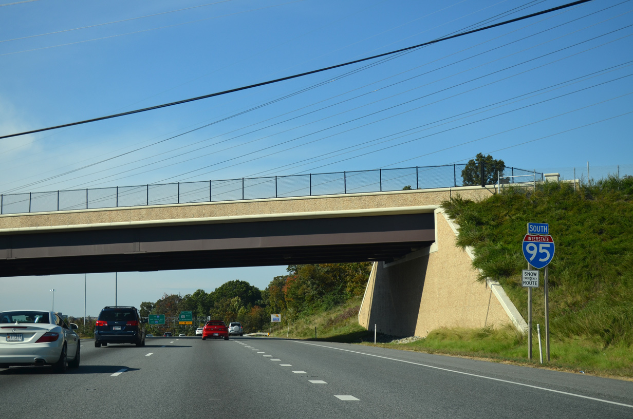
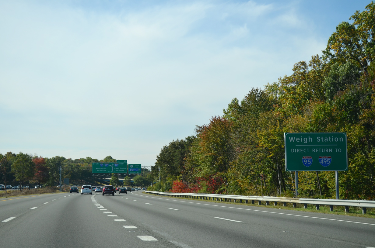
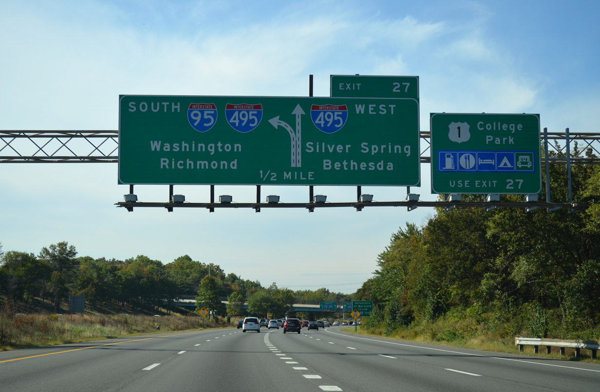
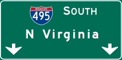
| I-95 partitions at the Capital Beltway with two lanes for I-495 west (Exit 27) and two lanes for the continuation onto I-495 south. Exit 27 follows the southbound roadway to a loop ramp for I-495 east ahead of U.S. 1 (Baltimore Avenue). 10/12/14 |
|
| I-95 was historically planned to continue southward directly into Washington, D.C. A short portion of the freeway was constructed south through the exchange with I-495. Part of it was repurposed for a truck weigh station and park and ride lot. 10/12/14 |
|
| When active all trucks are directed southward to the weigh station, where the roadway U-turns northward to ramps for both directions of the Capital Beltway. 10/12/14 |
|
| Interstate 495 winds westward through the northern suburbs of Takoma Park, Kensington, Bethesda, Garrett Park and Silver Spring. The Capital Beltway splits with I-270 at Exit 35 and crosses into Northern Virginia between Exit 41 and 43. 10/12/14 |
|
| Located in College Park, the University of Maryland lies south of the Capital Beltway along U.S. 1 (Baltimore Avenue). Signage however directs motorists to the campus via I-95/495 south to MD 201 (Kenilworth Avenue). 10/12/14 |
|
| Interstate 95 combines with I-495 along the eastern half of the Capital Beltway to Springfield, Virginia and the Henry G. Shirley Memorial Highway (I-395). I-495 was cosigned along I-95 south from College Park in 1991. 10/12/14 |
|
| Exit 27 separates from I-95 south for I-495 west and U.S. 1 to College Park and Beltsville. I-95/495 arc southward to Greenbelt, New Carrollton, Glenarden and U.S. 50 (I-595). 10/12/14 |
|
| I-95 meets I-495 at an overlapping directional T and trumpet interchange. The exchange was designed to work with the unbuilt alignment of Interstate 95 south into Washington. 08/04/13 |
|
| Exit 27 widens to three lanes ahead of the left exit for the park and ride lot, the weigh station, and ramp onto I-495 east for U.S. 1 (Baltimore Avenue). 08/04/13 |
|
| Traffic merges onto Interstate 495 westbound ahead of the Montgomery County line and MD 650 at Oakview Park. The left exit follows the I-95 roadway spur 0.75 miles south. 08/04/13 |
|
| A left side entrance ramp connects I-95/495 north with the roadway south to the park and ride lot. 08/04/13 |
|
| Southbound at the exit ramp for Interstate 495 east to College Park. 08/04/13 |
|
| A single lane continues south from I-495 to the weigh station and U-turn ramp north to the park and ride lot. 08/04/13 |
Page Updated 06-26-2020.

 South
South