|
| Route 93 (Farrington Highway) ends at the parclo interchange (Exit 1 A) joining Interstate H1 with unsigned Route 95. I-H1 travels east to Waipahu, Pearl City and Honolulu. Discontinuous sections of Farrington Highway parallel I-H1 as a local route from Makakilo City to Waipahu. 02/07/24 |
|
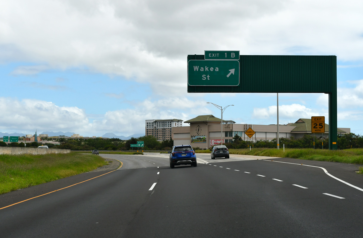
| A sign for the Queen Lilioukanai Freeway precedes the slip ramp at Exit 1 B onto a collector distributor roadway between Kalaeola Boulevard (Route 95) and Wakea Street (Route 8918). 02/07/24 |
|
| Part of Phase 1 of a $16.6 million improvement project at the Kapolei Interchange, the new exit ramp to Kamokila Boulevard and Wakea Street opened to traffic on November 2, 2011.1 02/07/24 |
|
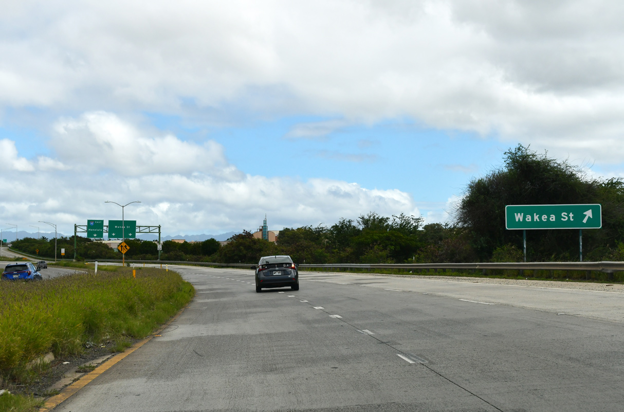
| Phase 2 of the Kapolei Interchange commenced in mid 2016 and was completed in June 2020. A dedication ceremony for the $64.5 million project took place on February 13, 2020. Construction added a new interchange with an extended overpass along Wakea Street above I-H1.2 02/07/24 |
|
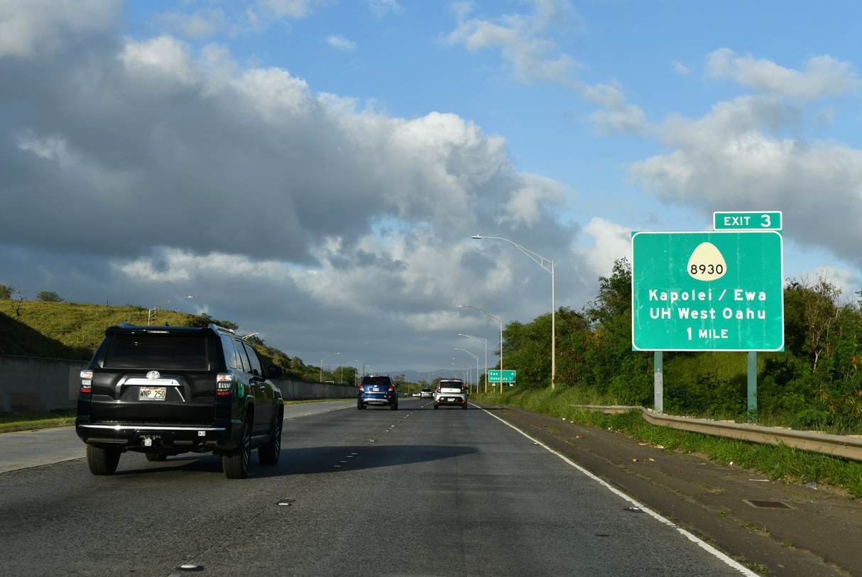
| The diamond interchange at Exit 3 and Kualaka'i Parkway (Kapolei North-South Road) was constructed as part of a $157 million project to serve the Kapolei development.3 02/04/24 |
|
| A parclo interchange joins Route 901 (Makakilo Drive) with I-H1 eastbound ahead of this distance sign posted 16 miles from Honolulu. 02/04/24 |
|
| Kualaka'i Parkway (Route 8930) runs 2.46 miles south to Kapolei Parkway (Route 8920) at the KaMakana Ali'I retail center. 02/04/24 |
|
| Exit 3 opened to traffic in February 2010 in conjunction with Kualaka'i Parkway. Palehua Road ties into the exchange from the north as a private road. 02/07/24, 01/17/11 |
|
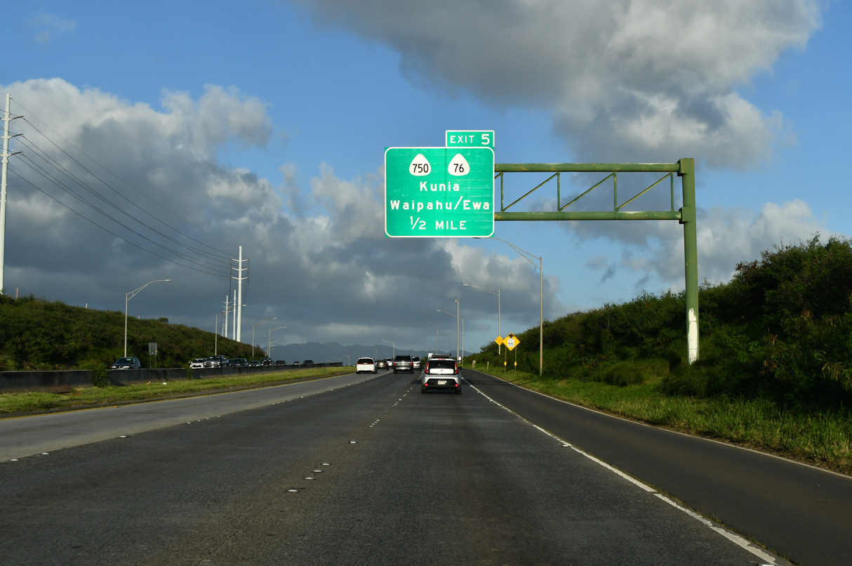
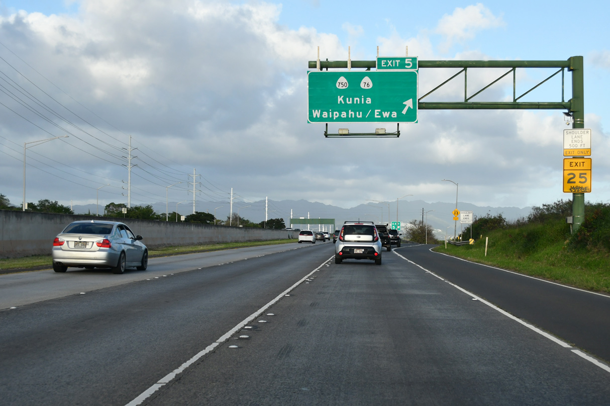
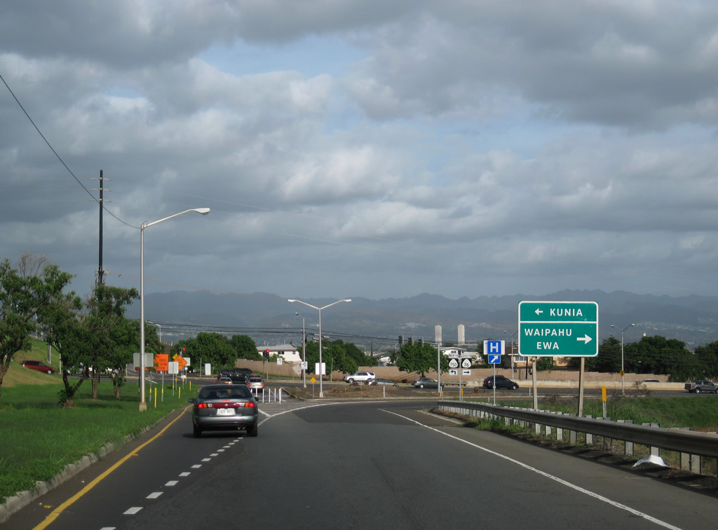
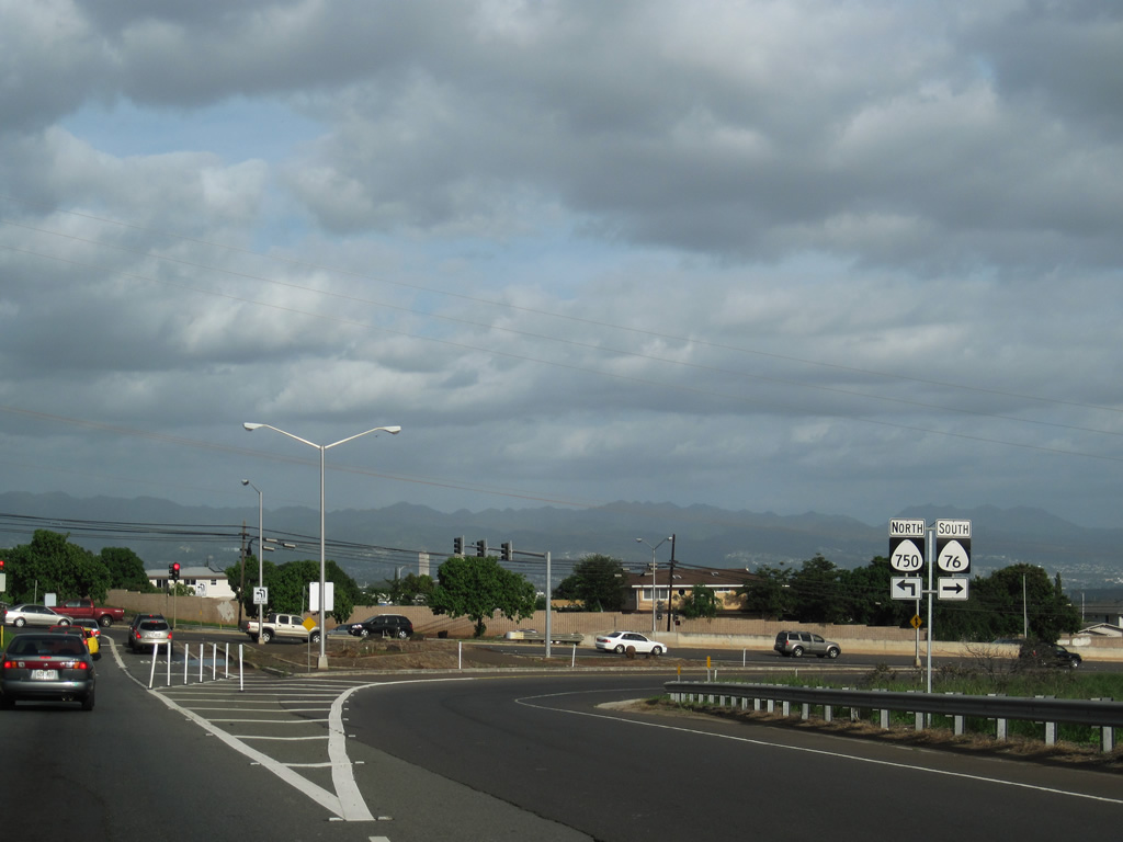
| Continuing east from near Kalo'si Gulch, Interstate H1 (Queen Liliuokalani Freeway) meets Route 750 (Kunia Road) north and Route 76 (Fort Weaver Road) south at a parclo interchange (Exit 5). 02/04/24 |
|
| Route 76 travels 6.62 miles south from Interstate H1 to the NOAA Pacific Tsunami Warning Center and Ewa Beach Park along Mamala Bay. 02/04/24 |
|
| Route 750 extends Kunia Road 8.05 miles north from Route 76 at Exit 5 to Route 99 (Wilikina Drive). Route 99 travels to the north shore from the Waipahu and Pearl City area. 02/04/24 |
|
| Route 76 originally traveled north to Route 99 near Wahiawa but was renumbered to Route 750. 01/17/11 |
|
| Route 76 comprises a controlled access arterial leading south to Lower Village, Fernandez Village and Renton Village among other suburban communities. A parclo interchange (Exits 6 A/5) joins Route 76 with Farrington Highway nearby. 01/17/11 |
|
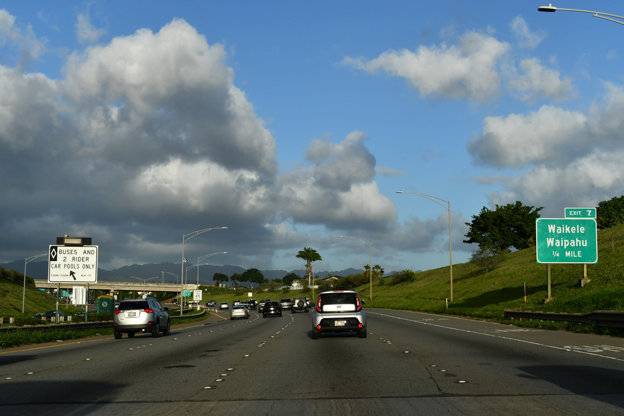
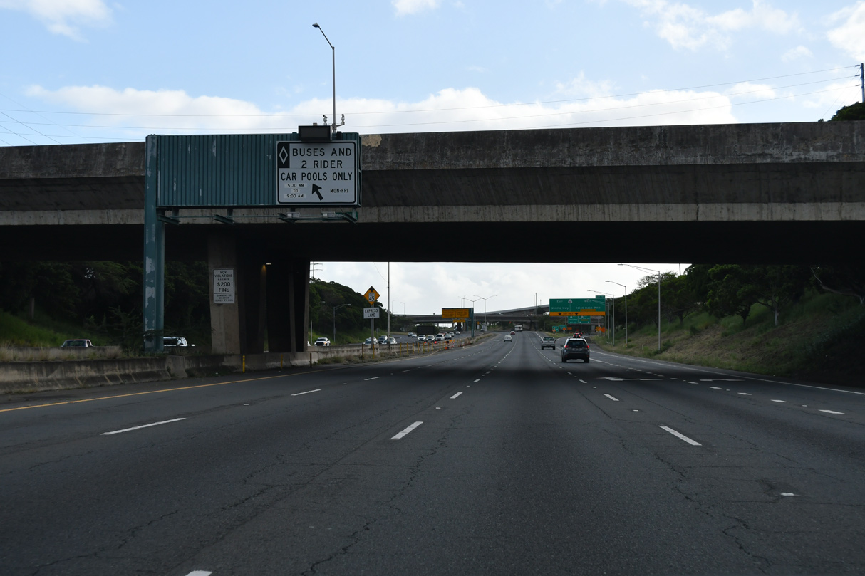
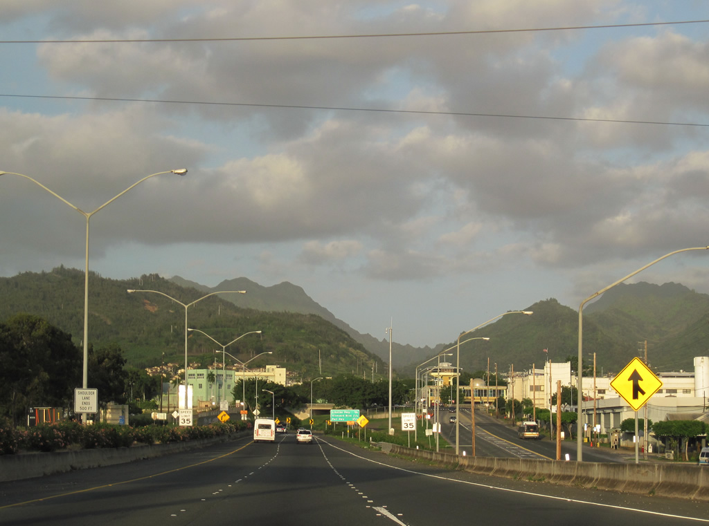
| During peak morning hours, the HOV-2 Zip lane operates along I-H1 by converting two westbound lanes to serve eastbound traffic. 02/04/24 |
|
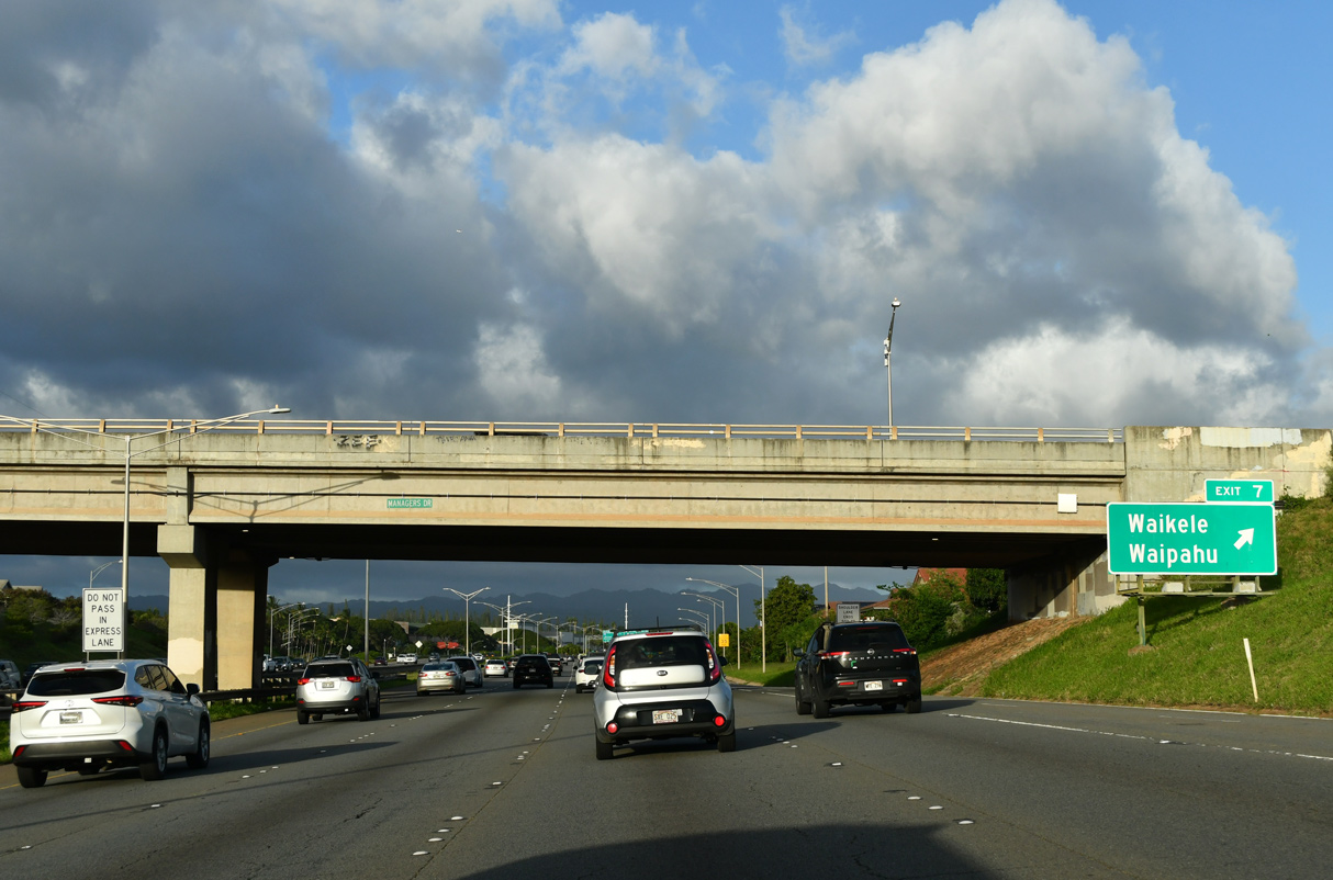
| Interstate H1 continues east across Waikele Stream to Exit 7, the Paiwa Interchange. 02/04/24 |
|
| The diamond interchange at Exit 7 joins Interstate H1 with Paiwa Street north of Waipahu and Waikele. Paiwa Street (Route 7170) weaves through neighborhoods southeast 1.12 miles to Farrington Highway (Route 7101). 02/04/24 |
|
| Paiwa Street (Route 7170) extends 0.283 miles north from Interstate H1 (Queen Liliuokalani Freeway) to Lumiaina Street (Route 7175). The local street continues north to Central Oahu Regional Park. 02/04/24 |
|
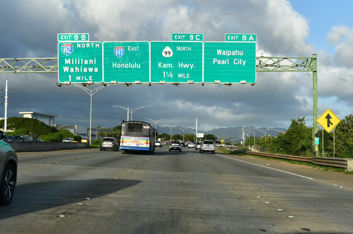
| I-H1 arcs east around the north side of Waipahu ahead of Left Exit 8 B for Interstate H2 (Veterans Memorial Freeway) north to Wahiawa. 02/04/24 |
|
| I-H2 provides a direct route to Wheeler Army Airfield and Schofield Barracks Military Reservation. Route 99 (Kamehameha Highway) parallels the freeway to the west along an arterial route through Mililani Town and Waipio Acres. 02/04/24 |
|
| A second crossover to the Express (Zip) lane east precedes Exit 8 A along Interstate H1 east. 01/17/11 |
|
| The eastbound Zipper lane has no exits until Honolulu International Airport (HNL). Forthcoming Exit 8 A for Wahiawa and Pearl City links I-H1 with Kamehameha Highway (Route 99) south. 02/04/24 |
|
| The Waiawa Interchange (Exits 8 A/C) overlays the three-wye interchange joining I-H1 with I-H2 north at Exit 8 B. Route 99 (Kamehameha Highway) turns east to the immediate south at Farrington Highway (Route 7101) and Waipahu. 02/04/24 |
|
| Interstate H2 north to Route 80 (Kamehameha Highway) at Wahiawa leads to Haleiwa and Route 83 east to the North Shore. 02/04/24 |
|
| Left Exit 8 B departs I-H1 east for I-H2 north. Interstate H2 travels 8.32 miles north to Route 99 (Wilikina Drive) by Wheeler Army Airfield. 02/04/24 |
|
| Exit 8 C loops onto Route 99 (Kamehameha Highway) north to Crestview and Waipio. The majority of the 23.81 miles along Route 99 follow Kamehameha Highway between the Haleiwa area and Honolulu. 02/04/24 |
|
| An entrance ramp links Farrington Highway (Route 7101) east with Interstate H1, 1.25 miles from Waimalu and 12 miles from Honolulu. 02/04/24 |
|
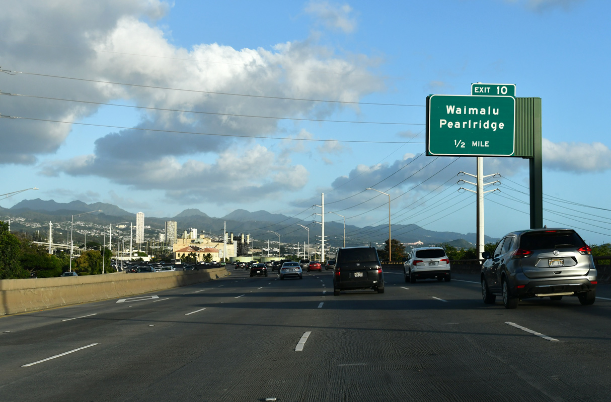
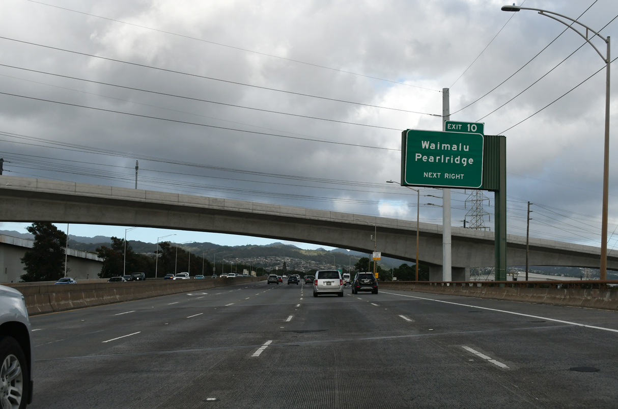
| Interstate H1 elevates along a viaduct from Waiawa Stream east to the six-ramp parclo interchange with Moanalua Road at Exit 10. 02/04/24 |
|
| I-H1 spans Lehua Avenue between Pearl City and Pearl City Peninsula, a half mile ahead of the Waiau Interchange (Exit 10) with Moanalua Road (Route 7210). Several industrial businesses line parallel Route 99 (Kamehameha Highway) by the ten lane viaduct along I-H1. 02/04/24 |
|
| Moanalua Road (Route 7210) meanders 2.60 miles east from Exit 10 to Waiau and Aiea and west 0.80 miles to Waiamano Home Road at Pearl City. 02/04/24 |
|
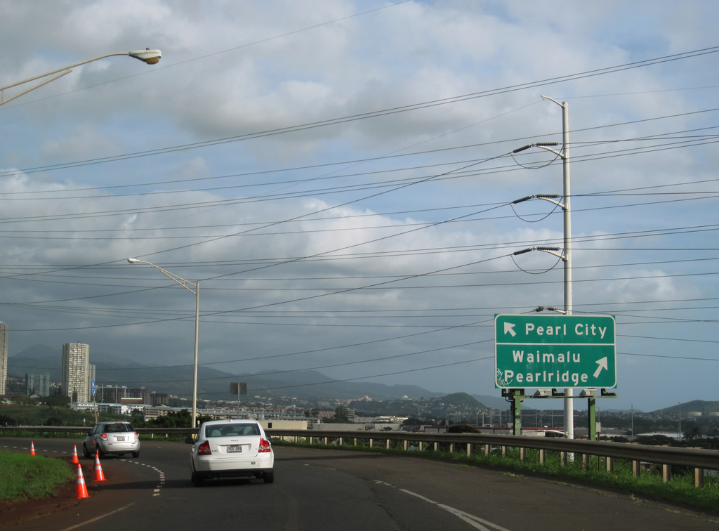
| Moanalua Road (Route 7210) constitutes a busy commercial arterial from Exit 10 east to Pearlridge. Kaahele Street (Route 7251) stems 1.86 miles north from nearby to the community of Waimalu. 01/17/11 |
|
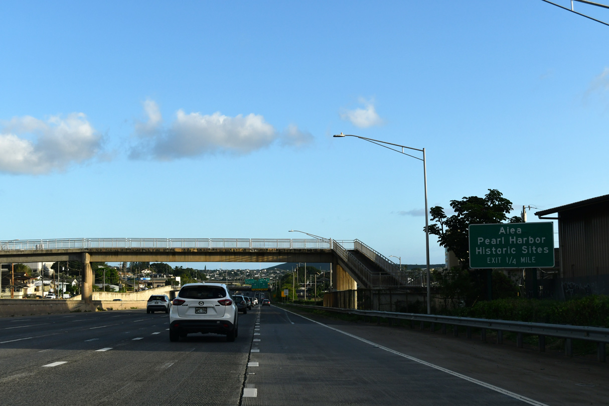
| Interstate H1 lowers to cross Waimalu Stream with eleven overall lanes at Waiau. Several condominium high rises appear along the south side of the freeway at Pearlridge. 02/04/24 |
|
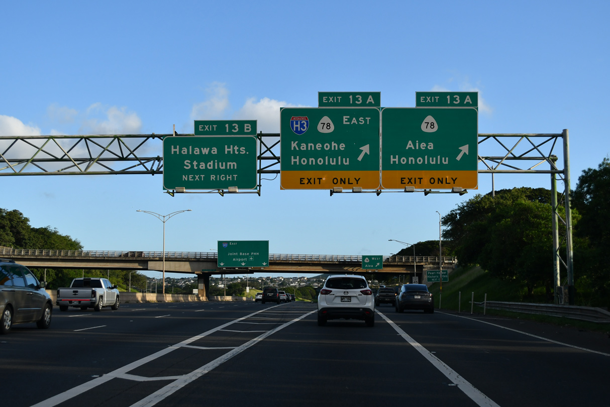
| The directional cloverleaf interchange at Exits 13 A/B joins I-H1 with Route 78 (Moanalua Freeway) west to Route 99 (Kamehameha Highway) at Aiea and I-H201 east to Moanalua. 02/04/24 |
|
| The Hawaii Department of Transportation recorded 201,400 vehicles per day on I-H1 east at Kaohoni Street in 2020. Interstate H3 (John A. Burns Freeway) travels 15.32 miles east from I-H1 at Exit 13 A to G Street at MCBH Kaneohe Bay. 02/04/24 |
|
| Forthcoming Exit 13 A partitions into ramps for Route 78 west to Route 99 adjacent to Aloha Stadium and Interstate H3 east to Kaneohe. 02/04/24 |
|
| Interstate H3 initially parallels I-H201 (Monalua Freeway) at Halawa before turning northeast across the Koolau Range. 02/04/24 |
|
| Costing $68 million, the H-1 Freeway Shoulder Widening and Portland Cement Concrete Pavement Rehabilitation (PCCP) project underway from May 2018 to early 2020 widened the eastbound shoulder lane between the Waimalu Viaduct and Aiea Pedestrian Overpass.4 02/04/24 |
|
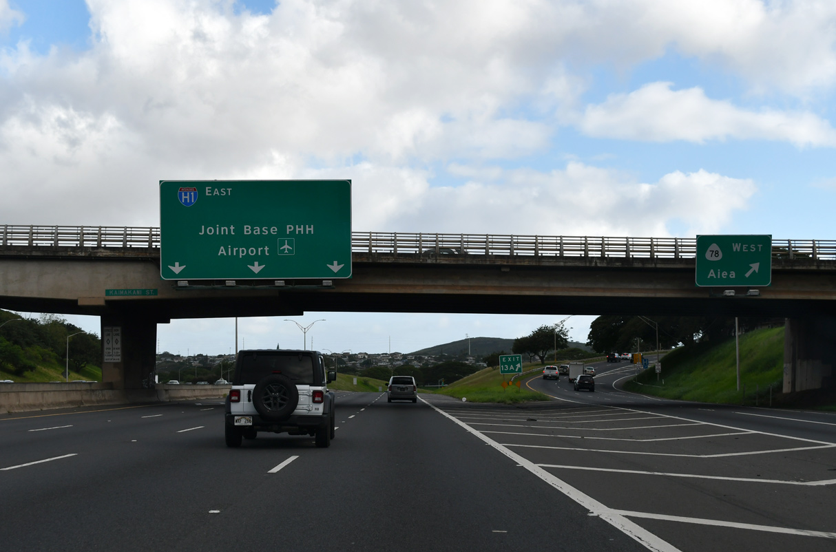
| Route 78 spurs 0.74 miles west from Interstate H201 to Route 99 at Aiea. I-H3 east across the Koolau Range was completed in 1997. 02/04/24 |
|
| Signed along the Moanalua Freeway in 2004, I-H201 bypasses Honolulu International Airport (HNL) along I-H1 east through Moanalua, Salt Lake and Fort Shafter. Guide signs for Exit 13 B however omit I-H201. 02/04/24 |
|
| Kaimakani Street spans Interstate H1 east at the Halawa Interchange (Exit 13 A) for Route 78 west and I-H3 east. 02/04/24 |
|
| Exit 13 B loops onto I-H201 (Moanalua Freeway) east ahead of the parclo interchange with Kahuapaani Street. Kahuapaani Street (Route 7241) leads north to Halawa Heights and south to Salt Lake Boulevard (Route 7311). 02/04/24 |
|
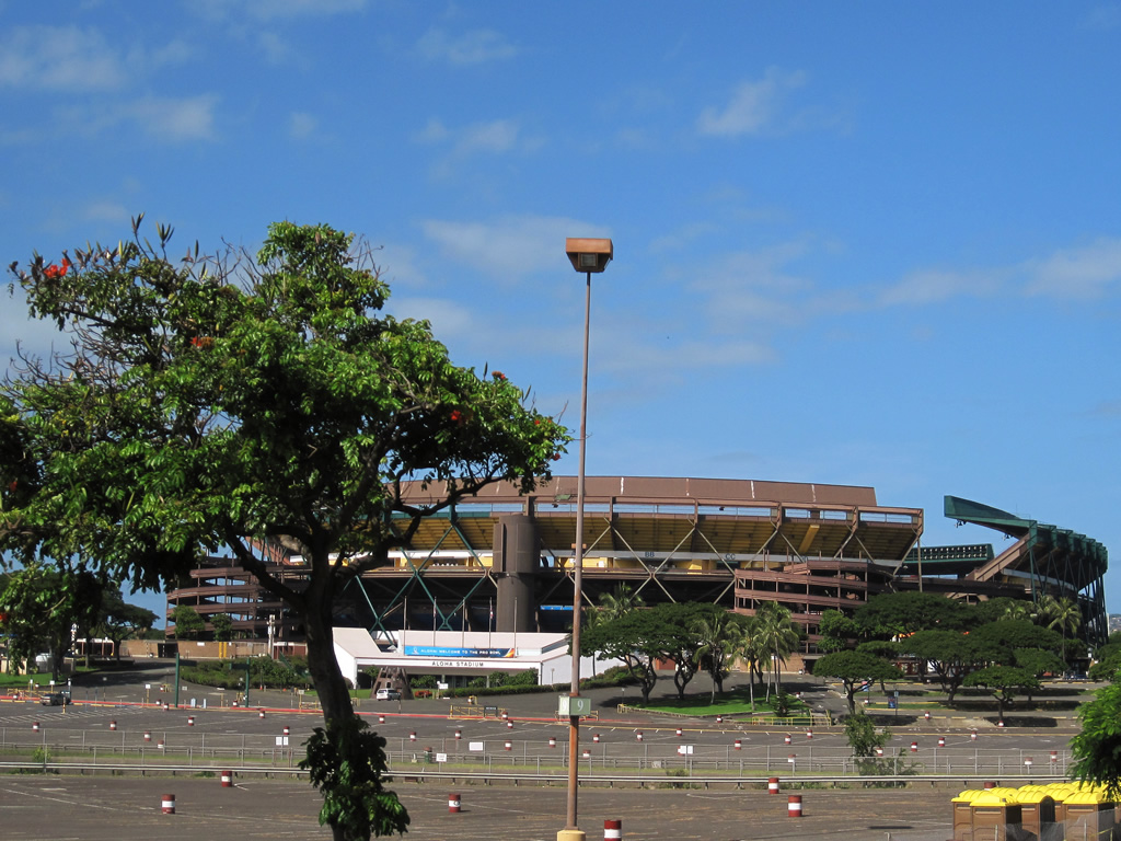
| Aloha Stadium comes into view along the Interstate H1 viaduct over Kahuapaani Street, Salt Lake Boulevard and Luapele Drive. The venue was formerly the home of the NFL Pro Bowl. 01/17/11 |
|
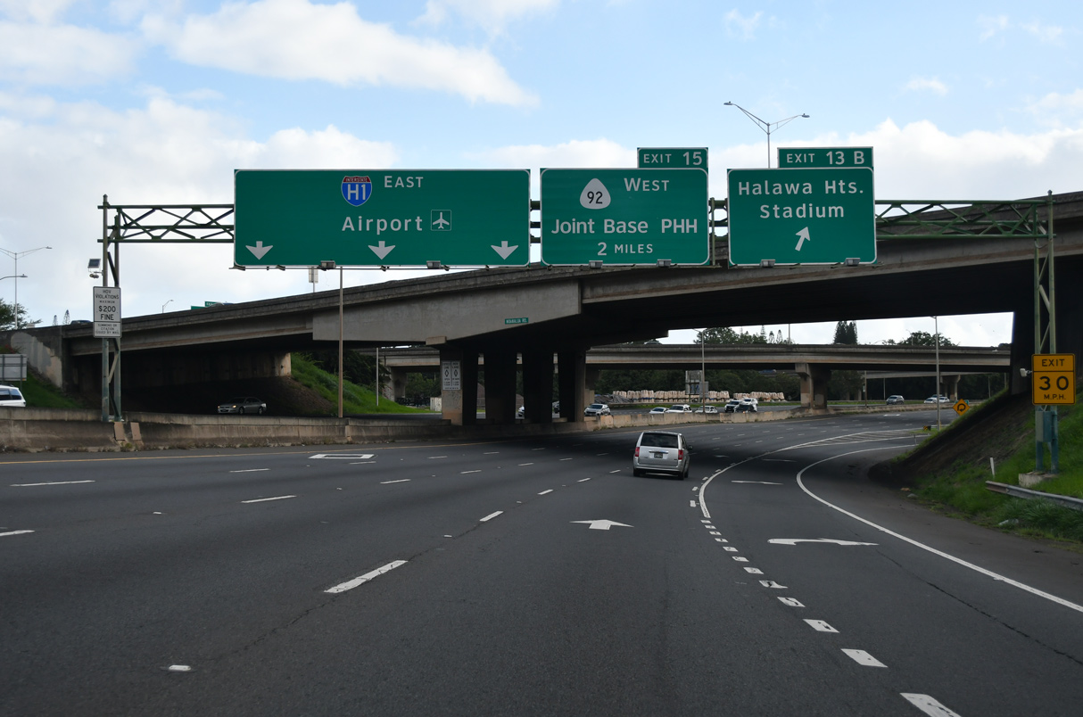
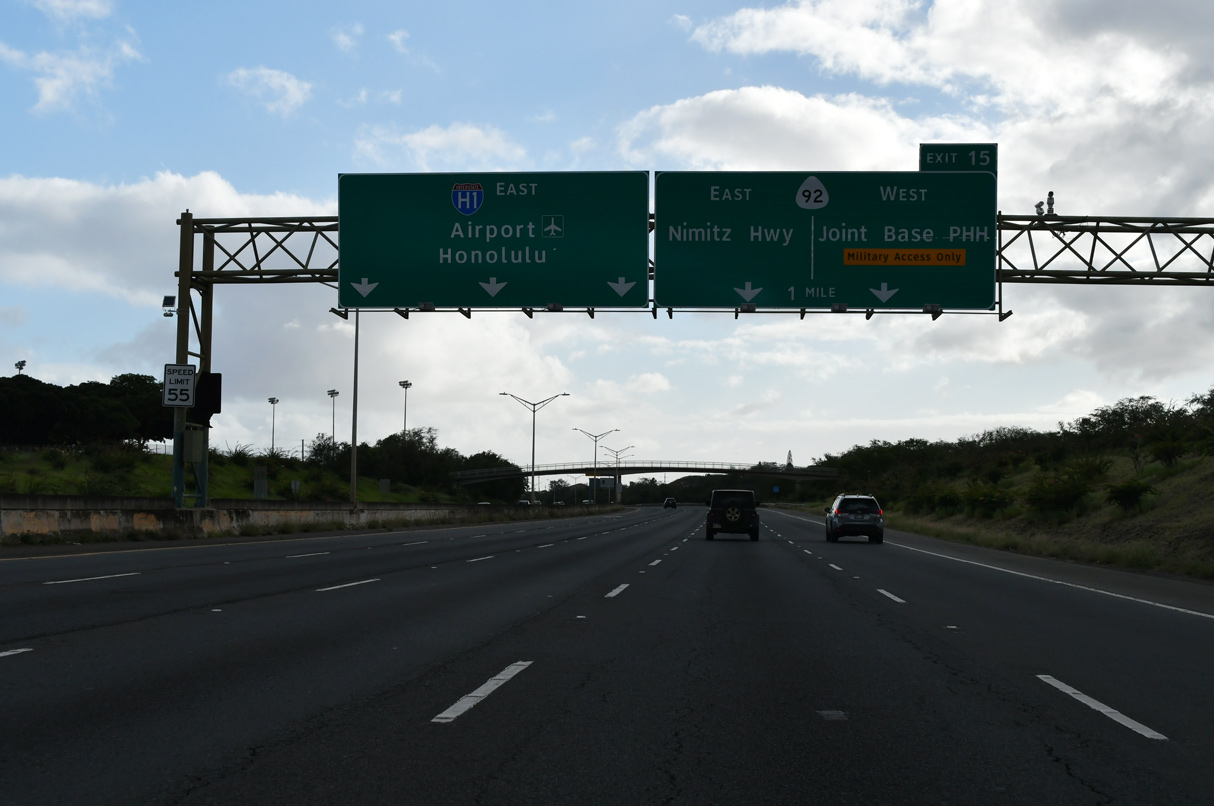
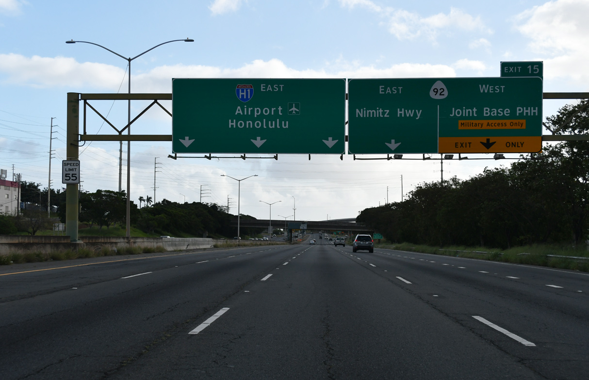
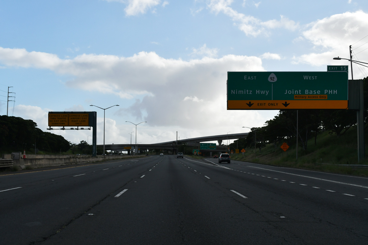
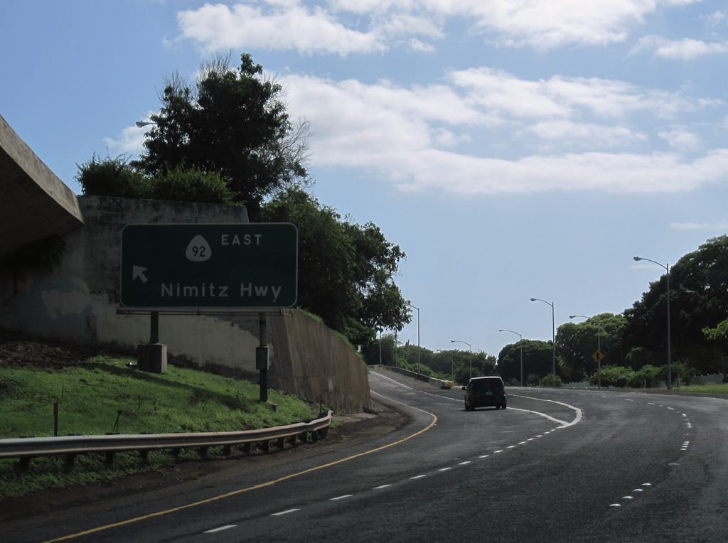
| Interstate H1 proceeds south through Makalapa Naval Reservation by Foster Village to a directional T interchange (Exit 15) with Route 92 (Nimitz Highway) west. 02/04/24 |
|
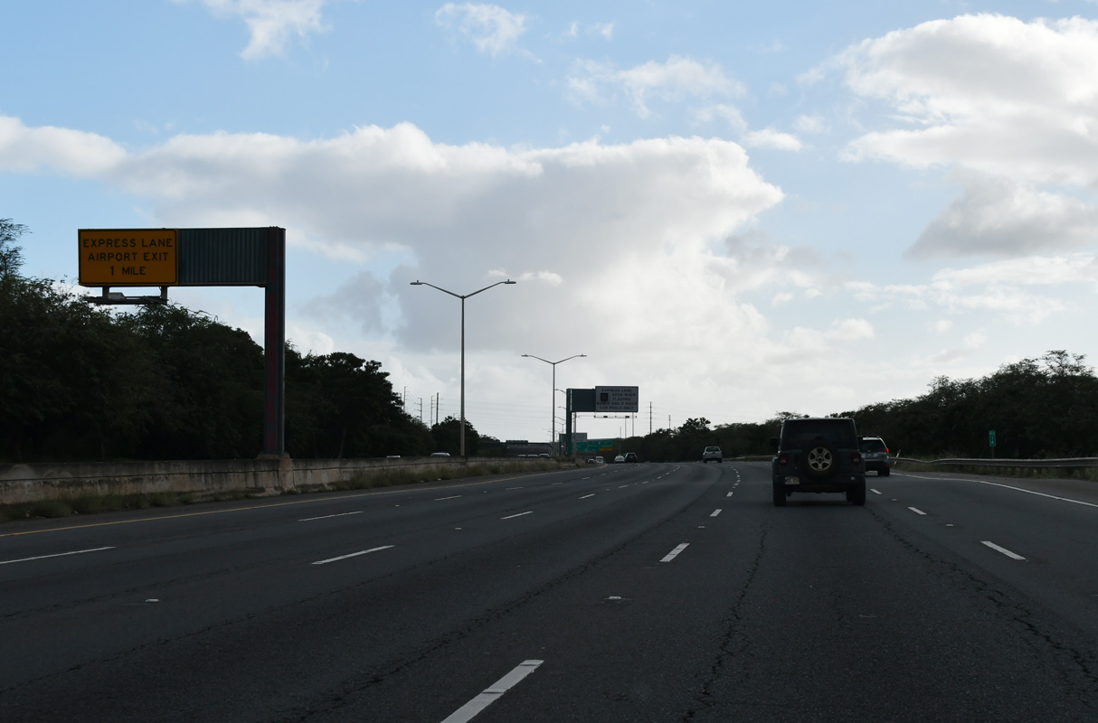
| The exit to Honolulu International Airport (HNL) departs from the Express (Zip) lane next. 02/04/24 |
|
| Operating during the morning peak hours, the Zip lane is restricted to HOV-2 traffic. 01/17/11 |
|
| A crossover to the Zip Lane east along Interstate H1 allows commuters to bypass the Airport Interchange. 08/15/19 |
|
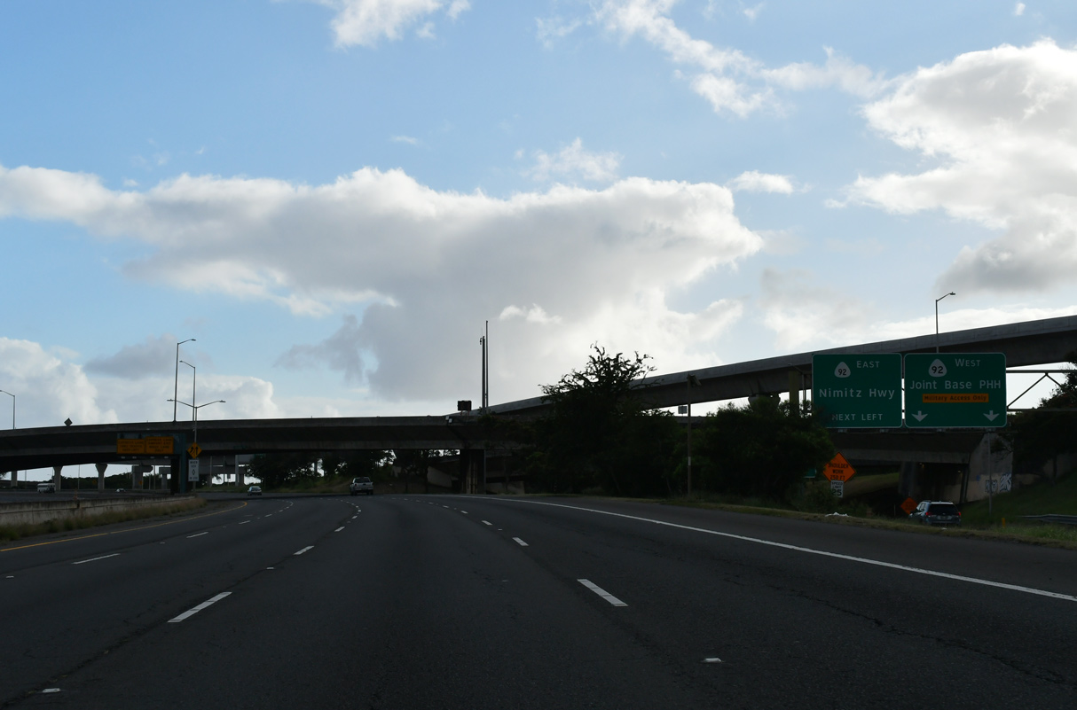
| Route 92 spurs 0.91 miles west to a gate at Joint Base Pearl Harbor-Hickam (PHH). Route 92 (Nimitz Highway) east runs below the viaduct along I-H1 by Honolulu International Airport (HNL). 02/04/24 |
|
| Radford Drive (Route 7351) passes over Interstate H1 at the ingress point for the Zip lane. 02/04/24 |
|
| Two lanes depart I-H1 at Exit 15 for Route 92 to Joint Base Pearl Harbor-Hickam (PHH) and along Nimitz Highway east to HNL Airport. 02/04/24 |
|
| Two lanes connect Exit 15 with Route 92 (Nimitz Highway) west ahead of O'Malley Boulevard south to Hickam Field. A turn off at the end of Route 92 links with Center Drive east to Route 99 north toward the Arizona Memorial at Pearl Harbor. 02/04/24 |
|
| The eastbound ramp for Route 92 joins the south end of Route 99 ahead of Valkenburgh Street. 01/17/11 |
|
| The Zip lane egress point for Honolulu International Airport departs from within the Pearl Harbor Interchange. 02/04/24 |
|
| The south end of Route 99 partitions into ramps for I-H1 and Route 92 (Nimitz Highway) eastbound. The Honolulu rail line runs along the ensuing stretch of I-H1 to HNL Airport. 02/04/24 |
|
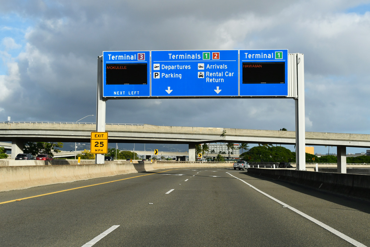
| Turning eastward, I-H1 shifts onto the Airport Viaduct, the longest bridge in Hawaii. Spanning Nimitz Highway, the succeeding exit along the elevated roadway is for the passenger terminal at Honolulu International Airport (HNL). 02/04/24 |
|
| The entrance ramp from Route 92 (Nimitz Highway) east forms an auxiliary lane to the flyovers for Honolulu International Airport (HNL) at Exit 16. 02/04/24 |
|
| Two lanes separate from Interstate H1 (Queen Liliuokalani Freeway) for Honolulu International Airport (HNL) at Exit 16. 02/04/24 |
|
| Exit 16 also connects Interstate H1 east with Paiea and Aolele Streets. 02/04/24 |
|
| Looking southeast beyond Ke'ehi Lagoon at the Honolulu skyline from the Airport Viaduct. 08/15/19 |
|
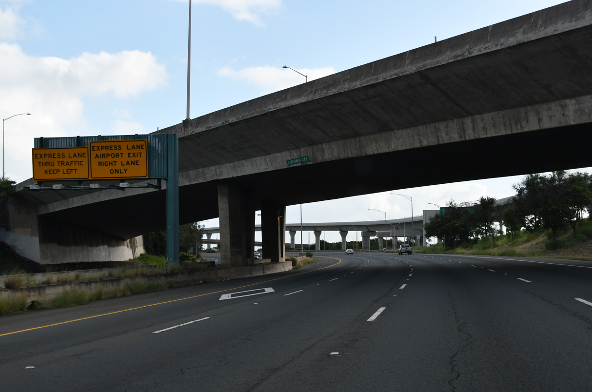
| Advancing east along the Airport Viaduct, traffic partitions with two lanes for I-H1 and three for the succeeding exits. This traffic pattern is designed to shift the majority of Downtown traffic from the Lunalilo Freeway onto Route 92 (Nimitz Highway). 08/15/19 |
|
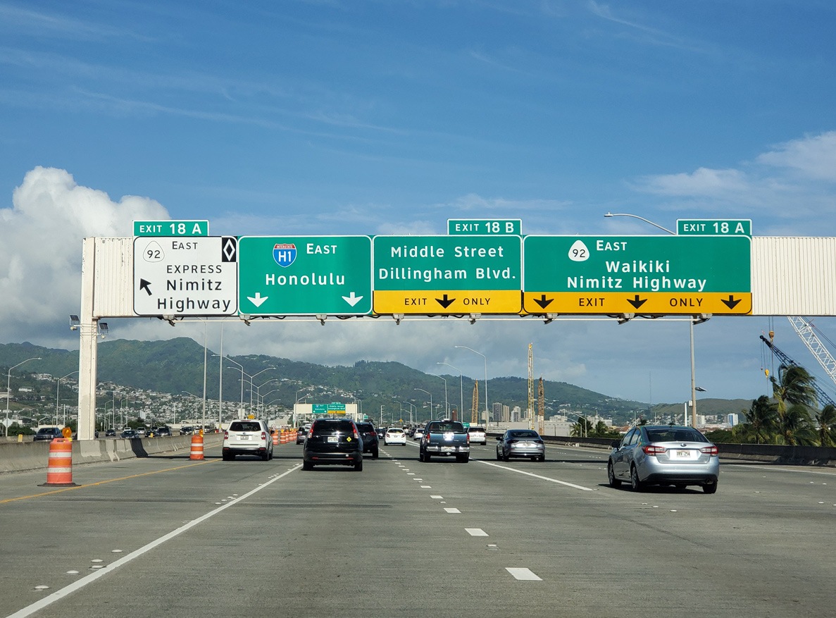
| An HOV exit joins Route 92 (Nimitz Highway) east just ahead of Exit 18 A from the general travel lanes. Route 92 angles southeast through industrial Kalihi Kai and Iwilei before reaching Downtown Honolulu. 08/15/19 |
|
| Interstate H1 turns northeast beyond Exit 18 B toward I-H201 (Moanalua Freeway) and the Lunalilo Freeway. Kamehameha Highway branches southeast from Exit 18 B onto Dillingham Boulevard at the Kalihi neighborhood. 08/15/19 |
|
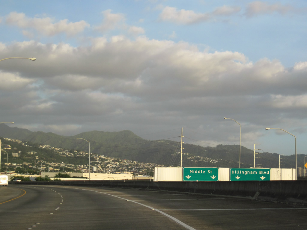
| Exit 18B lowers from the Airport Viaduct onto Kamehameha Highway (Route 7401) at Middle Street (Route 7415). Middle Street parallels I-H1 northeast to Fort Shafter. 01/17/11 |
|
| Completed in 1986, the short stretch between Route 92 (Nimitz Highway) and I-H201 (Moanalua Freeway) was the last section of Interstate H1 opened to traffic. 01/17/11 |
|
| I-H1 shifts from the Queen Liliuokalani Freeway onto the Lunalilo Freeway at the east end of the Moanalua Freeway. The ensuing exit is for Route 63 (Likelike Highway) at Kalihi in Honolulu. 08/15/19 |
|
| I-H1 converges with the east end of I-H201 at the Middle Street curve and tunnel. The tunnel was built in 1961 as part of the original Kahauiki Interchange. 08/15/19 |
Page Updated 02-18-2024.

 East
East