|
| Interstate 287 curves eastward onto Second Watchung Mountain, leveling out through southern Far Hills borough. 07/20/05 |
|
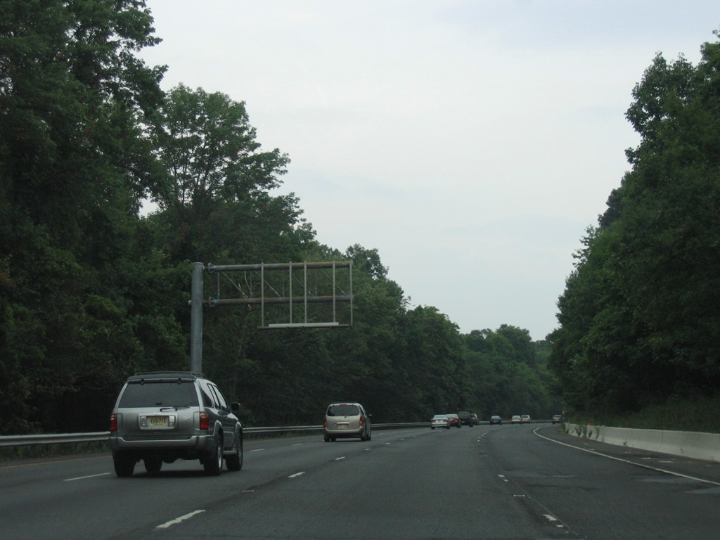
| An overhead sign structure posted over the left lane of Interstate 287 north remains from when HOV lanes were striped in 1998. 08/29/05 |
|
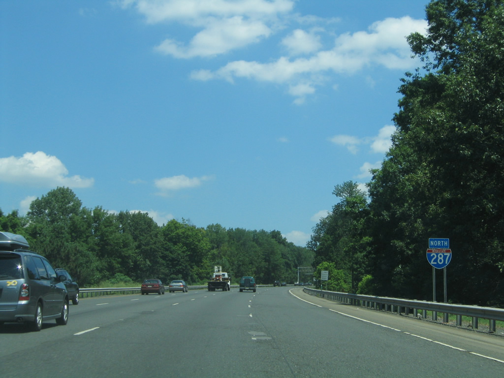
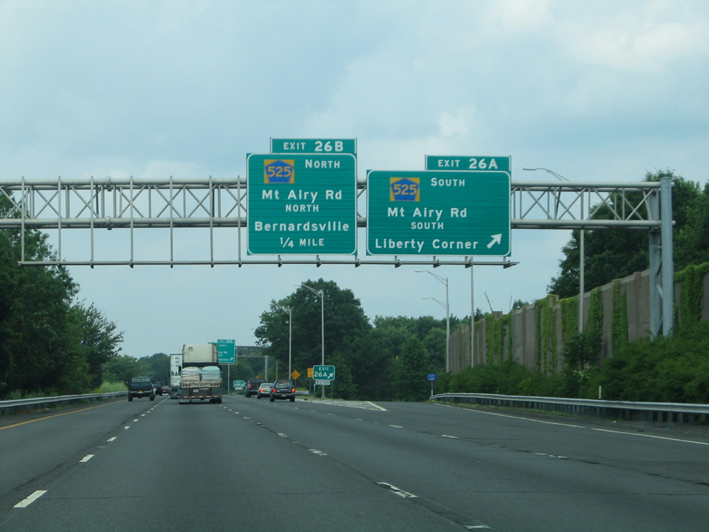
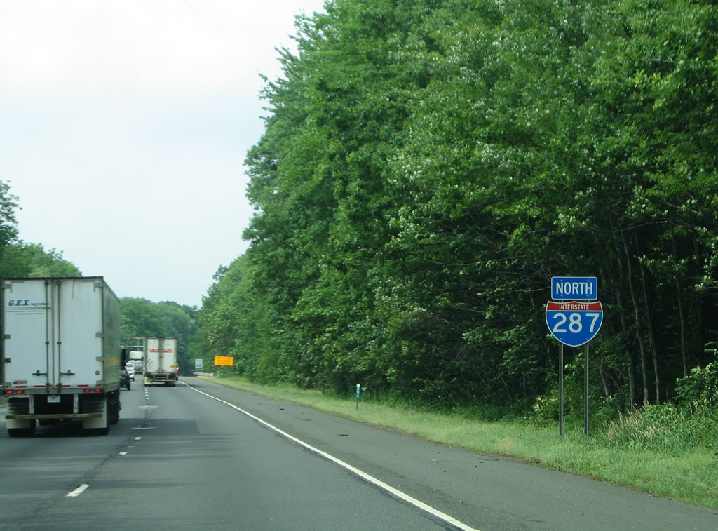
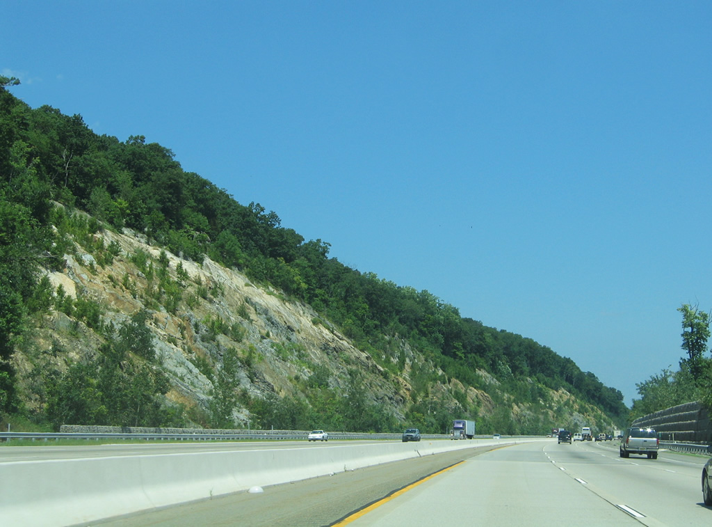
| Entering Bernards Township, Interstate 287 approaches a six-ramp parclo interchange (Exits 26A/B) with County Route 525 (Mount Airy Road). 07/20/05 |
|
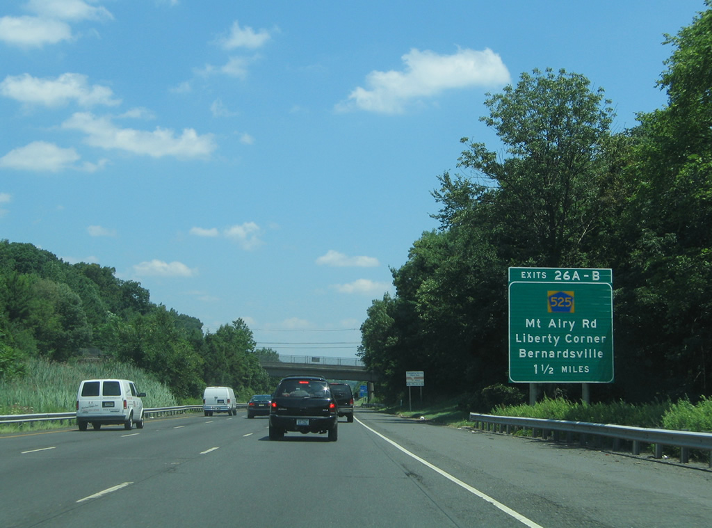
| Forthcoming Exit 256 onto CR 525 (Mount Airy Road) south serves both the USGA Museum at Far Hills and the Lyons VA Medical Center. County Route 525 meanders south otherwise to Liberty Corner and Exit 33 of I-78. 06/30/05 |
|
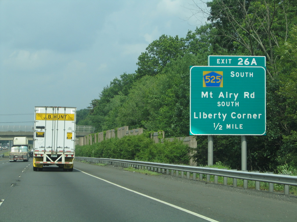
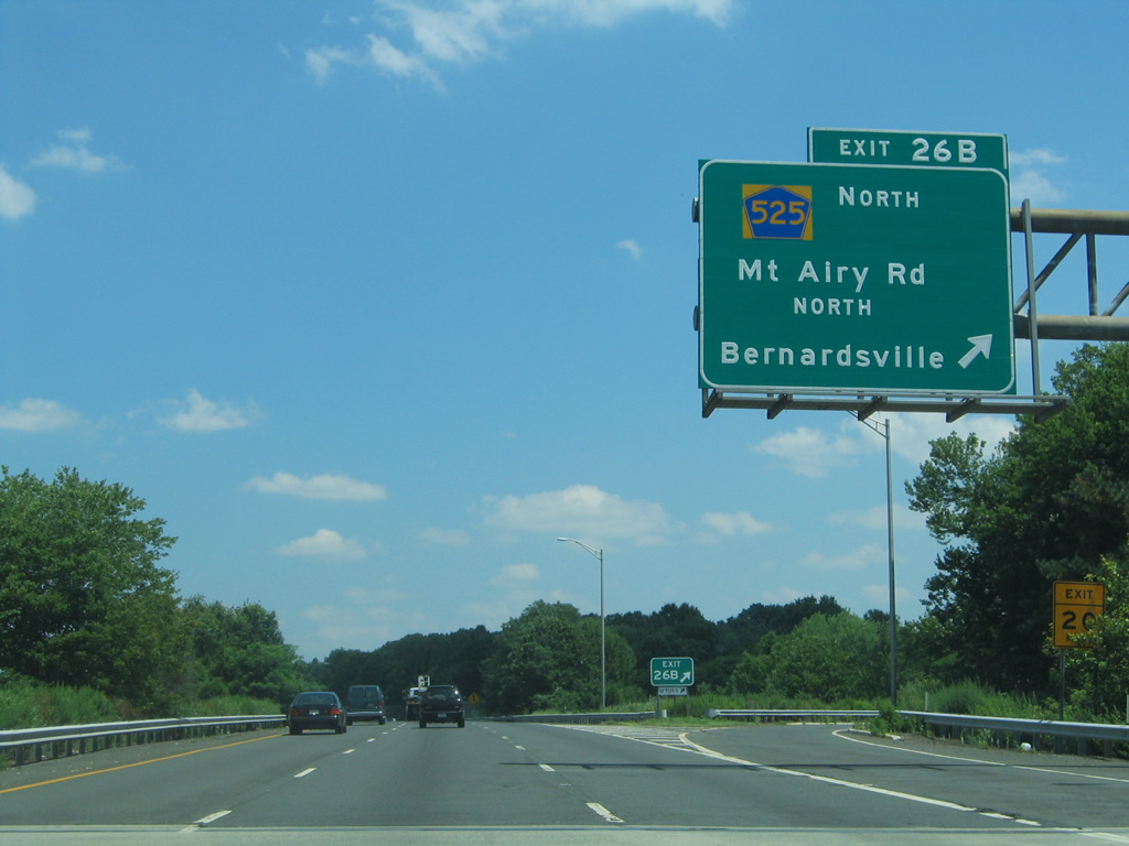
| Exit 26A departs Interstate 287 north for Somerset County 525 (Mount Airy Road) south. CR 525 winds southward to end at New Jersey 28 in Bound Brook. 06/30/05 |
|
| County Route 525 concludes a 16.88 mile route northward by way of Bernardsville to CR 510 at the borough of Mendham. 07/20/05 |
|
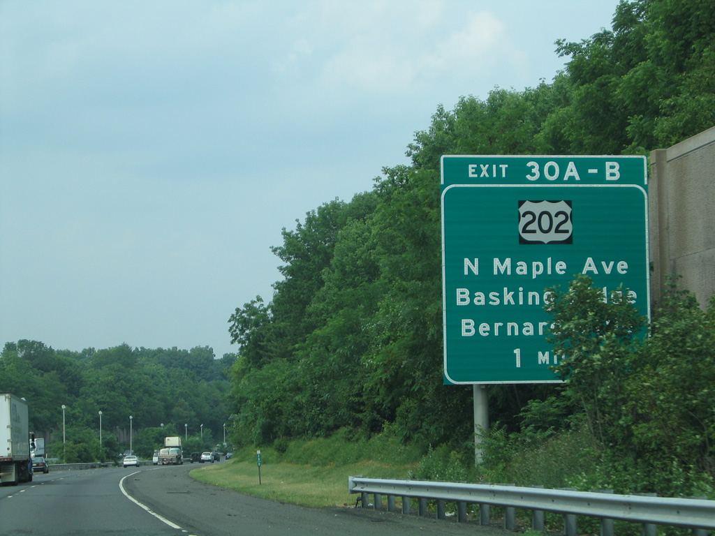
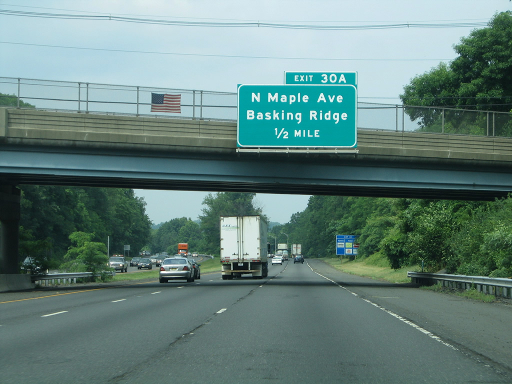
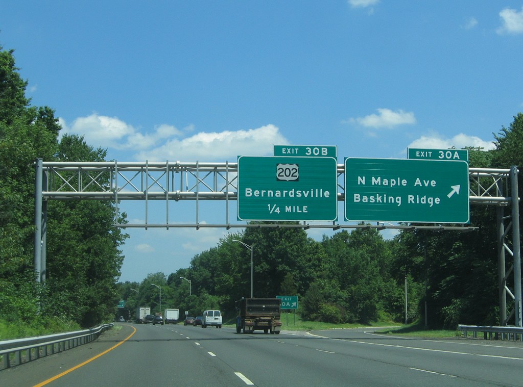
| Interstate 287 passes between Bernardsville and Basking Ridge to next meet North Maple Avenue at Exits 30A/B. 06/30/05 |
|
| North Maple Avenue leads back south to Basking Ridge from Exit 30A. 06/30/05 |
|
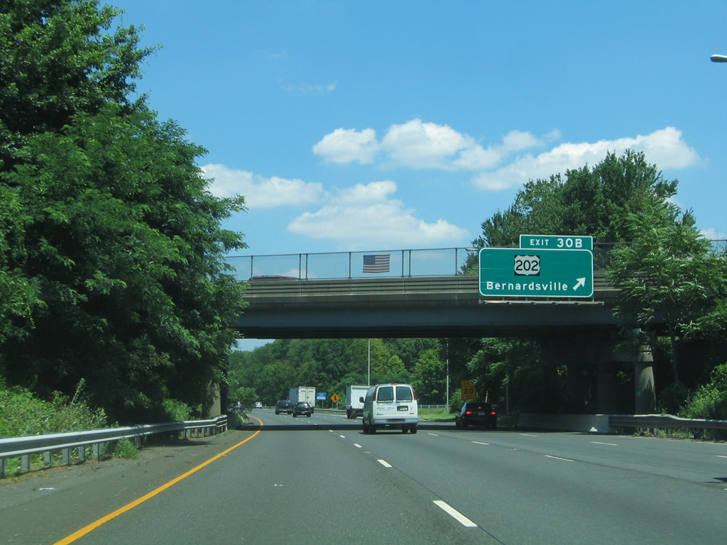
| Exit 30A leaves I-287 north for North Maple Avenue south to Madisonville. A loop ramp follows onto Maple Avenue north to adjacent U.S. 202 outside Bernardsville. 07/20/05 |
|
| U.S. 202 parallels the west side of Interstate 287 from Bernardsville northward to Mount Kemble in Harding Township. 07/20/05 |
|
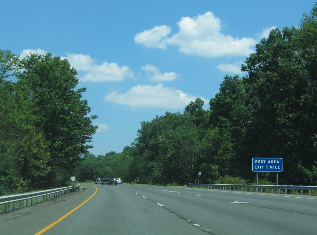
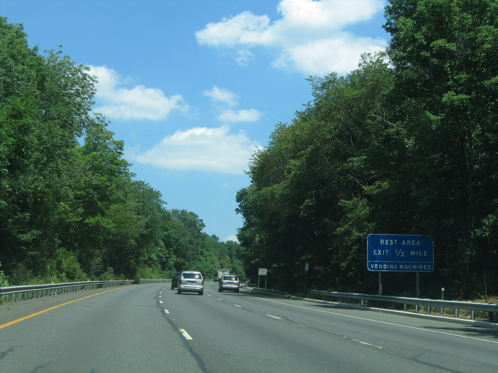
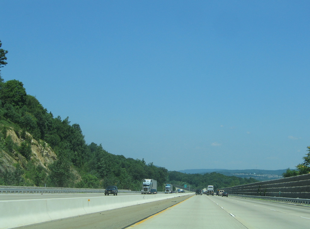
| Interstate 287 crosses the Morris County line ahead of a northbound side truck rest area near Mount Kemble. 07/20/05 |
|
| Northbound reassurance marker for I-287 posted near Glen Alpin in Harding Township. 06/30/05 |
|
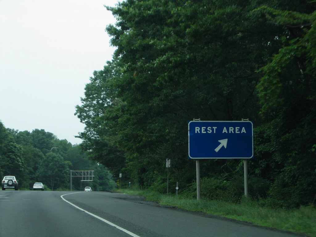
| Travelers along I-287 north reach the lone rest area for the nearly 99 mile route. This facility was restricted to trucks only after 2008. 06/30/05 |
|
| Interstate 287 veers away from the hillside of Mount Kemble toward Exit 33 in south Morris Township. 07/20/05 |
|
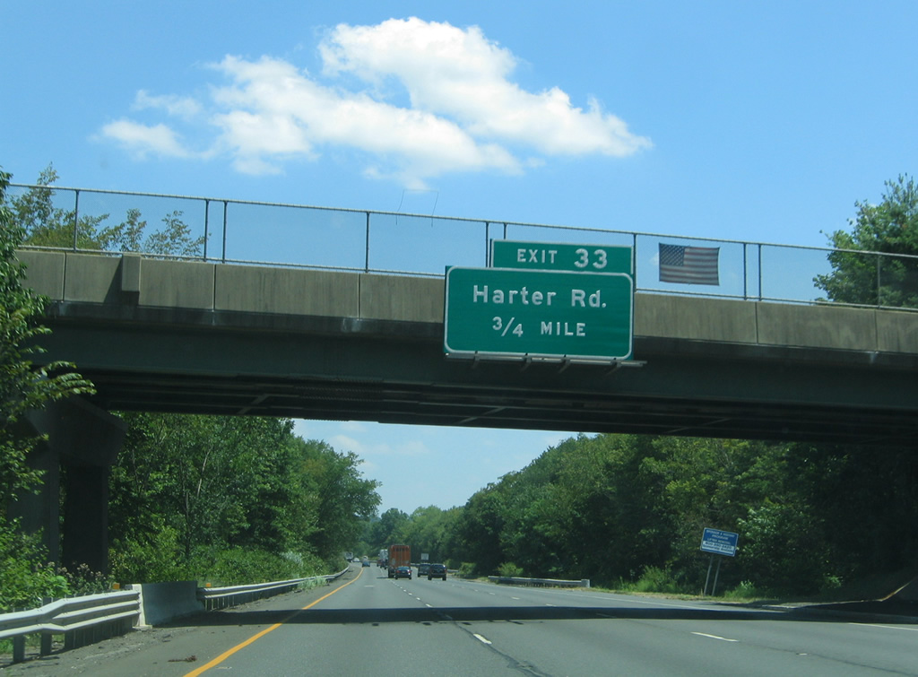
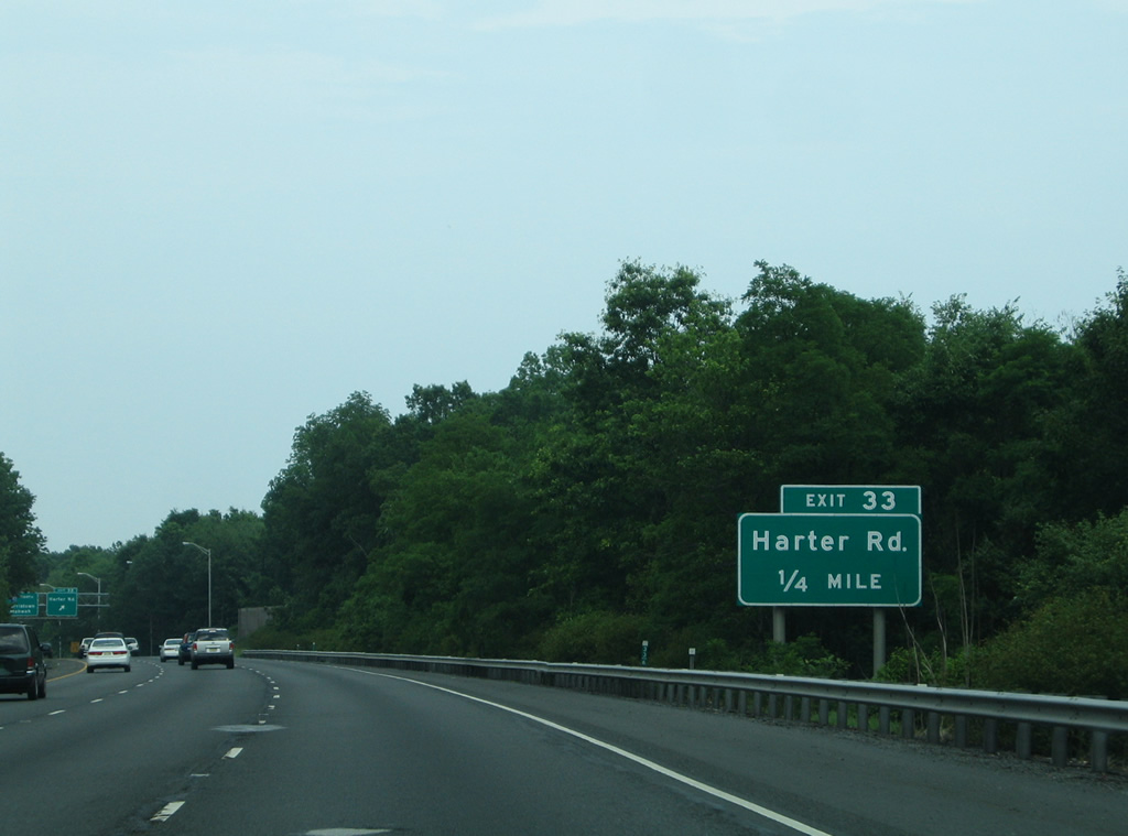
| Upcoming Exit 33 joins I-287 with Harter Road via adjacent Tiger Lily Lane. Trucks over five tons are prohibited from using Harter Road. 06/30/05 |
|
| Harter Road consists of a local residential road linking I-287 with CR 663 (James Street) to the east and U.S. 202 (Mount Kemble Avenue) to the west. Return access to I-287 north is provided via a ramps from James Street and Southgate Parkway nearby. 06/30/05 |
|
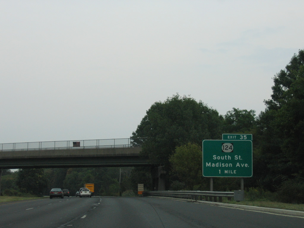
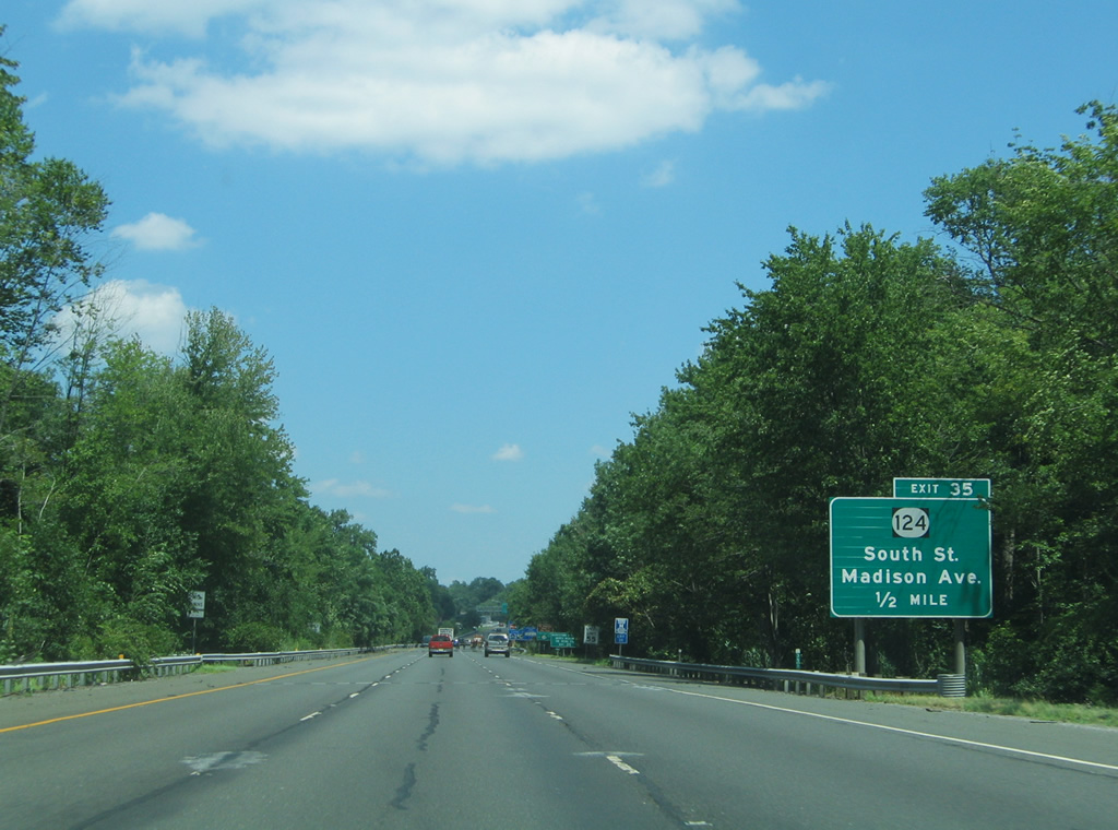
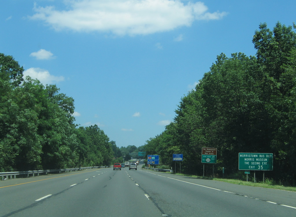
| Exit 35 with South Street is the first of three interchanges serving the Morris County seat of Morristown from Interstate 287 north. 08/29/05 |
|
| Route 124 (Madison Avenue) travels 14.74 miles from U.S. 202 in Downtown Morristown east to become CR 603 at the Maplewood / Irvington Township line. 07/20/05 |
|
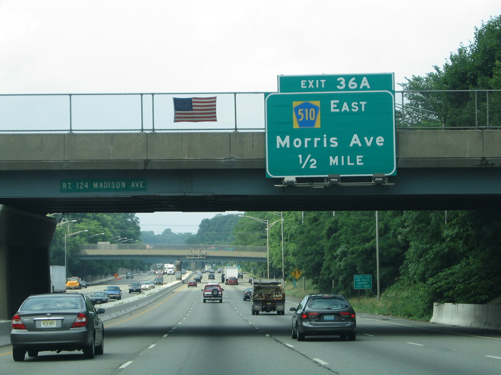
| Exit 35 joins I-287 north with South Street (CR 601) ahead of its merge with Route 124 (Madison Avenue) toward the Morristown business district. The exit serves The Shakespeare Theater of New Jersey and the Morris Museum via Route 124 east and The Seeing Eye guide dog school via Route 124 west to CR 510. 07/20/05 |
|
| Interstate 287 north reaches the Exit 35 off-ramp to South Street (CR 601). Route 124 takes South Street to Downtown Morristown while following Madison Avenue southeast to the borough of Madison. The state route represents the pre-freeway alignment of New Jersey 24 between Morristown and Summit. 07/20/05 |
|
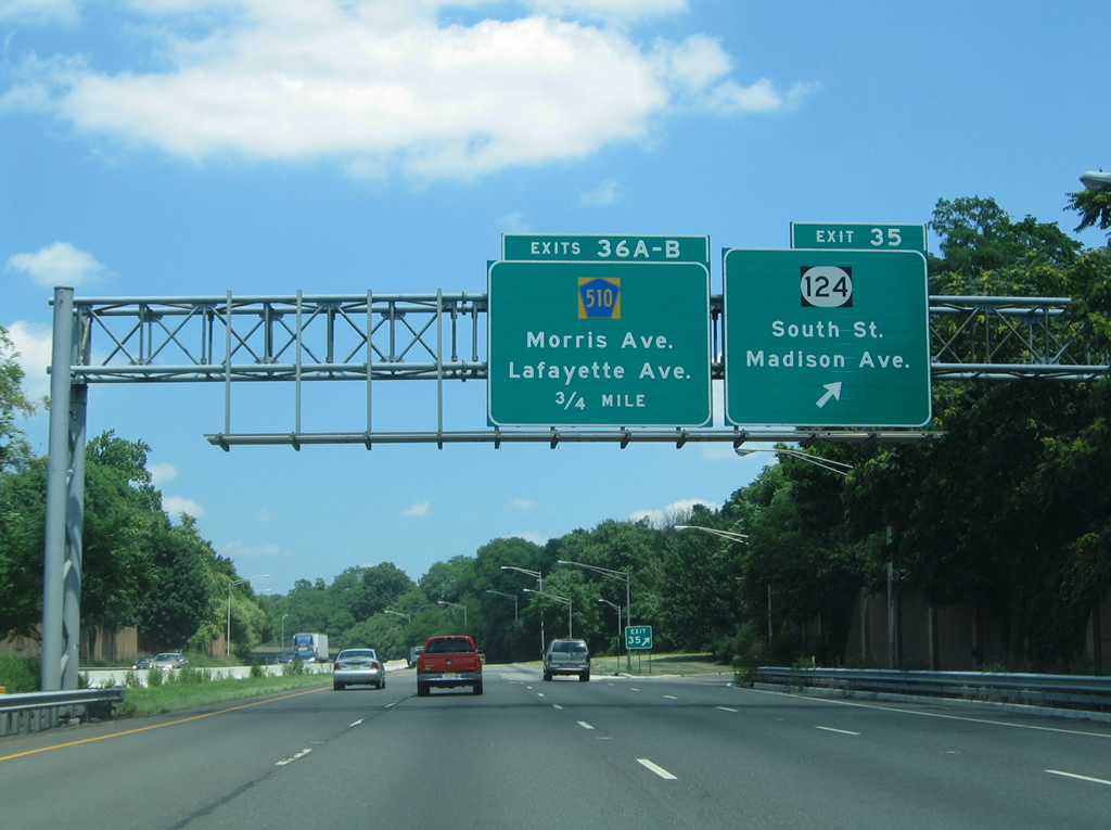
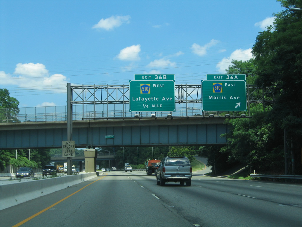
| Continuing through the village of Morristown, I-287 next meets Exit 36A onto County Route 510 (Morris Avenue) east. 06/30/05 |
|
| County Route 510 (Morris Avenue) heads east from Morristown to Florham Park, Livingston Township and ultimately Newark. The route totals 29.58 miles from CR 513 in Chester to the west. 07/20/05 |
|
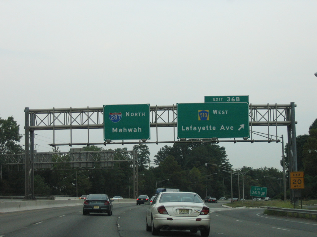
| Exit 36B follows onto Lafayette Avenue (CR 510Z) west to County Route 510 (Morris Street) into Downtown Morristown. The county route extends west from the village along the former route of Route 24 to Mendham. 08/29/05 |
|
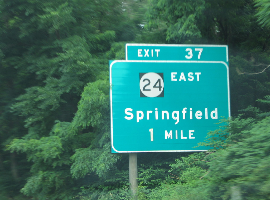
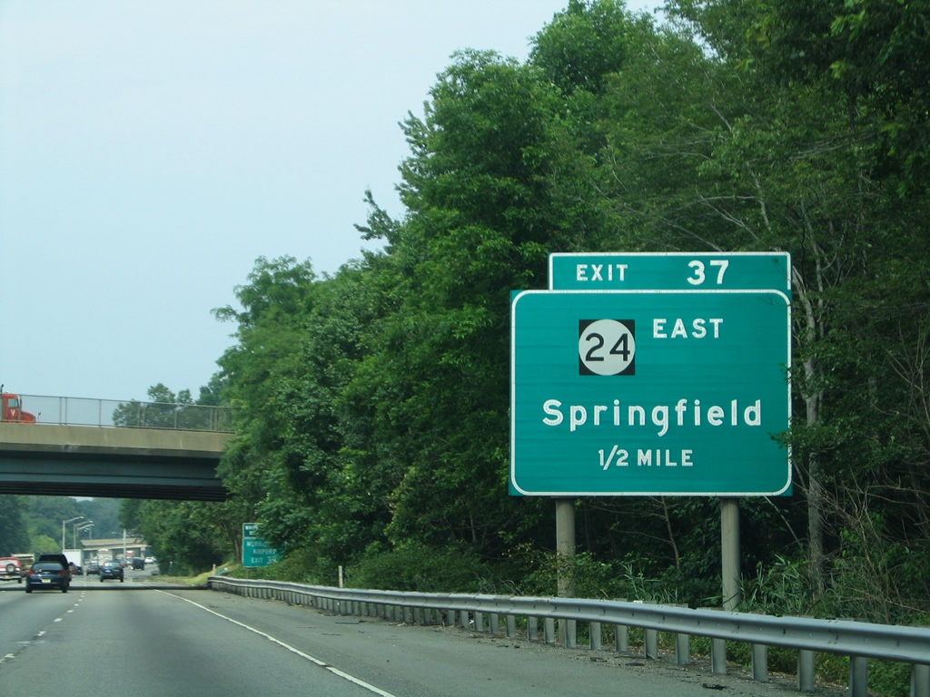
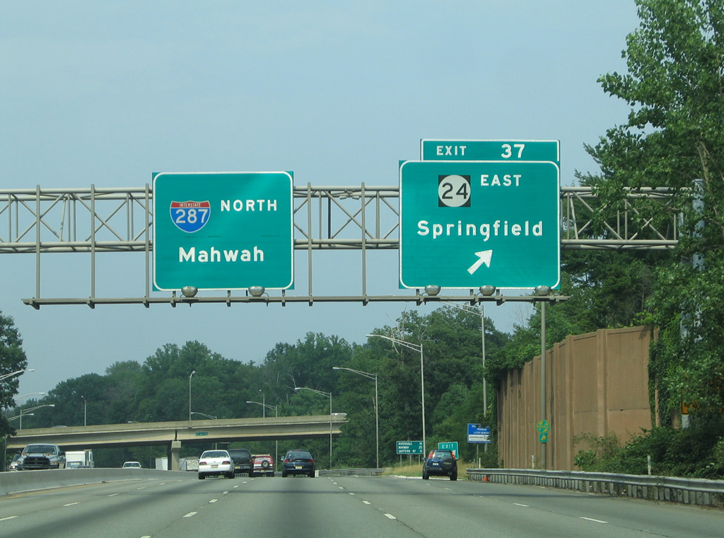
| Interstate 287 leaves Morristown for Hanover Township and a trumpet interchange (Exit 37) with the New Jersey 24 freeway. 06/30/05 |
|
| New Jersey 24 angles southeast 10.42 miles from I-287 to I-78 at Springfield. The entire route is a freeway. 06/30/05 |
|
| Exit 37 departs I-287 north for New Jersey 24 east to Springfield. The freeway comprises a busy commuter route, as well as the best way from Morristown to I-78 east for Newark Liberty International Airport (EWR). 06/30/05 |
|
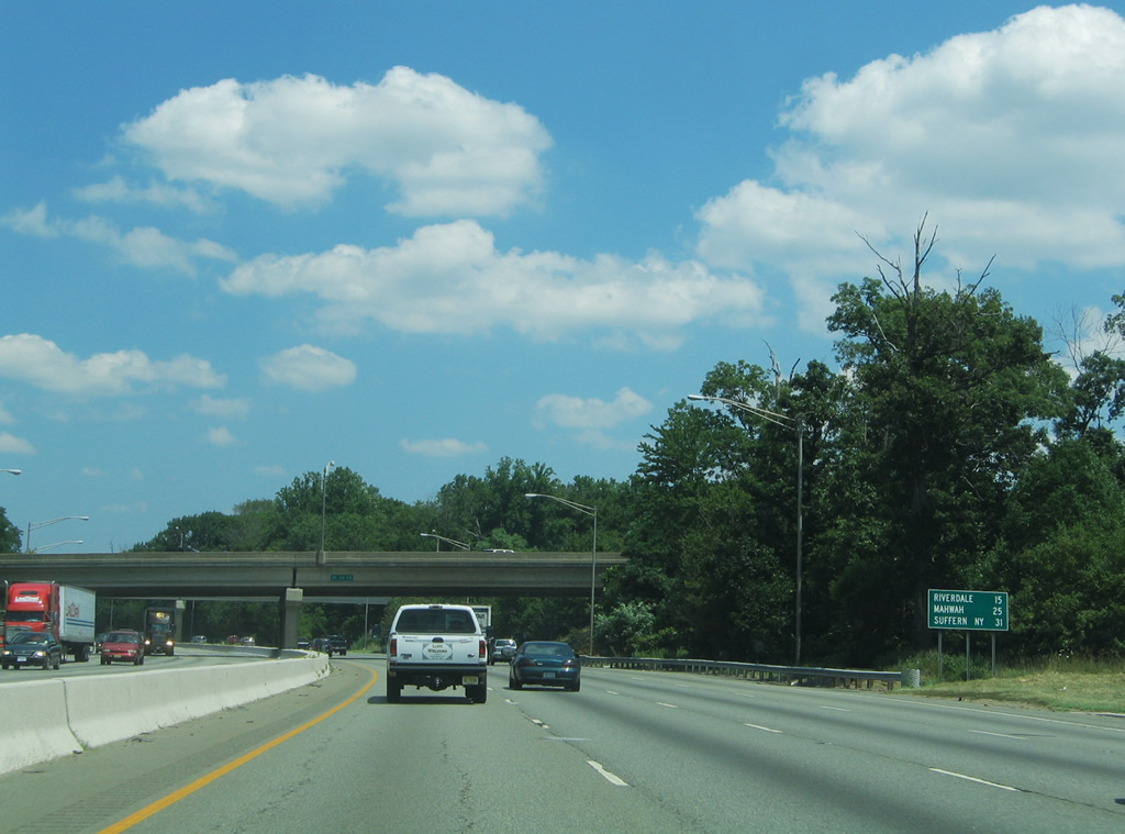
| Northbound distance sign posted 15 miles south of the borough of Riverdale, 25 miles from Mahwah near the state line and 31 miles from the merge with I-87 (NY Thruway) at Suffern, New York. 07/20/05 |
|
| Route 10 crosses paths with Interstate 287 at a directional cloverleaf interchange (Exit 10), west of Whippany, in one mile. 06/30/05 |
|
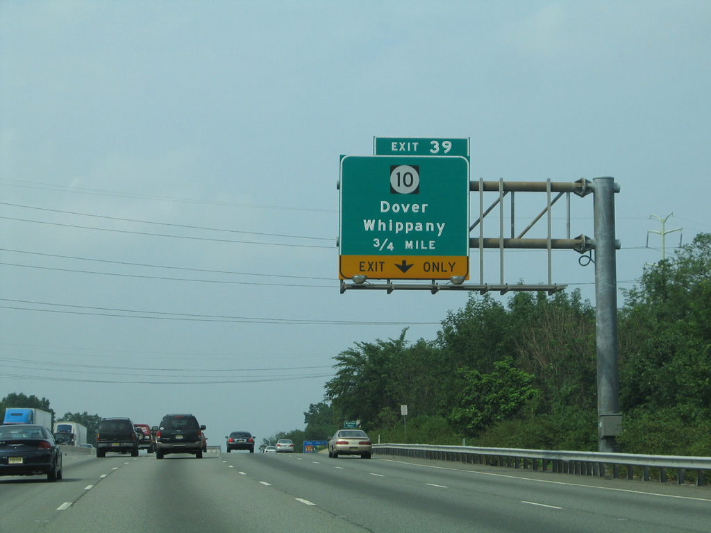
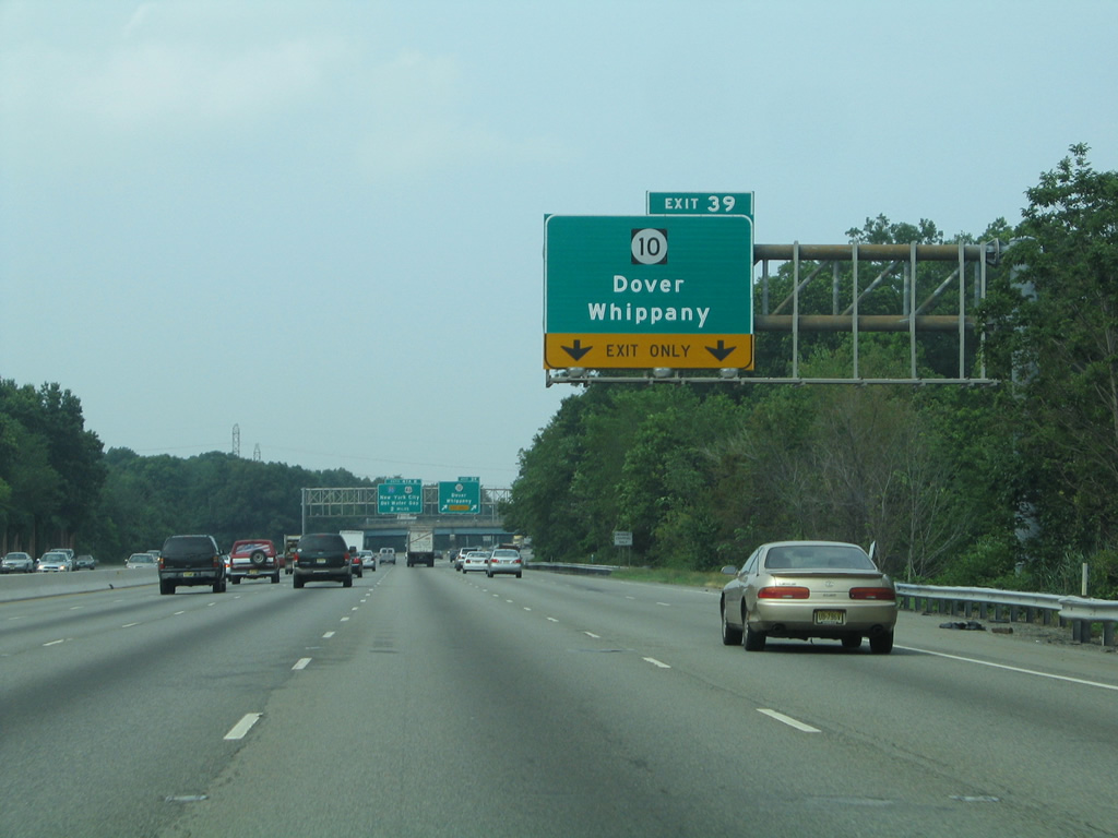
| I-287 north expands to six lanes ahead of the two lane off-ramp (Exit 39) for Route 10. Route 10 totals 23.51 miles from U.S. 46 in Roxbury Township to CR 577 in West Orange. 06/30/05 |
|
| Interstate 80 appears for the first time to northbound motorists as I-287 splits with Exit 39 for Route 10. Route 10 leads northwest to Morris Plains and Denville Township toward the village of Dover. 07/20/05 |
|
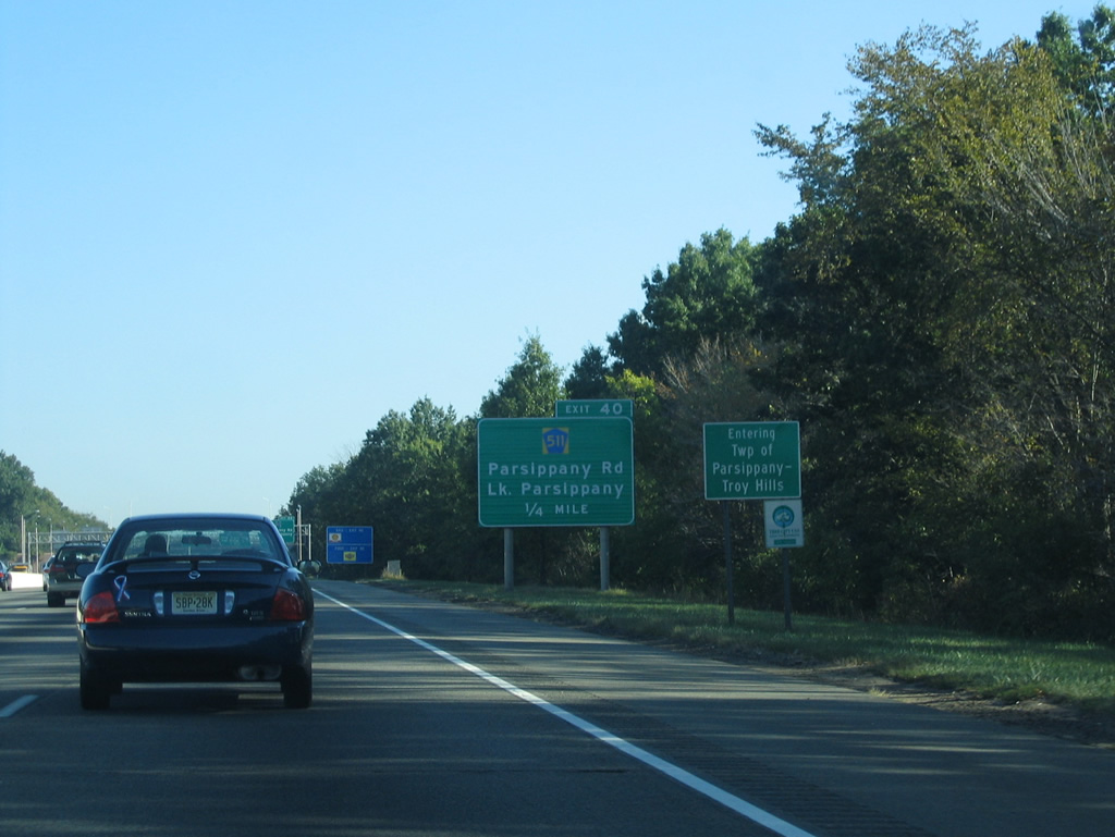
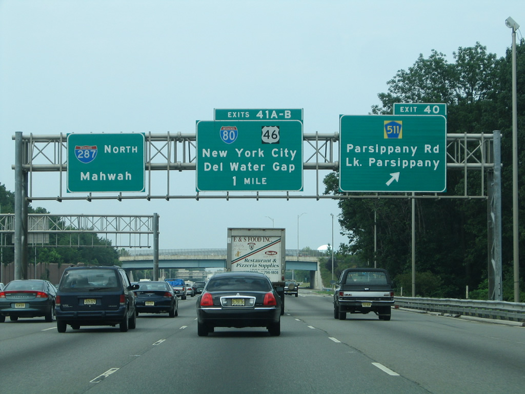
| County Route 511 (Parsippany Road) ventures north from Whippany to meet I-287 at Exit 40 by Lake Parsippany in 0.75 miles. 07/20/05 |
|
| Crossing the Parsippany-Troy Hills Township line, Interstate 287 nears the Exit 40 off-ramp to CR 511 (Parsippany Road) and East Halsey Road. 09/30/05 |
|
| Exit 40 parts ways with Interstate 287 north for CR 511 north to U.S. 202 at Parsippany.
The junction with Interstate 80 (Exits 41A/B) approaches in one mile. Traveling 68.54 miles across the Garden State, I-80 travels east to I-95 at Ridgefield Park and west into Pennsylvania at Delaware Water Gap. 06/30/05 |
|
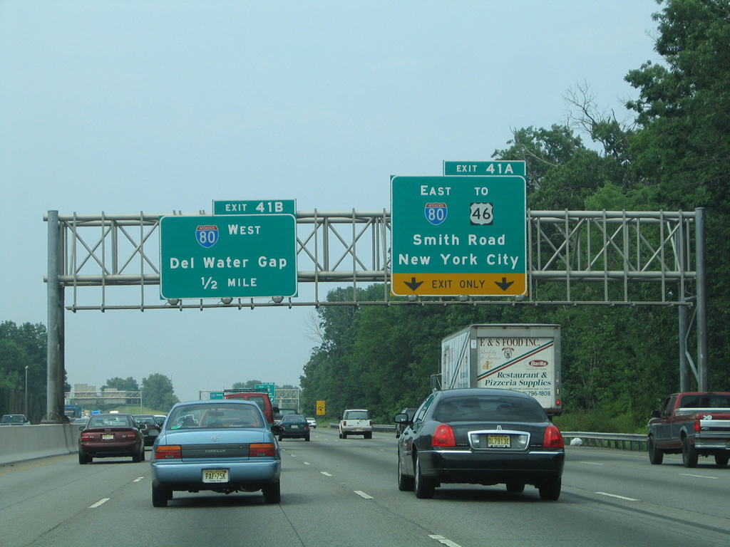
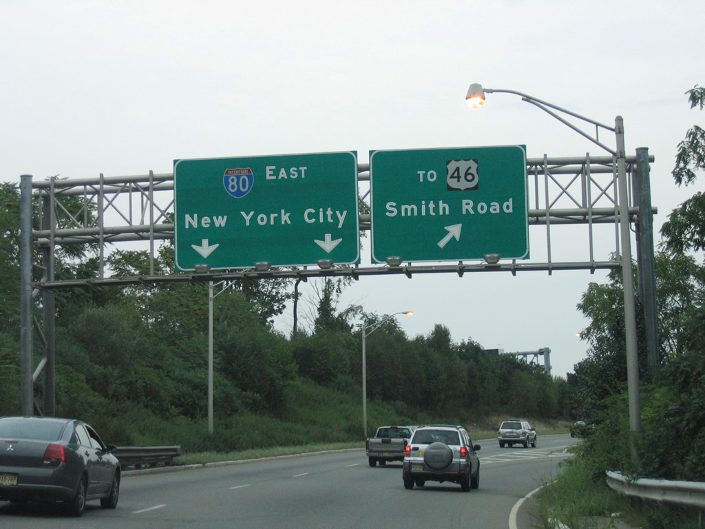
| A directional cloverleaf interchange with left side ramps joins Interstates 287 and 80 near Parsippany and the junction of U.S. 46 and 202. Two lanes depart in one half mile for Interstate 80 east to New York and adjacent Smith Road to U.S. 46. 06/30/05 |
|
| Interstate 80 winds east through Totowa, Paterson and Hackensack before ending at Interstate 95 ahead of Fort Lee and the George Washington Bridge into New York. I-280 partitions from the freeway nearby on a southward course to The Oranges and Newark. 06/30/05 |
|
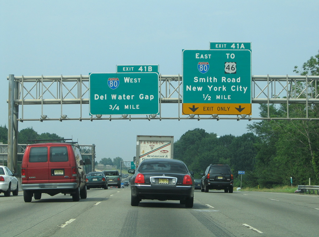
| Exit 41A parts ways with I-287 north for I-80 and Smith Road. A loop ramp (Exit 41B) follows onto I-80 west to Dover, Wharton, Netcong and Stroudsburg, Pennsylvania. 09/30/05 |
|
| U.S. 46 parallels I-80 through most of North Jersey, ending on the George Washington Bridge to the east and at Columbia near Delaware Water Gap to the west. Smith Road connects Exit 41A with the US route to the north while curving southward through a business park. 08/29/05 |
|
| Interstate 80 travels west from North Jersey nearly 2,900 miles overall to San Francisco, California. The bulk of the route beyond Netcong is rural to Youngstown, Ohio. There I-80 joins the Ohio Turnpike west to Cleveland, the next major city along the transcontinental route. 06/30/05 |
|
| On-ramps from CR 630 (Littleton Road) and Interstate 80 west combine before merging onto I-287 north ahead of this shield assembly. A left side ramp also ties in from I-80 east. 07/20/05 |
|
| A second reassurance marker appears for I-287 north after the on-ramp from U.S. 46 west along Boonton Reservoir. 06/30/05 |
|
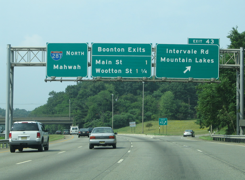
| U.S. 202 parallels I-287 closely along Parsippany Boulevard to the west to Exit 43 with Intervale Road. U.S. 202 overtakes Intervale Road east across I-287 toward the Boonton street grid. 06/30/05 |
|
| Exit 43 consists of a northbound only off-ramp to U.S. 202 (Intervale Road). Fanny Road connects the route with the borough of Mountain Lakes nearby. 06/30/05 |
|
| Interstate 287 spans the Rockaway River into the village of Boonton. Two exits follow, with the first joining Main Street (U.S. 202) via Lathrop Avenue in a half mile. 07/20/05 |
|
| Exit 44 loops away from I-287 north toward Main Street. U.S. 202 splits with Main Street nearby for Myrtle Avenue on the north side of I-287 while CR 511 takes over to Boonton Avenue.
Exit 44 represented the temporary north end of Interstate 287 in New Jersey until November 1993. 07/20/05 |
|
| Exit 45 quickly departs for Park Avenue east to Wootton Street. Wootton Street heads south to Lathrop Avenue and northwest to CR 511 and Oak Street. 06/30/05 |
|
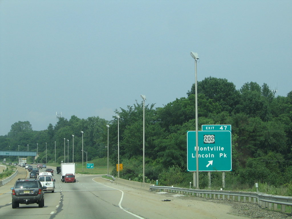
| U.S. 202 (Main Road) and Interstate 287 switch sides again at Exit 47 in Montville Township. 06/30/05 |
|
| Just ahead of the folded-cloverleaf interchange (Exit 47) with U.S. 202. U.S. 202 journeys west to Montville and east to Towaco. 06/30/05 |
|
| U.S. 202 stays east of Interstate 287 to Lincoln Park before turning north again alongside Route 23 through Wayne Township. The two routes meet again in 11 miles. 06/30/05 |
|
| Interstate 287 hugs the eastern slope of Waughaw Mountain and other hills through north Montville Township and east Kinnelon borough. 07/20/05, 06/30/05 |
|
| The scenic stretch of I-287 culminates at the borough of Riverdale. Forthcoming Exit 52 is the first of three exits for the community. 06/30/05, 07/20/05 |
|
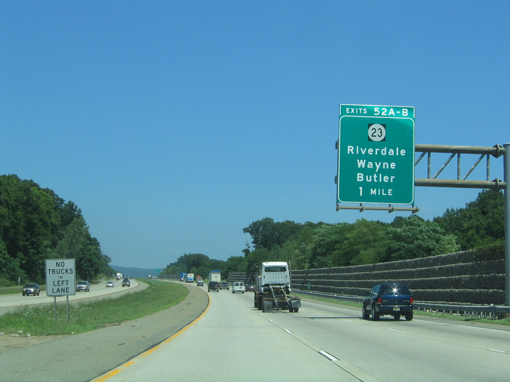
| Meeting Interstate 287 at Riverdale is New Jersey 23, a 52.63 mile route from Verona to the New York state line at Montague Township. 07/20/05 |
|
| Route 23 constitutes a multi-lane route south from Exit 52A in Riverdale through Wayne Township to Interstate 80. 07/20/05 |
|
| Entering the three quarter cloverleaf interchange (Exits 52A/B) with New Jersey 23 on I-287 north. 06/30/05 |
|
| Exit 52B joins I-287 north with New Jersey 23 west to Butler. Much of the route is commercial. 06/30/05 |
|
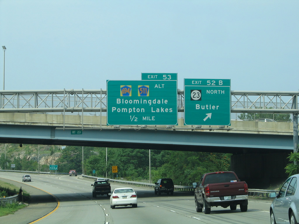
| A folded diamond interchange (Exit 53) lies just north of Route 23 with County Route 694 (Hamburg Turnpike). CR 694 connects I-287 with CR 511 Alternate at its eastern turn from Newark Pompton Turnpike to Pompton Lakes. 06/30/05 |
|
| West from Exit 53, CR 694 (Hamburg Turnpike) continues onto Main Street through the borough of Bloomingdale. The route ends at CR 511, which previously met I-287 at Exit 40. 06/30/05 |
|
| Interstate 287 encircles Federal Hill northward to the borough of Wanaque and Exit 55. 06/30/05 |
|
| County Route 511 arcs eastward from Bloomingdale to meet I-287 (Exit 55) at County Route 511 Alternate (Ringwood Avenue) north from Pompton Lakes. 06/30/05 |
|
| Exit 55 loops to CR 511 Alternate (Ringwood Avenue) south of CR 511 (Union Avenue). CR 511 extends Ringwood Avenue north to Haskell and Wanaque. 06/30/05 |
|
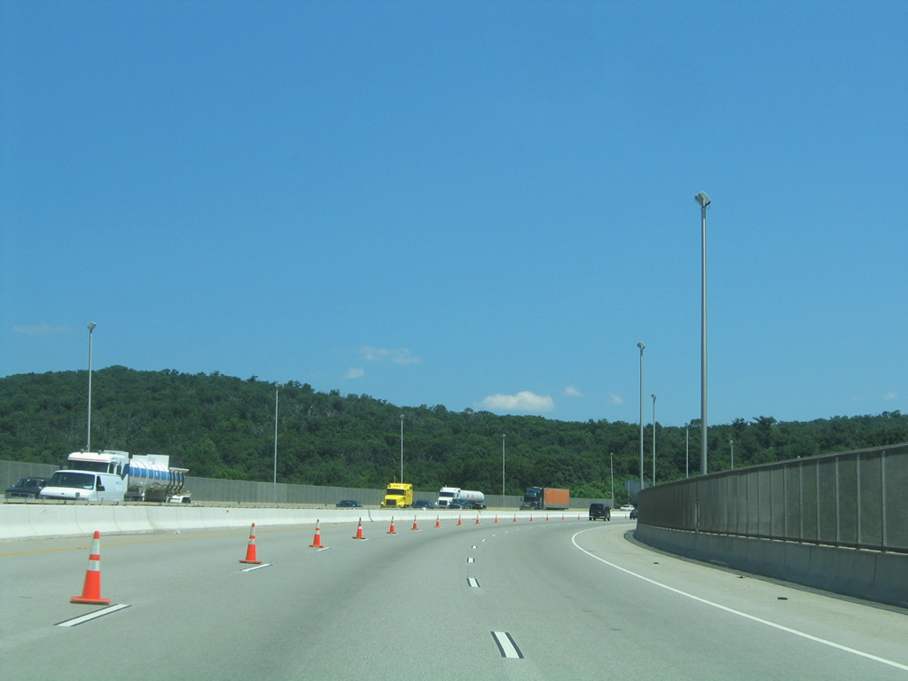
| An impressive rock cut lines the east side of Interstate 287 as the freeway slices across a hill west of the Wanaque River. 06/30/05 |
|
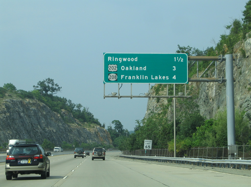
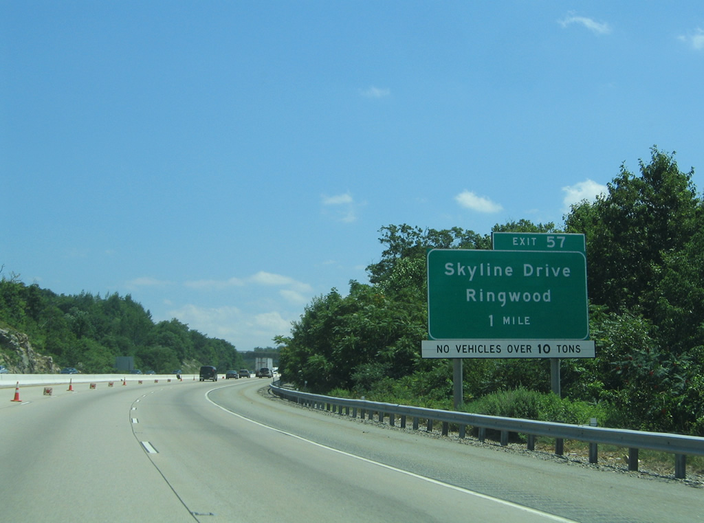
| An interchange sequence sign lies 1.5 miles south of Exit 57 with Skyline Drive (CR S91) and the borough of Ringwood. U.S. 202 returns at the second Oakland exit. 06/30/05 |
|
| Interstate 287 turns more easterly across the hills south of Ramapo Lake beyond the Wanaque River. 07/20/05 |
|
| Skyline Drive stems north from Oakland Avenue and Exit 57 to the Ramapo Mountains and borough of Ringwood. 07/20/05 |
|
| Northbound travelers cross the Bergen County line as Interstate 287 nears the parclo interchange (Exit 57) with Oakland Avenue and Skyline Drive (CR S91). 07/20/05 |
|
| Exit 57 departs Interstate 287 north for Oakland Avenue ahead of its turn at Skyline Drive. Oakland Avenue remains eastward to U.S. 202, doubling as part of the movement from forthcoming Exit 58 to U.S. 202 (Ramapo Valley Road). 07/20/05 |
|
| A second Oakland parclo interchange (Exit 58) joins Interstate 287 with U.S. 202 (Ramapo Valley Road) in one quarter mile. 06/30/05 |
|
| U.S. 202 follows Ramapo Valley Road north from Oakland to Mahwah Township and the state lane ahead of Suffern, New York. I-287 and the US Route do not directly meet again. 06/30/05 |
|
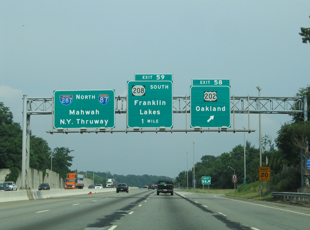
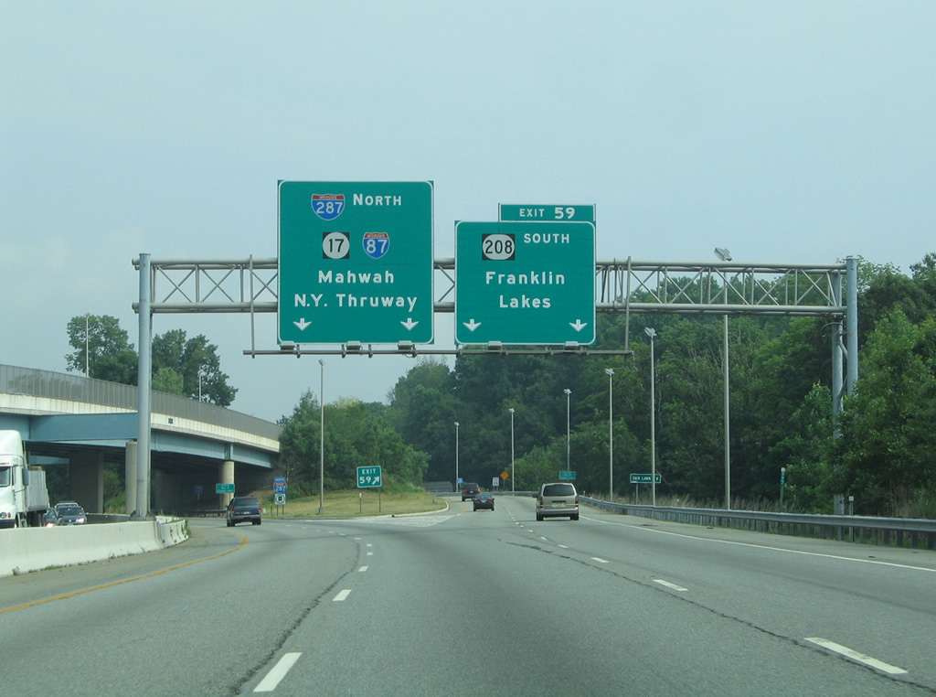
| A three wye interchange (Exit 59) ensues in one half mile with New Jersey 208, a 10.07 mile expressway leading southeast to Route 4 at Fair Lawn. 06/30/05 |
|
| Interstate 287 curves southeasterly to the split with New Jersey 208 at the Franklin Lakes borough line. 06/30/05 |
|
| Two lanes continue north along Interstate 87 toward Mahwah and the New York State Thruway while Exit 59 claims the right lane for New Jersey 208 south to Hawthorne, Glen Rock and Fair Lawn. 06/30/05 |
|
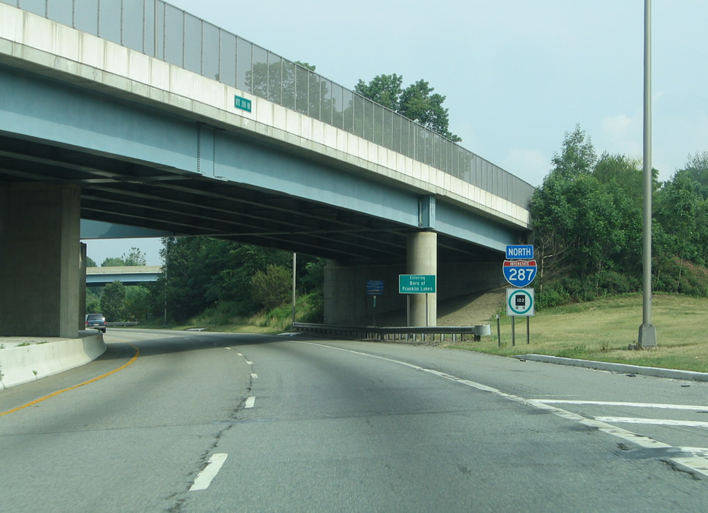
| Interstate 287 circles northeastward to straddle Campgaw Mountain through northern Franklin Lakes. 06/30/05 |
|
| A second reassurance marker appears after the on-ramp from New Jersey 208 west. 06/30/05 |
|
| Phelps Road spans Interstate 287 near the Mahwah Township line. 07/20/05 |
|
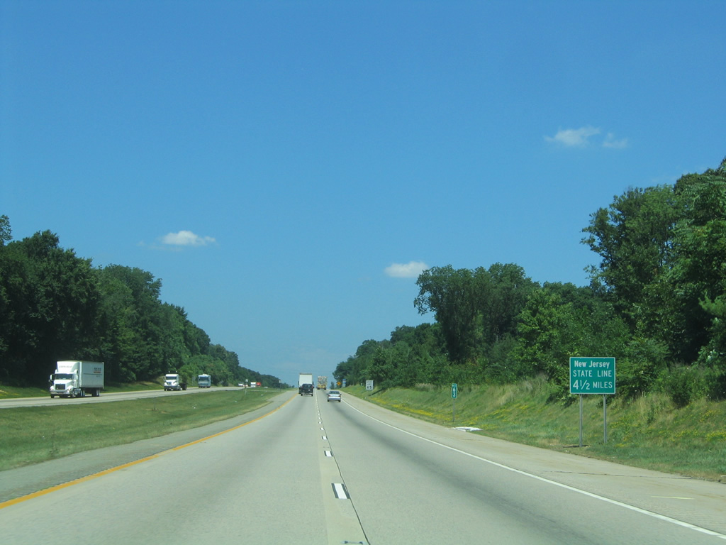
| This sign alerts northbound motorists of the approaching state line in 4.5 miles. A similar sign exists along I-78 west for the Pennsylvania state line. 07/20/05 |
|
| A northbound shield for I-287 follows as the freeway lines both Campgaw Mountain and Reservation. 07/20/05 |
|
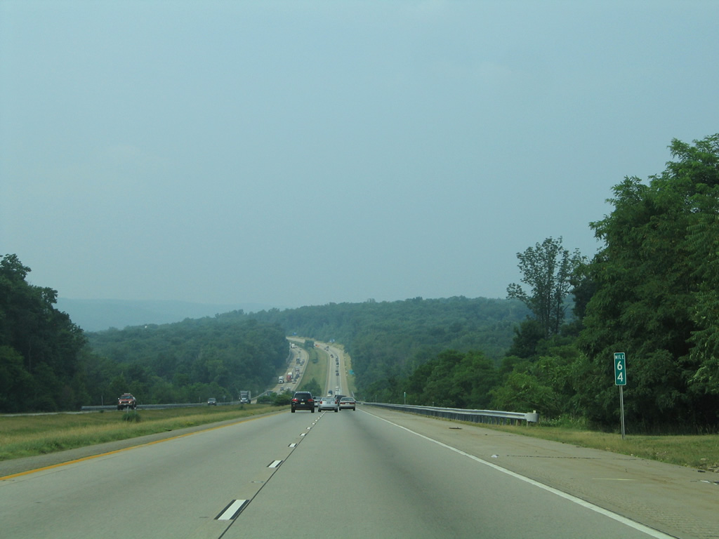
| Interstate 287 traverses a wide valley across Darlington Brook and Avenue in this scene at milepost 64. 06/30/05 |
|
| Long distance travelers bound for the New England States are advised to take I-87 (NY Thruway) north from I-287 at Suffern to Interstate 84 at Newburgh. 06/30/05 |
|
| Route 17, a multi-state route between Kearny, New Jersey and the Pennsylvania state line at Mina, ties into I-287 at the final Garden State exit. 06/30/05 |
|
| A second sign advises drivers headed to New England to use I-87 north to I-84. This route bypasses the congested Cross West Chester Expressway of I-287 and Interstate 95 along the former Connecticut Turnpike. I-84 however can be equally congested through both Danbury and Hartford, Connecticut. 06/30/05 |
|
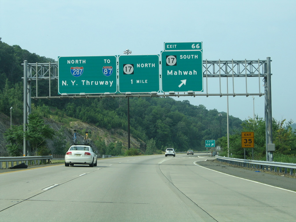
| Interstate 287 crosses over U.S. 202 near Ramapo College of New Jersey and the Ramapo River ahead of the two-wye interchange with Route 17. A loop ramp returns motorists onto the state route south to Mahwah. 06/30/05 |
|
| Exit 66 serves Route 17 south, while access to NY 17 through Hillburn lies 2.4 miles ahead via I-87 north at Exit 15A. Route 17 extends NY 17 another 26.80 miles to Ramsay, Allendale and Paramus. 06/30/05 |
|
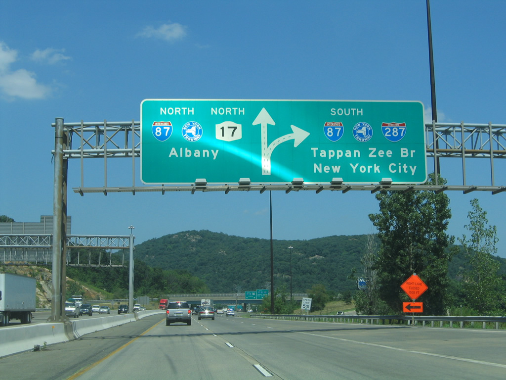
| Route 17 north merges onto I-287 and ends ahead of a three-wye interchange with Interstate 87 (New York Thruway). 07/20/05 |
|
| Interstate 287 splits with two lanes joining I-87 north to NY 17 at Hillburn and I-87 south to the Tappan Zee Bridge. Interstates 87 & 287 share 19.20 miles of pavement between Suffern and Tarrytown. 07/20/05 |
|
| Welcome to New York sign, since replaced with a more basic sign, that was posted at the Rockland County line along Interstate 287 north. 06/30/05 |
Page Updated 05-29-2014.

 north
north